Download Agreement, Release, and Acknowledgement of Risk:
You (the person requesting this file download) fully understand mountain climbing ("Activity") involves risks and dangers of serious bodily injury, including permanent disability, paralysis, and death ("Risks") and you fully accept and assume all such risks and all responsibility for losses, costs, and damages you incur as a result of your participation in this Activity.
You acknowledge that information in the file you have chosen to download may not be accurate and may contain errors. You agree to assume all risks when using this information and agree to release and discharge 14ers.com, 14ers Inc. and the author(s) of such information (collectively, the "Released Parties").
You hereby discharge the Released Parties from all damages, actions, claims and liabilities of any nature, specifically including, but not limited to, damages, actions, claims and liabilities arising from or related to the negligence of the Released Parties. You further agree to indemnify, hold harmless and defend 14ers.com, 14ers Inc. and each of the other Released Parties from and against any loss, damage, liability and expense, including costs and attorney fees, incurred by 14ers.com, 14ers Inc. or any of the other Released Parties as a result of you using information provided on the 14ers.com or 14ers Inc. websites.
You have read this agreement, fully understand its terms and intend it to be a complete and unconditional release of all liability to the greatest extent allowed by law and agree that if any portion of this agreement is held to be invalid the balance, notwithstanding, shall continue in full force and effect.
By clicking "OK" you agree to these terms. If you DO NOT agree, click "Cancel"...
http://vimeo.com/25850066
Last spring when we climbed 18,490ft El Pico De Orizaba my trip report ended in the following paragraph:
"The trip was great but it almost seemed too easy for the amount of planning and work that was put into it". Like Michael said "I want to climb a mountain where you're up there for a week riding out storms, getting sick of each other and overcoming obstacles".
Although Rainier is not higher than Orizaba I have learned it's not always just about elevation. Other factors such as total elevation gain, weather and terrain type are what really matter. Rainier gave us everything we wanted and more. Because of less than ideal conditions we were pushed to dig deep, making for a very rewarding outing.
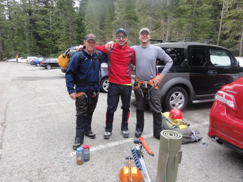
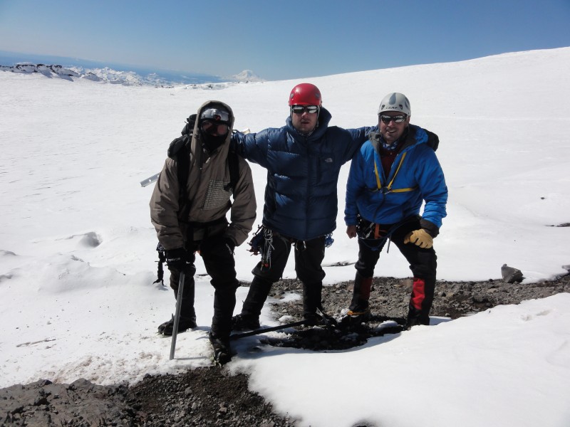
Group:
El Chupacabra aka Paul Perea
Shogun aka Michael Schiffmacher
Erik Tischner handle TBD
Rainier Statistics: Emmons Route
Distance 19.5 Miles
Elevation Gain 10,000 feet (about the same as from Everest base camp to Everest summit)
Most glaciated Peak in lower 48 states.
Prominence: 13,211 feet (4,027 meters); 21st most prominent peak in the world.
Mount Rainier, a giant stratovolcano in the Cascade Volcanic Arc, is considered an active volcano with its last eruption in 1894. Rainier erupted over a dozen times in the last 2,600 years, with the largest eruption 2,200 years ago.
No guides are allowed on the Emmons Route on weekends which gives the route more of a mountaineering feel.
The trip started off with some serious humor when we got off the plane in Seattle and see this guy with a hat walking into the ladies restroom. Michael says to him "Sir, that's that women's restroom". The person kept walking and Michael says a little louder "Sir". Just then, the person turned around (a very upset masculine lady) and yelled "I KNOW". We busted out laughing and quickly scurried off. I knew it was going to be a fun trip!
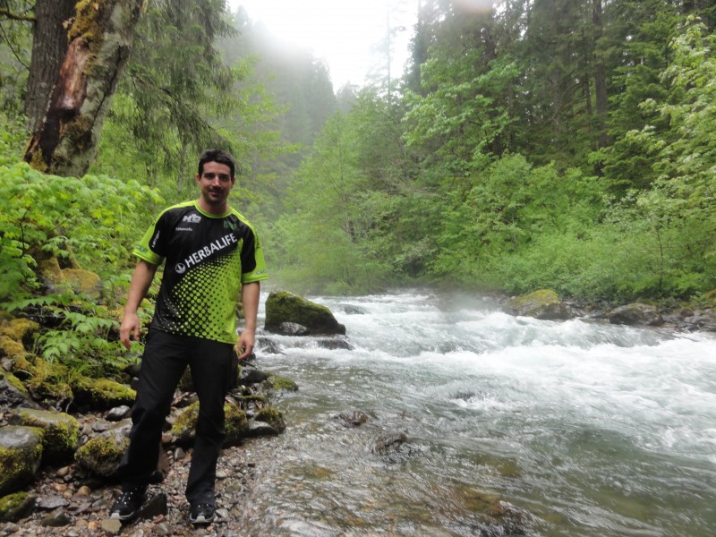
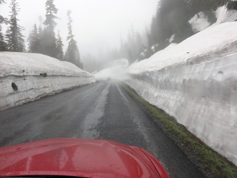
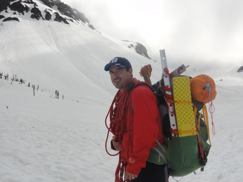
We checked into a hotel Friday night around midnight, got up at 5 am and slowly made our way to Mt. Rainer National Park. We made stops at the grocery store, Whittaker Mountaineering, and several rivers/waterfalls. It was raining and we could only imagine what it was doing higher up on the mountain. One of the stops en route to the mountain
As we drove higher, massive snow banks began to appear. At 3000ft, the snow
walls were bigger in June than I have ever seen in Colorado. Huge snow banks at 3000 ft in June!
When we arrived at the trailhead after checking in with the ranger station we were greeted by a mourning spouse whose husband had been missing since Monday. Apparently he and two others were caught in a storm on Liberty Ridge. They dug a snow cave and were getting hypothermia so two of them went out for help while he stayed never to be seen again. I'm not sure of all the facts but it was heartbreaking to see and know the realities of what probably happened. Even though we were going up a different route than what her husband was on, she asked us to keep an eye out and said "I believe in miracles". Ready to Roll.....
The first mile was lush green forests and waterfalls everywhere. There was a light rain falling on and off. Lots of green and water the first mile
Finally we arrived at the creek crossing the crux of the route. It might of been easier to pole vault across it. I fell in knee deep which you will see in the video and was playing the "dry your boots out game" all weekend. The Crux
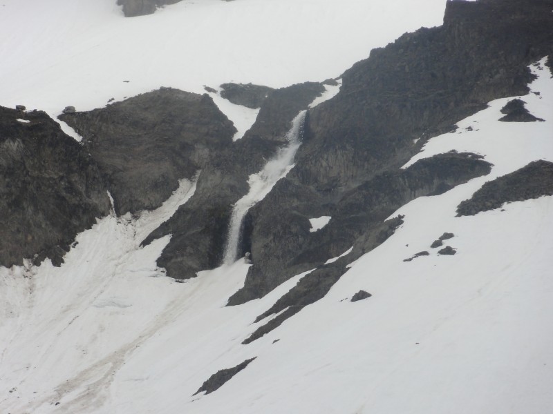
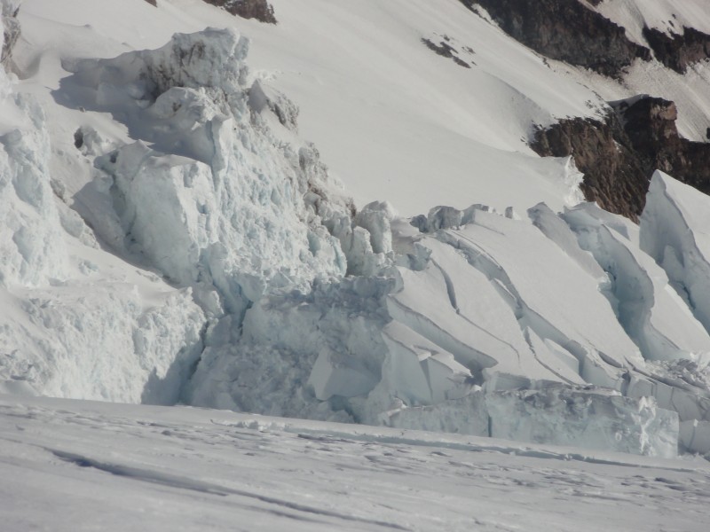
After the creek crossing the season started to change from summer to winter right before our eyes. Snow started to come in waves and the wind picked up. The start of the Inter Glacier was pretty straight forward no crevasse's just lots of ankle deep post holing which was starting to take a toll on me with a 50lb pack on. We saw a couple wet slides come crashing off the surrounding peaks and they looked like waterfalls (see picture #8). Holes in the snow along the trails first 2 miles Approaching tree line at about 6500 ft A wet slide Time for the shell
As we got higher on the Inter Glacier there was still no sight of Mt Rainier even though it was right in front of us hiding behind the clouds. I was anxious to see what it looked like. It was getting late. I kept looking at my GPS to see our elevation and could not believe we were only at 8000 ft. We had been climbing for hours and every time I thought we were topping out on the Inter Glacier it was a false summit. It continued to get colder and wetter at some points we were in an all out blizzard then it would clear before another wave came in. We were all very tired, wet, and cold at this point and it was starting to get dark when Michael says we should set up a camp here. He could not go on anymore. I dropped my pack and looked up and there were 6 tents up a little higher. I said "there it is, camp Shurman!, let's keep going a little longer and get there". When we arrived we found out it was not camp Shurman but rather camp Curtis and the other guys had set up camp earlier also in the same situation trying to find shelter from the weather. Blizzard Conditions Getting late, cold, windy, and snowy as we approach the top of the Inter Glacier
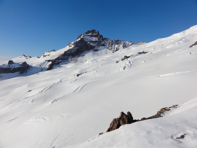
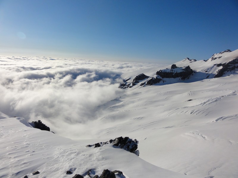
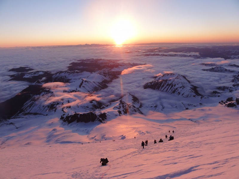
Finally there was a break in the clouds even though the winds were 50mph sustained. I dropped my pack and walked over to the top of the Inter Glacier and got my first view of Little Tahoma and Mt Rainier. I was like "Holy shit"!!! My first views of Crevasses, huge Ice falls, and the frigid winds made me question what I was doing. It was very intimidating to see the mountain and the valley of glaciers below. It looked nothing like the pictures I had seen on the web. It looked like a beast and I tried to see where the route was and thought how the hell am I supposed to climb that? It had a Denali feel to it. How am I going to get over that khumbu icefall looking section? We started frantically digging a platform for a tent. The plan was just to get one up and all cram in there until we rested and warmed up then dig out more room for the 2nd tent. It was survival time and not about being comfortable. All I could think about was that ladies husband somewhere on the mountain and wondering if it was possible for anyone to survive those conditions for more than one night with no shelter or food. We worked in shifts while one poor exhausted soul rested and warmed up the other two continued digging this went on until 12:42 p.m., when we finally went to sleep. I had cell phone service and talked to my friend Barry on Facebook before I went to sleep and he sensed my morale was low and quoted something to me I don't remember exactly how it goes but something along the lines of "it's always most stormy right before the calm". Looking over at Little Tahoma which we would be looking down at on summit day.
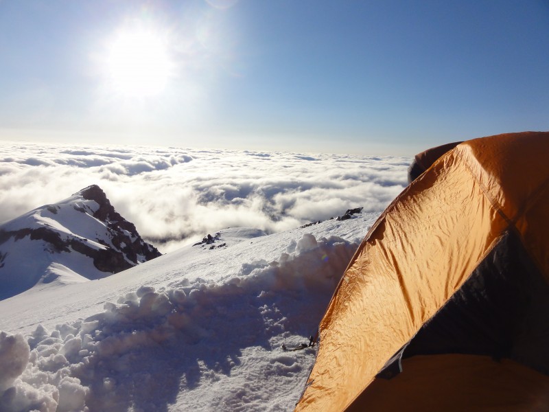
Sure enough then next morning the sun was out and the winds had died to about 10 to 15 mph. There was a beautiful blanket of clouds below us and the first views out the tent were unlike anything I had ever seen before. I also looked up at the route up the Emmons and it looked easy unlike the night before. Turns out the section I was looking at was the ice fall area which the route goes around. I felt so much better. I was still a little dehydrated but in good spirits again. We melted snow made breakfast and were off to camp Shurman. This is what it is all about!Nice weather moving in. Blanket of clouds below us Breathtaking! Trying to pass this group
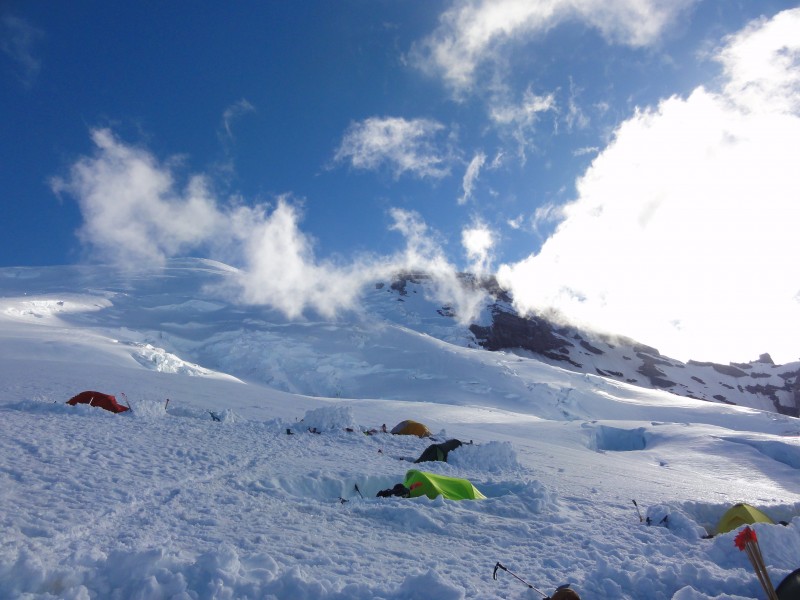
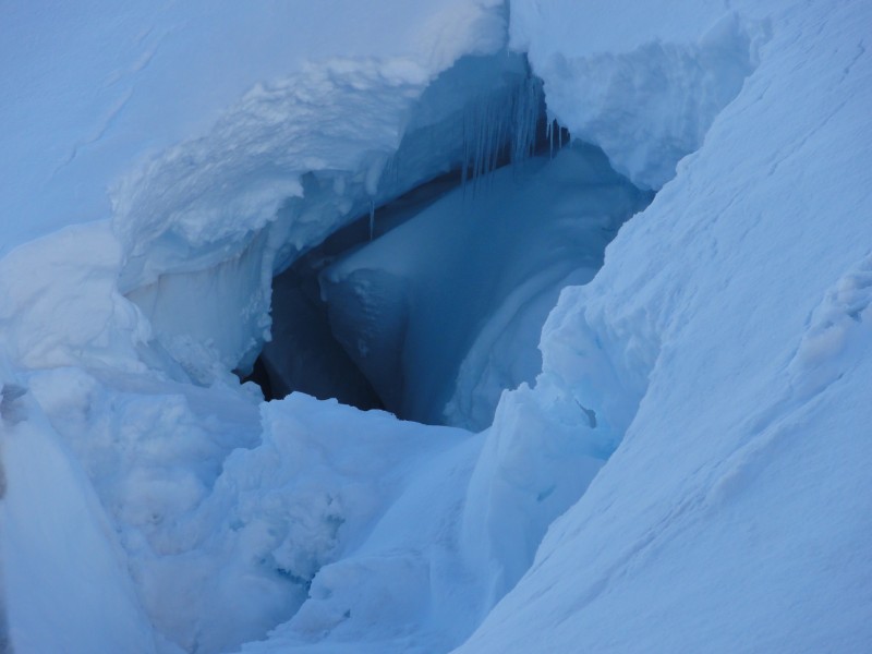
Once we got on the Emmons Glacier it was time to rope up. Each step was a little uncertain since it was my first time on a glacier. Would I take a step onto a trap door and fall in or would the snow hold? By the end of the trip I had learned how to identify where the crevasses form and what to look for and felt much more comfortable traveling on them. We arrived at camp Shurman set up camp and melted more snow. We got ready for our 1 am departure for the summit. That night the winds had picked up again and I was worried my tent might not be there when I got back from the summit of Rainier. I anchored it down best I could and built the walls around it as best I could. 1 a.m. came fast and it was cold and windy. Go Figure! We could see about 20 headlights already going up the mountain ahead of us. We soon caught up and were bottlenecked. I was leading the rope team and tried to pass any chance I got and soon we were the 2nd team up the route. over 4000 ft of elevation gain still to reach summit First Big Crevasse
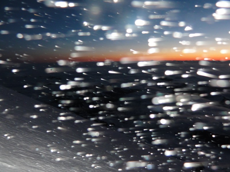
About 3:30 am the sun started to rise over the distant mountains and it gave us a spectacular light show over the blanket of clouds thousands of feet below us. Ground Blizzard Best sunrise I have ever seen and I have seen many Leading the Herd Break time
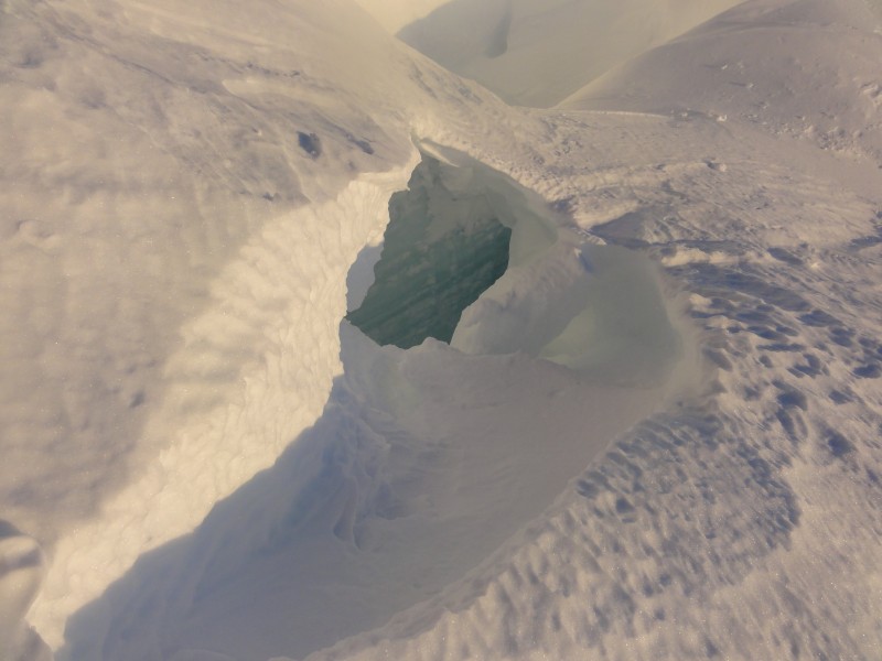
For the most part the snow bridges were pretty solid but we were ready to arrest a fall at each crossing. Small Crevasse Huge Ice blocks the size of houses
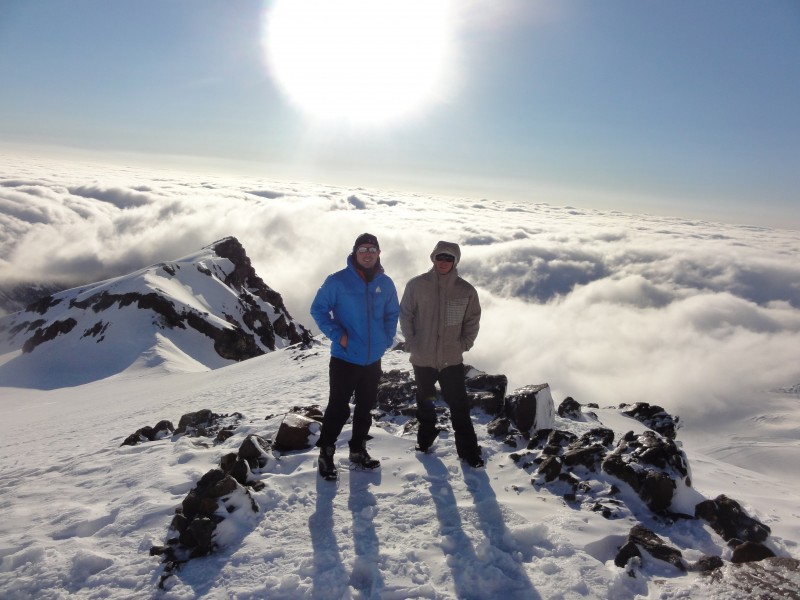
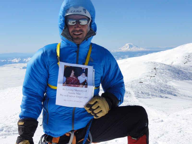
Our pace slowed to almost a standstill at 13,500 ft when I hit a wall and had to eat a candy bar and GU. Eventually we made it to the crater rim and unroped to the true summit. I took my pack off anchored it down with my axe to prevent it from blowing off into Seattle and took a picture holding a sign/picture of my aunt who our family lost a couple months ago to cancer. She had seen a episode on the animal channel called "I shouldn't be alive" a story about Jim Davidson who fell into a crevasse on Rainier descending the Liberty Ridge route and was worried. I told her the route we were doing is not as technical and two days before she died I told her I would climb it in her memory. Promise delivered! On the summit with a picture of my aunt who recently passed away of cancer.
I'm pretty disappointed it was too windy to actually stay up there long and look around. We dropped into the crater rim and got some much needed relief from the wind. It was so calm in there as the walls all around provide excellent windbreak. Protected from the wind inside the crater rim. Crater Rim
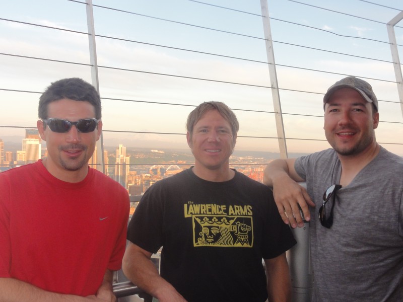
We made it back down to camp Shurman in 2.5 hours. As we descending the wind died and the heat became unbearable as the sun reflected off the snow. The bridges were also becoming weak. As soon as we got back Michael and I dove into the tents while Erik melted snow (very thankful for this because I was too tired and hot to do it). After discussing whether or not to pack out or wait until morning, we decided to spend one more night up there. Michael napped and Erik and I hung out with the Pink Flamingos, listened to some Reggae Music, and drank some Rum and Coke while talking to the rangers. It was relaxing, and warm light winds made it feel as though we were at a beach above the clouds staring at our accomplishment from the rock chairs in front of the hut (in Video). Awesome afternoon!!! The next morning we packed out and enjoyed a 3000 ft glissade (sliding down on your ass) down the Inter Glacier and made it to the car in 2.5 hours (we were flying). I didn't fall in the creek this time and Michael and Erik each went through a little water but nothing major. In no time we were back in Seattle on top of the Space Needle drinking beers and exploring the city. My favorite mountaineering trip to date. It will be hard to beat. Seattle with Rainier in the background from the Space Needle Miller Time!
Thumbnails for uploaded photos (click to open slideshow):
Ah...sweet success. I too am really happy for you guys. Yes, you trained hard and it all paid off. What a great trip...and now a great trip report. Congrats!!!
Paul and all, very happy for you guys. I know how much training and effort went into this and am just thrilled for your successful trip. Excellent report... I thouroughly enjoyed it. As for the quote...."The night is darkest before the dawn." But, you got the gist of it anyway! Again, great job.
Glad you got the full Rainier experience 6/27/2011 5:41pm
Hard to convince myself to go back when there are so many other mountains to climb, but I got to admit, the photos make me a little homesick for all of those nasty conditions on the big snow cone.
Ah Rainier, what a damn fine mountain. Thanks for the report Paul, the sunrise shots and all the others brought back fond memories. Congrats to the whole crew.
Nice job summiting. We were on Mt. Rainier on 6/27/11 and had to turn around at 13,500' due to whiteout conditions. It is an awesome mountain. Congrats on the summit
Everyone Mt Rainier is a beautiful place now I know why a lot of top U.S. mountaineers call it their home peak. We have some pretty serious mountains here in Colorado to though.
Thanks for the write-up Paul. Those crevasses are really something, aren't they?
Caution: The information contained in this report may not be accurate and should not be the only resource used in preparation for your climb. Failure to have the necessary experience, physical conditioning, supplies or equipment can result in injury or death. 14ers.com and the author(s) of this report provide no warranties, either express or implied, that the information provided is accurate or reliable. By using the information provided, you agree to indemnify and hold harmless 14ers.com and the report author(s) with respect to any claims and demands against them, including any attorney fees and expenses. Please read the 14ers.com Safety and Disclaimer pages for more information.
Please respect private property: 14ers.com supports the rights of private landowners to determine how and by whom their land will be used. In Colorado, it is your responsibility to determine if land is private and to obtain the appropriate permission before entering the property.