Download Agreement, Release, and Acknowledgement of Risk:
You (the person requesting this file download) fully understand mountain climbing ("Activity") involves risks and dangers of serious bodily injury, including permanent disability, paralysis, and death ("Risks") and you fully accept and assume all such risks and all responsibility for losses, costs, and damages you incur as a result of your participation in this Activity.
You acknowledge that information in the file you have chosen to download may not be accurate and may contain errors. You agree to assume all risks when using this information and agree to release and discharge 14ers.com, 14ers Inc. and the author(s) of such information (collectively, the "Released Parties").
You hereby discharge the Released Parties from all damages, actions, claims and liabilities of any nature, specifically including, but not limited to, damages, actions, claims and liabilities arising from or related to the negligence of the Released Parties. You further agree to indemnify, hold harmless and defend 14ers.com, 14ers Inc. and each of the other Released Parties from and against any loss, damage, liability and expense, including costs and attorney fees, incurred by 14ers.com, 14ers Inc. or any of the other Released Parties as a result of you using information provided on the 14ers.com or 14ers Inc. websites.
You have read this agreement, fully understand its terms and intend it to be a complete and unconditional release of all liability to the greatest extent allowed by law and agree that if any portion of this agreement is held to be invalid the balance, notwithstanding, shall continue in full force and effect.
By clicking "OK" you agree to these terms. If you DO NOT agree, click "Cancel"...
| Report Type |
Full |
| Peak(s) |
Pikes Peak - 14,109 feet
|
| Date Posted |
06/18/2011 |
| Date Climbed |
06/17/2011 |
| Author |
mlayman09 |
| Pikes Peak- Northwest Slopes |
Pikes Peak-Northwest Slopes Route
Starting elevation: 10,000. Ending elevation: 14,110
Hike Leader: Aaron Voth (mennoguy)
Starting time: 6:45
Summit time: 10:40
Ending time: 2:45
Mileage: 15
Some of the Senior High campers from Rocky Mountain Mennonite Camp went with 6 staff members to Pikes Peak via the Northwest slopes route. Packed lunches at 6am and drove up to the Crags campground and we were on the trail at 6:45. The first couple miles is rolling, easy terrain and follows fourmile creek for awhile. We reached the start of the switchbacks and took a break for water. Everybody was doing well at this point, for some it was their first time hiking Pikes Peak, including myself. Hit a steady pace going up to Sheep's ridge and took another break at the top to take in the view and put on more layers. The trail to this point was very well maintained and developed. Some of our group were sad that the porta pottys were locked. Went through the Devil's playground and through two small snow patches. Came to the boulder field and yelled encouragement to each other. Reached the peak in a camp record, just under four hours! Took pics at the sign then got inside to avoid the 25 degree temps outside. Most of us consumed multiple donuts which were an excellent treat. Went down after half an hour, some campers decided to drive down in the support van. While going down the boulder field we witnessed clouds rippling off the eastern slopes. It looked like there were geysers on the edge giving off steam. A few minutes later a hail/snow storm cooked up and sandblasted any exposed part of our bodies. Lightning struck only once thankfully. As quickly as the storm came it left and we soaked in the sun once again. As we reached sheep's ridge we took in a dramatic view to the west of dark purple rain clouds developing. Steadily made it down the slope and got into treeline just as the storm rolled in and dropped graupel for a few minutes. Stopped and waited for one of the campers who had gotten pretty bad altitude sickness. Got her some water and kept going down. As we neared fourmile creek again the sun came out and the air was heavy, so we all stripped down to t-shirts and shorts again. Cruised the rest of the way down and walked down the forest service road to camp. A terrific hike with great people, mostly good weather, and awesome views of God's creation.
My GPS Tracks on Google Maps (made from a .GPX file upload):
Thumbnails for uploaded photos (click to open slideshow):
 Taking in the early morning view on sheep's ridge")
 The men on the hike")
 And the women on the hike")
 The Peak")
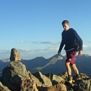
 My first 14er")
 Heading down into the clouds")
 Such an awesome experience")
 Our fearless leader")
 Heading down the ridge")
|
Caution: The information contained in this report may not be accurate and should not be the only resource used in preparation for your climb. Failure to have the necessary experience, physical conditioning, supplies or equipment can result in injury or death. 14ers.com and the author(s) of this report provide no warranties, either express or implied, that the information provided is accurate or reliable. By using the information provided, you agree to indemnify and hold harmless 14ers.com and the report author(s) with respect to any claims and demands against them, including any attorney fees and expenses. Please read the 14ers.com Safety and Disclaimer pages for more information.
Please respect private property: 14ers.com supports the rights of private landowners to determine how and by whom their land will be used. In Colorado, it is your responsibility to determine if land is private and to obtain the appropriate permission before entering the property.
 Taking in the early morning view on sheep's ridge")
 The men on the hike")
 And the women on the hike")
 The Peak")
 My first 14er")
 Heading down into the clouds")
 Such an awesome experience")
 Our fearless leader")
 Heading down the ridge")