Download Agreement, Release, and Acknowledgement of Risk:
You (the person requesting this file download) fully understand mountain climbing ("Activity") involves risks and dangers of serious bodily injury, including permanent disability, paralysis, and death ("Risks") and you fully accept and assume all such risks and all responsibility for losses, costs, and damages you incur as a result of your participation in this Activity.
You acknowledge that information in the file you have chosen to download may not be accurate and may contain errors. You agree to assume all risks when using this information and agree to release and discharge 14ers.com, 14ers Inc. and the author(s) of such information (collectively, the "Released Parties").
You hereby discharge the Released Parties from all damages, actions, claims and liabilities of any nature, specifically including, but not limited to, damages, actions, claims and liabilities arising from or related to the negligence of the Released Parties. You further agree to indemnify, hold harmless and defend 14ers.com, 14ers Inc. and each of the other Released Parties from and against any loss, damage, liability and expense, including costs and attorney fees, incurred by 14ers.com, 14ers Inc. or any of the other Released Parties as a result of you using information provided on the 14ers.com or 14ers Inc. websites.
You have read this agreement, fully understand its terms and intend it to be a complete and unconditional release of all liability to the greatest extent allowed by law and agree that if any portion of this agreement is held to be invalid the balance, notwithstanding, shall continue in full force and effect.
By clicking "OK" you agree to these terms. If you DO NOT agree, click "Cancel"...
With as often as I utilize TR's that other members post...I'm a little ashamed to say with now 22 14er's under my belt, this is my first TR. But hey...better late than never right? I plan on reporting the rest of our climbs this year.
TH: Jennings Creek
Start: 5:10 am
13,000' Ridge: 7:00 am
Tabeguache Summit: 9:45 am
Shavano Summit: 11:00 am
Elevation Gain: ~ 4700'
RT: ~ 8 miles
It would have been a little tricky to find the TH in the dark but with the help of google earth and the new 14ers app on the droid we were spot on. There's not much of an approach with 2500' of gain in the first mile. Starting out from the old TH.
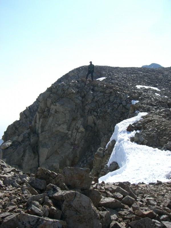
We avoided the errosion areas on the trail by staying to the far left as best as possible and caught our first small glimpse of the Tabeguache summit. 13,180' on the SW ridge.
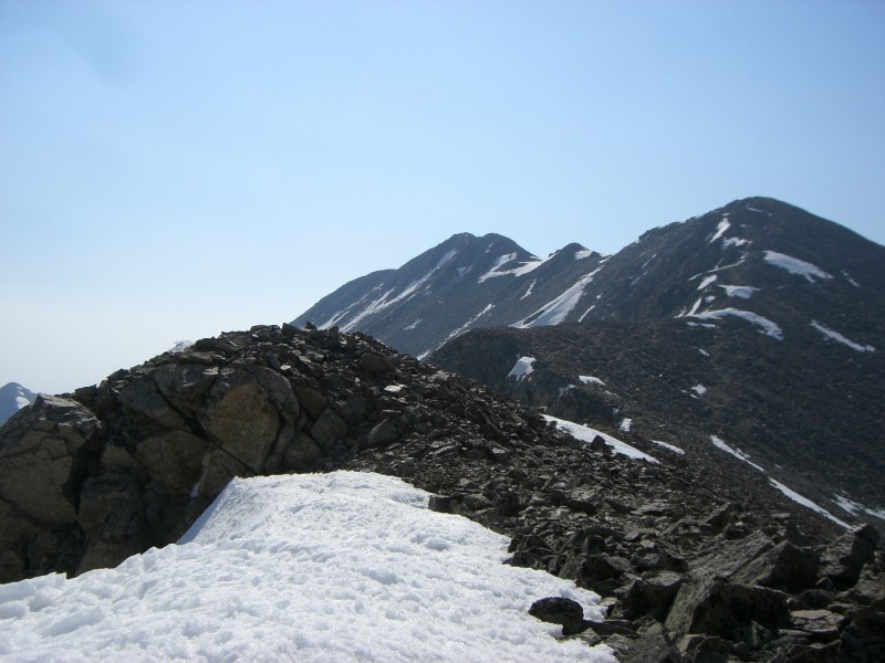
On the traverse up to the saddle we decided to use crampons to cross about 50 yards of a snowfield as it was frozen and pretty slick. Didn't want the hassle of putting them on for that short of a distance but why carry useful equipment if you don't use it. The saddle was the most wind of the whole trip (more so on the descent) at 20-25 mph max. 13,800' on the saddle of the west ridge.
Just before 9:30 we rounded the last point and saw that there was already someone on summit.
Half way across the final South ridge.
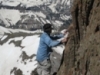
The wife slipping through the parted rock section. There was some more exposure on this ridge than what we expected. Still fun nonetheless.
There was some fun rock hoping to get to the summit of Mt. Shavano. Mt. Shavano Summit.
Had some company on the "retraverse" back to Tabeguache with 2 fellas from Colorado Springs for what I believe was their first 14er of the year. Hope you guys had a good trip out.
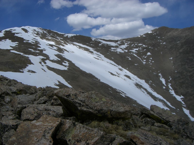
Looking back at our route to the west saddle.
Getting back to tree line.
We couldn't have asked for a better day. And for being "easier" 14ers, we were still pretty beat by the time it was all said and done.
Thumbnails for uploaded photos (click to open slideshow):
Road is good. A little bumpy and slow going but dry all the way. I clocked it at 7.6 miles when you turn off of highway 50. The road gets slightly wider at the TH but only enough room to reasonably park maybe 2 cars. It's pretty wet off the right side of the road right there and there is a large (~12' tall boulder) immediately after the TH.
Thanks for the beta. I plan on taking this route next weekend.
Caution: The information contained in this report may not be accurate and should not be the only resource used in preparation for your climb. Failure to have the necessary experience, physical conditioning, supplies or equipment can result in injury or death. 14ers.com and the author(s) of this report provide no warranties, either express or implied, that the information provided is accurate or reliable. By using the information provided, you agree to indemnify and hold harmless 14ers.com and the report author(s) with respect to any claims and demands against them, including any attorney fees and expenses. Please read the 14ers.com Safety and Disclaimer pages for more information.
Please respect private property: 14ers.com supports the rights of private landowners to determine how and by whom their land will be used. In Colorado, it is your responsibility to determine if land is private and to obtain the appropriate permission before entering the property.


 Starting out from the old TH.")
 13,180' on the SW ridge.")
 13,800' on the saddle of the west ridge.")
")
")
 Half way across the final South ridge.")
")
 Mt. Shavano Summit.")
 Looking back at our route to the west saddle.")
")