| Report Type | Full |
| Peak(s) |
Longs Peak - 14,259 feet |
| Date Posted | 01/04/2024 |
| Date Climbed | 12/29/2023 |
| Author | daway8 |
| Longs Winter Keyhole |
|---|
|
There's a ton of beta and reports on Longs and even lots about it in winter, but Longs via the Keyhole route in winter doesn't get as much love as some of the other options, despite that - under the right circumstances - it can sometimes be very viable albeit very, well - Looong route. Included in this report will be:
Longs Peak Winter Routes There are a wonderfully wide variety of options for climbing Longs Peak at any time of the year. Here are just a few quick thoughts on some of the more popular ones - note that I've only completed Keyhole in winter and did a partial pre-winter Cables - the rest is info I've gathered from research and compiled here for easy reference: Keyhole: This is the standard route in summer but seems less common in winter. The Ledges especially can be treacherous with steep snow and ice. The Narrows can also be totally wind-blown and dry or wickedly loaded and the really nasty thing is that you have absolutely no visibility of the Narrows from the road or any spot along the trail until you top out on the Trough and are right on them (that happened to me on my first trip in the spring and I was not prepared for that degree of sketch). So unless you get lucky and have somebody named Logan just happen to go up ahead of you each time you do this route then you may have to put in first tracks across a heavily loaded Narrows - but you won't know until you get there. Homestretch is a mixed bag - sometimes very easy with plenty of consolidated snow, sometimes icy and treacherous. The Trough: When referred to as a route this does not mean the little bitty section of it you ascend when doing the Keyhole route (it doesn't feel little bitty when you go up it but...). No, this one starts in Rocky Mountain National Park from Glacier Gorge and goes up past Mills Lake and Black Lake and takes the Trough all the way from the bottom. This makes the Trough section several times longer than normal (oh whippee!!). You'll still have to deal with the Narrows and Homestretch like normal. Cables: Also referred to sometimes as the North Face route. This seems to be one of the more popular winter routes these days. It follows the route that used to have actual metal cables on it until someone discovered that metal cables conduct electricity and therefore having people hold onto a long metal cable in a thunderstorm is not a good idea. Oh well, it shortcuts a good bit of distance and effort needed for the Keyhole route. Trade-off: it's class 5. And it's often coated in ice. And if you slip on the ice you'll likely plunge to your death off the East Face. Other than that, it's the perfect route for everyone!! Oh, if you don't want to die - most people seem to bring ropes for this one, at least in winter (and often summer as well). One plus is that the critical class 5 part of the route (just above the Boulder Field across from the Keyhole) is visible from Estes as well as much further away so you can get at least a general idea if it's super dry or super snow loaded before even starting your hike. I did a partial pre-winter ascent to the base of this route where I provided a lot of beta for finding where to go up in A Longs Shot at Wintery Cables The Loft: This route allows you to go up by Meeker and Southeast Longs (14er sub-summit). It's a shorter route but more scrambly and more route finding. Probably best to try it in summer first to figure out what you're doing. I haven't done that yet (meaning the route). Keplinger's Couloir: This is reportedly the preferred route for those nuts who ski off the 14ers (as compared to us totally sane people who hang off the side of snow covered cliffs with an ice axe!). This route has some wonderful advantages: for example, the standard route for Longs is too short so this route adds more milage by starting from the Sandbeach Lake Trailhead in the Wild Basin region of Rocky Mountain National Park. Also, the standard route doesn't have enough elevation gain so this route fixes that by adding an additional 800ft of gain as compared to the Keyhole route! Who wouldn't want those wonderful perks?!?! Keyhole Route December 2023 Fly-Through With that, let's take a quick fly-through of the Keyhole route as it appeared on my successful snowflake summit on Dec 29, 2023. Since the route description gives the needed data this will be mostly just a pictorial fly-through to show you what the key parts of the the route looked like at this particular stage in this particular winter. Jump down to the comparisons section if you want to see some of these same locations compared across different seasons/years. The Boulder Field After the long trek to the Chasm Lake turnoff, the slow swing around Mount Lady Washington, over Granite Pass and up that darn never-ending hill, you finally see the majestic summit of Long Peak jutting up over the Boulder Field. The Boulder Field can be a pure hell of trap-door snow but on this particular occasion it wasn't too horrible - rock hopping was fairly easy. 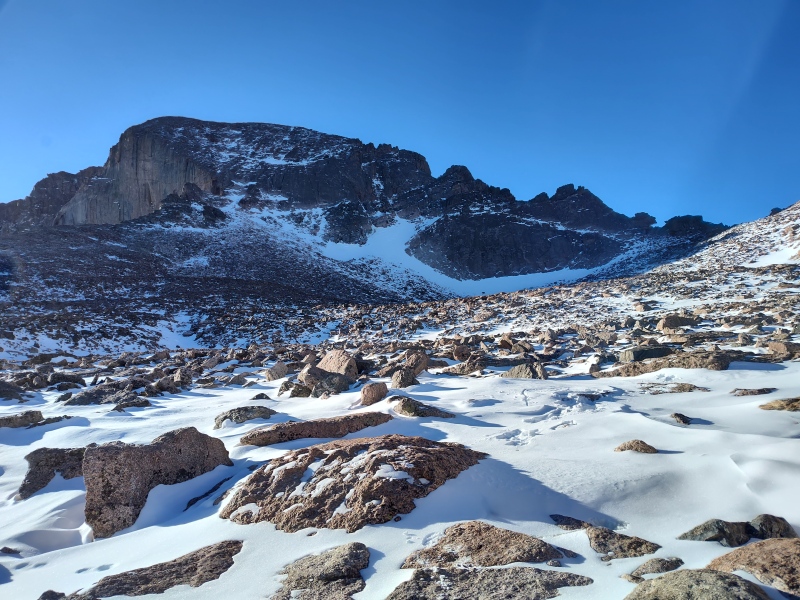
The photo below captures a little better how long the Boulder Field drags on... 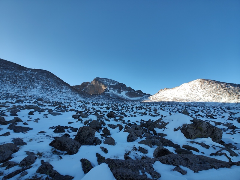
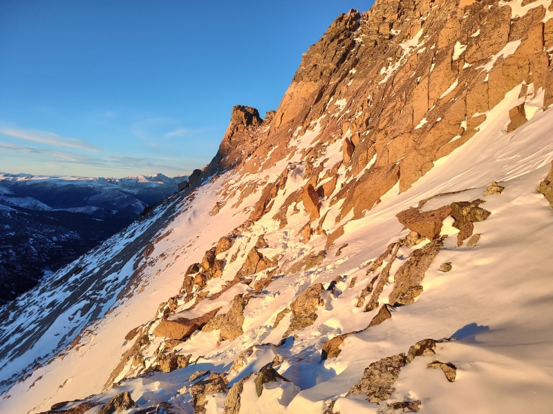
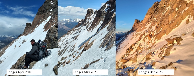
The Ledges This is one section that can be really sketch. When it's loaded, the snow fields are very steep and a possible avy risk. Other times it can be coated in ice waterfalls. On this particular occasion though it was pretty mellow and the bullseyes were actually mostly visible rather than buried in snow. 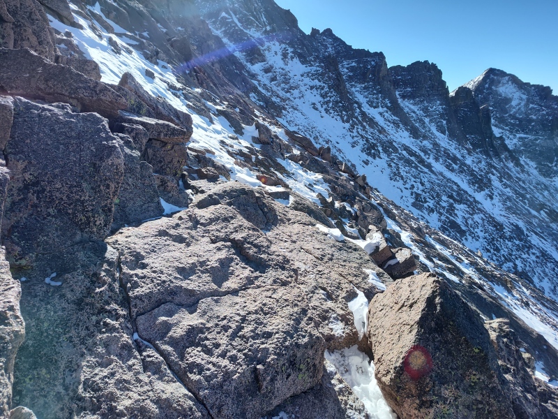
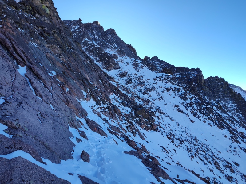
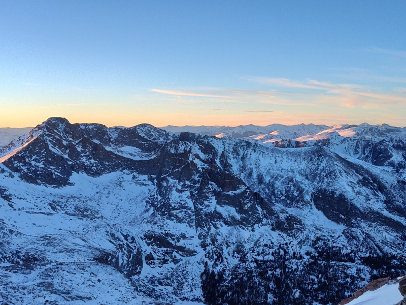
The Trough This is the section that a lot of people love to hate because the Ledges make you drop down in altitude only to regain it all in the Trough. But just be glad you're not starting all the way down at Black Lake like those poor suckers who take the Trough route in its entirety! 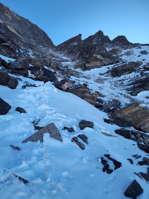
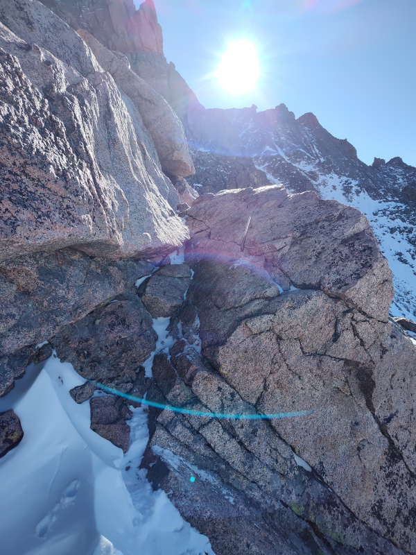
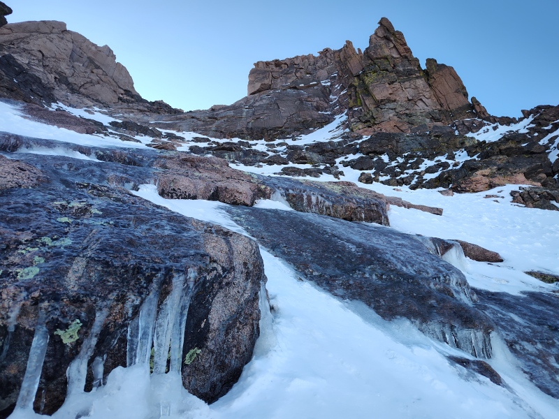
One item to note from this climb was that I learned the hard way that there were some hidden ice falls partway up the Trough. I had microspikes on and was going up mostly snow, with occasional rock felt underneath. But at one point the spikes started crunching on something under the snow only to give way a step or two later. Thankfully I was already leaning into the climb and only flopped/slid a tiny bit before then realizing the sheet of steep ice hidden by a coating of snow. I was able to divert around the ice without issue but later spent a good deal of time needlessly switching to crampons. I say needlessly only because I didn't encounter more ice. Otherwise they would have been essential. I did notice water trickling later that day so expect this often ices up even more. Therefore I would recommend always being prepared with crampons for Longs in winter even if you might not always need them. Because if you do need them, you will REALLY need them! 
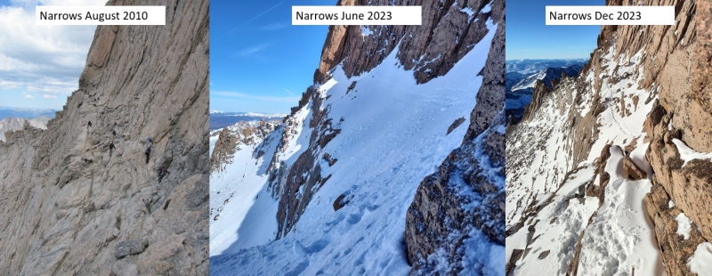
The Narrows This was always one of the sections that worried me the most about doing the Keyhole route in winter. What if the Narrows were totally packed in with snow?!?! Well that's exactly what I encountered last spring when I did a somewhat dramatic ascent of Longs as a practice run for this one. If interested you can read that spring version here: Snowy Longs up Keyhole down Cables On this occasion it was more loaded than I wanted to see but not nearly as bad as last spring. And the funny thing is, Logan5280 had overtaken me and put tracks across the Narrows for me this last spring on the same day I was there and then this winter (unknown to me until I was already packed to head to the trailhead) he put tracks in again the day before I did the route). Go Logan!!! 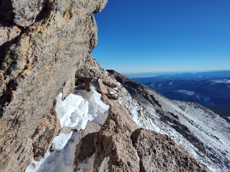
The first little section can require a slightly awkward crawl under an overhanging rock. After that, I had crampons on when going across but with all the exposed rock in places those made it almost more awkward to cross. This last spring they were absolutely essential but for this particular winter climb they were actually a bit of an impediment. On the way back I used microspikes instead and that felt much more secure to me when stepping on the exposed rock - but that again could vary greatly with just a little ice (I didn't encounter ice on the Narrows in June or December but that doesn't mean it doesn't get that way...) 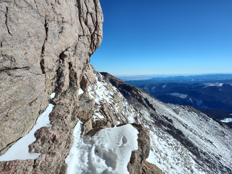
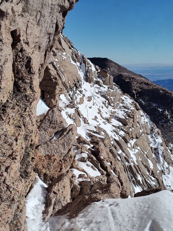
You might not die if you fall off the Narrows, but you probably would. I would recommend not trying... This region gets pretty sun baked which is why people say its often dry, but in my personal experience with this mountain, people are often wrong - I mean come on people does that look dry to you!?!? And also it's reportedly also wind blasted but there wasn't the slightest hint of wind along the Narrows or Homestretch this day so I felt like a chestnut roasting on an open fire during this section after having bundled up against the wind streaming through the Trough.. 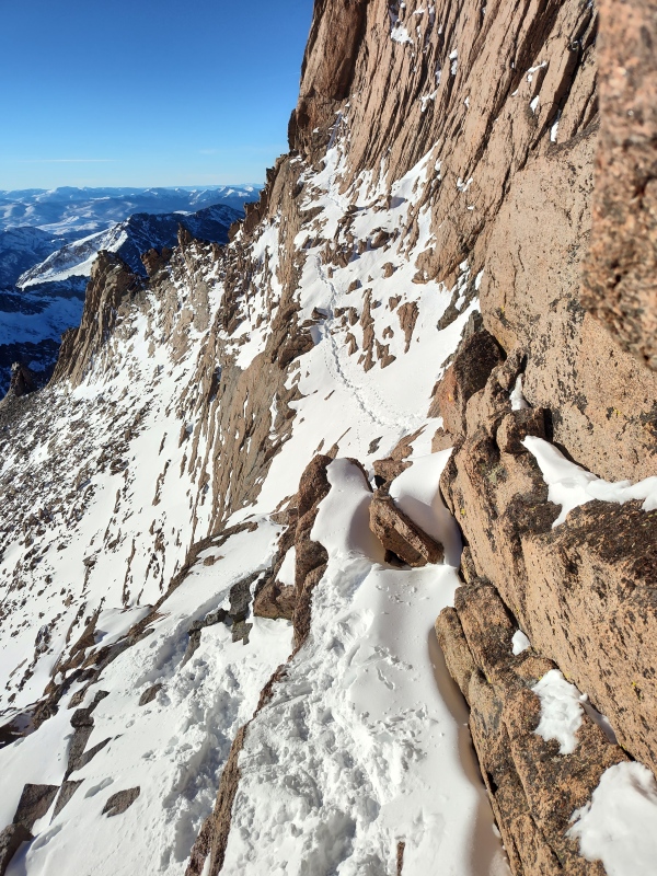
The Homestretch The Homestretch had just the right amount of snow (which Logan and others had very useful put steps up in) that it made it easier than summer in some respects (but not for the first guy - poor Logan! Thanks again!). Other people have reported it to be icy at times but I got lucky and didn't encounter any. 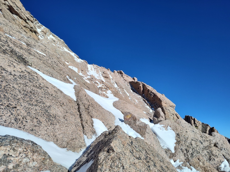
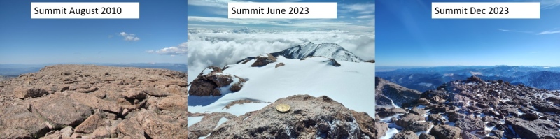
The Summit This monster football field sized summit can be a real beauty but is known for frequently strong winds - speaking of which, after roasting along the Narrows and Homestretch, I of course got massaged by an icy wind on the summit so didn't linger all that long but dropped back down to the sheltered Homestretch. 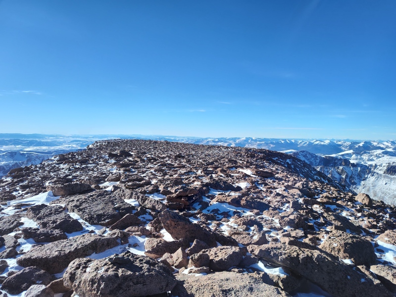
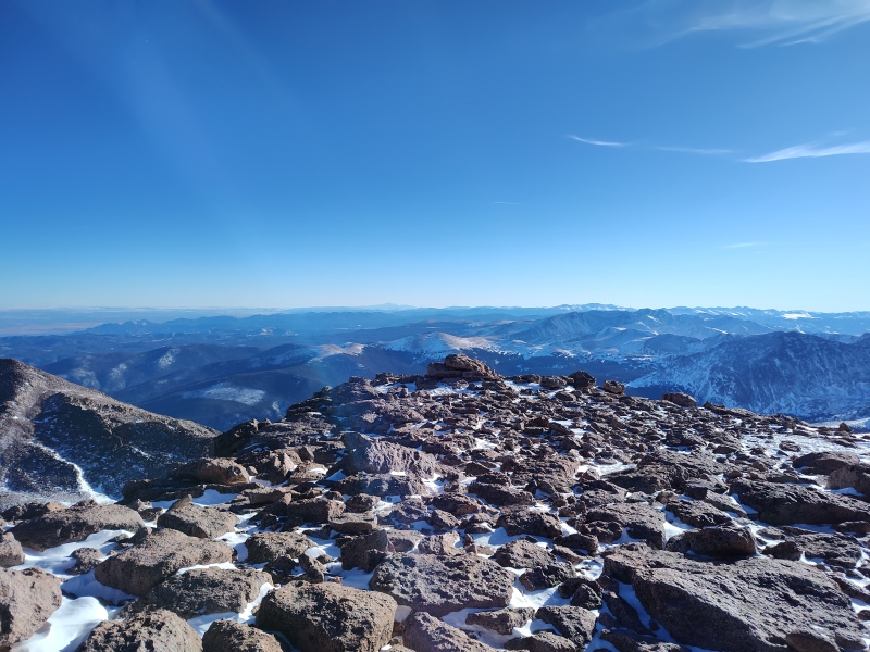
The Return On the return the temperature game continued full swing. Icy wind on the summit; totally dead along the Narrows with hot sun blazing on me, then icy blast at the top of the Trough then dead along the Narrows with the setting sun baking me, then more icy blasts at the Keyhole, then zero wind in the Boulder Field then icy blasts at the far side of the Boulder Field... you get the point... Make sure you have your layering scheme dialed in for this one because the temperature extremes when going between zero wind with baking sun and wind that freezes the insides of your arteries is rather extreme. 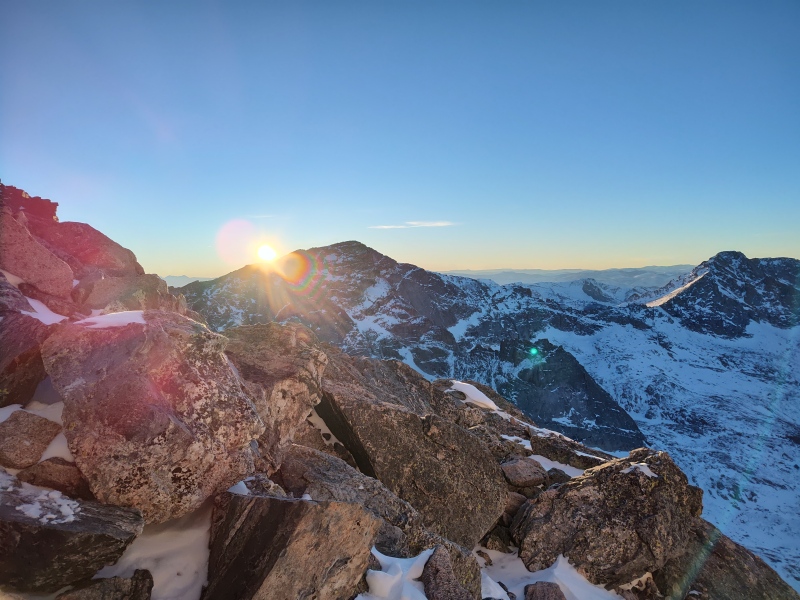
I was not on top of my game for this climb - too little sleep from winter car camping and too little exercise/acclimation over the holidays so I crashed at the Agnes shelter on both the way up and the way down. It was mostly filled with snow (seems to be pretty common) but the front step was dry and the remaining snow within was angled enough to lay down against, out of the wind. And I even had signal to send out some texts to friends (using Verizon). 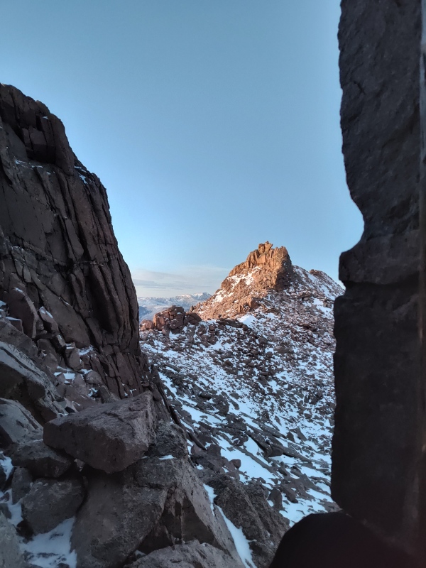
Comparison Photos Something important to note is that the Keyhole route in particular changes dramatically throughout the year. This is true of any mountain but due to certain constrictive features (Ledges, Trough, Narrows, etc) the changes are more dramatic and more consequential than how you'll see a peak such as Quandary change. The below side by side photos are taken from some of my various adventures on Longs over the years and are meant to give a few examples of the sorts of variable conditions you can potentially find on Longs - in particular along the Keyhole route - at different times of the year and across different years. Please note that May/June 2023 was an exceptional snow year with much greater amounts of snow loading than what's reportedly normal. But the photos give some idea of the potential range of conditions you might encounter. 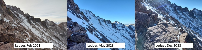
I'll also include here a couple photos from May 2023 that give a more intense feel of why some people prefer the torment of taking the Trough from Black Lake over crossing the Ledges in wintery conditions. 
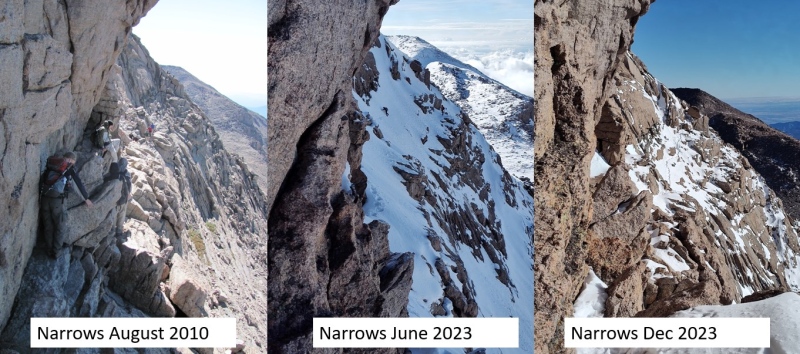
In case you can't see the details well, here's the full size version of Logan and Alessia crossing the Narrows in June 2023, with me following a little after. We essentially almost didn't touch a single rock the entire way across - it was all solid snow requiring kick stepping in with crampons and having only ice axes to provide handholds. That was VERY uncomfortable for me. 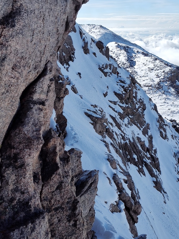
The takeaway here is that you never know quite what you'll encounter on the Narrows and, as mentioned before, you'll have no idea what to expect until you're right there, unless you get lucky and someone else posts a conditions update before you go. 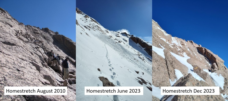
So overall - Longs is not part of the Dirty Dozen (the 12 peaks generally considered the most difficult in winter, for a collection of reasons) but it is also not a trivial winter peak. The Keyhole Route can be a viable option in winter but it can also be very treacherous and it takes even longer in winter than it does in summer. My time on this particular day was extra slow due to poor sleep, inadequate exercise over the holidays, etc. At 18 hours and 7 minutes it was a VERY long day. Others can bang it out much quicker but I'd still plan on a potentially much longer day than summer. My Times (for Dec 2023) 3:30am start from Longs Peak Ranger station 4:48am Lightning bridge 6:09am Chasm Lake turnoff 7:12am Granite Pass 8:27am Finally crested hill and entered Boulder Field 9:06am take a break by the toilets (finally in the sun and not the wind!) 9:28am continue on 10:20am Agnes shelter and really bonking (lack of sleep? Too much Christmas candy, not enough exercise over the holidays?) 10:51am continue with microspikes and axe 11:36am base of Trough 1:12pm finally at top of Trough after near wipe-out on ice and lengthy ordeal switching to crampons (which weren't needed on this day) 1:40pm across the Narrows after pausing to shed layers due to heat and lack of wind 2:22pm Summit!!!! 2:43pm start down to get out of the chilly wind 3:22pm start the Narrows; no wind, too much sun 3:35pm top of Trough; now crazy cold wind again 4:30pm crossing the Ledges, getting hit by setting sun and absolutely no wind 5:04pm back at Agnes shelter and again wiped out 5:37pm actually had signal and sent out a few texts to friends before starting down 9:37pm finally back at trailhead after really dragging hard on the return trip Thumbnails for uploaded photos (click to open slideshow): ")
")
")
")
")
")
")
")
")
")
")
")
")
")
")
")
")
")
")
")
")
")
")
")
")
")
")
|
| Comments or Questions | ||||||||||||||||||||||||
|---|---|---|---|---|---|---|---|---|---|---|---|---|---|---|---|---|---|---|---|---|---|---|---|---|
|
Caution: The information contained in this report may not be accurate and should not be the only resource used in preparation for your climb. Failure to have the necessary experience, physical conditioning, supplies or equipment can result in injury or death. 14ers.com and the author(s) of this report provide no warranties, either express or implied, that the information provided is accurate or reliable. By using the information provided, you agree to indemnify and hold harmless 14ers.com and the report author(s) with respect to any claims and demands against them, including any attorney fees and expenses. Please read the 14ers.com Safety and Disclaimer pages for more information.
Please respect private property: 14ers.com supports the rights of private landowners to determine how and by whom their land will be used. In Colorado, it is your responsibility to determine if land is private and to obtain the appropriate permission before entering the property.