| Report Type | Full |
| Peak(s) |
Wasatch Mountain - 13,560 feet "Oscars Peak" - 13,434 feet |
| Date Posted | 02/06/2023 |
| Modified | 01/03/2025 |
| Date Climbed | 07/25/2022 |
| Author | ECF55 |
| Telluride 13ers - Wasatch Mountain, Oscars Peak, and Blixt Family History |
|---|
|
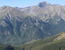
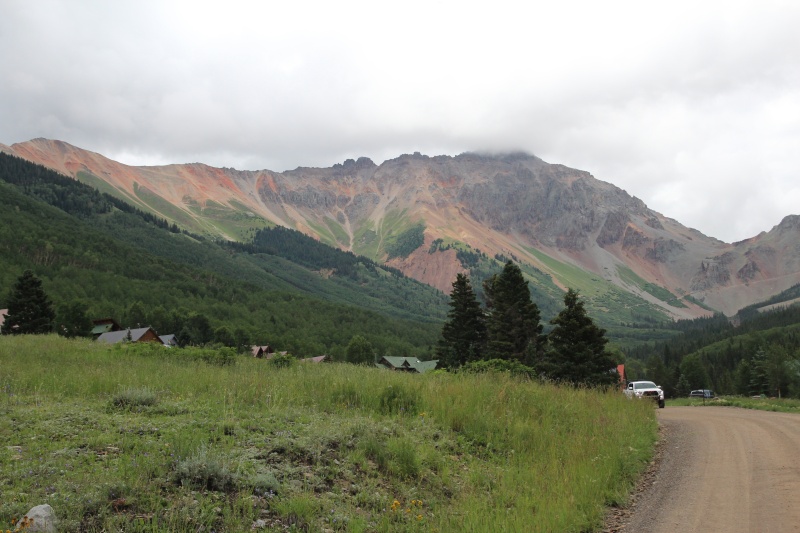
Wasatch Mountain and Oscars Peak via Ophir / Blixt Trail (with a Blixt Family History Epilogue) 25 July 2019 (Monday) Hike Times: 4:33am - 1:15pm MDT (8h 42min hike duration) Distance/Elevation: 11.97 miles / 4,627 ft (MapMyRun estimates) Mountain Conditions: Full summer conditions. Weather Conditions: Typical San Juan monsoon conditions. Moderate temperatures. Misty and cloudy in the early morning, increasingly clear in the late morning, and then showers in the early afternoon. Thunderstorms in the late afternoon and evening. Crowds: No one else on the trail. Cellular phone signal from Telluride was available on the higher peaks. The Telluride San Juans are blessed with great hiking trails, breathtaking scenery and a multitude of 13ers and 14ers in the immediate area. Our trip to Telluride in 2022 was a revisit to that magical, wonderful (and outrageously expensive) mountain town in southwestern Colorado. It was also an opportunity to finally explore the High San Juan terrain that was largely inaccessible to me in July 2019 due to the blockbuster snow season of that year. What a difference a few years makes. While the 2022 snowpack was anemic, the saving grace of the summer was a very strong monsoon pattern that brought frequent and drenching rains to the mountains. Landscapes were lush, regional wildfires were largely extinguished, and high country weather was potentially treacherous due to sudden onset of dangerous thunderstorms (largely but not exclusively in the afternoons). Wasatch Mountain Route Planning I decided to attempt Wasatch Mountain, with an option of hitting La Junta Peak afterwards (time, weather and energy, permitting). Wasatch Mountain is visible from the Telluride valley floor, and it's one of the highest peaks in the immediate area south of the city. Given Wasatch's central location in the sub-range, there are several corridors to get to the peak, including (a) Telluride-Bear Creek-Wasatch Connector, (b) Telluride-Bear Creek-La Junta Basin [alt route with dangerous gully crossings], (c) Bridal Veil Basin Trail, (d) Bridal Veil-Jackass Basin-La Junta [alt route with ridge obstacles], and (e) Blixt Trail from Ophir. After a lot of deliberation, I decided to attack from the south up the very steep engineered mountain path known as Blixt Trail, which is just to the east of the small mountain town of Ophir. Blixt Trail "more efficiently" gets you up to the High San Juan terrain because the trail was built directly into the mountainside by Telluride miner extraordinaire Oscar Blixt in the (est.) 1950s. The trail is well maintained and has been incorporated into the notoriously difficult long distance sufferfest that is the Hardrock 100 (Chapman Section). The Blixt Trail grade is a consistent 21% grade over the 2.6 miles of trail. [More on the Blixt Family at the bottom of this report.] Blixt Trail is an imposing sight to see from Ophir, zig-zagging straight up the face of the mountainside. After laying eyes on it in 2019, I knew I had to try it in more favorable conditions. A comparison of 2019 and 2022 conditions in Ophir Valley towards Blixt Trail: 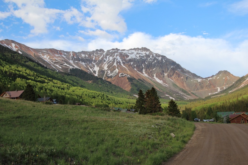
Wasatch Mountain / Oscar's Peak Trip Report (via Ophir / Blixt Trail) I got an early start to manage afternoon storm risk. I drove to the mountain town of Ophir via Ophir Pass Road (Forest Road #630), which is an excellent unpaved road between Colorado-145 and Ophir. The Ophir/Iron Springs Mining district was a hive of mining activity around 1900, but the town went bust in the late 1920s (along with many other mines in the area) and has only recently been re-populated with a number of outdoor enthusiasts. The valley is remote and gorgeous. There are two options for your tailhead, including the eastern edge of Ophir (2WD) or Iron Springs (4WD). Iron Springs (basically a big turn-around area; shown below) is about a mile east of Ophir on Ophir Pass Road and that section of road is decent, but there are a couple stream crossings along the way and 4WD vehicles with decent clearance will make the drive more enjoyable. I had a rental, so I parked on the eastern outskirts of Ophir and hiked in. 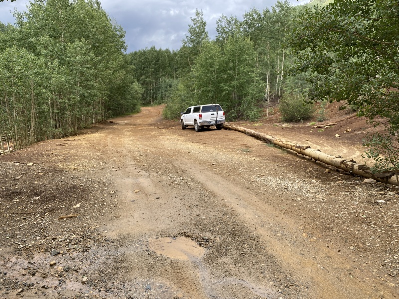
Ophir Valley is very dark at 4:30am on the approach to Blixt Trail. Jeep traffic picks up considerably by mid-afternoon, but the road was completely deserted in the pre-dawn hours. When hiking alone and a pair of well-spaced eyes down in the creek reflect headlamp light back at you, the mind begins to wander into unhelpful places and I questioned my logic of soloing this hike so far from civilization. Fortunately, everything worked out fine. There are two unmarked (north-bound) paths approximately one mile east of Ophir on Ophir Road; Blixt Trail is the second (easternmost) of the two on Ophir Road at ~10,300ft elevation. Begin your steep ascent. 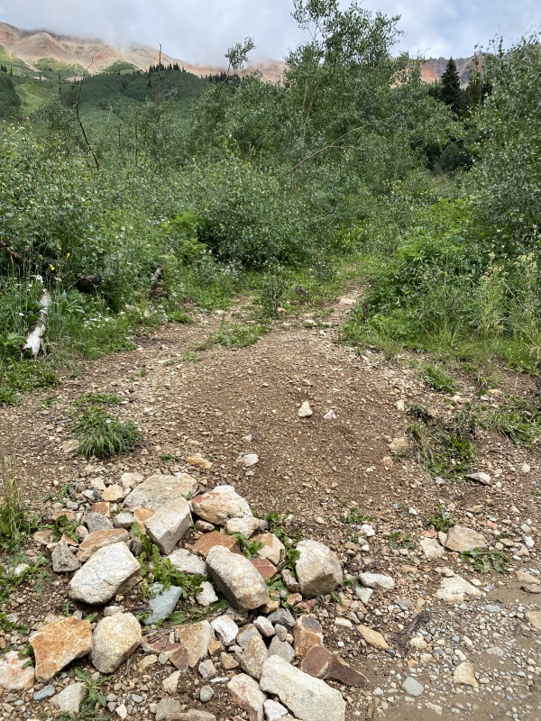
Blixt Trail is a consistently steep, generally well-worn trail / abandoned mining road. The lower portion of the trail makes its way through a mixed aspen-conifer forest. Before long, the trail reaches the northern slope of the Chapman Gulch drainage near the old Calumet Mine and the views begin to open up to the south across the valley (~11,300 ft). 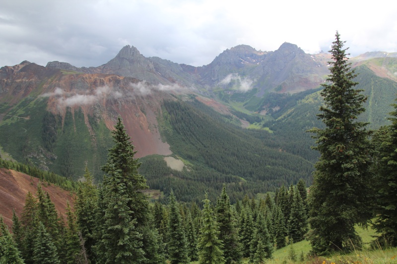
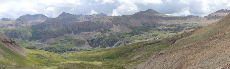
The humid monsoon conditions of the morning resulted in a periodic mist and a persistent cloud ceiling that obscured the highest peaks. However, the continuous wall of the San Joaquin Ridge was remarkable. 
The bedrock geology of the ridge is slow to reveal itself on the San Joaquin Ridge because the entire mountainside is covered in a thick layer of talus and vegetation. However, the upper section of the Blixt Trail includes a number of "roadcuts" that Oscar Blixt hewed into the side of the mountain. Close inspection of the in-situ rocks reveals a range of felsic volcanics (welded ash flow tuffs and massive-bedded flow breccia), reminding us that most of the upper Telluride San Juan stratigraphy includes enormous stacks of relatively young volcanic deposits from Yellowstone-class supervolcanos just to the east (~30 Ma). Really extraordinary stuff. The upper Blixt Trail is remarkably well-engineered, largely due to a combination of those deep roadcuts with stabilized berms. Talus now litters the trail near the pass, but it's an obvious and deliberate (albeit steep) path. 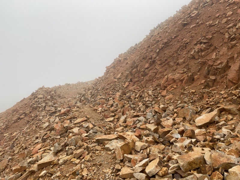
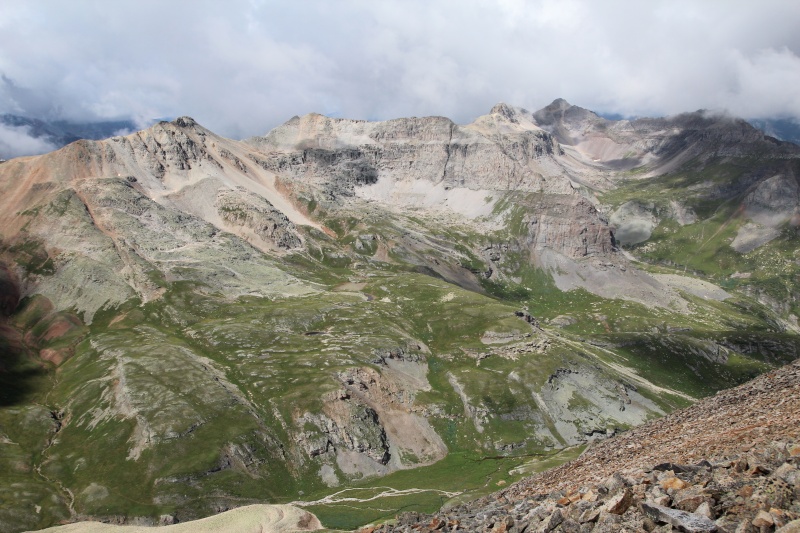
Once you reach Oscar's Pass (~13,100 ft), you have the option to hike into the Upper Bridal Veil Basin (straight ahead) or up to Oscar's Peak (immediately left along the relatively broad ridge of shattered rock). I chose the latter. Oscar's Peak summit is only 0.2 miles distance from the Pass; I am told that the views up there are some of the best in the Telluride region, but the clouds had yet to clear. The northern ridge descent from Oscar's Peak to the Oscar-Wasatch saddle was straightforward, even if tedious due to the platy talus frequently sliding underfoot. On my descent, the clouds finally broke and I was able to enjoy the amazing mountain scenery of the Bear Creek and Bridal Veil Basins. It's excellent high elevation Rocky Mountain landscape. 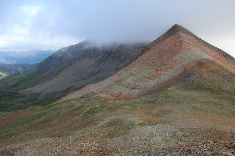
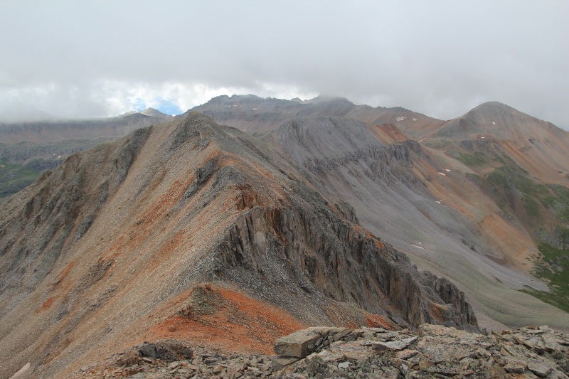
Once you reach the saddle, you have two realistic options to reach Wasatch Mountain: the Wasatch Ridgeline (pictured above) and the 4x4 jeep path along the east side of ridge (below). I really wanted to take the Wasatch Ridgeline as it looks like a classic San Juan entry-level traverse. The route has been summarized in other forums; it appears to be a slabby talus, Class 2 ridgeline with low-to-moderate exposure and a short Class 3 obstacle near the middle prominence. For a number of reasons (solo hiking, crappy San Juan rock, questionable weather conditions), I opted to take the 4x4 Jeep Path that would much more quickly get me to the base of the main Wasatch summit. However, I think the ridgeline is worth a visit in the future if I can ever make my way back with a partner. 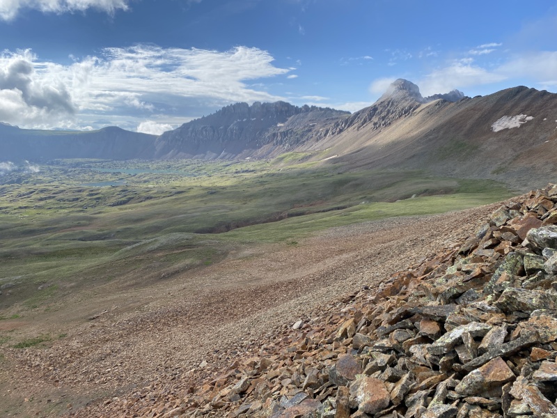
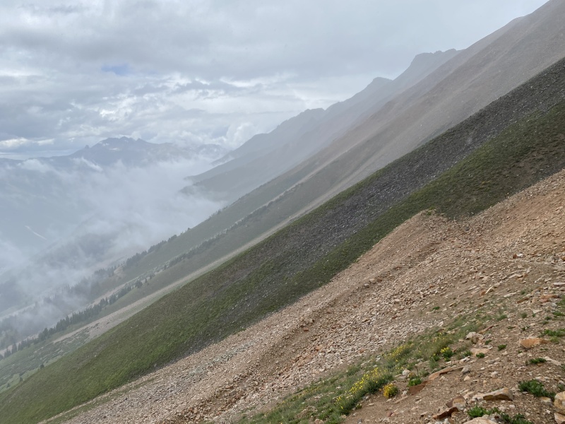
Hiking on the Jeep trail was very fast and the amazing views made up for the flat, pedestrian trail. A sign marks the point where the main Jeep trail turns hikers right; continue straight towards La Junta Basin. As you round Wasatch Mountain, La Junta Peak comes into view. La Junta's slopes are a remarkably constantly steep and the profile of the mountain really stands out. 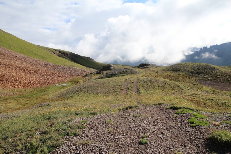
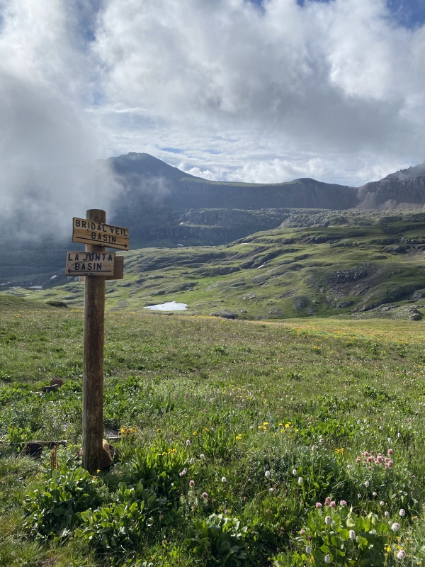
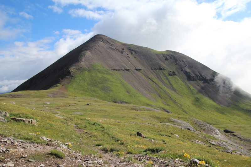
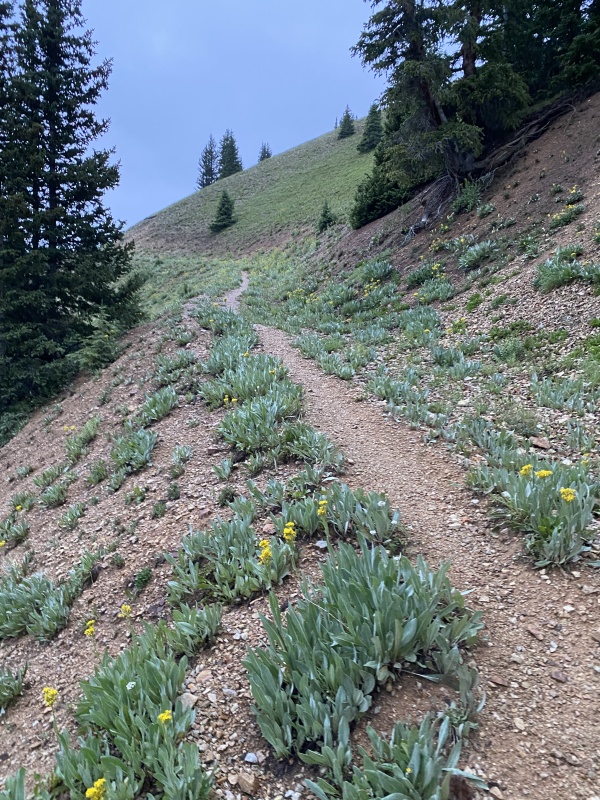
The old jeep trail takes you to the saddle between Wasatch and La Junta peaks. Take a second to enjoy the small, lovely unnamed alpine lake next to Wasatch. There's general consensus that the Wasatch north ridge approach should be avoided (it's an unpleasant, loose stack of scree) in favor of heading south of the alpine lake and gaining Wasatch's northeast ridge via the grassy slope (pictured below). I opted to hike just to the left of the grass to not destroy the fragile alpine soil/grass. 
I will stress that even this approach is rocky, dirty stuff and it's difficult to keep your footing. For every two steps up, I slid a half step down. I eventually thought back to advice proffered on the Non-Standard 14er Podcast from Short-Rope Stiffler where you just need to "bear crawl up the mountain" on those dirty slopes. It really worked! 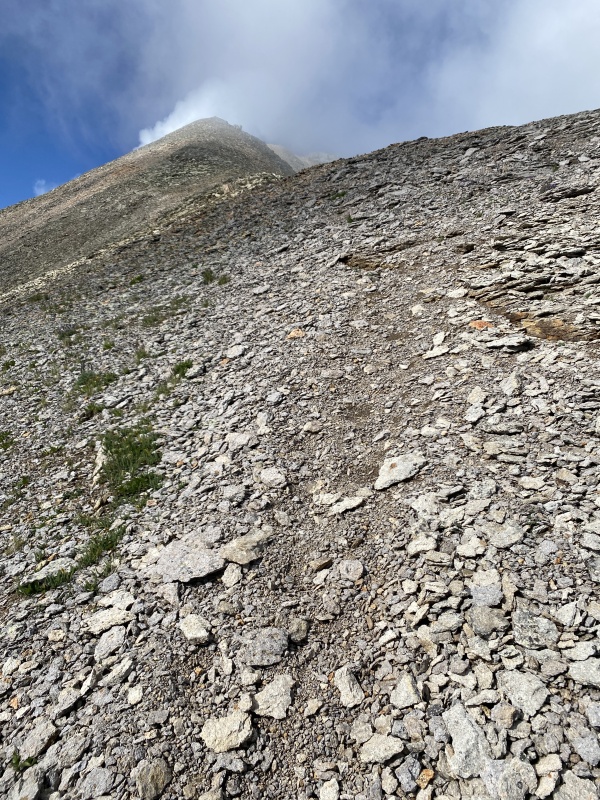
Once you gain the ridge, views really start to open up to the north towards Telluride. The last stretch to gain the summit includes ~400ft elevation and is a steep, difficult Class 2 (no exposure, not technical) scree mess of plates and cobbles that shift when you step on them. Classic San Juan terrain. 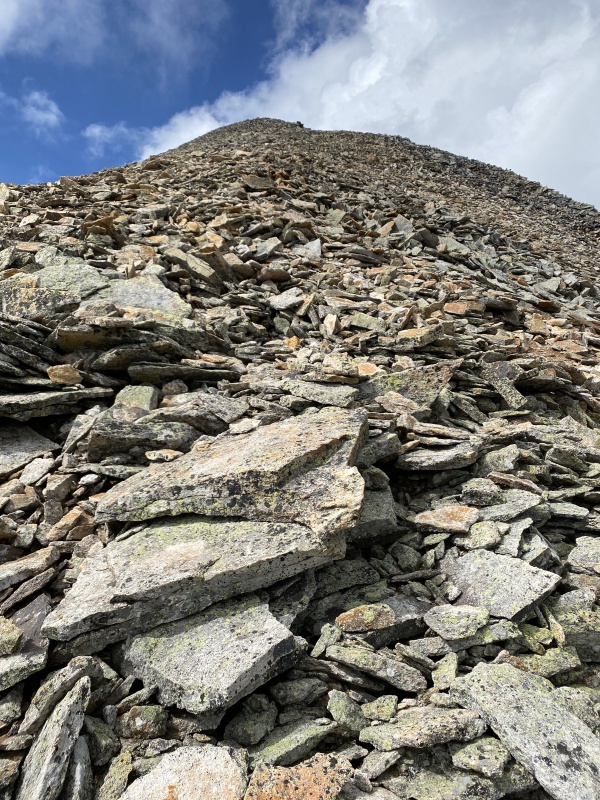
The Wasatch Mountain summit is a stunner with jaw-dropping views in every direction. Even better--I had the whole summit to myself. 13ers, including those with great infrastructure close to tourist destinations, really do get a lot less love than the 14ers! I spent some time on the top, but it was getting later in the morning (10:30am) and clouds were starting to build. 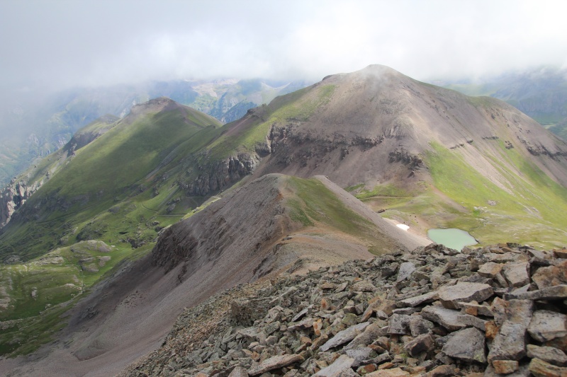
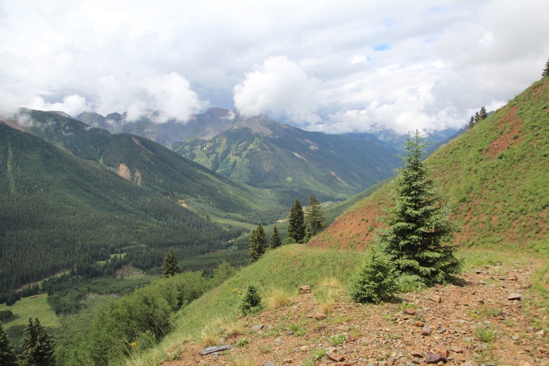
By the time that I descended Wasatch Mountain, I was growing tired due to the big day and my body still trying to acclimate to the altitude. La Junta would have to wait for another day. However, it really didn't matter because the clouds quickly piled up, bringing intermittent showers, and I had a fair amount of trail in the Upper Bridal Veil basin (~12,800 ft) plus a crossing of Oscars Pass (13,100 ft) before I could quickly lose elevation on Blixt Trail. This is something to consider with Telluride's trails as the afternoon approaches: while you may not be stuck on a ridge during the monsoons, many of the trails in the High San Juans can still have extended travel above treeline, leaving you dangerously exposed if thunderstorms suddenly organize directly over your head! 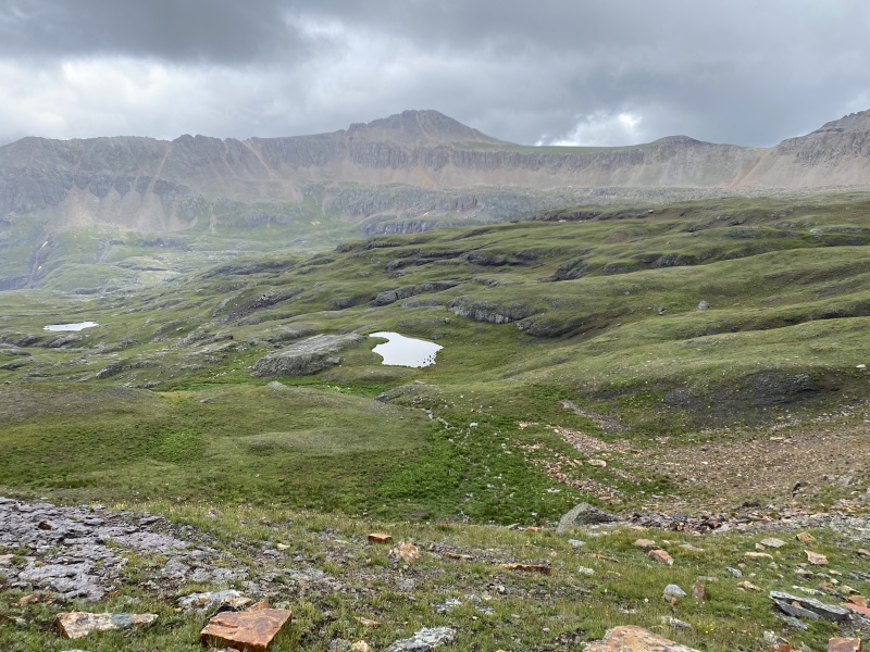
I cleared Oscar's Pass a little bit before noon with some icy precipitation falling and then had a rapid but wet hike down to the base of the valley. There was some spotty thunder a couple mountains over as I neared Ophir Pass Road, but the worst of the thunderstorms held off until well after I was off the trail. The one major benefit of Blixt Trail is that it made for a relatively rapid descent to safety from the Pass. All in all, it was a great day in the mountains and the views were outstanding. 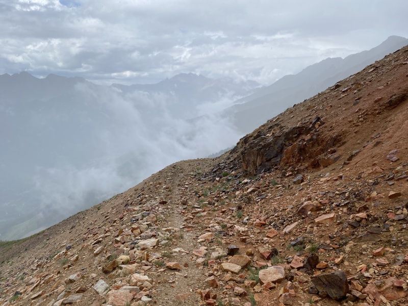
EPILOGUE: Blixt Family History Blixt Trail. Oscar's Pass. Oscar's Peak. Who were the people that inspired the names for these local but obscure features? What started as a simple historical and genealogical search turned into a giant, multi-faceted rabbit hole that consumed a significant amount of my goof-off time for a couple months. I thought it was a great exercise in Telluride mining history and I offer the highlights here for anyone interested: The Blixts were an energetic and entrepreneurial family of Swedish-American miners with restless spirits that moved to Colorado in the early 1890s. Swan BLIXT was the patriarch of the family and hailed from Grinstad Parish, Dalsland, Sweden (b. 1859). He married a woman in Sweden [no record of her name] and they had three children in Stockholm, Sweden before traveling to America (Anna Maria Helena, b. 1885; Elsie Christina, b. 1887; Carl Swan, b. 1889). Swan Blixt immigrated to America in approximately 1889 and his wife and children followed 2-3 year later. While there are no records of Swan's occupation before his immigration, he very quickly began work in metallurgy and mining after moving to the American West. By 1892, the Blixt family was living in Denver and Swan was employed at Argo Smelter, which processed gold, silver and copper ores. Shortly afterwards, Swan worked as a bi-metallic smelter in Leadville and his son Alfred was born in the same town (b. 1893). Soon after, the Blixts moved to Durango (one would assume for mining employment opportunities) and Harry (b. 1895) and Oscar (b. 1897) were born. Their final child Ruth was born in Victor/Cripple Creek, Colorado on 29 Mar 1900. However, tragedy struck immediately after Ruth's birth with Swan's wife dying (d. 14 April 1900), perhaps due to complications from childbirth. The unexpected death of a wife and mother of seven must have been a shock to the family. For a short period, Swan and his children moved back to Denver and he rejoined the ranks at Argo Smelter. However, Swan was one of those types that can't be satisfied with daily industrial drudgery. Mining was his calling and he was compelled to answer. By 1905, Swan Blixt had found employment in the Telluride-area gold mines as a foreman at the Liberty Bell Mine. He moved his family to Olathe, Montrose County, Colorado and rented a ranch near town from Talitha A. MCNEIL Church in February 1906. Life in the Telluride mines in the early 1900s was difficult and dangerous. Records show that Swan Blixt spent most of his time up in the mountains as a shift boss at Liberty Bell leading labor-intensive gold mining activities, but he also allowed himself occasional short breaks where he would travel back to Olathe to visit family, monitor ranch activity and generally recharge from the grinding mining schedules. Given the poor state of mining safety in that era, it should probably not surprise us that Swan suffered injuries from a fall in the mine (Nov 1907), requiring him to receive care from the local Telluride hospital for more than a week. Talitha Church and his daughter Anna Blixt retrieved Swan from the hospital and escorted him back to Olathe for a month-long recovery period back at the ranch. Somewhat surprisingly (to this author, at least), Swan and Talitha decided to marry each other during his convalesce period. Swan Blixt, now in his late forties, couldn't be held down for long, and he almost immediately returned to Liberty Bell Mine to work as a shift boss. Swan also enlisted Talitha to accompany him at Liberty Bell where she took charge of a boarding house on the property and cooked meals for the workers. The two spent most of their time in mining camps the next couple years, but also periodically returned to Olathe for recovery. The union did not last, however. Swan Blixt returned from Liberty Bell to Olathe in January 1910 and the couple had a very public argument where Swan declared that he would "never, no never, live with her again". They divorced shortly afterwards and Swan moved to a homestead plot out in East Mesa (Olathe). He continued gold mining for a few more years, but he was largely out of the gold mining business by 1914 (age 55) and complained about rheumatism. 
The Blixt boys initially worked as ranch hands and hired labor around Olathe and Montrose. They also spent a lot of time with friends, attending local social gatherings and doing big outdoor recreation outings. Oscar, in particular, took long horseback rides with close friends in the lower Gunnison Canyon and also took camping trips out to Black Mesa. Carl was the first to enter work in the Telluride mines (Liberty Bell) in 1910 and was a regular in the mining camps for several years. The two Blixt girls had decidedly different life arcs from their brothers, moving to Denver in 1908 and both marrying local-area men in 1910. Anna BLIXT married James Gale SILVEY, a worker in the Denver stockyards. They both moved to Greeley, Colorado in ~1913 and James took employment in the Greeley Rendering Plant. Elsie BLIXT married Fred Paul MCINTOSH, a meat inspector for the US Bureau of Animal Industry at Denver meat packing houses, and they remained in Denver for the duration of their adult lives. Both Anna and Elsie had children and traveled back to Olathe regularly to check on their aging father. There is no mention of Ruth BLIXT after 1903. World War I disrupted the Blixt brothers' lives in 1917. Carl and Alfred were drafted and deployed to Vancouver Barracks (Mar 1918 - Feb 1919) to participate in the Spruce Production Division, a domestic Army unit in the Pacific NW that produced millions of board feet of high quality Sitka spruce timber needed to make aircraft for the US war effort. Harry was drafted into Army active duty service, shipped to Camp Funston, Fort Riley, Kansas for initial training (Sept 1917), and ultimately deployed to the European Theater in May 1918 in Company E, 105th Ammunition Train, 30th Infantry Division. The division took part in the Ypres-Lys and Somme offensives and it was rumored back home that Harry was missing in action; however, those rumors proved false and Harry redeployed home in March 1919 and arrived back to Olathe in April 1919 to Swan's great relief. By the early 1920s, all four Blixt Brothers took up employment around Telluride, finding work in the same mines that saw significant new gold production that decade (initially Smuggler/Smuggler-Union and later the Tomboy mines). Records indicate that in addition to general mining work, the Blixt brothers also worked higher skill mining jobs including diamond drill contracts. Carl and Harry worked diamond drill contracts on Mount Wilson and Smuggler-Union mines (with James M. Johnson in 1924) and Harry and Oscar also worked a diamond drill contract at Smuggler-Union (1924). Carl Blixt also took a job in the Mt Wilson mining district working for Dr Sabin A. Von Sochocky "on his mining property" (1924). Details of the job are sparse, but Dr Von Sochocky is famous for co-founding what became the US Radium Corporation that sought to market a new glow-in-the-dark radioactive paint for various military applications. Radium was mined largely from the Paradox Basin in Western Colorado, shipped east where it was purified in processing factories, and then combined with copper-doped zinc sulfide in a paint that glowed in the dark (radium atom radioactive decay releases alpha particles that excite zinc sulfide electronic states, resulting in green light phosphorescence as it relaxes). Radiation risks were not well understood and numerous factory workers died of cancer and other maladies like radium jaw due to horrible levels of radioactive material exposure (see Radium Girls for specifics). Why Dr Von Sockocky owned property near Mt Wilson (and not Paradox Basin) is less clear, although early radium research was conducted on samples from the Primos Chemical Company Mill in Vanadium, Colorado just downstream from Telluride, so there could be a link. On the personal front, several of the Blixt brothers married in the 1920s and purchased land. Oscar married a woman in 1921 (name not listed; "Friends of Oscar Blixt gave him and his bride a rousing chirivari last Thursday night.") and she accompanied him frequently up to Tomboy mine. Oscar also purchased 640 acres of land near Blue Mesa, Colorado, where he spent time when not mining. There is no mention of Oscar's first wife after 1925. Oscar's close childhood friend Johnnie ASCHENBRENNER bought an equivalent sized property next to Oscar in Blue Mesa and he ranched on the land. Harry married Ella WIGGETT in 1926 and they finalized purchase of 640 acres of land adjoining Oscar in Blue Mesa. Carl moved east to Greeley before the end of the decade and married Katherine ASCHENBRENNER, an old family friend from Olathe and the younger sister of Johnnie. Alfred, for his part, appears to be the least social of the four and never married. Swan started ranching in earnest around 1920. He and a friend traveled to Green River, Utah to buy "a bunch of cattle" and he used his ranch land for beef production. Nonetheless, Swan couldn't kick his desire to mine, and he immediately hatched a scheme to work some coal seams approximately six miles east of Olathe. In 1922, Swan put advertisements in local Montrose papers for a big public sale of livestock, farm machinery and even a 1917 Model Ford touring car (in good condition) in what appears to be a liquidation effort to finance formation of his coal mining operation (HUB Coal Mining Company). Swan and his son-in-law (specifics not provided) claimed to have spent "several thousand dollars of their own money" for preliminary mining work, including sinking a drill 416 feet and finding two veins of coal (the first was 7ft thick at 333ft depth with 90 feet of hard rock "roof"; 1924). They also proposed sale of fifteen thousand shares of stock ($1 per share asking price) to open the shaft and commence operations. In actuality, Blixt's coal mining activities do not appear to have ever taken off and there is no evidence that he raised sufficient capital to economically reach the deeply buried sub-bituminous coal seams. This effort was almost certainly financial folly for the patriarch of the family. 
By the end of the 1920s, the entire economy went bust with the onset of the Great Depression. All major mining operations in Telluride closed down in 1928 and the town saw significant economic contraction. The Blixt family migrated in search of new economic opportunities. Swan moved to Denver in 1929 to live with Elsie and he died shortly afterwards (d. 29 Mar 1930). Harry, Alfred and Oscar initially moved in together in Leadville as "out-of-work miners" (1930 US Census). Harry subsequently moved to Greeley, Colorado in 1931 where he found employment with Carl and his bother-in-law James at the Greeley Rendering Plant. Rendering plants are useful but gruesome factories that convert all manner of animal bi-products into new rendered materials like grease, soap and animal food. The Greeley Plant put ads in the local paper to pay top dollar for “dead horses and cattle" for use in the factory. I'm not sure I want to imagine what Great Depression-era rendering plant sanitation and/or ventilation conditions were at the time, but I am sure it was a long, long way from what the Blixts experienced in the San Juan gold mines. Harry and his wife moved back and forth between Western Colorado and Greeley over the next 15 years. He initially tried his hand out west as a WW1 Pensioner, but was back at the Greeley Rendering Plant in 1942. More interestingly, Harry joined a small mining crew in the late 1940s at the Minnie B. Mine (Yankee Boy Basin/Ouray, Colorado). The 1949 Mining Yearbook included a promotion about mine owner William C. Francis and his small crew that planned to work a large fluorspar vein at Minnie B. Mine that contained principal values of lead and silver. Harry was included in several of the article's pictures and appears to be the mining experience of the operation. Harry and Ella separated some time between 1950 and 1960 and he lived the remainder of his life in Delta County, Colorado. 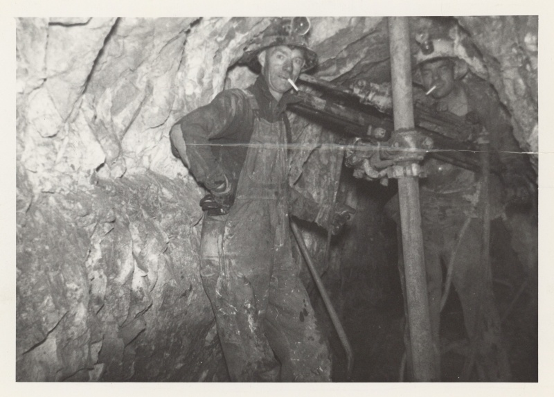
Alfred (childhood diminutive "Allie", adult nickname "Gator"; get it?) and Oscar lived and worked together in Telluride from 1935 into the 1960s. Telluride legend Bill Mahoney described the Blixt Brothers as some of the last "wise old salty miners" in the business. They were initially employed by the Telluride Mines, Inc. and they transitioned to self-employed gold miners as Telluride mining operations saw significant consolidation in the 1950s. The brothers prospected and mined in Bridal Veil and La Junta Basins throughout this time. Oscar married Lena GIACHELINI Sams in 1946 (Aztec, New Mexico) and they lived the remainder of their lives in Telluride. The "Telluride - Images of America" book states that "Oscar and his wife used a swinging lantern at night to communicate with each other between her porch in Telluride and his work site in East Bear Creek Canyon." Mining records are sparse, but the Blixt Brothers filed a claim in 1963 for the "Telluride Mine", which was on the western wall of Bear Creek Canyon with line-of-sight views to the houses in Eastern Telluride. This could possibly be the mine mentioned in the Telluride book. Regardless, the story conveys the difficulty of small claim gold mining on the steep slopes of Bear Creek Canyon, but also the resiliency and improvisation of Oscar and Lena to stay connected as he worked in this difficult profession. Oscar was also an active citizen of Telluride, being appointed town marshal by the town council in 1958 and, separately, rescuing a neighbor from a house fire in 1963 (at the age of 65!). 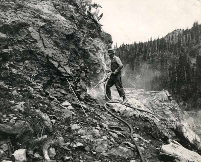
I was not able to find any specific references that nailed down the construction history of Blixt Trail, but there are anecdotes and USGS maps that may provide some clues. What is certain is that Ophir Valley mining activity peaked in the early 1900s. Miners built a network of access roads up the steep slope of the San Joaquin Ridge to enable operations, including an access road on the north side of Chapman Gulch to the Calumet Mine (elevation ~11,400ft). The 1955 USGS Topo Map (based on 1951 aerial imagery) includes the old mining road to Calumet Mine, but it does not include any record of Blixt Trail up to Oscar's Pass. Unsubstantiated anecdotes tell a wonderful story about Oscar's drive and tenacity to mine gold during the latter years of his life. Oscar worked claims in the Bridal Veil basin in the early 1950s and he accessed these sites via Bridal Veil Road. As the story goes, Oscar lost access to Bridal Veil Road after a mine changed ownership and closed the road, preventing Oscar from easily accessing his claims further up the basin. Oscar's solution was to find the next easiest access point into the Upper Bridal Veil Basin (i.e., what became known as Oscar's Pass at 13,100 ft elevation) and build a new road over the mountainside into the basin. Blixt Road is an audacious engineering project that rehabilitated older mining roads on the lower third of the slope and built a new, multi-switchback access road on the upper two-thirds of the mountain, including those stabilized berms and impressive road-cuts that still stand today. With completion of the road, Oscar went back to his passion, which was small-scale gold mining from high grade ore in the San Juan back country. Just amazing. 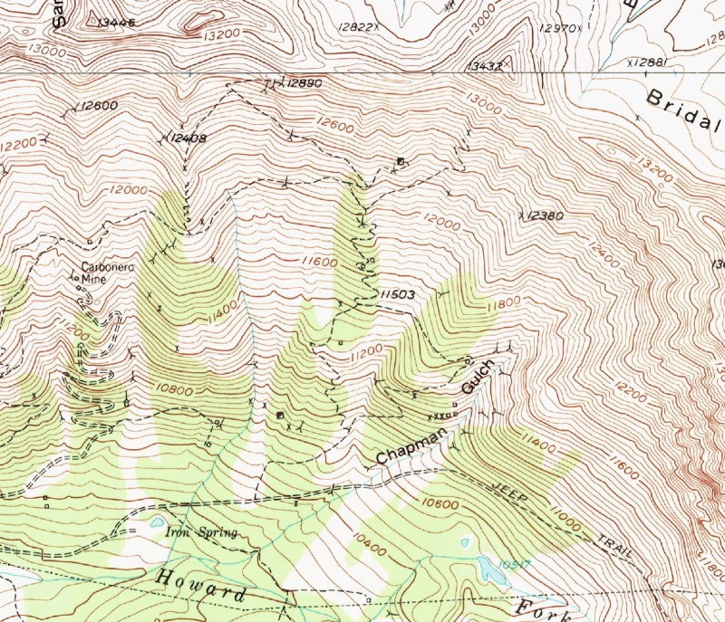
The lives of the other Blixt children was more varied. Anna lived out her life in Greeley with her husband and by all accounts maintained a happy union. Elsie took up work as a laundress with Colorado Lace Cleanings in Denver in ~1932 when her husband Fred was committed to the "Pueblo Colorado State Hospital for the Insane" (no justification yet identified). Fred spent the remainder of his life in the Pueblo Insane Asylum and Elsie did not remarry. Carl continued working at the Greeley Rendering Plan and participated in the local Catholic Church social scene. However, Carl abruptly put an advertisement in the local paper for a complete liquidation sale of all of his property (Greeley Daily Tribune, 8 December 1942). Shortly afterwards, Carl was divorced and living in a Los Angeles boarding house (1950 US Census), while his former wife Katherine had moved to Denver and was working as a maid. The Blixts are buried in plots across Colorado. Swan Blixt is buried with his daughter Elsie in Denver (Riverside Cemetery). Anna Blixt is interred in Greeley (Linn Grove Cemetery). Carl, Alfred and Harry are all buried with white veterans headstones, Carl in Denver (Fort Logan National Cemetery) and Alfred and Harry in Grand Junction (Veterans Cemetery). Finally, Oscar can be found next to his second wife Lena in Lone Tree Cemetery, Telluride, Colorado. Swan BLIXT (b. 16 May 1859, Grinstad Parish, Dalsland, Sweden; d. 29 Mar 1930, Denver, Colorado). Married Anna(?) MNU (b. ?; d. 14 Aug 1900, Colorado) in Sweden and had seven children together. Married Talitha A. MCNEIL Church Southland on 16 Jan 1907 (Montrose, Colorado); divorced on 25 Jan 1910 (Montrose, Colorado).
Thumbnails for uploaded photos (click to open slideshow): ")
")
")
")
")
")
")
")
")
")
")
")
")
")
")
")
")
")
")
")
")
")
")
")
")
")
")
")
")
")
")
")
")
")
")
")
")
")
")
")
")
")
")
")
")
|
| Comments or Questions | |||||||||||||||
|---|---|---|---|---|---|---|---|---|---|---|---|---|---|---|---|
|
Caution: The information contained in this report may not be accurate and should not be the only resource used in preparation for your climb. Failure to have the necessary experience, physical conditioning, supplies or equipment can result in injury or death. 14ers.com and the author(s) of this report provide no warranties, either express or implied, that the information provided is accurate or reliable. By using the information provided, you agree to indemnify and hold harmless 14ers.com and the report author(s) with respect to any claims and demands against them, including any attorney fees and expenses. Please read the 14ers.com Safety and Disclaimer pages for more information.
Please respect private property: 14ers.com supports the rights of private landowners to determine how and by whom their land will be used. In Colorado, it is your responsibility to determine if land is private and to obtain the appropriate permission before entering the property.