Download Agreement, Release, and Acknowledgement of Risk:
You (the person requesting this file download) fully understand mountain climbing ("Activity") involves risks and dangers of serious bodily injury, including permanent disability, paralysis, and death ("Risks") and you fully accept and assume all such risks and all responsibility for losses, costs, and damages you incur as a result of your participation in this Activity.
You acknowledge that information in the file you have chosen to download may not be accurate and may contain errors. You agree to assume all risks when using this information and agree to release and discharge 14ers.com, 14ers Inc. and the author(s) of such information (collectively, the "Released Parties").
You hereby discharge the Released Parties from all damages, actions, claims and liabilities of any nature, specifically including, but not limited to, damages, actions, claims and liabilities arising from or related to the negligence of the Released Parties. You further agree to indemnify, hold harmless and defend 14ers.com, 14ers Inc. and each of the other Released Parties from and against any loss, damage, liability and expense, including costs and attorney fees, incurred by 14ers.com, 14ers Inc. or any of the other Released Parties as a result of you using information provided on the 14ers.com or 14ers Inc. websites.
You have read this agreement, fully understand its terms and intend it to be a complete and unconditional release of all liability to the greatest extent allowed by law and agree that if any portion of this agreement is held to be invalid the balance, notwithstanding, shall continue in full force and effect.
By clicking "OK" you agree to these terms. If you DO NOT agree, click "Cancel"...
Prelude: I originally referenced Brandon and Kristie's report before going out and attempting this ridge; http://brandonandkristine.com/colorado-traverses/rockinghorse-ridge/. The ridge was a ton of fun and it's possible to keep the ridge 4th class while staying near the ridge proper without any long detours (always a bonus). Another great thing (as with most Gore scrambles) is that we didn't encounter another person until we were back on the main Booth Falls Trail! The Gores are a truly magical place - basically a series of incredible scrambling ridges rather than standalone peaks with generally good rock. They're an incredible option you're interested in great scrambling routes.
Rocking Horse Ridge connects Peak P and West Partner Peak. Other iconic scrambles in the area include The Saw (Peak H to Peak P), the scramble to Peak Q, and the Partners Traverse (West Partner to East Partner). In the attached GPX track, you'll see an option for a connection to Peak Q. Unfortunately, we didn't have the time to go this route, but Climb 13ers lists it as a Class 4 alternative to the standard route and the ridge from Peak P to the saddle looked like chill Class 1/2. You'll also see a potential route connecting West Partner Peak to Outpost Peak. We didn't get a chance to accomplish this one either. We lost about 2 hours in the morning due to a combination of factors (including a forgotten helmet), but there's lots of ways to combine this ridge with other seldom-done scrambles in the area to make for an amazing endurance day!
Approach This was the annoying part. The town of Vail doesn't allow parking at the trailhead. Instead, they require you to park at the Vail Transportation Center and take a free bus to the Brook Falls Trailhead. The only problem is that the first bus doesn't leave until 6 AM. With such a long and committing route during summer thunderstorm season, you'll probably want to get an earlier start than 6:06 AM (arrival at Booth Falls Trailhead). They haven't restricted parking at Pitkin Lake Trailhead. Rather than wait for the bus, we parked at the Pitkin Lake Trailhead (allowed) and walked the extra 1.3 miles to Booth Falls. The 14.5 miles below includes the 2.6 mile back and forth between Booth Falls and Pitkin Lake. You can also take the bus back to Pitkin Lake when you come down, but they shuttles only run every 40 minutes, so it may be faster to walk back depending on your timing.
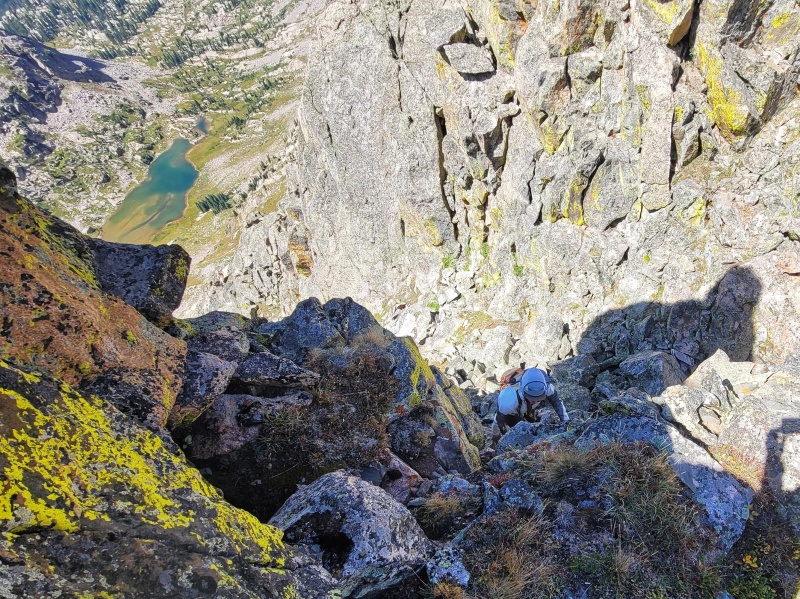
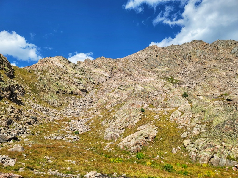
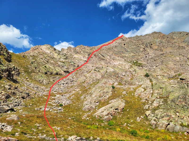
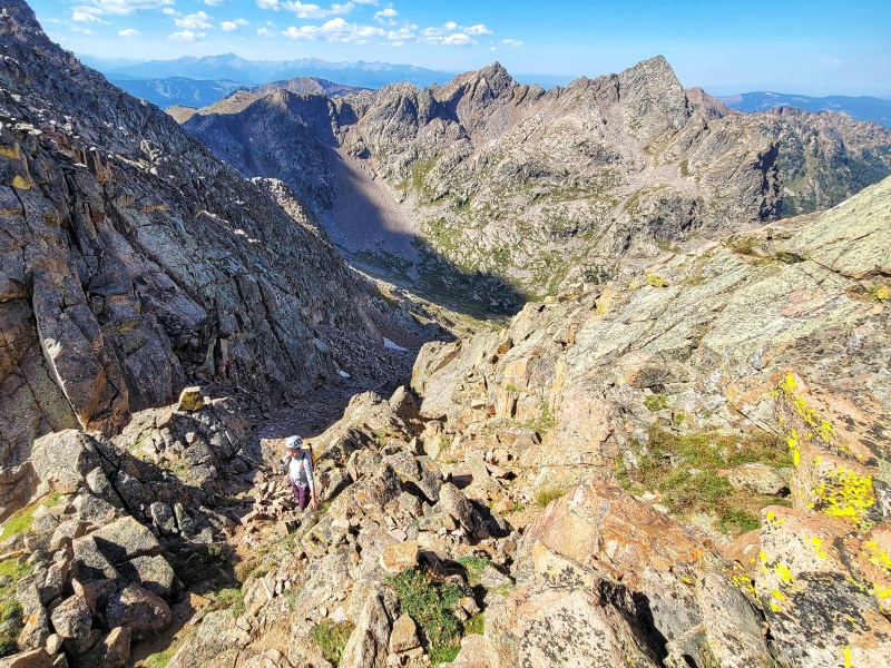
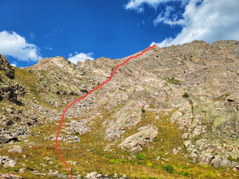
From Booth Falls Trailhead, head up the main trail before splitting off to the right at a creek crossing. Follow the creek up to a small lake (tarn) and ascend to Booth Pass. From Brandon and Kristie's trip report, it's possible to traverse across some scrambling terrain higher up, but we decided it would be faster to loose some elevation and follow the grassy slopes than engaging in complicated route finding to stay higher. The route up to the ridge furthest South is what we took and actually takes you into Crux Notch #2, which means you have to complete a convoluted downclimb into Crux Notch #1 to get over to Peak P and back to complete the ridge. Our ascent up the gully to Notch #2 also included some pretty loose terrain with not insignificant rockfall hazard if you have people above you. It goes, but it MIGHT not be the ideal route. The route up to the ridge closest to Peak P actually looked to hold a fair amount of grass and might be the easiest option. At minimum, it would prevent you from needing to downclimb into Crux #1 on the hard side. The crux notches are significantly easier going North to South (P to West Partner) than they are going South to North. The gully up to Notch #2 looked more attractive than Notch #1, though I did include a line up to Notch #1 in the GPX as well. The GPX track on the along ridge is approximate and shouldn't be used for route finding.
Route Information (Less Quandary): Mileage: Approximately 14.5 (Caltopo Estimate) Elevation: Approximately 5600' (Caltopo Estimate) Class: 4
Exposure: High Rockfall: High Route-Finding: Extreme Commitment: High
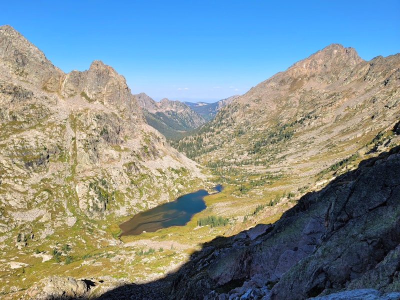
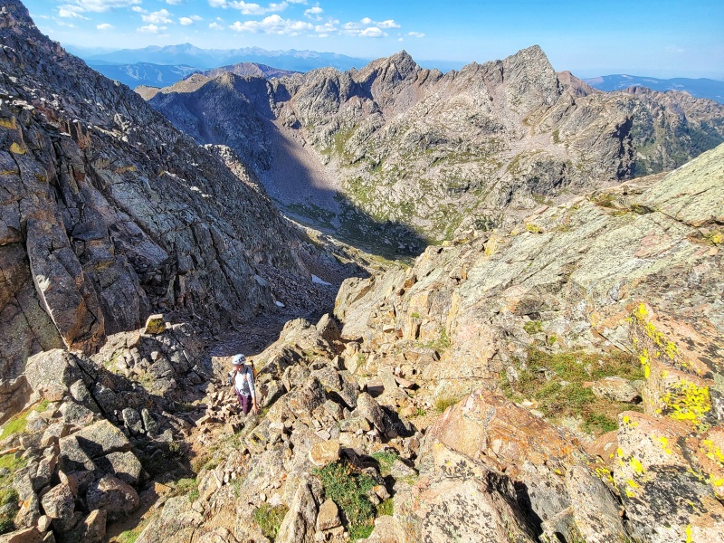
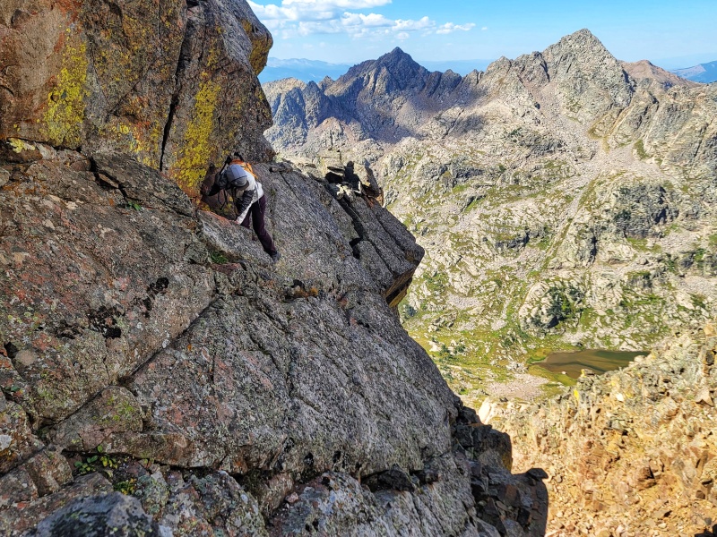
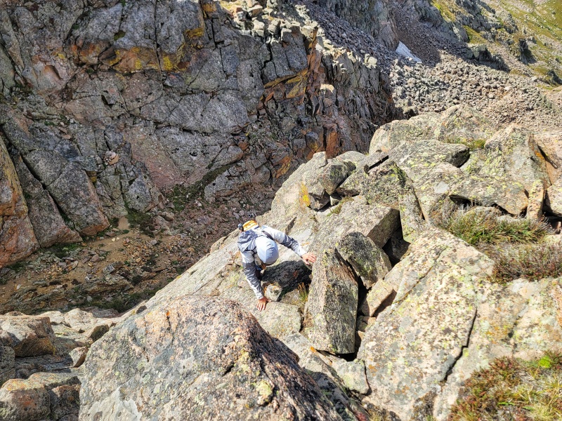
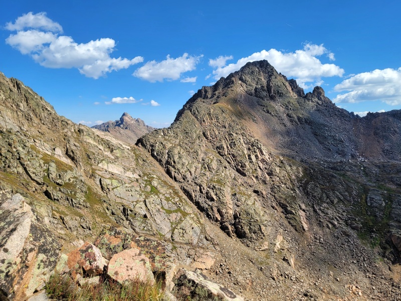
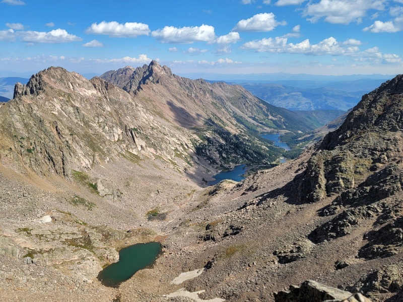
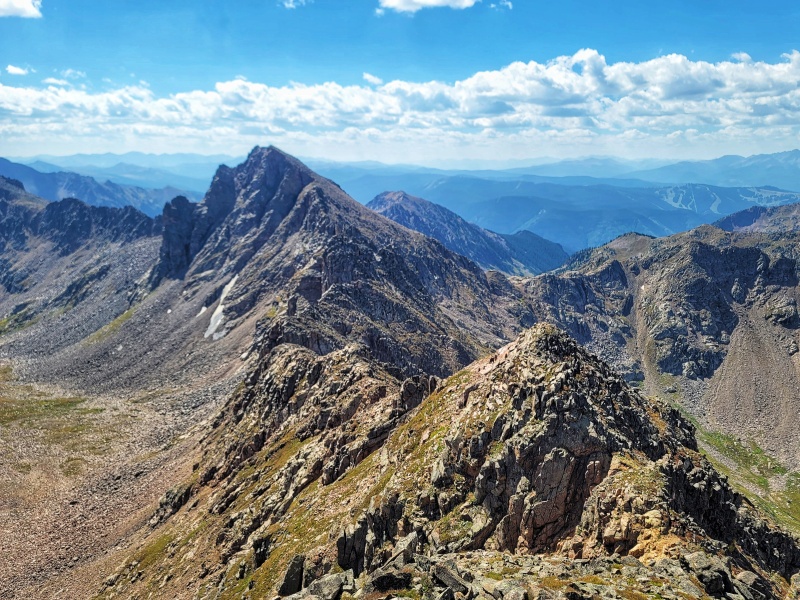
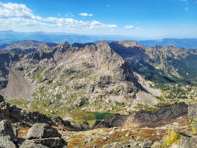
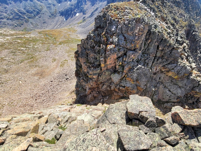
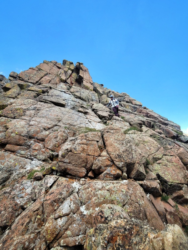
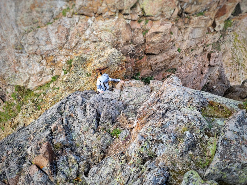
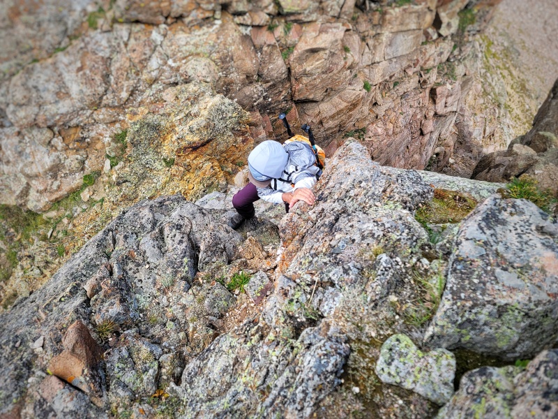
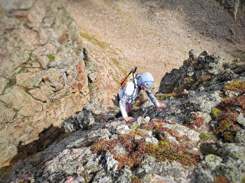
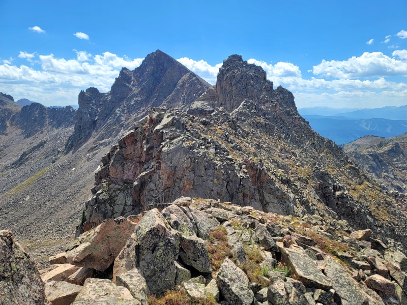
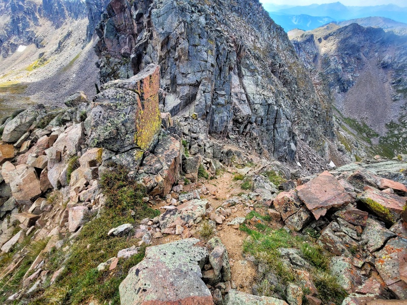
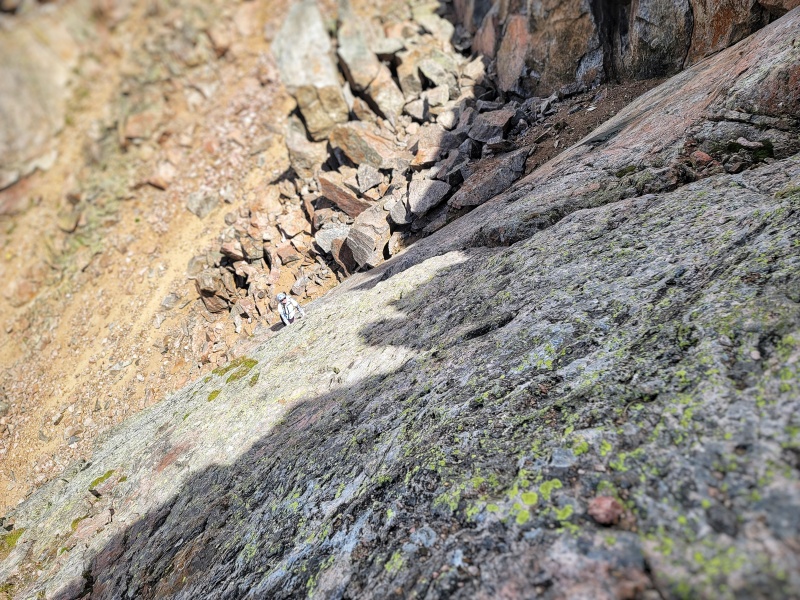
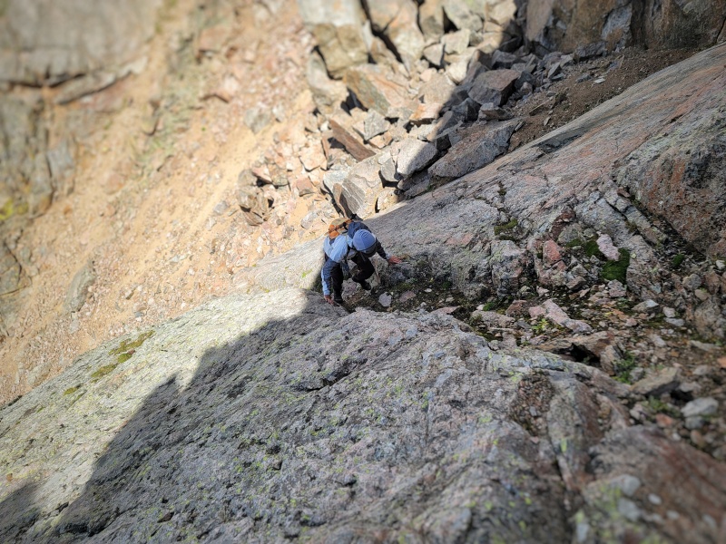
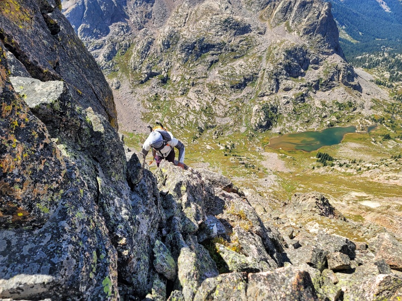
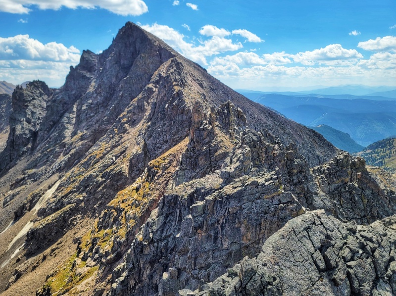
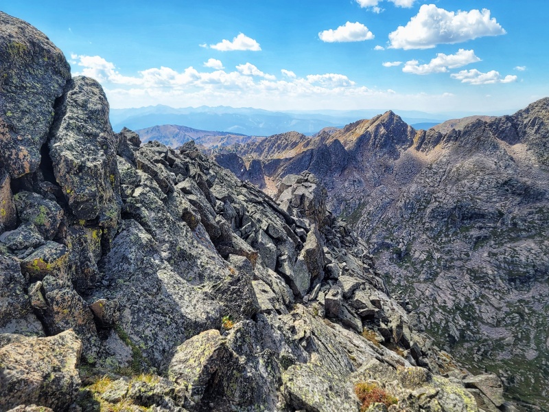
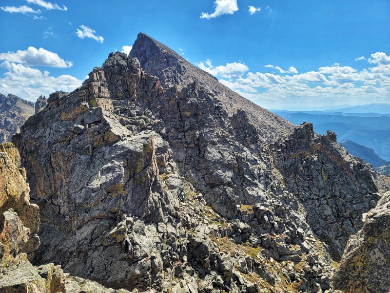
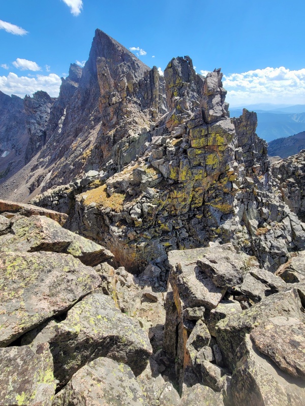
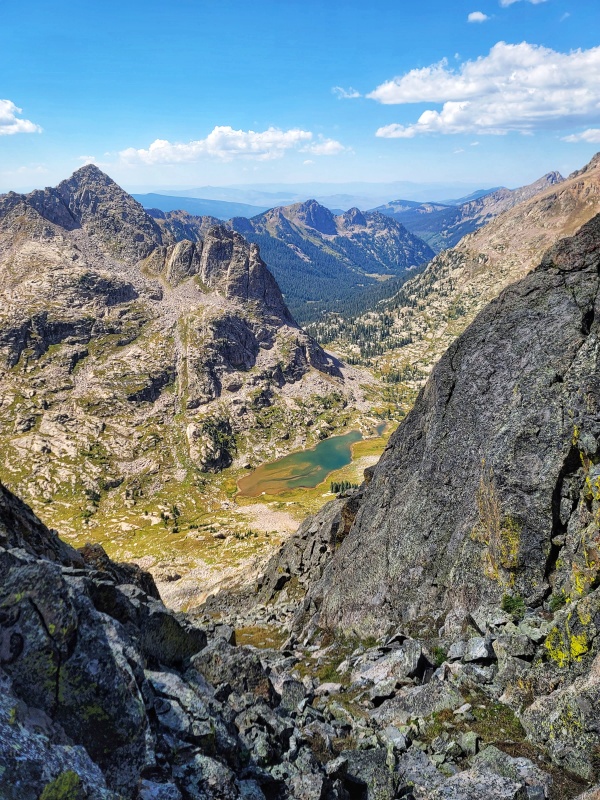
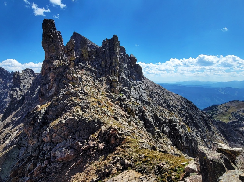
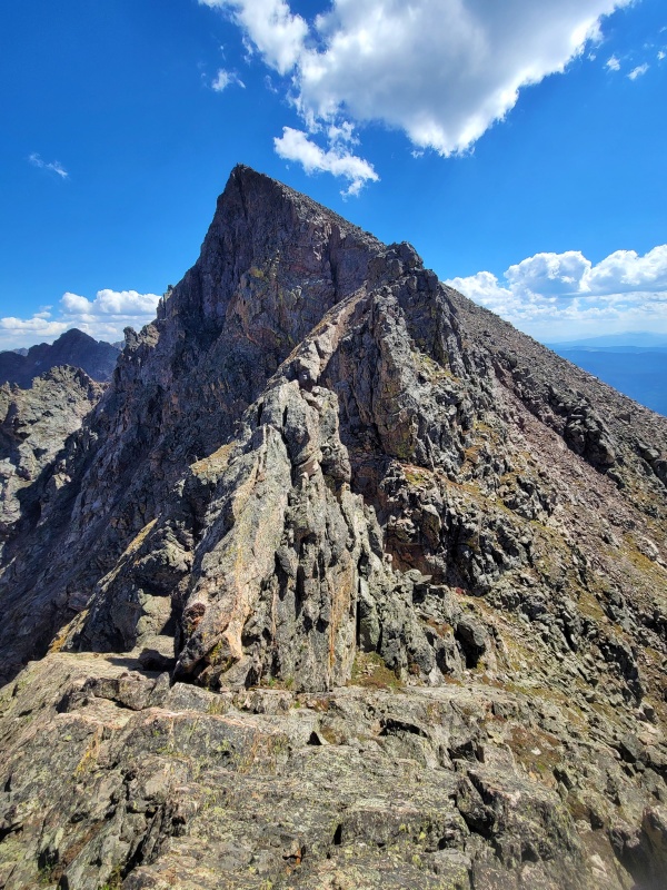
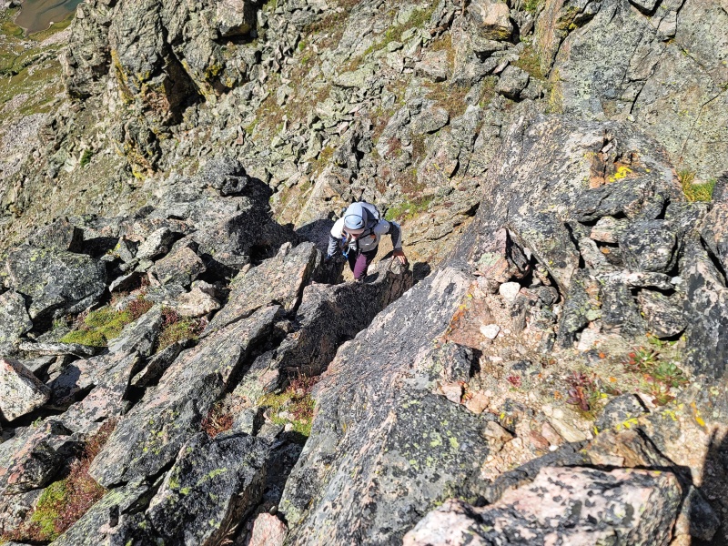
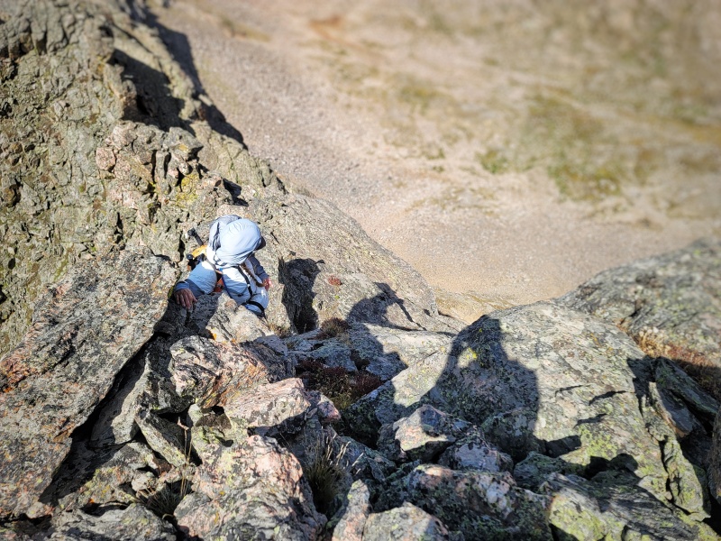
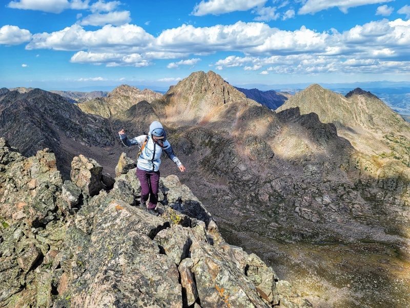
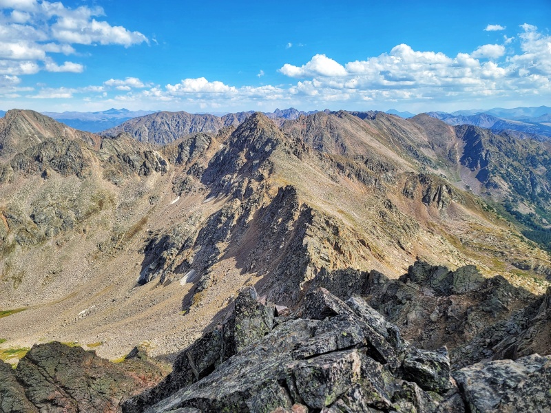
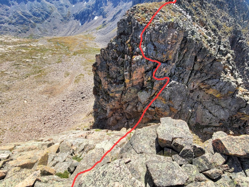
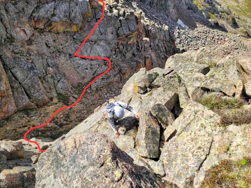
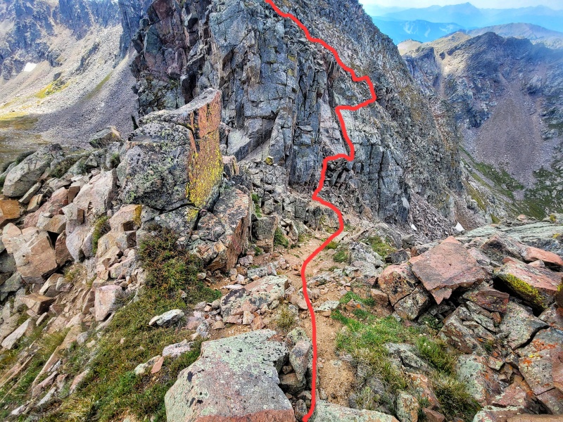
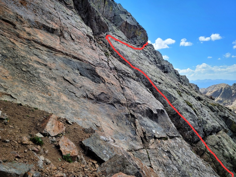
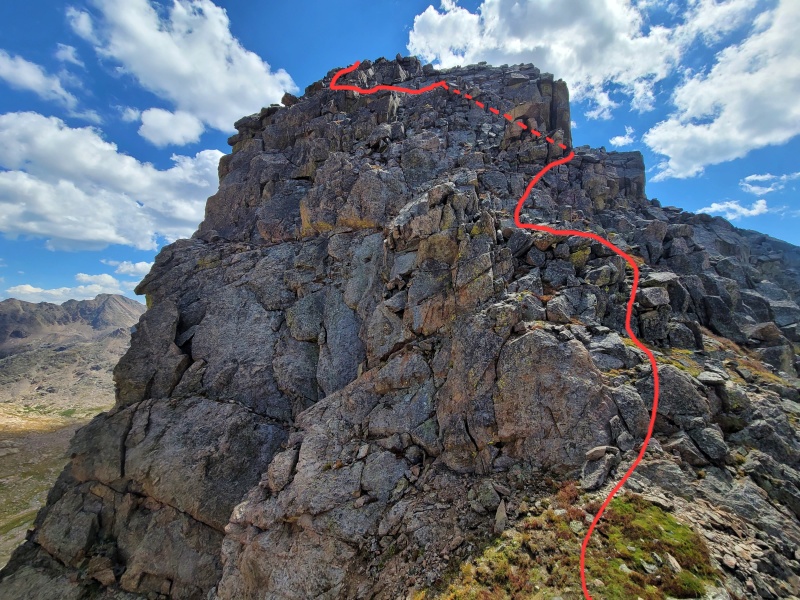
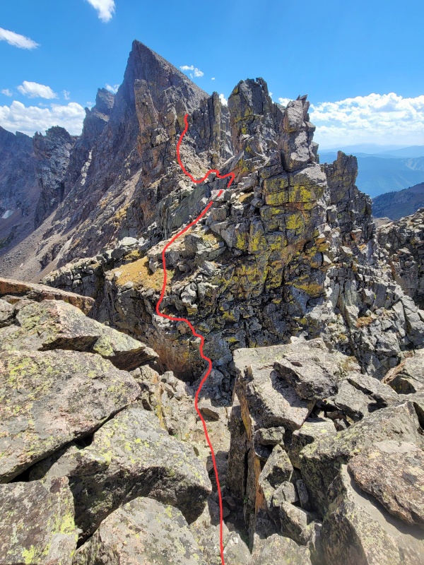
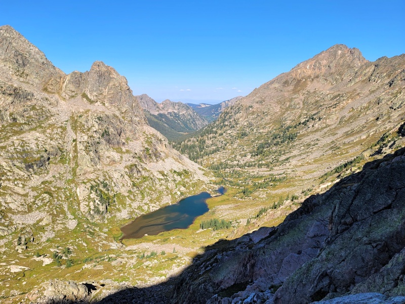
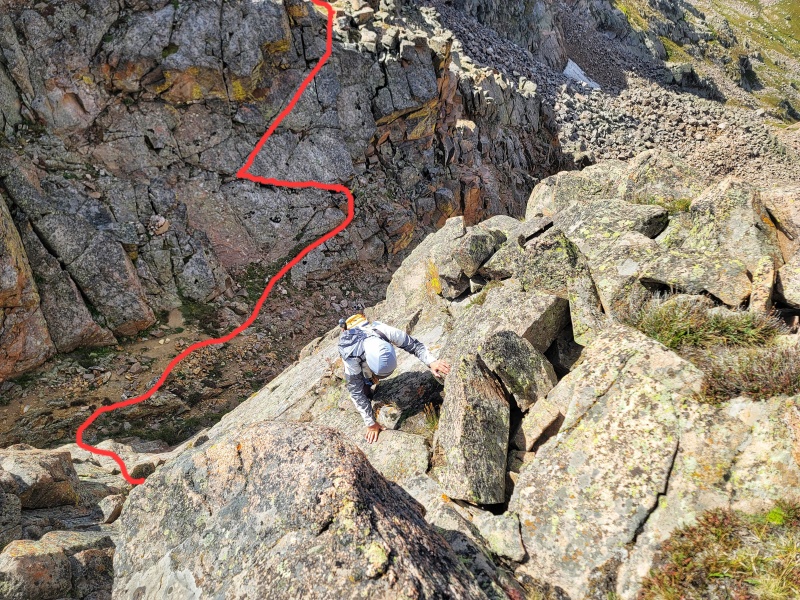
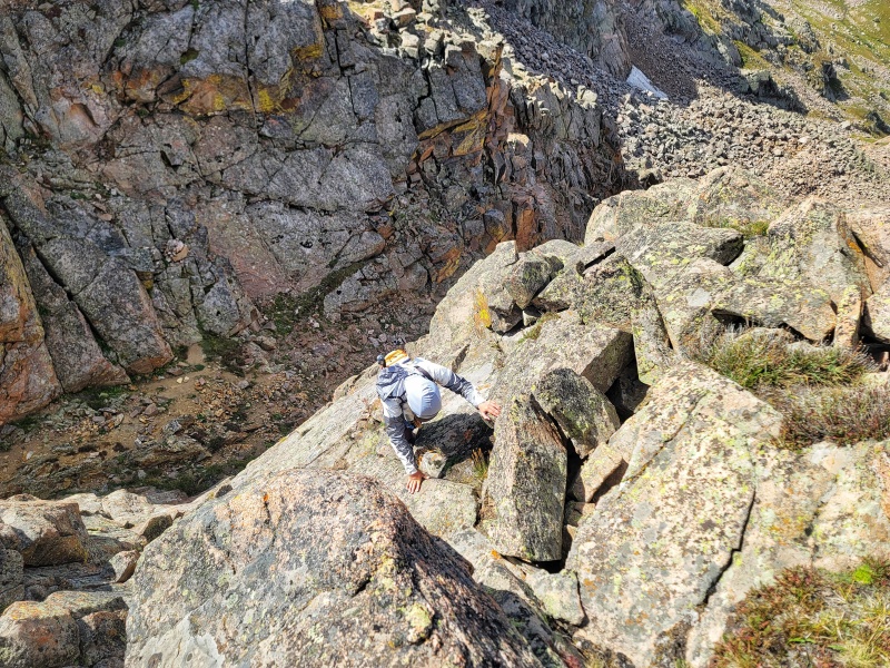
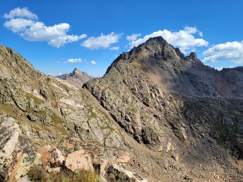
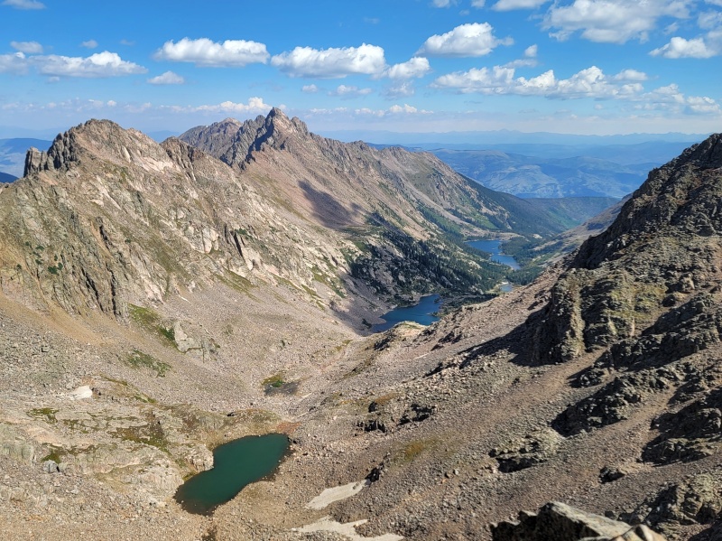
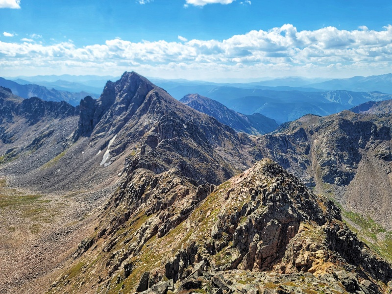
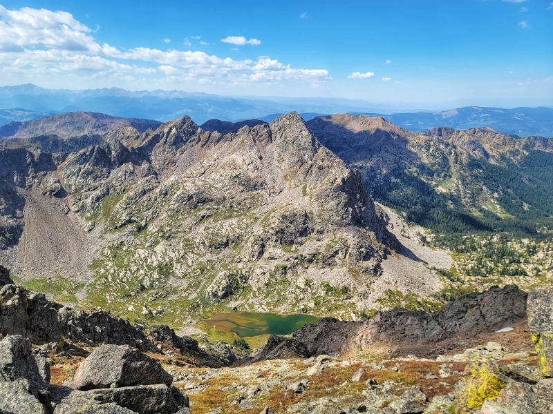
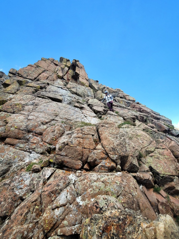
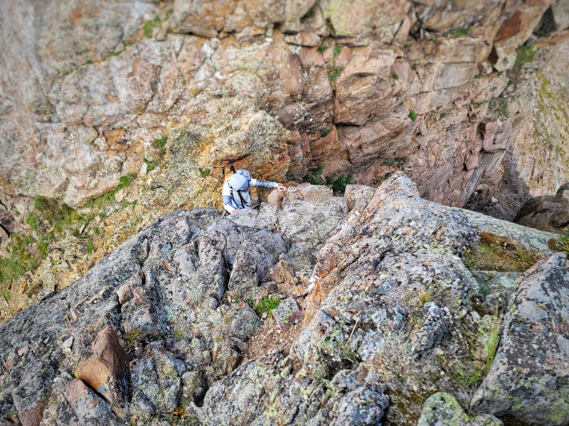
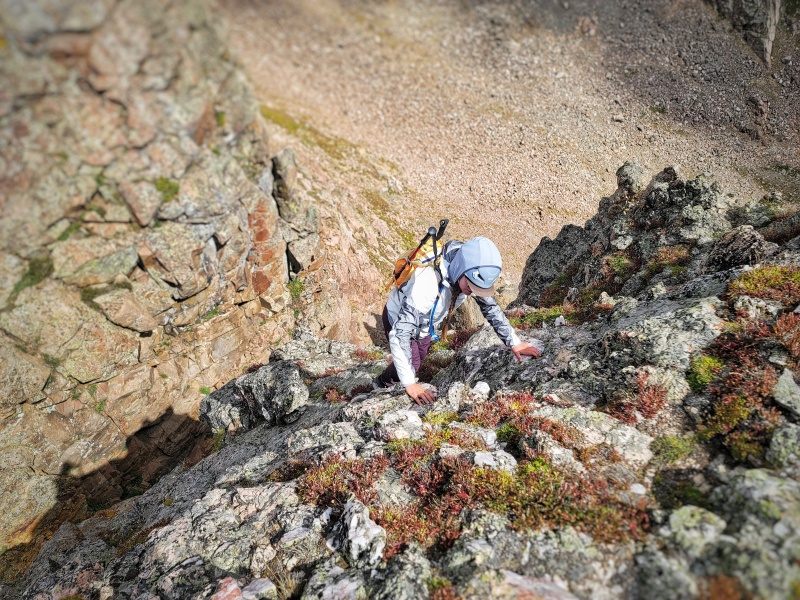
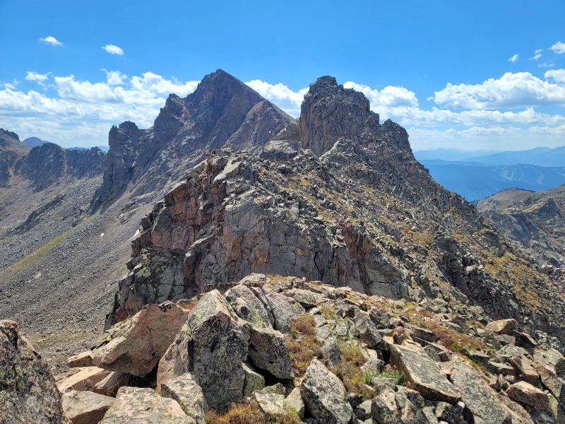
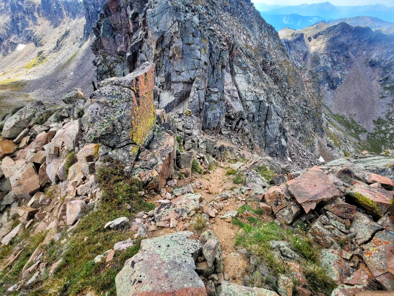
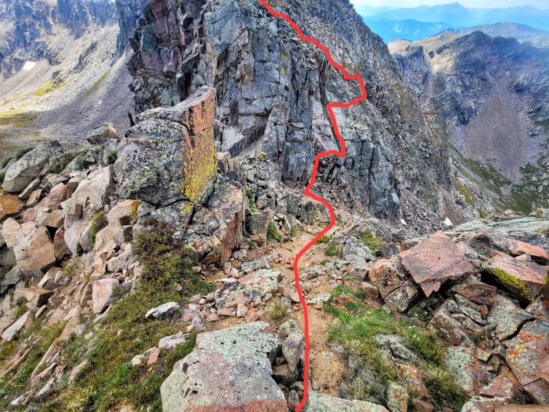
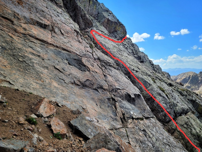
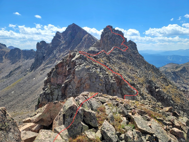
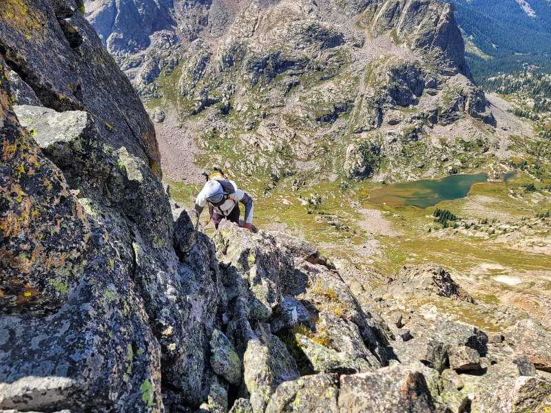
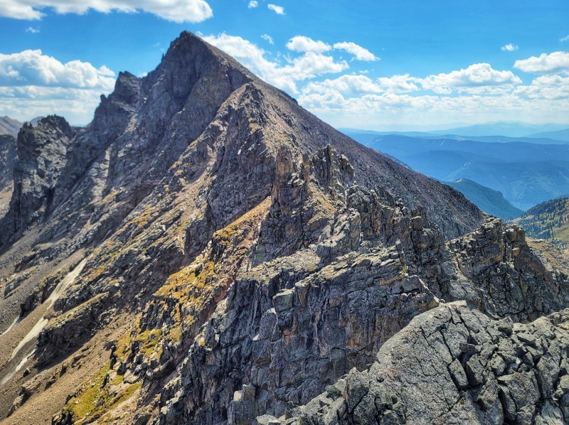
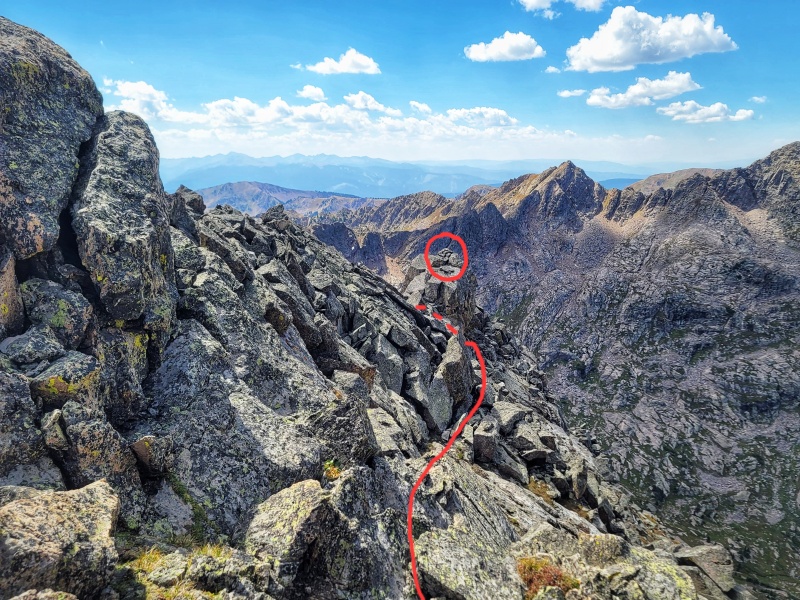
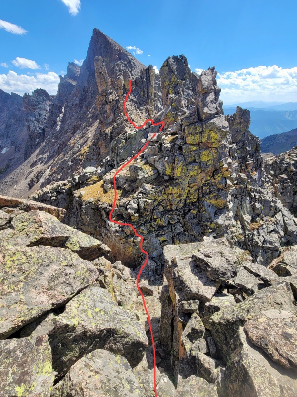
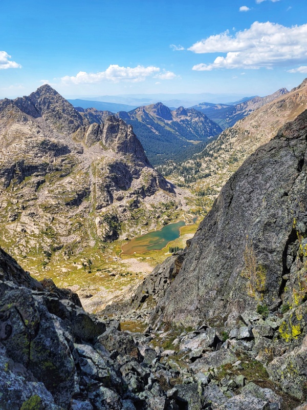
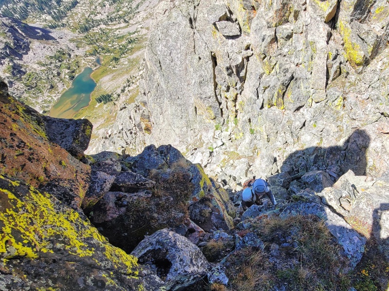
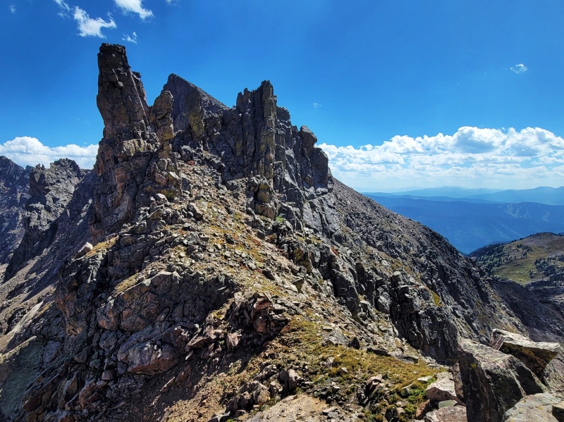
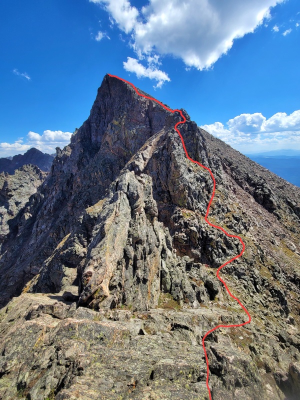
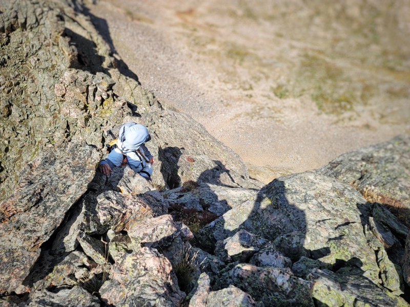
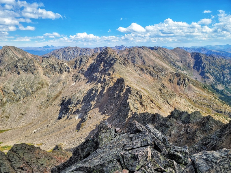
Upper Piney Lake from near Booth PassAt the top of the gully leading to Crux Notch #2Making our way through Crux Notch #1 on the way to Peak P. The red route shows our descent into the notch, which followed a 1-2" ledge before zig zagging to a broader, more manageable ledge. On our way back, we found that it was much easier to attack the headwall of the notch directly... The direct approach is much steeper, but has more holds and is less sketchy. Alternative descent into Notch #1 and also the climbing route we took going from Peak P to West Partner. Our ledge route is in the far right side of the photo. Le tiny ledge. Climbing out of Crux Notch #1. Peak Q looking very Q-y. Looking down into Slate Lake Drainage from the summit of Peak P - many a great scramble to be had back there. Looking South towards West PartnerLooking over across Piney Lake Basin towards The Spider and The Fly - another fun ridge scramble.
Peak P through Crux Notch #1 Now we start the ACTUAL traverse (Peak P to West Partner).
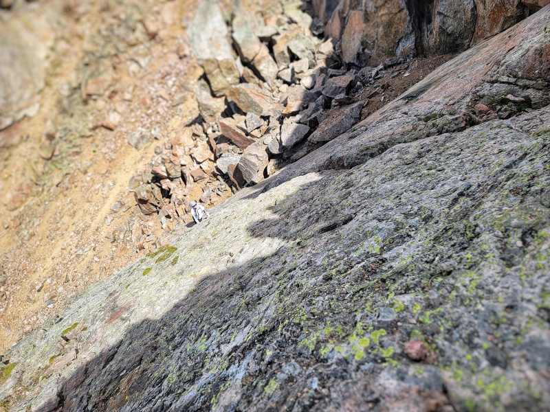
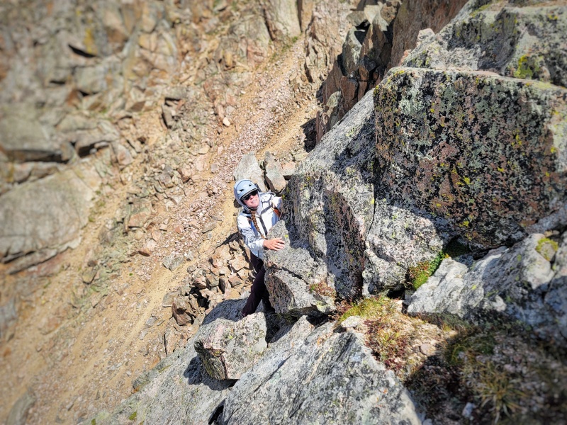
Back at Notch #1. The descent down into Notch #1. Climbing out of Notch #1. Just a little exposure
Crux Notch 2
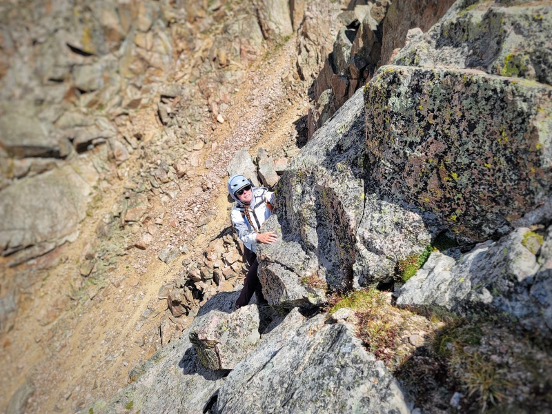
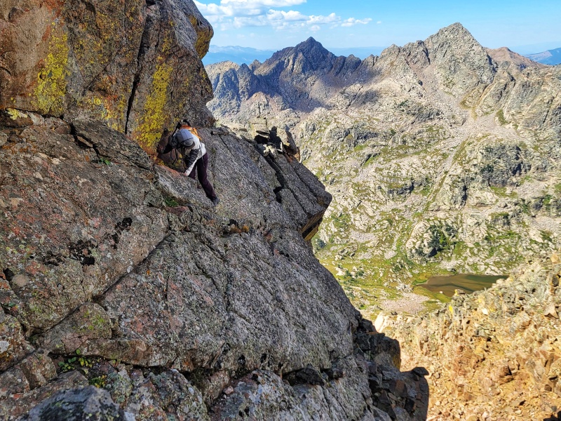
Looking towards Notch #2, Rocking Horse Tower, and West PartnerEasy descent into Notch #2The route out of Crux Notch 2A closer look at the crackAscending the CrackThere was definitely a funky move after the small ledge traverse at the top of the crack to get onto the West Face.
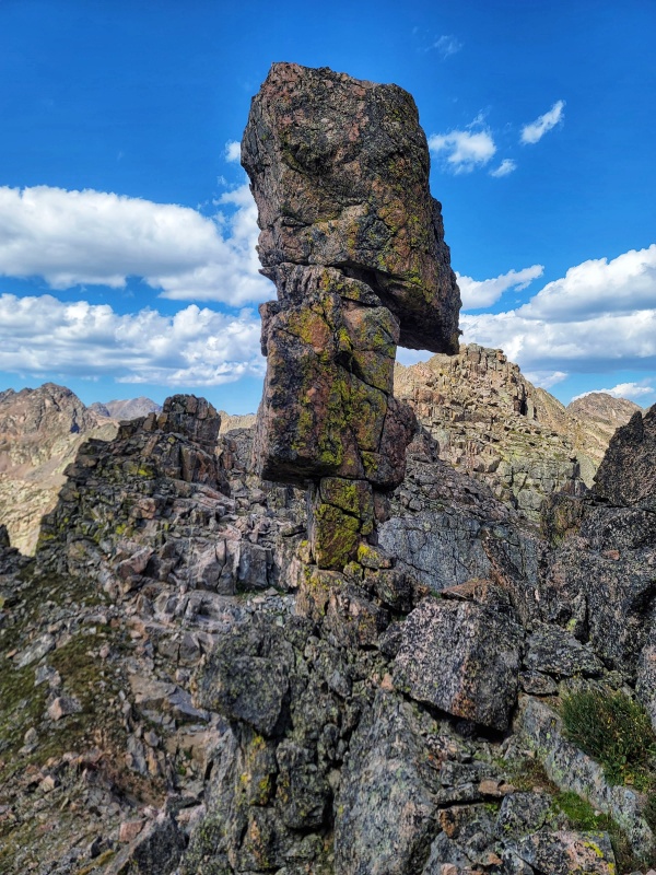
Rocking Horse Tower
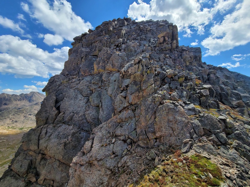
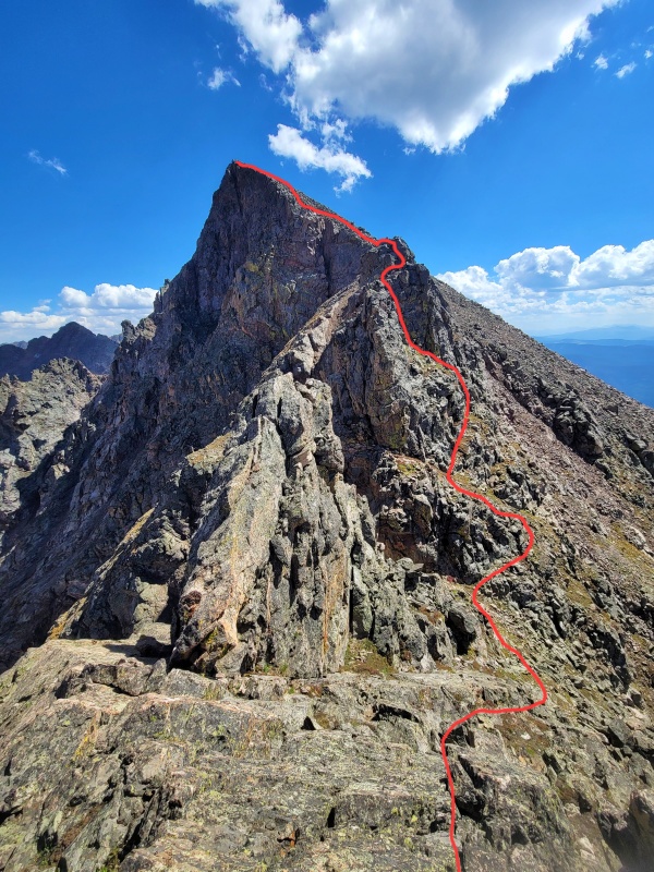
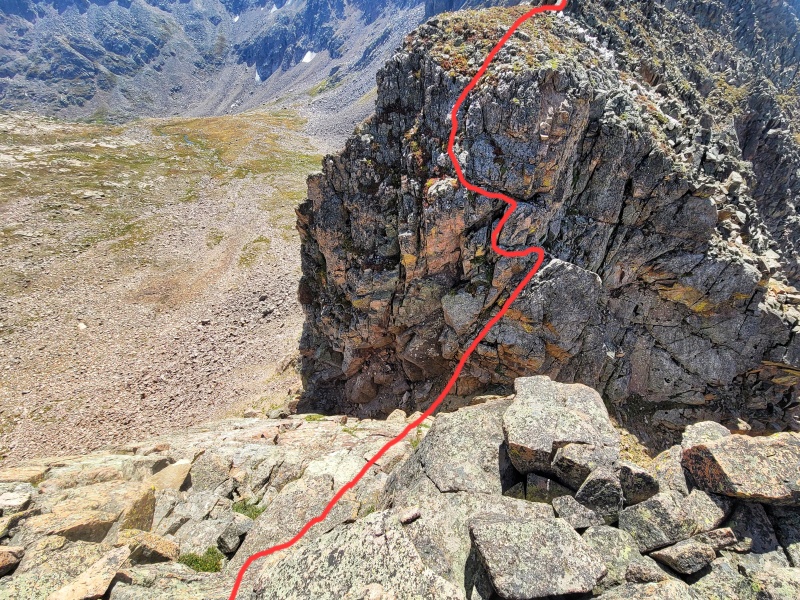
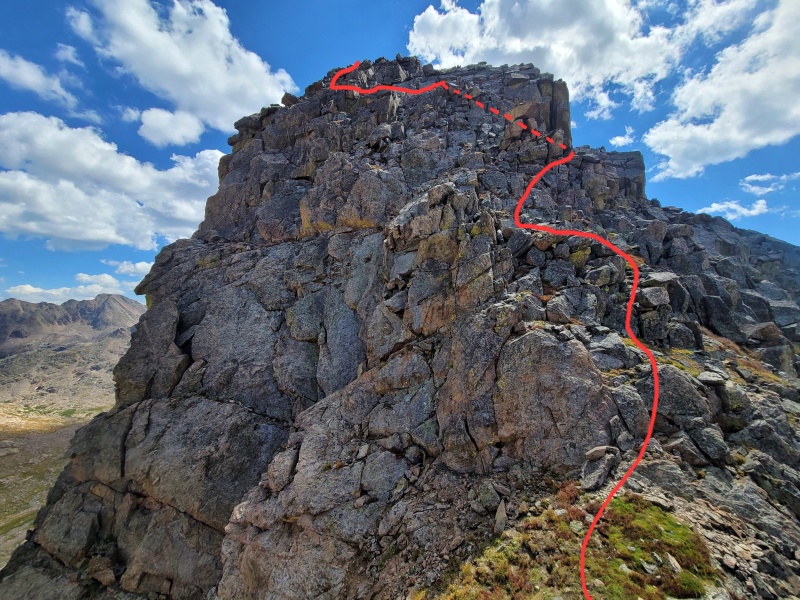
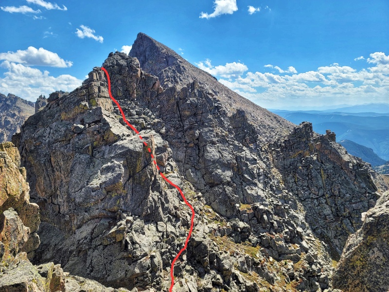
A look at the approximate route to the top of Rocking Horse Tower from between Crux Notch 1 and Crux Notch 2. Follow a series of ledges that zig zag up the tower. The scrambling shouldn't exceed Class 4. A closer look - red line is approximate as best as I can remember. Scrambling up Rocking Horse Tower. At the top of Rocking Horse Tower looking towards West PartnerTurn right and aim for a notch in the West-facing rock rib - there should be a cairn
The Rest of the Ridge
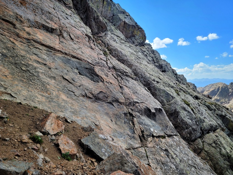
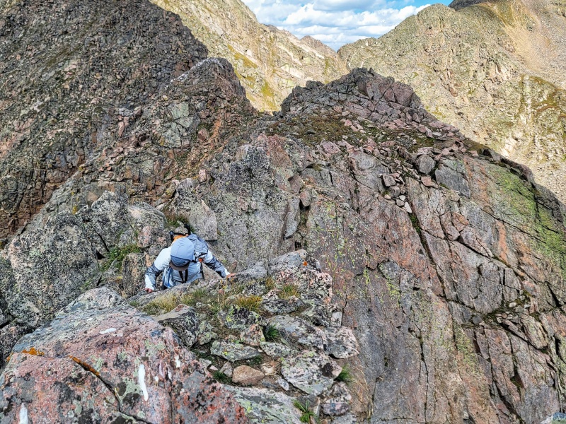
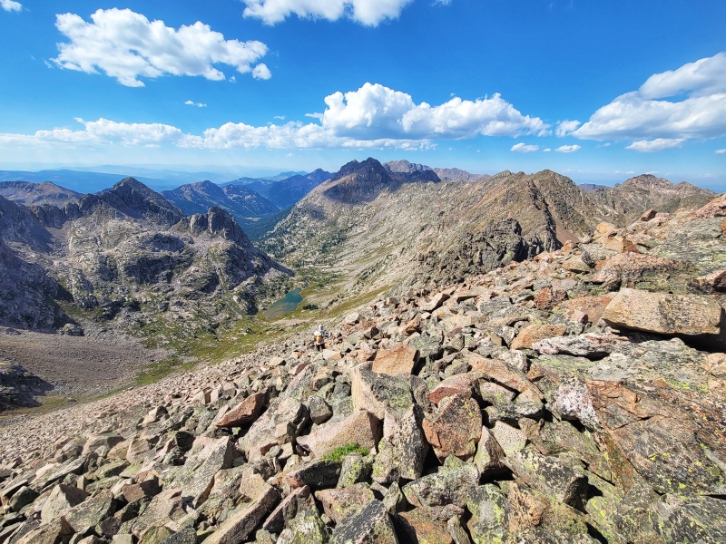
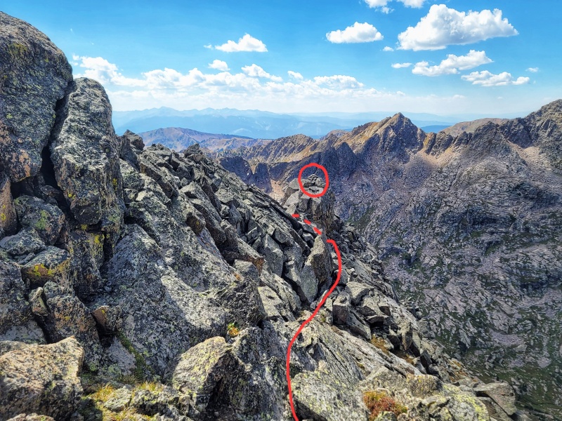
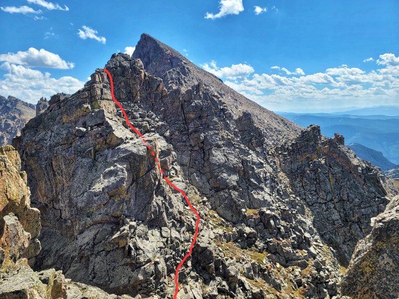
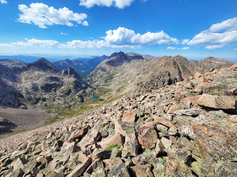
Looking through the notch at the rest of the route we took (Class 4, maybe low 5th near the top). It also looked possible to take a low route to the right of the cliffs to keep the scrambling Class 3. After going around the tower in the previous photo on the left side, looking towards West Partner. Looks of interesting rock formations. Looking down the gully in the previous photoThe climb out (Class 4)Looking towards West PartnerAlmost there! Descending down and to the right looked like it would keep the terrain at Class 2 around the base of the cliffs after an initial Class 3 downclimb. You can also climb back up to the left to regain ridge proper for more sustained scrambling. Looking out onto the Partners Traverse from the summit of West Partner (next year). Looking towers Peak H and Upper Piney Lake on our descent down the Class 2 boulder field on West Partner's West FaceOur descent gully from West Partner. Booth Pass is the grassy saddle in the left side of the photo.
My GPS Tracks on Google Maps (made from a .GPX file upload):
Thanks for sharing. I had to go look it up to see if I had climbed this one. While I lived in Vail in the early 90s, I was up in Booth and Pitkin it seems like all the time. For some reason this peak got left out til I was able to finally bag it from Pitkin Lake in 2009. Very nice pictures. Man, I miss climbing in that part of the Gores. I had a 30 year reunion with Powell back in Sept, but other than that it's been many years since I've climbed in these majestic peaks. I just wish there was more access from the East. Well hopefully you climb some more of the Gores so we can live vicariously through you. Nice Outing!
Did this traverse in opposite direction at Sep 2016 as part of 5days trip from Valhalla to Pk C' . Also climb this at Feb 2023 as part of winter Gore Main Ridge Winter Traverse. Travers from Pk P to Q is difficult at Cl5. I know about 2-3 ascents. I did it bypassing at north below summits on 4-th day (of5) of my winter traverse around north and west of Slate Basin, Mar 2018.
Caution: The information contained in this report may not be accurate and should not be the only resource used in preparation for your climb. Failure to have the necessary experience, physical conditioning, supplies or equipment can result in injury or death. 14ers.com and the author(s) of this report provide no warranties, either express or implied, that the information provided is accurate or reliable. By using the information provided, you agree to indemnify and hold harmless 14ers.com and the report author(s) with respect to any claims and demands against them, including any attorney fees and expenses. Please read the 14ers.com Safety and Disclaimer pages for more information.
Please respect private property: 14ers.com supports the rights of private landowners to determine how and by whom their land will be used. In Colorado, it is your responsibility to determine if land is private and to obtain the appropriate permission before entering the property.




 Download GPX file used in this map