Download Agreement, Release, and Acknowledgement of Risk:
You (the person requesting this file download) fully understand mountain climbing ("Activity") involves risks and dangers of serious bodily injury, including permanent disability, paralysis, and death ("Risks") and you fully accept and assume all such risks and all responsibility for losses, costs, and damages you incur as a result of your participation in this Activity.
You acknowledge that information in the file you have chosen to download may not be accurate and may contain errors. You agree to assume all risks when using this information and agree to release and discharge 14ers.com, 14ers Inc. and the author(s) of such information (collectively, the "Released Parties").
You hereby discharge the Released Parties from all damages, actions, claims and liabilities of any nature, specifically including, but not limited to, damages, actions, claims and liabilities arising from or related to the negligence of the Released Parties. You further agree to indemnify, hold harmless and defend 14ers.com, 14ers Inc. and each of the other Released Parties from and against any loss, damage, liability and expense, including costs and attorney fees, incurred by 14ers.com, 14ers Inc. or any of the other Released Parties as a result of you using information provided on the 14ers.com or 14ers Inc. websites.
You have read this agreement, fully understand its terms and intend it to be a complete and unconditional release of all liability to the greatest extent allowed by law and agree that if any portion of this agreement is held to be invalid the balance, notwithstanding, shall continue in full force and effect.
By clicking "OK" you agree to these terms. If you DO NOT agree, click "Cancel"...
This route was just too much fun to not write a trip report for – I felt I had to give my own personal take on this deliciously enjoyable route, including the classic 5.4 chimney!
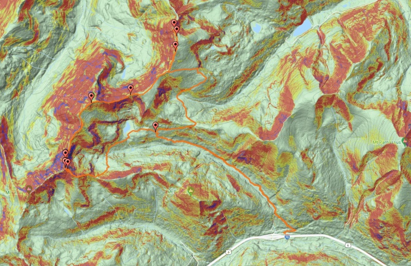
Trailhead: Herman Gulch Trailhead
Route: Herman Gulch Trail - Continental Divide Trail to Hassell - traverse to Pettingell and Citadel (via 5.4 chimney) - down saddle between Citadel and Mount Bethel - faint trail to Herman Lake - main trail to trailhead
Stats: 14mi, 4,100ft, 10h 29min
Included in the report will be:
Quick mention of Hassell (barely worth the hassle)
A few glimpses of the Hassell-Pettingell traverse (much more fun - with variable terrain to choose from)
A close look at the class 5.4 chimney just north of the Citadel (much more sustained than the famous class 4 chimney on North Maroon)
Some views and discussion of the summits of Citadel (including the multiple summit blocks on West Citadel)
A few words on how and how not to descend back to Herman Gulch (with discussion of possible future route when I return for Hagar)
As usual, look for large bolded section headers if you want to quickly jump to a particular section
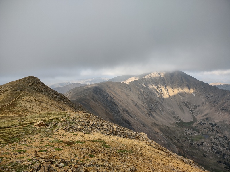
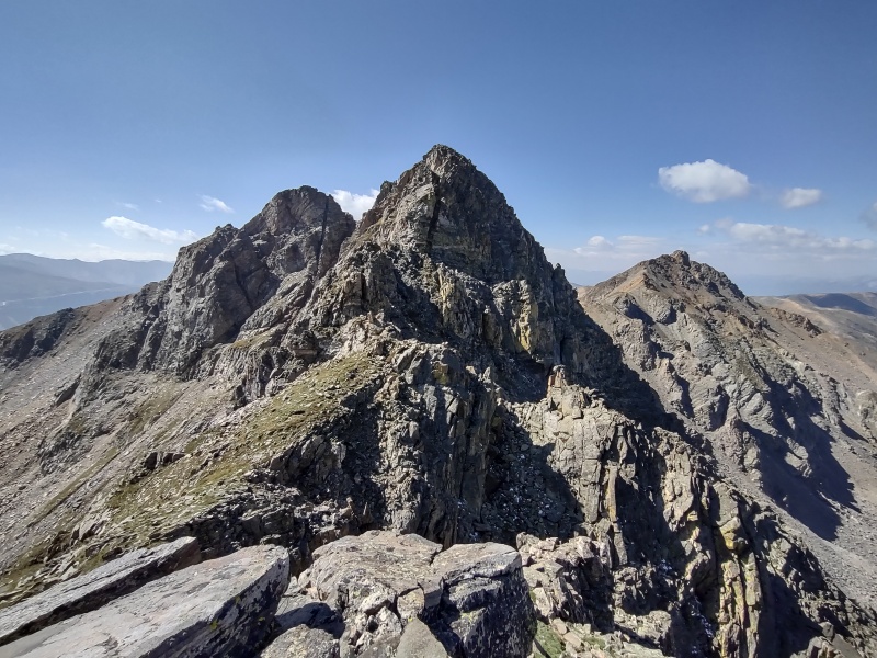
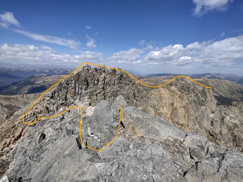
Unlike some mountains, The Citadel even looks cool!Overview map of the route. Note twin waypoints for West/East Citadel and waypoint just barely north marking the 5.4 chimney
Trailhead
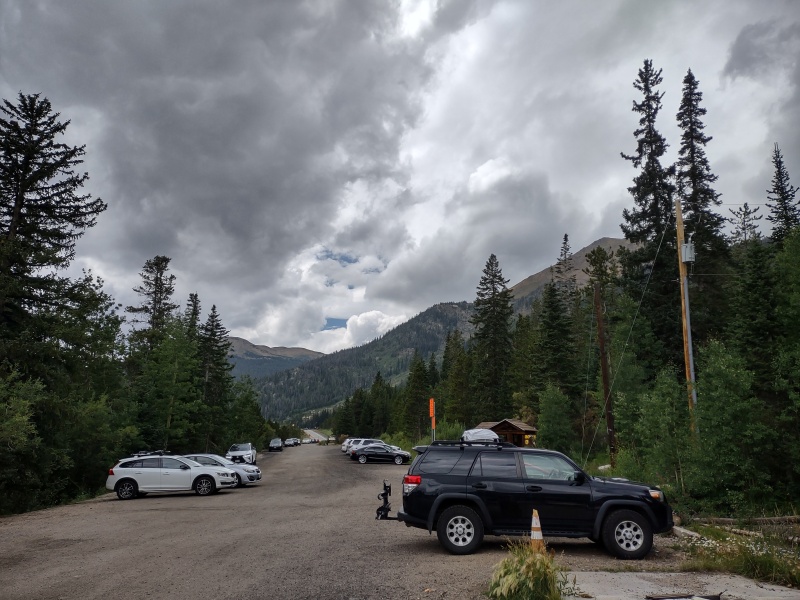
I had never been to Herman Gulch Trailhead before and hadn't noticed much mention of it in the skimming I did of a few trip reports so I wasn't sure what to expect for something just off I-70 (you can literally see the traffic on I-70 from the parking lot and during the first portion of the trail)
Turns out this is an ENORMOUS long skinny lot that must fit easily at least 100 cars or more (huge contrast to the tiny parking area at Ruby Gulch for the nearby Bard group I did recently).
There were only a couple vehicles there when I arrived just before 4am and still some open spaces when I got back a little after 2pm!
Looking back towards to entry to the parking lot - there's still almost as much space behind this too!
Hassell - the Checklist Peak
I'll be honest - Hassell is mostly a checklist peak - great, easy add-on if you're looking to crank up your peak count, but not a whole lot to recommend it otherwise. While it is a ranked 13er and had some neat views under the weather conditions I did it in (see below) it's not one I'd be likely to repeat except to grab a snowflake for it.
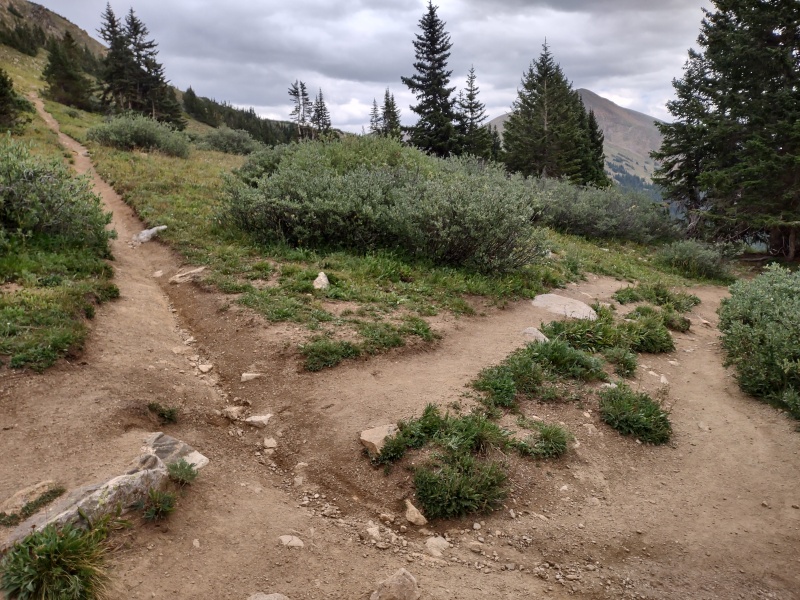
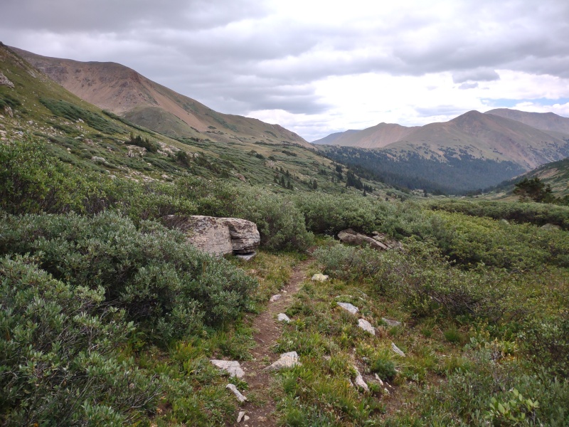
From the huge lot just off I-70 you take the large, well established, highly popular Herman Gulch Trail towards Herman Lake (where all the tourist seem to go - don't worry, the tourist all sleep in late - you won't see them until your return...)
But a little before getting to the lake you cut hard right on the almost as solidly established Continental Divide Trail (also labeled in this section on some maps as Jones Pass Trail since it eventually takes you to that pass).
Taken on the return from Herman Lake, the smaller path up to the left leads to Hassell; straight ahead goes back to Herman Gulch TH.
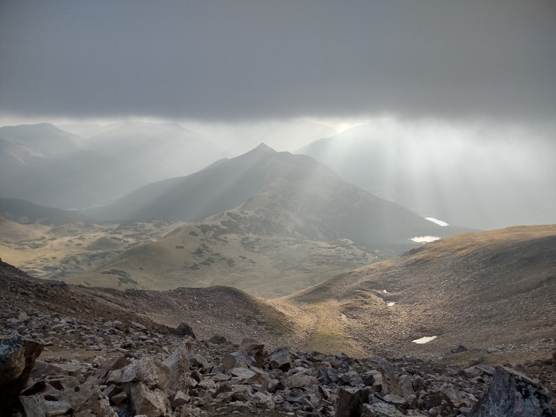
To be fair, there are still some good views to be had on the way to Hassell - the low hanging clouds with sun trying to pierce through enhanced the mood the morning I did it - but the peak itself looks and feels pretty bland compared to the dramatic and engaging Citadel nearby.
Early morning view looking over to upper and lower Urad dams next to the Bard group.Path up the Continental Divide trail to Hassell, with its false summits along the way. Low hanging clouds providing a neat view of pointy Red Mountain across the valley.Looking over to Pettingell hidden in the low clouds but with a little sun striking it.
Hassel-Pettingell Traverse - the Warm-Up
This is where the route starts to get more fun and is an excellent section to do as a warm-up before tackling the Citadel. Or if the class 5.4 chimney of the Citadel is too much for your tastes, this route is worthwhile in and of itself and you can safely drop down to Herman Lake from the far side of Pettingell if you decide not to continue to the Citadel.
This traverse could possibly be kept class 2 or difficult class 2 if you worked at always finding the easiest possible line (which I decidedly did NOT do).
It's better though to be prepared for some class 3. If you're concerned about being ready for the Citadel chimney (or just want to have some fun) there are a few bits of class 4 if you go out of your way to engage them (trivial to avoid otherwise). In fact, if you really, really want to intentionally go looking for trouble (like I did) then you can even milk this ridge for a couple spots of class 5, but be careful of questionable rock quality in those sections.
General rule for the Hassell-Pettingell traverse - right side (north) is harder; left side (south) is easier.
Low hanging early morning clouds really add mystique to this fun traverse.If you want to add some gratuitous class 5 you can explore near the gash on the right. To keep it closer to class 2, stay further left. This is one of the optional class 5 sections I almost engaged until encountering too much loose rock.Looking up one of the out of the way rock faces I went to investigate.
Overall this section was quite enjoyable and might have received more attention and more raving in this trip report if not for that fact that the Citadel totally overshadowed and overpowered it.
General rule for the Hassell-Pettingell traverse - right is harder; left is easier.
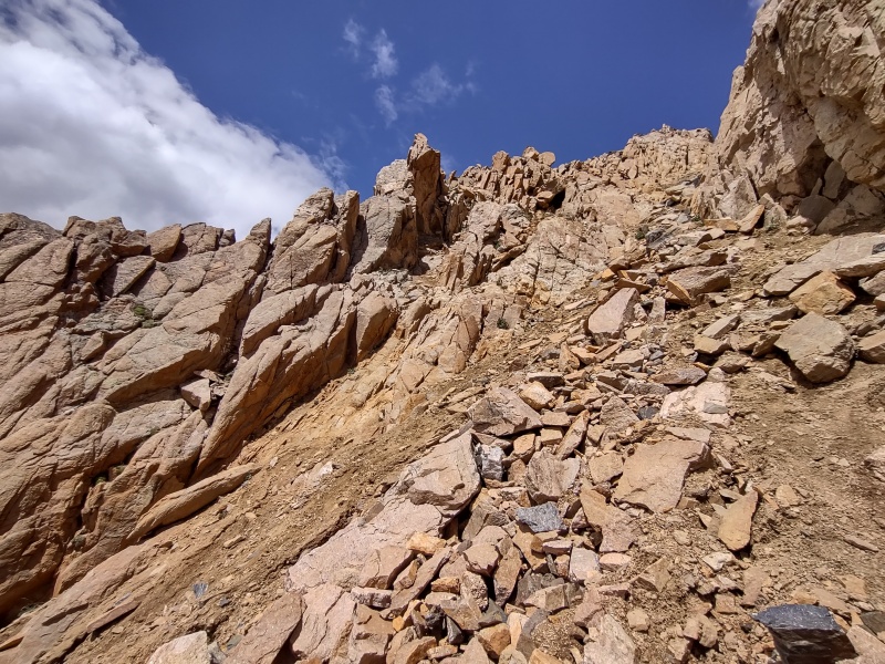
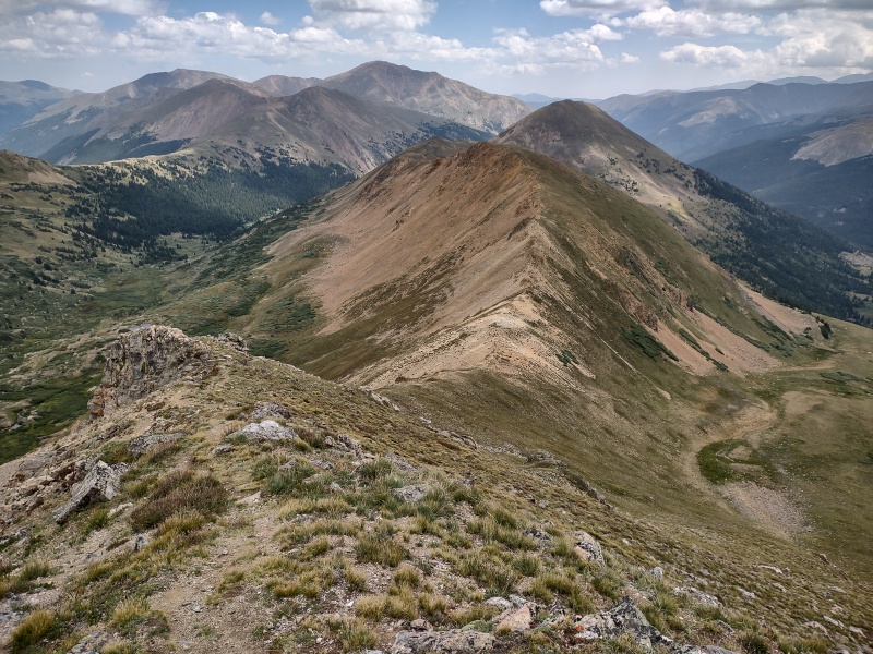
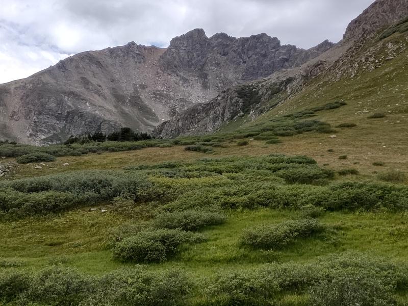
Approaching the Citadel
After Pettingell you'll need to walk a short ways towards the Citadel to get to where the standard trail for Pettingell drops down to Herman Lake. That was actually Plan A for this day - I wasn't sure I was ready for a class 5.4 chimney so I was originally going to perhaps go partway over just to take a closer look for future reference.
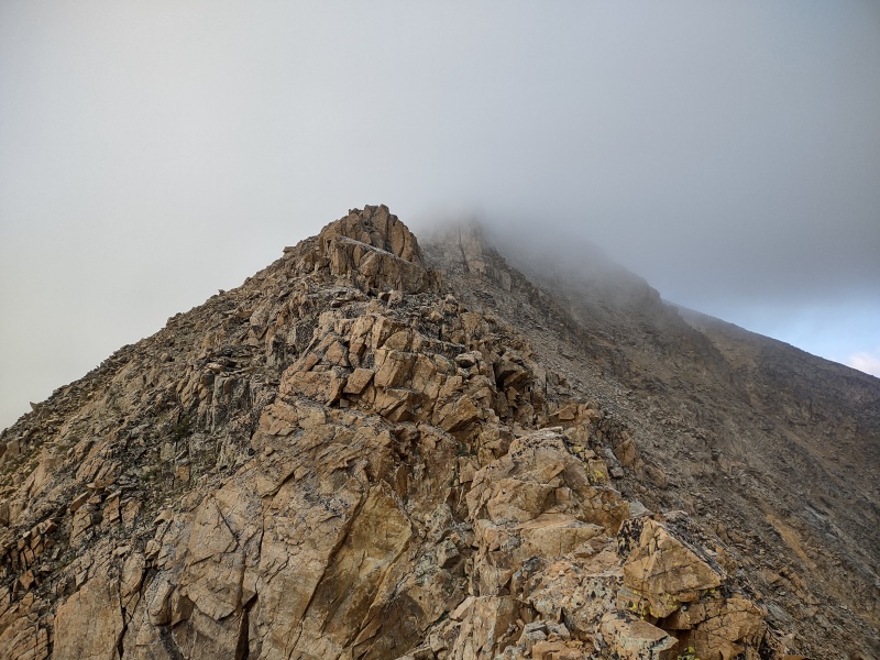
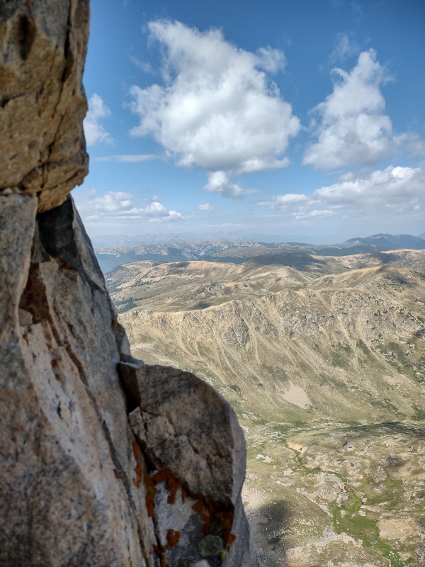
But as I walked closer and closer I was enthralled by the dramatic appearance of the peaks in front of me.
A lot of mountains are rather homely looking in and of themselves - the view from the top of them is what's most impressive.
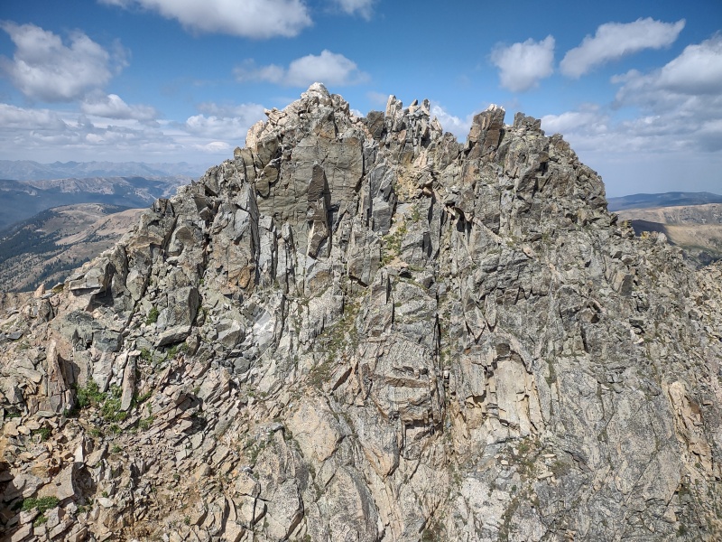
Not so with the Citadel. The closer I got the harder my heart beat and the wider my eyes opened. The Call of the Wild beckoned louder and louder and I began to feel myself coming truly alive - this is no puny little Mt. Cameron that doesn't even make the official list, nor a bland Robeson that you walk by without realizing it was a mountain - this is what mountains are supposed to look like!
Initial view of the Citadel at the end of the ridge and Hagar off to the right.The closer you get the more enticing it looks.Once you're on the last main hump before it, the Call of the Wild becomes too strong to resist. The details stand out clearer and clearer as you approach - opening a world of opportunities before your eyes.These are the mountains you're looking for...
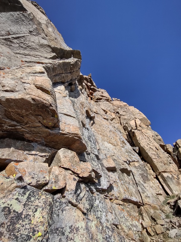
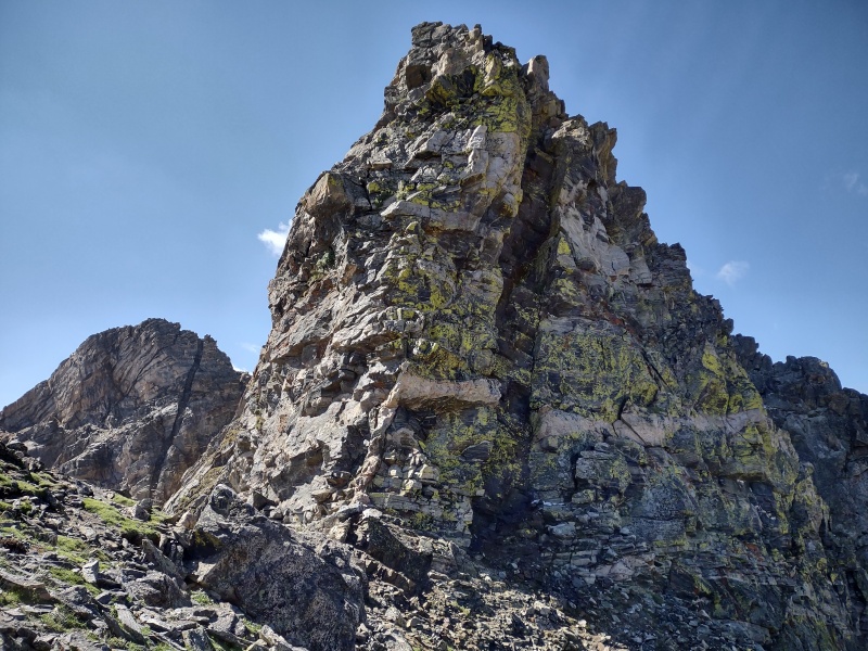
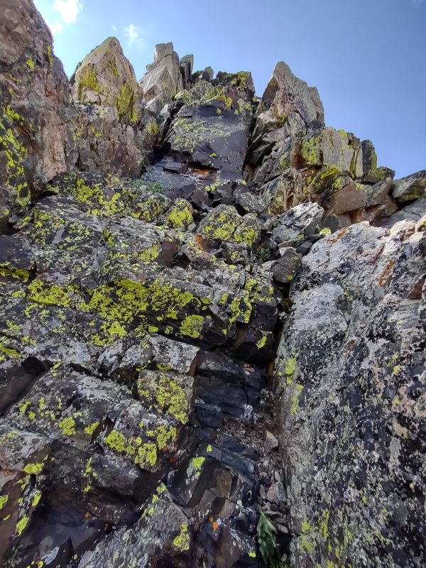
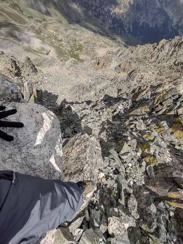
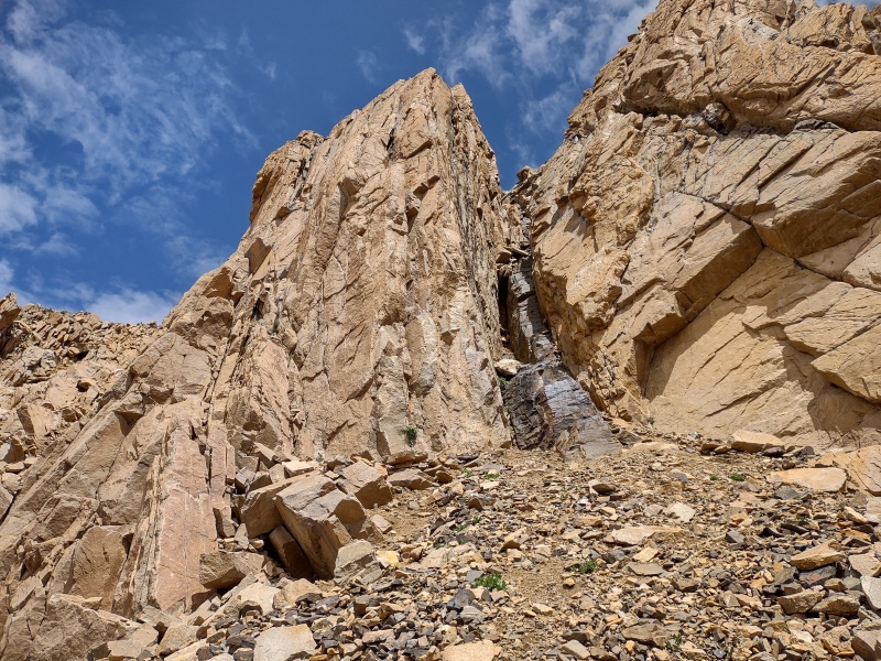
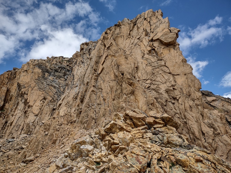
The Class 5.4 Chimney - a True Classic!
North Maroon is well known for it's class 4 chimney, but that's just a cute little thing next to this towering vertical masterpiece! I'm sure the more experienced climbers on the forum would probably downplay this as much as I just downplayed the chimney on North Maroon (don't get me wrong, that one's really neat too - see my step by step analysis in One Bell at a Time) but as someone who has only recently started to get into class 5 terrain outside the gym, this was really, really sweet and I was absolutely pumped that I made it up with relatively little effort!
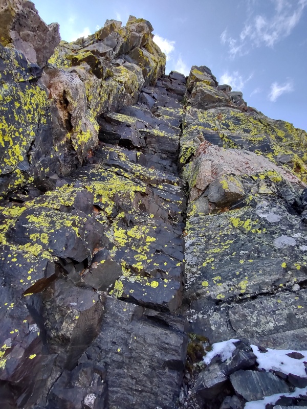
I won't be able to give as detailed of a play by play as I did for the North Maroon chimney (at least not in this TR - but perhaps I might collect more detailed beta when I return for Hagar) but I'll try to describe it as best as I can.
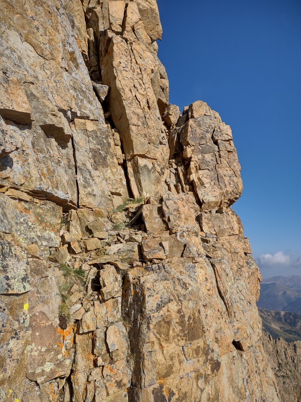
One thing worth noting up front - this chimney appeared to be perhaps 98% rock solid, which makes it fun - but watch out for that 2% - I did find one pretty sizeable rock that wiggled significantly when I tested it as a handhold...
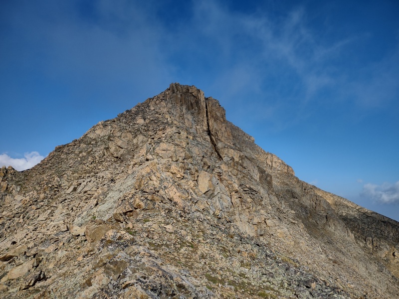
The big black gash in the foreground is the chimney (back in the left is another going up East Citadel - perhaps worth exploring later... The full chimney captured in wide angle mode.
I had recently done the SouthWest Corner scramble up The Hobo in the Flatirons which Mountain Project lists as class 5.4 (see The Hobo & the Frontporch: easy Flatirons for a couple images of that if you're interested in a relatively easy-ish class 5 along the front range). That had me wondering if maybe the class 5.4 there was anything like this class 5.4 chimney in terms of difficulty (I've been warned many times how difficulty rating vary tremendously from place to place).
Well, this chimney has a totally different look and feel than the chunky spine going up the back corner of the Hobo but it probably was more or less comparable in terms of overall difficulty.
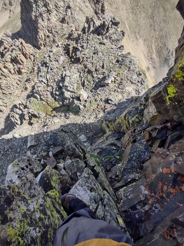
Me partway up the chimney - secure enough to be comfortable snapping photos.Looking upward - looks much harder in this photo than it felt.
I don't consider myself to at all be a skilled climber yet. I can do 5.10 in the gym but this was the most ambitious thing I've ever tackled on a mountain so far.
For reference I'm 6'2' and though I probably could have avoided it if I was better at climbing or took more time to look around, I did end up doing a couple mantle moves when my handholds were absolutely bomber but I couldn't find a satisfactory foothold without boosting myself up a little by my arms (I knew that was slightly risky due to the difficulty of reversing such a move if needed but by the time I did those moves I was feeling confident I would be able to top out eventually).
I stayed generally on the right side of the chimney - I may pay more attention to the other side next time.
Looking sideways from partway up the chimney. Looking down from a good solid platform partway up.
There were a few times when I could just begin to feel the first twinges of getting nervous. I immediately stopped, took a couple deep breaths and told myself to move slowly and only use the absolutely bomber holds. That did the trick and I made it up without ever having felt sketched out.
As you can see, there were even some spots where I was comfortable enough to pause and pull out the camera to document the experience.
The last little bit.View after getting fully up the chimney - West Citadel on the right and East Citadel on the left.
I'll almost certainly pick a route for getting Hagar that allows me to revisit this chimney and perhaps see if I can manage a cleaner ascent next time.
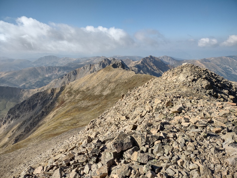
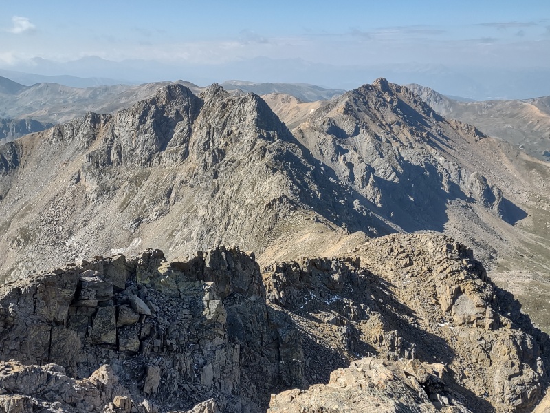
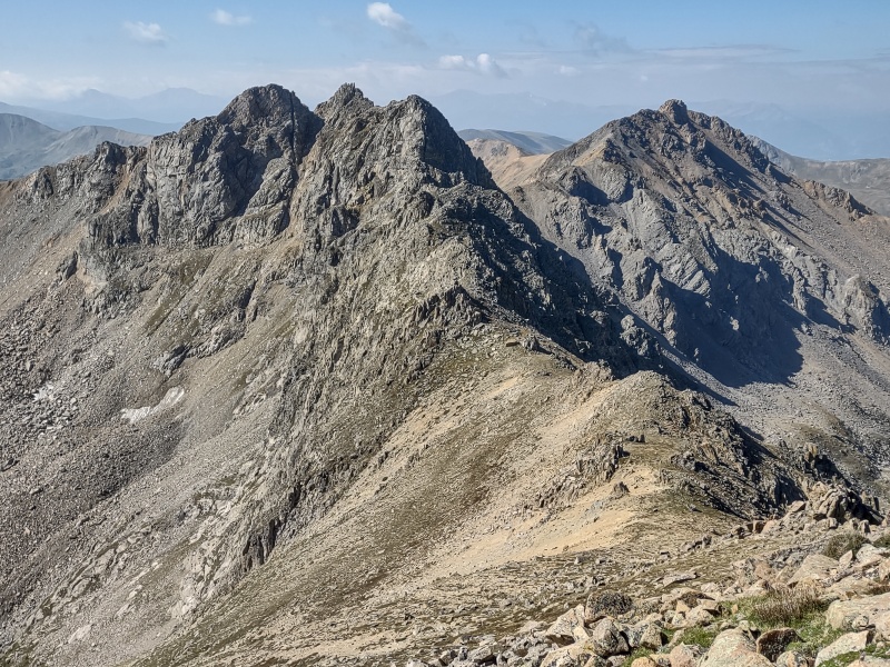
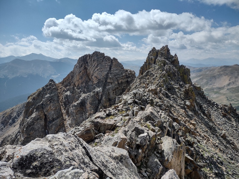
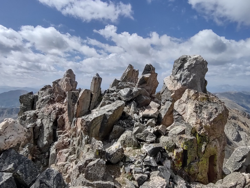
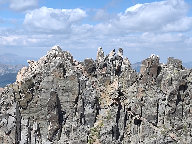
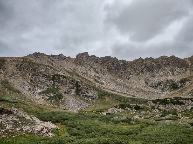
The Citadel (also known as East and West Citadel)
Once you're at the top of the chimney the fun isn't over yet! That's part of what makes this route so sweet - even if the chimney was followed by boring class 2 it would still be worthwhile to do this hike simply for the sake of such a neat and solid chimney, but the fact that's there's so much scrambling fun with class 3, 4, and 5 options beyond the chimney makes this route truly special.
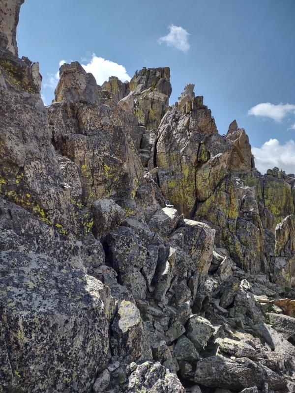
Coming up the ridge to West Citadel.On West Citadel looking over at a few folks on East Citadel.
From the top of the chimney I more or less just took a straight line to the summit of West Citadel. I think there was probably a mixture of class 3, 4, and 5 terrain scattered around - I'm honestly not even sure how hard the Citadel's were because after acing that class 5.4 chimney I was on cloud 9 and practically dancing up the rest of the way, oblivious to difficulty.
The multiple summit blocks on West Citadel - the closest one is a real hoot to get on top of - but the farthest one seems to be the highest.
There were a whole series of summit blocks awaiting me on West Citadel. Some people might be horrified by such a sight - I was delighted!
I of course went straight for the top of the first block - it was a bit spicy - definitely at least class 4, maybe even class 5 to get on top of it. I'd consider the moves getting up on that more difficult than getting up the Snowmass summit block and more involved than the infamous Sunlight summit block.
But not to fear timid peak baggers - I later concluded that the summit block on the far end (south side, which is farthest away from the class 5.4 chimney) is the actual high point of West Citadel (my GPS waypoint put it one foot higher, though I forget if I was standing or sitting when registering the waypoints...).
Me sitting on top of the first summit block on West Citadel looking over at the folks on East Citadel.Me spun around the other direction looking down some pretty decent exposure on that side.
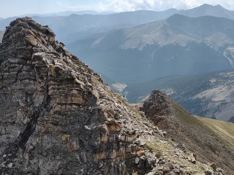
From the summit of West Citadel I started down the spine on the south side, opposite of where I came up, then cut over to the flat gully between the two Citadel summits. I took took a more or less straight line up the most solid looking route I saw.
One person seen coming down East Citadel and another about to disappear past the hump beyond Citadel.Approaching East Citadel.
My GPS put East Citadel a little higher than West Citadel but within the margin of error, so for a proper summit of The Citadel you should probably go ahead and tag both just to be safe (and tag the various summit blocks on West Citadel if you want to be very, very safe.
Looking back at West Citadel and its summit blocks - from here it's clearer the the leftmost (southern) one seems highest. Coming up East Citadel.A zoomed in view of the summit blocks on West Citadel.Rough approximation of my route - basically up chimney and straight along ridge up and over West Citadel then drop in gully and up.
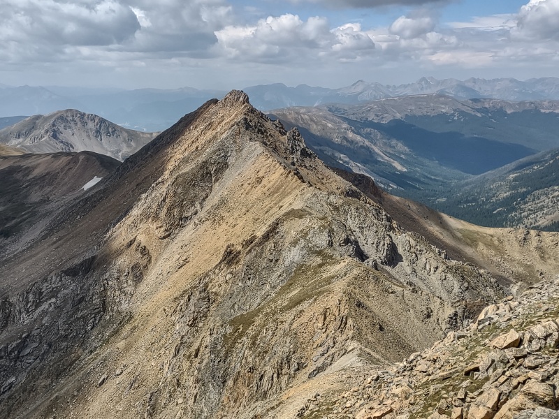
Hagar - I'll Be Back...
It would have been really nice to add on Hagar with its class 3 and 4 scrambling but I was concerning by the slowly growing clouds and, not being sure how long it would take to get there and back, nor entirely sure of exactly what route I'd take off the Citadel to get back to Herman Gulch Trailhead, I decided to save that neat looking peak for another day.
Besides, I enjoyed the Citadel so much that I intend to redo it when I come back for Hagar!
The route over to Hagar also looks fun but I wasn't sure the weather would leave me enough time to grab it this trip - I'll be back!
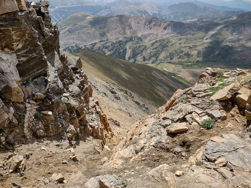
The Descent from Citadel - Towards Mount Bethel
A quick note before describing my actual decent: on the way over to the Citadel I noticed what looked like a pretty low angle, easy descent down to the valley which seemed like a possible escape route if someone chickened out upon approaching the chimney.
The stuff just off to the side of the chimney is very clearly cliff-out territory, but a little ways before that (closer to Pettingell) was a descent path that, from above, looked viable.
The map however shows a lot a red shading there with some purple splashed off to either side. So I don't know if that is a viable path or not. I might tried to ascend that way by hiking a ways past Herman Lake on my return and seeing if there's a viable way up. Or maybe I'll just do the standard route up Pettingell which cuts up just before Herman Lake (you can get to the Citadel from there without actually going up Pettingell).
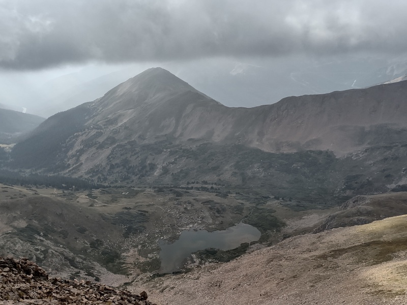
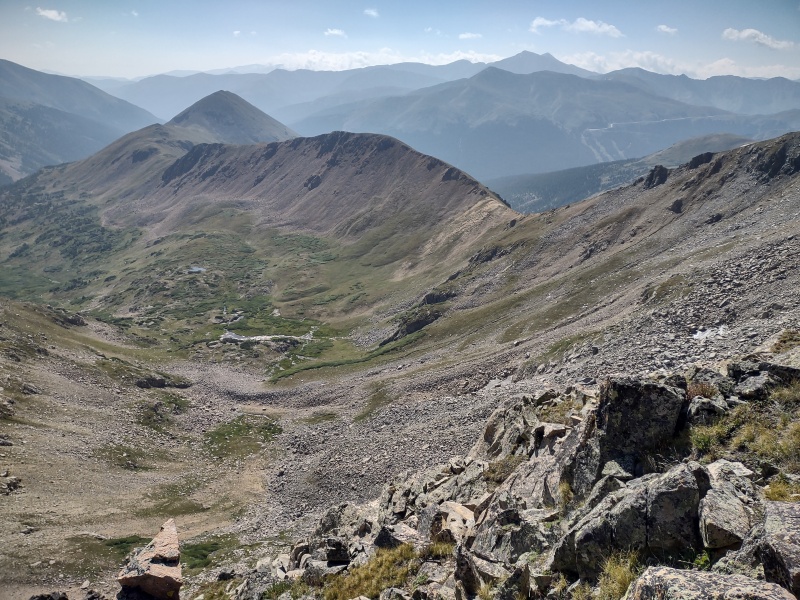
Looking over at Mount Bethel from before reaching the Citadel - Herman Lake visible below.View from near the Citadel - the left side of this photo seemed like a possible descent route (but map shows it's steep).
I hadn't really researched how to get off the Citadel other than to download some GPS tracks that went down towards Mount Bethel and dropped into the valley. But I soon found that you don't just stroll off from East Citadel...
WARNING: The ridge going east off of East Citadel looks like an easy walk-off. IT IS NOT!!!
Well it was real easy until it suddenly went from a casual flat stroll to a very dramatic cliff. I ended up back-tracking to the Citadel and went down next to, then in, the gully coming out from between the Citadel summits. The gully was pure garbage - I stayed on the solid rock next to it for as long as I could before entering the slip and slide loose dirt/rock.
After my dead-end descent I backed up and went down by, then in the gully between the Citadels Looking back up the gully.
After getting down the gully I came along the bottom of the cliffs I had been on top of and spotted a chimney like descent which I think the group ahead of me had used when walking off East Citadel.
I have no idea how difficult that route is - quite possibly class 5 - I would imagine at least class 4. Perhaps I might investigate it for my return trip.
The black gash is the chimney that another group seems to have used; could be class 5, I'm not sure.I came to the edge of this point above before looking down and then backtracking to the Citadel.
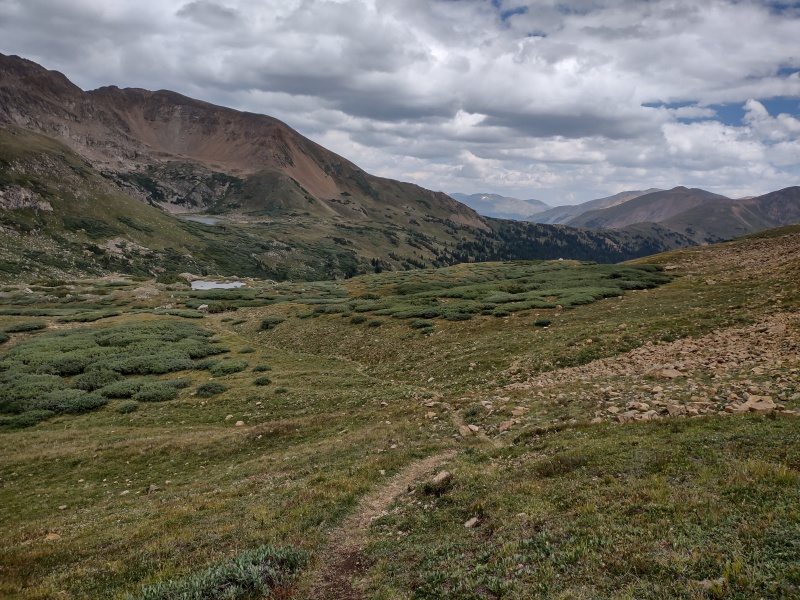
After getting past those cliffs it does indeed become a simple walk off. Just drop down to the first saddle on the way to Mount Bethel and follow the (initially) obvious trail dropping down to the left towards Herman Lake.
The trail fades in spots but then becomes really clear a little ways before Herman Lake. Once at the lake you'll encounter the masses of tourists that flock there and can easily follow the major trail back to Herman Gulch Trailhead.
Past the obstacles and dropping to the first saddle along the way to Mount Bethel. Trail drops to the left toward Herman Lake. Looking back up at the Citadel.The trail to Herman Lake is sometimes faint but I was able to follow it.Another view of the Citadel from lower in the valley.The trail cuts through the willows without any need for willow bashing.One more look at the dramatic Citadel.
My Times
3:49am start from Herman Gulch Trailhead
5:13am reached the turnoff to go up the Continental Divide trail to Hassell
6:39am almost to the ridge and already put on all my emergency layers since it was much, much colder than anticipated
7am passed the first hump on the ridge to Hassell
7:10am Hassell summit
7:28am back on first big hump (after checking out another hump slightly beyond the summit just to be sure)
7:58am last main low point before Pettingell
9:16am Pettingell summit (after lots of needless detours on harder terrain features to warm up on)
9:35am continue on
9:57am moved on to final high point before the Citadel - totally hooked on going forward
11:35am on East Citadel summit (forgot to check time arriving on West Citadel)
11:55am descend
2:18pm at Herman Gulch Trailhead
GPX note: I had a few glitches where the GPS stopped tracking for a short time. I edited the GPX file to clean those up as best as I could.
My GPS Tracks on Google Maps (made from a .GPX file upload):
Thanks. Yep, at one point in the report I mentioned the altitude readings being "within the margin of error" for the GPS - it's still interesting to try comparing waypoints but due to the issue you mentioned, I made sure to get on all the highest looking points (in this case doing so was actually rather fun!)
Nice report & pics. I was thinking as I read your chimney description and looked at the photos that the chimney would probably be a good alpine route to practice placing gear & ropework. There are of course closer spots but places like the Flatirons I've never thought really mimic alpine rock. Not sure if you have any interest in gear/ropes, but those chimney stances would be ideal spots to fiddle with gear placements. Just an idea.
Tom, that's a great idea! I was ok doing it without ropes but I suppose that makes it an even better candidate for practicing since I know I don't actually need ropes for it. Though at the moment the only gear/experience I have outside is for the short simple tree rappels I did in the Flatirons. Maybe I should try to find a mentor who's interested in the Citadel who could clue me in on what kind of pro would be appropriate for something like this and give me some pointers on how to actually use it. I mostly tend to free climb but it would be good to develop the know-how to protect a route when appropriate.
And as I don't have the climbing skills you have, I live vicariously through them! I took the much more pedestrian route up the Citadel when I did it some years back.
I did Hassell this past May, and it was soooo much fun. The ridge is pretty steep and it was an epic snow climb, we needed crampons and an ice axe, with a pretty steep descent (ski) or if youre just a climber, I went around to the other side and linked it up with an extremely steep glissade. Definitely much more fun in the spring! I will attach my peak conditions report - maybe to persuade you its not all that boring! Lol
Lol, yes, it looks a lot more interesting under those conditions!
Caution: The information contained in this report may not be accurate and should not be the only resource used in preparation for your climb. Failure to have the necessary experience, physical conditioning, supplies or equipment can result in injury or death. 14ers.com and the author(s) of this report provide no warranties, either express or implied, that the information provided is accurate or reliable. By using the information provided, you agree to indemnify and hold harmless 14ers.com and the report author(s) with respect to any claims and demands against them, including any attorney fees and expenses. Please read the 14ers.com Safety and Disclaimer pages for more information.
Please respect private property: 14ers.com supports the rights of private landowners to determine how and by whom their land will be used. In Colorado, it is your responsibility to determine if land is private and to obtain the appropriate permission before entering the property.


")
")
")
")
")
")
")
")
")
")
")
")
")
")
")
")
")
")
")
")
")
")
")
")
")
")
")
")
")
")
")
")
")
")
")
")
")
")
")
")
")
")
")
")
")
")
")
")
")
")


