Download Agreement, Release, and Acknowledgement of Risk:
You (the person requesting this file download) fully understand mountain climbing ("Activity") involves risks and dangers of serious bodily injury, including permanent disability, paralysis, and death ("Risks") and you fully accept and assume all such risks and all responsibility for losses, costs, and damages you incur as a result of your participation in this Activity.
You acknowledge that information in the file you have chosen to download may not be accurate and may contain errors. You agree to assume all risks when using this information and agree to release and discharge 14ers.com, 14ers Inc. and the author(s) of such information (collectively, the "Released Parties").
You hereby discharge the Released Parties from all damages, actions, claims and liabilities of any nature, specifically including, but not limited to, damages, actions, claims and liabilities arising from or related to the negligence of the Released Parties. You further agree to indemnify, hold harmless and defend 14ers.com, 14ers Inc. and each of the other Released Parties from and against any loss, damage, liability and expense, including costs and attorney fees, incurred by 14ers.com, 14ers Inc. or any of the other Released Parties as a result of you using information provided on the 14ers.com or 14ers Inc. websites.
You have read this agreement, fully understand its terms and intend it to be a complete and unconditional release of all liability to the greatest extent allowed by law and agree that if any portion of this agreement is held to be invalid the balance, notwithstanding, shall continue in full force and effect.
By clicking "OK" you agree to these terms. If you DO NOT agree, click "Cancel"...
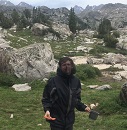
Climbing Colorado's 14ers last summer inspired me to learn rock climbing over this past winter. Specifically, multipitch trad climbing so that I could do more challenging objectives in the mountains. Somewhere along the way, I got the idea that it would be awesome to first summit Mt. Whitney via its awe-inspiring east face! And so I did.
California 14ers
By and large, California's 15 14ers are, compared to Colorado's:
Glacier travel is not strictly required, but standard.
Longer and more strenuous. I plan to backpack all but one CA 14er, even though I day-hiked the Blanca and Crestone groups.
Less populated, and more by sufferfest-lover types than casual hikers. Ironically, the proportion of backpackers on CA 14ers is actually lower, because of the permit difficulty and the fact that ultrarunners use them as endurance testpieces.
More remote, 7h from the nearest population centers
More red tape. Backpacking permits are required, they do sell out, and the process for obtaining them is onerous. (Day-hikes do not require permits except Whitney, but then most 14ers are not day-hikeable for mortals.)
Less scenic IMO
Less but still sufficient beta available
Hotter and drier. So, the hiking season runs roughly June-July, thereafter largely prevented by wildfire. The entire inyo national forest was closed due to fire from Aug-Nov 2020. Since you can only hike during the hottest months, combined with low trailheads, overheating and dehydration become serious concerns.
Afternoon thunderstorms are rare (roughly 1/4 of the time vs. 3/4 in Colorado); from living in California prior to 2020, I'd developed a "boy cries wolf" disbelief because rangers kept going on about those storms, but I rarely saw them. By default you can plan to have the whole day available, so a culture of pre-dawn starts has not evolved. But the 1/4 of the time those thunderstorms do arrive, they can be extreme.
They span 3 major mountain ranges (on the same level as the Rockies): Sierra Nevada, Cascades, and White Mountains
See a 14ers.com style chart of California 14ers:
Peak
Easiest grade
Mileage
Elevation gain
Permit & permit difficulty
Permit Difficulty
Mt. Whitney
1
20.9
6,650
Whitney trail or any day-trip: Whitney Lottery East face routes overnight: N Fork Lone Pine Ck
Whitney trail/c2c: extremely hard East face overnight: hard
Mt. Russell
3
8.5
6,100
N Fork Lone Pine Ck
hard
Mt. Muir
3
18
6,800
same as Whitney
same as Whitney
Mt. Williamson
3
25.4
10,100
Shepherd Pass
medium
Mt. Tyndall
2
22.5
9,950
Shepherd Pass
medium
Mt. Langley
1
18
5,000
Cottonwood Lakes
hard
Split Mountain
2
19.7 (13.4 w/ 4wd)
9,300 (7,400 w/ 4wd)
Red Lake
easy
Middle Palisade
3
16.2
6,900
S Fork Big Pine Ck
medium
North Palisade, Starlight Peak, Mt. Sill, Polemonium Peak, Thunderbolt Peak
Traverse: 5.9(aidable), 5.6, lots easy 5th, rappels * sill can be done separately, others only done in traverse
21
7,300
N Fork Big Pine Ck or South Lake
medium-hard
Mt. Shasta
Easy snow
10
7,300
non-quota
easy
White Mountain Peak
1
15
3,500
none
n/a
Sierra Peaks Section & Emblem peaks
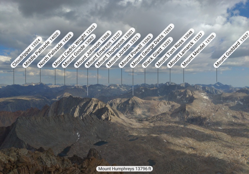
In addition to 14ers, California peakbaggers tend to care about the Sierra Peaks Section list of 247 worthy peaks. The Sierra Club selected these peaks for their aesthetics, historical and cultural importance, and prominence within their subrange, in addition to elevation. Notably, all of these peaks have been day-hiked, even those requiring 43mi or 14k' gain. In particular, 15 "Emblem" peaks are the most sought after. 11/15 Emblem Peaks are not 14ers. I have climbed two non-14er Emblem Peaks: Mt. Humphreys and Mt. Lyell. Outside the Sierra Nevada range, there are also other peakbagging lists like the Desert Peaks Section, California Coastal Peaks list, etc.
My Sierra Peakbagging trip
For the week of july 4th, I got 9 days off work for the price of 3. I decided to spend it hiking and climbing in the sierra, compounding the benefits of acclimatization. The crowning accomplishment was to be the East Face of Mt Whitney, whose permit I had dutifully booked 6 months in advance.
Date
Activity
Mileage
Elevation gain
Grade
Highest elevation
Friday 7/2
Work
0
0
0
16'
Saturday 7/3
Approach w/t
11.5
7,300'
1
12,200'
Sunday 7/4
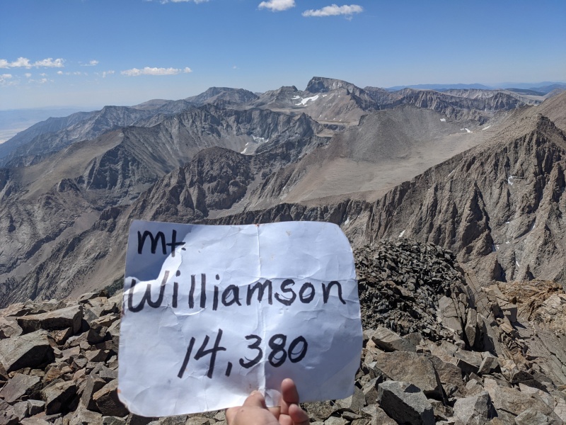
Williamson & Tyndall
8
5,080'
CA 3 ~ CO 4
14,380'
Monday 7/5
Descend w/t
11.5
1,000'
1
12,200'
Tuesday 7/6
Humphreys E Arete
5.4
5,000'
5.5 2 pitches (lead 1), 5.easy solo
13,993'
Wednesday 7/7
Approach Langley (rest)
5.5
1,665'
1
11,063'
Thursday 7/8
Langley (rest)
15
3,280'
1
14,026'
Friday 7/9
Approach Whitney
2.7
3,100'
3
11,300'
Saturday 7/10
Whitney & Muir
7.6
4,075'
5.7 7 pitches (lead 3)
14,505'
Sunday 7/11
Russell & Carillon
8
3,430'
3
14,094'
Williamson & Tyndall
7k' gain is my limit for a day. Williamson and Tyndall need 9-10k' gain each. So they became my second backpacking trip ever.
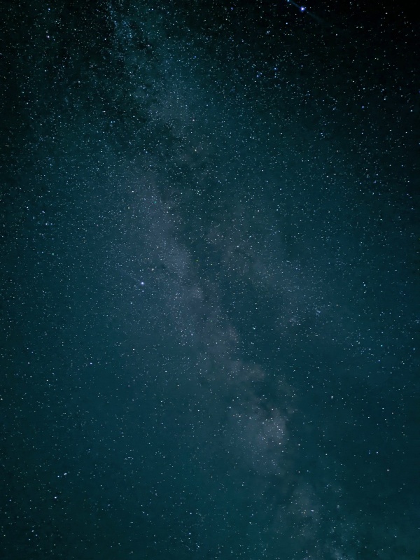
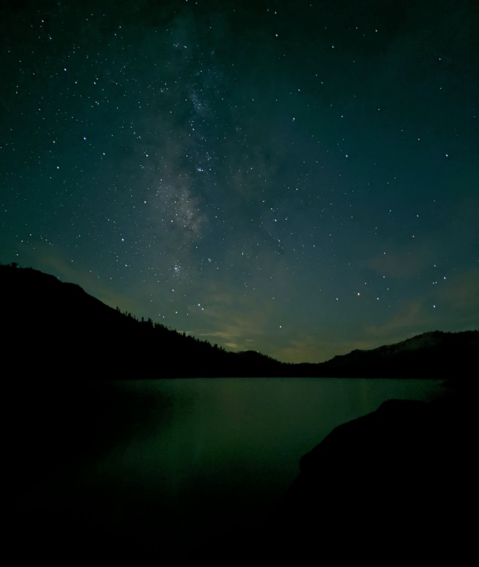
On Friday afternoon, I picked up my rental car near work in South San Francisco. I downgraded from an SUV to a sedan and used the savings to book a hostel. On the long drive over, in order to acclimate, I stopped to organize my gear and take astrophotos at 9k' in Yosemite. I don't think it helped much.
Tuolumne Astrophotography
The Civic made it admirably up the "4wd" road to the trailhead at 6k'. It was sweltering at 7am, but clouds soon rolled in and reduced the temp.
Heading up the good trail toward Shepherd Pass, I felt great! My first-ever backpacking trip to Mt Lyell had required glacier gear and a bear canister; so now my pack felt feather-light in comparison. I gained 3k' in 2 hours! I optimistically thought of completing the 2 peaks in 2 days.
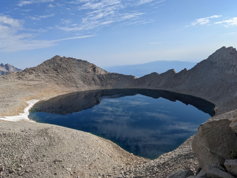
First View of Williamson from Symmes Saddle (9k)
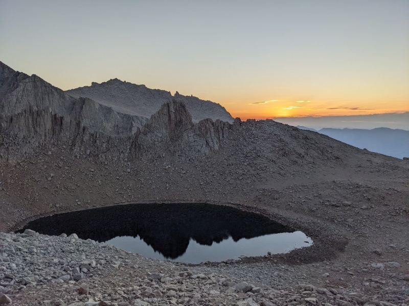
But as soon as I passed 10k', I crashed! I felt terrible. I couldn't blame it on elevation, because I wasn't breathing hard; my muscles just didn't want to move. The normal remedies of rest, food and water didn't help. but I had to push on to shepherd pass, or else my summit day would be too big. I suffered terribly up to shepherd pass at 12.2k. I spied the deer graveyard and commiserated. I finally arrived at 4pm and collapsed in the sand for an hour before gaining the energy to pitch my tent. This is the first time that I have ever run out of endurance before running out of time.
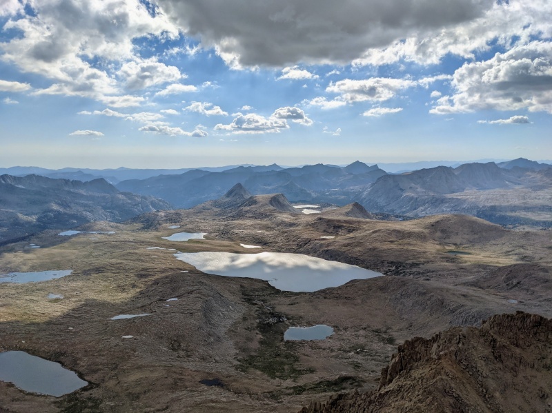
After a great night's sleep, I was reinvigorated. I picked my way across Williamson Bowl toward Mt. Williamson. I made my way up the scree chute by sticking to the class 3 rock on the side. An ultrarunner passed me. Later I learned that it was Cordis Hall setting a new FKT for williamson (5h 1-way) and for the Williamson & Tyndall combo (10h RT)! WOW! All this despite that he was climbing the slow scree instead of rock, and paused to gather my message to pass on to my friend on Tyndall. He also holds the Longs Peak Keyhole Route FKT.
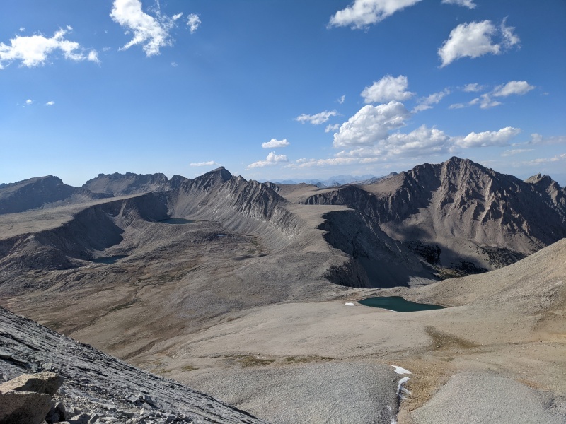
View from Williamson across Williamson Bowl toward Tyndall.View from Williamson toward Whitney.
After a class 3 chimney and quick talus hop, I scree-skied down Williamson and headed over to Tyndall. Met up with my friend who was day-hiking tyndall (9k' gain, from sea level, and all). topped out on Tyndall via its north rib, headed down to camp. All in all, a leisurely day, sunrise to sunset. the wonders of backpacking!
View from TyndallHike into the national park
The next day I suffered through the heat on the descent (including the 1k' gain on descent). A recurring theme in this trip, I chatted with another bearded old white guy. I always imagine these bearded Sierra-saunterers to be reincarnations of John Muir. This John Muir called me a "speed demon", an utter lie. I grabbed a gas station shower, wandered around Independence, and met up with my partner for the next day...
Humphreys
Something in my psyche needs a c2c sufferfest every once in awhile. After all, this was supposed to be a climbing trip, not peakbagging trip. I found a partner on mountainproject to do Humphreys East Arete. I heard it had miles of exposed easy 5th which I imagined we would simul (good practice for Thunderbolt to Sill traverse). In reality, everything was soloable except for two 5.5 pitches. No simuling.
Fun fact: a 8.5mm x 60m rope is still heavy af, and in fact the skinny diameter makes a backpack coil cut painfully into your shoulders. We really did need at least 50m; the summit rap used almost all the rope. I coiled it at least 7 times.
- 6am-10am: Trailless, sandy, bushwhack, 2-steps-forward-1-step-back approach to the ridge. - 10am-noon: 1500' of 3rd class ridge scramble - noon-2pm: 4th class scrambling and two rappels (bypassing 5.6 and 5.7 downclimbs). The exposure was bearable enough to solo. my new-to-me tx4s were bomber! - 2pm: Barely beat our turnaround time at the descent gully around 13k. - 2pm-5pm: Two 5.5 pitches, interspersed with more 4th class. My partner led the first pitch, then we soloed more, then I led the second pitch, almost to the summit. It was actually pretty fun and sustained. I brought ratty old Mythos imagining that I'd use them for hours of simuling, but only donned them for my lead. - 5pm-8pm: 3 raps off the summit, down-scrambling to the descent gully, scree-skiing and drinking our fill of snowmelt. - 8pm-11pm: Blind, headlamp-lit talus-hopping and bushwhacking. Went on forever. The lights of Bishop guided us in the right direction. - 1am: Collapsed into the back of my rental sedan. - 7am: Awakened by 97 degree heat.
Summit pitchLooking at Humphreys E AreteFirst 5.5 hand crack pitchHumphreys Basin
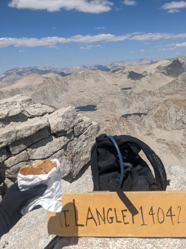
Langley
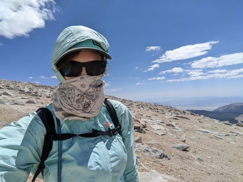
Langley is day-hikeable (18mi 5k') but after my pathetic performance on Humphreys, I really needed a rest day. I got 2 great rest days in a row by backpacking it.
On Wed 7/7 I wandered around Bishop, resupplying. Made my way up to the mercifully high (10k') trailhead. with a 4pm start, I expected unbearable heat. But the shade and elevation made it comfortably cool.
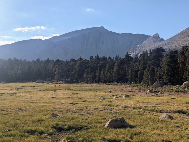
The meadows were so peaceful and beautiful! Birds were singing, marmots were chirping, deer were grazing. The promised bears were nowhere to be seen. Comfiest campsite I've used. Travel was all on-trail. What a pleasant, relaxed experience.
Langley Cottonwood Meadows
I slept in until 7am. Made my way up Old Army Pass, which I'd been warned was "sketchy", but in fact it was a perfectly good trail. Quite windy above the pass; but it was a wind blowing me uphill.
Langley's terrain is great because you have a choice of solid talus (for ascending) and soft sand (for bounding down). I got to the top without much effort. On the way down, I saw a bighorn sheep ram chasing his harem across the plain.
Langley summit cookieWindy
On the way back, I met another fascinating John Muir reincarnation. He was out fishing for Golden Trout. He recalled using a metal tube called a "bong" to protect an offwidth in the Wind Rivers 50 years ago.
Whitney, Russell, Muir
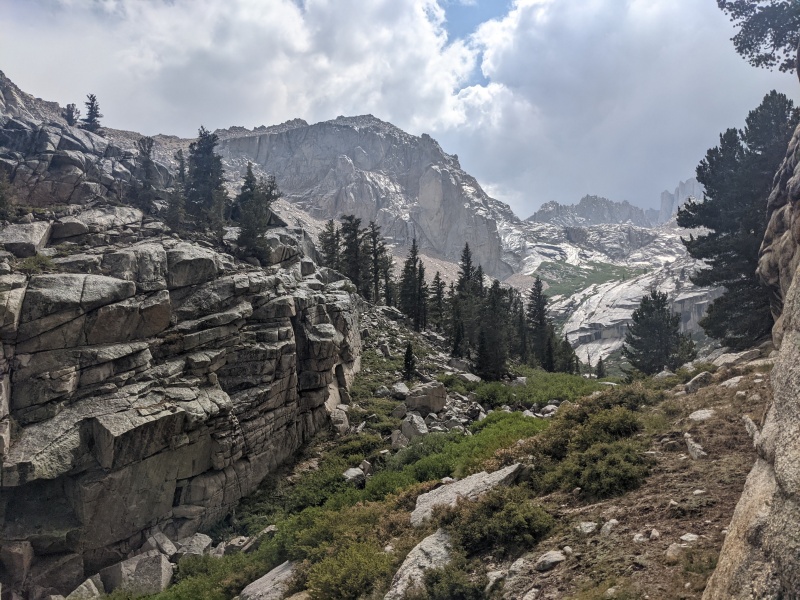
Finally time for my first 14er technical climb! The East Face and East Buttress are parallel and similar ~1000' 5.7s. I preferred to do the East Face for its aesthetics and history as the first Sierra technical climb; but most climbers prefer the East Buttress for its climbing quality; so I could only find a partner for the East Buttress.
The famous Whitney Trail is the class 1, 22-mile long slog up the south and backside of Whitney. For that (or for any route-in-a-day), you need to win the incredibly difficult Whitney Permit Lottery (up there with Half Dome in odds). But a little-known fact is: For overnight trips to the north/eastern routes (including the actual East Face, East Buttress, and 3rd-class-or-snow Mountaineers Route), you don't need to win the Whitney Lottery; you only need a North Fork of Lone Pine Creek backpacking permit. It's the most difficult Inyo NF permit to get; but if you wake up at 7am PST 6 months in advance when they're released, it's quite easy to catch one. Thus, I avoided needing to win the Whitney Lottery.
Pack weight (rack, no rope, 3 days food, no bear canister)Wet approach
On 7/9, my partner was recovering from Bear Creek Spire c2c (an incredible accomplishment, 10-pitch 5.8 and hours-long approach and descent). So we started pretty late. It was 1pm before we started up the North Fork of Lone Pine Creek. We followed a steep trail, scrambled up the 3rd class Ebersbacher Ledges, and bushwhacked across wet slab, willows, and ant-infested sand. It rained hard for 30 minutes; I hid under a tiny overhang. My partner got off route, slipped on wet slab, and cut his palm badly. Then, a violent thunderstorm started. We huddled in boulders around Upper Boy Scout Lake (11.3k) and decided to bail on Whitney. I thought, OK, I'll scramble up Russell tomorrow, and I'll use my backup permit to get Whitney in a couple weeks. But after setting up camp, the weather lifted, and along with it our spirits. We decided to make a dash for it. Based on Colorado experience, I was sure we'd have until at least noon before the weather turned the next day. But could we do 8 pitches in the 6.5 hours between sunrise and noon?
We meant to camp at Iceberg Lake (12.6k) but since we had decided to bail, we stopped at 11.3k. So we started out at 4am in the pitch dark to finish that hike. We arrived at Iceberg Lake around 5:30 to see 2 parties already ahead. One party disappeared into the dry scree Mountaineers Route. The other started up the East Buttress ahead of us. It was 6am before my partner cast off into the initial stemming crack of the east buttress.
Sunrise on the East ButtIceberg Lake
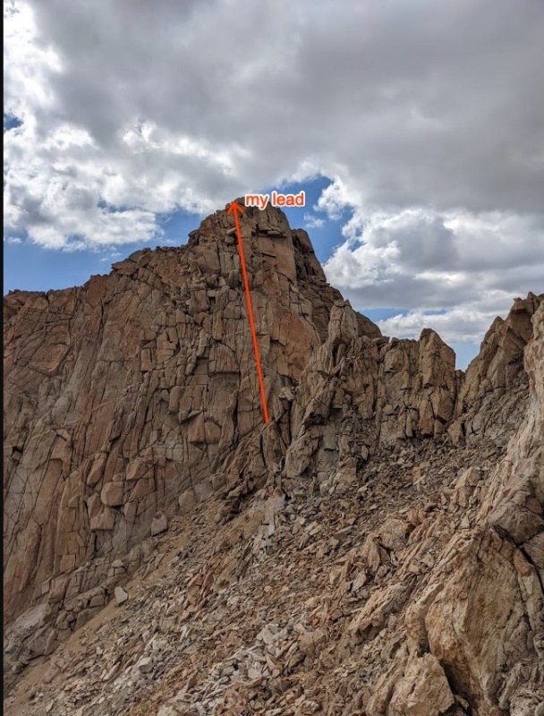
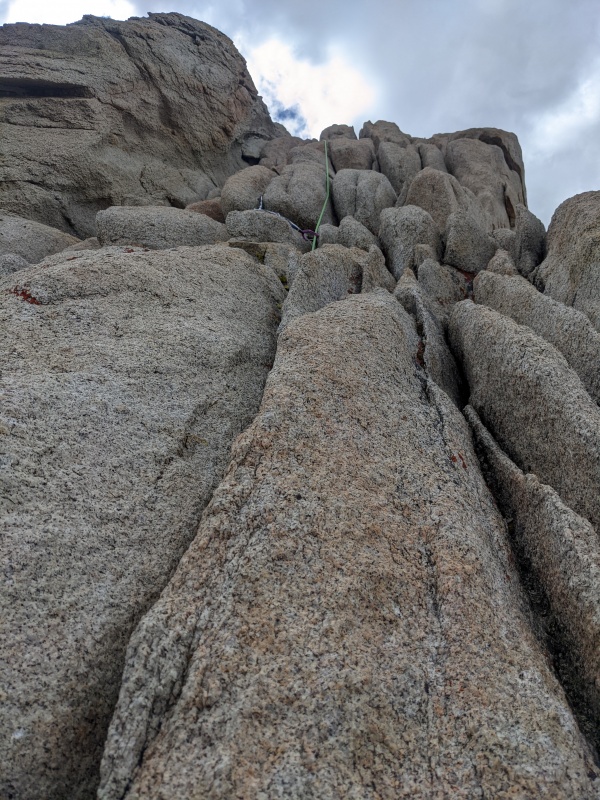
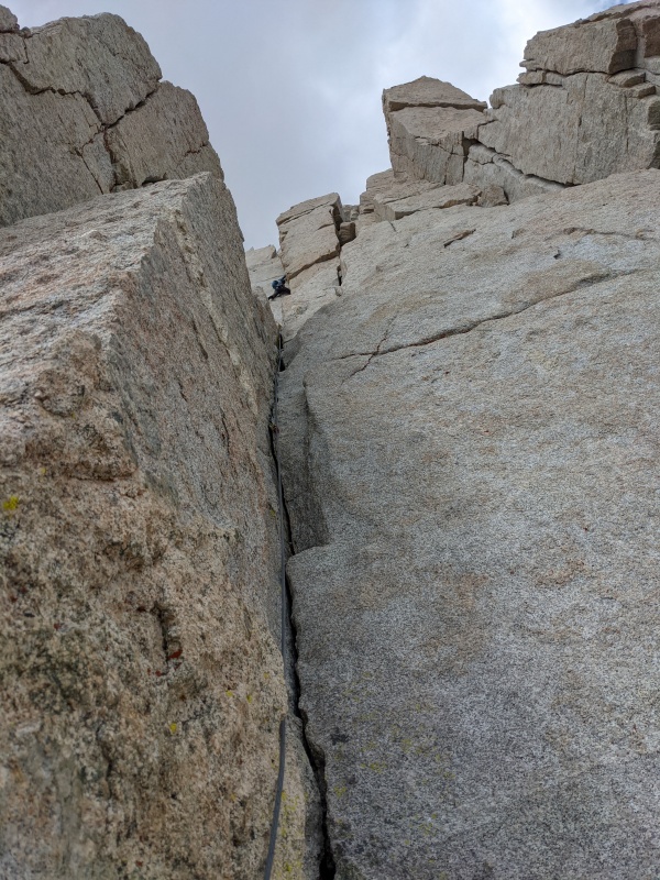
The climbing was interesting and fun as advertised. We swung leads, but each put in very little gear in the long 4th class sections between 5.6 cruxes. The topo shows 11 pitches, but #9-11 are 4th class, #7 & 8 can be linked with a 70m; so we did 7 pitches. I led the even-numbered pitches because I'm a slow noob leader and because #7 is the crux.
looking up pitch 5Russell Viewed from 4th(?) belay. I gotta climb that Mithral Dihedral someday!
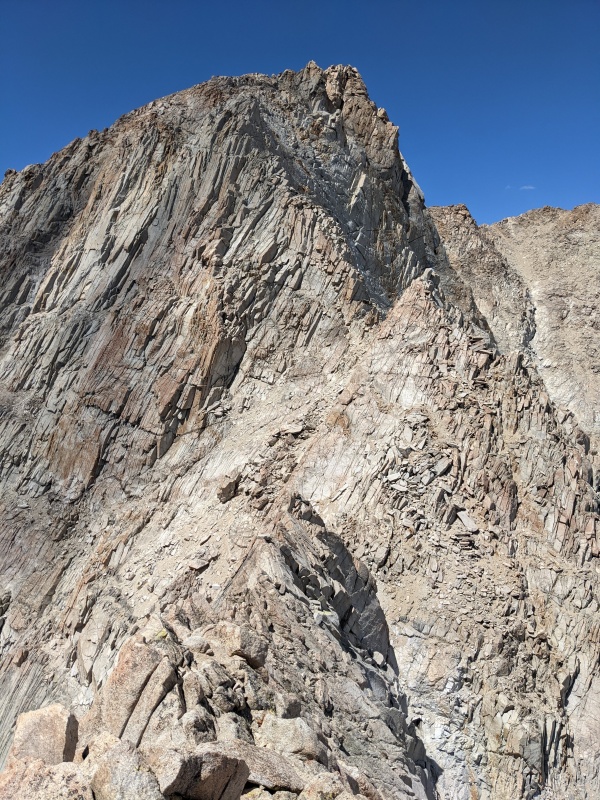
As early as 9:30, clouds appeared. After leading pitch 6, I felt the first raindrop, and preemptively put on all my jackets. As my partner cast off the crux pitch, the weather got progressively worse. On this pitch, if you head straight up as would seem obvious, you get into 5.8 offwidth. You have to traverse left to keep it 5.6. Obviously, we did not carry any offwidth pieces up Whitney. The poor guy lead unprotected 5.8 offwidth in worsening graupel at 14k'. Following up, terrified of the weather, I forewent any consideration of good style, flailing up as fast as I could, dismayed at a tipped-out .2 in a flaring crack.
5.8 offwidth, without wide gear, in the storm
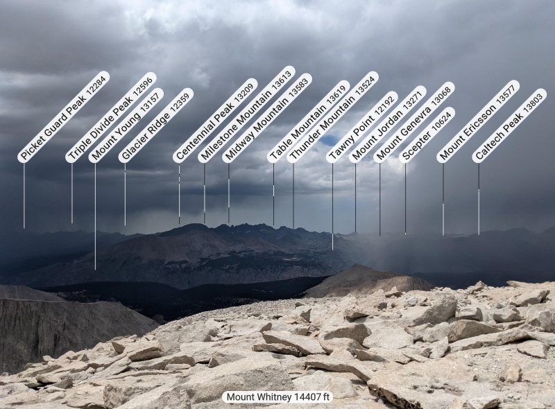
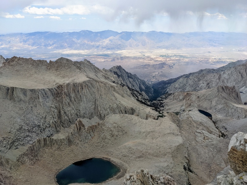
I led a tiny traversing pitch across a "leap of faith", then unroped as the graupel accumulated. It was still only 11am. I discovered that rock shoes perform terribly on wet rock, slipped and gave myself a flapper. Changed back into approach shoes, got lost among the 4th class giant talus, and eventually found our way to the summit. 14,505ft! The precipitation let up somewhat, and we heard no thunder. We'd made it! The view was intimidating, the clouds black, the Kaweahs and other remote peaks stretching into infinity, Owens Valley 10k' below. The summit was uncrowded as most of the hikers had more sense than us and had headed down already.
Kaweahs from whitney.
Owens Valley from Whitney. 10,800' below.
Mt. Muir
With the weather, it was a questionable decision to head to another 14er, Mt. Muir. "The mountain will always be there" but I won't always be that close to the mountain! I'd need to drive another 8 hours, win another permit, and hike another 2 days to get that close again. So, the risk was rationally worth it to me. Mt. Muir is really a minor sub-summit of Whitney, which happens to have 300' prominence. I had confirmed that my permit legally allowed me to traverse on the Whitney Trail between Whitney and Muir, so I stashed the rope and trotted southwards on it toward Mt. Muir. A few straggling altitude-sick zombie day-hikers were shuffling miserably up. Left the trail at 13.8k', scrambled 250' up California 14er #5, on dry rock just as rain was restarting.
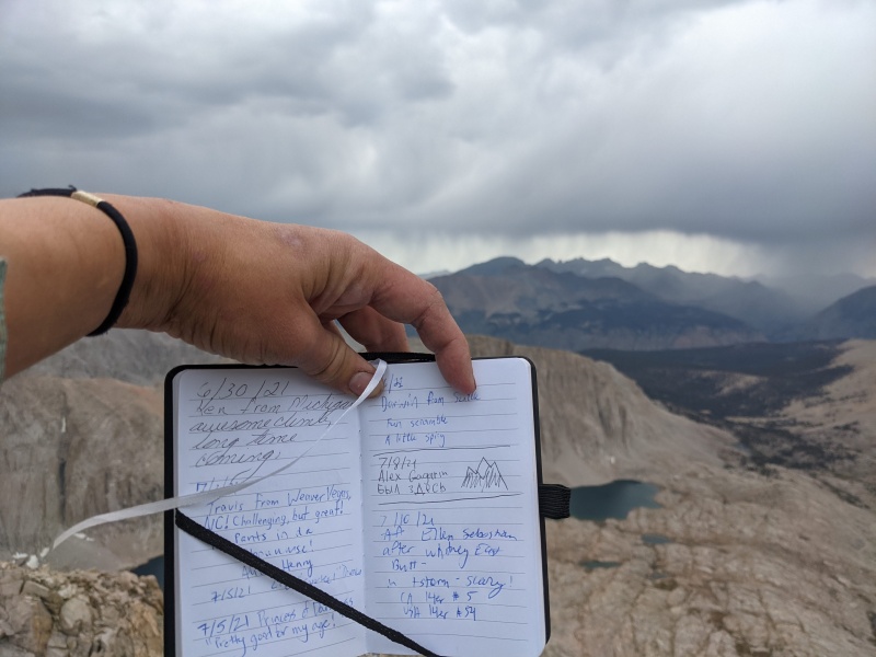
Mt Muir Summit Register
Headed back up toward Whitney but bypassed its summit, topping out at 14.2k'; then tumbled down the tedious Mountaineers Route, to Iceberg Lake. The weather turned beautiful again.
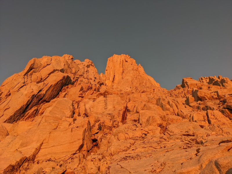
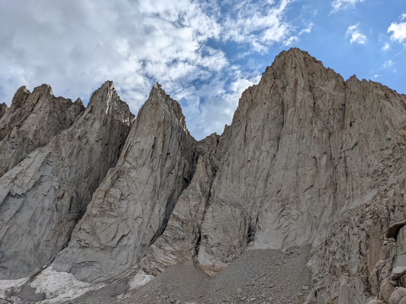
Departing Iceberg Lake back to camp, I was struck by the most incredible view of Whitney's East Face. I had missed it in the morning in the dark. I'm not a religious person, but this view gave the undeniable impression of staring at the face of, or being in the presence of, a God. It commands respect and reverence. You can feel a solemn presence looking at you. Twin ridges reaching eastward from Whitney remind you of a monarch sitting on a throne. I was entranced, felt it difficult to pull away, and even now feel the pull to come back and climb the East Face proper.
The countenance of a monarch. Scale not conveyed here.
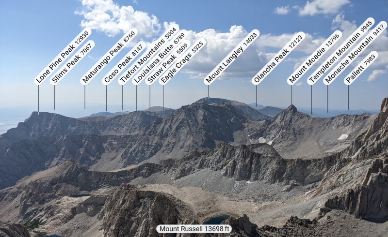
Mt. Russell
The original plan had been to climb the Fishhook Arete or Mithril Dihedral on Russell. But, the weather forecast was terrible. There was no way we could top out before the storm. Regardless, I would be flailing following those routes, and wouldn't be able to count them as respectable ascents. So, I took the 3rd class East Ridge. The scrambling was mellow, but thrillingly exposed. Back to the good old days of scrambling above 2000ft dropoffs!
Tunnaborra lake
Amazingly, the couple who we'd followd up the East Butt the day before, was on the summit at 9:30am! They'd taken the Fishhook! I'm still amazed at their speed. I made it safely off the ridge by 11am. I hypocritically warned a young family heading up of the impending storm. I felt the first raindrop at 11:38am, 20' below the summit of 13er Mt. Carillon. I quickly bagged it, and tromped down the sand back to upper boy scout lake in light rain. I started packing up camp, only to feel the storm worsening. I huddled in my hastily-repitched tent. As the rain built and the winds whipped, it got so cold that I had to put on all my clothes and get inside my sleeping bag. The storm pounded violently for 3 hours. I dozed off. Finally, the rain stopped, I packed up camp for real, headed down now-dry slabs back to Whitney Portal, and drove 8 hours back to San Francisco -- a 3am traffic jam bringing me back down to earth.
What's next
After taking a rest this week (and losing all my acclimitization), I'll head back to the sierra next week. As much as I'd like to say I've finished the Sierra 14ers, I also have no desire to slog up Split Mtn soon; it's better done in the cool of fall. I won't be terribly sad if another complete Inyo NF closure precludes that (... rather I'll be sad because it's burning, not because of my own peakbagging). So I'm aiming to only finish 7 more 14ers that week (Thunderbolt to Sill traverse, Middle Palisade, White Mountain Peak; plus Bear Creek Spire, and another SPS Emblem Peak, Mt. Abbot). I also will not finish California's 14ers this year, because a historically low snow year cancelled my attempt on Shasta, and I refuse to take the non-snow scree route up it.
My GPS Tracks on Google Maps (made from a .GPX file upload):
only one point, since you enter the whitney zone on a climb of russell, you unfortunately need to go through the same process to get a permit as if you were climbing whitney. this changed back in the late 2000's. the summit destination doesn't matter to them, just whether you ever enter the whitney zone.
The entirety of my trip was in the Whitney Zone, but overnight climbs originating from the North Fork of Lone Pine Creek definitely do not need a Whitney Lottery ticket;
The more gray area to me was whether I could actually walk on the Whitney Trail to Mt. Muir. I carried a downloaded copy of the email from a ranger stating that this was allowed. I do wonder, if I had run into a ranger, whether they might disagree with the email and ticket me!
technically, any trip entering the whitney zone doesn't "need" to enter the lottery - if you are able to snag a leftover permit. but the same quota and permitting rules apply as soon as you enter the whitney zone, regardless of destination (thor, carillon, russell, muir, etc) - the north fork entry point doesn't matter.
You need neither a lottery win nor a leftover lottery permit for Russell: "If you wish to approach climbing routes like Mountaineers Route, East Face, East Buttress, or Mt. Russell request an overnight permit for North Fork of Lone Pine Creek (not in the lottery)."
https://www.fs.usda.gov/detail/inyo/passes-permits/recreation/?cid=stelprdb5150055
Unless by "leftover" you mean a "walk-up" (released 14 days in advance) North Fork of Lone Pine Creek permit -- which is true.
I especially liked seeing your report on Williamson and Tyndall, I really want to hit those while I am out in California for the summer. I have also heard that Russel is a fun/pleasant scramble. I like the pictures!
We ended up climbing an itinerary of Sierra 14ers the weekend before. We were a little ways to the North and did Split, Middle Palisade and Langley as 3 back to back day hikes.
Everything seems so dry out there when compared to Colorado (I am sure the pathetic California snow year did not help)! The mountains certainly are imposing though, especially from Bishop/Independence/Lone Pine, they certainly feel bigger (and are bigger) than their Colorado counterparts.
Haven't heard anyone mention a bong (a climbing bong, that is...) in a long, long time. More of a 60's thing, I think, for protecting & aiding off-hands/off width cracks before the advent of cams. And if he was using them in the Winds that long ago...oy, I wonder who he was? Anyway, I really enjoyed your report, esp the tech sections. Sad to read how disruptive the fires have become out there.
Thats a monster trip. Most of those mountains are death marches one at a time. To do them all in a week is pretty special. W/T from the pass in one day is pretty nuts. Well done.
You don't have any more beta on Humphreys, do you? Headed up there in August...
And I think I'm in your picture of the Kaweahs --- I was actually on Florence Peak (out of Mineral King) getting rained on right about then... lol
Well I was too pooped to get my camp over to Williamson Bowl! So i'm forced to do W&T in a day or else lose elevation! Even so, the approach day was more brutal than summit day.
For Humphreys, I went by the High Sierra Supertopo, but similar info about the east arete is also on mountainproject: https://www.mountainproject.com/photo/106736913
there is also a 4th class route, and I haven't heard that it needs high clearance/4wd: https://www.summitpost.org/southwest-slope-northwest-face/155668
Great writeup! It makes me sad to read that "the hiking season runs roughly June-July, thereafter largely prevented by wildfire." You're not wrong, but this is a relatively recent phenomenon. August was prime Sierra peak-bagging season as recently as 10 years ago, and still is in a big snow year. October is still a good time, though the days are short and non-lake water sources may be dry.
That ws a great report with wonderful photographs.
Caution: The information contained in this report may not be accurate and should not be the only resource used in preparation for your climb. Failure to have the necessary experience, physical conditioning, supplies or equipment can result in injury or death. 14ers.com and the author(s) of this report provide no warranties, either express or implied, that the information provided is accurate or reliable. By using the information provided, you agree to indemnify and hold harmless 14ers.com and the report author(s) with respect to any claims and demands against them, including any attorney fees and expenses. Please read the 14ers.com Safety and Disclaimer pages for more information.
Please respect private property: 14ers.com supports the rights of private landowners to determine how and by whom their land will be used. In Colorado, it is your responsibility to determine if land is private and to obtain the appropriate permission before entering the property.


")
")
")
")
")
")
")
")
")
")
")
")
")
")
")
")
")
")
")
")
")
")
")
")
")
")
")
")
")
")
")
")
")
")
")
")
")