Download Agreement, Release, and Acknowledgement of Risk:
You (the person requesting this file download) fully understand mountain climbing ("Activity") involves risks and dangers of serious bodily injury, including permanent disability, paralysis, and death ("Risks") and you fully accept and assume all such risks and all responsibility for losses, costs, and damages you incur as a result of your participation in this Activity.
You acknowledge that information in the file you have chosen to download may not be accurate and may contain errors. You agree to assume all risks when using this information and agree to release and discharge 14ers.com, 14ers Inc. and the author(s) of such information (collectively, the "Released Parties").
You hereby discharge the Released Parties from all damages, actions, claims and liabilities of any nature, specifically including, but not limited to, damages, actions, claims and liabilities arising from or related to the negligence of the Released Parties. You further agree to indemnify, hold harmless and defend 14ers.com, 14ers Inc. and each of the other Released Parties from and against any loss, damage, liability and expense, including costs and attorney fees, incurred by 14ers.com, 14ers Inc. or any of the other Released Parties as a result of you using information provided on the 14ers.com or 14ers Inc. websites.
You have read this agreement, fully understand its terms and intend it to be a complete and unconditional release of all liability to the greatest extent allowed by law and agree that if any portion of this agreement is held to be invalid the balance, notwithstanding, shall continue in full force and effect.
By clicking "OK" you agree to these terms. If you DO NOT agree, click "Cancel"...
Precipice Peak
Elevation: 13,144 Ft.
Rank: 530
Trailhead: Wetterhorn Basin Trailhead
Mileage RT: ~6.5 miles from 2wd TH, 3.5 from 4wd
Gain: ~2,400 ft
Precipice is a fairly easy peak but is seldom climbed and there are not a lot of reports out there, so I thought I'd share my route and advice. The day before my hike I had looked around for trail reports to guide me up the mountain, but there were few to be found and those that were available had few route descriptions and usually looped this in with other nearby peaks. Precipice is not a difficult mountain by most accounts, but it's still nice to know how to get where you want to go.
Living in Montrose for the summer, I was only about an hour and a half from the 2wd TH at Owl Creek Pass so instead of camping I opted to get up early and drive. Well that didn't happen either. I knew the weather was supposed to be beautiful all weekend with little to no chance of rain even in the high country, so I took my time, slept in, and got to the end of the 2wd road just after 12 noon. I parked here and had to walk the 4wd road the rest of the way to the true TH, taking off my shoes and crossing West Fork of the Cimarron in the process. I made it to a large beautiful meadow just on the other side of the fork, about a mile from where I parked, by 12:30, and was at the TH by 12:40. In all, it adds about 1.5 miles each way to park at the 2wd TH.
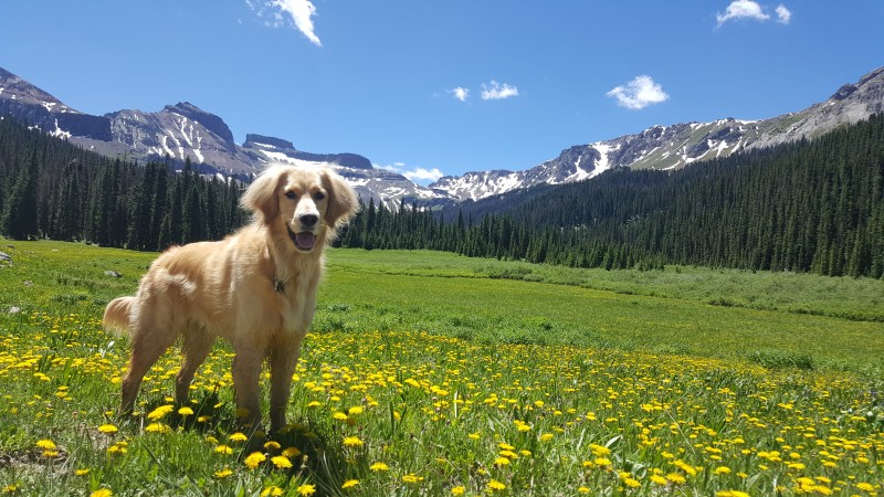
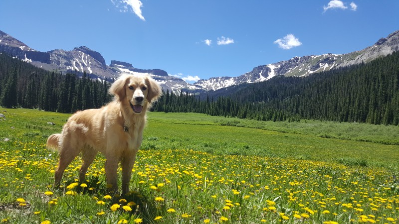
Harper in the meadow after crossing the West Fork, Coxcomb in the back (still on 4wd road)
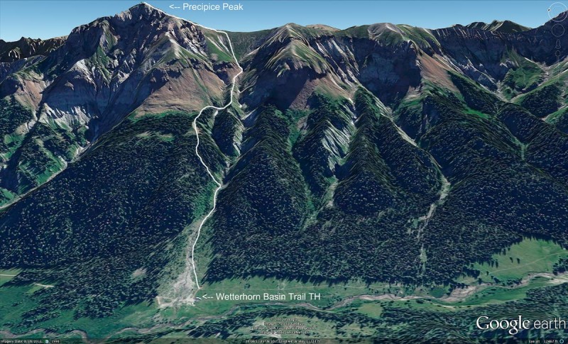
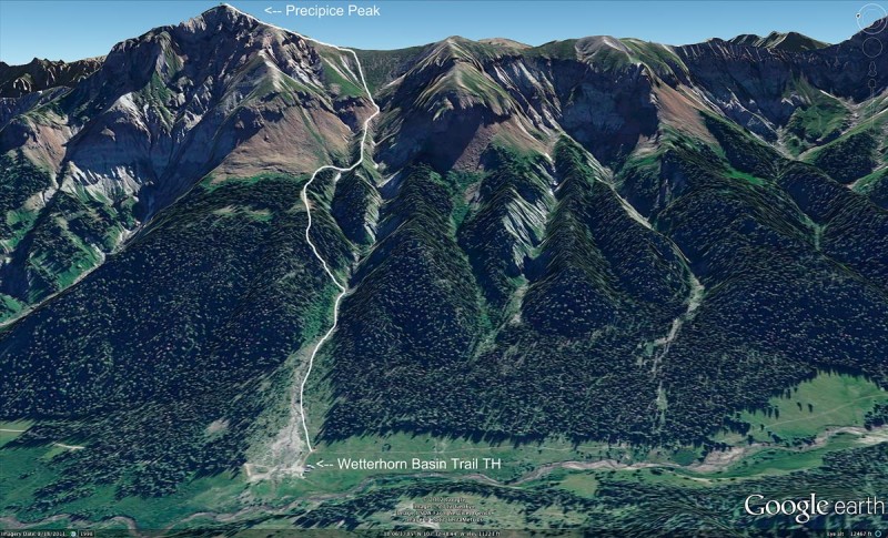
From the end of the 4wd road, you can see almost your entire route up the peak. Isn't it nice when you can see your destination? This is the only picture of the route I could find, thanks to Jack Brauer in his 2012 trail report you can find HERE
From the parking lot, follow the gully to the east straight up. Just as the gully starts to narrow at about 11,000 ft, stop following the water and instead head up the treed slope to the northeast. If you hit a small waterfall, you've gone too far and will have difficulty continuing up from this point. There is no trail, but when I hiked there were several game paths heading into the trees that generally led me in the right direction. Climb the side of the treed slope until reaching the top, then head directly east again following the game paths over downed trees and thick underbrush. After what seems like forever of bushwhacking, but is actually only about a quarter mile, you should come out to a small rock field (still in treeline) with cairns placed on several large boulders. Take a breath, the rest of the trail is easy compared to what you've just been through. Just above this reassuring point, look for a much more well-traveled path that leads you to timberline and to a second patch of boulders with cairns.
The path above timberline is pretty straightforward, but you do have a choice. When I returned to the area a week later to climb Redcliff (report still to come), I spoke with a couple of gentlemen who had climbed Precipice just after me who said they had opted out of the saddle and notch and instead took the route leading north from the second patch of boulders and cairns. When I asked why, they said they were avoiding any class 3 terrain, but I just don't see how that is possible on the route they took. They said they made it to the summit with a lot of scrambling and several spots of pretty extreme exposure on loose rock. I'd rather take the fun, short, class 3 notch over notoriously dangerous San Juan scree. But to each his own. The route I took is the typical approach to Precipice from what I've read, and has only brief exposure.
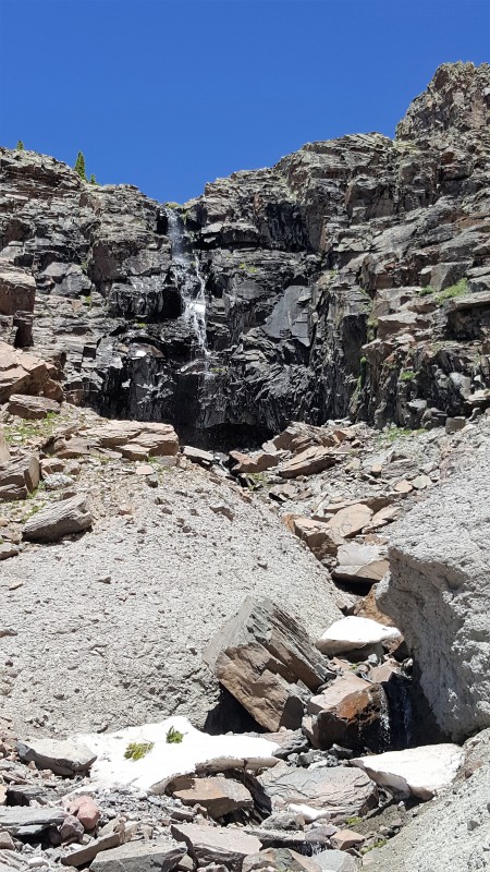
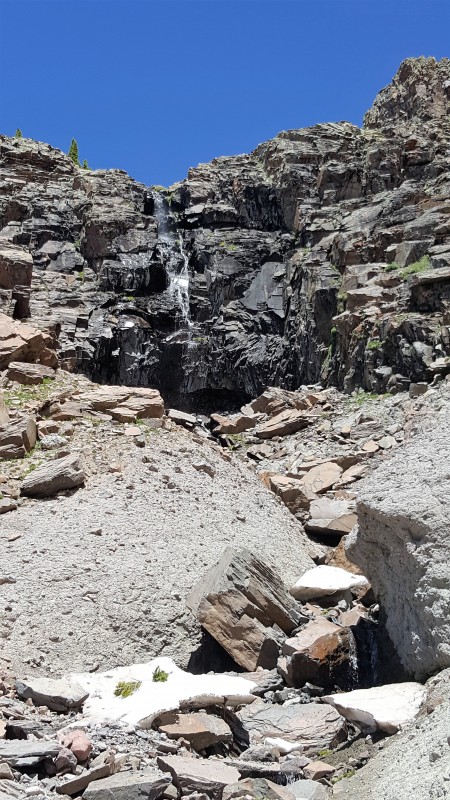
Once you reach timberline and the second patch of boulders and cairns, climb east. You'll skirt beneath a large cliff face with caves and head toward a creek with a beautiful waterfall. Cross this creek then follow it up all the way to the tundra. There is a faint trail on this portion that will lead you through the rocks, but few cairns. Don't worry about losing the "trail." As long as you are heading up, you are going in the right direction. The entire path from timberline to the saddle is extremely steep and tiring, but not loose or exposed and it is clear where you need to go once you near the saddle. The open tundra itself is beautiful and secluded, making the steep climb well worth it.
Waterfall in the gully between timberline and saddle. I climbed up to the right.
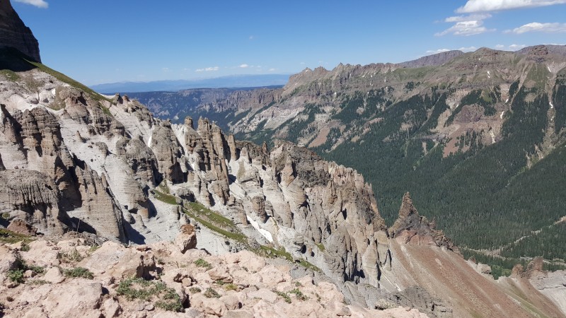
We made it to the saddle by 3:00 and stopped to rest and take pictures. It's about a mile from the TH to the saddle, but it's all steeply uphill and the bushwhacking slowed us down quite a bit. However, the views of the surrounding peaks from the saddle are absolutely gorgeous, as are the views of Precipice herself. The colors and hoodoos really are something else.
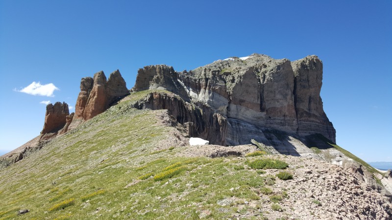
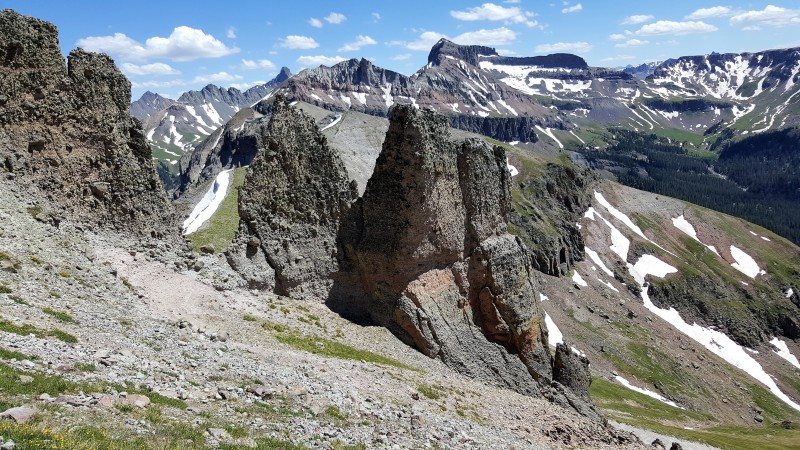
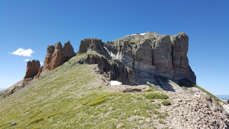
Precipice as seen from the saddle. You can see the class 3 notch to the left. Doesn't look too bad from this angle.
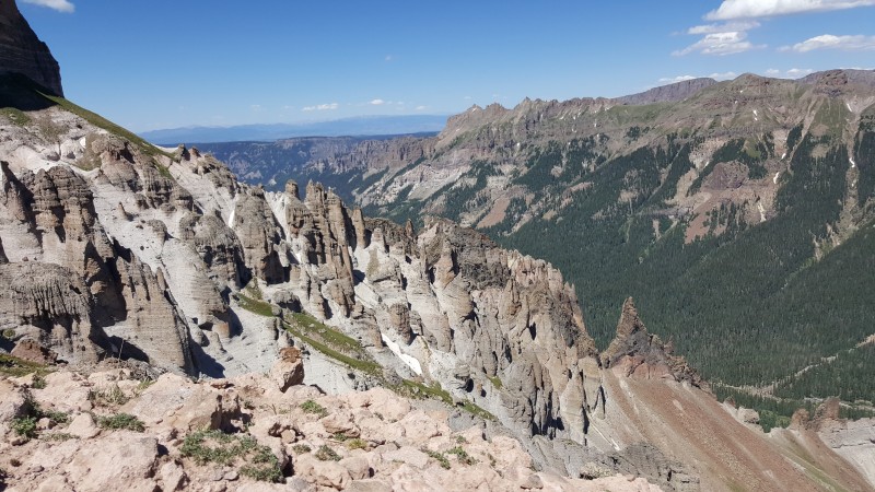
Hoodoos on Precipice's east side, as seen from the saddle.
After a short break we moved on, approaching the notch. Harper was not so pleased when I climbed over without her, but even she was able to make it without my help and only a little encouragement. Not a bad section at all, and actually quite fun. My only note would be that on the other side of the notch, the rock and sandstone debris is pretty loose with a little exposure. On my return I stayed high which was actually worse than just following the worn path. Just be careful and be aware that this sandstone is slippery stuff.
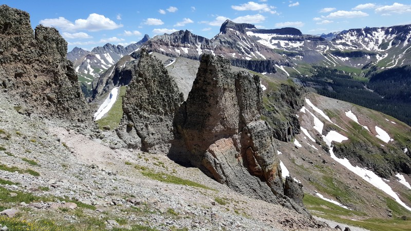
Notch from the summit side
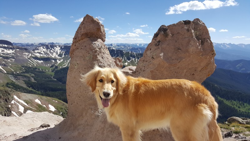
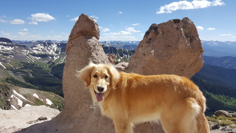
Harper near the false summit, with a sandstone mitten!
From the notch, the terrain gets a little loose and steep but I never had to use my hands to pull myself up and Harper had no problem at all staying right on my heels. There is one false summit with a small dip in elevation to get to the true summit, but definitely not the worst false summit disappointment I've had. We reached Precipice by 3:45, about .3 miles from our break at the saddle. The views were amazing, and I even got cell service! I made a quick call to my 80 year old grandfather who can see Precipice from his living room and we gave each other a wave.
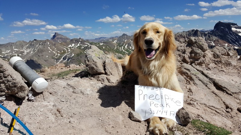
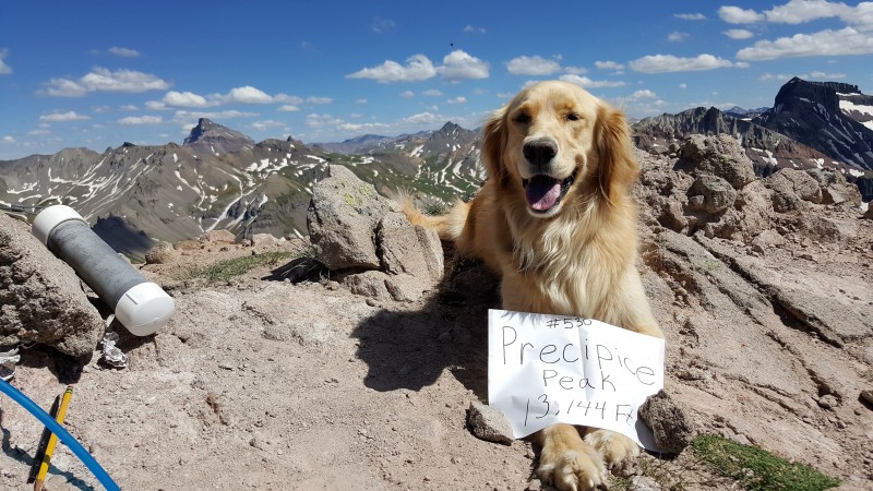
Harper's victory shot! Favorite 14er Uncompahgre in the background.
We left the peak at around 4 and started on our way down. This is where things turned sour and I would highly advise extra caution. Be extremely cautious of when you decide to head back down to the gully from the trees. I made the big mistake of trying to drop elevation too early after hitting the first set of cairns, and ended up on a loose dirt slope. I continued down the slope, thinking it may get easier, but it does NOT. There are rocks on this dirt that you may think are good hand/foot holds, but they come loose at the slightest touch and send a storm tumbling down the slope. The dirt was so loose that I ended up sliding about 20 feet down, ripping the seat of my pants wide open in the process. Ouch. Harper fared a little better with her four paws and better instincts, but she kept crying for me to get out and find a better way. So make sure you pass BOTH the cairn patches before you begin to descend, and follow the game trails for as long as you can on top of the ridge. Don't head toward the gully until you are sure you are returning to your start point. My mistake ended up delaying us big time on the way down, since the loose slope stranded me and made me stop and think about my every step.
We made it back to the car by 7, but this time could have easily been cut by about 3 hours had we not stopped in the saddle or taken the wrong path down too soon. While the trip down was no fun at all due to my own user error, the seclusion of this trail makes it a very worthwhile hike. As promised, the weather held for us and we were rewarded with a spectacular day in the heart of the magical Cimarrons.
Next goal: Fortress!
Thumbnails for uploaded photos (click to open slideshow):
Either of my partners could correct me, but I don't remember going back into the gully until we were almost at the bottom. The bushwhacking wasn't fun, but the footing was solid.
Regardless, this remains one of my favorite 13ers because of the interesting views of better known peaks, the hoodoos, and chance to hang out in the Cimarrons.
Thanks for posting.
Caution: The information contained in this report may not be accurate and should not be the only resource used in preparation for your climb. Failure to have the necessary experience, physical conditioning, supplies or equipment can result in injury or death. 14ers.com and the author(s) of this report provide no warranties, either express or implied, that the information provided is accurate or reliable. By using the information provided, you agree to indemnify and hold harmless 14ers.com and the report author(s) with respect to any claims and demands against them, including any attorney fees and expenses. Please read the 14ers.com Safety and Disclaimer pages for more information.
Copyright: Route information, text, risk factors, maps, GPX files, charts, photos, 14ers.com-created map imagery, flythroughs, and other content provided in this route description are copyrighted by 14ers.com and may not be copied, reproduced, republished, distributed, modified, or used to create derivative works without prior written permission.
Please respect private property: 14ers.com supports the rights of private landowners to determine how and by whom their land will be used. In Colorado, it is your responsibility to determine if land is private and to obtain the appropriate permission before entering the property.