Download Agreement, Release, and Acknowledgement of Risk:
You (the person requesting this file download) fully understand mountain climbing ("Activity") involves risks and dangers of serious bodily injury, including permanent disability, paralysis, and death ("Risks") and you fully accept and assume all such risks and all responsibility for losses, costs, and damages you incur as a result of your participation in this Activity.
You acknowledge that information in the file you have chosen to download may not be accurate and may contain errors. You agree to assume all risks when using this information and agree to release and discharge 14ers.com, 14ers Inc. and the author(s) of such information (collectively, the "Released Parties").
You hereby discharge the Released Parties from all damages, actions, claims and liabilities of any nature, specifically including, but not limited to, damages, actions, claims and liabilities arising from or related to the negligence of the Released Parties. You further agree to indemnify, hold harmless and defend 14ers.com, 14ers Inc. and each of the other Released Parties from and against any loss, damage, liability and expense, including costs and attorney fees, incurred by 14ers.com, 14ers Inc. or any of the other Released Parties as a result of you using information provided on the 14ers.com or 14ers Inc. websites.
You have read this agreement, fully understand its terms and intend it to be a complete and unconditional release of all liability to the greatest extent allowed by law and agree that if any portion of this agreement is held to be invalid the balance, notwithstanding, shall continue in full force and effect.
By clicking "OK" you agree to these terms. If you DO NOT agree, click "Cancel"...
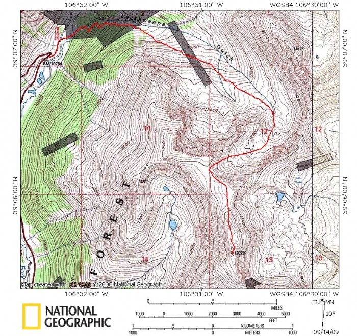
Trailhead: North Lake Creek Trailhead Approach: Lackawanna Gulch Routes: North ridge Distance: ~7.25mi RT (roundtrip) Elevation Gain: ~3100'
Gear: daypack w/Essentials
Resources Used for Trip Planning: Jennifer & Gerry Roachs' Colorado's Thirteeners guidebook, Trails Illustrated map #127, and additional route information provided by our friend Cathy McKeen
Foreword
Out of the Top 100 highest peaks in Colorado, twenty-seven of them reside in the Sawatch Range. The first peak I hiked in the Sawatch was 14er Mount Antero in 2002.
I finished the 14er's in this range in September of 2006, with a "massive mania" hike of Mount Massive.
I also hiked several of the 13er's in the area along the way; but the bulk of them came in 2008 with climbs of Hope, Casco, Oklahoma, French, Emerald (& soft ranked Iowa), and Cronin. However, I was still "lacking" one peak in the Sawatch to finish off the range.
"Lackawanna Peak," its unofficial name, presumably "named" after the gulch on its northern side, sits north of Hwy 82 and on the east side of Independence Pass. I've driven by it several times this summer, so finally I thought it was time to make the stop and hike this peak. Plus, I wanted visit the Sawatch Range anyway.
Carson and I planned this weekend to nab my last Sawatch centennial, and the next day we would hit a bicentennial on his list. Coincidentally, Carson was with me when I finished the 14er's in this range.
I also asked Cathy McKeen if she wanted to join us, but unfortunately Cathy couldn't get away for either day. However Cathy gave Carson and me some good information on our approach for Lackawanna that proved to be very useful. Hence the reason I will try to give some detail in this trip report, since the route description in Roachs' book can be a little confusing.
The Hike of Lackawanna
We drove to the trailhead the night before, sleeping in Carson's VW Westfalia van, which is a sweet set-up for car-camping!
We set out from our "camp" at 6:30am.
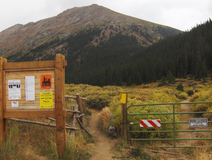
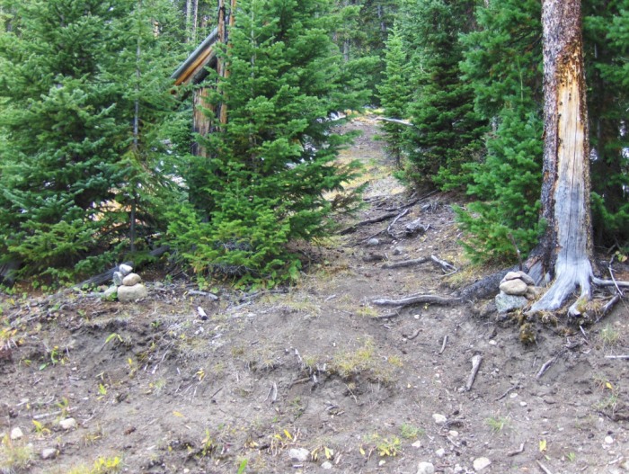
Trailhead (Picture taken later in the day.)
Shortly after leaving the trailhead, we headed northeast in search of a stream crossing that Roach describes in the guidebook.
Shortly after leaving the TH, turn right (NE) at this boulder onto a faint single track that leads to a cobblestone like trail.
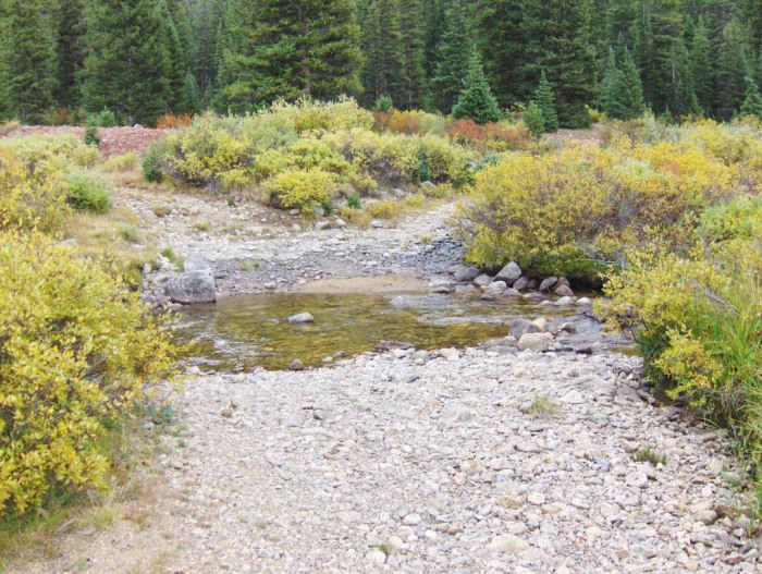
The cobblestone trail will lead to the stream crossing, which at this time of year wasn't a problem. Cross this stream, and take the right turn.
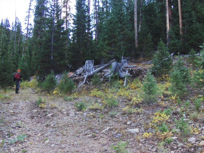
After the stream crossing, we passed a two-seater outhouse, and then the old road veers to the left.
The road switch-backs up through the forest, as is mentioned in the guidebook and it's easy to follow.
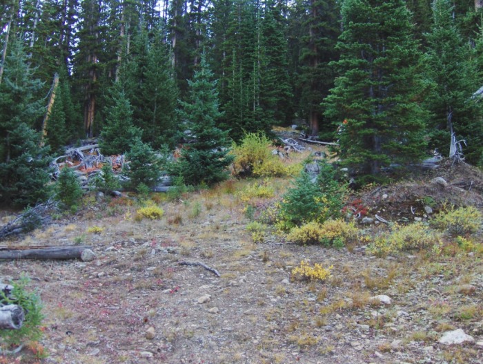
Although along the road there're a few "older" turn-offs, but the key is to stay low and continue in the direction of the gulch. Keeping a map & compass handy is helpful.
Go left here, which continues to take you E/NE in the direction of Lackawanna Gulch.
Eventually, we needed to leave the road and follow a trail. But the trail wasn't obvious to us at first. We followed our intuition instead and stumbled onto the trail!
We went straight here, where the road switchbacks to the right (south).
To the right of the last picture, we later found cairns marking the trail...
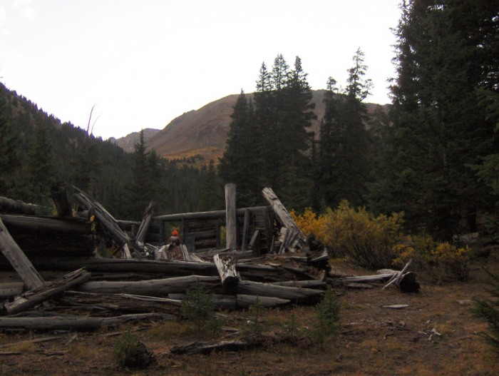
The good trail that leads to a couple of collapsed cabins.
Follow the trail east until you come across two collapsed log cabins. Go to the second structure and continue E/NE through the forest on a faint trail.
(Note: there's a cairn at the second cabin, which marks "a trail" that goes south and higher into the forest, but this is where Cathy suggested we go east beyond the cabin for a better route. Cathy did both routes, the one I'll try to describe here was the better one, or so she thought.)
This is the second cabin; from here continue beyond it and through the trees in the center of photo.
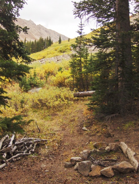
The trail through the forest (after the cabin) is short, and the goal is to reach a talus slope for the next part of the route.
The exit from the forest, looking E/SE. (Picture taken later in the day.)
The talus slope is obvious, and it's also fairly stable and easy talus to walk on. It's surrounded by willows, but there're game trails through it, some good, some not.
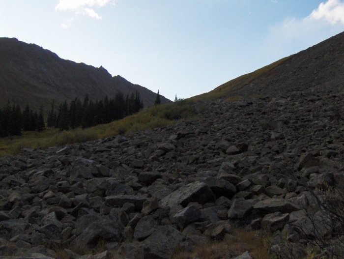
Once on the western edge of the talus, do an ascending traverse across the talus with an E/SE bearing.
Do an E/SE ascending traverse across this talus slope.
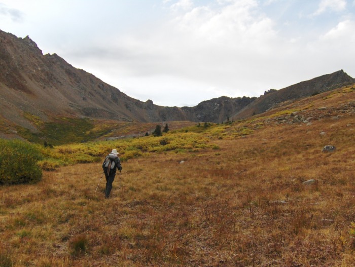
Once above the talus slope, we found a strong game trail leading through the willows that brought us to more open terrain in the right (southern) branch of Lackawanna Gulch.
Carson leading the way E/SE into Lackawanna Gulch.
Continue into the gulch on mellow open terrain, heading towards the distant ridgeline that runs N to S.
The direction of travel will naturally trend to the SE around steeper terrain.
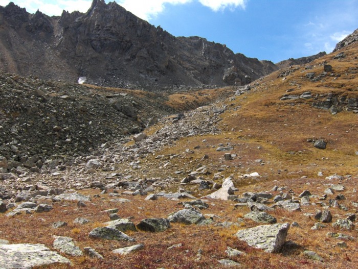
Eventually, the gulch turns south and there're options as to where to go.
In the following picture, staying in the drainage works, as does staying higher (looker's right) on the grassy slope. Either way will start to contour SW towards the saddle used to reach the north ridge.
The south trending gully leading to the saddle used for the upper part of the route.
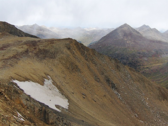
A look at the slope leading to the saddle.
Carson went up the black rock on the left of the snow field, and I went up the right side of the snow.
Carson's route was slightly steeper on okay rock/talus, and my route was loose dirt/rock. Earlier in the season, going up the snow (with an ice axe) would be my preferred route.
A look down on the slope used to reach the saddle.
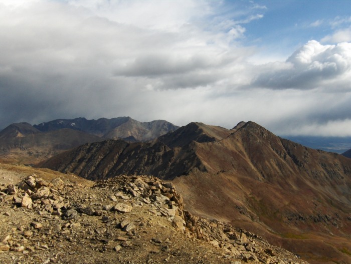
From the saddle, it's an easy hike south across tundra and some rock to gain the summit.
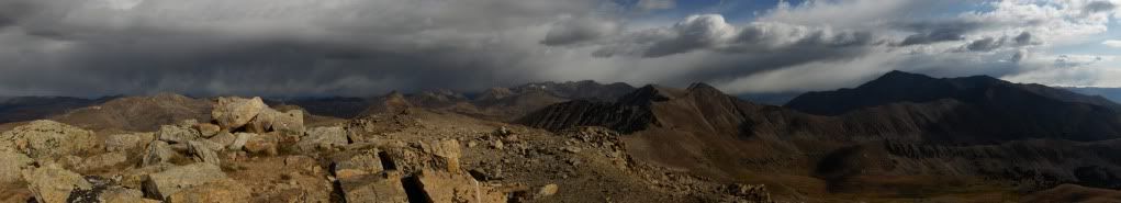
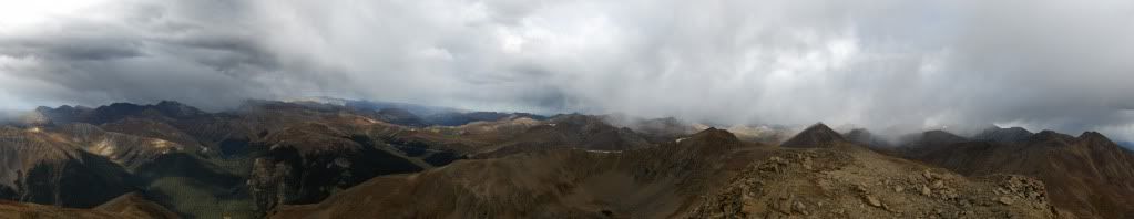
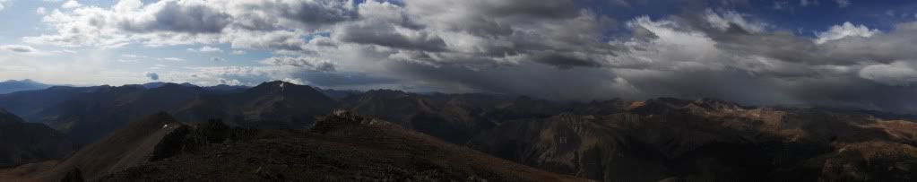
The views also open up from here.
A look to the north, (l. to r.) with Mount Oklahoma, all of Mount Massive, "Frasco," French Mountain nestled between the former and latter, and Casco Peak (in the foreground far right).
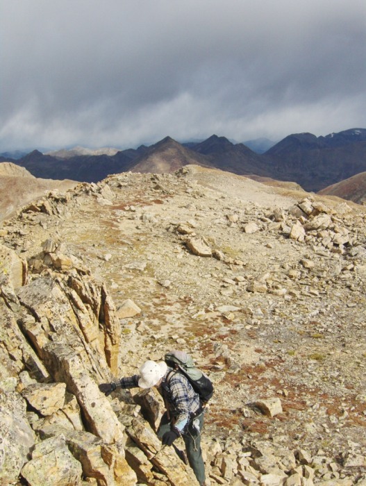
I reached the summit at 9:35 and finished on a nice but very short class 3 section.
Carson on the class 3 finish. (Optional, there‘s a class 2 way up.)
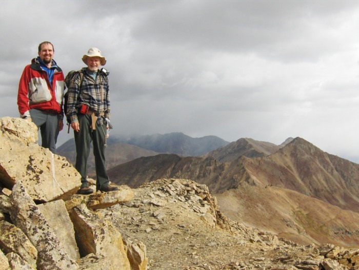
Me and Carson on the summit.
The weather was an interesting mix on this hike.
We would be in the clouds at times with spitting snow, and other moments we would have blue skies and sunshine overhead!
All with very little wind, even on the summit!
N/NE view
W view
SE/S view
We left the summit at 10:05, and retraced our route back to the trailhead.
We got back to the van at 12:25pm.
Roughly a 6hr tour, which turned out to be a nice hike; after all, it's a Roach "classic!"
Hindsight & Personal Notes
With the combination of Cathy's advice, Roachs' description, and our own instinct, the route finding wasn't too difficult. The landmarks Cathy told us to look for (e.g., cabins & the talus slope) certainly helped us. Without those known landmarks to look for, I think the hike would be hit and miss if we were following Roachs' description alone.
Either way, this was a nice "fall" hike. Yes, it's still officially summer, but it felt like fall.
We started the weekend out with a questionable weather forecast, but with the route we were doing, it wouldn't be a big deal if there was snow on it.
Besides, you can't always believe the forecast! Sometimes you need to go and see what Mother Nature will actually deliver; and in our case, it was an interesting mix that still allowed us to summit!
Thanks for reading,
Darin
The map above is our approximate route, for the ascent and descent.
Thumbnails for uploaded photos (click to open slideshow):
Excellent job - I love the focus on landmarks and route issues on these climbs that don‘t have well defined trails. This is one report I‘ll print out to save for when I do get to it.
Thanks for the comments everyone. I hope the TR will help those that are looking to hike Lacka.
Side note: for Roachs‘ description on the NW ridge, I think it can be accessed by the talus slope mentioned in this TR. Enter the talus slope and look to your right and there‘s a gully to the SE to ascend. See SP for the description on that route and the picture that is posted I believe is that gully. http://www.summitpost.org/view_object.php?object_id=40370
Uwe...I have a couple of more cent-13ers planned for this month, but beyond that I‘m not sure. Other peaks until the ice comes in I guess.
Re: the Westy is a ‘91, I think. It‘s sweet for car-camping!
Glad to see the weather played nice and you made your peaks for the weekend. This is a great and very useful report, when I did Lackawanna I pretty much just busted straight up the slopes from near the trailhead. All bushwhacking to treeline. Your route looks MUCH better!
About time to retread those boots...
Great TR, and agree with the others...You are making these lesser known peaks easier to tackle with the great TR's and photos.
I'll follow your lead on this one as well.
What's next?
Carson‘s got a Westy???
What year? Always wanted one of those....
This will be useful when I finally do get out there. Nice TR. I wound up being sick as hell all weekend so it‘s a good thing I didn‘t come. Not exactly the way I planned to spend my weekend.
Caution: The information contained in this report may not be accurate and should not be the only resource used in preparation for your climb. Failure to have the necessary experience, physical conditioning, supplies or equipment can result in injury or death. 14ers.com and the author(s) of this report provide no warranties, either express or implied, that the information provided is accurate or reliable. By using the information provided, you agree to indemnify and hold harmless 14ers.com and the report author(s) with respect to any claims and demands against them, including any attorney fees and expenses. Please read the 14ers.com Safety and Disclaimer pages for more information.
Please respect private property: 14ers.com supports the rights of private landowners to determine how and by whom their land will be used. In Colorado, it is your responsibility to determine if land is private and to obtain the appropriate permission before entering the property.