Sunday, May 29, 2011
Climbers: Tom McClernon, Bill Tarvin, Janet Lightburn, Carson Black, & Darin Baker
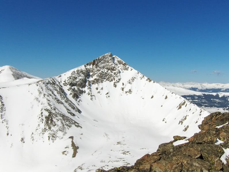
Crystal Peak (13,852')
Father Dyer Peak (13,615'; unranked)
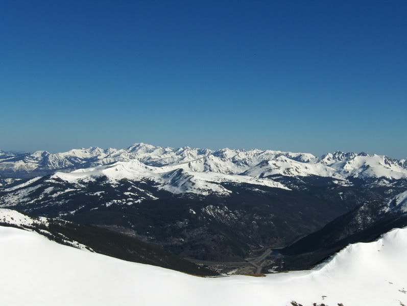
Tenmile Range
Trailhead: Spruce Creek (from winter closure)
Route: "Dyer Straits" to Father Dyer's SE ridge to Crystal's SE ridge, w/descent of E slope of Crystal
Distance: ~7.5mi RT
Elevation Gain: ~3500'
Starting Time: ~4:30am
Ending Time: ~12:00pm
Gear: daypack w/Essentials, snowshoes, crampons, ice axe, helmet, & avalanche gear (beacon, probe, shovel " for a few of us)
Resources Used For Trip Planning: Roachs' Colorado's Thirteeners guidebook, NOAA forecast, TOPO! mapping software
Foreword
The CMC (Colorado Mountain Club) will be reaching the century mark in 2012, so with that in mind, trip leaders in the club have been encouraged to organize Centennial Celebration Climbs to commemorate the first 100 years of the CMC by climbing the Top 100 peaks in Colorado!
When I heard about the Centennial Celebration Climbs, I liked the idea so I decided to lead a couple of trips this spring/summer. My first plan for Memorial Day weekend was a snow climb up Thunder Pyramid. However, the week leading into the trip I changed the plan (for various reasons) to climb Crystal Peak instead.
The Approach
The overnight freeze down low (~10,300') didn't happen. The trail is well traveled in the winter so the snow is well packed, but snowshoes were still needed. Otherwise, without snowshoes or some kind of flotation the occasional post-hole would occur.
At the start of the trip, we had discussed the possibility of changing our route according to snow conditions. If the snowpack didn't improve (i.e., cold firm snow) by the time we got into the Crystal Lakes drainage, we would go up a mellower line that would not expose us to possible avalanche danger. One alternative route in mind would have been to ascend Peak 10's E ridge and then onto Crystal via the NE ridge.
Thankfully conditions improved the higher we got, so we stuck with our plan of Roachs' *classic* Dyer Straits route.
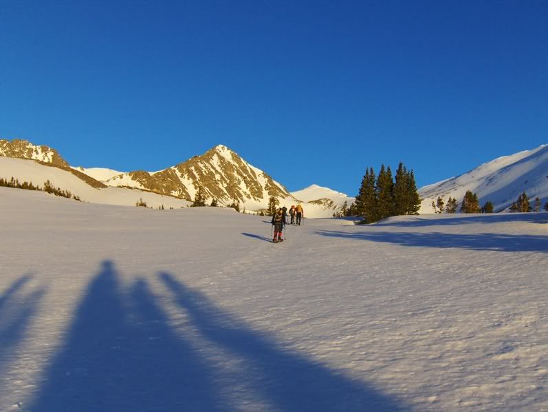
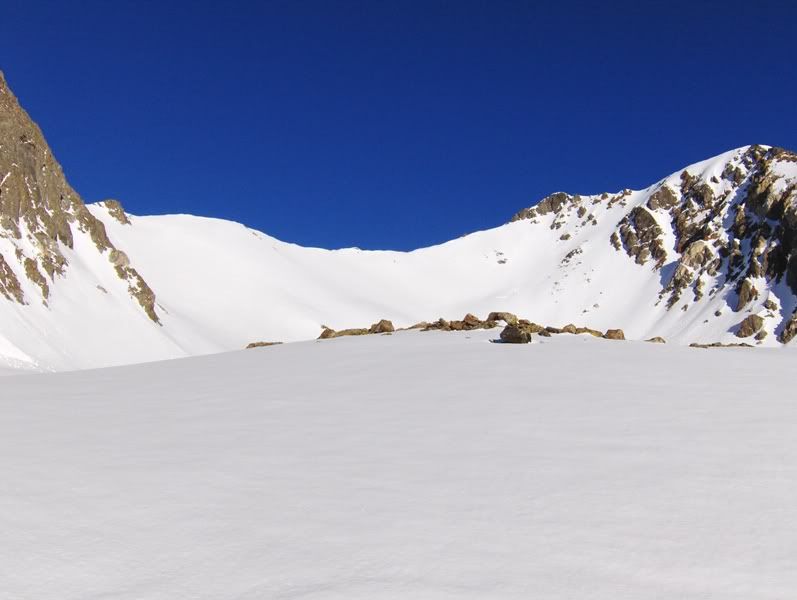
The Sun Rises

Our goals come into sight
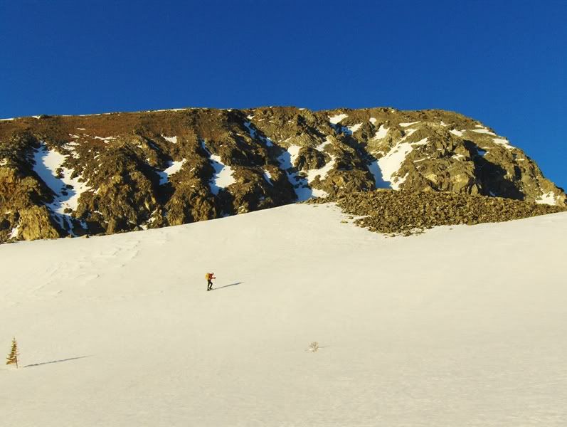
Bill below the N side of Mount Helen (13,164')
Janet with Helen's NW face behind her
Helen has been "shedding skin"
The above photo with the avalanche debris was some of the larger slides that we noticed in this basin. Evidence of slides were all shallow point releases starting near rock outcrops. Nothing appeared to step deeper into the snowpack, and our route has not had a release other than on far climber's left which started near rocks near the top. With a firm cold snowpack under foot, and with our route looking safe, we continued on with our plan.
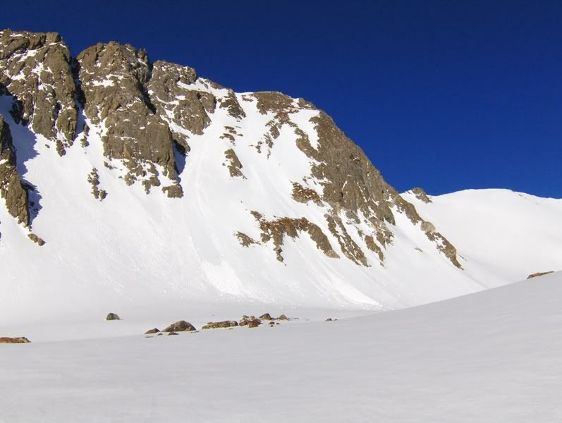
Dyer Straits
The Climb
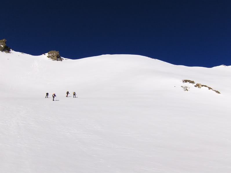
The Dyer Straits route is a mellow snow slope (probably in the low 30 degree range) that leads up to the saddle between Father Dyer and Mt Helen's fun class 3-4 W ridge. From the vantage point in the above picture we were still on snowshoes, in fact some of the group would go on to snowshoe up the entire slope to the saddle. I opted to take off my snowshoes mid-slope in favor of axe and crampons, although it was bootable and crampons were not necessary.
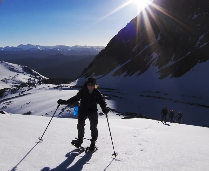
The Team starting up a little after 7am
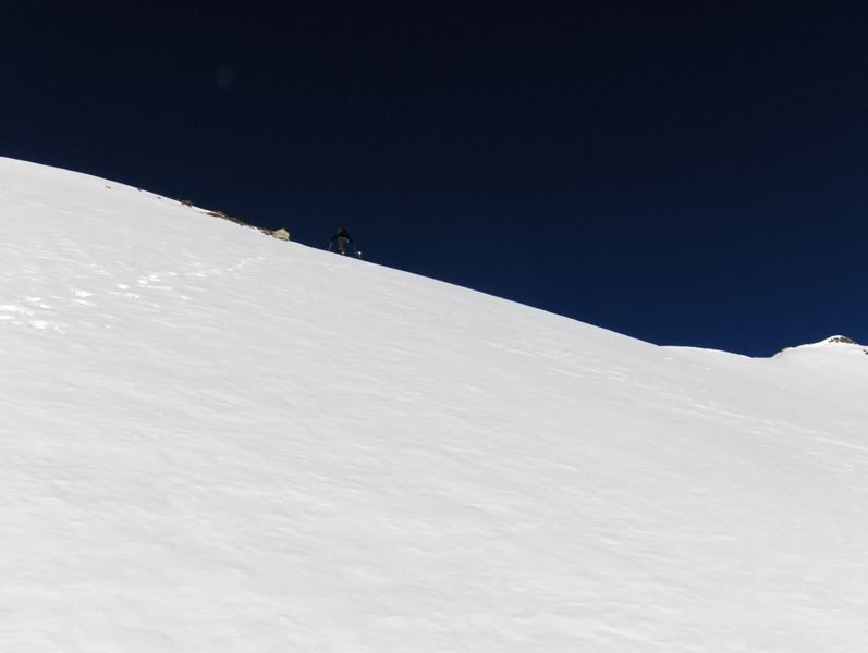
Janet finishing the slope a � hour later
Going up the slope, the wind let its presence known. But the wind really found us at the saddle. Strong, trying for a knock-out gust was a common occurrence for the rest of the day on the ridges and summits. Luckily it was sunny, so it didn't feel as cold. Mittens were donned by several of us though to help keep our digits happy. It was also from this point on that I didn't take as many pictures!
From the saddle, I led us up the ridge to Dyer's summit. I had kept my crampons on, and along certain sections they were nice to have because the snow on the SW side was wind-hardened and boot penetration wasn't as easy. Trying to breathe at 13,000'+ and kicking steps while trying not to get blown off balance was a chore!! I stayed on snow as much as possible, but at times we went over talus. Near the top, Bill opted for an easy rock scrambling line to the summit.
Papa Smurf arrives at the summit of Father Dyer
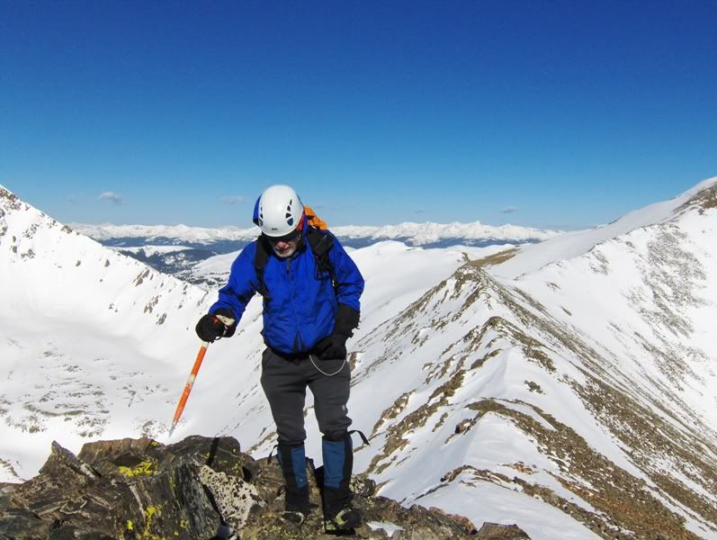
We reached the summit of Father Dyer Peak shortly after 8am, where a fairly quick break commenced. At this point we figured Crystal Peak was doable albeit while battling the winds, but going to Peak 10 (like I initially had hoped for) was not going to happen.
From the summit of Father Dyer, our line to Crystal was clear, as was our descent line into the Crystal Lakes drainage. At least it was clear for most of us! 
The ridge to Crystal with Janet, Bill, & Carson leading the way

Gore Range to the N and the I-70 corridor below
Pacific Peak (13,950') from the connecting ridge between Father Dyer and Crystal
En route to Crystal I slowed down, and I was about to bonk because I had not eaten enough during the morning. The others were ahead but I wasn't concerned because I have plenty of faith in each of them, so I stopped for a snack in a leeward protected area to refuel.
When I started again, we had a "rogue climber" traversing out on the S face of Crystal. At first I figured he wanted a continuous snow line to the top, but he continued towards the SW ridge without going up. I hollered to Carson to see what he was up to. Of course with the wind and distance between us, verbal communication was denoted to hand signals.
Turns out that Carson thought we were going to descend into the Mohawk Lakes side, which we were not, so he had to turn around and come back! While I waited for him, the others continued to go to the summit.
It was at this point that I decided that I wouldn't go up: beat and wasted from a long week at work (almost 60hrs of manual labor"landscaping) and not having been at altitude in three weeks, the decision was easy for me. Even though I was probably within 100' from the top when I went up to make sure Tom was coming down and not waiting for me to show up!
I've been on the summit of Crystal a couple of times anyway, and Carson probably has numerous summits of it, so opting out of a summit was fine with us. The other three did summit though, but only for a brief moment before the winds chased them back down to join us.
Now it was glissade time!
We were at the Upper Crystal Lake a little after 10am where we took a short break. From there, we would get in two more quick & fun glissades on softening snow.
Tom below Crystal Peak's E face

One last glissade before Lower Crystal Lake
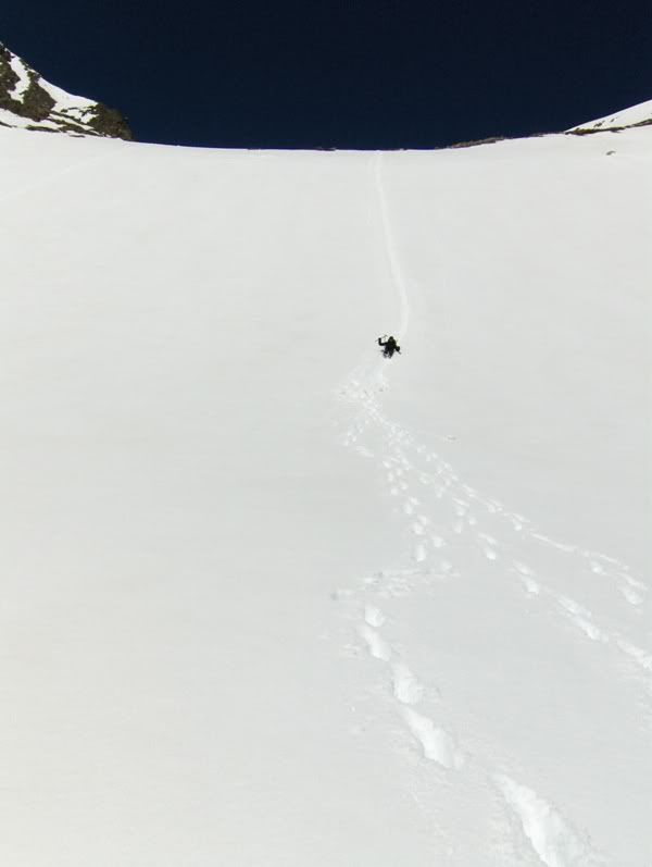
Yup, that was fun!
Goodbye, Father Dyer Peak. And thank you for allowing safe passage today

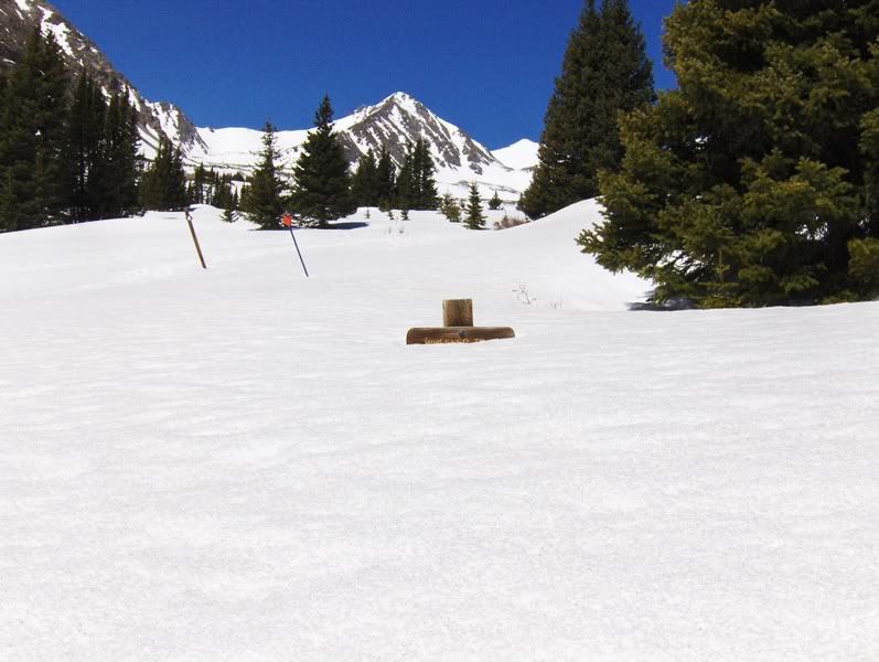
The Wheeler Trail sign, trying to make an appearance before summer
Hindsight & Personal Notes
The original plan of climbing Thunder was aborted for several reasons; one reason being the uncertainty of Independence Pass opening by its usual Memorial Day goal. CDOT (Colorado Department of Transportation) was working to remove the winter snows from the pass, which is still piled high throughout the central and northern mountains this year. Maroon Lake Rd still had snow piled up on it a week prior to the trip too (according to some recent trip reports from the area). It was likely that the Maroon Lake Rd would be open by Memorial Day weekend though. With those two roads being questionable a week before the trip, along with the not-so-much-like-spring weather recently, the combination of those factors prompted me to change the plan for a closer peak, and one with options for safer lines if the snowpack was not safe. It all worked out just fine, and Thunder will be there another day for a snow climb! Maybe sometime soon even?
With that said, I would like to thank Tom, Bill, Janet, and Carson for joining me on this trip! It was a nice day out with fellow CMC'ers!
And it is because of the CMC that I am a climber. When I joined the club in 2002, I had no idea where it would take me....and I like to think it has taken me far. In fact, two of the members on this trip - Carson and Bill - have played a big part in my growth and experiences in the Colorado mountains. So thanks guys!
I also want to thank all of the volunteers in the CMC - past, present, & future - you help make the club special!
Thanks for reading,
Darin
Centennial Celebration Climbs
CMC History
|


