Download Agreement, Release, and Acknowledgement of Risk:
You (the person requesting this file download) fully understand mountain climbing ("Activity") involves risks and dangers of serious bodily injury, including permanent disability, paralysis, and death ("Risks") and you fully accept and assume all such risks and all responsibility for losses, costs, and damages you incur as a result of your participation in this Activity.
You acknowledge that information in the file you have chosen to download may not be accurate and may contain errors. You agree to assume all risks when using this information and agree to release and discharge 14ers.com, 14ers Inc. and the author(s) of such information (collectively, the "Released Parties").
You hereby discharge the Released Parties from all damages, actions, claims and liabilities of any nature, specifically including, but not limited to, damages, actions, claims and liabilities arising from or related to the negligence of the Released Parties. You further agree to indemnify, hold harmless and defend 14ers.com, 14ers Inc. and each of the other Released Parties from and against any loss, damage, liability and expense, including costs and attorney fees, incurred by 14ers.com, 14ers Inc. or any of the other Released Parties as a result of you using information provided on the 14ers.com or 14ers Inc. websites.
You have read this agreement, fully understand its terms and intend it to be a complete and unconditional release of all liability to the greatest extent allowed by law and agree that if any portion of this agreement is held to be invalid the balance, notwithstanding, shall continue in full force and effect.
By clicking "OK" you agree to these terms. If you DO NOT agree, click "Cancel"...
58 of 58! I've finally climbed all the 14ers in Colorado!!! But you're not here to read about me, so here's what you can find in this trip report:
Analysis of Lake Como road in a stock vehicle (to 10,200 ft)
Extensive analysis and photos of the infamous Hourglass
Added emphasis of the EPIC rockfall potential in the Hourglass
Evaluation of microspikes in the often overlooked but bothersome first gully
Comparisons of this peak to others
A few reflections on major moments and how different peaks stacked up to each other
A collection of thank you's to all the folks who helped me to accomplish this goal of finishing the 14ers
My times from point to point along the drive/hike
GPX tracks from Lake Como to Little Bear summit w/ alternative routes above the Hourglass
Look for section headers in large, bold font if you want to skip to particular information. A special shout out to Perry (Ptglhs) who joined me on this trip and was an invaluable spotter for me on the Lake Como road as well as a good partner for helping spot cairns and decide how to tackle the Hourglass.
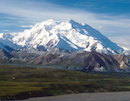
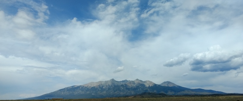
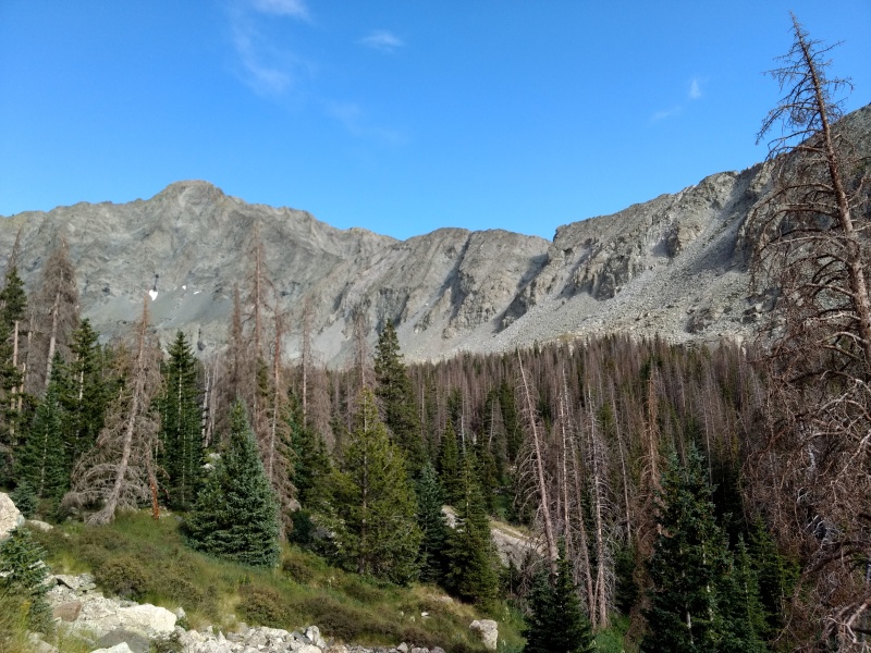
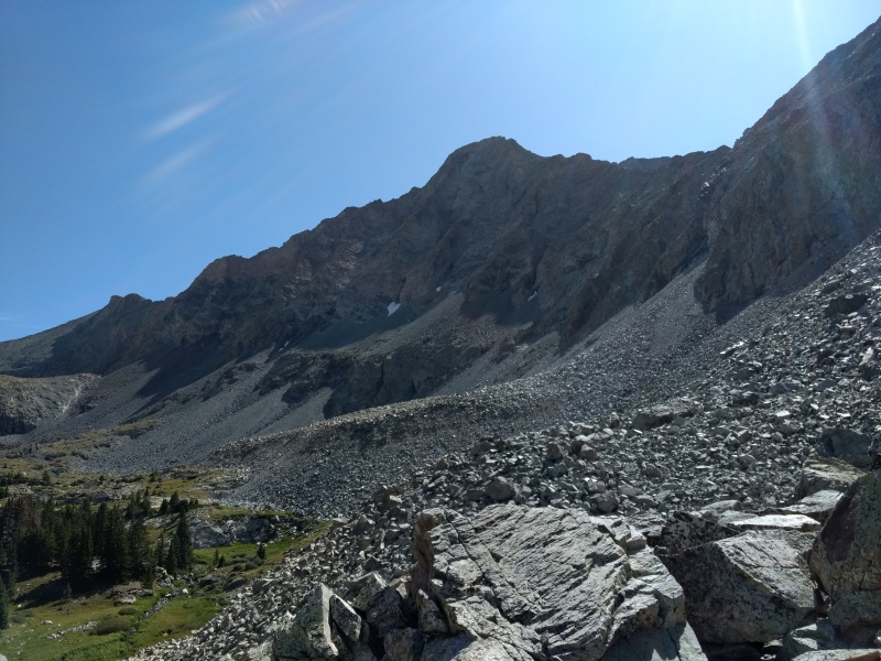
Little Bear (far left jag) and surrounding peaks from the south.
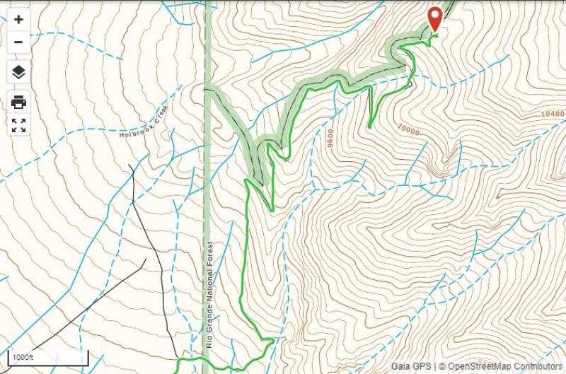
Lake Como Road (aka Blanca Peak Road) in a stock vehicle
This road very deservedly has a reputation for being one of the nastiest, most challenging 4x4 roads in Colorado. Anybody who has done any research knows it's basically madness to take on the Jaws obstacles in a stock vehicle. But just how far can you go in a stock vehicle? Or perhaps better asked, how high can you go? (Different sites give all sorts of different numbers based on whether they measure the road from Colorado 150 or from the last place most 2WD vehicles stop, etc. So it's easier to speak in terms of what elevation you can get to).
When doing Blanca and Ellingwood last year I gave up at ~8,800ft and set up a tent next to the road. But after hiking up I decided I very well might have made it to around 10k. So this time I decided to take my Jeep Renegade Trailhawk (8.7" ground clearance and completely stock except for BFG KO2 tires) as far as I could. Knowing what I was up against I went ahead and dropped into 4LO as soon as I hit the first rocky sections past where most 2WD vehicles were pulling off. I rolled with ease past 8,800ft with my skid plates only seeing a little action here and there - most of it from being perhaps a little impatient.
If you can make it just over 8,800ft you can probably easily make it to the switchback that's at about 10,080ft. Here there is room for maybe 3 or so vehicles to park while still allowing room for people to pass. All those spots were taken when we arrived Friday August 24 around 3pm. It would have been a VERY long drive back down a LOT of elevation to the closest other alternative spot to park with no idea if there would still be any spots open down there (parking is EXTREMELY limited past 8,800ft until you get to at least 10,200ft). So Perry and I both got out and walked the road up to the next switchback to scout it out.
I do have some 4x4 experience (having gone up to ~12k on Antero, driven up to Clohesy Lake and to the 4WD trailheads on Wetterhorn and Uncompahgre, etc) but I'm certainly not an expert driver and a Renegade is certainly not a top of the line 4x4 vehicle. Those with vehicles that can go all the way to Lake Como probably didn't hardly even take notice of this little segment of road. The stretch of road between those two switchbacks (at about 10,080 feet and 10,180ft) is only on the order of maybe 400ft in length but it took us over 15 minutes to navigate up it in my Renegadewith Perry putting his life in peril (sorry for the poor alliteration) to spot me and guide me up, over and around some very ill-placed large and occasionally pointy rocks.
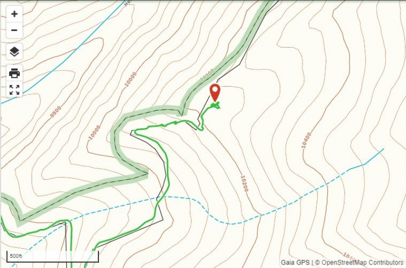
Lake Como Road from ~8,800ft (at national forest boundary) to large parking/camping area at about 10,200ft.Zoom in on final nasty section from switchback at ~10,080ft to switchback at ~10,180ft with broad pull-off area above.
This section was NASTY in a stock Renegade and my skid plates picked up all kinds of new battle scars going up (and the next day back down) this one little 400 foot stretch between switchbacks. But shortly after that last switchback there's a huge pull-off area at ~10,200ft with room for possibly as many as a dozen vehicles or more if everyone carefully parked. It's also very flat and seems to have been used as a camping spot (which would reduce available parking).
Looking at the road as we hiked up to the lake, Perry remarked that it looked like we probably could have easily driven on for a while. I replied: "The Renegade could have made it further; it's driver couldn't have." My nerves were shot after making it that far...
One more note: I have NO IDEA how people pass on this road after 8,800ft except at the corners of the switchbacks!!! Thankfully I didn't have to find out - going up from ~2pm to 3pm on Friday and coming down between ~1pm - 2pm on Saturday I was so relieved not to have encountered anyone going the opposite direction (and especially grateful the convoy of ~20 Jeeps made it up just before we headed down on Saturday).
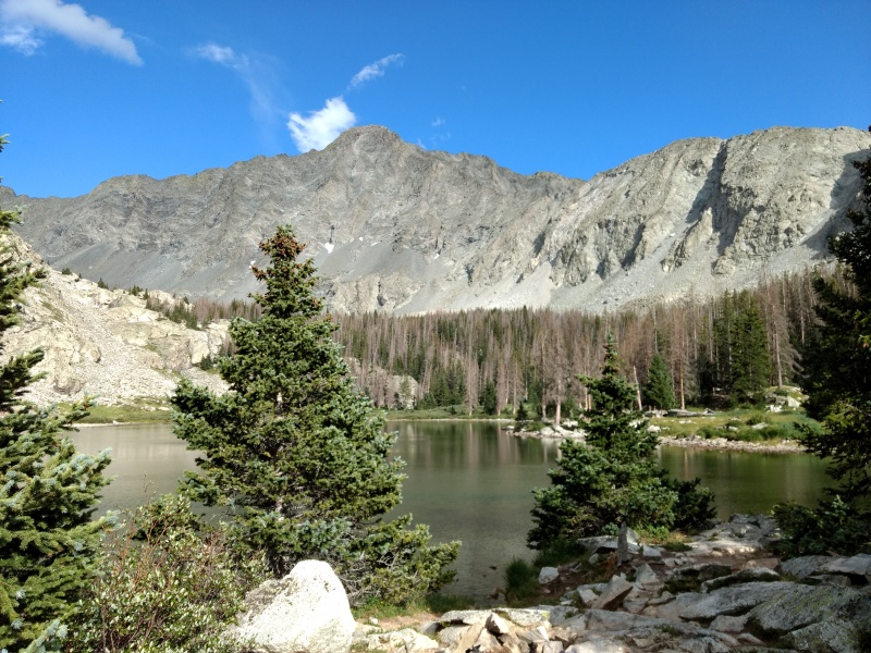
Lake Como
The Lake Como area is a rugged but beautiful spot to camp despite extensive amounts of beetle kill. But unlike other remote areas that can only be reached on foot, this spot attracts a somewhat different crowd since it can be reached with a sufficiently advanced vehicle with the proper driving skills. The party life didn't get too wild Friday night but I can easily believe the stories of very lively events going on at times.
Approaching Lake Como with Little Bear and the notch you take to go up it both clearly visible.Lake Como with Little Bear in the background. Lots of beetle kill all over.
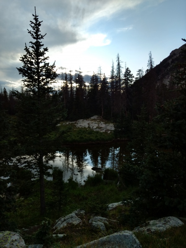
Lake Como in late evening.
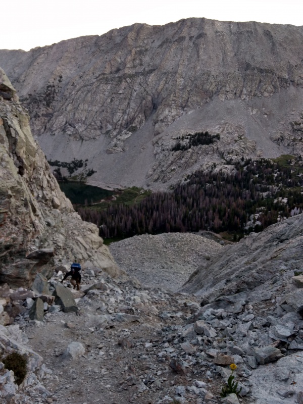
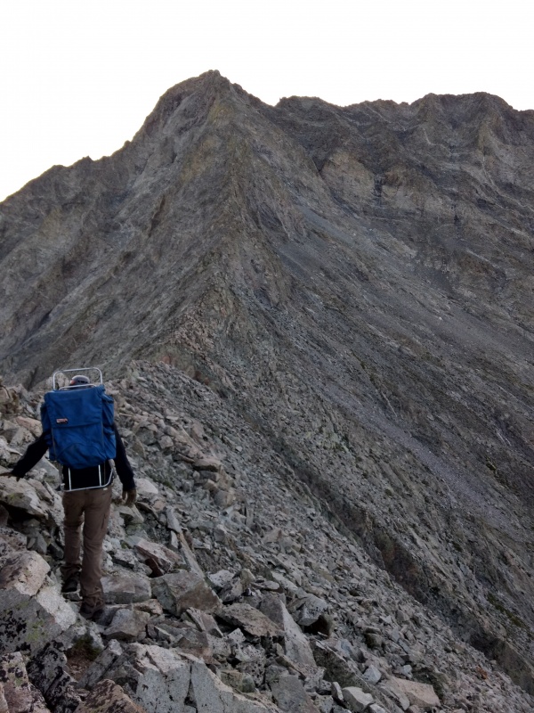
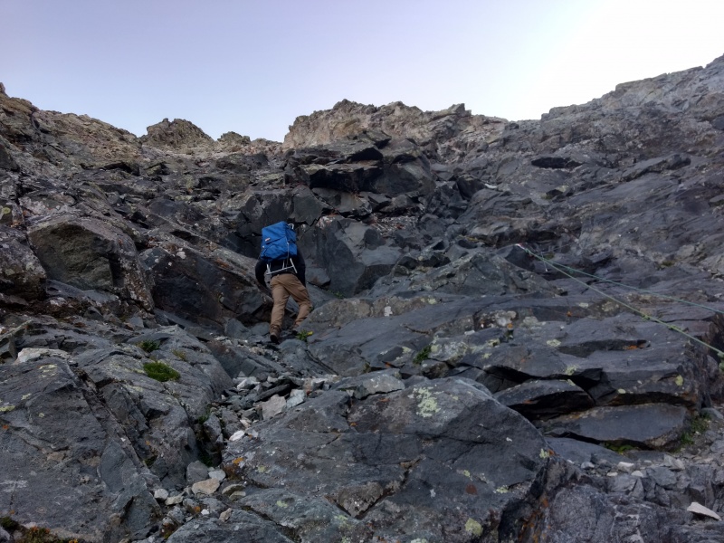
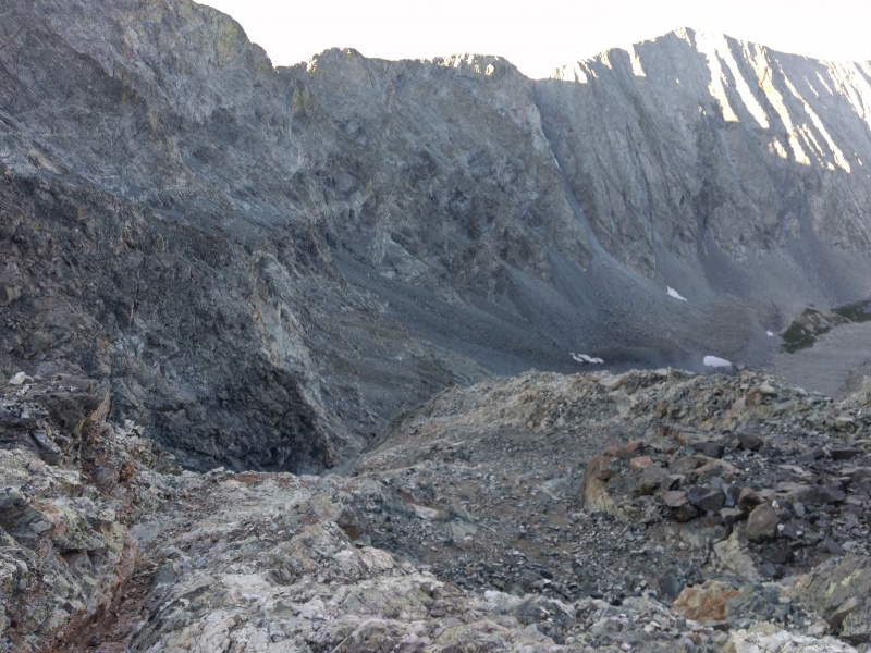
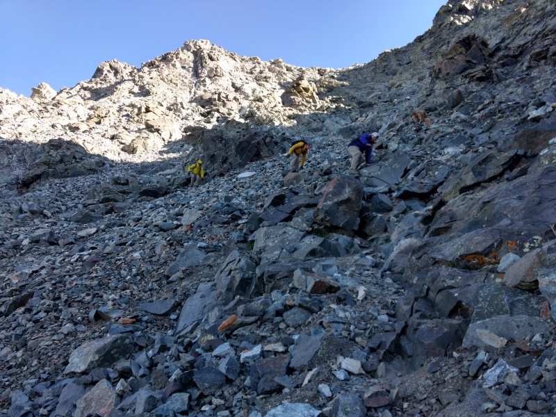
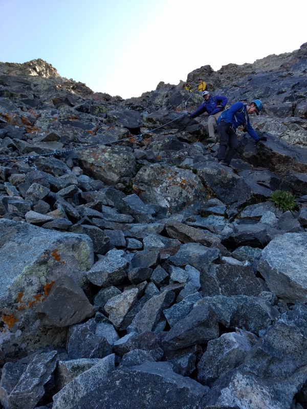
Gully 1 - kid brother of the Hourglass
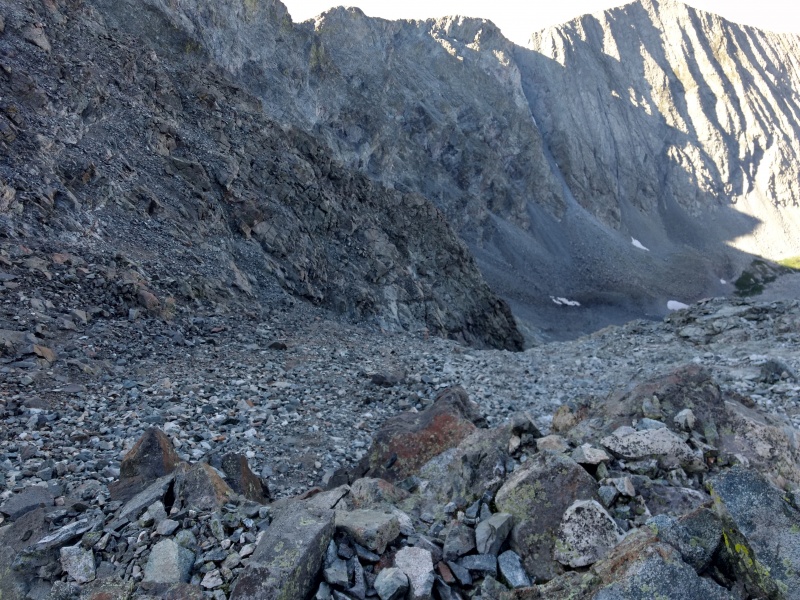
This gully is almost ignored because it's older brother the Hourglass gets all the fame and attention. But I heard no small amount of grumbling from folks going up and down this easy yet annoying gully. The segment leading up to it from the 4WD road is basically pure rock/boulders but near the base of the main part of the gully you start to find a significant amount of loose dirt mixed in with all manner of scree and rocks big and small, stable and loose.
As with other such sections on recent peaks, I again pulled out the microspikes and stuck mostly to the dirt regions when going both up and down this gully. Others who didn't have microspikes on tended to prefer trying to stay on solid rock to avoid the one step forward, two steps back trouble - but solid rock is often hard to find in this steep and ugly little gully.
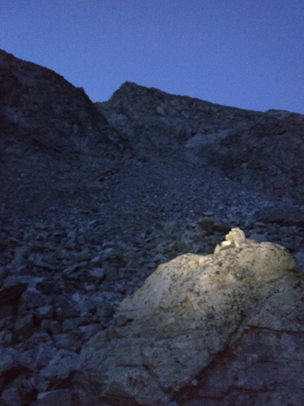
Nearing the base of the gully in the early morning light (plus headlamp).Looking down from partway up the gully with Perry towards the left of the image.
Once again the microspikes absolutely shined in this kind of terrain. I waited until I was past the initial rocky section by the road and until I confirmed that even with brand new boots I was slipping like crazy on the dirt section and then I put on the microspikes. I immediately noticed a huge difference. However there were some sections of this gully that were SO steep and SO loose that I was still sliding even with the microspikes on. Sidestepping these sections helped a decent amount but in some spots it was still very sloppy. But overall I'm still totally sold on using microspikes on this type of terrain (see my report One Bell at a Time for a detailed analysis of the pros/cons of using microspikes on dry terrain like this).
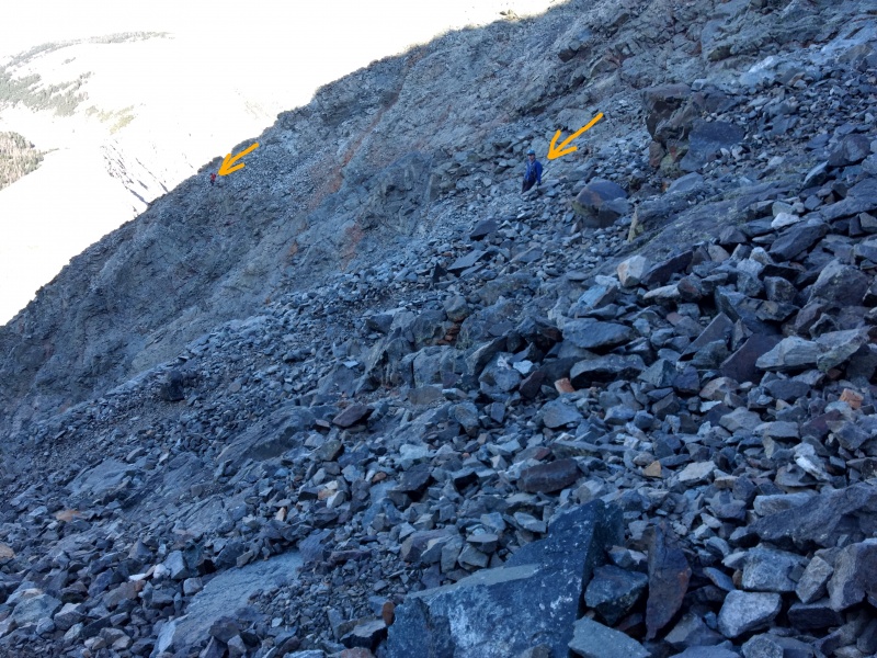
For scale, I'm including here some photos from the way back down when there were some others in the photo and where I made full advantage of the microspikes to speed my descent down this ugly section.
Looking back up on the way down the gully - 3 others near the top.Further down the gully on the return - others in the shadow
Zoomed image of others in the shadow.One more wide shot from the bottom. Dead center is a tiny black spot - that's Perry.
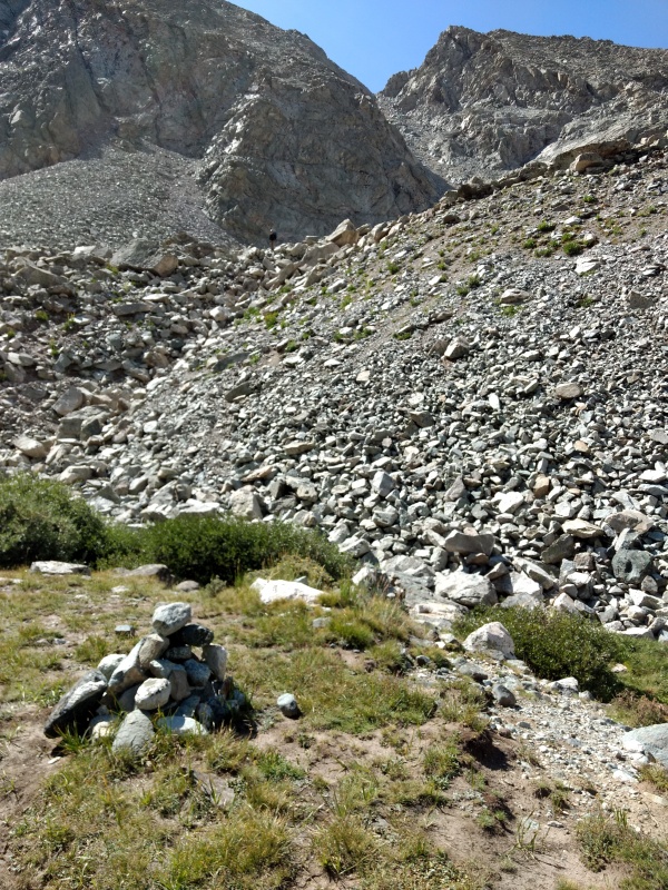
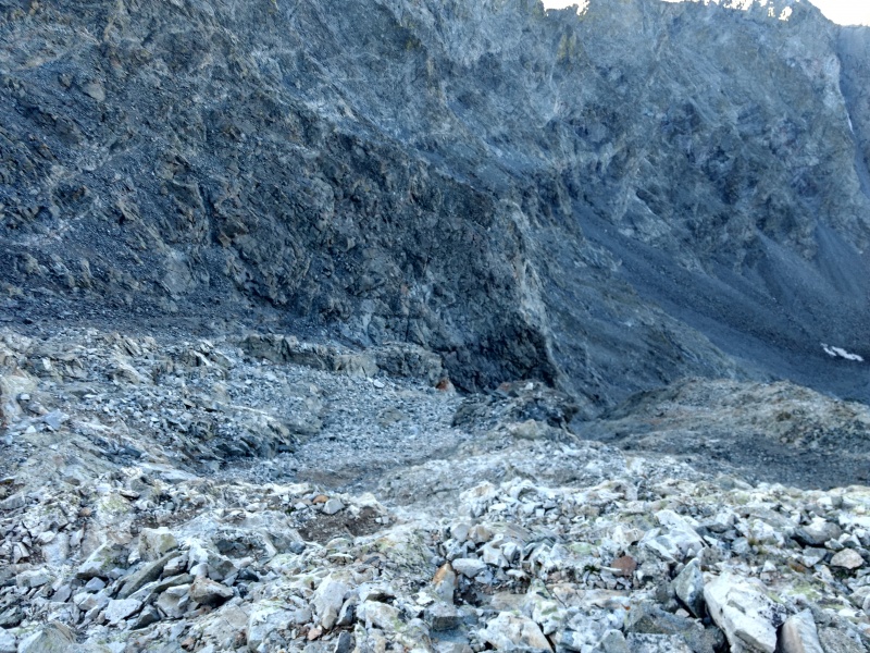
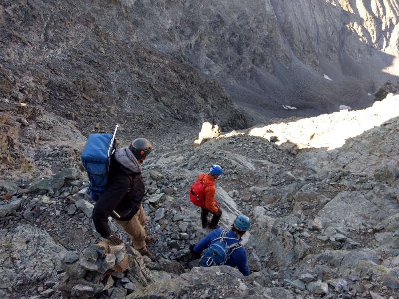
Cairn marking turnoff from road with Perry atop rocks across from base of gully.
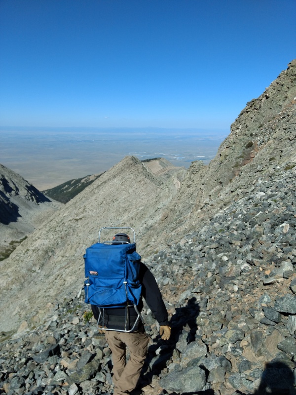
Now back to the ascent... When you're going up, at the top of the gully be sure to look west for your last glimpse of scenery before getting lost in a sea of endless, bare rock.
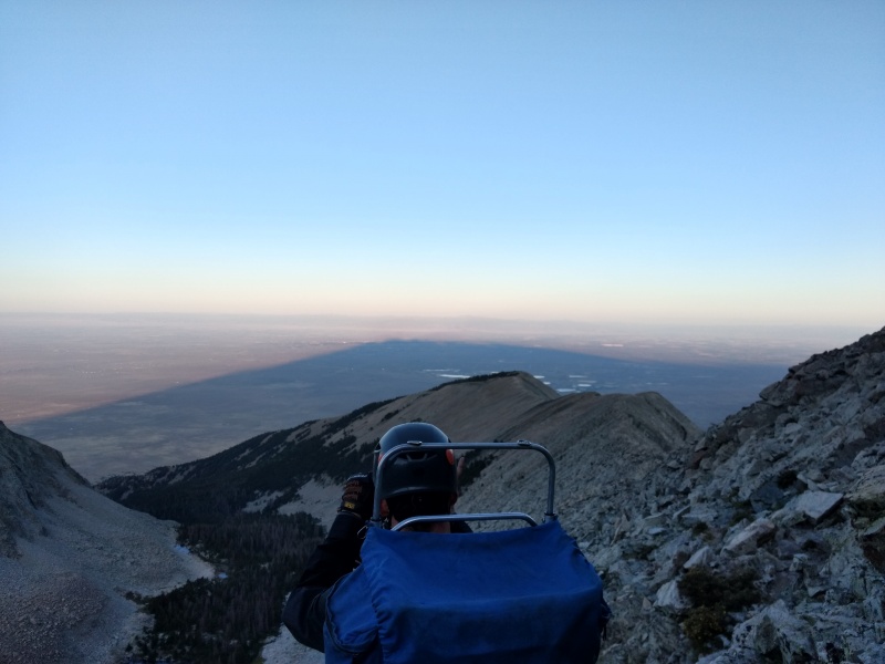
Looking down at Little Bear Lake and out west towards Alamosa.Caught this cool shot (along with the back of Perry's head) of the early morning sun casting an enormous shadow of Little Bear.
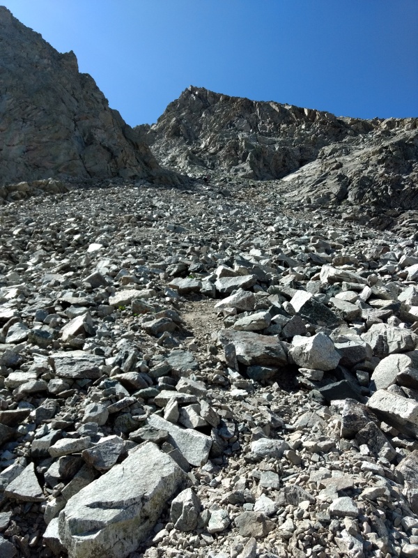
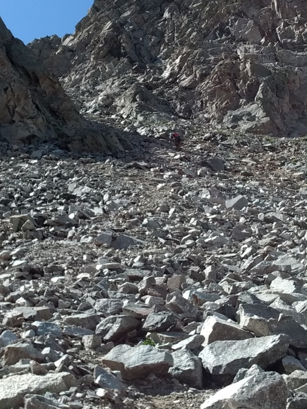
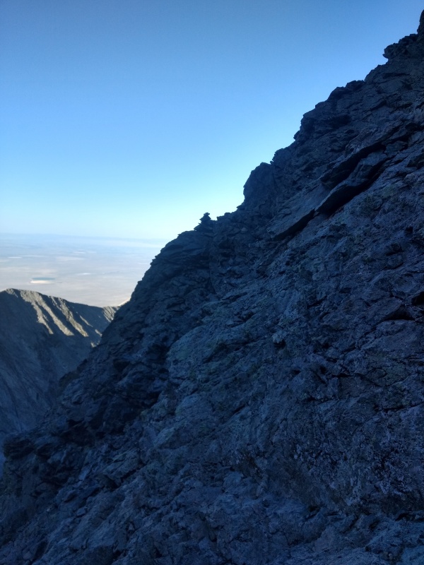
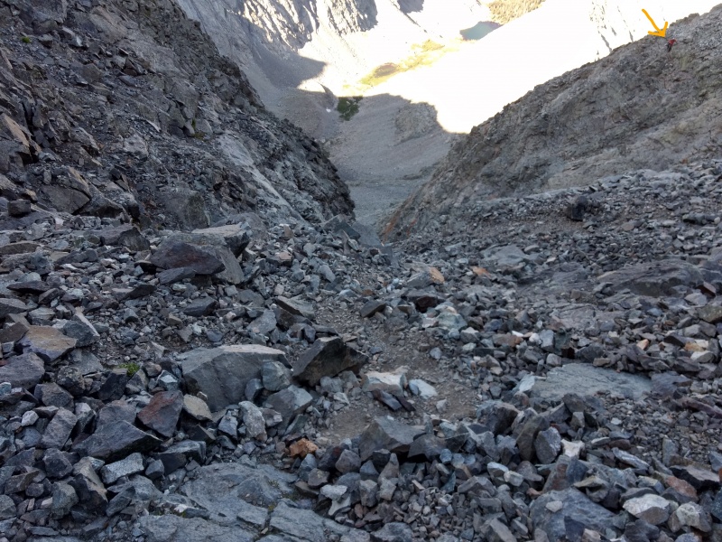
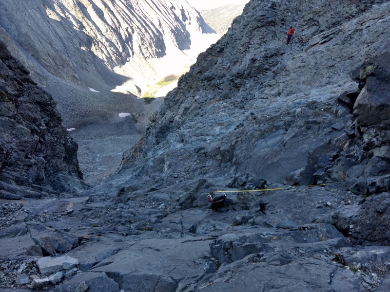
The Approach to the Hourglass
Just a couple quick words on the approach to the Hourglass: when going through the route description sequentially you expect to see the image in Photo 8 shortly after passing the image in Photo 7 of the route description. But that's not so. You have to keep going through the route description to photo 10 to realize what a long and barren section this is in between Gully 1 and the Hourglass.
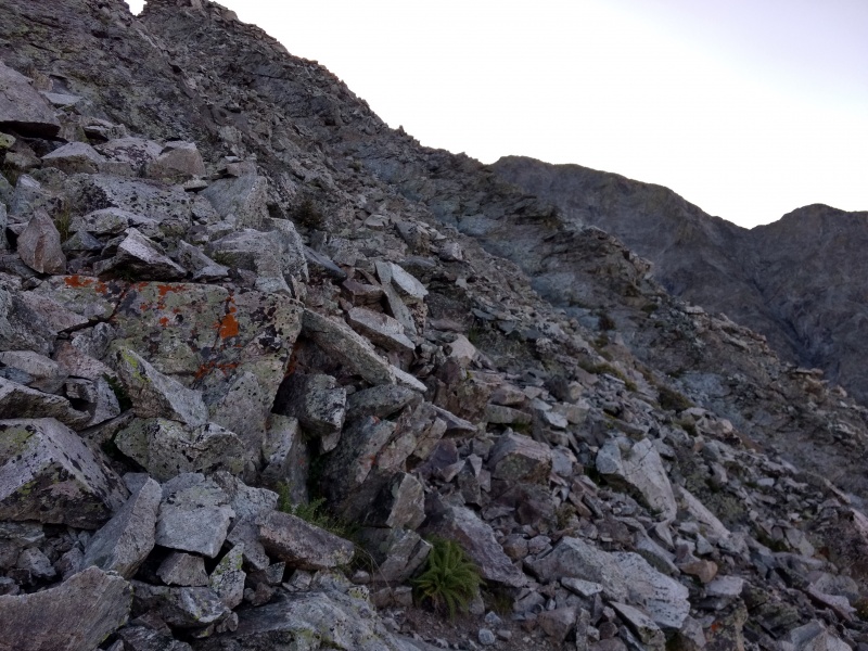
As is common with terrain like this there are cairns all over the place at all sorts of elevations with varying degrees of paths that are more or sometimes less obvious. Basically a choose your own adventure of trying not to needlessly loose elevation or expend excess energy for no real purpose. Just an easy class 2 stroll with plenty of options that are each about as good as the other, but some lines are a little more obvious and stable than others (we stayed higher on the return and that seemed a little better).
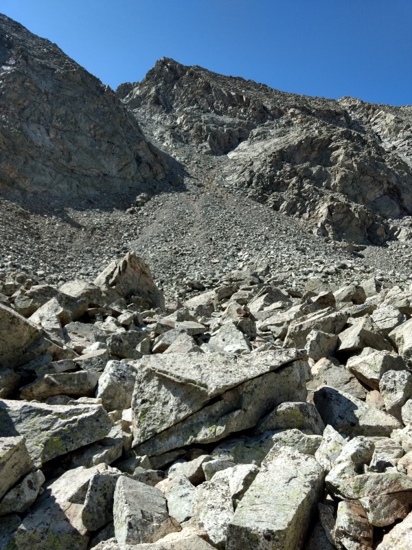
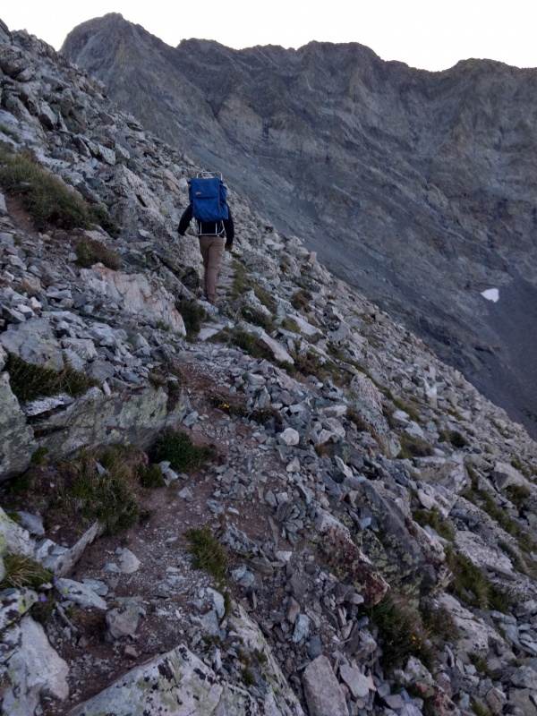
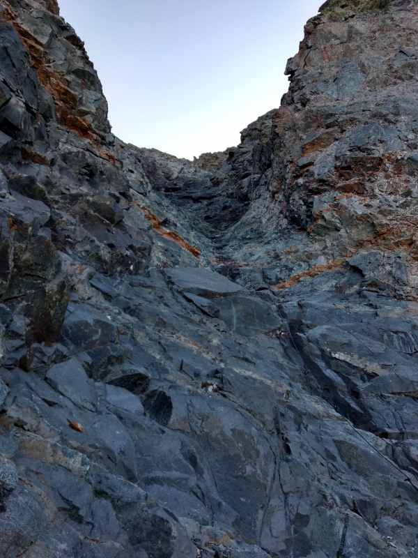
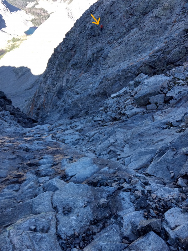
Part of the long, barren traverse over to the Hourglass.The Hourglass finally coming into view with a distinct V shape at top with lighter colored rock to right.
Going along the ridge before crossing over to below the HourglassSame stretch on the way back
Coming up to the Hourglass. Distinctive lighter colored rock with black stains to the right of it.
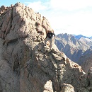
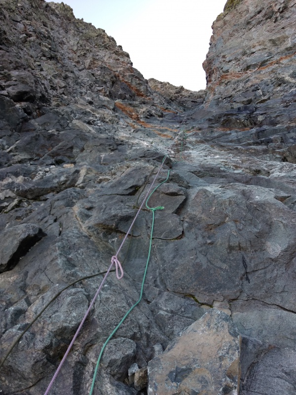
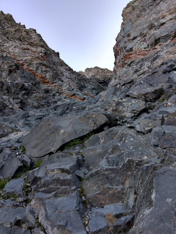
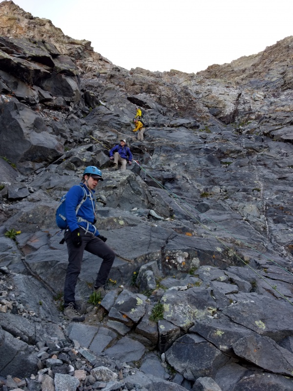
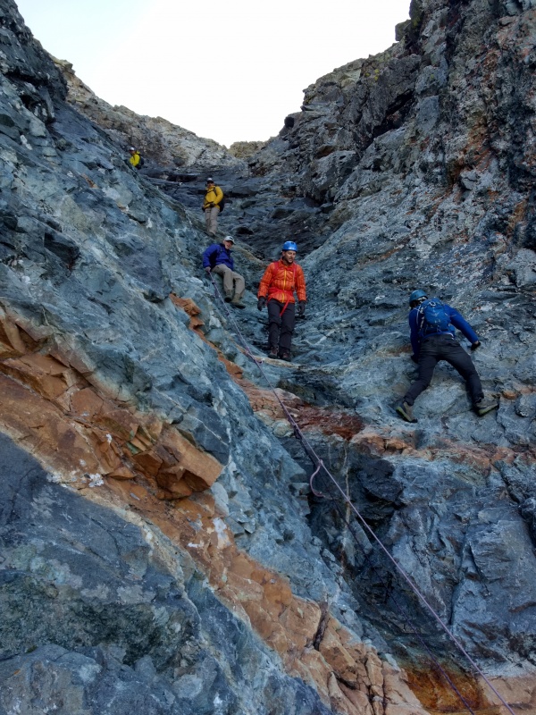
The infamous Hourglass - climbing up
This section of the trail is one of the most hyped segments of all the 14ers, along with other famous spots like Capitol's Knife Edge, North Maroon's Chimney, etc. I'll have various comparisons throughout the report but for now let's take a look at the hype and see in what ways it does and doesn't live up to it's reputation. In short: in terms of steepness and technical difficulty I felt it is perhaps a bit over-hyped but it's by no means a trivial gully either. However, in terms of rockfall - well that's going to get its own entire section here in a bit - jump down to the next section header if you want the drama part...
The Hourglass and associated terrain above goes on for too long to break it down into a simple 5 step process like I did for Sunlight's summit block and North Maroon's chimney, but since this section is THE defining aspect of this route and one that spawns all manner of questions/fears/concerns for people I will be including an exceptional number of photos to help you do you own informed evaluation alongside my commentary.
For the record, I went all the way up and all the way down without ever grabbing the ropes (except to push one out of my way) and there were several others that day who I believe did likewise. I don't recall even feeling any particular need to grab them except briefly considering it when down climbing the crux, until I looked around and spotted some holds that were plenty sufficient.
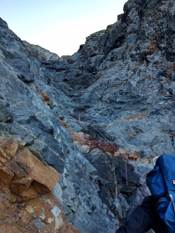
Near the bottom of the Hourglass - several ropes have been left hanging in various conditions.Slightly further up - this shows the sometimes limited but viable footholds in the trickier sections.
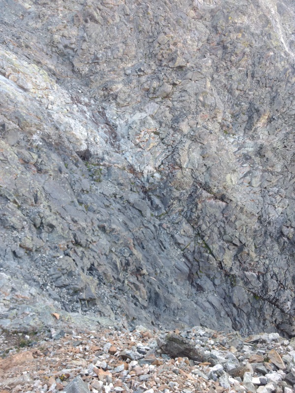
As always with photos of gullies, they tend to look way more steep in the photos than in real life. I think a decent comparison I heard a few folks make is this gully is somewhat like going up Crestone Needle but with all the awesome handholds shaved off and the rock smoothed down a bit. As you can perhaps make out in the photos there are still plenty of options for hand and footholds, they're just typically not as big and easy as the holds on the Needle.
So as far as steepness goes - which was one of my concerns going into the climb - this gully really didn't feel much more steep than many other similar gullies on other 14ers. The rock in the Hourglass itself is mostly fairly solid (we'll talk about the rocks above in a moment...) so it's just a matter of going slow and looking around for good holds. Given the way the ground fans out at the bottom of the gully there wasn't really all that dramatic of a feeling of exposure here, even when down climbing - I think I would say that Wetterhorn's last bit to the summit has a much more airy feel than the Hourglass.
Some people have portrayed an image as if any slip in the Hourglass is certain death - I think that's way overstating it. It would certainly not be fun to slip in this gully but most slips would be recoverable if you caught yourself before getting any speed up by grasping at the small but frequent handholds. Now if you took an outright head over heels tumble you're probably not going to walk away from that but as long as you go slow that's not likely to be an issue.
I believe this was near the crux - options get more limited but still viable without ropes.There were one or two small spots where you almost had to step on some wet rock briefly, but had no issues.
You can examine these photos for yourself and see that while you may have to look a little more carefully for your holds they are indeed there and they are generally very solid in this section.
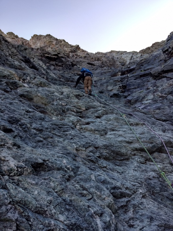
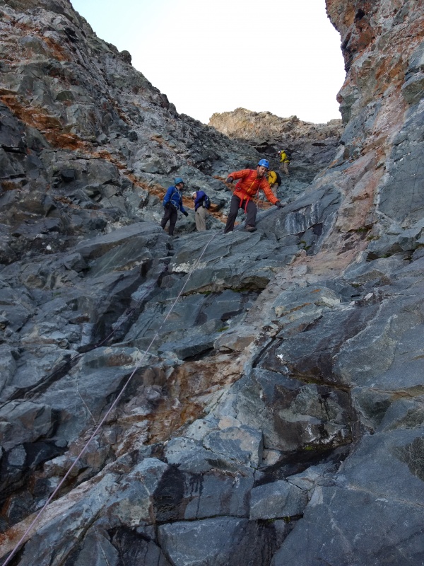
From this angle Perry looks fairly vertical but much of the time you may end up in more of a bear crawl pose.Looking back down from partway up. The angle of the climb goes up and down as you go along.
Perry near the first anchor point. From here you have a wide range of options - far left or right or straight on up - but the middle is messiest.This is one of the cairns for the supposedly better route up the left - tried to get there on the way up.
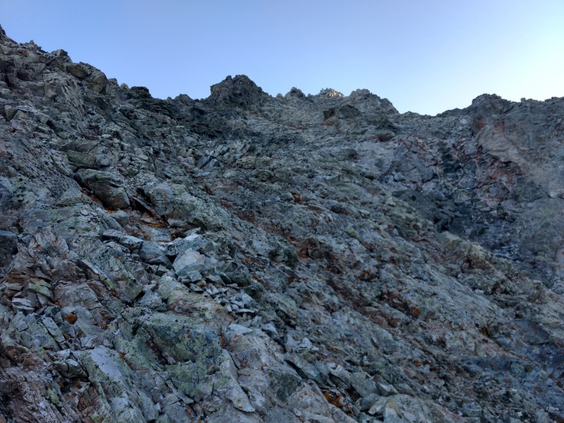
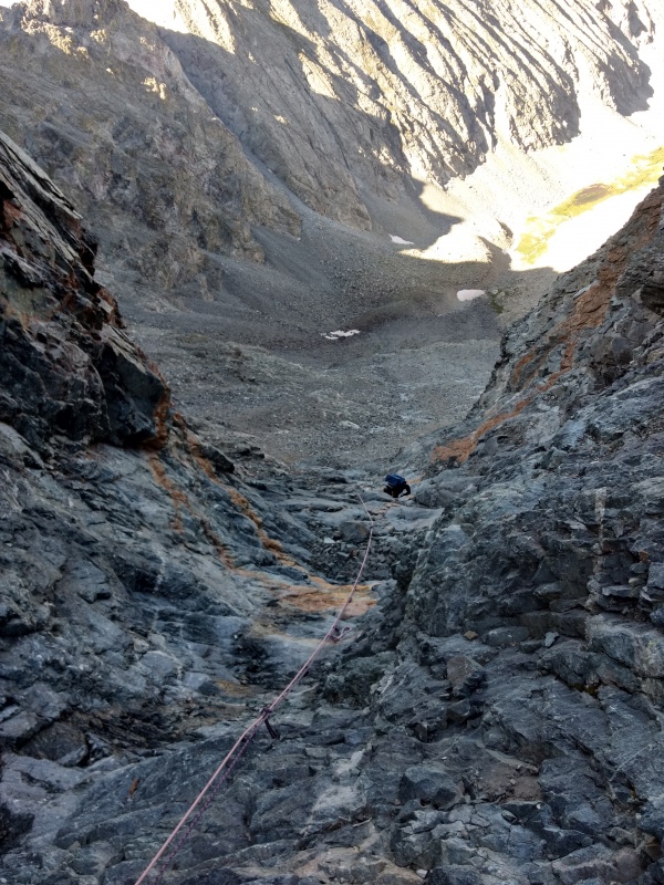
Once you get up around the first set of rope anchors you'll start to see why rockfall is such a danger in this gully - loose rocks are all over the place the higher you go - and they all funnel down the Hourglass.
Part of the region to climbers left above the Hourglass. Plenty of solid rock but lots of loose stuff mixed in. Overall route here = so-so.Looking down at one of several piles of death-in-waiting above the Hourglass.
This photo above the Hourglass give a feel for the steep drop down into it (but remember the photos tend to exaggerate it too)This photo gives you a feel for the armies of loose rocks waiting at the top of the Hourglass...
Rockfall in the Hourglass
After the increasingly ominous captions on some of the photos above you might be getting clued in to how I viewed the rockfall danger in the Hourglass. I will say upfront that it is entirely possible to go up and down the Hourglass without knocking any rocks down. I never sent anything skidding more than just a foot or two and the same could be said for some (but not all) of the others on the mountain that day.
It is very important to note that people who have gone up this section solo will likely have no clue of the magnitude of the peril lurking nearby, nor will those who did not experience the kind of rockfall I did.
Other people who climbed Little Bear that same day may well have thought very little of the rockfall danger and considered it over-hyped. Many people who read this will likely think I'm just dramatizing or merely some fearful little butterfly frightened by every falling pebble.
Let me give you a little context for my comfort level on 14ers. Capitol's Knife Edge: loved it! Walked across much of it and stood in the middle pivoting around taking pictures. Sunlight's summit block - stood on the very top with arms lifted high and jumped back down (then went back up to help another climber up). The Chimney on North Maroon - now I did get a bit uneasy here, particularly on the move where I had to rely totally on my arms but overall it was neat and I would happily repeat that one. Rockfall on Pyramid and Capitol - the goats on Pyramid took some shots at me with rockfall and on Capitol coming down from the summit there were rookies knocking rocks all over the place with the sound of rocks crashing down for thousands of feet. That made me rather uneasy at times but again I wouldn't mind doing those peaks again some day.
Now back to the Hourglass on Little Bear. Perry and I made it together to the section a little below and to the side of the Hourglass when we heard the familiar sound of rocks bouncing down the mountain and instantly became very alert. We could tell by the thuds that something non-trivial was coming down. Sure enough, seconds later a rock that was perhaps twice the size of a football came rocketing out of the the Hourglass.
Now when I say ROCKETING out of the Hourglass I want you to notice the choice of words. I did NOT say FALLING out of the Hourglass - that would give a totally wrong impression to think this was just another rock tumbling down the mountain like most experienced climbers have seen countless times. What was most shocking is that I HEARD the rock - and I'm not talking about hearing it bounce nor about the whoosh of something rushing by right next to your head. This rock was at least twenty feet off to my side and had bounced probably at least that high into the air and yet even from that distance I HEARD THE ROCK whoosing and whirring through the air!!!
Yes, while it was travelling through the air it was moving so fast that it made a LOUD and distinctive sound from over 20 feet away! Not to mention the crash when it next bounced on the ground!
Rockfall on Pyramid or Capitol could seriously injure or perhaps even kill you - a rock such as the one that I saw rocket out of the Hourglass that day would quite possibly have made it difficult to even identify your remains if it hit you head on!
I know this probably sounds like I'm overly dramatizing but I can honestly say that after completing all 58 14ers in Colorado that this was by far the freakiest experience I've yet had. There have been plenty of times where I was nervous and at times a bit worried but this was the first time on a 14er that I felt PURE RAW FEAR. It didn't help that seconds after remarking that I was glad we weren't in the line of fire of the Hourglass that two more smaller rocks came rocketing out at the same speed crazy speed but at a dramatic angle - shooting right past us on the right and the left, even though we were well over to the side of the region below the Hourglass.
I yelled up at the climbers we had earlier seen disappear up into the Hourglass to please step more carefully. Then Perry and I discussed what to do - I think we were both rather shaken by the speed, size and unpredictability of the rocks shooting out of there like RPG's. We ended up waiting at the bottom for a bit until a good while passed with no rockfall then nervously started up, zigzagging back and forth as we started up the Hourglass so as to have as much cover as possible by hugging the larger rock faces. Thankfully there was no more rockfall on our way up.
I made this simple illustration to help capture the psychological impact of the Hourglass w/ and w/o rockfall.
This simple little chart conveys visually how, apart from the rockfall concerns, I wouldn't have been overly wowed by the Hourglass. It would have certainly ranked more impressive than Wetterhorn but with no where near the impressive presence of Capitol. However, once the rock missiles are taken into consideration, basically every other danger I had ever experienced just faded into the noise.
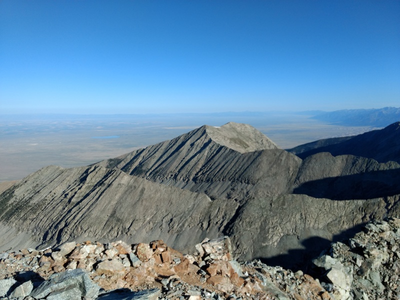
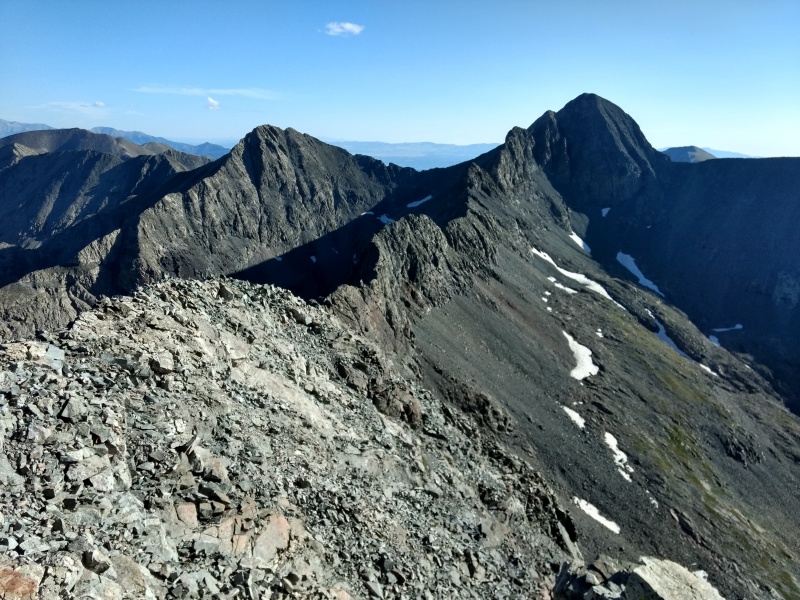
Summit
Had to throw in a couple photos from the top - showing the Sand Dunes in one and the infamous Blanca-LB traverse in the other.
Sand Dunes visible in the center right.Ellingwood on the left and Blanca-LB traverse running down the middle.
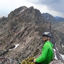
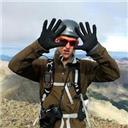
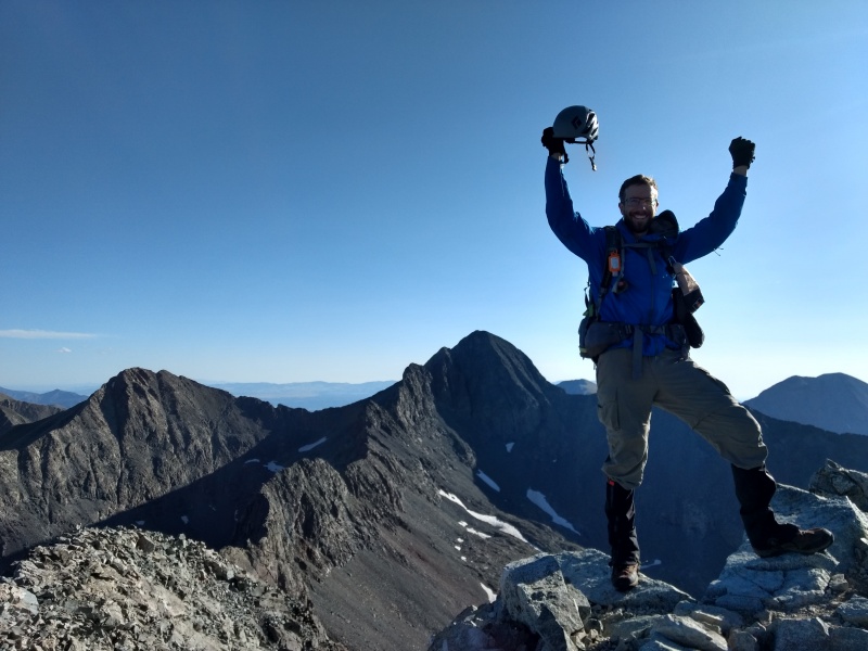
Typically don't put photos of myself in my reports but it seemed fitting to have a Finisher photo (have another with better lighting but this one has the better view).
Finisher photo atop Little Bear.
Hourglass down climb
So once Perry and I made it to the summit we brought the total to 7 people up top. Besides us there were two guys who came up the Northwest face, one of whom I believe goes by LivingOnTheEdge and the other I think had something about skiing in his username. After that there was a group of 3 cadets - one of whom was doing this as his 1st 14er! We traded congratulations for first and last summits respectively although process of elimination seemed to point strongly to someone among the 3 cadets as being the one to inadvertently launch those missiles down at us. The cadets had been contemplating also doing the traverse to Blanca but the collection of more experienced climbers talked them out of it given the increasing winds (to say nothing of experience levels...). It became gradually apparent that all 7 of us were intending to go down via the Hourglass.
After sitting on the increasingly windy summit for what seemed a somewhat unusually long time I finally vocalized what I began to suspect everyone else might have been thinking:
"Uh, so who's going to go down the Hourglass first and have all the rest of us over his head?"
LivingOnTheEdge had previously admitted to having done Little Bear before by the standard route and so Perry elected him as our fearless leader. There had been some brief talk about going down in waves, waiting for each other but in the end we all stood up and went down as one big group. However LivingOnTheEdge (Cody) ended up sweeping way over to the right side (climbers left) and the rest of us kind of fanned out from there with the 3 cadets ending up pretty much following me - not sure if they were just picking the guy with the highest peak count, or trying to finish the earlier inadvertent assassination attempt, or just liked the line I picked better.
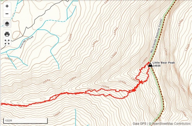
GPX plot shows the fan out of routes taken above and below the Hourglass - there's a wide range of options.
So let's talk about routes above the Hourglass. A few people had suggested just after the choke in the Hourglass, and before you get to the first anchor point, go up to the left along a cairned route that is supposedly easy class 3 on solid rock. Others told us, no, go up the right along the ropes to the second anchor point. Seems each climber has their own preferred route. That also played itself out in our group's descent.
Cody leading the way down towards the Hourglass.Another view of the epic quantity of loose rocks all over the place above the Hourglass - the loose stuff is worst in the middle.
The next several photos will give you some idea of just how much room there is to spread out above the Hourglass - probably not a bad strategy if you're with a group, due to the rockfall danger.
The cadets coming down - yes, those are ball caps. Yes, they got lectured several times for not bringing helmets!Here's an indication of how spread out we ended up. Cody in the far distance on climbers left and the ski guy in the middle.
Another shot of the abundant loose rock - note again Cody way off on his own.Coming down from the 2nd anchor point (climbers right). Closing in on Cody.
Second anchor point: on climbers right. This was some hazardous bunching up in dicey territory...Coming down to the first anchor point with Cody being forced ever nearer the larger portion of the group.
You can see the first anchor point and rope leading to the 2nd anchor point up to the right.Perry had taken a commanding lead by this point.
Coming down to the crux where you have to get more creative with footing...This section looks dicey but actually has some large, easy ledges to walk down on.
So in summary, we all made it down safely, without too much more rockfall though after the cadets knocked loose a couple rocks I called out tips on how to step slowly and lightly on the worst segments we had to cross up above the Hourglass. This brought a reply of "Yes, sir" and seemed to have worked because they followed my lead and didn't knock anything loose on the ugliest sections.
I would stress at this point two main things for this route:
1) PLEASE WEAR A HELMET!!! (As opposed to the ball caps you see in several of these photos!)
2) PLEASE STEP VERY SLOWLY AND CAREFULLY in and above the Hourglass
I assume the comparatively low fatality rate on the peak must be due to:
Fewer people climbing this peak as compared to others
Usually (but obviously not always) people not taking this on until they've built up experience elsewhere (and know how to minimize rockfall).
Pure statistics - the rocket ship rocks whizzing down here may only touch ground a few times on the way down and can bounce very high in the air so your odds of being hit are lower but consequences higher.
But nonetheless it should be noted by all that the rockfall here due to the very large, long funnel above, can be far more deadly than rockfall on other peaks due to the shocking speed the rocks can pick up while still along the standard route (as opposed to other peaks where you're not nearly as likely to have rocks pick up that kind of speed before they plummet harmlessly off a cliff away from the standard routes.
One more look at Little Bear after nearing the bottom of the first gully on the way back.
Reflections/Comparisons
I figure a trip report on my Finisher is as good a place as any to offer a few summary thoughts on some key experiences.
Here is how I rank some key aspects of the 14ers, after having done the standard route on all 58.
Hardest technical move on any 14er standard route: Chimney on North Maroon (this was the only time I was significantly uneasy about a move that had to be made on a 14er)
Most intimidating aspect of any 14er: rockfall blazing out of the Hourglass on Little Bear (this was the only time I felt pure, raw fear on a 14er)
Most epic exposure: Knife Edge on Capitol (I actually really liked this - walked across much of it - stood and twisted around taking photos in the middle - the views are outstanding!)
Runner up for epic exposure: Uncompahgre (not on the standard route technically, but if you walk over to the far side of the summit and look down - whoa!!! More visually stunning than the Narrows on Longs Peak)
Best combo of exposure and challenging moves: Sunlight summit block (I thought this was really cool - I could play on that all day if it was in my backyard)
Most enjoyable climb that felt challenging: Crestone Needle (this was one of the first peaks I felt like I actually "climbed" but the holds were so huge it was easy and enjoyable)
Funnest easy climb: Wetterhorn (this was one of my first climbs with 4/6 exposure rating on class 3 terrain, but the large, perfect, natural stair steps near the top made it easy and fun)
Most epic 4WD road: Lake Como road going up to Little Bear, Blanca and Ellingwood (I was pumped that I made it to 10,200ft in my Jeep Renegade - but boy did those skid plates get some action!)
Most impressive sustained elevation: Holy Cross Halo Ridge (epic views on this one - especially when you stand atop Holy Cross and look way, way over to see the tiny box of the lightning shelter a couple miles away)
Most expensive peak: Culebra (paid $150 not once but twice since I fumbled my snowflake attempt and had to go back in summer)
Worst rockfall: Little Bear Hourglass (did I mention the rocket ships that came blazing out of there?!?)
Runners up for worst rockfall: Pyramid (due to goats) and Capitol (due to people)
Best food on a 14er: Pikes Peak (those donuts at the summit house make the whole climb worth it!)
Best raw beauty: The Maroon Bells (apparently hundreds of thousands of people agree with me on this one!)
Thanks You's
So it's hard to list out all the folks who have in some way or another helped me out over the years but a few I want to be sure to mention:
Bill Middlebrook: Haven't met you yet (but perhaps we've passed each other by in the mountains...) but a million thank you's for putting this site together!
Nathan Hale: Also haven't met you but I see your name on the 14ers app which has been my constant companion and best resource.
All the hundreds (if not thousands) of trail workers at CFI and elsewhere who have done the backbreaking work of building/maintaining these trails - would've have got this done without all you folks.
Everyone who has posted countless trip reports, conditions reports, trailhead status updates, etc - I've gleaned so much useful beta from all this.
Everyone who has posted in the forum with useful info, questions that I had too; advice, critiques, etc. It's all helped me grow my knowledge and skills.
Everyone who has accompanied me for all of or for any given portion of any of the many trips it's taken over the years to finish these peaks.
Last but not least I thank God for protecting me and orchestrating so many meaningful encounters over the years as well as for creating a world full of such beauty!
Times from Little Bear:
Friday
2:15pm start up from 2WD lot right off of 150.
3:15pm arrive at large clearing at 10,200ft (after some very challenging road over the last 400ft between siwtchbacks)
3:32pm start hiking to lake
5pm reach Lake Como
Saturday
5:38am start from campsite by Lake Como
6:27am reach notch at top of first gully
7:29am base of Hourglass
~8:14am summit
~8:47am descend
10:18am top of first gully
10:47am at road at base of the first gully
11:53am camp torn down, start hiking out
1:09pm back at Jeep at 10,200ft
1:18pm Made it down to the switchback 400ft away - easy (but bumpy) sailing from there!
My GPS Tracks on Google Maps (made from a .GPX file upload):
Great report and cool photos. Interesting analysis in reflections/comparisons. My opinion differs a little, regarding N. Maroon vs. Little Bear. I've done both twice, though Little Bear as a snow climb the first time. You were more comfortable climbing through the hourglass, I cheated a little and grabbed the rope (rationalized by a discussion with someone at Lake Como the day before who had inspected the anchor). On the other hand, I had no problem with the chimney on N. Maroon, quickly found solid handholds and footholds. Also, it was so short I never felt exposed.
Your report is perfectly timed for me, as I have 4 peaks left and am contemplating sneaking LB in yet this season (while saving the final three, Capitol, Wett, & Unc, for next year). It's also incredibly thorough and thoughtful. In equal parts, it gives me the beta and courage I need to attempt the Hourglass, and gives me motivation to read up on the grueling but Hourglass-free Southwest Ridge route as an alternative. Thanks!
Congrats on completing number 58! I had met you the night before your climb when you walked through my camp on the east side of lake como, as you were reconning the trail. Happy to hear you had a good day in the mountains. You nailed it on your description of the rockfall hazard in the hourglass, it is no joke. My partner and I summited Little Bear at 7 15 that same day and went on to Blanca via the ridge traverse.
Thanks for the great post. Congratulations. I, and three others who are all over 62, climbed it on the Monday after you did. I personally found the ascent up the hour glass straight forward. While I never put weight on the rope, I did keep it close by. But on the way down I was having a very difficult time finding and feeling secure with my footing and was not sure if my hands could hold my weight if I lost my footing. Eventually I made a risk management decision. I decided that the rope breaking with a little weight on it was far less likely than me slipping. Thus, there were a few times I used it. But as I said, that was my own risk management decision. I really appreciated your post. I did let loose a rock above the hour glass. I was shocked at how the one rock got other rocks going. I am very very thankful that we were the only ones on the mountain that morning.
I sure wish I would have thought about my microspikes for the first gully. That would have really helped.
I will finish the 58 next weekend with a climb of Crestone Peak.
Congrats on finishing with style and thank you so much for the detailed trip report. Much like luke314, your beta, words and pics are extremely helpful in giving me the confidence, both physical and mental to get this one done. Also strongly considering the SW ridge after reading (and seeing) more about the rockfall danger. What's next?
Great job finishing and an even better job writing reports. They're both informative and entertaining. Your Chicago Basin report a month ago helped us out tremendously.
Hey man! Didn't see you posted this on here until I saw your name in our finisher thread. Big congrats and excellent write up! The pictures really do show how much you can spread out after the hourglass. I was thinking the exact thing as I looked at mine. I'll pitch the climbers route to the left til I die if for nothing else than it gets you out of the line of most of the upper face sooner! Congrats again!
Thoroughly enjoyed and appreciate this account as I gear up for a run at LB this upcoming summer. Congrats on the 58, and thanks for the obvious extensive time and effort you put into this and other TRs. Couple thoughts on this one:
Perry's pack - don't see too many external frame packs on 14ers. Looks like ideal capacity for hauling a 12pack to the summit.
Caution: The information contained in this report may not be accurate and should not be the only resource used in preparation for your climb. Failure to have the necessary experience, physical conditioning, supplies or equipment can result in injury or death. 14ers.com and the author(s) of this report provide no warranties, either express or implied, that the information provided is accurate or reliable. By using the information provided, you agree to indemnify and hold harmless 14ers.com and the report author(s) with respect to any claims and demands against them, including any attorney fees and expenses. Please read the 14ers.com Safety and Disclaimer pages for more information.
Please respect private property: 14ers.com supports the rights of private landowners to determine how and by whom their land will be used. In Colorado, it is your responsibility to determine if land is private and to obtain the appropriate permission before entering the property.


")
")
")
")
")
")
")
")
")
")
")
")
")
")
")
")
")
")
")
")
")
")
")
")
")
")
")
")
")
")
")
")
")
")
")
")
")
")
")
")
")
")
")
")
")
")
")
")
")
")