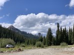
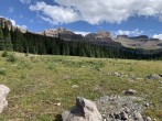
6/14/2025 Posted On: 6/14/2025 By: Boggy B Info: Past the stream crossing there are a bunch of drifts, melting fast. The last few drifts before the trailhead are deep. Someone took a huge rig through. I got good and high centered in the first one, winched out and parked. Not worth the effort to save 30 seconds of walking. | 1 |
|||
9/19/2024 Posted On: 9/20/2024 By: cloudkicker Info: Made it to the upper Wetterhorn Basin TH in a stock Xterra without incident last night. Creek crossing was very low per usual for this time of year. A couple rough spots including a couple ruts going across the width of the road in the very last stretch. Nothing all that notable otherwise. The current 3/6 difficulty rating is fair, when the creek is low. A Subaru could probably make it to the creek crossing (doesnt add much RT mileage for any of the 13ers past there) without much difficulty. 2-3 nice campsites right before you cross the creek. Another interesting note, the Courthouse Mountain TH camping area was a zoo on a Thursday night. Caravans of people camping everywhere in that little stretch. Way less people once you reach the 4WD stretch of road. | 1 |
1 |
2 |
|
6/18/2024 Posted On: 6/18/2024 By: Boggy B Info: 2 or 3 stout snow patches just before the trailhead will pose issues for stock clearance for the next week or so, but other than that it's mostly dry all the way. On the way back down we ran into a road closure just above Vista Point. Flagger told us there's a sign at the turnoff for CR 8 (which is the way I always go in), but there definitely isn't. So we had to drive all the way back over Owl Creek and out Silverjack, then back through Montrose and south again to meet the family in Ouray. This will wrap up Thursday according to the notice on the Ouray County Road & Bridge site: "June 10-13 & June 17-20 7AM-4PM Mon-Thurs Road is open Fri-Sun Rebuilding 5 miles of County Road 8 (Forest Service Road 858 ) Where: Owl Creek gravel pit to Sleeping Indian Lodge Travel Impact: Throughout the project, the road will be CLOSED and flaggers will be stationed at both ends. Non-emergency / non-local traffic will be turned around." -- https://ouraycountyco.gov/151/Road-Bridge | 4 |
|||
11/6/2023 Posted On: 11/6/2023 By: Boggy B Info: From the West: Shaded sections with packed snow/ice beyond Vista Point over Owl Creek and on up the West Fork. All packed snow/ice on the rougher section beyond Courthouse to Wetterhorn Basin. AT tires or chains should get it done. 4WD might help. | 2 |
2 |
||
10/7/2023 Posted On: 10/10/2023 By: supranihilest Info: Road is rough starting a mile or two before the creek crossing. The creek crossing is steep and badly deteriorated with a large rock step or a steep, canted bypass a few feet away. Pretty crappy. The rest of the road is in good shape. | ||||
9/30/2023 Posted On: 10/2/2023 By: Kiefer Info: From the turnoff on County Road 8, West Fork Road is easy 2-wd. Lots of cows in the area with some minor washouts. The last ~1.2 mile or so, road is quite a bit rougher. Most of it could probably be drivable in a higher-clearance Subaru. The exit from the stream crossing is going to cause some real problems with anything other than a 4x4. It's only about 8'-12' but it's steep with some large, embedded rocks. Stream crossing is currently low. Past this, the road goes back to being rough 2-wd (IMO). | 3 |
1 |
||
7/16/2023 Posted On: 7/17/2023 By: Flyingfish Info: Creek is low enough for a fairly safe crossing. Getting out immediately after the crossing is very hard and will stop any car without 4x4 and decent clearance. | ||||
7/2/2022 Posted On: 7/2/2022 By: supranihilest Info: Clear to trailhead. Some mud and water-filled potholes. The river crossing had some work done on it and is now easier in a vehicle. No place to jump across on foot though, I just waded it. | ||||
6/28/2022 Posted On: 7/8/2022 By: TravelingMatt Info: I've made it all the way to the trailhead, including crossing the creek, multiple times in a Rav4. | ||||
8/22/2021 Posted On: 8/24/2021 By: RyGuy Info: TH is in great shape. Lots of recent road work and the parking area is recently graded. Most SUV's should have no trouble getting up there. Fair warning, lot of cows nearby, so watch out for the stinky landmines. | ||||
8/17/2021 Posted On: 8/17/2021 By: docjohn Info: Lo and behold! The forest service has indeed done a partial repair on the 4WD section as of 8/13. The excavator was parked lower down on the good dirt road. Not only that, but the parking area is flattened (but not level) with a rock berm to close off the meadows from ATVs, etc. I think they responded to the cattlemen in the area because at least twenty head of moo cows were loitering about, and everyone knows the cattlemen need to get their trucks into the wilderness! (However the forest folks will not listen to those of us who wish to walk in the wilderness! I have complained to various functionaries about lack of just basic care of roads over the years to no avail.) BTW I think the mud holes will reopen soon because there was no drainage constructed!! | ||||
9/18/2020 Posted On: 9/19/2020 By: MC.Ikema Info: The 28 mile northern approach off US-50 is along a nice washboard free 2WD dirt road (County Road 858) all the way to Owl Creek Pass. From Owl Creek Pass its a 2WD road until the 4WD split. The last ~2 miles are along a standard 4WD drive road. The road reaches what looks like an old split. Theres a large parking area to the left by a red sign post indicating this isnt a road. The road continues uphill and slightly to the right. The 4WD bumps are immediate. I wasnt the driver but the creek crossing exit on the east side looked like the toughest part. The creek bed is wide so crossing in high water might require you to float your wagon across Oregon Trail style. I believe this is where the Subies parked (38.126843, -107.559716). I imagine theres a wizard out there who will eventually levitate a Crosstrek to the TH, but for mere mortals its probably not advisable. | ||||
9/13/2020 Posted On: 9/13/2020 By: supranihilest Info: The road up from Ridgway is very long and winding but all 2WD. Down low it's quite a washboard. Up high on the 4WD section there's some rocks and muddy potholes but nothing terrible. Stock vehicles (Jeeps, trucks, SUVs) should have no trouble with the road. The creek crossing is low flow right now and easy. If hiking the road go upstream from the creek crossing to where there's more rocks and the crossing is narrower, pick your line and cross, then hike back downstream to the road again. |


