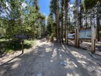
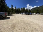
10/13/2024 Posted On: 10/13/2024 By: Steelernation Info: Detour is well signed and easy to follow. The detour road is a bit rougher than the Halfmoon road but still doable by any car, even a prius or other very low-clearance sedan. | ||||
10/9/2024 Posted On: 10/9/2024 By: MountainMan56 Info: Drivers beware! I had a hard time getting to the Mt. Elbert (North) Trailhead yesterday. There were several road closures and neither Siri or Google could direct me around the closures. I talked with some construction workers who told me that a hydro-electric plant failed, taking out several bridges... But I cannot find anything in the news to substantiate that story. Google, Siri and the road workers all recommended that I go to the south trailhead. I decided to go climb Quandary instead, as I was running out of daylight. | 3 |
|||
5/22/2024 Posted On: 5/22/2024 By: Brian Garkie Info: Road in the morning had a light dusting of snow and was dry in the afternoon with the usual potholes, but no washboarding. I easily made it with my front wheel drive Mazda 3. | ||||
5/14/2024 Posted On: 5/16/2024 By: Jcinco Info: Road is still quite snowy starting about 3 miles in just past the first cluster of dispersed campsites. There are definitely vehicles traveling past this point, but it was getting too snowy/slushy for me to venture beyond in my minivan. With the upcoming stretch of warm weather, Im guessing it will fully melt in the next week or so. | ||||
12/19/2023 Posted On: 12/21/2023 By: mcookhines Info: I highly recommend parking at Halfmoon East campground. Up until there, the road is snowy, but generally flat and well packed out. I went as far as Emerald Lake Picnic Area (in a small AWD truck/SUV thing with all-weather tires and plenty of snow-driving experience), and had serious trouble getting back up the first hill on my way out. We weren't the only ones who got stuck that day, either. Learned my lesson and plan to purchase chains asap. Parking and walking the extra mile would have been way faster. | ||||
11/3/2023 Posted On: 11/4/2023 By: aholle88 Info: Road is snow covered the whole way from where it turns to dirt. The snow ruts/tire tracks get deeper further on, but I did make it to the trailhead in my Impreza Friday night. Wouldnt recommend it in that low of a car though. It was risky at best and I decided to go to the south TH this morning to avoid driving the road again. Nobody had pulled into the upper lot as of last night, deep snow there but parking on the side of the road by the TH is an option. | ||||
7/25/2023 Posted On: 7/26/2023 By: jbferree Info: A dirt/gravel road for the last few miles to get to the parking lot but it was maintained and any car can do it. No snow remaining anywhere. I arrived at 4:45am on a Tuesday and there were maybe 10 cars there so plenty of parking. I assume on the weekend it is much tougher but there is room to park on the side of the road approaching the trailhead as well. The beginning of the trail is in the trees so make sure you have a headlamp if starting early. I met a few people without one who were just relying on others having them. Two vault toilets available at trailhead but no hand sanitizer. | ||||
5/11/2023 Posted On: 5/12/2023 By: Jirwindisc Info: Road to NorthEast trailhead was completely clear up till 7:30 pm on 5/11/2023. Could have driven any car up there at that time. Some snow at the parking lot sides, and snow started up road after first 1/4 mile. Didn't need Snowshoes till 1.75 miles in. | 1 |
|||
4/22/2023 Posted On: 4/23/2023 By: dmgilmour Info: To Halfmoon West should be doable with AWD, to Elbert TH might be, we didn't get the chance to try. Road is probably thawed for the first half of the dirt road and the rest should be manageable for any AWD car. Parked near the Halfmoon West campground, couldn't continue to the Elbert TH because a car was parked in the middle of the road, though the conditions didn't look much worse than the rest of the road. When we parked our car got a bit stuck, but a shovel was all we needed to get it out. | ||||
9/17/2022 Posted On: 9/19/2022 By: eastcoast14er Info: Beautifully maintained 5 mile dirt road leading up to the trailhead (Mount Massive trailhead is just 0.5 miles further up the road). Arrived at the trailhead parking lot at 5:15 AM and the car in front of me grabbed the last of the ~30 spots. Ended up parking along the road just 100' from the parking lot entrance. Plenty of dispersed spots available. Bathrooms available at trailhead. | ||||
9/1/2022 Posted On: 9/6/2022 By: GuiGirard Info: A lot of work went into this road recently, unfortunately it receives high traffic and potholes are starting to show up in numbers. Nothing of an issue even for a 2WD vehicle but caution is advised, and driving fast is not advised (your Taco/Jeep will likely survive unscathed but the road will take a hit). The 15 MPH speed limit signs are posted for a reason. Careful about where to park whenever the Elbert lot is full. Lots of no parking signs along the road (as well as no camping/no fires at places). The FS/county (?) clearly spent a good amount of $ on this (and road upgrades) recently so they might wanna consider recoup some of the costs. Don't be that fool who is going to get a ticket! The Forest Service was out there working on some fencing along the road near the Half-moon Campground. My first visit to this road in 10 years, and the overcrowding of dispersed camping sites is showing. Please be careful where you drive/camp and leave sites sparkling clean when "checking out". I had to do some cleanup at the dispersed campsite where I stayed, which was left littered. Let's all work not to turn this area into the next Aspen (ie, only camp at designated places). | ||||
6/12/2022 Posted On: 6/13/2022 By: madups1 Info: Arrived around 6:30am. Most of the main spots were taken and didn't want box anyone in, so just parked on the road. No issues. | ||||
5/7/2022 Posted On: 5/8/2022 By: Carrion3 Info: Completed a there and back to the summit of Elbert. 1. Trail Head is open. (Parked at the trail head) 2. Trail was cleared enough and easy to follow. (Yak-trak for sure) 3. At about 11,000 lots of snow. (Was frozen in the early AM) 4. Once you clear the tree line, smooth sailing. 5. Trail is very easy to follow the rest of the way. Expect 3 false summits.. 6. When descending back to tree line expect, lots and lots of post-holes. (up to my waist on the return) the post holes added another 30 to 45 minutes. (Not sure snow shoes will help) All in all. The trail head is open 5.2 from the start of the trail head to the summit. Round trip distance 10.4 miles from the trail head. 4300 feet of elevation gain. 4.5 hours up and 3.5 hours down. Good Luck | ||||
5/7/2022 Posted On: 5/8/2022 By: Carrion3 Info: Completed a there and back to the summit of Elbert. 1. Trail Head is open. (Parked at the trail head) 2. Trail was cleared enough and easy to follow. (Yak-trak for sure) 3. At about 11,000 lots of snow. (Was frozen in the early AM) 4. Once you clear the tree line, smooth sailing. 5. Trail is very easy to follow the rest of the way. Expect 3 false summits.. 6. When descending back to tree line expect, lots and lots of post-holes. (up to my waist on the return) the post holes added another 30 to 45 minutes. (Not sure snow shoes will help) All in all. The trail head is open 5.2 from the start of the trail head to the summit. Round trip distance 10.4 miles from the trail head. 4300 feet of elevation gain. 4.5 hours up and 3.5 hours down. Good Luck | ||||
5/7/2022 Posted On: 5/8/2022 By: Carrion3 Info: Completed a there and back to the summit of Elbert. 1. Trail Head is open. (Parked at the trail head) 2. Trail was cleared enough and easy to follow. (Yak-trak for sure) 3. At about 11,000 lots of snow. (Was frozen in the early AM) 4. Once you clear the tree line, smooth sailing. 5. Trail is very easy to follow the rest of the way. Expect 3 false summits.. 6. When descending back to tree line expect, lots and lots of post-holes. (up to my waist on the return) the post holes added another 30 to 45 minutes. (Not sure snow shoes will help) All in all. The trail head is open 5.2 from the start of the trail head to the summit. Round trip distance 10.4 miles from the trail head. 4300 feet of elevation gain. 4.5 hours up and 3.5 hours down. Good Luck |


