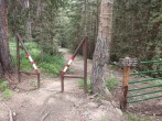
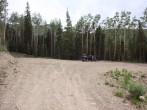
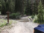
8/27/2012 Posted On: 8/27/2012 By: bking14ers Info: I was able to drive Toyata Yaris car all the way to the TH. Silver Pick Rd. is very good. At the turn off to Rd. #622 it is a little rocky and rough the further you go up it, but is easily drivable in a car if you drive slow and carefully. At Wilson Mesa TH. the road Y‘s, and there is a sign that says unimproved road past this point. This road is by far better than Rd #622. It will take you to the TH. where there is a large parking lot. There is one stream crossing you will have to go over. This was the worst spot on the entire road. Drive slow across it and pick your entrance and exit points to avoid rocks. I would advise not to cross the stream if there is any chance of rain or stream is high. There is a enough room just before the stream to park two cars. PLEASE DO NOT TAKE UP THE WHOLE SPOT FOR ONE CAR... It‘s about a mile or so to the TH. from the stream. | ||||
7/26/2012 Posted On: 7/30/2012 By: vorticity Info: I have a .gpx file of the road to parking and of the new Rock of Ages trail all the way to the saddle. E-mail me at vorticity4@gmail.com, I will send it to you. The new trail is excellent all the way to the saddle and very well marked with new signage. It would be tough to get lost. The new trail bypasses the stone house. On the way back, we detoured to the house for some photos. Evidently there is Wolverine (DOW has it radio tagged) living at the house. We saw Marmots, but no Wolverine. Along Silver Pick Road (8.4 miles is the correct mileage to the trail head from CO 145) there is one stream crossing (Big Bear Creek) about 7.2 miles (mileage is wrong in other status reports) from CO 145 at N37 52.923, W108 00.494 (You can see this on Google Earth). This will be no issue for a high clearance vehicle. I was able to cross it fine in my Subaru Outback. However, after a heavy rain, this will prevent passenger cars (even a Subaru) from crossing. If you have to park on the north east side of the stream, you will have to hike 1.2 miles to the trail head after crossing a log on foot. As stated in prior status updates, there is no place to camp at the parking lot. There are several camping turnouts along the road. Even if you park and try to walk in to camp, you are going to have a hard time finding camping. The old Jeep trail is cut into the side of a steep slope. There are no flat spots past the parking lot, up ROA trail for quite a way. There are Forest Service "No Camping" signs and a Port-A-Potty at the parking lot. Vort. I was asked a few questions about this route: 1. RT mileage--Rock of Ages TH to Rock of Ages Saddle = 8.6 miles 2. RT mileage--Rock of Ages Saddle to summit of Mt. Wilson = 1.2 miles 3. RT mileage--Rock of Ages TH to summit of Mt. Wilson= 9.8 miles 4. How many hours did it take you to complete the RT from Rock of Ages Saddle to summit of Mt.Wilson and back to vehicle. 0501 Departed Parking Lot 0734 Arrived Rock of Ages Saddle = 2 hours and 3 minutes 0910 Summited Wilson Peak = 1 hour and 6 minutes from the saddle 1042 Back at the Saddle = 1 hour and 32 minutes, but includes time on the saddle and talking to some others on the way down 1302 Back at the car. Total trip = 8 hours and 1 minute | ||||
5/28/2012 Posted On: 5/29/2012 By: wildlobo71 Info: Road from turnoff from CO 145 (to Telluride) at Silver Pick Road is clean 2WD, all the way to the stream crossing (approx. mile 5.4 from Hwy 145 turnoff). Stream is running moderate, one 2WD vehicle made it across but is not recommended for newer model (i.e., still making payments) vehicles. 4WD cleared the stream fine, another mile or so to the TH. | 1 |
|||
8/7/2011 Posted On: 8/8/2011 By: tmathews Info: The roads that lead to the trailhead are signed well. Off of Hwy 145, the road continues for a couple of miles and forks (take the left fork). The next fork may be confusing at first for some. You come to a three-way intersection, but the two forks on the right are not immediately visible. Look to the right and you will see a sign for the Rock of Ages trail (access to Mt. Wilson) on the middle of the three forks. The rest of the roads (about 11.1 miles total) have really good signage. While I would call the access roads rough 2WD you do have to cross a creek to get to the trailhead. That being said, there was a passenger car with Massachusetts license plates there on Sunday. TAKE INSECT REPELLENT. I‘ll say that again -- TAKE INSECT REPELLENT. If anyone out there has been wondering where all the biting insects are this summer -- they are in Silver Pick Basin at the new Rock of Ages Trailhead. I couldn‘t even stand outside or open the windows in my vehicle while parked there preparing to overnight. There are swarms of biting black flies and mosquitoes like you would never believe. I was inhaling mosquitoes while trying to take off my boots afterward. Long-sleeve baselayers and long pants are highly recommended in the morning hours to start out. | ||||
8/7/2011 Posted On: 8/8/2011 By: rockdoc53 Info: I rate the road as moderate 2WD. No camping is allowed at the trailhead but there are 6 new campsites along the FS road. The mileage is a bit off. The total distance from pavement is 8.6 (not 6.8). My odometer clocked the junction where you take the middle road at 4.1 (not 3.8), and the forest service road 645 at 6.4 (not 6.0). | ||||
8/3/2011 Posted On: 8/5/2011 By: tmathews Info: Officially opened 8/3/11. http://14ers.com/forum/viewtopic.php?t=19907&p=370826#p370826 | ||||
8/9/2010 Posted On: 8/9/2010 By: letsgocu Info: This Trail head is official still closed until June 2011. This is what the sign says at the gate. It is not worth it to climb onto the private property to attempt the Wilson group. Trail is out of repair and you go right up to the property owners house with no way to skirt around due to terrain. It is still a long hike from this trailhead you are better off going to one of the others. | ||||
5/14/2010 Posted On: 5/14/2010 By: PKR Info: Road passable to Wilson Mesa Trail, snow mostly continues beyond that. | ||||
5/11/2010 Posted On: 5/11/2010 By: PKR Info: Road passable to 9,700ft. Patchy snow up to Wilson Mesa Trail, snow continues beyond that. |


