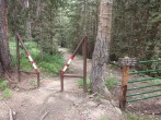
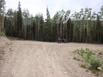
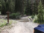
8/17/2015 Posted On: 8/18/2015 By: HikerGuy Info: The county portion before the last turnoff onto the forest service road has just been graded. The road is in very good condition except for one challenging mud hole right before the creek crossing on the way up. This could be very tricky/risky in a 2wd vehicle. Plot your line carefully, maintain speed and this should not be a problem in any AWD vehicle. Creek is max 6 inches deep. I'm headed back down on Wed night (8/19), will update if conditions have changed and maybe post of photo of the mud hole. | ||||
8/13/2015 Posted On: 8/13/2015 By: Misi197 Info: Road in very good shape and likley passable for all vehicles, including 2 wheel drives that take it slow. The mud pit before Big Bear Creek remains and proves to be the only tricky spot. The Creek itself remains at only 2-3 inches in depth. | ||||
8/13/2015 Posted On: 8/14/2015 By: Chipmonk Info: Made it to TH in 93 Subaru Impreza wagon. I think the creek is lower than 3" now but keep in mind they‘ve been getting more rain this week. The muddy spot was ok on the way in. The river cleaned off the tires. On the way out I slid sideways and bottomed out, but no real damage. Lost traction for a short period while the mud worked itself off the tires. I do think the right 2wd can easily make this drive. | ||||
7/29/2015 Posted On: 7/30/2015 By: zsmith Info: The road is mostly smooth and in very good condition. Bear creek is currently only 3" deep. It may rise with the rain in the forecast. The road is passable by most vehicles except one mud pit just before the creek crossing. This may present a challenge to some cars. | 2 |
|||
7/1/2015 Posted On: 7/1/2015 By: Urban Snowshoer Info: Returned today from a successful ascent of Wilson Peak. The road is dry, relatively well marked, and it good shape. You could almost make it up the road in a 2WD, though the stream crossing might be a bit difficult. | 2 |
|||
5/20/2015 Posted On: 5/22/2015 By: WillRobnett Info: Road was in good shape within 2 miles of the TH. Storm layer and drift snow immediately after the last turn. Coverage on the remaining 2 mile except for the a short stretch of the incline after crossing Big Bear Creek. Creek crossing is an ice bridge, no water passing. The Rock of Ages Approach is chest high snow swimming within a quarter mile of the TH. I did not climb Wilson Peak that day, scouting the TH at sunset. Meet a group of skiers that skied center straight from the top of Wilson Peak. They found a 5 foot rock band in the descent where they had to sidestep. | ||||
8/22/2014 Posted On: 8/22/2014 By: JackBauer Info: 4wd a must. Steep and muddy sections. Dicey stream crossing. Thanks to Larry and crew for lift to and from parked 2wd van. | ||||
8/3/2014 Posted On: 8/3/2014 By: noshirt Info: Made it all the way to the top in my 1996 Nissan Maxima. The creek crossing wasn‘t bad at all. | ||||
7/17/2014 Posted On: 7/18/2014 By: BillMiddlebrook Info: Open and the road is in good condition. The stream crossing at Big Bear Creek isn't too high and good clearance AWD/4WD vehicles should have no problems. | 1 |
|||
5/27/2014 Posted On: 5/28/2014 By: realhillboarding Info: The road to silver pick is blocked by multiple large downed trees across the road 2.2 miles from trailhead. There are also multiple snowbanks blocking the road, although these are melting fast. | ||||
1/1/2014 Posted On: 1/1/2014 By: Eagle Eye Info: Almost identical to a month ago, the road is now harder packed and more icey in places but is only traveled ~1 mile past the intersection. | ||||
12/1/2013 Posted On: 12/1/2013 By: Eagle Eye Info: Silver Pick Road is driveable/has been driven 1 mile past the "confusing" intersection. This is a total of 5 miles from the start of the road. At this place there is an open, green gate on the left and a cattle guard on the right. On an uphill section .2 mile beyond here it is obvious people have been stuck. The road has not been driven beyond there. | ||||
11/9/2013 Posted On: 11/18/2013 By: cphill Info: Silver Pick road was unpassable about 2-3 miles before trailhead on the weekend of Nov 9th. The unbroken snow on the road was 4-8 inches deep. The Silver Pick trail was mostly snow covered on the northern aspects of the trail with annoying post holing. | ||||
9/21/2013 Posted On: 9/22/2013 By: jimmtman Info: Little mud but otherwise an easy drive. Great aspens on both sides of the road that haven‘t turned yet. | ||||
4/25/2013 Posted On: 4/27/2013 By: cjw Info: Open 1.75 mile up 622; about half mile short of Wilson Mesa TH. 9700‘. |


