7/8/2007 Posted On: 7/8/2007 By: Aubrey Info: As of July 4-6, 2007, the creek crossings were much lower than two weeks ago. I'd say between 6 and 9 inches lower. Interestingly enough, the lower creeks have exposed some big rocks that I couldn't see before. Made it up and down the trail without any problems, but I think it was easier the second time. Not much else has changed since I last reported. | ||||
6/26/2007 Posted On: 6/26/2007 By: lordhelmut Info: F^^k this road | ||||
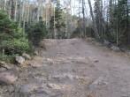
6/25/2007 Posted On: 6/25/2007 By: Aubrey Info: 6/23/2007: Rocky, rough and rutted as ever. For the last 2.5 miles or so, that is. First half (up until the first creek crossing) was relatively easy. I saw a Subaru Outback parked just before the first creek crossing. First creek was easy to cross and not very high. Second creek crossing was very low. Third creek crossing came up to the bumper on my 2001 Nissan Xterra (see posted pic). As I wrote in my trip report, this a pretty serious 4x4 road for any stock SUV or truck. Water flows down many sections of the road, washing the dirt away from rocks and deepening ruts and mud pockets. I have a good 15 years of off-roading experience and this is about as rough as I'll go in a stock truck. In 1999, Gerry Roach described it as one of Colorado's roughest roads, and he said it gets worse every year. Even though improvements have been made to the lower half of the road, the upper half is still quite "interesting." And while other 4x4 roads tend to only have a few "rough" sections that challenge you, this road has non-stop roughness from the first creek crossing to the end. Driver beware. | ||||
6/17/2007 Posted On: 6/17/2007 By: shanahan96 Info: clear all the way to the upper trailhead. the road is muddy in spots and all the little creeks near the top of the road have overflown. jamie | ||||
5/24/2007 Posted On: 5/24/2007 By: Jcwhite Info: Drove to within 1 mile of upper parking lot this past weekend. Did do some driving through snowdrifts though. | ||||
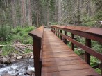
5/22/2007 Posted On: 5/22/2007 By: w5cto Info: The first 2.5 or so miles of the road after the lower trailhead is clear and is easily driven in a stock 4x4 vehicle. After the first stream crossing, however, it is in very bad condition due to all of the runoff. I would recommend parking in the areas right after the stream crossing and hiking the remaining 3 or so miles to the upper trailhead. The last mile of the road is mostly covered in snow. As of May 22, everything past the foot bridge at the upper trailhead was completely covered in at least 3 to 4 feet of snow, so don't go without skis or snowshoes. | ||||
2/4/2007 Posted On: 2/4/2007 By: shanahan96 Info: we were stopped 2.4 miles short of the lower trailhead by a sizeable snow drift on feb 3rd. the road is normally plowed and they expect it to be open within a few days. just don't plan on reaching in the trailhead in the next 24-48 hours. | ||||
12/13/2006 Posted On: 12/13/2006 By: bmratc Info: The First half of the road as you pass through private property is fine. The snowpack increases as you continue up. The furthest I got up(in a jeep laredo), was 50 feet past the sign for the San Isabel forest boundary. | ||||
8/23/2006 Posted On: 8/23/2006 By: Tommy Dorr Info: Ready for this? My 1985 Subaru Wagon GL made it to the TOP of the South Colony Lakes Road. I would not recommend attempting a feat like this. I just wanted to show that it could be done. BTW the new road improvements are amazing for the first couple miles. | ||||
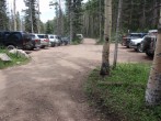
7/11/2006 Posted On: 7/11/2006 By: philbucher Info: The road "improvement" work on the lower section of road up to South Colony Lakes has been completed. It looks like they worked some sections of the lower 2.5 miles, primarily to add drainage sluce cut-offs. 4WD vehicles can easily (but slowly) navigate the first 2.5 miles (approximately half way to the upper trail head). After that point there are a number of really "interesting" sections which will challenge the best 4WD drivers. (Big rocks mixed with deep pockets.) We did see four cars at the upper trailhead, so we know it is possible for some. Two were very short/high Jeep "CJ" versions. One was a pickup and (surprisingly), one was a newer Jeep Cherokee. Being cautious, we parked near the first big chasm in the road - at 2.5 miles. From there we needed 70 minutes to walk to the upper trailhead. But since even the most adventurous driver would still need ~30 minutes to drive it, we really added very little to the total trip time. The road is plenty wide everywhere, but some of the rocks, dips and mud pockets would dictate the use of a truck with skid plates and a short wheelbase. | ||||
6/24/2006 Posted On: 6/24/2006 By: mpa Info: We arrived at this trailhead on 6-23-2006 and discovered that the Road Construction closure date has been extended to June 30, 2006. The road is still open to hiking, but not vehicles; thus you'll have to hike the road for apprx. 5.5 miles to the TH. The F.S. Office in Westcliffe also told us that there is a proposal to close this road permanently. Just FYI | ||||
6/19/2006 Posted On: 6/19/2006 By: GoHigher Info: Road was in rough shape 6/17 in AM, worse in PM. Road repair was halted for the weekend. The right vehicles could make it to the gate. Only short wheelbase, high clearance vehicles should attempt this road. Those that made it said their vehicle took some very hard hits on the way up. Both creek crossings were quite shallow and had rocky bottoms. Vehicle coming up Saturday basically destroyed what was left of the road. ATV's and dirt bikes are the way to go here. | ||||
6/6/2006 Posted On: 6/6/2006 By: GoHigher Info: June 12th - 23rd road work closing South Colony Rd. | ||||
6/1/2006 Posted On: 6/1/2006 By: nickonov Info: The road is free os snow all the way to the gate. It's still strictly a 4WD road. | ||||
5/21/2006 Posted On: 5/21/2006 By: Jcwhite Info: I busted down the last couple snowbanks a couple nights ago, and with decent clearance you can get all the way to the top of the road. |


