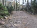
9/15/2008 Posted On: 9/15/2008 By: ossie322 Info: With all the recent snow I thought I would update the status of the Colony Lakes TH. It is still clear and mostly dry, and the creek crossings are really of very little consequence if your SUV has decent clearance. I will warn of one nasty section immediately below the final creek crossing to the upper TH. I saw/heard at least a half dozen vehicles bottom out pretty aggresively right before crossing the river (or right after the crossing as they were descending the road) Take it slow here. I also saw a Subaru almost the entire way up the road, but it looked as if its lower right end had been completely obliterated. Take it slow and if your car doesn‘t have great clearance, don‘t destroy it. :) | ||||
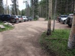
9/9/2008 Posted On: 9/9/2008 By: rleclair Info: Reviewed all the previous postings about the conditions of S. Colony Lakes "road" to the TH and planned to drive as far as I could in a 2002 Honda CRV. Road conditions from the 2WD parking lot to the first stream crossing would be passable by most vehicles (cars, trucks, SUV‘s). Afterwards, I saw mostly vehicles with higher clearances that had successfully navigated the rockier terrain. I was able to drive my CRV to 10.7 miles (of the total 12.5 length) and walk the remainder of the trail to the TH. After 10.7 miles, the road becomes much more technical that a light weight SUV would not be able to handle (unless you hate your vehicle...) Conditions were dry as of 10/6-10/7/08. Good luck! | ||||
9/1/2008 Posted On: 9/1/2008 By: Aubrey Info: As a reference, I‘ve made it to the end of the South Colony Lakes road twice before it was "improved" (in a stock Xterra), and I just did the drive again after it was "improved" today (in the rain and the dark). Based on that, here‘s my opinion of the road, as it is now: All of the cruxes (3 or 4 of them, as I remember) have been blasted away ... but keep in mind, the road is still pretty rough, rocky and rutted. High clearance and/or driver skill/experience is definitely recommended. Today, I did see one Subaru near the end of the road, but I imagine one of the following: a.) the driver is a professional and deserves some sort of award, b.) the driver took FOREVER to get up there, as he must‘ve had to cautiously and carefully place tires constantly, and/or he bottomed out many times, or c.) he‘s insane and/or doesn‘t care about his car at all. By the way, regardless of what you hear, I‘d advise against taking 2WD and/or low-clearance vehicles to the end of this road. Halfway, perhaps, but personally I wouldn‘t go any further. As of 9/1/08, streams seemed to be running a little deeper than normal, but then again it was raining on me at the time. | ||||
8/6/2008 Posted On: 8/6/2008 By: CincyBearcats Info: On Friday (8/1/2008), I drove my stock 2006 Toyota Tacoma (w/ Off Road Package) to the 4WD TH without too much trouble. I‘m a novice off road driver, so I just took it slow and had Sarah spot me in a few sections. The final creek crossing right at the 4WD TH was less than 12-in deep. All creek crossings down lower were 6-in deep or shallower. It exactly one hour for us to get from the 2WD TH to the 4WD TH. | ||||
7/14/2008 Posted On: 7/14/2008 By: BillMiddlebrook Info: No problem driving my Suburban to the end of the road. The final river crossing was only about 15 inches deep. | ||||
7/12/2008 Posted On: 7/12/2008 By: iowa_born Info: My Jeep Liberty and a Toyota Highlander, both non-modified made it to the top. | ||||
7/3/2008 Posted On: 7/3/2008 By: Cheesehead Info: Rough but passable, Water crossing is probably at 2-3 feet, Gate at the top parking lot half exposed. | ||||
6/17/2008 Posted On: 6/17/2008 By: Schroder Info: Road is passable in 4WD up the 4WD parking area. Road seems to have been improved since 2 years ago, not quite as rough as it used to be. The gate and the trail head sign are just now starting to peek through the snow. Access from the TH to South Colony Lakes is via the snow, the trail is still completely covered, and will remain that way for at least 2 more weeks. Snow between the trees up to the lake varies from 10-30‘ deep in standard snow slide areas, to as little as 2-4 feet. | ||||
6/9/2008 Posted On: 6/9/2008 By: 12ersRule Info: Road is passable to the 2nd major stream crossing about 1 mile from the end of the road. Still a lot of big snowdrifts in the last mile. | ||||
6/1/2008 Posted On: 6/1/2008 By: cpittman Info: Hiked to South Colony Lakes today. Any 2WD with some clearance can get to the rainbow trail. Road becomes unpassible due to large snow drifts 1 to 1.5 miles past the large creek crossing. The creek is running high, so expect to get your shoes wet trying to cross it if you do not drive across. | ||||
5/26/2008 Posted On: 5/26/2008 By: Kinesiologyman Info: The South Colony lakes road is still socked in with snow. You can drive about 2 miles beyond the lower parking lot (almost to the Rainbow Trailhead). After that, you can hike without snowshoes the additional 3.5 miles to the upper trailhead. There are several great parking/camping spots where the road becomes impassable. I would estimate the snow is about 10+ feet deep at the upper trailhead. Snowshoes are mandatory beyond the upper trailhead and a few of the slopes are sketchy, so be aware of avalanche danger. I don‘t see this road being clear until late June! | ||||
5/22/2008 Posted On: 5/22/2008 By: Alan Ellis Info: South Colony Road Update (May 22, 2008): The entire road will be open all the way to the upper parking lot through the fall of 2009. In the fall of 2009, the road will be permenantly closed about halfway up. This information was confirmed by ranger Jeff Outhier who is located at the Westcliffe Forest Service office. | ||||
5/4/2008 Posted On: 5/4/2008 By: Georgie Info: You can now get around the fallen tree to the left, but only about 1/4 mile up the road. The snow is melting fast, and should to be able to make it much further up the road very soon. | ||||
4/19/2008 Posted On: 4/19/2008 By: Scanner Info: Zero snow to 2WD parking lot. Recommend parking at 2WD parking lot, as road almost entirely covered with slushy snow inside the trees. Plus, large pine tree down over 3/4 of road just inside the trees at about 9200‘. ATVs could pass by on left, but not much else. Snow hard-packed and icy in the morning (snowshoes not needed at all), but very slushy sugar in the afternoon (still need snowshoes for afternoon). | ||||
2/17/2008 Posted On: 2/17/2008 By: centrifuge Info: Colfax is blocked by massive snowdrifts 3.5 miles down the road. I looks like Custer County stopped plowing past this point. If you go up in the next couple of weeks you can expect to add 2 miles to your hike to get to the T-Junction. |


