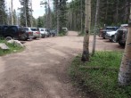
2/18/2010 Posted On: 2/18/2010 By: RoanMtnMan Info: Car transport ends at the junction with CO 121. About 1/4 mile below the 2wd parking. | ||||
1/23/2010 Posted On: 1/24/2010 By: piper14er Info: No surprise the road above the 2wd parking is drifted in and then plenty of snow above the second cattle guard. Needed 4wd to get from the road below the last 1/4 mile to the parking. | ||||
11/16/2009 Posted On: 11/16/2009 By: killingcokes Info: Gate in place at 1st creek. Went up via snowmobile. We could only drive the truck to just after the cattle gate down low. | ||||
10/3/2009 Posted On: 10/3/2009 By: TravelingMatt Info: A sign at the first stream corssing states the upper road will be closing for good on October 13th. Hurry, you have 9 days left! 8...7... | ||||
8/18/2009 Posted On: 8/18/2009 By: Thunder Dan Info: I got a Kia Spectra and my friend driving behind me got a Toyota Camry approximately 1.8 miles beyond the "4WD" sign on 8-7-08. The main thing that was required was very slow and careful driving to get this far. I let several high clearance vehicles pass me en route. However, at approximately 1.8 miles in, or about 0.2 mi before the Rainbow Trail crossing, I reached an obstacle(a steep hill with rocks and loose dirt that I could not get over unless I had a running start, which I was unwilling to do because of numerous rocks below this hill). There was a nice pull-out just below this hill big enough for two vehicles and my friend and I parked here and walked the rest of the way up. It was useful for our situation to get this far in a 2WD vehicle because we reached a reliable water source within 0.5 miles at the first stream crossing. Had we parked at the 2WD trailhead, we would have had to walk a rather hot and dry 2.3 miles to get to a water source. This road really is a rocky 4WD road the entire way, and I would plan on having plenty of water when I arrive at the 2WD trailhead if I only have a 2WD car. | ||||
7/24/2009 Posted On: 7/24/2009 By: denvermikey Info: Aug 11th to Sep 11th this year, the upper part of the road (just past the 1st creek crossing) will be closed during the week for construction. On Monday thru Friday, the road will be closed from 7:30am-5:30pm. There will be brief periods allowing vehicles through at 10am, 12:30pm, & 3:30pm. If you are traveling the road between 5:30pm and 7:30am, it will be open. | ||||
7/21/2009 Posted On: 7/21/2009 By: James Scott Info: The road up to South Colony is, in my opinion, much worst than last year. Last Sept, I drove my CRV to the trailhead, surprised at how easy it was, and I never bottomed out. On 7/21/09 I tried to make the same drive in the same vehicle, and it was disasterous. It was dark, so I pushed farther than I should have, but eventually stalled out on a steep section covered with loose gravel. I bottomed out a few times before giving up 1.6 miles from the trailhead. On the way down, I was stunned at what I made it past the night before. I had no business being there in a CRV. My recommendation is a CRV type vehicle could make it to the river crossing with come creative driving, but after that, it is truly a 4x4 road. Nasty. | ||||
7/6/2009 Posted On: 7/6/2009 By: Unknown Info: I was there a month ago and regretted not taking my 2wd up to S. Colony Creek b/c the road was in such good shape. Do not have any illusions now about taking a Kia Sephia up a couple of miles unless you want to trash it. Road is open all the way but very bumpy and rocky- it will take plenty of time even in a good 4wd to get to the TH. | ||||
6/11/2009 Posted On: 6/11/2009 By: JB99 Info: Clear of snow all the way to the 4wd trailhead. Cars can drive at least 2 miles in on the 4 wheel road which was demonstrated by a compact Kia Sephia today. | ||||
5/30/2009 Posted On: 5/30/2009 By: Nelson Info: I was able to drive about 4.2 miles from the 2wd trailhead and was stopped by major snow drifts. 2 people got across the stream that stopped me and got about .1 miles further. This will only change gradually over the next week or two | ||||
5/27/2009 Posted On: 5/27/2009 By: Alan Ellis Info: Talked to Ranger Jeff Outhier from Westcliffe yesterday. South Colony road will be open all summer, but closed permanently in October 2009 just past the Rainbow TH. | ||||
5/22/2009 Posted On: 5/22/2009 By: dubsho3000 Info: I drove my forester 3.8 miles past the first private property sign (and parking area). This is 1.2 miles past the first stream crossing. We saw a Dodge Ram truck stuck in some mud, but this is avoidable. They turned around in an unlucky spot. There is a tree down at 10,650‘ on the road (not far from where I parked) and I think it will need a chain saw and/or strong arm. | ||||
5/12/2009 Posted On: 5/12/2009 By: tmahon Info: As of 5/10 the road is drivable for about 1.9 miles from the 2wd parking, to just below the Rainbow Trail. | ||||
4/25/2009 Posted On: 4/25/2009 By: darklich14 Info: Was able to make it to about 9100‘ on S Colony Rd. Hiked 500 yards in mud/dirt/snow mix. From there, about 4 more miles of snow. Snowmobile/snowshoe access only. Didn‘t have snowshoes, and it was not pleasant. South Colony Creek is melting fairly well, so be prepared with waterproof shoes. | ||||
11/24/2008 Posted On: 11/24/2008 By: George Kaplan Info: The road is still mostly clear dirt for the first mile, then quickly alternates between snow and super-slick ice. The icy portions are in pretty large patches. The major creek crossings are iced over with a thin layer of what I thought looked like 12 inches at the deepest. I don‘t have a lot of experience with 4WD vehicles, but I couldn‘t see how any vehicle could make it all the way to the 4WD TH. I just parked at the 2WD TH and hiked the whole way in. Will try to get a trip report up soon under Humboldt Peak with some photos. |


