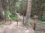
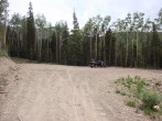
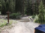
5/15/2023 Posted On: 5/16/2023 By: aksean22 Info: Dry to 9,800' - about 3.25 miles from the summer TH. Patchy snow drifts for another 1/4 mile that I did not attempt to drive through, then continuous snow the rest of the way to the TH. | ||||
5/9/2023 Posted On: 5/10/2023 By: Kya Cav Info: El Diente Luttrell Line: 5/9/23. Drivable to about 9,700 feet then started skinning about 1/4 mile further. Will likely be melted out up to 10,000 ft road intersection within a week. Skied pow off the summit around 9:45 and crossed the Fox soon after. Perfect timing for that upper section. Bottom half of the NW couloir was still very frozen. Would have take a few more hours to soften up. Great coverage throughout the route. | ||||
4/30/2023 Posted On: 5/1/2023 By: Kya Cav Info: Trailhead and peak conditions report for Wilson Peak via Silver Pick approach and NE face 4/30/23. Road is dry to 9,173 then good snow coverage rest of the way up. A few small spots will be melting dry and getting larger within the first 2 miles or so but otherwise good skinning all the way to Wilsons SW ridge. NE face is fading with a lot of exposed sidestepping from the top. The main couloir is sharky but still skiable. The exit chutes are starting to close out and definitely recommend getting eyes on those from Silver Pick Road before committing to the decent. | ||||
9/3/2022 Posted On: 9/7/2022 By: E_A_Marcus_949 Info: Creek crossing minimal. Some deep ruts driving in but easy to avoid. Big parking area - front-in parking only. A few dispersed, marked campsites along the road in. Portapotties are tipped over and not usable. | ||||
8/27/2022 Posted On: 8/30/2022 By: donovanrice Info: Portapotties are tipped over, so don't plan on using them. | ||||
8/21/2022 Posted On: 8/23/2022 By: TheSpaceForce Info: 8/21/22: To add to previous post - approaching the trailhead, there are some left-overs from a downed tree near the start of the first rut. We got distracted avoiding this and completely messed up the tire position with respect to the rut. With recent rains the road was muddy, and the creek was probably 2-3 inches deep and 1.5 car-lengths across. We were able to get the 2WD CRV to the trailhead with only one or two stressful moments. | ||||
7/18/2022 Posted On: 7/18/2022 By: Istoodupthere Info: 8.5 miles off 145 to the trailhead. Had a Kia Soul rental (not by choice) with 6.7 inches of clearance and I made it fine to the TH. Creek crossing not an issue. There is a large rut in the middle of the road on both sides of the creek that could become an issue in the future with more rain. | 2 |
|||
7/14/2022 Posted On: 7/14/2022 By: jwagz13 Info: Road is clear. Small trickle of water 4-6 inches (maybe) about 1 mile from TH. | ||||
7/9/2022 Posted On: 7/13/2022 By: ltlFish99 Info: road us dry, and in good shape yo the trailhead. The creek crossing was trivial, withe water 4 to 6 inches deep at most. i agree with another update that states some of the trees that were cleared kind of encroaching on the road passage. i came close to hitting one with the front dide of ny vehicle. They do not blick the road , just something yo watch out for. | ||||
7/9/2022 Posted On: 7/13/2022 By: ltlFish99 Info: road us dry, and in good shape yo the trailhead. The creek crossing was trivial, withe water 4 to 6 inches deep at most. i agree with another update that states some of the trees that were cleared kind of encroaching on the road passage. i came close to hitting one with the front dide of ny vehicle. They do not blick the road , just something yo watch out for. | ||||
7/9/2022 Posted On: 7/13/2022 By: ltlFish99 Info: road is dry, and in good shape to the trailhead. The creek crossing was trivial, with the water 4 to 6 inches deep at most. i agree with another update that states some of the trees that were cleared kind of encroaching on the road passage. i came close to hitting one with the front side of my vehicle. They do not block the road , just something to watch out for. | ||||
7/8/2022 Posted On: 7/9/2022 By: bosnian2014 Info: All clear to trailhead. Plenty of crossovers at the trailhead, various brands and models. I even saw a Corolla ~ 1.25 miles from the trailhead (right before drop into water crossing). That probably took some above average driving skill. Some of the cleared trees are still kind of encroaching the road as you get close to TH - I was glad I had just enough daylight when I was driving in the evening. Something to keep an eye on if driving to the trailhead at night. | ||||
6/29/2022 Posted On: 6/30/2022 By: jackjk1011 Info: All downed trees mentioned by Bill have been cleared. IMO any crossover with a reasonably competent driver should have no problems getting to this trailhead. The road contains some mild to moderate rocky spots, ruts, potholes, and of course the water crossing, but I had no issues whatsoever in a Kia Sorento. There are campsites along the road not far from the trailhead. | ||||
6/7/2022 Posted On: 6/7/2022 By: BillMiddlebrook Info: Road is dry but you cant quite get to the trailhead yet because of a dozen trees over the road on the final 1/2 mile. No problem, there are places to pull off the road at or below that point as well as some camp spots further down the road. Hopefully the USFS will get the end of the road cleared soon but until then the downed trees werent too much of a hassle, just an extra mile round trip. | ||||
5/11/2022 Posted On: 5/11/2022 By: Kiefer Info: I didn't climb anything. I just drove up to the TH to check it out for a trip in a couple weeks to gauge conditions. Road is clear & open to the trailhead. Road is in decent enough shape, at least for a Subaru Crosstrek. Lots of downed trees, branches & such from the recent wind event. There is a downed tree crossing the road at mile 5.7 (from the bridge/creek crossing just off hwy. 145). It's elevated above the road. Cars can pass underneath but trucks won't be able to without assistance. I stopped at mile 6.7 due to a snow drift. People have driven though it, but without good tires, I didn't want to chance it. Past the drift, the road was clear again. | 3 |
1 |


