
Log In 
 FAQ

Uncompahgre Peak - Highest 14er in the San Juans

9 miles northwest of Lake City, Uncompahgre Peak is located in the Uncompahgre Wilderness, in the northern San Juan Mountains. The Ute word Uncompaghre loosely translates to "dirty water" or "red water spring" and is likely a reference to the many hot springs in the vicinity of Ouray, Colorado. Uncompahgre isn't easily seen from paved roads so full views of the peak are reserved for those who climb it or surrounding peaks.

Climbing the standard route on Uncompahgre isn't too difficult since it's Class 2 but you'll need to either walk or drive the rugged 4WD road to reach the Nellie Creek Trailhead. From the 4WD trailhead, the hike to the summit is 3,000 feet of elevation gain and 7.5 miles roundtrip. It's a beautiful hike with spectacular views from from Uncompahgre's broad, flat summit.
  360° Panorama from the summit of Uncompahgre Peak.
360 Pano

Uncompahgre seen from Wetterhorn Peak.
pic1
Uncompahgre and Wetterhorn Peaks.
pic2
Uncompahgre from tree line.
pic3
Wetterhorn and Uncompahgre from Slumgullion Pass.
pic4
Taken during a hike on Uncompahgre.
pic5 pic6 pic7 pic8 pic9 pic10 pic11 pic12 pic13 pic14 pic15 pic16
Wetterhorn Peak (far left) and Uncompahgre Peak seen from Handies Peak.
pic17
Wetterhorn Peak and Uncompahgre seen from Slumgullion Pass.
pic18
Uncompahgre seen while hiking Redcloud and Sunshine.
pic19 pic20 pic21 pic22 pic23 pic24 pic25 pic26 pic27 pic28 pic29
Hiking Uncompahgre Peak.
pic30 pic31 pic32 pic33 pic34 pic35 pic36 pic37 pic38 pic39 pic40 pic41 pic42 pic43 pic44 pic45 pic46 pic47 pic48 pic49 pic50 pic51 pic52
Uncompahgre from Wetterhorn Peak.
pic53 pic54 pic55
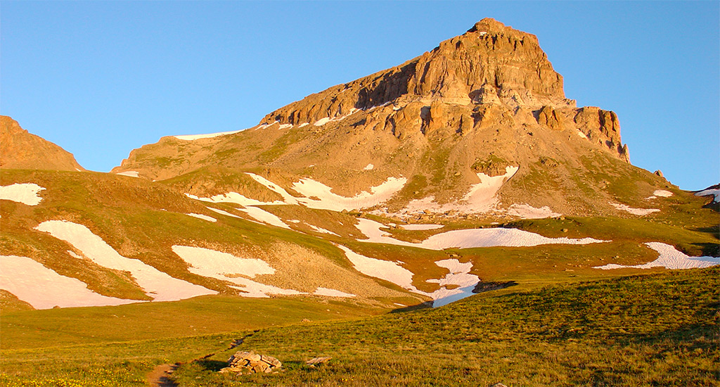
Uncompahgre at sunrise.
pic56
Hiking Uncompahgre Peak.
pic57 pic58 pic59 pic60 pic61 pic62 pic63 pic64
Uncompahgre from Redcloud Peak.
pic65
Uncompahgre from Slumgullion Pass.
pic66 pic67

Member-Contributed Photos


 Upload a Photo

Frequently Asked Questions about Uncompahgre Peak

 Top

How did Uncompahgre Peak get its name?

The name Uncompahgre is pronounced "un-come-pah-gray". It originates from a Ute Indian word that loosely translates to "red water spring," "dirty water," or "where water makes rock red". This name historically refers to the natural, mineral-rich hot springs located in the surrounding San Juan region (such as near nearby Ouray) that stain local riverbeds a distinct reddish color.

How difficult is the vehicle access via Henson Creek Road?

Henson Creek Road (County Road 20) out of Lake City is a standard dirt road that is generally easy and accessible to normal 2WD vehicles and passenger cars during summer. However, the actual challenge is the 4-mile turn-off onto Nellie Creek Road (#877) to reach the upper standard trailhead. Nellie Creek Road is a rough, narrow 4WD track with two deep stream crossings that strictly requires a high-clearance 4WD vehicle; standard cars must park at the Henson Creek intersection and walk the extra 4 miles to the start of the trail.

Are there places to stay around Lake City if I don't want to camp?

Yes, Lake City sits just 5 miles east of the Nellie Creek turn-off and offers excellent indoor lodging alternatives to camping. The historic mountain town features a variety of local motels, rental cabins, bed and breakfasts, and rustic lodges catering directly to hikers. Because Lake City is a small mountain community and a major hub for the Alpine Loop, you should reserve your indoor accommodations well in advance for peak summer weekends.

Is the final summit push on Uncompahgre Peak dangerous?

While Uncompahgre is a non-technical Class 2 hike, the final 125-foot push right below the broad summit block gets quite steep and requires basic hands-on scrambling. The trail breaks through a cliff band via a short, eroded chute filled with loose rock and dirt. Hikers must take deliberate steps to avoid slipping or knocking rocks onto people below them, though the rock handholds are generally solid if you test them before pulling. But once you get above the loose section, the summit plateau is a breeze.