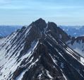
Hazel lake to sunlight lake via grizzly peak GPX track
Forum rules
- This is a mountaineering forum, so please keep your posts on-topic. Posts do not all have to be related to the 14ers but should at least be mountaineering-related.
- Personal attacks and confrontational behavior will result in removal from the forum at the discretion of the administrators.
- Do not use this forum to advertise, sell photos or other products or promote a commercial website.
- Posts will be removed at the discretion of the site administrator or moderator(s), including: Troll posts, posts pushing political views or religious beliefs, and posts with the purpose of instigating conflict within the forum.
For more details, please see the Terms of Use you agreed to when joining the forum.
-
Tweedie
- Posts: 19
- Joined: 5/19/2017
- 14ers: 7
- 13ers: 28
- Trip Reports (1)
Hazel lake to sunlight lake via grizzly peak GPX track
I’m heading into the Weminuche for 6 days on Saturday. I was wondering if anyone had a KML or GPX track of the route from Sunlight lake to Hazel lake. I know it normally crosses the pass west of grizzly peak, but which route is better north of that. Looks like a ton of elevation loss dropping down to the little unnamed lake north of Grizzly, is that avoidable? It also looks like a chose your own adventure between grizzly pass and Sunlight. Any recommendation or warning for that little area.

Re: Hazel lake to sunlight lake via grizzly peak GPX track
Interesting. I've not been into Sunlight basin yet, and I know Furthermore made a combo of Greylock and 121 with Grizzly-McCauley several years ago, but he didn't have a backpacking pack. I can tell you from my trip to get Jupiter, Grizzly and McCauley that the ridge did not appear especially "backpacking friendly." Looking at the topo and from my dim recollection of staring down into that tiny, beautiful area from Windom's summit in 2009, I don't think you can avoid the drop (certainly would not save any time). I think your best bet would be to aim for the northeastern edge of the pond labeled 12,235 on the topo, then angle SE as you ascend from there, before turning to gain the pass head on.
Alternately, you might consider touring additional basins with a trip over the pass north of Knife Point, then up and over Twin Thumbs between Eleven and Sunlight, to pick up the trail in upper Chicago basin over Columbine Pass.
Have a great trip!
Alternately, you might consider touring additional basins with a trip over the pass north of Knife Point, then up and over Twin Thumbs between Eleven and Sunlight, to pick up the trail in upper Chicago basin over Columbine Pass.
Have a great trip!
I have phenomenal route-finding abilities. Specifically, I have an uncanny knack for selecting the path of most resistance.
-
seano
- Posts: 836
- Joined: 6/9/2010
- 14ers: 56
- 13ers: 218
- Trip Reports (3)
- Contact:
Re: Hazel lake to sunlight lake via grizzly peak GPX track
It’s not *too* deep a hole — about 1000’ from the lake to the ridge, and if you’re going from Sunlight to Hazel, you’re taking the unknown terrain in the uphill direction. It probably goes, and might be unpleasant.
Why not just go back there and have an adventure? The Weminuche has more than enough “Kodiak High Routes.” Part of the joy of off-trail travel is learning to read terrain and figure things out.
Why not just go back there and have an adventure? The Weminuche has more than enough “Kodiak High Routes.” Part of the joy of off-trail travel is learning to read terrain and figure things out.

Re: Hazel lake to sunlight lake via grizzly peak GPX track
Here's a map with relevant bits of a Grizzly-Greylock connector: https://caltopo.com/m/AFJT9ST
You might save a tiny bit of elevation taking that saddle east of E Windom. The lake to the west is also nice.
No idea why the dogleg away from the lower bog on return, either marsh avoidance or hunting for water.
The route we took back over the Grizzly-Jupiter ridge was to stick to familiar terrain from earlier in the day--I don't know anything about the proper saddle 200' lower but it looks more rugged in lidar.

Re: Hazel lake to sunlight lake via grizzly peak GPX track
On my trip from Chi Basin to get Jupiter and Grizzly C, I gained the Jupiter - Griz ridge on the Jupiter side of the saddle at about 13,300. My memory is that the ridge from there provided good scrambling the whole way. I don't think the saddle provides respite from the scrambling. But my memories are also colored by the fact that I was having severe stomach problems that day.
"This route is awesome; you can bring all your favorite holds home with you!" - Cedar Wright
"Experience is the hardest kind of teacher. It gives you the test first and the lesson afterward." - Oscar Wilde
"I just wanna live the life I please; I don't want no enemies; I don't want nothing if I have to fake it
Never take nothing don't belong to me; everything's paid for; nothing's free; If I give my heart will you promise not to break it?" - Lucinda Williams
-
9patrickmurphy

- Posts: 324
- Joined: 7/16/2018
- 14ers: 55 1 2
- 13ers: 429 35 2
- Trip Reports (2)
- Contact:
Re: Hazel lake to sunlight lake via grizzly peak GPX track
The climbing Cooneys have a route on their website that gets at what you describe. This idea sounds terrible, in my opinion, but it's an option!
https://www.climb13ers.com/colorado-13e ... ly-peak--c
https://www.climb13ers.com/colorado-13e ... ly-peak--c
-
Tweedie
- Posts: 19
- Joined: 5/19/2017
- 14ers: 7
- 13ers: 28
- Trip Reports (1)
Re: Hazel lake to sunlight lake via grizzly peak GPX track
I am planning on some adventure on this trip. Just trying to do my best to know what I am getting into and avoiding some section that just don't go or cliff out too much. I'll probably do all or most of the Kodiak on this trip too.seano wrote: ↑Tue Jun 24, 2025 8:49 pm It’s not *too* deep a hole — about 1000’ from the lake to the ridge, and if you’re going from Sunlight to Hazel, you’re taking the unknown terrain in the uphill direction. It probably goes, and might be unpleasant.
Why not just go back there and have an adventure? The Weminuche has more than enough “Kodiak High Routes.” Part of the joy of off-trail travel is learning to read terrain and figure things out.

