Yes. Thanks for the summary.Boggy B wrote: ↑Mon Jun 26, 2023 10:05 am If you mean "designated on LoJ" then the qualification seems to be that the point was named in a written/published work.
That includes the unofficial Roach names, which is mainly the list used on this site. Roach assigned (arguably terrible) names to mostly unnamed ranked or (pre-LiDAR) soft-ranked points.
LoJ pulls unofficial designations from many sources, of which the largest contributor in western CO seems to be the 1932 SJM Mountaineers' Guide. Lavender and cohorts were rabid for technical ascents of largely insignificant towers and pillars, hence most of the unofficial designations from that volume (technically never published) are of technical summits with very little prominence.
LiDAR: Colorado 13ers and 14ers Completed
Forum rules
- This is a mountaineering forum, so please keep your posts on-topic. Posts do not all have to be related to the 14ers but should at least be mountaineering-related.
- Personal attacks and confrontational behavior will result in removal from the forum at the discretion of the administrators.
- Do not use this forum to advertise, sell photos or other products or promote a commercial website.
- Posts will be removed at the discretion of the site administrator or moderator(s), including: Troll posts, posts pushing political views or religious beliefs, and posts with the purpose of instigating conflict within the forum.
For more details, please see the Terms of Use you agreed to when joining the forum.
-
HikerGuy
- Posts: 1453
- Joined: 5/25/2006
- 14ers: 58
- 13ers: 499 8
- Trip Reports (9)
Re: LiDAR: Colorado 13ers and 14ers Completed
-
jkirk

- Posts: 89
- Joined: 7/19/2005
- Trip Reports (0)
- Contact:
Re: LiDAR: Colorado 13ers and 14ers Completed
Boggy B wrote: ↑Mon Jun 05, 2023 12:59 pm Prior to the LiDAR update, this was the note on the Castles East at LoJ. The analysis is interesting.I was long curious about this one, going back to the mid-2000s. The reason photo pixel analysis in 2008 didn't catch East Castles being so prominent actually stems from two mapping errors. The West Castle is also missing many contours, and when taken at face value from the map as used as a reference elevation, the results were highly skewed; GIGO (garbage in garbage out).LOJ wrote: Notes: Based on images comparing east to west summits, the East Castle summit is probably 30' lower than the West Castle summit. Here is a detailed analysis run by John Kirk using Geopix (Geopix software developed by Edward Earl).
-
KentonB
- Posts: 724
- Joined: 5/13/2007
- 14ers: 58
- 13ers: 64
- Trip Reports (3)
Re: LiDAR: Colorado 13ers and 14ers Completed
HikerGuy... Just checked and LiDAR analysis was completed on that point. The altitude was found to be 13,565 feet, with 210 feet of prominence.HikerGuy wrote: ↑Mon Jun 26, 2023 8:36 am This question may have been answered way back, but I can't remember if it was addressed. Was the elevation of the point 13,568 checked? It lies between 13,587(13,581) and 13,573(13,580). It had a Mike Garrett register on it and the height seems close to 13,573.
EDIT: Just saw this got answered on the other thread. Sorry for the duplication!
-
RyanSchilling

- Posts: 190
- Joined: 1/18/2005
- 14ers: 58
- 13ers: 256
- Trip Reports (1)
Re: LiDAR: Colorado 13ers and 14ers Completed
My copy of the SJM guide from CMC Press, with an ISBN and everything, seems published to me.Boggy B wrote: ↑Mon Jun 26, 2023 10:05 am 1932 SJM Mountaineers' Guide. Lavender and cohorts were rabid for technical ascents of largely insignificant towers and pillars, hence most of the unofficial designations from that volume (technically never published) are of technical summits with very little prominence.

Re: LiDAR: Colorado 13ers and 14ers Completed
Hm, no idea. My understanding was that due to Lavender's untimely death the volume was not published and existed only as a mimeograph. Did the CMC publish it in 2008? I see a CMC Press edition online with that published year. The copy I borrowed was an awful photocopy with a CSU hardcover binding and handwritten edits.

Re: Lidar: Colorado 13ers and 14ers Completed
There are two summits on the west?bdloftin77 wrote: ↑Tue Feb 14, 2023 2:27 pm
Too close to call ...
"The Citadel" Of the two competing summits on the west, the southern one is higher by a foot
According to my (unpublished) trip report, I reached the western of two high points, which I described as "the tip of a large pointed shard of rock."
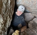
That might be the one shown in this pic (posted with MaryInColorado's 2022 trip report):
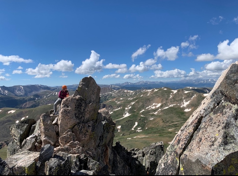
Does it sound like I reached the accepted summit? And is the second "summit on the west" the rock that is visible on the right side of Mary's photo?
My trip report further reminds me I did attempt to reach another high point about 200' ESE, but couldn't quite get to the top of it.
=============================================
https://listsofjohn.com/m/Candace+Skalet
https://peakbagger.com/climber/climber.aspx?cid=29263
https://listsofjohn.com/m/Candace+Skalet
https://peakbagger.com/climber/climber.aspx?cid=29263

Re: Lidar: Colorado 13ers and 14ers Completed
My trip report from a while back shows the different summits pretty clearly - scroll down about halfway to the section labeled "The Citadel (also known as East and West Citadel)" The one I referred to as the "furthest one" is, I believe, what's above called the "southern one" and the true summit.Candace66 wrote: ↑Sun Nov 12, 2023 8:23 pmThere are two summits on the west?bdloftin77 wrote: ↑Tue Feb 14, 2023 2:27 pm
Too close to call ...
"The Citadel" Of the two competing summits on the west, the southern one is higher by a footA pity I don't have any pics from my May 2000 ascent (a lot of my old 35mm prints were lost).
According to my (unpublished) trip report, I reached the western of two high points, which I described as "the tip of a large pointed shard of rock."
That might be the one shown in this pic (posted with MaryInColorado's 2022 trip report):
Does it sound like I reached the accepted summit? And is the second "summit on the west" the rock that is visible on the right side of Mary's photo?
My trip report further reminds me I did attempt to reach another high point about 200' ESE, but couldn't quite get to the top of it.
https://www.14ers.com/php14ers/triprepo ... m=tripmine
Re: Lidar: Colorado 13ers and 14ers Completed
OK, seems like people (or at least you, me, and MaryInColorado!) are in agreement about the highest point on "West Citadel."daway8 wrote: ↑Sun Nov 12, 2023 10:52 pm
My trip report from a while back shows the different summits pretty clearly - scroll down about halfway to the section labeled "The Citadel (also known as East and West Citadel)" The one I referred to as the "furthest one" is, I believe, what's above called the "southern one" and the true summit.
https://www.14ers.com/php14ers/triprepo ... m=tripmine
But there's still no certainty as to whether "West Citadel" or "East Citadel" is the summit of the mountain. You said, "my GPS put East Citadel a little higher than West Citadel but within the margin of error." This agrees with was said earlier in the thread: too close to call.
A little more from my 2000 report, talking about "West Citadel": "The [other people who summited before me] had mentioned that there are two high points but that this one appears slightly higher, and after getting there I agreed." I tried and failed to reach "East Citadel", but at the time I viewed it as "extra credit" and did not think it was higher.
Perhaps more people will weigh in.
Along those lines, I'm still wondering the same about Cirque Mtn (San Juans).
=============================================
https://listsofjohn.com/m/Candace+Skalet
https://peakbagger.com/climber/climber.aspx?cid=29263
https://listsofjohn.com/m/Candace+Skalet
https://peakbagger.com/climber/climber.aspx?cid=29263
-
dwoodward13
- Posts: 848
- Joined: 3/26/2011
- 14ers: 58 12
- 13ers: 170 6
- Trip Reports (1)
Re: Lidar: Colorado 13ers and 14ers Completed
I believe per LiDAR, the eastern summit was found to be higherCandace66 wrote: ↑Mon Nov 13, 2023 9:08 am Along those lines, I'm still wondering the same about Cirque Mtn (San Juans).I did not go over to the eastern high point due to incoming weather, though my notes indicate I thought it might be higher. My understanding is that the traverse is fairly easy, so if I'd had time to try, I should have made it. It's interesting that the old Garratt & Martin guidebook pointed people to the western high point, and that is traditionally where the summit register was.
-
HikerGuy
- Posts: 1453
- Joined: 5/25/2006
- 14ers: 58
- 13ers: 499 8
- Trip Reports (9)
Re: LiDAR: Colorado 13ers and 14ers Completed
The western tower (Class 3) was confirmed to be higher than the eastern tower (Class 4).
Discussion of LiDAR analysis: https://www.14ers.com/forum/viewtopic.p ... &start=396
Discussion of LiDAR analysis: https://www.14ers.com/forum/viewtopic.p ... &start=396
- citadel_summit.png (772.98 KiB) Viewed 3607 times
-
sunbleached

- Posts: 19
- Joined: 11/6/2023
- 14ers: 15 1
- 13ers: 55 7
- Trip Reports (0)
- Contact:
Re: LiDAR: Colorado 13ers and 14ers Completed
Do both anyway for fun times 
Climb For Revenge!
IG: @sunbleached_summits
IG: @sunbleached_summits
-
9patrickmurphy

- Posts: 323
- Joined: 7/16/2018
- 14ers: 55 1 2
- 13ers: 429 35 2
- Trip Reports (2)
- Contact:
Re: Lidar: Colorado 13ers and 14ers Completed
This is not true. Eyes are deceiving, GPS has substantial margins of error, but LiDAR is comparatively crazy accurate. If you're curious about twin summits and which one is higher, check the mountain's page on listsofjohn.com. Brad, John, Teresa, and more have spent tons of time scouring over all this LiDAR data that is as accurate and objective as anything we've ever had. They have listed notes on these pages when a summit is too close to call, if a summit moved from its previous location, or if summits were close but can still be confidently declared. In the case of "The Citadel", it is not too close to call; the west summit is definitively higher.

