Ah yes ... well an excuse to go back anyway.DaveLanders wrote: ↑Mon Feb 20, 2023 11:08 am"West Eolus" might be a ranked 13er; it's definitely not close to being a 14er.nmjameswilson wrote: ↑Mon Feb 20, 2023 10:56 am "Unranked to Soft-Ranked
"West Eolus": In the 298.5 to 299.4999 soft-ranked threshold and just shy of being ranked. Lidar likely missed the very top of the narrow summit, and this one is very likely ranked."
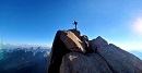
Look like I am heading back to Chicago Basin to get #59!
LiDAR: Colorado 13ers and 14ers Completed
Forum rules
- This is a mountaineering forum, so please keep your posts on-topic. Posts do not all have to be related to the 14ers but should at least be mountaineering-related.
- Personal attacks and confrontational behavior will result in removal from the forum at the discretion of the administrators.
- Do not use this forum to advertise, sell photos or other products or promote a commercial website.
- Posts will be removed at the discretion of the site administrator or moderator(s), including: Troll posts, posts pushing political views or religious beliefs, and posts with the purpose of instigating conflict within the forum.
For more details, please see the Terms of Use you agreed to when joining the forum.
-
nmjameswilson
- Posts: 321
- Joined: 9/7/2018
- 14ers: 58
- 13ers: 15
- Trip Reports (0)
- Contact:
Re: LiDAR: Colorado 13ers and 14ers Completed
-
bdloftin77

- Posts: 1215
- Joined: 9/23/2013
- 14ers: 58 1
- 13ers: 71
- Trip Reports (2)
- Contact:
Re: LiDAR: Colorado 13ers and 14ers Completed
To be on the safe side, I'm going back through any 13ers with known summit structures (towers, buildings, ruins, tall poles) to make sure the structures were excluded. Can anyone think of any others I could look at? So far I've checked the ones below:
Quail Mountain (cabin ruins)
Fairview Peak (fire lookout tower)
Horseshoe Mountain (old building)
Mt Eva (radio tower)
Tower Mountain (radio tower)
Kuss Peak (building/radio tower)
Peak 8 (small radio tower)
Peak 10 (large pole)
Clinton Peak (large pole)
Quail Mountain (cabin ruins)
Fairview Peak (fire lookout tower)
Horseshoe Mountain (old building)
Mt Eva (radio tower)
Tower Mountain (radio tower)
Kuss Peak (building/radio tower)
Peak 8 (small radio tower)
Peak 10 (large pole)
Clinton Peak (large pole)
Re: LiDAR: Colorado 13ers and 14ers Completed
I assume this one has been covered since its a centennial, but I understand that there is a rather large cairn on Phoenix. I haven't been there yet, though.bdloftin77 wrote: ↑Mon Feb 20, 2023 11:29 am To be on the safe side, I'm going back through any 13ers with known summit structures (towers, buildings, ruins, tall poles) to make sure the structures were excluded. Can anyone think of any others I could look at? So far I've checked the ones below:
Quail Mountain (cabin ruins)
Fairview Peak (fire lookout tower)
Horseshoe Mountain (old building)
Mt Eva (radio tower)
Tower Mountain (radio tower)
Kuss Peak (building/radio tower)
Peak 8 (small radio tower)
Peak 10 (large pole)
Clinton Peak (large pole)
I thought, I taught, I wrought
-
bdloftin77
- Posts: 1215
- Joined: 9/23/2013
- 14ers: 58 1
- 13ers: 71
- Trip Reports (2)
- Contact:
-
supranihilest

- Posts: 810
- Joined: 6/29/2015
- 14ers: 58 42
- 13ers: 744 2 8
- Trip Reports (121)
- Contact:
Re: LiDAR: Colorado 13ers and 14ers Completed
Hey Ben, how was Bartlett measured? There were two high point contenders a couple years ago, a pyramid which was clearly natural and another that was a two-tiered, mostly flat pile of overburden (they probably drove dump trucks on it) with what appeared to be a tiny bit of still-natural rock at the end (LoJ photo). This point was northwest of and visually higher than the pyramid but close enough to be questionable. The point on LoJ seems to line up with this as well, but LiDAR data was collected prior to my climb. I doubt the summit has changed since either event. Does this match your findings?

Re: LiDAR: Colorado 13ers and 14ers Completed
Interesting the range of different ratings people give - I've only done it from the Crestone side which is class 4. I did a quick review to see if I could recall where I got the 5.6 for the N Buttress side from - looks like one report took an odd bypass of NEC and came across a face they labeled as 5.6 - maybe that's where I got that number from? Don't remember for sure.
Anyways, if it's mostly 4th with a little easy 5th then that's all the more reason to go back and check out that direction - that's like perfect playground land for me with that rating on that kind of rock, whereas 5.6 would be probably pushing the limit of where I'd be comfortable alone and unroped on unfamiliar terrain.

Re: LiDAR: Colorado 13ers and 14ers Completed
I think this move is stature dependent. I am pretty comfortable on low 5th terrain and went down in the notch to check it out and poke around but backed off it this past summer. Not saying it is 5.6, but easy 5th is questionable as well. Maybe a reachy 5.4? It is only jthat one move to pull and then you hit another ledge and more angled (i.e. crestone needle headwall) C4 rock to the finish. If I had 6" more reach, I probably would have pulled it without thinking about it. Being reachy, slabby, and exposed, that was a spicy combo. Ended up doing a high traverse around and that worked out well, standard traverse on the ledge but shooting up at some point that I felt comfortable with instead of wrapping all the way around.

Re: LiDAR: Colorado 13ers and 14ers Completed
I'm not sure why people traverse around/up NE Crestone or who recommends that, but I think that accounts for why some people think it's 5.easy and some think it's harder.aholle88 wrote: ↑Mon Feb 20, 2023 2:31 pmI think this move is stature dependent. I am pretty comfortable on low 5th terrain and went down in the notch to check it out and poke around but backed off it this past summer. Not saying it is 5.6, but easy 5th is questionable as well. Maybe a reachy 5.4? It is only jthat one move to pull and then you hit another ledge and more angled (i.e. crestone needle headwall) C4 rock to the finish. If I had 6" more reach, I probably would have pulled it without thinking about it. Being reachy, slabby, and exposed, that was a spicy combo. Ended up doing a high traverse around and that worked out well, standard traverse on the ledge but shooting up at some point that I felt comfortable with instead of wrapping all the way around.
From the notch on the Crestone side, it's 4th class up the ridge to the summit of NE Crestone. From the notch on the N Buttress side, it's a couple moves of (fantastically exposed) 5.easy up a headwall to NE Crestone (which is what earns it the "easy 5th" rating).
The only traversing is when you scooch over to/from the Crestone/NE Crestone notch via the top of the NW couloir. I've never taken the lower ledge but people seem to not enjoy it.
[EDIT] Here's an extended discussion on the topic.
/derailment
-
bdloftin77
- Posts: 1215
- Joined: 9/23/2013
- 14ers: 58 1
- 13ers: 71
- Trip Reports (2)
- Contact:
Re: LiDAR: Colorado 13ers and 14ers Completed
Here's Bartlett as of fall 2019. The large light blue area is mainly flat. The NW point is higher at 39.37866,-106.15989 at 13347.667. The SE point is about 3' lower at 39.37743,-106.15782 13344.360. The NW point was sent to LoJ, but if you think that HP isn't natural and the SE point is, I can submit the SE point. Thanks!supranihilest wrote: ↑Mon Feb 20, 2023 1:57 pm Hey Ben, how was Bartlett measured? There were two high point contenders a couple years ago, a pyramid which was clearly natural and another that was a two-tiered, mostly flat pile of overburden (they probably drove dump trucks on it) with what appeared to be a tiny bit of still-natural rock at the end (LoJ photo). This point was northwest of and visually higher than the pyramid but close enough to be questionable. The point on LoJ seems to line up with this as well, but LiDAR data was collected prior to my climb. I doubt the summit has changed since either event. Does this match your findings?
- Bartlett
- Bartlett.png (578.3 KiB) Viewed 4301 times
-
supranihilest
- Posts: 810
- Joined: 6/29/2015
- 14ers: 58 42
- 13ers: 744 2 8
- Trip Reports (121)
- Contact:
Re: LiDAR: Colorado 13ers and 14ers Completed
Nope, that lines up with what we found up there! The northwest point was what we thought was higher. I think this came up before too, but I wanted to make sure that my mind wasn't playing tricks on me. Thanks!bdloftin77 wrote: ↑Mon Feb 20, 2023 3:32 pmHere's Bartlett as of fall 2019. The large light blue area is mainly flat. The NW point is higher at 39.37866,-106.15989 at 13347.667. The SE point is about 3' lower at 39.37743,-106.15782 13344.360. The NW point was sent to LoJ, but if you think that HP isn't natural and the SE point is, I can submit the SE point. Thanks!supranihilest wrote: ↑Mon Feb 20, 2023 1:57 pm Hey Ben, how was Bartlett measured? There were two high point contenders a couple years ago, a pyramid which was clearly natural and another that was a two-tiered, mostly flat pile of overburden (they probably drove dump trucks on it) with what appeared to be a tiny bit of still-natural rock at the end (LoJ photo). This point was northwest of and visually higher than the pyramid but close enough to be questionable. The point on LoJ seems to line up with this as well, but LiDAR data was collected prior to my climb. I doubt the summit has changed since either event. Does this match your findings?
Bartlett.png
-
LetsGoMets
- Posts: 399
- Joined: 9/9/2012
- 14ers: 58 5
- 13ers: 139 6
- Trip Reports (2)
Re: LiDAR: Colorado 13ers and 14ers Completed
East Crestone is a quick Class 3 scramble from the saddle between it and Crestone Peak. I would venture to say the vast majority of people do not climb it. We hit it when we were up there because it's a county highpoint.

Re: LiDAR: Colorado 13ers and 14ers Completed
For anyone so inclined, I believe I found a ranked summit in Utah that was missed on LoJ for some interesting reasons/topography.
Coordinates:
37.41811,-110.16284
The topo map is wrong, the creek/creek-bed actually cuts through the rock wall where the red line is marked (approximate). The big bed around hasn't been the creek-bed for probably thousands of years and is an interesting abandoned meander.

Here is a photograph from yesterday of where the creek cuts through the wall:

nterpolated rise should actually be 320', though this should be verified by LiDAR.
The saddle should actually be in the old creek bed somewhere to the west or northwest of the summit.
It's also interesting to look at Google Earth and see what's going on.

Zoom in where you can see the creek slicing through the rock wall:

Coordinates:
37.41811,-110.16284
The topo map is wrong, the creek/creek-bed actually cuts through the rock wall where the red line is marked (approximate). The big bed around hasn't been the creek-bed for probably thousands of years and is an interesting abandoned meander.
Here is a photograph from yesterday of where the creek cuts through the wall:
nterpolated rise should actually be 320', though this should be verified by LiDAR.
The saddle should actually be in the old creek bed somewhere to the west or northwest of the summit.
It's also interesting to look at Google Earth and see what's going on.
Zoom in where you can see the creek slicing through the rock wall:
I'm old, slow and fat. Unfortunately, those are my good qualities.

