Taken from the summit of Boreas Mountain,
1 provides a great overview of the up-and-down nature of this route. From the Boreas Pass parking area, locate the start of the trail near the north end of the railcar -
2. Follow the well-defined trail west through willows and up into a forest near the base of Point 12,029' -
3. After weaving up through the forest, the trail traverses left (south) before climbing to the top of Point 12,029' -
4. From the top of this point (
5), you cannot yet see Red Peak.
Your view to the west is of Point 12,331'. To gain this point, descend past a dangerous mine shaft, cross a broad saddle, and follow an old road to gain the north ridge on Point 12,331' -
6. Hike (Class 2) along the ridge to reach the top of the point -
8. Finally, you can see Red Peak. Before descending off of Point 12,331', hike south along its summit ridge for a few hundred yards. As seen in
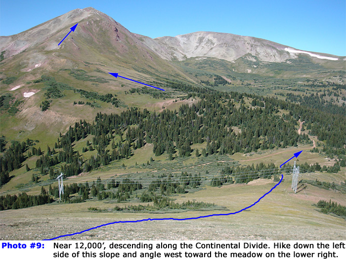
8, there are a line of cairns along the top. Once you reach the southern end of the point, turn right and begin your descent down to the saddle between this point and Red Peak -
9.
Descend 600' and angle slightly right (west-northwest) to pass under the lines just before a meadow and corner of a 4WD road ahead, shown in
9. After going under the power lines, hike through some trees and cross a meadow to reach the 4WD road on the saddle -
10. Once on the road, follow it west up into the trees. After less than 1/4 mile on the road, reach a fork in the road; stay left and continue south over a small hill in the trees. Just above 11,800', leave the trees to see much of the remaining route -
11. Continue on the road all the way to its end at 12,200' on Red's northeast ridge.
12 provides an overview of the area and the end of the road. The remainder of the hike is a bit more difficult, but still Class 2.
Pick your line and hike directly west up the northeast ridge. There's some loose rock in the area, but it's easily avoidable. Begin climbing.
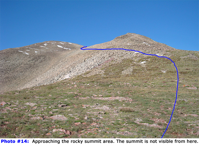
13 was taken along the ridge. After approximately 600' of gain on the ridge, the pitch eases and the top of the mountain comes into view -
14. From this area, you can see two points, but neither is the true summit. Hike up to first point and locate a faint trail that crosses left in front of the point and heads toward the terrain between the two points -
14. After passing the first point, enter a rocky bowl between the two points where you can finally see the summit -
15. Continue west through the bowl to reach the base of the final pitch -
16. There's no trail here, so pick your line to reach the summit. The easiest terrain is by going left or right to reach the ridge on either side of the summit and then hiking up to the top.
17 and
18 are views from the top.


 GPX Track File
