Log In 
Difficulty
 Class 2 
Risk Factors
ExposureModerate
RockfallConsiderable
Route-FindingModerate
CommitmentModerate
Trailhead
Iowa Gulch 12,100 feet
Summit
13,861 feet
Elevation Gain
1,775 ft
Length Round-TripRT
3 mi
Peak Conditions
Downloads
Photo
Show More
Route Last Updated: Apr 2023

Trailhead

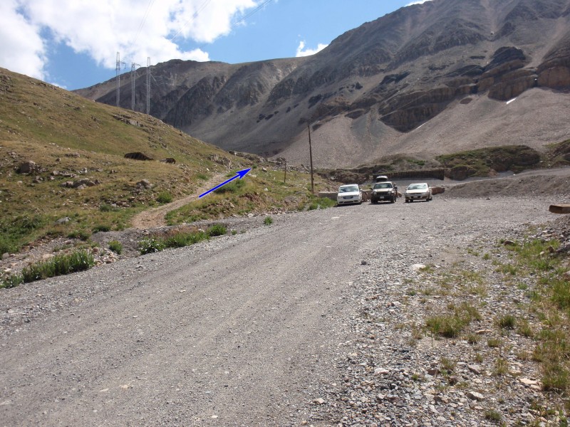
Take US 24 through downtown Leadville to the southern end of town. Turn east onto Monroe Street and drive 0.2 miles. Turn right (south) on Lake County 2 (Toledo St). Follow CR 2 (paved) for approximately 3.8 miles to a fork in the road. Turn left on a 2WD dirt road and continue 3.0 miles up into Iowa Gulch to the trailhead. A total of 7 miles from US 24 in Leadville. The trailhead is unmarked - park along the road. If you're hiking Mts Sherman or Sheridan, locate the trail (below the edge of the road) as it heads toward the creek under the power lines.

Route Description

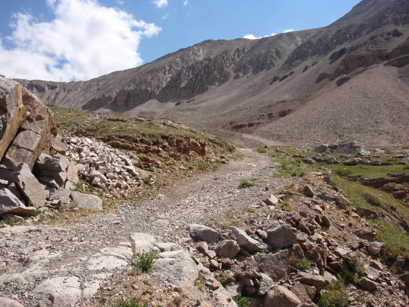
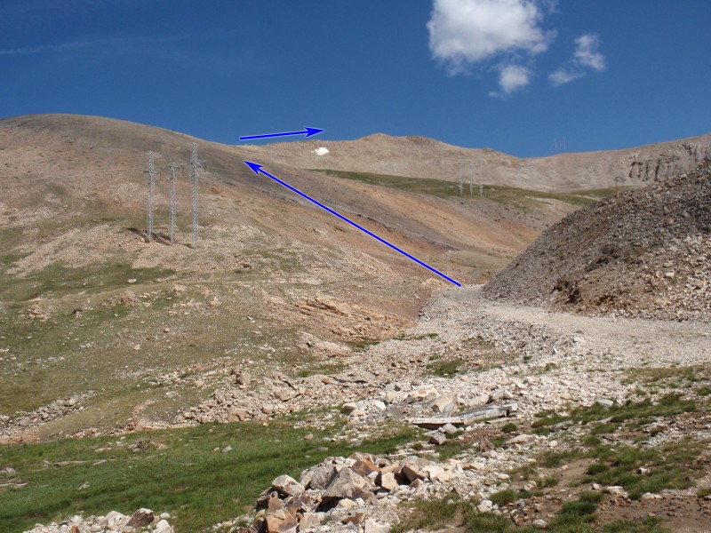
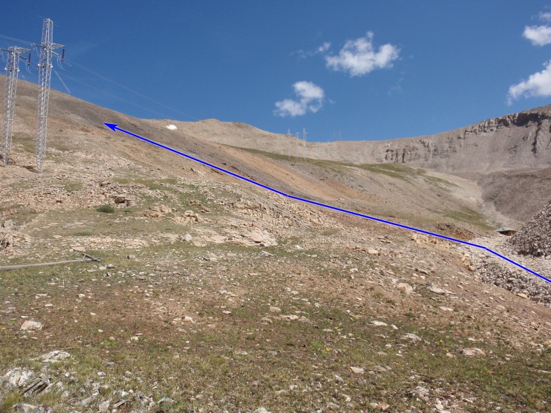
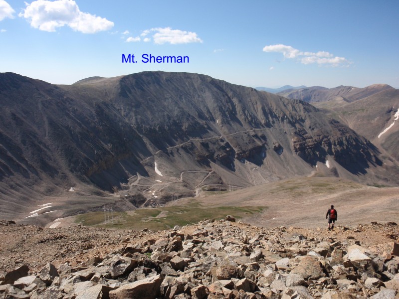
Drive up the Iowa Creek 2wd road all the way to a small parking area (12,100') where you should find the remainder of the road blocked. Taken from 13er Mt. Sheridan,  1 is an overview of the entire route. Leave the parking area and walk east up the road ( 2) leading to the mines in the upper Iowa Amphitheater. Continue ( 3 and  4) up to 12,600' and look for an easy spot to leave the road, before reaching the first mine building -  5.

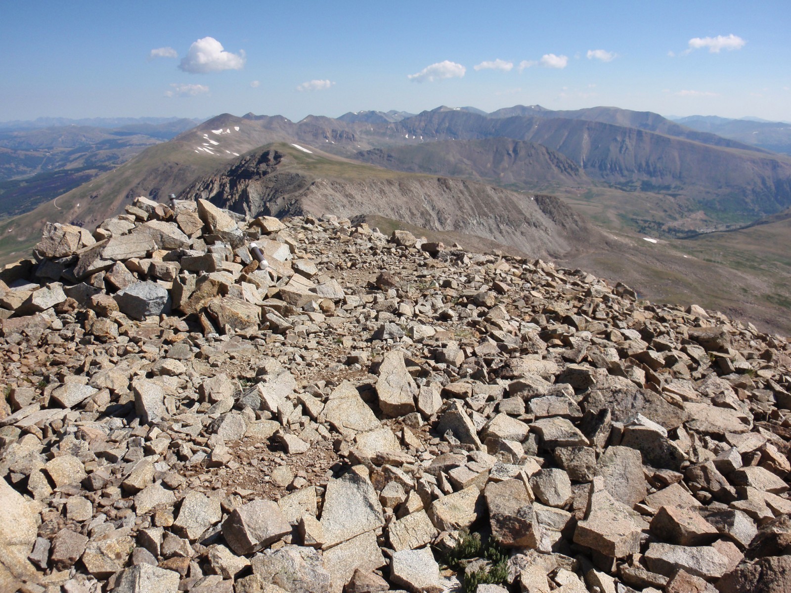
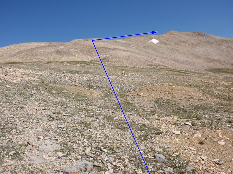
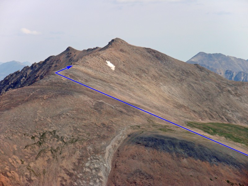
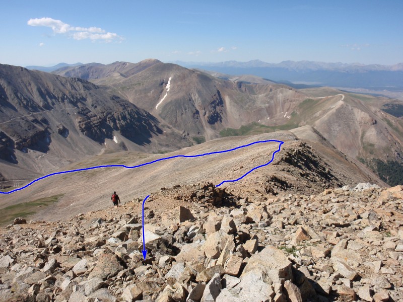
Leave the road and begin hiking west up Dyer's southeast slopes -  6 and  7. Reach easier terrain near 13,200' ( 8) and continue up to the crest of the south ridge - 9 and  10. Turn right (north) and follow the rough ridge ( 11 and  12) to the summit -  13,  14 and  15.

Maps

JPG Image
Static Map JPG
Interactive Map & 3D Flythrough
Human Verification Required

Photos

#1#2#3#4#5#6#7#8#9#10#11#12#13#14#15

Weather

Caution: The information contained in this route may not be accurate and should not be the only resource used in preparation for your climb. Failure to have the necessary experience, physical conditioning, supplies or equipment can result in injury or death. 14ers.com and the author(s) of this route provide no warranties, either express or implied, that the information provided is accurate or reliable. By using the information provided, you agree to indemnify and hold harmless 14ers.com and the route author(s) with respect to any claims and demands against them, including any attorney fees and expenses. Please read the 14ers.com Safety and Disclaimer pages for more information.

Copyright: Route information, text, risk factors, maps, GPX files, charts, photos, 14ers.com-created map imagery, flythroughs, and other content provided in this route description are copyrighted by 14ers.com and may not be copied, reproduced, republished, distributed, modified, or used to create derivative works without prior written permission.

Please respect private property: 14ers.com supports the rights of private landowners to determine how and by whom their land will be used. In Colorado, it is your responsibility to determine if land is private and to obtain the appropriate permission before entering the property.

Heading to a 14er soon? Don't forget the 14ers.com mobile app.
Google Play     Apple App Store