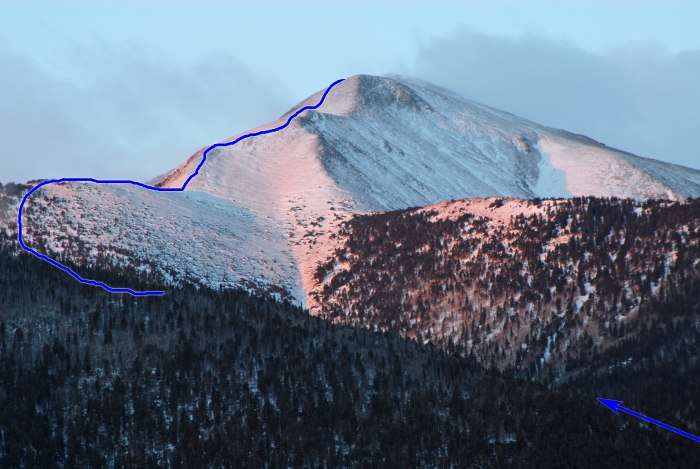
Taken from the northeast,
1 and
2 show Spread Eagle's east ridge and some of the route. From the trailhead (
3), follow the trail west along fenced, private property to reach a trail junction -
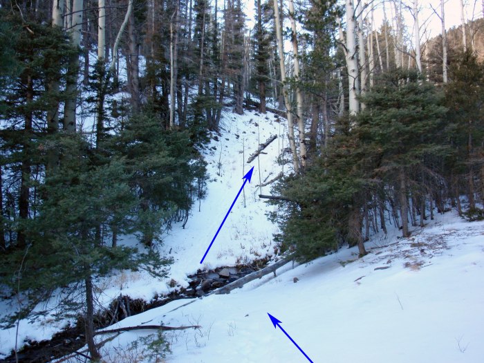
4. Do not turn left or right on the Rainbow trail - continue straight towards Gibson Creek. Hike another 0.3 mile, cross the creek near 9,400' (
5) and continue west -
6. After 0.75 mile the trail curves left as you continue higher into Gibson Creek -
7. To reach the east ridge, pick your turn-off by leaving the trail and climbing south up through the forest -
8. You won't find a trail leading up to the ridge so be prepared for some steep hiking in the trees. Hike south to reach the crest the east ridge -
9.
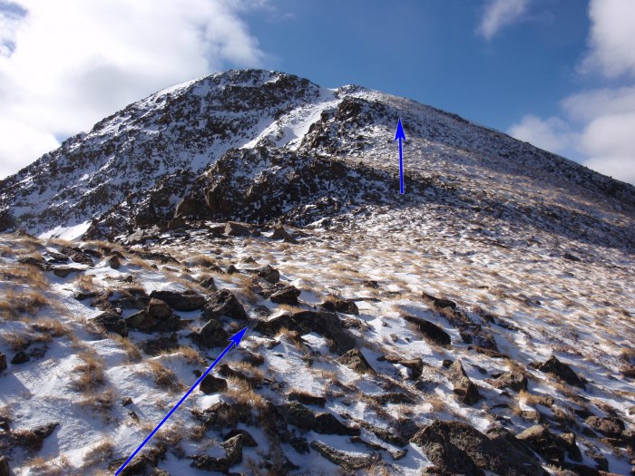
Turn right and continue southwest up the forested ridge to reach tree line, near 11,800' -
10. The ridge narrows (
11) as you approach 11,900' and the views open up to the south and southwest -
12. Turn right and follow the defined ridge west-northwest as the remaining route comes into view (
13), near 12,000'. Continue to a saddle at 12,100' (
14) and terrain that's a bit more difficult -
15. Stay near the ridge crest and continue higher (
16 and
17) to reach a broad, flat area below a distinct point on the ridge -
18. Sorry, it's not the summit.
From 12,700', hike 400' to reach the top of the point and a view of the upper east ridge -
19. The remaining ridge is rugged but not as bad as it first appears. Continue west along the ridge (
20) and bypass a few rugged portions on the right to reach the final pitch -
21. Climb up to the summit -
22.


 GPX Track File


