Download Agreement, Release, and Acknowledgement of Risk:
You (the person requesting this file download) fully understand mountain climbing ("Activity") involves risks and dangers of serious bodily injury, including permanent disability, paralysis, and death ("Risks") and you fully accept and assume all such risks and all responsibility for losses, costs, and damages you incur as a result of your participation in this Activity.
You acknowledge that information in the file you have chosen to download may not be accurate and may contain errors. You agree to assume all risks when using this information and agree to release and discharge 14ers.com, 14ers Inc. and the author(s) of such information (collectively, the "Released Parties").
You hereby discharge the Released Parties from all damages, actions, claims and liabilities of any nature, specifically including, but not limited to, damages, actions, claims and liabilities arising from or related to the negligence of the Released Parties. You further agree to indemnify, hold harmless and defend 14ers.com, 14ers Inc. and each of the other Released Parties from and against any loss, damage, liability and expense, including costs and attorney fees, incurred by 14ers.com, 14ers Inc. or any of the other Released Parties as a result of you using information provided on the 14ers.com or 14ers Inc. websites.
You have read this agreement, fully understand its terms and intend it to be a complete and unconditional release of all liability to the greatest extent allowed by law and agree that if any portion of this agreement is held to be invalid the balance, notwithstanding, shall continue in full force and effect.
By clicking "OK" you agree to these terms. If you DO NOT agree, click "Cancel"...
Mileage: 7.67
Elevation: +4,339 -3,834
Starting Trailhead: Kendall Gulch Rd by Titusville site
Ending Trailhead: Deer Park by Montana Mine
Saved the best peaks for last. Or at least the best views for last. After a full weekend of staring at the Weminuche peaks, now we would be on some of the closest peaks to the north of them. Plus with 2 vehicles, we would be able to set up a traverse. My first "successful" car shuttle traverse! Very excited. Though I'm sure Bob didn't like the ride in my tiny jumper seat of my truck on the return...
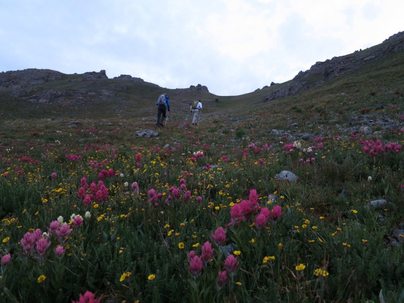
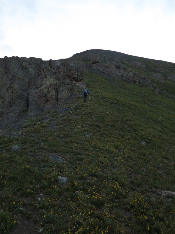
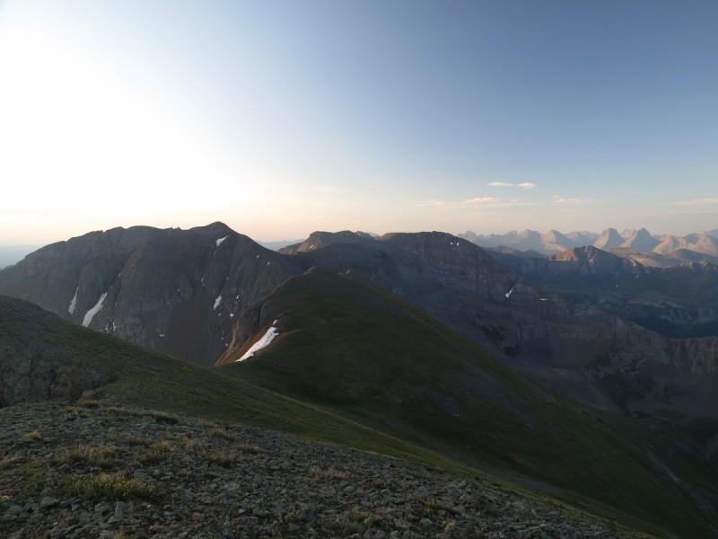
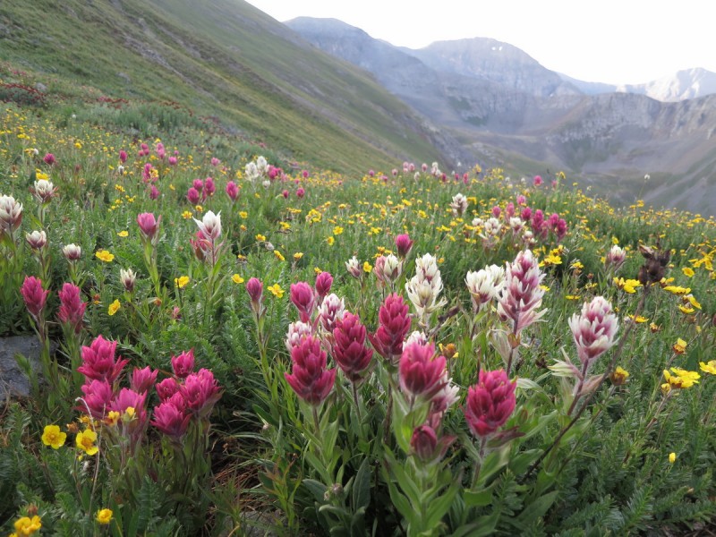
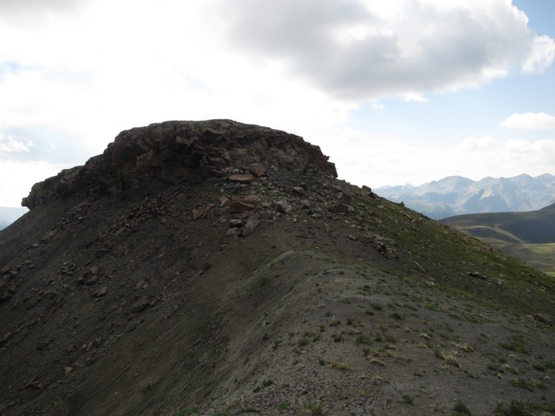
So after setting up our vehicles, we start out at the Titusville mine site, at the junction of the road up to Kendall Benchmark (which we scurried up at 3K/hr the evening before). We followed the obvious flower gully up to the saddle, and then went up the ridge to the summit. It seemed easier than Furthermore's direct assault on the face slope. Plus there were pretty flowers to enjoy!
Strawberry fields forever... Ridge up to Kendall Mountain
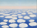
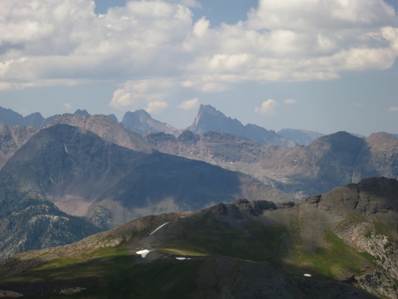
Arrived on the summit to see my fourth sunrise of the trip! Seeing the peaks light up with the first rays of sunlight is so magical! It makes getting up that early, each day worth it.
Sunrise #4 Our route to the south Day #4 of Weminuche viewing
After a brief respite, we head back down the same way to enjoy the flowers some more, before we walk up the road to the mine.
Heading down, with Kendal BM in background San Juan flowers More pretty flowers to stop and enjoy
As we approach the mine, we are greeted my gunshots of a guy target practicing. As soon as he noticed us approaching from behind, he thankfully ceased. I bet he thought he would be alone this early in the morning!
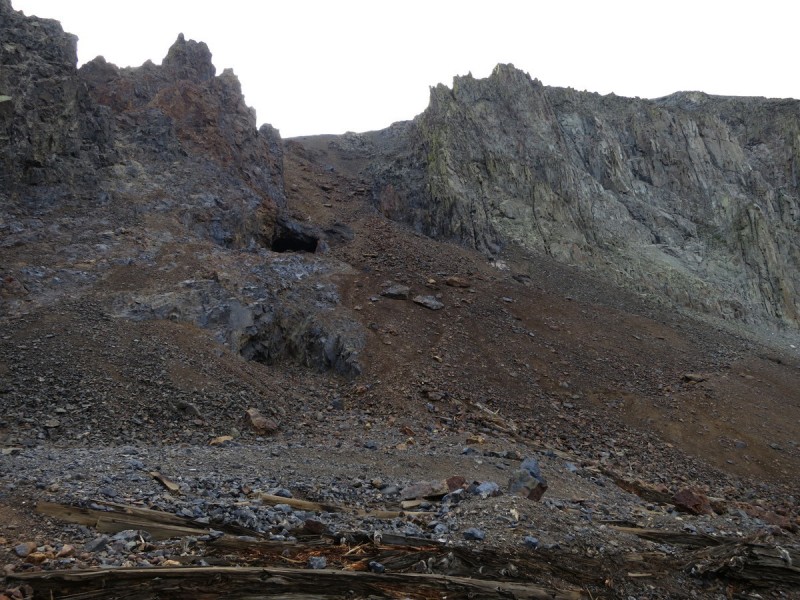
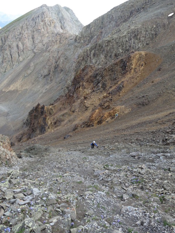
We all knew the ascent of the gully would suck, and it did. It's a fairly standard San Juan scree junk show. Very loose and friable rock awaits. Though you do have options once you round the choke point. I chose the slightly more solid class 3 rock ascent on the far right. Kate went middle with the larger blockier talus, and Bob went far left on the scree. This way we didn't send rocks down on each other, as it was almost impossible to avoid at that slope angle. But we made it, and the final ascent from the saddle to Kendall Peak was much easier.
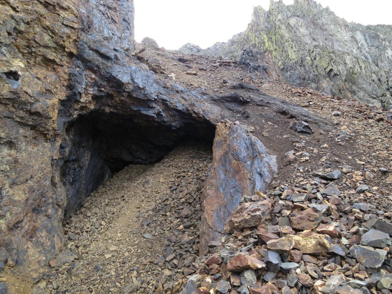
The craptastic slope by the mine The mine kinda looks like a mouth... Our 3 paths up gully
Bit more scrambling on right - Photo credit: Bob
Last section up gully - Photo Credit: Bob
After another short break, we decided to not drop the opposing scree gully, like Furthermore did. Instead we followed the ridgeline to the same saddle where we spotted 2 "trails" that crossed the scree slope. At first the upper trail looked more enticing, but as soon as we got closer, the lower one looked better. So for future reference, the lower trail that starts from the saddle and goes above the grass is the best option at this point. Also, for those who do not want to ascend the mining scree slope, there are other "trails" (game trail or human - unknown) from other basins to get you to Kendall Peak. Though our way was the closest to the road. Pick your own route!
Descending Kendall Peak
Looking for the "easy way" - Photo Credit: Bob Route through talus starting at saddle Looking back at Kendal Peak and the "trail" across the talus field
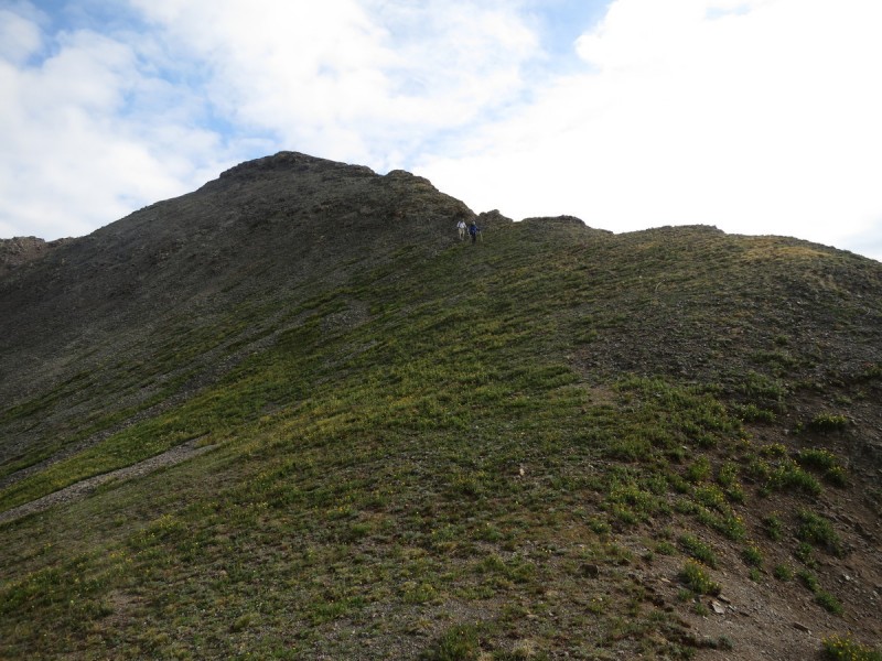
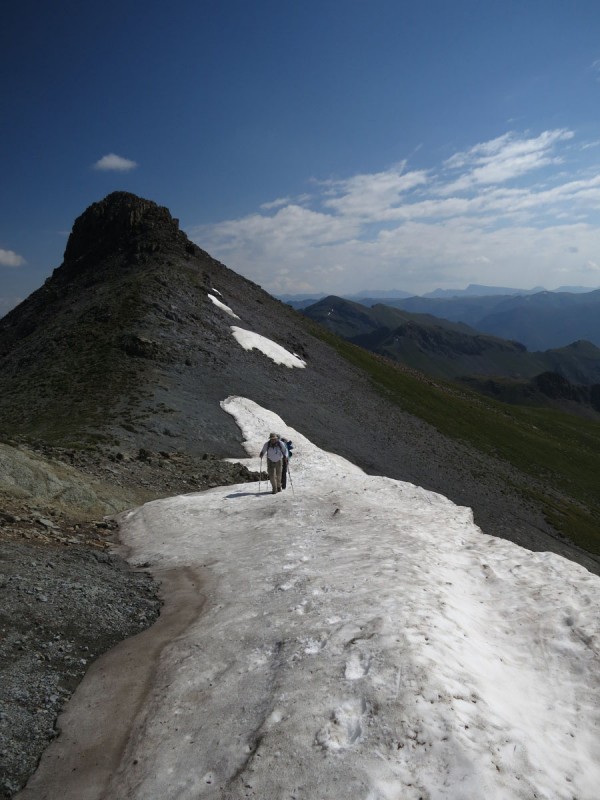
Once around the unnamed unranked unrecognized bump in our path, we skirt the other side on tundra to find a way up to our next peak Pt 13,434. We could have avoided the bump on the ridge before Pt 13,434, but that snow looked so tempting, I had to climb it! So yeah, sorry Fincutters for making you go up an extra 100'
Grassy Slopes with Little Giant behind Yes, we did a "snow climb" up some super unranked bump
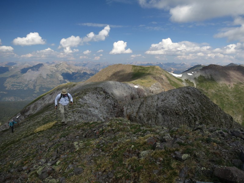
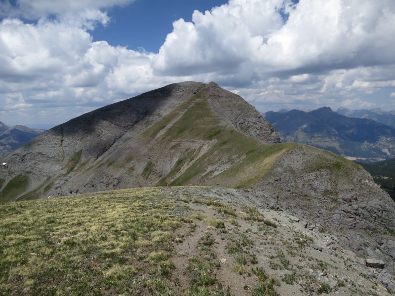
From there, it was a simple ridge run for the last 4 peaks. From a distance Mt Rhoda looked like it may be fun, and I was excited to get closer and find out!
The Finns climbing the last part of 13,434 Looking at the last 3 peaks of the day Mt Rhoda
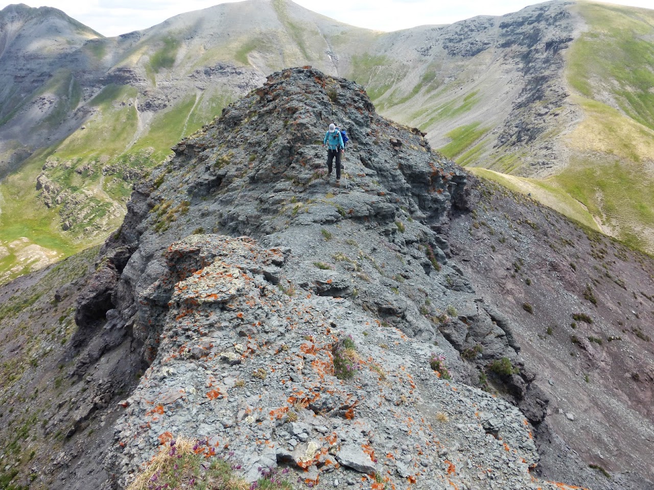
As we got closer to Mt Rhoda, it looked like we may actually get to scramble! There are plenty of options, from overhanging class 5 to class 2 if you want to punt completely. So we found a nice class 3/4 weakness in the summit rock, and then descended the class 2 option on our way to Whitehead Peak.
Summit of Mt Rhoda looking interesting! A little scramble to the summit
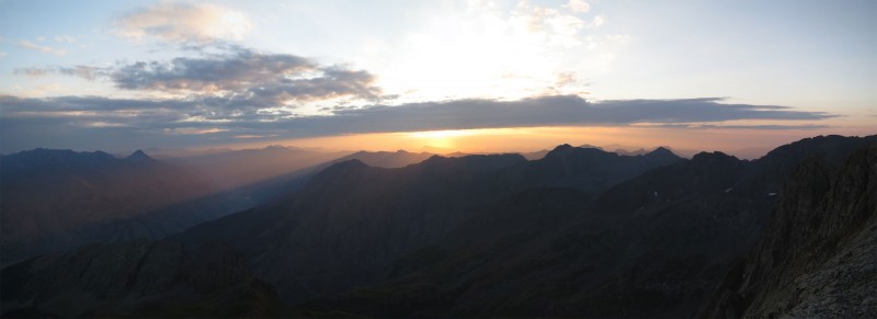
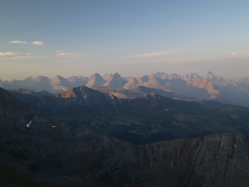
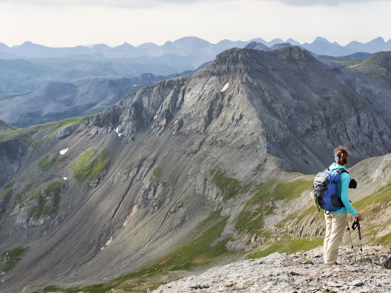
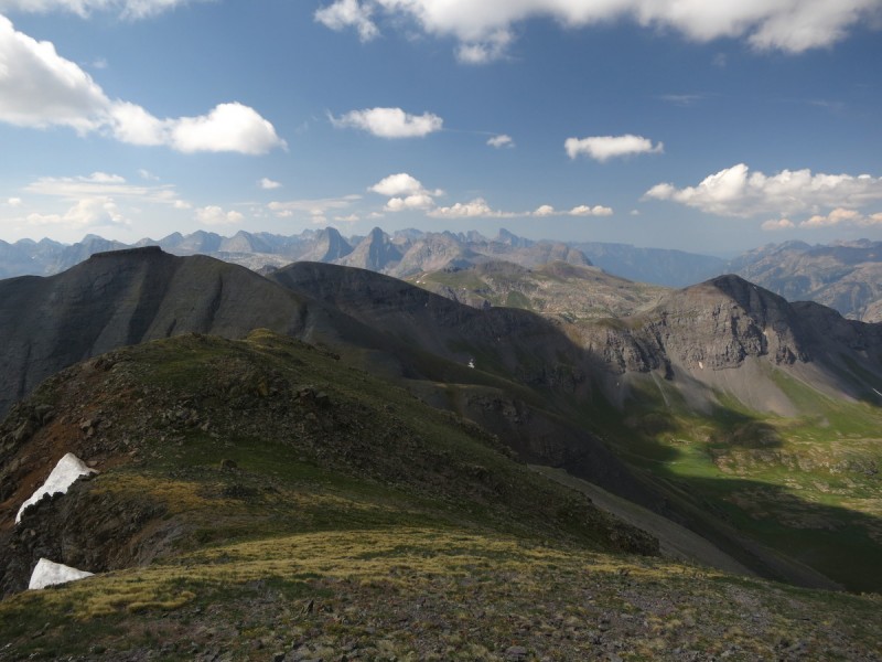
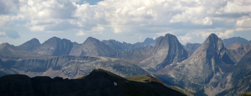
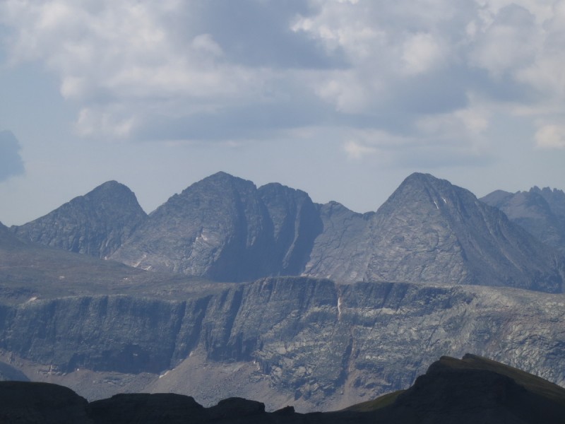
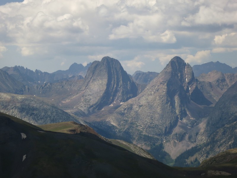
Once on Whitehead Peak, I get the views I've been waiting for all day and all trip! I had originally planned on doing a trip into Vestal basin this early summer, but schedules didn't seem to align with my partners B(3). Maybe they will in the near future... HINT HINT
Summit view from Whitehead Peak Weminuche Pano Vestal Basin Trinities Vestal and Arrow Pigeon - Kate's favorite peak view of the weekend
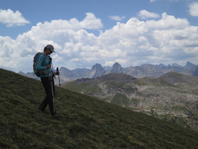
Tearing myself away from the summit of this unranked peak was difficult... But eventually I had to. The last peak of the trip and day was awaiting! #23 of trip and #200 for my 13er list. At least it would have great views too! The bugs and insects were intense on Pt 13,109. Butterflies were everywhere!
Pt 13,109, last peak of trip! #200 total, and #23 of trip
A last little bit of excitement on our way to the last summit - Photo Credit: Bob A very butterfly summit view
After a nice long break, we head down the ridge to the saddle with some unranked 12er bump and descend the gully. It had a "trail" game or human for a short distance in the scree, then disappeared into the flowers. From there we descended and followed game trails as we head to the west to find the trail back to my truck. An actual human trail, and not just game trail, does exist at the far side of the drainage that drops into the valley below to the north. Just traverse to the far side by the trees. Some posts are visible along the trail to guide you to it. Unfortunately the trail ends by an old bus at the edge of the trees. The trail that is shown on maps to take you back to the end of the road by the mine no longer exists, or was swallowed by willows. So like most 13er adventures, it ended with a willow bash. Another option would be to park at a turn out on a small hill before you reach that final meadow. But we saw another vehicle camped there, and didn't want to intrude.
Wish I had been able to get out last week, as it looks like a great trip. Loved the (not so) subtle hints. :lol: If I find a way to swing that trip, I'll let you know...
Caution: The information contained in this report may not be accurate and should not be the only resource used in preparation for your climb. Failure to have the necessary experience, physical conditioning, supplies or equipment can result in injury or death. 14ers.com and the author(s) of this report provide no warranties, either express or implied, that the information provided is accurate or reliable. By using the information provided, you agree to indemnify and hold harmless 14ers.com and the report author(s) with respect to any claims and demands against them, including any attorney fees and expenses. Please read the 14ers.com Safety and Disclaimer pages for more information.
Please respect private property: 14ers.com supports the rights of private landowners to determine how and by whom their land will be used. In Colorado, it is your responsibility to determine if land is private and to obtain the appropriate permission before entering the property.


 Bit more scrambling on right - Photo credit: Bob
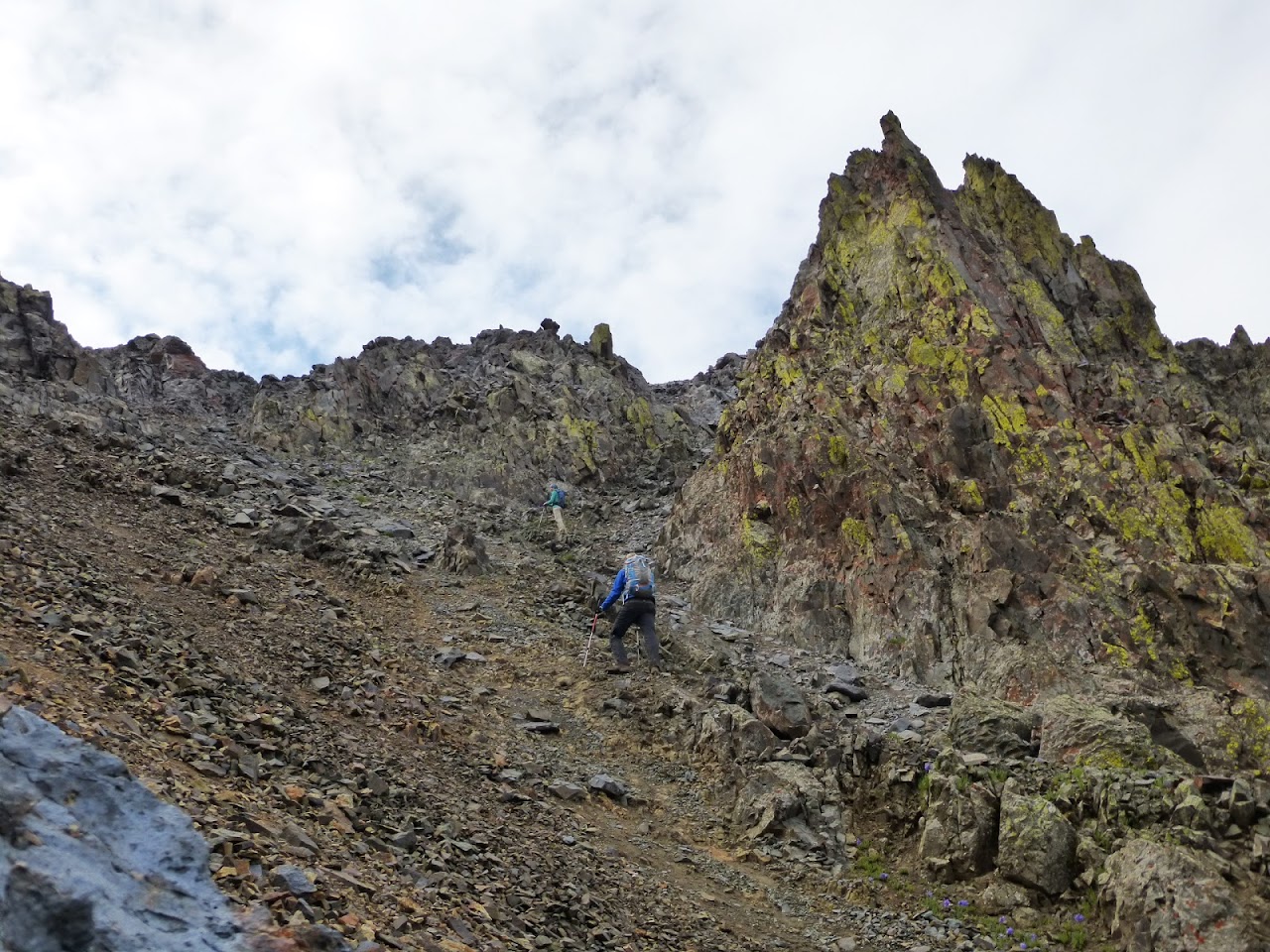


 Strawberry fields forever...")
 Ridge up to Kendall Mountain")
 Sunrise #4")
 Our route to the south")
 Day #4 of Weminuche viewing")
 Heading down, with Kendal BM in background")
 San Juan flowers")
 More pretty flowers to stop and enjoy")
 The craptastic slope by the mine")
 The mine kinda looks like a mouth...")
 Our 3 paths up gully")
 Descending Kendall Peak")
 Route through talus starting at saddle")
 Looking back at Kendal Peak and the")
 Grassy Slopes with Little Giant behind")
 Yes, we did a")
 The Finns climbing the last part of 13,434")
 Looking at the last 3 peaks of the day")
 Mt Rhoda")
 Summit of Mt Rhoda looking interesting!")
 A little scramble to the summit")
 Summit view from Whitehead Peak")
 Weminuche Pano")
 Vestal Basin")
 Trinities")
 Vestal and Arrow")
 Pigeon - Kate's favorite peak view of the weekend")
 Pt 13,109, last peak of trip! #200 total, and #23 of trip")
 A very butterfly summit view")
 Kate descending last peak of day/trip")