Download Agreement, Release, and Acknowledgement of Risk:
You (the person requesting this file download) fully understand mountain climbing ("Activity") involves risks and dangers of serious bodily injury, including permanent disability, paralysis, and death ("Risks") and you fully accept and assume all such risks and all responsibility for losses, costs, and damages you incur as a result of your participation in this Activity.
You acknowledge that information in the file you have chosen to download may not be accurate and may contain errors. You agree to assume all risks when using this information and agree to release and discharge 14ers.com, 14ers Inc. and the author(s) of such information (collectively, the "Released Parties").
You hereby discharge the Released Parties from all damages, actions, claims and liabilities of any nature, specifically including, but not limited to, damages, actions, claims and liabilities arising from or related to the negligence of the Released Parties. You further agree to indemnify, hold harmless and defend 14ers.com, 14ers Inc. and each of the other Released Parties from and against any loss, damage, liability and expense, including costs and attorney fees, incurred by 14ers.com, 14ers Inc. or any of the other Released Parties as a result of you using information provided on the 14ers.com or 14ers Inc. websites.
You have read this agreement, fully understand its terms and intend it to be a complete and unconditional release of all liability to the greatest extent allowed by law and agree that if any portion of this agreement is held to be invalid the balance, notwithstanding, shall continue in full force and effect.
By clicking "OK" you agree to these terms. If you DO NOT agree, click "Cancel"...
Canby Mountain - 13,478 feet
"Hardrocker" - 13,214 feet (unranked)
Galena Mountain A - 13,300 feet
"Stony Pass Peak" - 13,165 feet
Green Mountain A - 13,049 feet (unranked)
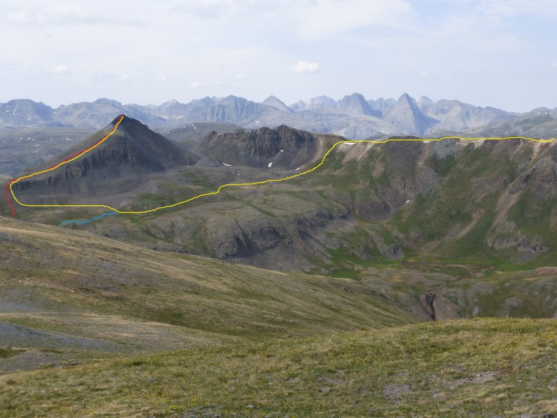
Route - Part 1 in red, Part 2 in blue
This was hiking day 3 of 4 and we were looking for an easier day. Hiking some low 13ers from a TH at 12,600 seemed like it would work well - and it did.
Trail head: The top of Stony Pass Directions to the TH: From downtown Silverton, head toward Cinnamon Pass on the Alpine Loop road. About 3.9 miles from the right turn off of Greene Street, which is the main street in Silverton, onto the Alpine Loop road, you'll get to a right turn - there's a brown sign on the right side of the road with "Stony Pass" and an arrow indicating you should turn right here. Turn right off of Alpine Loop road. This turn off is right near the Howardsville site. Turn left maybe 1/4 mile farther. At 7.4 ish miles from the Greene/Alpine Loop turn, turn right to stay on the road to Stony Pass. You'll get to the top of the pass after about 10.3 miles from the Greene/Alpine Loop turn.
There are several pull offs around the top of the pass. Access: The road is rocky and rough in areas, but a stock 4WD should get you there. Starting elevation: ~12,600 feet Special gear: None
Part 1: Canby, Hardrocker, and Galena Miles: 5.9 Elevation gained: 2,100 feet
The weather report wasn't great, so we started early - around 4:30 ish in the morning.
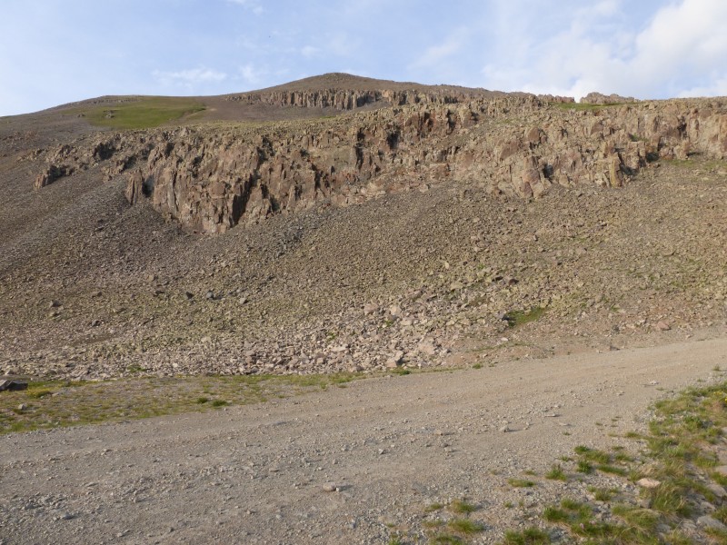
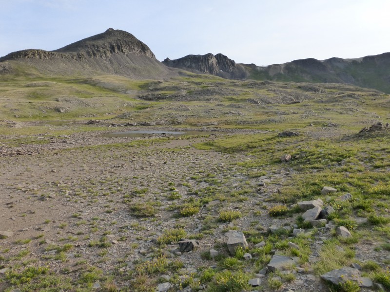
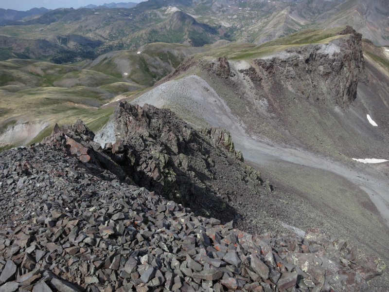
When we arrived at the top of the pass the afternoon before our hike, we saw miserable-looking scree slopes and cliffs blocking easy access to Canby Mountain. After a quick look around just passed the top of the pass, we saw some grassy slopes that looked like they would go for us the next morning as we hiked in the dark. Scree and cliffs
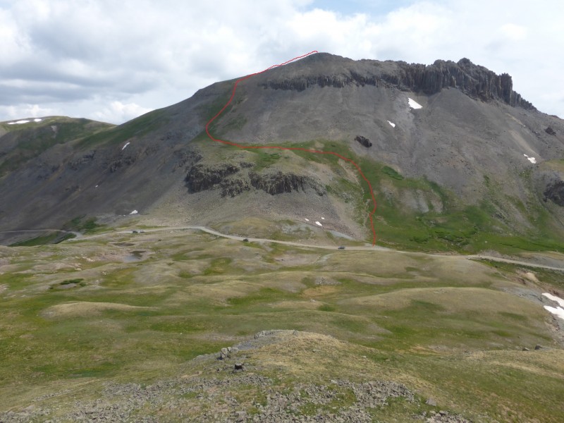
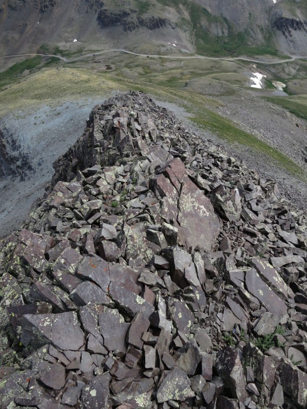
We walked to the top of the pass and a few yards beyond it in the dark in the morning. It was a good thing we scouted the route the day before since we didn't want to deal with scree and cliffs in the dark. As we started up the slopes, the light from our headlamps reflected off some metal tags indicating the Hardrocker 100 course path. We followed the Hardrocker path until it suited us to not follow it at which point we headed straight up to the ridge a little below the summit. The grassy slopes route.
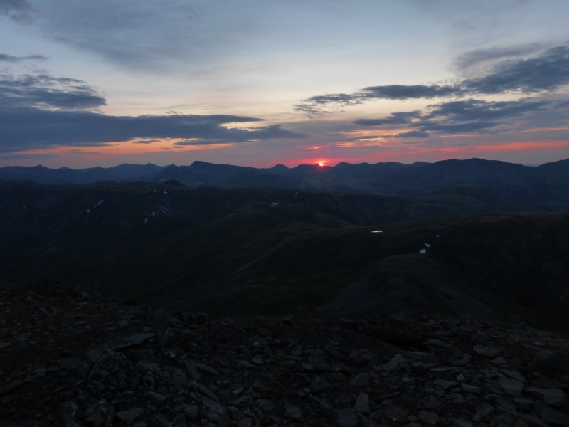
Sunrise from the summit was pretty nice!
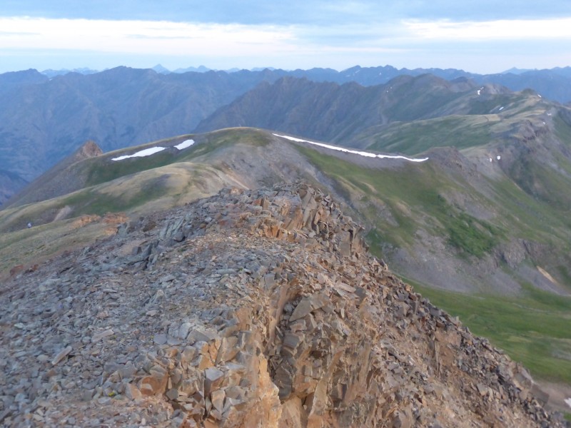
The rest of the ridge in the early morning light. Hardrocker is the rounded bump with the snow on its ridges.
Looking back at Canby from along the way. The trail is visible. Credit - Otina
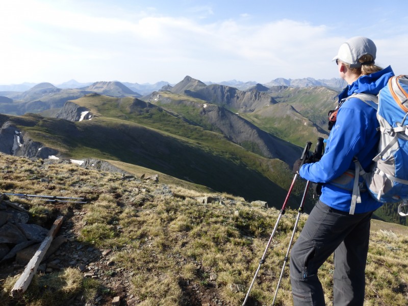
Kate heads off Hardrocker toward Galena - there is a big mine building and a road leading to the ridge in that drainage on the left. Galena is the high point on the ridge out there left of center. Credit - Otina
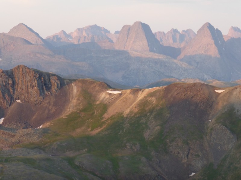
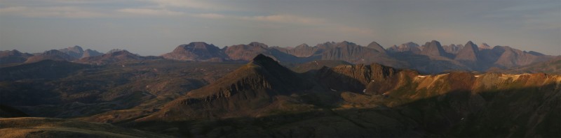
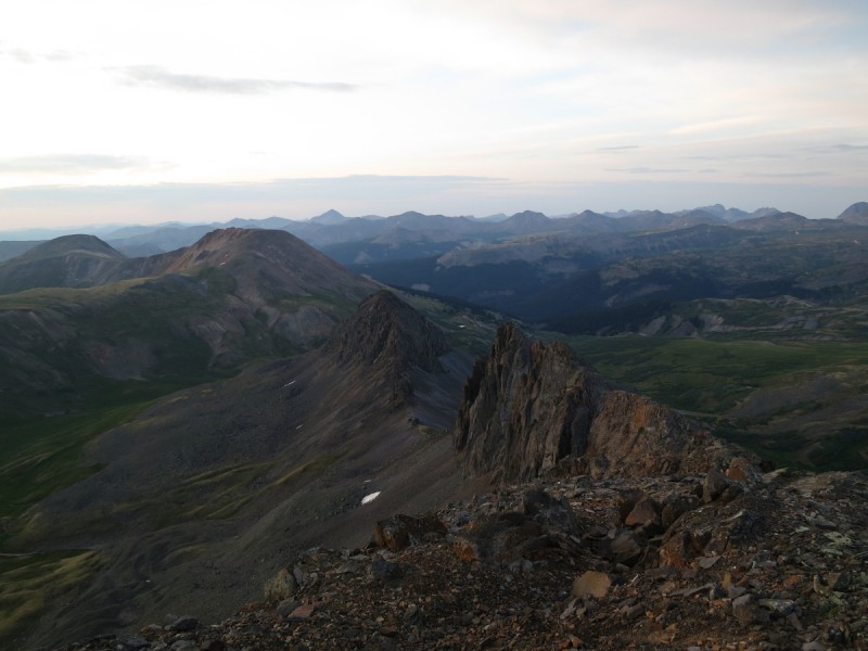
There was a pretty good view of the Grenadiers from this ridge. Credit - Otina
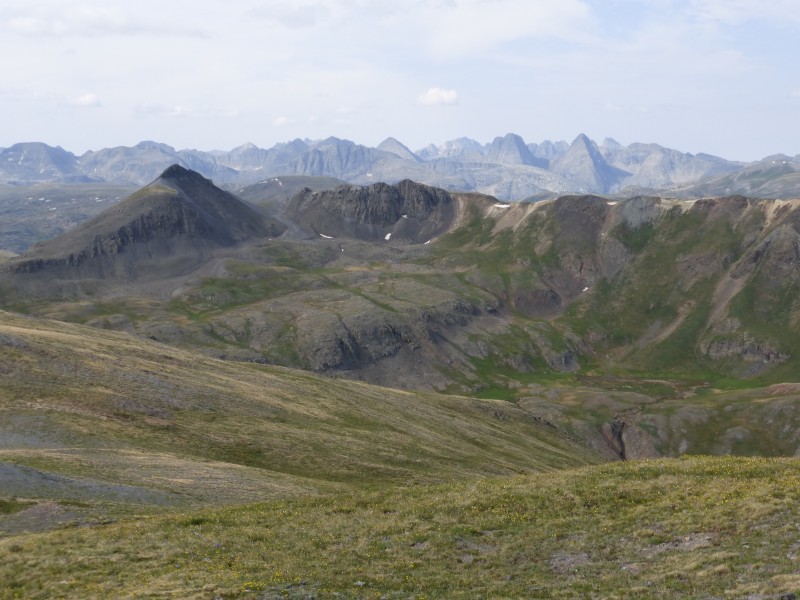
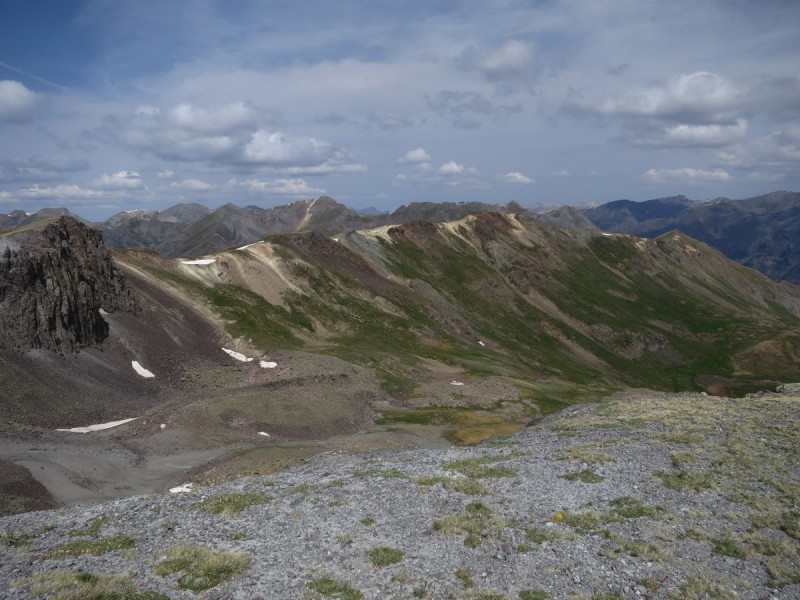
The route from Canby to Galena was via mellow grassy slopes. It was a very nice, relaxing hike. However, it looked like a very long way back to Canby from the top of Galena. Canby is the pointy one in the center.
I was dumb on the summit of Galena - I didn't lock my Camelback tube and all my water leaked out when I leaned against my pack during our summit time. It wasn't too far to get back to the pass and more water in our car, but it was a stupid mistake that could have been more costly on a more difficult/long route.
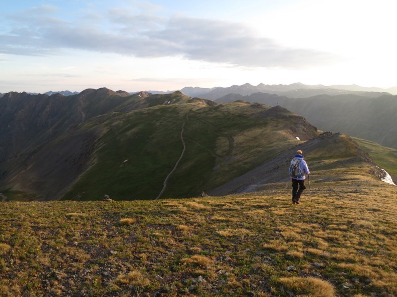
Heading back to Canby. We didn't re-ascend Canby to get back to the pass; instead, we picked up the Hardrocker trail and followed it back to the pass.
There was a memorial on one of the points.
The view toward Stony Pass Peak, near left, with the Grenadiers behind.
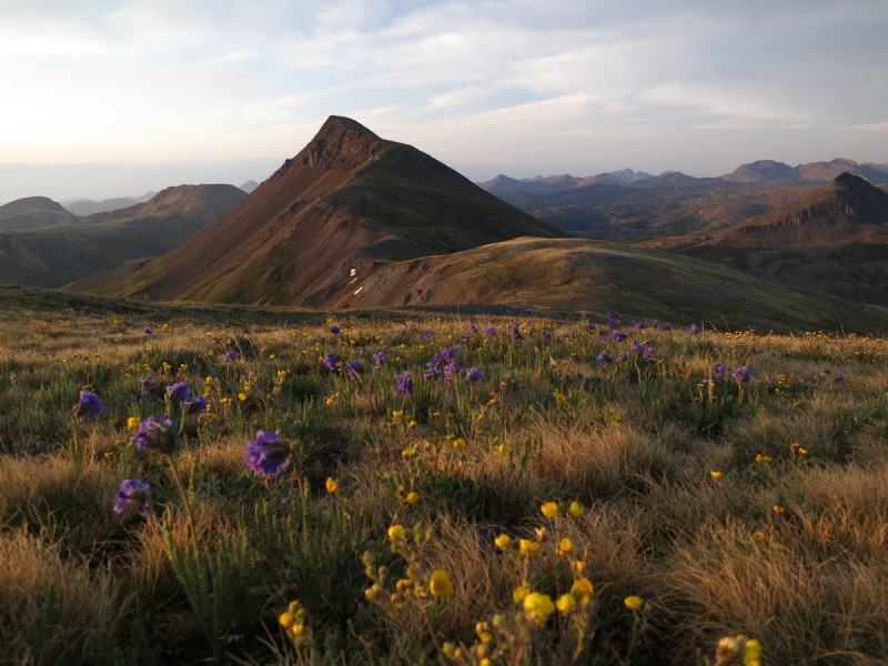
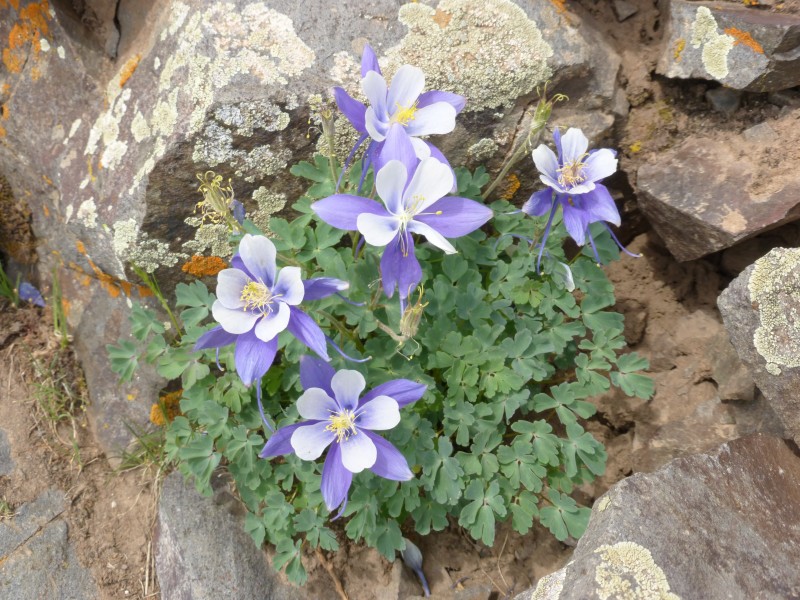
The flowers were in bloom!
We tried to connect "Could Be Peak" (13,152 feet), which is just south of Canby Peak, but the ridge does not go. We didn't even try to hike it - it looked very cliffy and steep. Here's a pic of Could Be (center) from the summit of Canby. Sheep Mountain and Greenhalgh Mountain are in the background. Credit - Otina
Part 2: Stony Pass Peak and Green Mountain A Miles: 2.5 Elevation gained: 800 feet
We could see our route up Stony Pass Peak and Green Mountain from the Canby/Galena ridge. Up Stony Pass Peak in red, over to Green in yellow, back to the pass in blue.
Here's the view from our parking spot just short of the pass, Stony Pass Peak looks very close - and it is. I think it was less than 30 minutes from the top of the pass to the top of the peak.
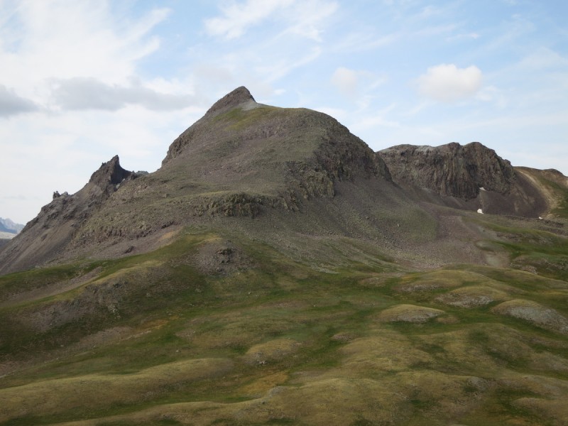
A closer view of Stony Pass Peak. The top was class 2+. Credit - Otina
The summit of Stony Pass Peak looking at the ridge to Green Mountain. Credit - Otina
The summit looking back at the parking spot. Credit - Otina
We tried to make a direct link between Stony Pass Peak and Green Mountain, but it didn't go. There was a potential downclimb from the summit to the ridge to Green Mountain, but it was above our risk tolerance level. Plan B was to go just below the summit of Stony Pass Peak along some talus to the ridge to Green, but this looked miserable - steep, loose side-hilling. Plan C was to go back the way we came to get to the basin floor. This was an easy way to go.
We gained the ridge to Green by that bump on the ridge to the left of the snow. There was a faint trail up there. Credit - Otina
The ridge to the summit of Green was another straightforward ridge walk without any difficulties or obstacles. There were some interesting rocks and crystals that caught Otina's attention. Here's that ridge. Credit - Otina
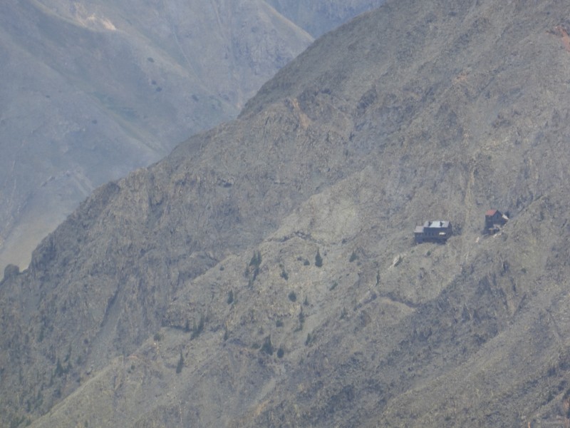
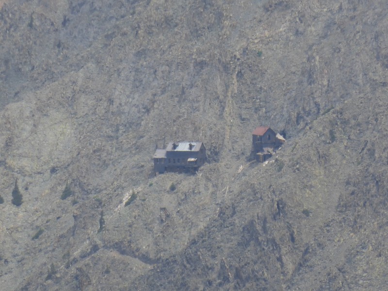
Along the ridge, we could see in the distance some cool looking old mine buildings that looked like they should just fall off the side of the mountain. I guess those miners were made of strong stuff...
Fun times. This is a great hike when you don't have all day to spend on the peaks.
Thumbnails for uploaded photos (click to open slideshow):
This area doesn't have a lot of beta available and I will put this to good use. Like Matt typed...Thanks for the roadmap! :D
Caution: The information contained in this report may not be accurate and should not be the only resource used in preparation for your climb. Failure to have the necessary experience, physical conditioning, supplies or equipment can result in injury or death. 14ers.com and the author(s) of this report provide no warranties, either express or implied, that the information provided is accurate or reliable. By using the information provided, you agree to indemnify and hold harmless 14ers.com and the report author(s) with respect to any claims and demands against them, including any attorney fees and expenses. Please read the 14ers.com Safety and Disclaimer pages for more information.
Please respect private property: 14ers.com supports the rights of private landowners to determine how and by whom their land will be used. In Colorado, it is your responsibility to determine if land is private and to obtain the appropriate permission before entering the property.
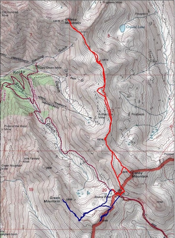


 Route - Part 1 in red, Part 2 in blue")
 Scree and cliffs")
 The grassy slopes route.")
")
")
 Credit - Otina")
 Up Stony Pass Peak in red, over to Green in yellow, back to the pass in blue.")
 Credit - Otina")
")
")
")
")
")
")
")
")
")
 Credit - Otina")
 Credit - Otina")
 Credit - Otina")
 Credit - Otina")
 Credit - Otina")
 Credit - Otina")
 Credit - Otina")


