Download Agreement, Release, and Acknowledgement of Risk:
You (the person requesting this file download) fully understand mountain climbing ("Activity") involves risks and dangers of serious bodily injury, including permanent disability, paralysis, and death ("Risks") and you fully accept and assume all such risks and all responsibility for losses, costs, and damages you incur as a result of your participation in this Activity.
You acknowledge that information in the file you have chosen to download may not be accurate and may contain errors. You agree to assume all risks when using this information and agree to release and discharge 14ers.com, 14ers Inc. and the author(s) of such information (collectively, the "Released Parties").
You hereby discharge the Released Parties from all damages, actions, claims and liabilities of any nature, specifically including, but not limited to, damages, actions, claims and liabilities arising from or related to the negligence of the Released Parties. You further agree to indemnify, hold harmless and defend 14ers.com, 14ers Inc. and each of the other Released Parties from and against any loss, damage, liability and expense, including costs and attorney fees, incurred by 14ers.com, 14ers Inc. or any of the other Released Parties as a result of you using information provided on the 14ers.com or 14ers Inc. websites.
You have read this agreement, fully understand its terms and intend it to be a complete and unconditional release of all liability to the greatest extent allowed by law and agree that if any portion of this agreement is held to be invalid the balance, notwithstanding, shall continue in full force and effect.
By clicking "OK" you agree to these terms. If you DO NOT agree, click "Cancel"...
Outside the rain fell dark and slow
While I pondered on this dangerous but irresistible pastime
I took a heavenly ride through our silence
I knew the moment had arrived
For killing the past and coming back to life
-Pink Floyd "Coming Back to Life"
Partners: Chicago Transplant (Mike): "CT" Wooderson (Sarah a/k/a "The Cook") and Pappillon (Kevin): Collectively "Papperson" Shanahan96 (Jamie): "S96"
Introduction:
This was a week that would test friendships and stretch our risk tolerances. Ultimately, we would walk out of the wilderness with a better understanding of what we are all capable of not only individually, but collectively and I think a mutual respect for one another that hopefully leads to many more climbs in the future.
I believe Mike and I began talking about this trip on our incredible July 4th trip last year in the West Needles. Mike mentioned that he had his eyes set on Jagged in 2012 and that worked perfectly for me as I take a weeklong trip on the "even" years while I join my family on their annual trip to the PNW on the "odd" years. After our inboxes recovered from our Slate Lake Adventure last fall, we quickly began dissecting every approach and angle on the intimidating mountain.
I've respected Kevin for years before meeting him as his trip reports are more eloquent than most novels and we have a similar mindset when it comes to the "political side" of mountaineering and 14ers.com. We finally met at a gathering of sorts for the LSU-Alabama game last November. He expressed a sincere interest in joining Mike and me for Jagged as he is trying to finish the Centennials, like Mike. Our first climb together was for Huron last January which wasn't the greatest opportunity to determine whether or not we could tolerate each other for a week in the backcountry, but our Peak N trip last May put any concerns of that to rest.
Up until last spring, I was convinced that this trip was going to go down in late June as my wife could take advantage of our youngest daughter flying for free before her second birthday in early July. But, our oldest has turned into quite the swimmer and socialite so her schedule pushed their trip back until late July-early August. Since stream crossings, snow climbs, etc were no longer a hindrance we were free to roam wherever we pleased. This meant Mike wouldn't "have" to repeat the Vestal Basin peaks, but it also meant we were looking at serious mileage with our heavy packs.
We settled on a 2-car adventure that would take us from Vallecito up to Sunlight Lake and out to Purgatory. We had hoped to hit NoName and Ruby Basins along the way, but we quickly learned that our eyes were stronger than our bodies would allow - more on that later. We all agreed that the Sunlight Lake peaks and Peak Fifteen would be the priorities.
There was an unbelievable amount of planning by all members of the group. We meticulously went through our packs in an effort to minimize pack weight while making sure we had all our essentials and enough food to keep us moving for the week. I located some shower facilities in Durango and for some reason the group put me in charge of the pre- and post-climb meals. But, this is a field in which I do consider myself an expert. Finally, after over a year of planning, we were off - but not before Jamie would be added to the group about a week before we left.
Part I: A Journey to Sunlight Lake and the surrounding 13ers (Days 1-3)
Day 1: Backpack to the Sunlight Basin Confluence and a Jaunt Up a Wrong Basin: ~13 miles/3,200 ft
The alarms went off at 5:00 at the Purgatory TH. We quickly consolidated our stuff into Kevin/Sarah's car and were on the road to Durango at 6:00. We stopped at Carver's in DGO for one last hot meal before we said good-bye to civilization for the next nine days. Mike went respectable with a veggie omelet; Kevin was a little weary of what his stomach would take on the long approach so he ordered a double order of home fries, Sarah, regrettably, in poor form, ordered granola, and me? Well, I went for the gusto: eggs, sausage, and some pancakes that were the size of hubcaps.
We arrived at the Vallecito TH around 8:30 and got the scales out to see how efficiently (or inefficiently as the case may be) we packed. Kevin and Sarah both came in around 35 pounds (give or take) after Mike pawned some trad gear off on them. Mike and I crapped the 55 pound scale out. I'm guessing we were both well into the 60s if not over 70 pounds. That's fine for me, I tend to over-pack for the sake of comfort and have the frame to carry it. Mike, on the other hand, weighs probably 75 pounds or more less than I do and that pack would haunt him for the next week. If any reader is curious about backcountry diet or packing for 9 days, anyone in our group would be happy to help out. We did some extensive research and the detail we got into was pretty minute so I won't go into the details here.
We were on the trail at 9:00, making up our way up Vallecito Creek. The first portion is a little frustrating since you circumnavigate the campground, but once back along the creek, it's a very mellow and pleasant walk. We passed several day hikers and one group of older guys took a look at our group and said, "Looks like you fellers are out for one heck of an adventure." And at the sight of Sarah, one decided to spout out, "Who's she? Your cook?" We weren't sure if they were kidding or not, but we decided the small talk should end there as we failed to see the humor in the comment.
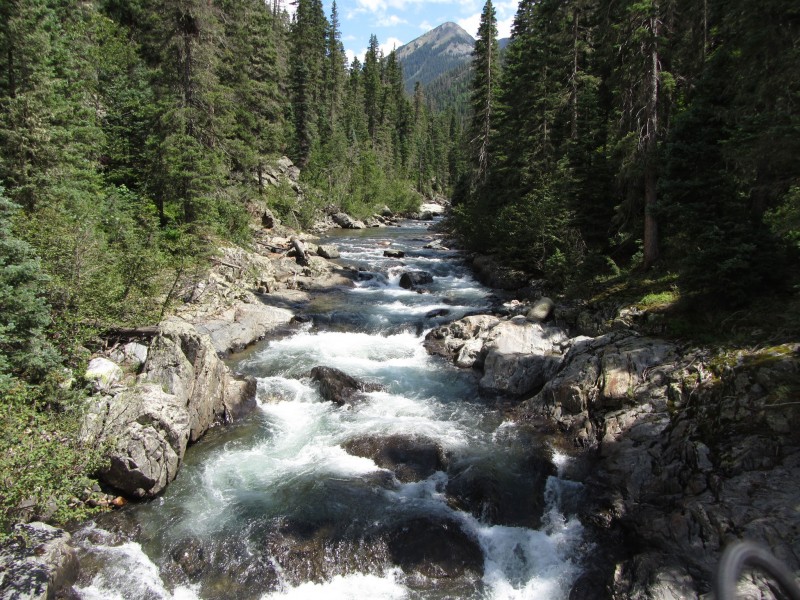
Vallecito Creek
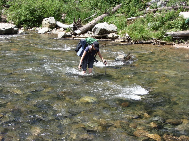
We came to the crossing where the hanging bridge was knocked out and took a break for lunch in a nice camping spot right along the creek. After getting our first dose of trail food and me dressing my blisters which I got the weekend before, we forded the creek for the first of many times.
Sarah fording the Vallecito
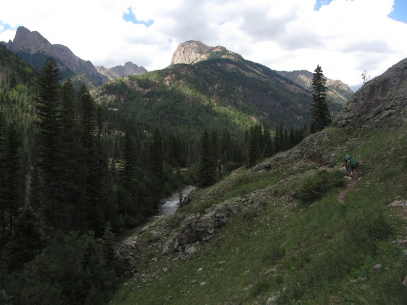
As we ventured up the trail, we finally started catching some glimpses of the Needles around the Johnson Creek junction.
On the Trail approaching the Johnson Confluence (Papperson right)
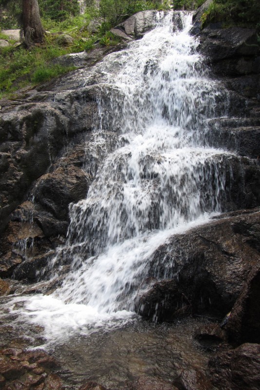
Roach's book states that you're supposed to leave the trail at 11.3 miles, then crossing the creek at 11.5 miles. Well, we crossed the creek to enter a basin immediately across from us based on our pace for the day. Wrong move. Looking back, there were SOOOO many signs that we were in the wrong basin, but I think this is one of those times where fatigue and anticipation clouded all common sense. We knew we had a tough bushwack in front of us, so even though we didn't have a trail, we had anticipated the worst and we got it.
WRONG BASIN A**HOLES!!!
We spent the next 2 hours floundering around on the steepest, most difficult terrain imaginable in a full pack. There is a waterfall about half-way up to the confluence of the two creeks that is quite nice, but pretty dangerous to get anywhere near. It wasn't until we reconvened at the confluence (about 800 vertical feet up) that Mike pulled out a map and we realized our mistake when Roell Creek was directly across the valley from us. Per another guidebook that Mike had, the Roell Creek crossing was at 11.7 miles and per the map is obviously short of the Sunlight turnoff. We chalked this one up to getting "Roached" but the blame rested purely on our shoulders. Kicking ourselves for being such idiots, we realized our little snafu cost us at least 2 hours and there wasn't any way we were making a high camp this day.
Tired and dejected, we hoofed it back to the Vallecito and set up a camp along the shores just north of our crossing point in a meadow on the west side of the creek around 6:00 pm. After setting up the tents, I took a quick dip in the Vallecito and then we ate our first backcountry dinner (Papperson cheated by packing in lunch meat/bagels for dinner) and called it a night.
Day 2: Sunlight Basin: ~3 miles/1,800 ft
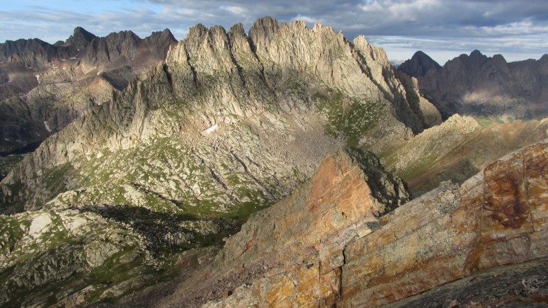
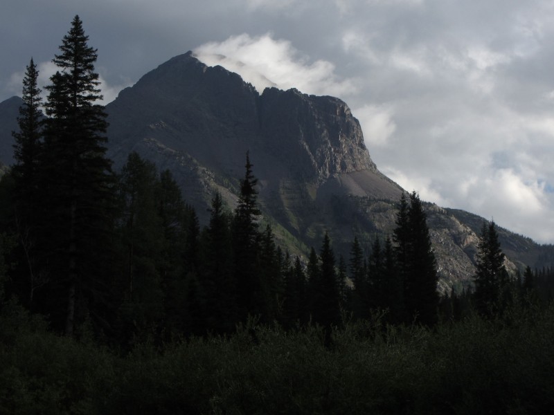
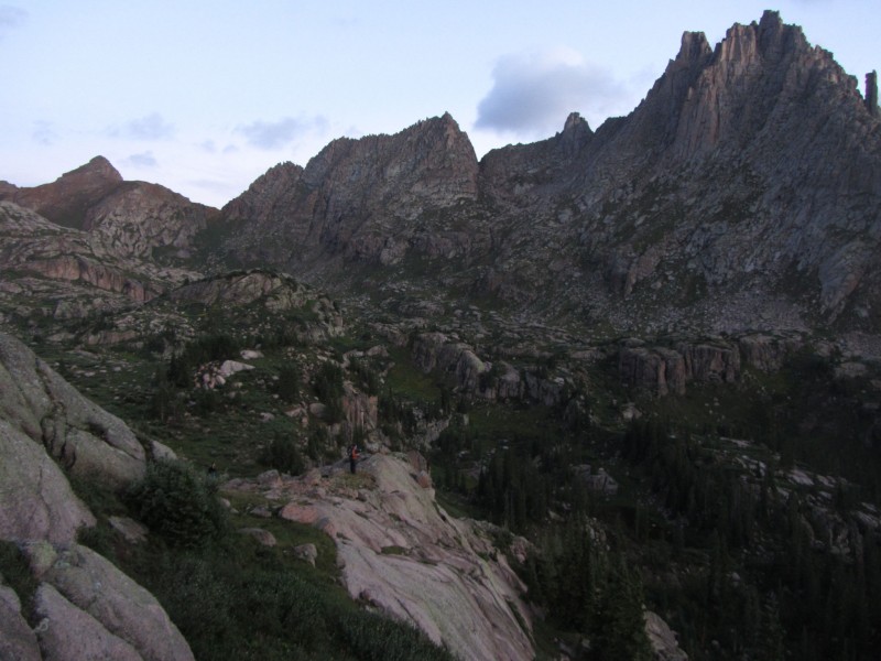
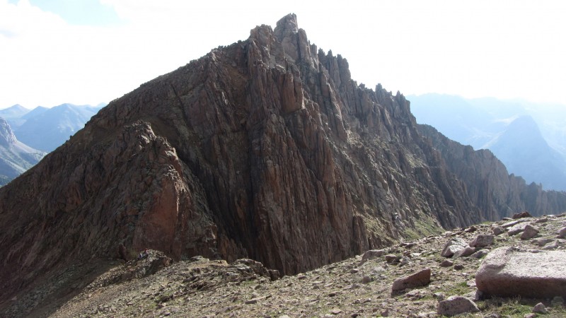
We woke the next morning to a faint drizzle and fog and clouds hanging in Sunlight Basin. The fog made the Guardian look as if it were a volcano and added an eerie feel to the whole area. I would have been pretty tentative to climb any peaks in that weather so it wasn't a bad morning to finish up the approach.
The Guardian
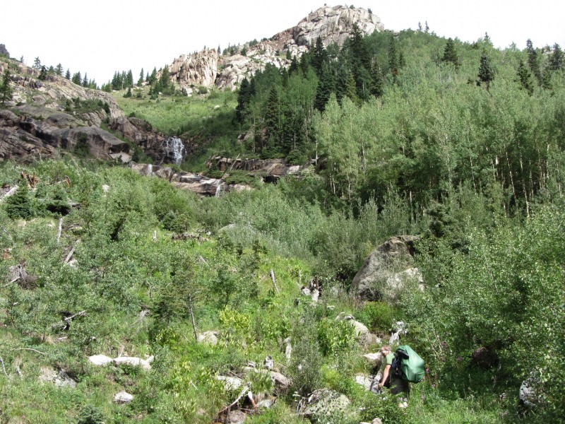
There is a trail on the west side of the Vallecito from our crossing point (maybe a half-mile or more short of the correct place to cross) and we hit the Sunlight Creek crossing after a nice stroll. Mike used a log-jam while Kevin, Sarah, and I avoided the inevitable fall into the creek since we aren't so graceful and switched into our creek shoes to wade it. We had heard absolute horror stories about the condition of the Sunlight trail, but we found it to be quite manageable. Don't get me wrong, you can get yourself into a world of hurt if you lose the trail in the avy debris, but there is a trail throughout it. We lost it for a brief moment, but luckily Kevin, who was a few feet in front of us, stuck with it and guided us back to a more reasonable path - the fact I'm 6'5" came in handy as I was able to yell to him (standing on a rock) over top of the deadfall.
Kevin on the Sunlight Trail
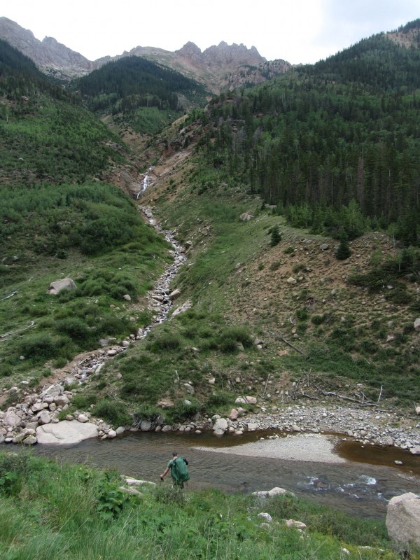
Once through the debris, the trail is in great shape, but it does get steep. We crossed the creek again (used our water shoes once more) and started up the steep headwall to the bench at 11,600 that we had planned on making our home for the next few days.
Mike ascending the final headwall before camp
The trail above our camp (Papperson pictured - Mt. Oso in background)
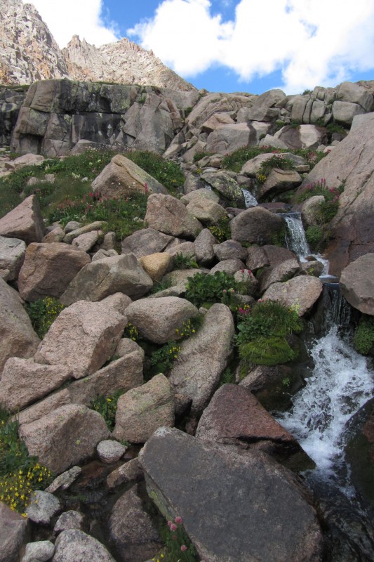
I ventured further up the trail above this area as Jamie had hiked in the day before and we were hoping to find him as well. Now above treeline, I couldn't find any sign of him and it was starting to rain. Plus, the upper basin gets fairly boggy and there weren't a lot of spots flat enough for 2 relatively large tents. I turned back to meet the others as they were setting up camp about 30 yards from a waterfall that we would use as our shower and Jacuzzi for the foreseeable future. These falls even had a large 10 foot rock in front of it for added privacy and was the icing on the cake to our little piece of paradise.
Beats the hell out of a hot tub at a TH
Day 3: 13,121/Greylock/"East Windom"/Knife Point/attempt at Peak Ten: ~9 miles/5,500 ft
Mike and I were splitting my 4-man tent (I carried the tent to offset the weight of the rope/rack that he had) and we awoke to rain falling at 3:30. Unhappy, Mike reset his 4:00 alarm for 5:00 and we fell back to sleep hoping for the best. At 4:45 a rude headlamp came knocking on our door:
Kevin, "You guys ready?"
Us, "No, sleeping. It isn't raining?"
Kevin, "Nope, not a cloud in the sky."
Us, "Well, hell yes! Give us 20 minutes."
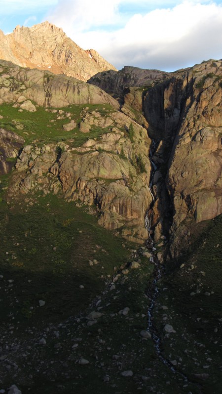
I don't think I've ever choked down breakfast, got dressed, and ready to go faster in my life - and more hungry for a summit (or 4 or 5?) after our approach debacle. We were on the trail by 5:15 and, while easy to follow to Sunlight Lake, it does take you through plenty of ground cover and willows so we were significantly soaked by the time we reached the lake. Kevin was stopping every so often to wring out his socks but my blisters welcomed the puddles in my shoes. After dropping to the east off of the bench holding Sunlight Lake, we walked across another (boggy) basin holding a world-class waterfall cutting through a cliff below the lake at 12,545, we ascended Greylock's north ridge and then traversed around to the 13,121 saddle on a ledge system.
Mike taking it all in (Jagged in background)
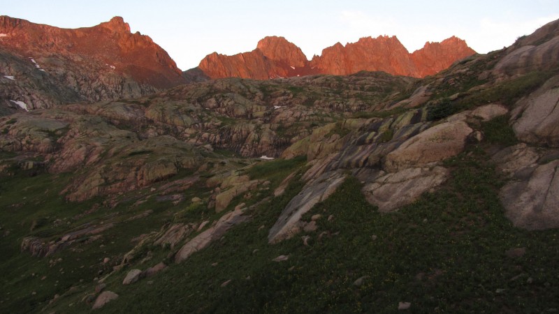
Morning alpenglow on the 14ers.
Beautiful waterfall
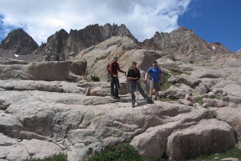
Papperson traversing to 13,121
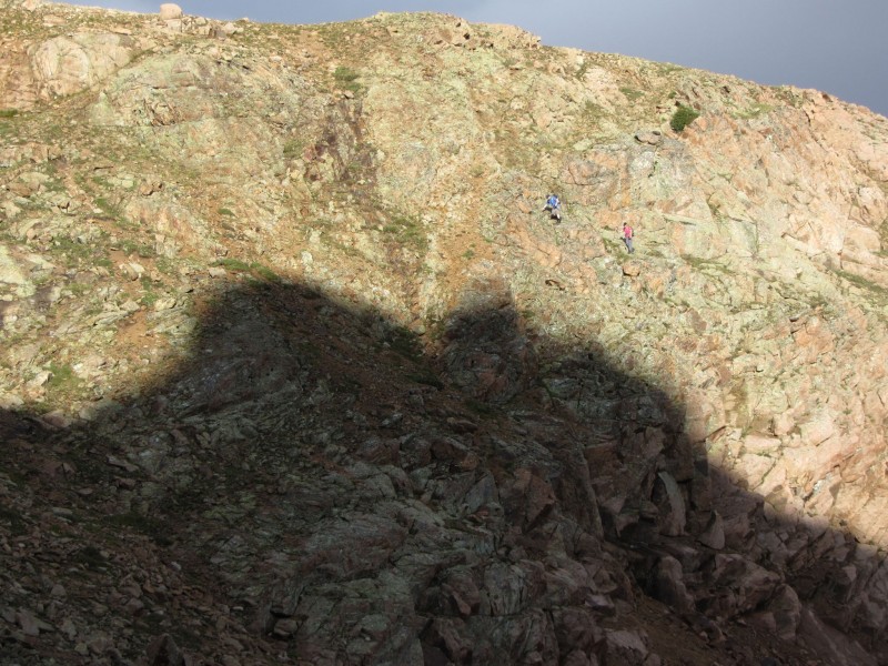
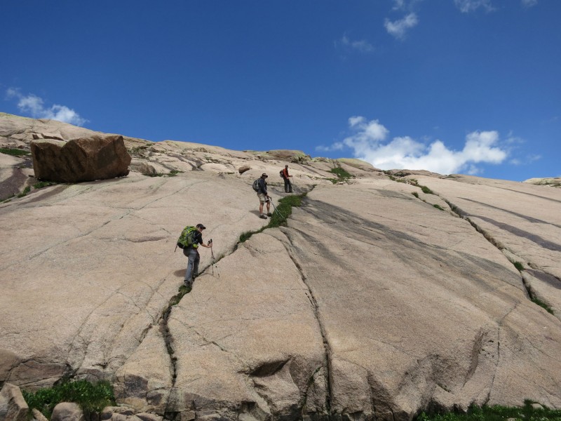
Finally, after a few hours of navigating the upper basin, we found ourselves at the base of our climb. The route up 13,121 hits a headwall before hiking across a large flat area then into the summit boulder area. I took on the headwall first and, after taking a minute or 2 to find a reasonable Class 3+ weakness (right side), I quickly scrambled to the top of the pinnacle. The downclimb and ensuing traverse was pretty sketchy but it is much easier if you don't go all the way up and start making your way around to the left of the tower. Regardless, the scrambling was a welcome respite from the hours of hiking that we'd been doing for the previous 2+ days and I was actually seeking out more difficult terrain just for fun.
Sarah and Mike climbing the headwall on -121. I'm seen higher up (Photo by Kevin)
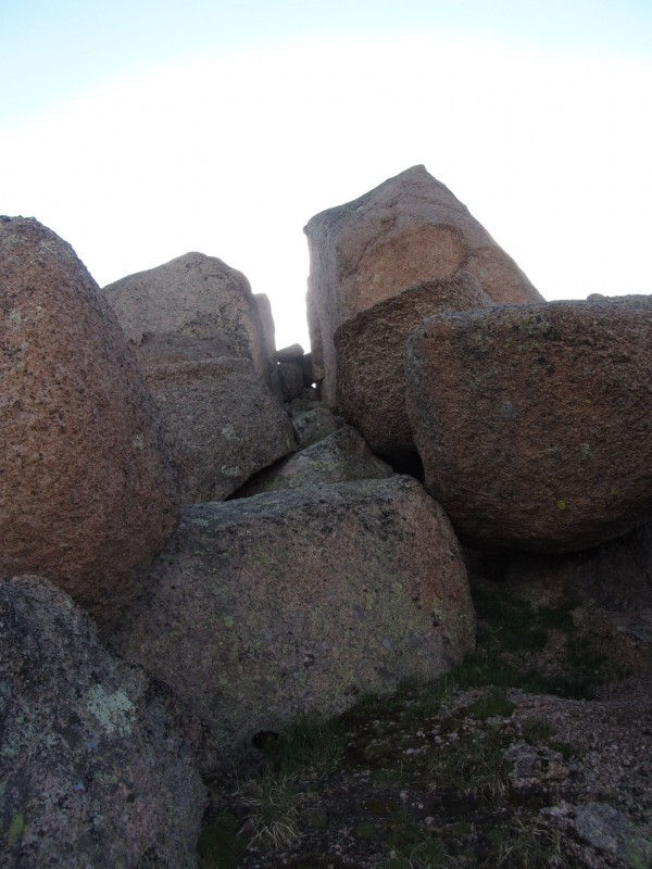
After the initial climb, you cross a flat expanse about the size of a football field before hitting the ledge system to the summit blocks. For the summit, we walked into an alley of sorts between the towers, squeezed through a small hole behind the chockstone at the end of the alley (if I was 10 pounds heavier, I don't think I could have made it) and then had an interesting climb to the actual summit. This one shows the alley and the small hole used to access the summit area though and I had to include one of the summit and view from up top...
Alley to the summit. Small hole can be seen.
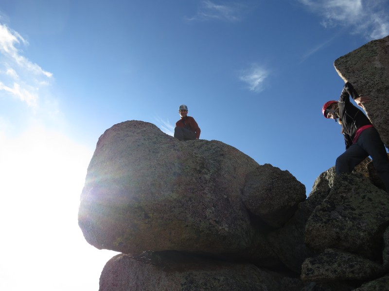
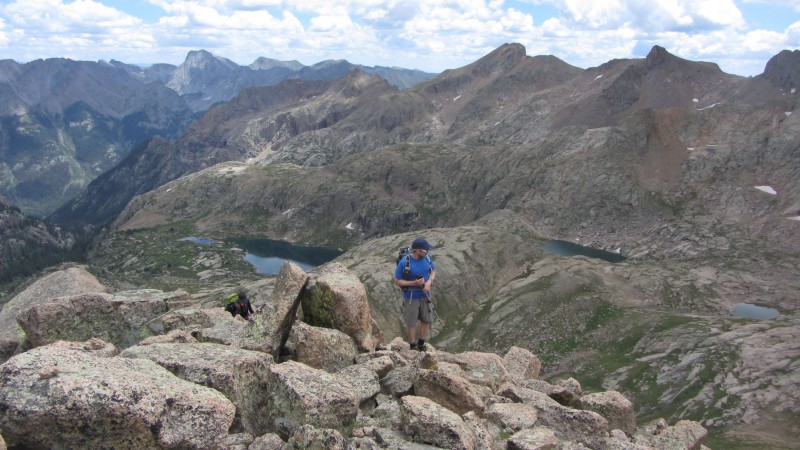
Mike on the true summit (Photo by Kevin)
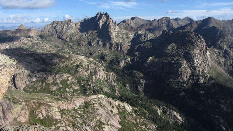
-121's views do not disappoint.
For the descent, we used a loose gully which bypassed a downclimb of the initial headwall which proved to be a smart choice. An ascent of it would have been flat out miserable, but it definitely made for a quick decent. Once back at the saddle, the rest of the group stopped to wring out socks and get a snack but I was hungry for more mountains.
Group taking a breather at the saddle beneath 13,121
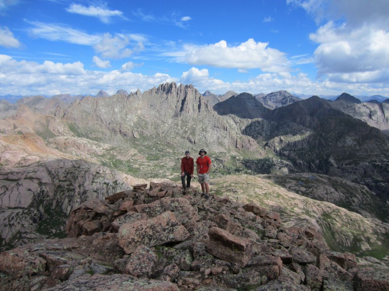
I started up Greylock's NE ridge and quickly learned that you want to stay to the right on the grass as the scree was frustrating - which I advised my group who now had a little easier time (or at least more pleasant time) with the ascent. While an excellent summit, Greylock is pretty much a slog and to top it off, once you think you've climbed it, you have a hundred or so yards of rolling false summits to the south before you are at the highest point. Since I didn't stop at the saddle, I had the summit to myself for 10 or more minutes before the rest of the group made their way up. This summit did hold a register which was an oddity for the week and it was an index card left 2 weeks earlier by a 74 year-old climber - impressive feat to say the least!
Curiosity of the traverse to East Windom was taking over in my mind so I set off 10 minutes or so before the others. The initial ridge was straightforward enough and things didn't get interesting until we started to ascend to point 13,229. I wasn't sure what the west side of this bump looked like but I could see a grass ramp leading to the EW saddle. Only problem was that I had to slide (literally) down a couple hundred feet of a nasty scree gully. The others caught up to me as I was hitting the bottom and their lack of desire to descend what I just did was palpable. But, once on the grass ramp, I could run over to the other side for a scouting mission. After confirming that it did go, the others went up and over. The other side did hold some difficulties, but nothing too bad - especially since I could direct them from the other side of the saddle to a short (10 ft?) gully that led through the cliffs down to easy terrain.
The east ridge of East Windom held some very fun Class 3 scrambling. There was harder stuff if you wanted it - or easier to the north. After the scramble, we found ourselves once again on easy terrain to the summit. East Windom was a real treat. I like these soft ranked peaks and the views back to our route and what lie ahead were incredible - not to mention Windom and Sunlight were standing tall and loomed over us. Those peaks are quite daunting from the east.
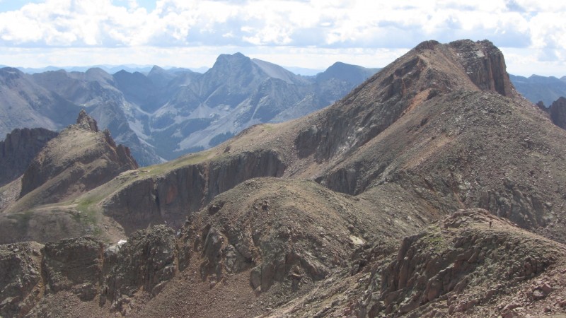
-121/Greylock from East Windom. Mike can be seen on the ridge.
Windom/Sunlight standing tall from East Windom
While on the summit, we spotted what looked like a tent that we thought was Jamie's high on a bench below Jagged around 12,000. I was up there on our approach day and was shouting for him but didn't see or hear any response. We made a note of it and we'd swing by on our way back to camp later in the day.
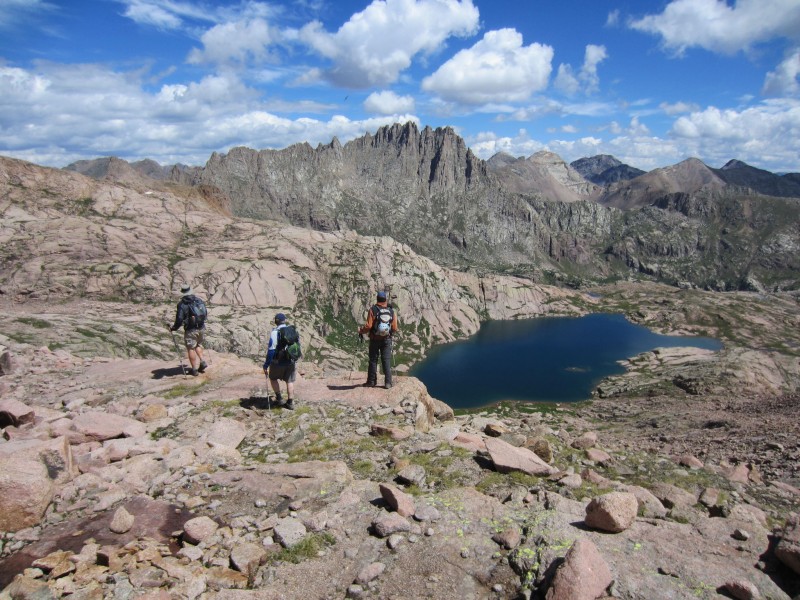
We descended a scree/talus slope from the East Windom/Windom saddle towards the lake at 12,545 and weather seemed to be holding quite well so we decided to make a run at Knife Point too. Our high traverse oscillated around 12,800-13,100 and went through some of the most interesting and gorgeous terrain imaginable. I now consider this my favorite basin in Colorado - beating out such gems as Ruby and Slate Lake. We finagled a route through the grassy benches and cliff bands and basically tried to take in the beauty as best we could.
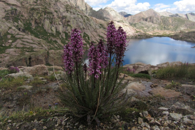
Some Pink Elephants for my daughter
Interesting slab walk on our route to Knife Point (Photo by Kevin)
Mike and I enjoying the basin (photo by Kevin)
(photo by Sarah)
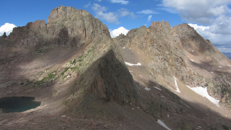
Cascade and Sunlight Peak
Papperson and Mike in front of Sunlight
Knife Point proved to be a relatively easy hike via the south/southeast slopes but the kitty litter took its toll on our tired legs. Again, once on top, we could bask in the awe of the Weminuche and this time take in a new basin - NoName Creek. The sheer 2,000 ft drop off the west face of Knife Point will definitely get your attention and we enjoyed playing name that peak/route for the next several minutes. By this time, however, clouds were starting to build and I still wanted to give Peak Ten a try. Unfortunately, none of my partners shared my enthusiasm so I set off by myself.
Kevin topping out on Knife Point
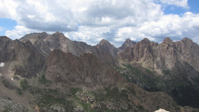
Monitor Group and Eolus from Knife Point
I had heard horror stories of traversing the hardpan below Knife Point so I stuck to the ridge until the Peak 10 saddle and then descended around to the ascent gully. The ridge to the saddle was fun Class 2 with maybe 1 or 2 Class 3 moves. I was starting to wonder if I had the legs for Ten too, but I decided to give it one strong push and see what happened. but I didn't have the time or energy to concern myself with routefinding. So, up I went and I got about 200 feet from the summit before I go to a ledge that wasn't going to let me ascend further. There is a large horizontal boulder in the next picture. I'm 90% sure that you want to be left of that to get to the top. I wasn't. Having to descend a hundred or so feet and try again was not something that I could have pulled off so I left the peak for another day. It's a shame too, it looked like a lot of fun (and was for the brief time I was on it).
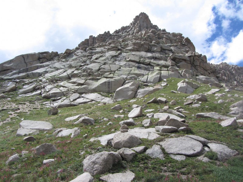
A look up Peak Ten.
The rest of the group went over to the campsite we spotted earlier while I was on Peak Ten to see if it was in fact Jamie's. My descent route more or less followed a creek that was flowing from the Peak Ten/Jagged Saddle. This led me right by the other site and I and I ran into the others there. It turned out to be Jamie's site but it was a pretty stealthy spot that we couldn't have found in the rain the previous day and there wasn't room for other tents anyways. No one was home though so we left him a note and returned to camp. Back at camp, I continued my daily regimen of sitting in the creek for 20 minutes to soak my blisters and "ice" my hips/joints to recover for another big one the next day - Jagged Mountain.
Epilogue: Guys, it was truly a pleasure to share this week with you all. I know, at times, things were a little stressful, but I have nothing but incredible memories of the time back there. Sunlight Basin is somewhere that any person that considers themselves an outdoorsman needs to experience. The views, high lakes, and unique terrain need to be experienced to be fully appreciated and I am proud that I had such a great group to share them with. Thank you again for all of your help on and off the trail - and keeping me under control (Well, most of the time anyways). And Mike, you may want to start coming to grips with "having" to repeat the Grenadiers in 2014.
Good luck on RGP guys! That is another spectacular area.
I also need to say a special thank you to not only my wife and the in-laws for being so understanding of my mountain pursuits but Steve Gladbach, Sarah Meiser, Terri Horvath, and Presto (sorry, don't know your real name) for all of your help and advice that you provided for our group.
Thumbnails for uploaded photos (click to open slideshow):
Gives a solid visual when thinking about the Weminuche.
13,121, Sunlight Basin and your shot of The Guardian make this a stellar TR, and your description and gratitude for those that have come before and passed along wisdom make it all the more better.
A week in the Weminuche is a necessity for anyone that has ever called themselves an ”outdoorsman”.
It was a great week indeed, glad to have been able to share it with you all as well. My longest previous trip was maybe 5 days, so this was more than just an adventure, but a test of endurance and mental fortitude. The lifelong memories we made will always be regarded fondly!
I hope to be an outdoorsman in a couple weeks 8/16/2012 5:05pm
Well, at least 5/7 of one.
I never tire of pics of this area, and your storytelling hits the spot.
Fantastic TR. I enjoyed it almost as much as I'm gonna enjoy Cuckoo's in a couple weeks. Was that pre or post-climb?
To this beginning of the saga that was your "excellent adventure" of the summer of 2012. 8) That area of the state has been our home away from home many times, and I get a little misty-eyed from incredible memories that you feed with stuff like this. Floyd, you did a great job with this part of the trip report. So many good lines (you don't know if you have the legs :shock: that will be the day!; having your own shower and jacuzzi ... bonus :!: ). And to whomever referred to Sarah as "the cook" (even in jest) has no clue about how that chick can climb (though, it is my understanding that she really did shine when it came to culinary skills on this trip :wink: ). I was certainly there in spirit with all of you for this one. Thanks so much for posting ... I look forward to the other chapters. Happy trails! :D I will add that everyone who loves the wilderness should take at least one LONG trip (and I've had many) where you forget what day of the week it is because you've been out so long. It does something very good to ya. 8)
This is just what I needed. When it comes to 13ers, you guys know how to do it. Love these epic adventures. Hope to follow this up next year fo shizzle!
Nice job to all of you! Can't wait to read parts 2 and 3. When I can finally make it down there for an extended trip, I'll be using one of your reports to help plan.
Brian: I can't imagine a better way to sum up the Wem than those lyrics Mike: Looking forward to Part 2! Matt: Post-climb. Good luck down there! Presto: You would have appreciated us debating which day it was to sign summit registers. By about Tuesday it was getting comical. Thanks again! Terry: Call me a hipster, but this was my happy place for sure. cftbq: Glad you liked it. 49ers: Hey, you could always day trip it! Reinhold: Thanks for the compliment. FOTM: I hope you do get back there and this helps. Special place. I think Papperson broke out a packet of tuna on night 8, but I think that was the only time for any of us. Sarah: Thanks again for all of your help. Now for parts 2/3... Steph: Drop me a line if you do plan a trip. When I said we dissected every angle, that wasn't an overstatement.
The Floyd reference seems to sum up this area quite well. I got out my map of the Weminuche and followed your progress through part 1...now off to part 2.
Just finished reading Mike's report, so had to find the 1st part too! Such an amazing place, it's difficult to find enough superlatives! But great job in relating your experience, and some truly outstanding photos to go with it! Especially loved image #9, but like you said, anywhere you look would put a happy face on you for sure! Thanks for sharing! :D
Thanks for the hours and hours of work you put into the planning of this one, Scot. It was truly an incredible eight nights. I can't believe we made it. I'll never forget it.
And I cannot stress the importance of at least one big Weminuche trip in a Colorado mountaineer's career. To just check out for a full week is a must. The passes are pretty tame and the options are endless. Brian and Terri are 100% correct in their assessments.
I was so nervous going into this trip, unsure if I could handle 8 nights. To my surprise, it actually went by fast and I never had that ”can't wait to get out” feeling (well, maybe a few times when the food talk got going!).
Being surrounded by such amazing scenery for that long certainly puts you in a different state of mind. I found the re-entry into civilization rather jarring.
Anyway, lots of emotions about this trip still close to the surface. You captured it all so well, Scot. Thank you for all the time and effort you put into planning this. I feel really fortunate to have been part of it.
The leading photo of Jagged is unreal, like some mean prehistoric creature frozen in rock.
Floyd, your story really set the stage. This took some meticulously planning to succeed, and I think that shows loud and clear here. Thanks for writing it up and sharing it.
Different state of mind...and it's right outside the front door...
Colin: Think you can stay in the states in '14 for the next weeker? MtnHub: Truly, anywhere you turned was a jaw dropper. Thanks for the compliment. Pap: I love doing the research - heck, it kept me out of New York Basin. Until next time... Sarah: So you couldn't wait to get out once the talk of arugala and spinach was flowing freely? Jamie's asparagus reference on Day 4 must have drove you insane! Again, my pleasure and you never know when that alusive pic on Jagged's 1st crux may make its 14ers.com debut. Kimo: Don't bother going to the Weminuche. We joked several times that you may not ever make it farther than 100 yards from camp with all the photo opps. Thanks for the compliment on that pic. I can't believe it's a point and shoot without any work. That light was what we saw.
Yet another fantastic Weminuche report 7/29/2013 6:29pm
Great stuff, thanks! I'm not a backpacker, yet I wanna go here.
Caution: The information contained in this report may not be accurate and should not be the only resource used in preparation for your climb. Failure to have the necessary experience, physical conditioning, supplies or equipment can result in injury or death. 14ers.com and the author(s) of this report provide no warranties, either express or implied, that the information provided is accurate or reliable. By using the information provided, you agree to indemnify and hold harmless 14ers.com and the report author(s) with respect to any claims and demands against them, including any attorney fees and expenses. Please read the 14ers.com Safety and Disclaimer pages for more information.
Please respect private property: 14ers.com supports the rights of private landowners to determine how and by whom their land will be used. In Colorado, it is your responsibility to determine if land is private and to obtain the appropriate permission before entering the property.