Download Agreement, Release, and Acknowledgement of Risk:
You (the person requesting this file download) fully understand mountain climbing ("Activity") involves risks and dangers of serious bodily injury, including permanent disability, paralysis, and death ("Risks") and you fully accept and assume all such risks and all responsibility for losses, costs, and damages you incur as a result of your participation in this Activity.
You acknowledge that information in the file you have chosen to download may not be accurate and may contain errors. You agree to assume all risks when using this information and agree to release and discharge 14ers.com, 14ers Inc. and the author(s) of such information (collectively, the "Released Parties").
You hereby discharge the Released Parties from all damages, actions, claims and liabilities of any nature, specifically including, but not limited to, damages, actions, claims and liabilities arising from or related to the negligence of the Released Parties. You further agree to indemnify, hold harmless and defend 14ers.com, 14ers Inc. and each of the other Released Parties from and against any loss, damage, liability and expense, including costs and attorney fees, incurred by 14ers.com, 14ers Inc. or any of the other Released Parties as a result of you using information provided on the 14ers.com or 14ers Inc. websites.
You have read this agreement, fully understand its terms and intend it to be a complete and unconditional release of all liability to the greatest extent allowed by law and agree that if any portion of this agreement is held to be invalid the balance, notwithstanding, shall continue in full force and effect.
By clicking "OK" you agree to these terms. If you DO NOT agree, click "Cancel"...
Background: We had some ridiculous plans for our Slate Creek trip last fall which, while a heck of a lot of fun, had to be scaled back a bit since we were a little out of control with what we wanted to do in 4 days. This left some outliers in the area for us. So, I guess another trip was in order, and soon. During an evening of about 10 rounds of Dales watching the Alabama-LSU game last November we all circled May 2012 for another try at Peak N.
Saturday, May 19:
Kelso Mountain - Brian and I walked up, we walked down. Let's move on...
"Why did we do this again?"
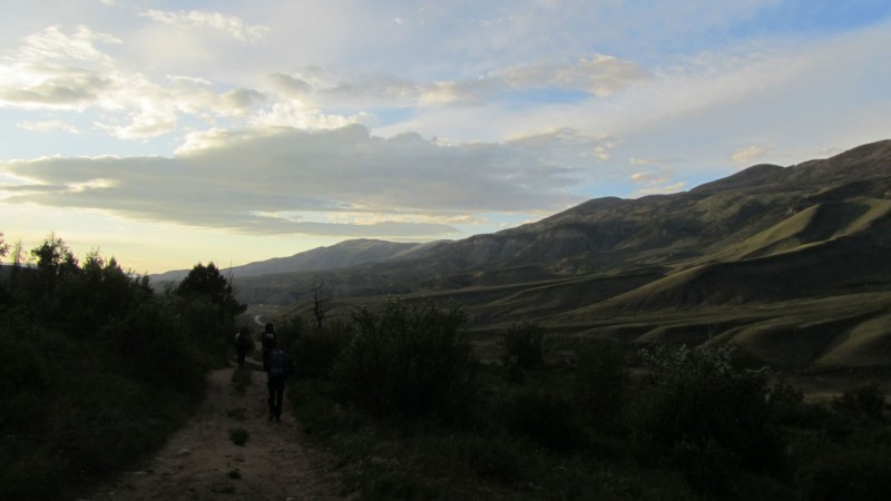
Lost Lake Approach -
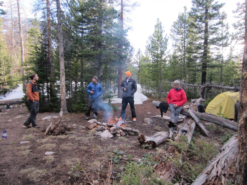
Since the little warm-up hill went a lot quicker than we thought, we arrived in Silverthorne an hour early (10:00) so instead of our intended meeting place of Jimmy Johns, we hit up a little café/diner for some eggs, bagels, and a brick of blueberry/cream cheese coffee cake. Also, a pit stop to the local liquor store was in order to stock up for the evening campfire festivities where we found a newly stocked shelf of Pliney the Elder for $5 - all signs were pointing to this being a stellar weekend. We met up with Mike/Kevin/Sarah at JJs and let Kevin in on our little secret across the parking lot. He wasted no time in buying the few we left in the store while Brian and I sorted our packs to get out of day-trip mode and ready for the pack into Lost Lake.
We started hiking the road around 1:00 and anyone reading this shouldn't expect it to be drivable any time soon. The deadfall was atrocious. We got up to the lake around 5:00 and after a flurry of unpacking and setting up, Deviants were cracked open kicking off an evening of friendly company, swapping stories, and all around good times. Starting a campfire proved troublesome as wet as everything was, but eventually the pyros prevailed. At one point, there were several pops and cracks throwing an "ember" between Brian's feet. To his surprise, the ember was moving. After a Deviant and a half, a flying flaming earthworm makes for a hilarious encounter. Brian, being the animal lover, was nice enough to extinguish him with a tablespoon of beer. A light drizzle started around 9:00 which prompted us all to call it a night.
Good times.... (Photo by Sarah)
Sunday, May 20:
Peak "N"
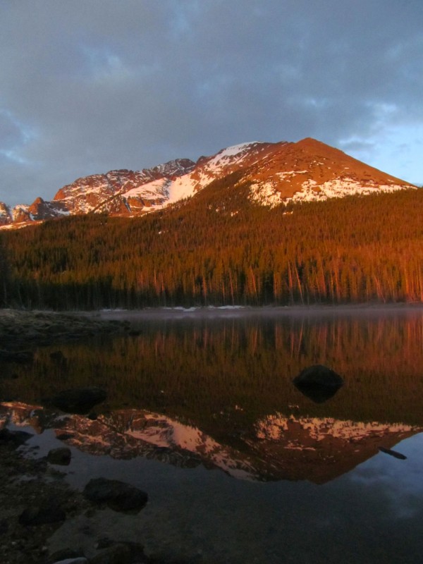
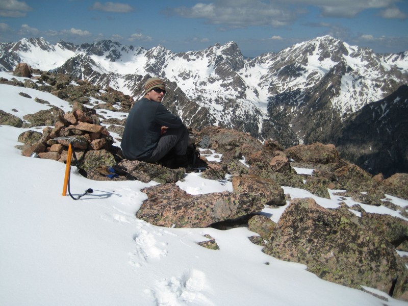
Alarms went off at 5:30 and we were on the trail by 6:30. In between, we were treated to an amazingly beautiful morning alpenglow on Dora Mountain and "Peak O" and reflection in Lost Lake.
Peaks N/O (Mike)
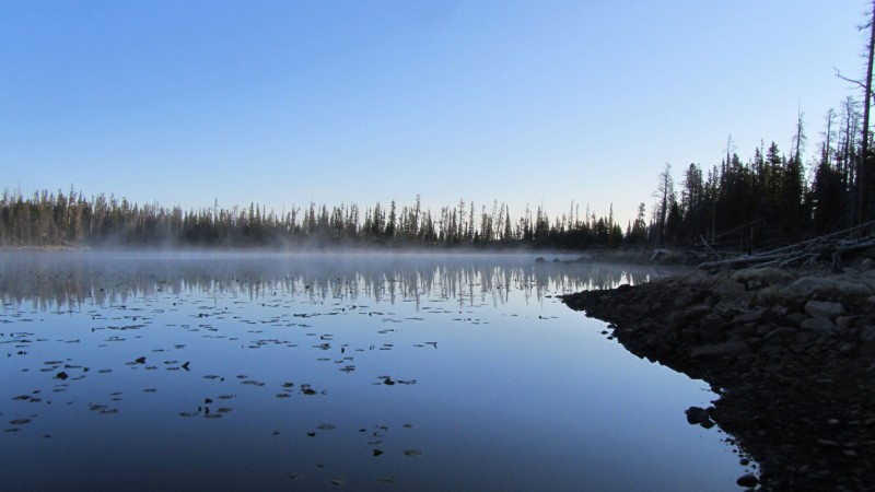
Lost Lake (Brian)
We chose a later start because we knew the ensuing bushwhack was going to be anything but trivial and wanted daylight to navigate the woods. As far as beta: You need to get in the basin to the E/NE of "N" and in order to avoid the long shoulder coming off of O, go left, then when you think you've gone far enough left, go left some more. A GPS helps... immensely.
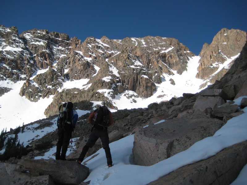
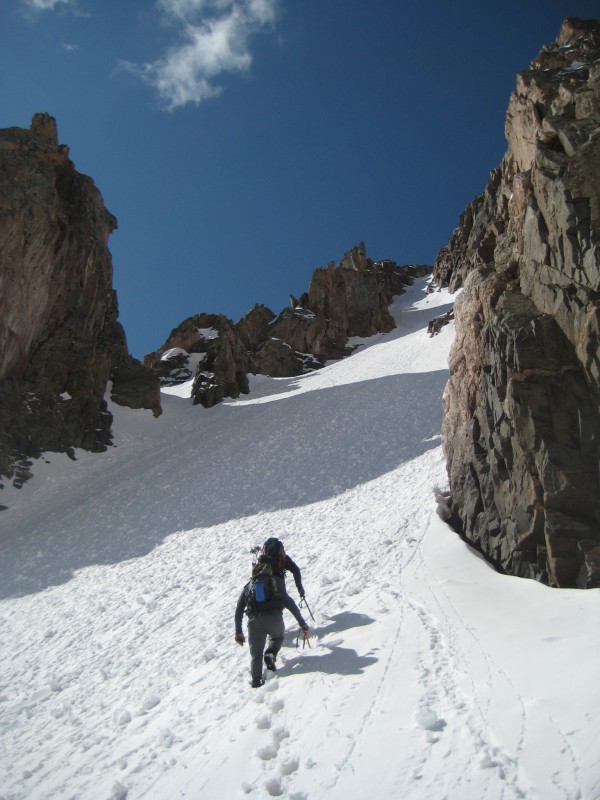
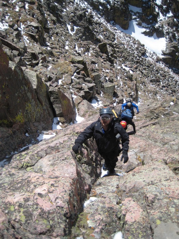
The bushwhack was as expected and just as the saying goes, "There is bushwhacking and then there is Gore bushwhacking." This would definitely be the latter variety. Along the way, we had to ask, was it Olestra or retro Rolling Rock that caused the green poo in the woods and who's was it? Mercifully, we eventually broke tree line but it wasn't until around 8:30 and then went onward to the apron and were spiking up around 9:30.
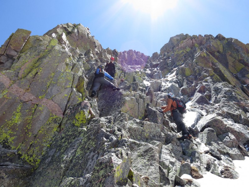
Mike/Kevin scouting out the route
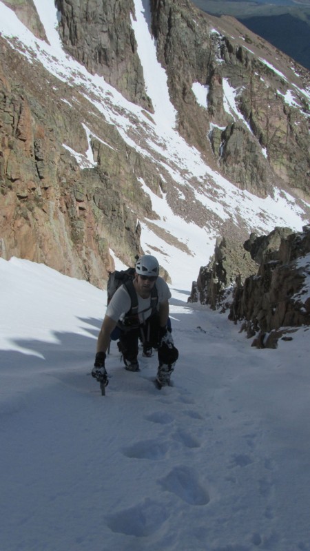
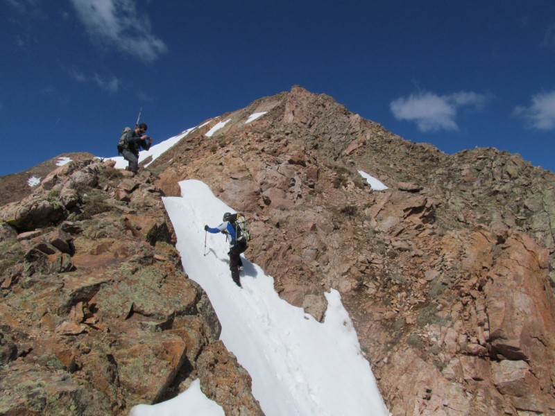
I think we all had our doubts about the snow quality since the standard couloir was now baking in the hot sun for over 3 hours but there were dry ascent options if needed. The snow still felt summer-like though, but still a little soft and we didn't want to lug our crampons up there in our mountaineering boots for nothing. As we started up, all of our eyes seemed to be drifting to our left where there was a fine-looking deeply-inset snow line that was still in the shade thanks to its northern aspect and high walls. It was also a lot longer and steeper than the standard. Brian and Mike asked us what we thought and I, for one, didn't hesitate to jump at the route variation - not only for the potential of better snow, but the heat from the sun was also forcing Deviant out of every one of my pores.
Mike/Brian heading up
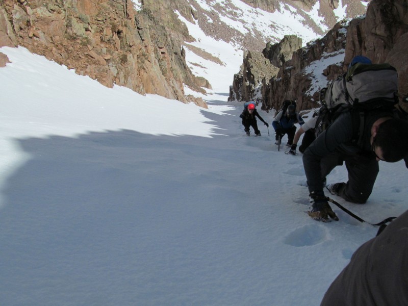
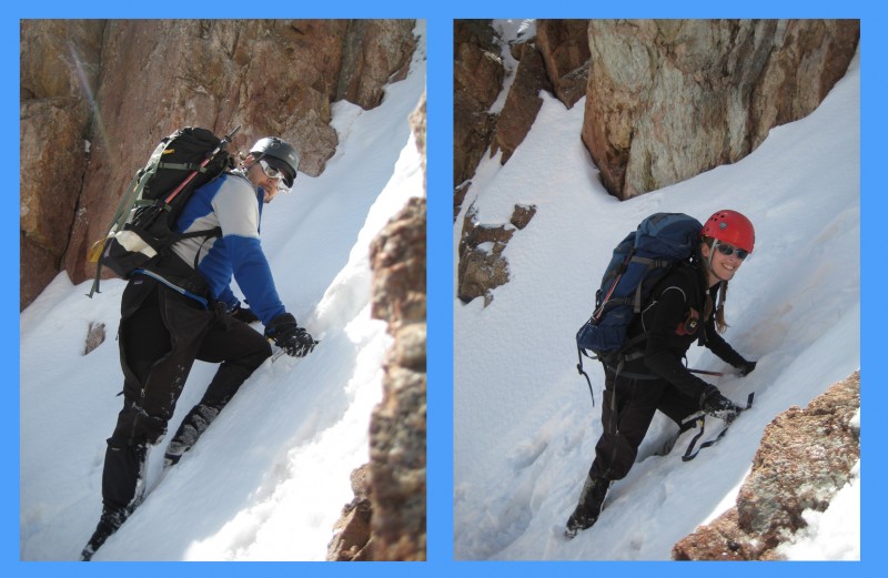
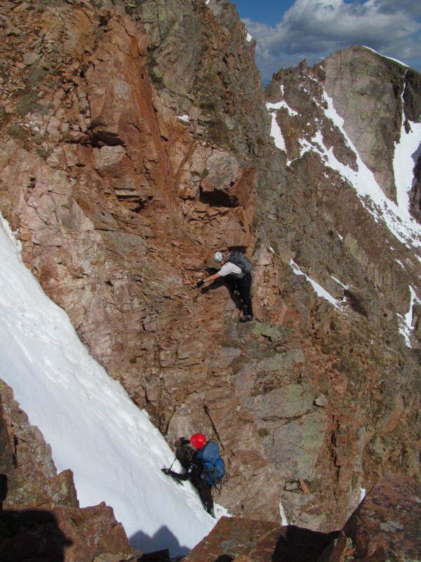
This line was a sustained 40+ degrees with a steeper finish for the last 30 or so feet (maybe mid-50s?). Brian/Mike were in the lead and Kevin/Sarah were right behind me. The snow was excellent going up but pure soup at the very top so I opted for a short 4th class mixed climb finish through a rock notch to bypass the wallowing in steep snow.
Kevin and Sarah in the Couloir
Yours Truly (Brian)
Ants Marching (Mike)
Starting to get steep. Notice me bailing? (Mike)
Team Papperson (Photoshop credit to Mike)
"Can I get a hand?" "Nope, busy." (Mike)
Sarah and I climbing (Mike)
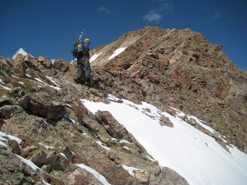
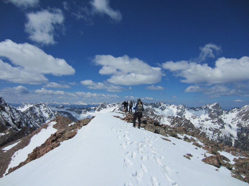
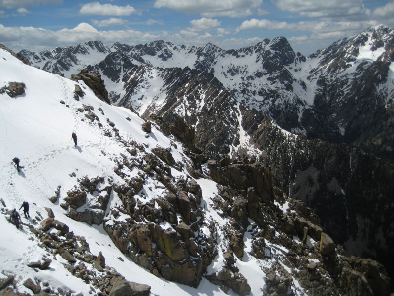
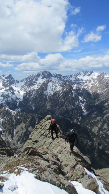
The view after cresting the top would take your breath away. All that was left to summit "N" was a classic 3rd class Gore Range ridge scramble for 200-300 vertical feet. Man, I love this range...
Mike is all smiles.
Brian hitting the ridge
Mike/Kevin/Sarah on the ridge
Peak N is nearly in a class of its own for views, especially this time of year as the snow highlights each aspect of the surrounding mountains. I've been on other Gore summits where they are comparable, but good luck getting to Peak "K" or "R" this early in the year. The topic of conversation turned across valley as we tried to figure out how many deer/rabbits are hanging from the roof of the cabin next to "John Wayne Gacy" Lake.
Junior Lord Gore in his element
Gangs all here (Sarah)
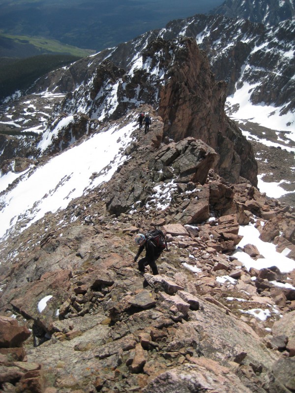
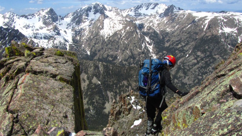
Peak "O": unranked, 160 feet of prominence, 0.29 miles from "N" so it should go quickly enough, right? We set off down the scree on "N"s NW side to the top of the standard route - so far, so good. Here we had a choice to either 1) hit the impending tower head on which would require 4th or low 5th class under a talus/scree field or 2) drop to the west and pick our way around it. Mike started up the tower and it seemed to be going well, but I (others?) talked him out of it as 5 of us going up that thing with a loose mess above may have proven troublesome. I was having flashbacks of the Hourglass on a summer weekend and I definitely didn't want to down climb it should the other side get ugly.
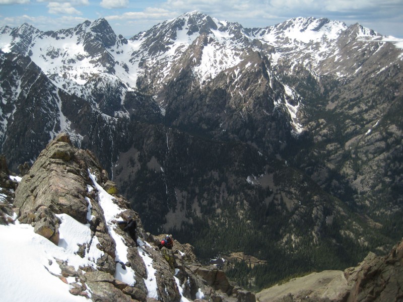
During the drive home, Brian and I discussed how best to describe a route for the traverse, and neither one of us could come up with anything. Basically, good luck and expect to get cliffed out no fewer than 5 times. It's trial and error at its finest. There were numerous 4th class chimneys (that had to be repeated in both directions as we turned around due to impassable terrain), at least 1 low 5th class icy downclimb, a 60+ degree snowfield traverse, and the ice axes really came in handy in chipping away ice or as a climbing tool when soft ground or a suitable crack in the rock allowed. When dry, it may be as "straightforward" as other Gore traverses, but the thin covering of fresh snow made every step unsecure and we couldn't utilize benches as they were generally covered with solid ice that would have no problem sending you tumbling into the Black Creek drainage. Exposure was always present, but never overwhelming.
Sarah with a nice backdrop (Brian)
Mike's got a little Cap'n in him. (Sarah)
Kevin/Sarah/Brian along the traverse.
Mike/Brian spot Sarah on a nasty downclimb.
Making diamonds from coal.
Kevin, "Screw it, call SAR! I can't climb up or down."
Kevin/Sarah walk the line (Brian)
Finally, over 2 hours after leaving "N" (did I mention only 0.29 miles of isolation?) we were at the base of the final climb to the summit of "O." Mike and Brian chose the snow line on the SE face which was partially melted out and what was left was pure slush. Mike was far enough in front though to confirm the ridge direct did in fact go. Kevin, Sarah, and I chose that route and the start required a chimney move that would have made Bear Grylls proud then ended with a short "skinny catwalk" or wide "knife edge" depending on your perspective. Two and a half hours after leaving "N", we finally sat atop "O". (Did I mention only 160 feet of prominence?) As seen from the other side, if we had chosen to take on the initial tower directly, the east side is relatively mellow so it's feasible if you have a) a small group b) very patient c) trust your partners (and yourself) immensely to not kick any rocks or d) all of the above.
A look back at N. That's our line on the left
Satisfying Summit (Sarah)
My definition of mountain hell is descending loose talus. We descended directly back to Lost Lake off of the north ridge/slope of "O" and found nothing but my personal mountain hell, 2,000 vertical feet of it and all of it in about a quarter of a horizontal mile. And, just for the icing on the cake, my hiking pole snagged a rock about 2 minutes off the summit and the bottom section snapped in two. The only bright spot was when Brian stopped to thank the land owners around Black Lake for helping make accessing some of these mountains so straightforward.
From Brian, With Love (self-portrait)
Once in the trees, none of us minded the slick soft snow or maze of deadfall as our feet were eternally grateful to not be on teetering rock. Again, a GPS comes in handy for this stretch.
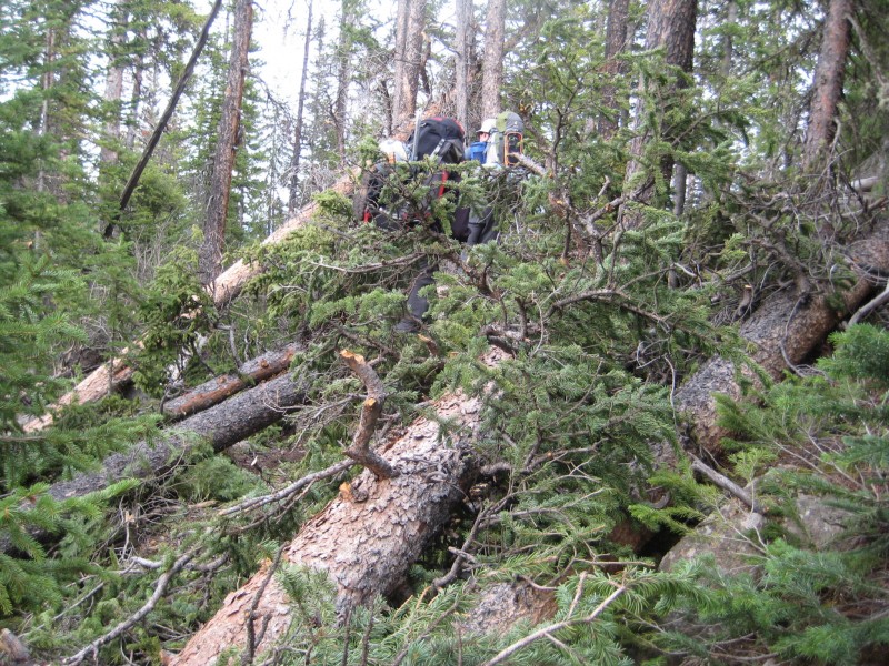
We arrived back at camp at 4:30, so it took us 10 hours to go about 5 miles. We had figured on a conservative 7-8 hours WITH "M" included. We underestimated this one, but it was not underappreciated. We packed up, refilled water, and were back on the trail by 5:40. Brian lost count of deadfall at 75 just after the junction with the Gore Trail (which IMHO is the most annoying trail in Colorado) so we guess there are no less than 200 trees across the trail between the Brush Creek TH and Lost Lake.
The Lost Lake Trail. See it?
It looked like someone drove the road on Sunday to clear some of it but simply gave up after cutting 3 or 4 trees and realizing a few more chainsaws were needed to make any real progress. We hit it pretty hard on the way out and made the car at 8:00 even. Kevin/Sarah high-tailed it back to Denver to attempt to make a pizza joint before it closed and Brian, Mike, and I swung by Chipotle in Silverthorne where a couple of burritos took the edge off.
Good Night, Thanks for Reading (Brian)
Thumbnails for uploaded photos (click to open slideshow):
Very descriptive writing ... felt like I was there (in a sick, bushwhacking sort of way). Don't forget ... they would also be known as ”the Woodions”. :wink: Love Brian's simple, yet expressive, self portrait. :lol: Way to get after it ... congrats to all on the summits. Thanks for posting. Happy trails! :D
Another fun filled weekend in the Gore! Peak N is worth repeating, Peak O - not so much. It always amazes me how the Gore peaks as single climbs are quite manageable, but try combining them along their connecting ridges and it quickly turns much more difficult.
So did you guys get any of that snow/grappel/rain on Saturday?
A friend and I climbed Snow Pk that day and had it all, except for views from the top!
I was thinking of you guys & gal while on our hike.
But whatever man, nice report! Cool & fun looking snow climb you found!
We were on W Partner the same day, but I could not spy any ants on the horizon. ;)
What a gorgeous day to be in the Gore!
Thanks for inviting a couple of Gore neophytes along for the ride, Scot. I'd also like to thank Brian and Mike for the spots on those icy downclimbs. It was a ridge of seemingly never-ending obstacles.
And yes, I did request the presence of SAR at one point. It was during a moment of what helmut likes to refer to as ”nerd rage” when you reach a level of frustration that leads to little alpine tantrums.
Still don't know what to make of the green cairns though. Maybe some hardened peakbagger wandered up to Lost Lake after a few too many St. Patty's Day pops?
I remember the Dales and Alabama-LSU session 5/23/2012 2:39am
Some things have changed quite a bit since then, though.
I'm looking forward to getting out with you somewhere besides Dry Dock, Scot.
That looks like a trip to remember.
One thing I'm learning about this game is that it's the difficulties that create the best memories. And the company. Oh, and flaming worms.
I'll repeat Papi's thanks for the invite, and for giving me a hand in several dicey spots.
Great write up Mr. Floyd... didn't think anyone could capture the experience but you nailed it! Looking forward to future adventures with you and the rest of this great crew.
Anyone willing to haul skis, boots and everything else it entails on their back on a trail with 157 deadfall (yeah, I counted) for 6 miles, then a 2 mile, full on Gore bushwack to ski a 1000 foot line on N, be my guest.
That being said, on a better snow year, with the road skinnable from atleast a few miles in and snow covering up the bushwacking from Lost Lake, the N and O Cirque offers a plethera of skiing with a high camp.
Yes I bet the bushwhacking would be terrible with skis on pack and there are many easier slogs to achieve quality skiing in the gore. However gotta be tough from a skiers perpective hiking epic lines in the gore without skis.
To those that joined, thanks for the great company and memorable times. Looking forward to the next time out which hopefully comes sooner than later.
To those that didn't but should have (Colin) - the Greys Peak trail makes for a much easier pre-approach hike than a 15 mile RT through a downpour.
Skiers - while I'm admittedly not a skier, that would be one approach that I'd like to watch someone haul skis back there for the pure entertainment factor.
Matt - hopefully the stars align next month.
Darin - we got just enough precip on Saturday to keep the approach comfortable. We seemed to have the weather window nailed.
Presto - I don't know, the ”Woodons” seems to be a little risque for this site.
Dude! :shock: Woodions. :wink: :D Just trying to give my gal some cred (I mean, c'mon, she does seem to be the ”token chick” ... no shame in that ... I've been the token chick many times myself). 8)
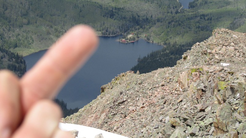
The best part is the middle finger to the Black Lake residents. That lady got all pissed at us but we just ignored her and walked into a living hell of deadfall :lol:
Scot, you did the Gore right. That ”making diamonds from coal” picture is magnificent and the caption so true. Some of those moves look to be a bit beyond my skill set so in some way I'm glad I had to pass on the trip. But on the other side of the coin I so wish I was there to experience it. Visceral and exciting? Great group and good times? Absolutely no doubt. Your story-telling says it all. Hope to hook up with the crew sometime this summer. And in the meantime, thanks for the fine vicarious living!
Caution: The information contained in this report may not be accurate and should not be the only resource used in preparation for your climb. Failure to have the necessary experience, physical conditioning, supplies or equipment can result in injury or death. 14ers.com and the author(s) of this report provide no warranties, either express or implied, that the information provided is accurate or reliable. By using the information provided, you agree to indemnify and hold harmless 14ers.com and the report author(s) with respect to any claims and demands against them, including any attorney fees and expenses. Please read the 14ers.com Safety and Disclaimer pages for more information.
Please respect private property: 14ers.com supports the rights of private landowners to determine how and by whom their land will be used. In Colorado, it is your responsibility to determine if land is private and to obtain the appropriate permission before entering the property.