Download Agreement, Release, and Acknowledgement of Risk:
You (the person requesting this file download) fully understand mountain climbing ("Activity") involves risks and dangers of serious bodily injury, including permanent disability, paralysis, and death ("Risks") and you fully accept and assume all such risks and all responsibility for losses, costs, and damages you incur as a result of your participation in this Activity.
You acknowledge that information in the file you have chosen to download may not be accurate and may contain errors. You agree to assume all risks when using this information and agree to release and discharge 14ers.com, 14ers Inc. and the author(s) of such information (collectively, the "Released Parties").
You hereby discharge the Released Parties from all damages, actions, claims and liabilities of any nature, specifically including, but not limited to, damages, actions, claims and liabilities arising from or related to the negligence of the Released Parties. You further agree to indemnify, hold harmless and defend 14ers.com, 14ers Inc. and each of the other Released Parties from and against any loss, damage, liability and expense, including costs and attorney fees, incurred by 14ers.com, 14ers Inc. or any of the other Released Parties as a result of you using information provided on the 14ers.com or 14ers Inc. websites.
You have read this agreement, fully understand its terms and intend it to be a complete and unconditional release of all liability to the greatest extent allowed by law and agree that if any portion of this agreement is held to be invalid the balance, notwithstanding, shall continue in full force and effect.
By clicking "OK" you agree to these terms. If you DO NOT agree, click "Cancel"...
Peaks (in order ascended):
Snowdon Peak (13,077') - 588th Highest
"South Snowdon" (13,046') - 611th Highest
West Needle Mountain (13,062') - 600th Highest
PT 12932 (12,932') - 693rd Highest
PT 12618 (12,618') - 920th Highest
North Twilight Peak (13,075') - 590th Highest
Twilight Peak (13,158') - 515th Highest
Base Camp:
Crater Lake (via Andrews Lake trailhead off US 550)
Climbers:
Chicago Transplant (Mike) and Floyd (Scot)
Stats:
About 32.5 total miles and 12,000' vertical
Introduction:
Plans have a funny way of changing, and it seems that the early part of the 2011 summer climbing season is ripe with change as we chase the snow, or lack thereof, depending on what we are looking for. Fourth of July weekend 2011 was planned back sometime last summer when Scot (as well a few others) and I started talking about trying to get into the remote reaches of the northern Eagles Nest Wilderness to climb some seldom climbed 12ers and 13ers of the Gore around the Bubble Lakes. We had been looking forward to this trip for a long time, and frequently found ourselves emailing each other pictures and route ideas all winter long as "cabin fever" set in. All spring we were keeping a close eye on the conditions in the Gore, especially seeing as our proposed route would take us over Kneeknocker Pass, a pass that has thwarted members of our group in past springs when its cornice was too threatening to allow for safe passage. This winter and spring we had so much snow in the Vail area that the road to Piney Lake (the trailhead for our planned adventure) was not going to be opened until July 1. This led us to believe the cornice would be in full force and a potential "deal breaker" for the weekend. Not wanting to hike all the way to Kneeknocker in heavy packs just to be turned away, we started brainstorming on other ideas.
In come the West Needles, an area we knew little about. From Dave Cooper's snow climbs book, we could see that Snowdon and North Twilight had good snow routes, and pictures of West Needle from the summit of Twilight show a great couloir splitting the northwest face. We now have a "highlight peak" for each day, and the opportunity to combine on scrambly ridges with neighboring 12ers and 13ers. Of course there is very little information on any of these peaks around, a little bit on summitpost, and one North Twilight trip report here, but that is it. Using a combination of Cooper's book, a photo album posted by SarahT, and some maps, a Plan "B" came together, or so we hoped. We would have to have some confidence in our ability to put routes together with maps and photos, and "wing it" so to speak when we got there. Added to the snow climbs was the potential for cleaning out all seven peaks of the West Needles, something I had heard referred to as "Effective Cluster Busting" by Ken Nolan or Teresa Gergen somewhere once before. Let the cluster busting begin...
Day 1 (July 2): The Modestly Naked Lady
Peaks:
Snowdon Peak (13,077') - 588th Highest
"South Snowdon" (13,046') - 611th Highest Mileage: 8.5 miles Vertical: 3500'
Via Andrews Lake Trailhead (About 10,400')
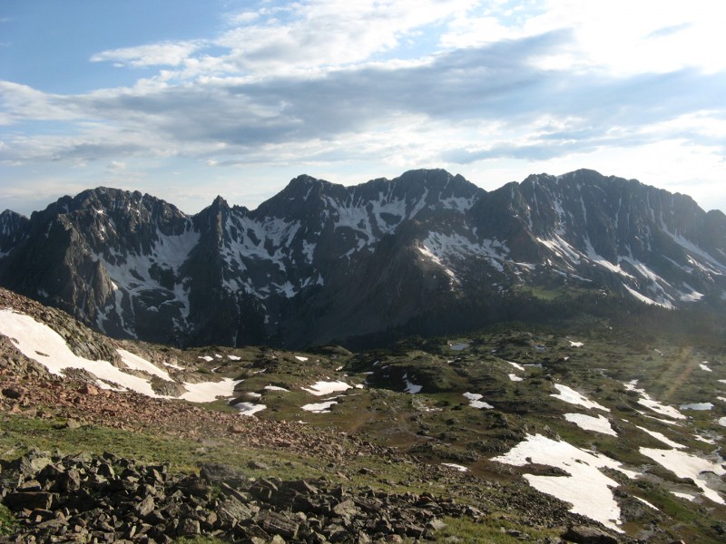
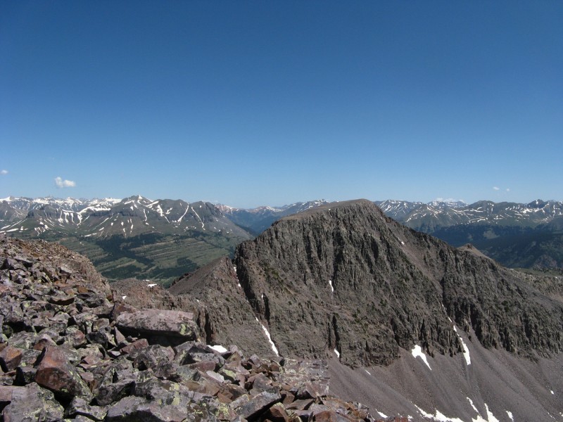
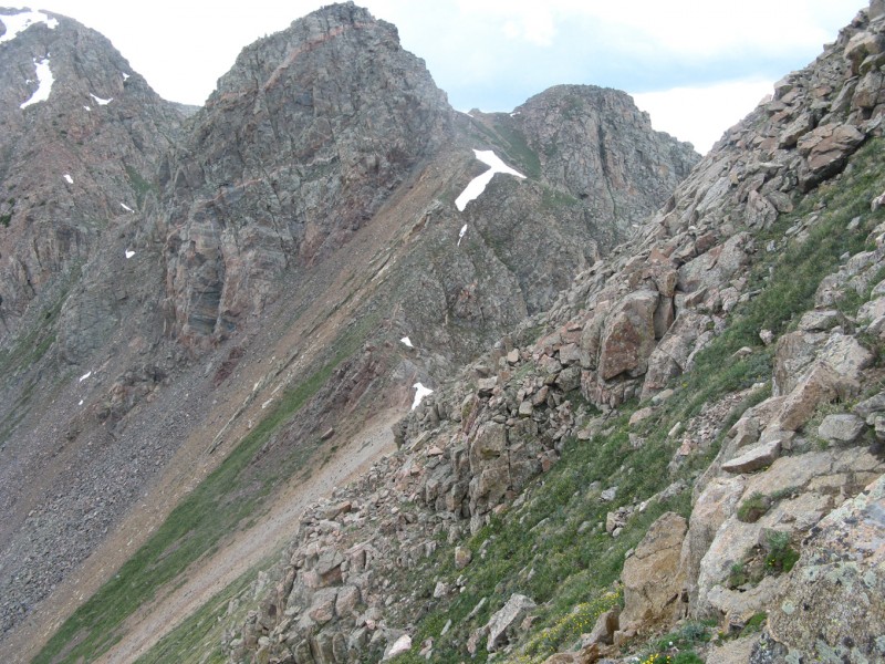
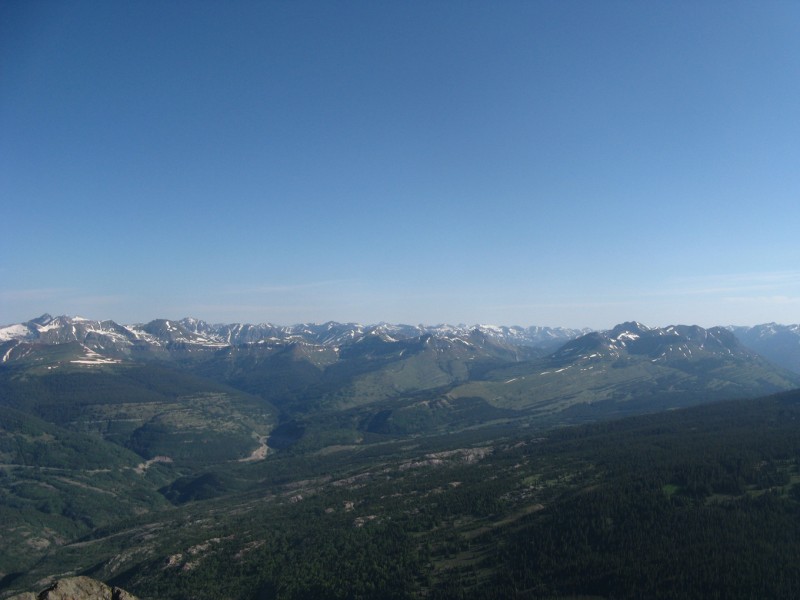
Snowdon from lower Meadow
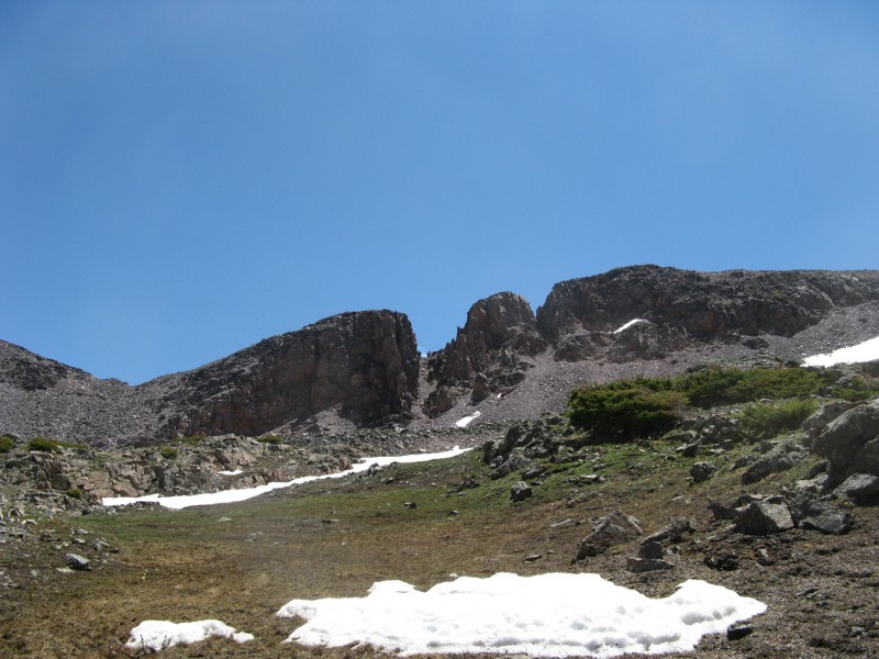
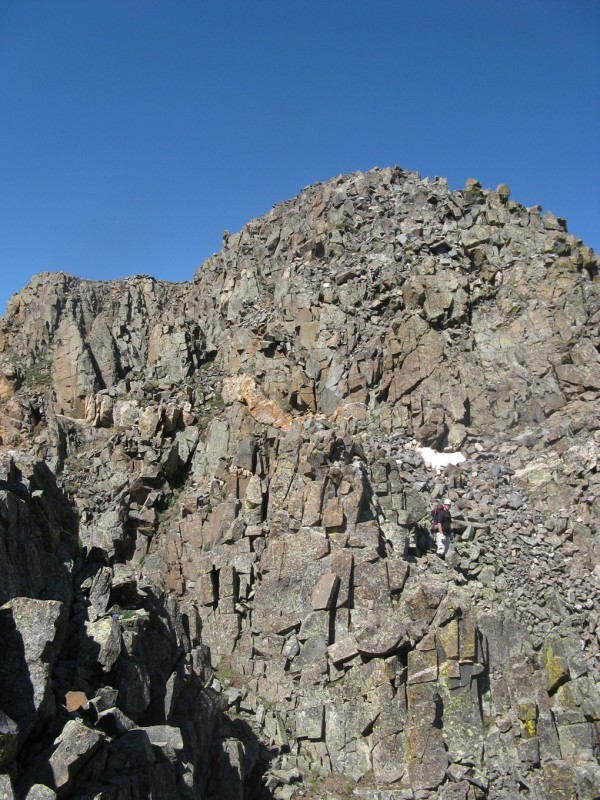
First up would be a climb of Snowdon Peak and "South Snowdon", which lie within 2 miles of the trailhead at Andrews Lake and work best as a day trip from that location rather than backtracking to them from Crater Lake. We hit the trail at 5am and quickly made our way up the switchbacks to a bench where a climbers trail peels off to the left through a large meadow headed straight for our peak. We made a small route error here, in that the trail dies in the grass and we went straight across the meadow, while a better route would have been to aim for the corner to the back left when facing the meadow. There you would pick up the trail again, pass through a second meadow, and reach the base of the talus below the couloir. We ended up in the same place, and from there worked our way up to the base of the snow to gear up for our climb.
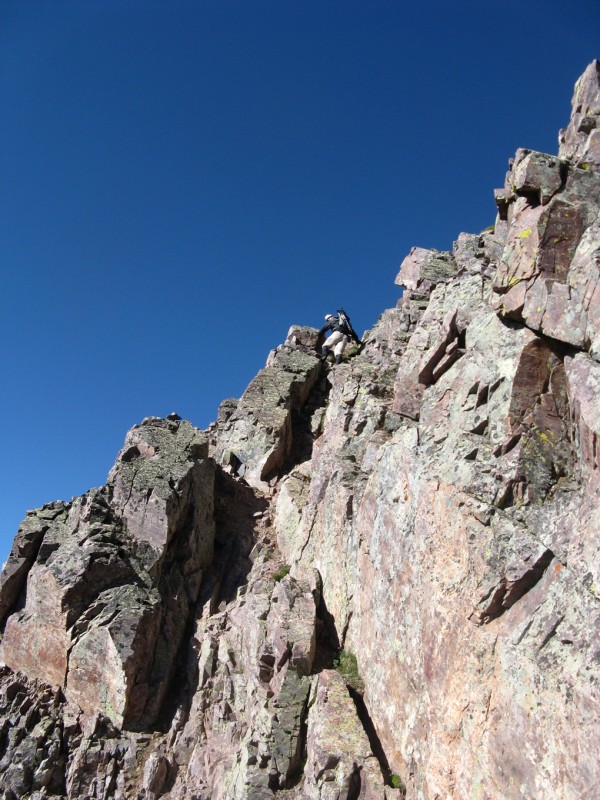
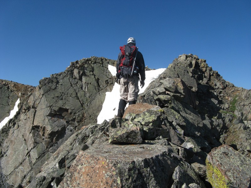
Climbing the Naked Lady
The west face of Snowdon is spectacular. Made of a quartzite similar to the Grenadiers, but with green and red hues, the peak looks like the scales of a snake or a lizard's skin and at times catches the light quite dramatically when viewed from US 550 seeming to shimmer. The Naked Lady Couloir is the snow line that splits this face ending on the ridge just north of the summit. Named so because from certain angles it is supposed to sort of look like one. On this day, however, there was a good section melted out about 2/3 of the way up, so she was a little more modest. This was unfortunate, because that section turned out to be loose, but we will get to that. When fully in condition, this route would be a classic, but for us it was a little less so. The snow was in good condition for crampons and we were able to make good steps, but it was littered with dirt and rocks from previous rockfall earlier in the season. We worked our way up efficiently, and soon found ourselves at the route's crux.
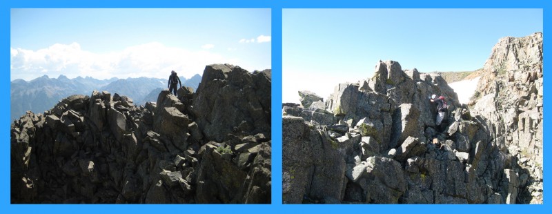
(L)Scot negotiating the ledges, (R) Scot on the steep snow near the top
When snow covered, this bulge can be in the low 50's, Cooper's book describes it as "approaching 55 degrees", but when dry it is a 3rd class scramble on grubby loose rock with some ice present. We worked our way left to avoid the ice, and found ourselves on loose nasty rock, one of which hit my knee for a little sting, but to no ill effects. We careful scrambled through this area with crampons still on, which always makes things interesting. Then it was back onto the snow until just shy of the top where again the couloir was melted out and we had to scramble out, this time on much more solid rock, although that is a relative term. Using the rocks above as a guardrail of sorts, we carefully scooted along the solid sloping ledges to the final class 3 "pull up" to reach the ridge.
Me on the melted out ledges below the top (photo by Scot)
The second we could see over the top, however, we both paused to gaze in awe at the Grenadiers which were right in our face. We took our crampons off and headed up the class 3 ridge to finish. The climb initially traverses slightly onto the east face, then up a nice class 3 ridge before easing to some grass just below the high point.
Scot scrambling up the summit ridge
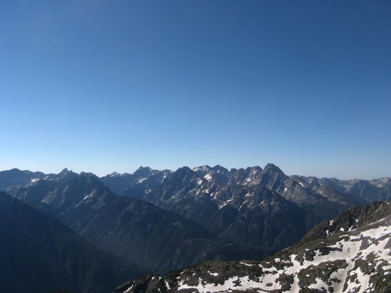
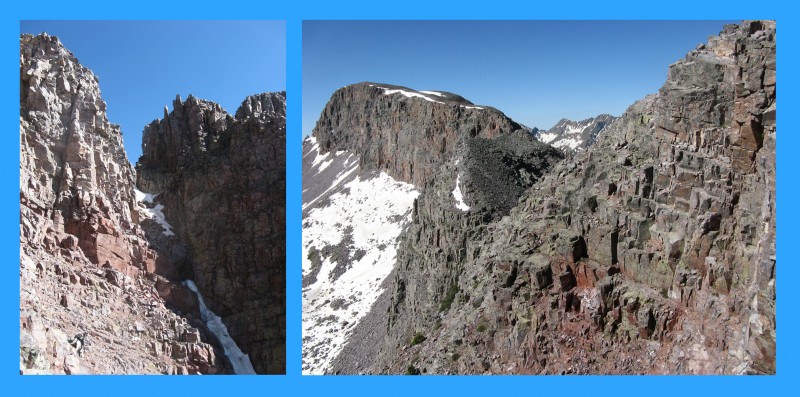
The summit views do not disappoint; which was one of the themes of this entire weekend. Another was "the notch does not go", which is a quote from Sarah's photos in particular regarding the notch between Snowdon and "South Snowdon". In actuality there are two notches, the first one we could negotiate, but first, lets enjoy the summit!
Recognize any of these beauties?
Once you reach the first notch, descend towards the base of the cliffs down a steep and loose gully with one short cliff step. There are good ledges, it's just a little blind reaching the feet for them, but the rock was solid here. To get back to the ridge, we stayed on the east side crossing ledges that reminded us of Pyramid Peak in the Elks. We continued down some more loose talus to the base of the saddle, then descended loose talus to an elevation of around 12,500'.
(L)Descending the tricky gully, (R) Pyramid-esque ledge system back to ridge
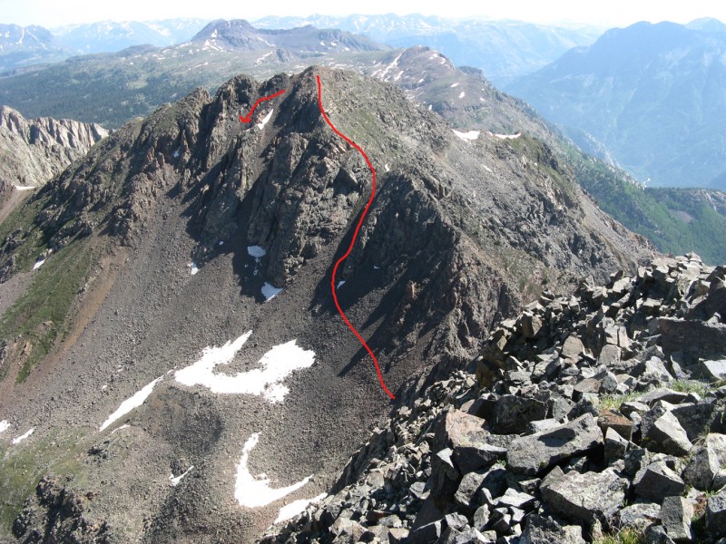
We then traversed around until we were clear of the cliffs and began to ascend talus back up to the ridge of "South Snowdon", now sufficiently past the notch, and up the easy class 2 finish on the summit. As you can see from below, the notch does not go!
Looking back at "South Snowdon's" notch from the return, we stayed high below the cliffs on the ascent
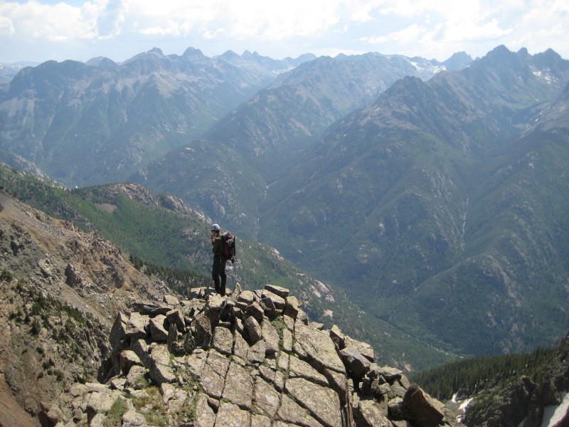
The summit views were equally impressive and Crater Lake looked awfully close, but we had to go back to the cars and re-gear for the backpack in. I guess we could have done this with the heavy packs, but that just seemed like torture we did not want to endure. We descended snow and crossed a talus bench before dropping back to the meadows below Snowdon and back to the trail and our cars. Here we geared up for the backpack, but not before grilling some cheddar brats, it is July 4th weekend after all, what would it be without a little grillin'?
Looking back at Snowdon from "South Snowdon", you can see the first notch and our traverse ledges
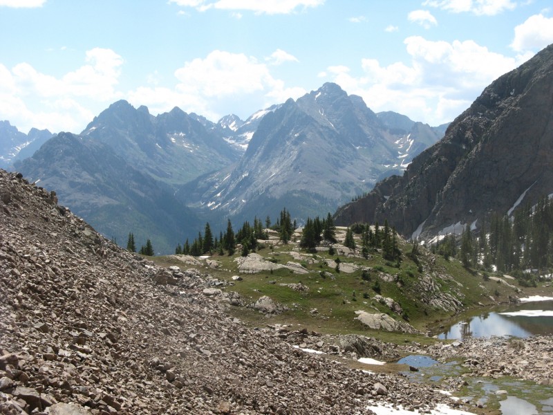
The hike in to the lake was fairly typical, just a well marked trail for 5 1/2 miles. It had its ups and downs as it crosses a few ribs, giving it about 1400' of vertical gain total (900 net). There were plenty of wet and muddy spots along the way, but we made good time, even it was a little painful. We got good views of North Twilight along the way at least!
We set up camp above the lake on the northeast side, set up our tents, had dinner, filtered water, and applied the bug spray - yet another theme for the weekend as the lake was overrun every evening by hungry mosquitos.
Day 2, Part 1 (July 3): The Haystack in the Needle
Peaks:
West Needle Mountain (13,062') - 600th Highest
PT 12932 (12,932') - 693rd Highest
PT 12618 (12,618') - 920th Highest Mileage: around 6 miles Vertical: 3500' +/-
Via Camp at Crater Lake (11,700' or so)
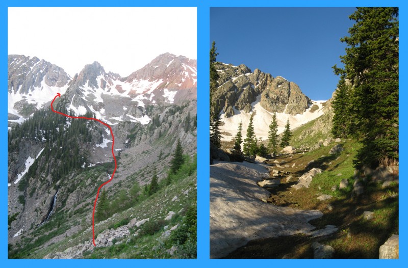
This was the "Wild Card"; there is very little information about West Needle Mountain that we could find anywhere, no trip reports, no summitpost page, barely any images. We pretty much just winged this route off of maps and a photo from the summit of Twilight. We had no idea if what we had in mind would even work, but that is part of the allure of the remote thirteeners! Let me know if you would like a map of our route to aid those of you looking to climb this one in the future to help you get back here. Trust me, its worth it, the snow climb was a true hidden classic!
We started out by climbing from our camp to a saddle above the lake, here there was a small tarn. We then descended the upper reaches of Watertank Canyon, which is right about Needleton and could be an alternate approach for this peak. We worked our way to the southwest from here, pleased to find our traverse was mostly grass. The first part went quickly as we dropped to about 11,500' at a bench above a cool looking waterfall.
(L) Our basic route in Watertank Canyon and over the ridge, (R) Slopes to saddle
From here we climbed on the left (south) side of the creek until we could find a good way to cross a steep ridge line coming off of a sharp false summit point that fills the South Twilight - PT 12932 saddle. Still unsure of what we would find on the other side, we made our way around to find a steep grassy side hill that we were able to find a trail on that we could follow to the snow line. Here we put on crampons and got out the ice axes as the 7.30am sun and heat were already becoming unbearable, it was the most we have ever sweated at that time of day at those elevations, it was a warm one! We climbed snow to the saddle, which is at about 12,500'.
Overview of our traverse to the 12,500' saddle, taken from PT 12618
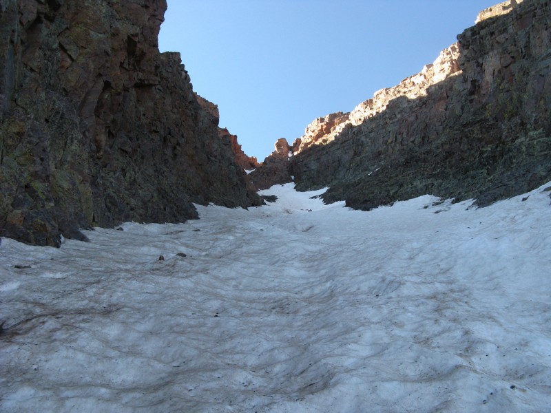
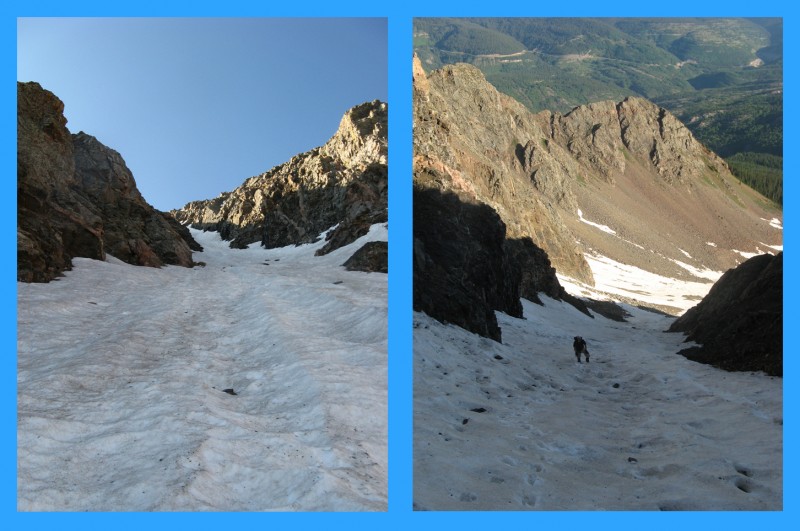
From here we dropped once again, to about 12,100' on dry talus and grass above a cool hidden lake which actually had some campers who probably a) wondered where the heck we came from and b) wondered what the heck we were doing there! We re-geared up and headed up the delightful northwest facing couloir. The bottom was a little melted, but as it got into the couloir proper the snow was perfect and the shaded aspect was delightfully cool on this warm morning.
Our intended couloir, viewed from Twilight the next day
Somewhere in the couloir we decided to call it the "Haystack Couloir", a sort of play on the old "finding a needle in a haystack", in this case it was just the opposite, we had found a haystack in a needle... West Needle that is. The snow got a little steep in some places, maybe low 40s, but was mostly in the mid 30s for steepness. The shade felt good and we plugged our way up the 1000' of snow.
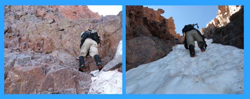
(L) Scot in the couloir, (R) Me in the couloir (Photo by Scot)
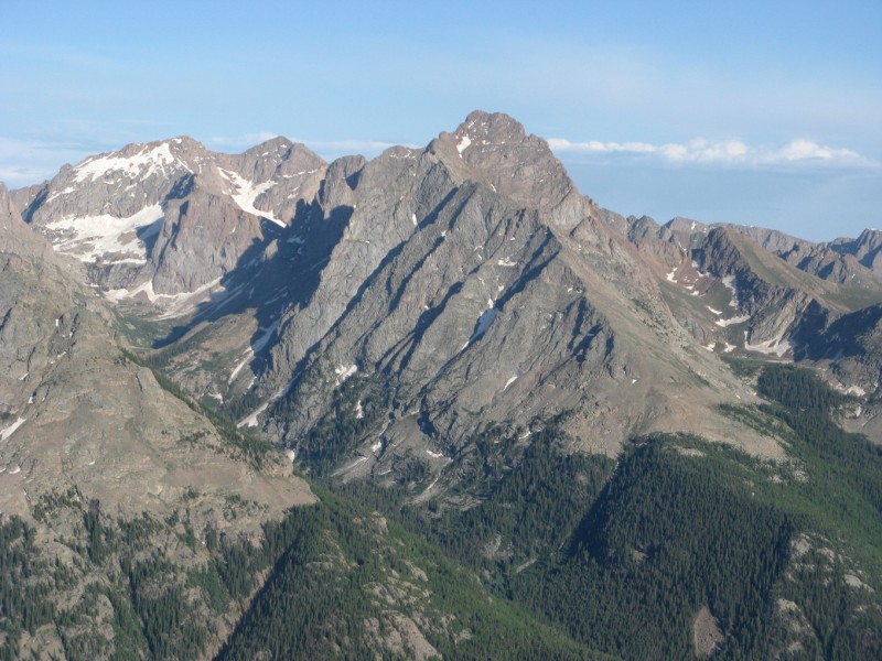
Near the top it flattened out and melted a few feet before a broad flat area where we easily were able to walk to the highest point and once again soak in the incredible views. This one looks almost straight up Ruby Creek and stares Pigeon Peak in the face. What else can you say but "Wow"?
Between the remote setting, hidden snow route, and spectacular views, this peak is going to stick around as one our favorites for a long time! To add to it, we still had a classic ridge scramble with two steps to negotiate on our way towards PT 12932, where from below we had already determined that once again, the notch does not go. We started our descent easily enough, zig zagging through some third class on the relatively exposed ridge. It made for some dramatic action shots climbing!
Scot working through the zig zagging
At the first step we made our way down the east side, crossed through and continued across the ridge crest to step #2. Here I went down a steep class 4 chimney on the left, while Scot found some ledges on the right that finished with a class 4 ledge. We then crossed a narrow broken ridge with dramatic exposure.
(L)Me crossing ridge (photo by Scot), (R) Scot crossing ridge
We couldn't see whether our route would go or not, but luckily had been able to spy it from our traverse to the snow, and were confident the broken ledges would provide safe passage to the PT 12932-West Needle saddle.
Me checking if the route will go with dramatic backdrop (Photo by Scot)
It did, and we descended our way through the various ledges and gullies trying to find the easiest and most stable way through. From here, knowing the notch between the towers at the saddle didn't go, we descended below the towers in the saddle and contoured around to a talus gully to gain the ridge and finish on solid climbing to the summit of PT 12932 at 11.30.
Route we took up PT 12932, arrow marking descent gully
The ridge back to our ascent saddle had some towers that we didn't feel like fiddling around with (for one, we were two drainages from camp with some clouds starting to get organized), so we dropped down another talus gully and traversed a high ledge system back to the saddle and reversed our route back towards camp.
Ledges we took back to the saddle before reversing our approach
Somewhere along the way the weather caught up (around 12.30) and it began to rain and sleet with some thunder audible, but no visible strikes. We were fortunate enough to find a trail across our earlier grass slopes and moved quickly back towards camp where we hid out in our tents until 2.30.
Day 2 (Part 2): After Dinner Mint
Peak:
PT 12618 (12,618') - 920th Highest Mileage: 2.5 miles Vertical: 900'
Via Camp at Crater Lake (11,700' or so)
When the skies cleared we dried out our gear and made an early dinner before heading out for a quick evening ascent of PT 12618. This peak is very gentle, and rises about 900' above camp barely a mile away. The route is all off trail, but very gentle albeit a little serpentine to work through the rolling marshy terrain to the ridge.
Gentle rolling terrain to PT 12618
It is well worth the trip to tag this summit, for this peak has quite possibly the single best views of the Needles you can find without being in them. Basically it looks directly up both Tenmile and Noname Creeks, we sat there for an hour taking in the views in the calm comfortable evening before heading back to camp to get ready for our final day. We both thought this one would be cool in winter, an avy safe peak with front row views of the Needles in their winter white? How cool would that be! Bill, this one would make a heck of a summit panorama for the site! I don't want to spoil the views, you really need to go there and see them in person.
Okay, you twisted my arm, I will give you a little taste...
Eolus and Pigeon from PT 12618
Day 3 (July 4): "By the Dawn' Early Light"
Peaks:
North Twilight Peak (13,075') - 590th Highest
Twilight Peak (13,158') - 515th Highest Mileage: 4.5 miles Vertical: 2400'
Via Camp at Crater Lake (11,700' or so)
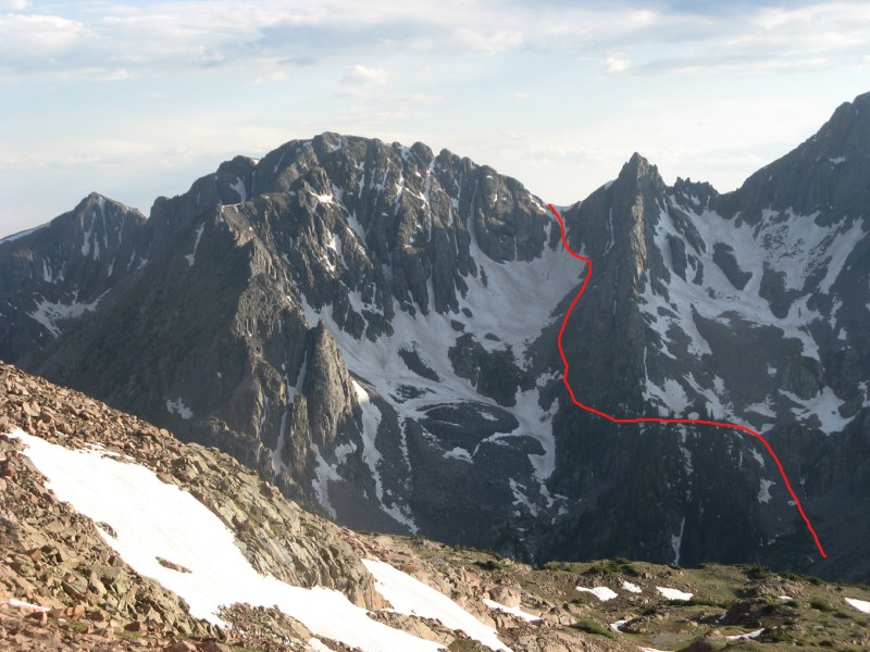
During the night we awoke to rain on the tents at 1am, but luckily it didn't last. Then at 3.30, rockfall woke us up, hopefully not on our route! When the 5am alarm sounds we peek out our tents to make sure the sky is clear and begin the familiar routine of getting our food out of the tree, having a quick breakfast, and lacing up the boots for another day. Of course I don't mean to make it sound mundane, as this range is anything but! For a change of pace, today we have to go around to the west side of lake, a side we had not yet explored. The beginning of the route from camp is straightforward enough as you just follow an open meadow at the west end of the lake until the terrain starts to drop at 12,600'. Here we worked our way down steep treed slopes to the open terrain across the base of the peak. The start of the couloir is a bit to the northeast of the summit, so you stay along the bottom for a while. We gradually ascended, but staying low probably actually works better as it makes the snow ascent longer and reduces the sidehilling talus.
North Twilight and couloir from approach hike earlier in the trip
The night was warm and with the 1am rain storm, kept things from freezing and the apron snow was very soft. The snow started at 11,900' for us, so fairly low, and we are hopeful that the snow will get better as we get higher. Fortunately it did, and in particular the upper half was very enjoyable. The route is mostly around 35 degrees with one short bulge to 40 near the top. The snow tops out almost right on the summit, just a short walk to the north and we are at the highest point. This line is mellow and wide, the easiest of the weekend, but a nice aesthetic line and one that would be fun to ski in good condition.
(L)Looking up, (R) Scot climbing
The summit of course has spectacular views, once again the Needles are on full display, but not to be lost, are the views to the west. You can see the LaPlatas to the southwest, and the peaks of the Ice Lakes Basin area with the Wilsons peeking out.
Don't forget to check out the views to the west too!
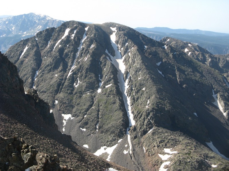
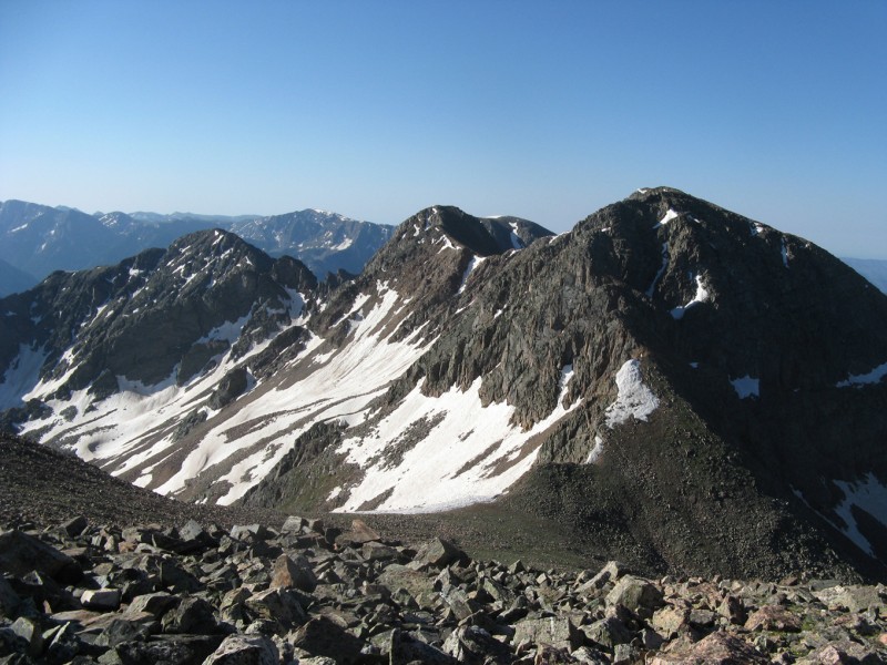
From here Twilight looks like it could get interesting. The descent to the saddle and the first 300 feet up look like all class 2 and fairly straight forward, but there is a tower and yet another notch, that probably won't go, because after all that is the theme of the weekend.
Looking at Twilight (right) from North Twilight
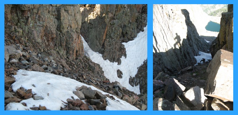
We reach the base of the tower and down climb on some loose talus to a steep gully that is below the notch about 100'. The first 10 feet are snow, but its soft enough to not need the spikes and then its some grubby class 2 with a couple of short class 3 steps to overcome to reach the notch. We go one at a time to avoid kicking things on each other.
(L)Going around the tower, (R) Scot in the gully to get to the notch
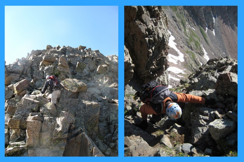
From the notch we are pleased to find that at least one side of the notch goes, and it's the side we need to climb to reach the summit. We start up some dizzying exposed class 4, but when we reach the top of this initial 20' headwall, we realize we could have gone around to our left on easier terrain, good to know for the descent!
(L) The climb out of the notch, (R) looking back at the notch
We continue up the ridge zig-zagging past some snow, then up another class 3 step to the crest of the ridge which leads to a short knife section.
(L) Scot continues up 3rd class, (R) Me scrambling on the ridge (Photo by Scot)
The knife is solid, but with a short exposed up sloping section that adds a little extra excitement. We then walk over to the highest point, and once again soak in the views before discussing possible descent routes.
Scot engages the knife edge
Most people descend the southeast ridge of North Twilight back to Crater Lake, but we eye some other options that go back to Watertank Canyon and our traverse route from the day before.
We descend the ridge back towards the saddle, but stop just short of the saddle to downclimb some wet 3rd class ledges. This is to avoid the very large cornice in the saddle. The wetness and grassy patches keep us on our toes, but soon we are plunge stepping on snow and quickly losing elevation. Some talus patches and more snow and we are at a delightful tarn with killer views at just below 11,800' and the side hilling commences. We are able to keep it mainly on grass and also stay a little higher than the previous day as we are on the opposite side of that sharp ridge I described from our West Needle approach. This helps reduce our elevation loss and we only have to reclimb about 200' to get to the saddle above Crater Lake.
So long Pigeon, time to head back to camp
Its noon, and we waste no time packing up camp so that we can hopefully have a dry hike out. The weather holds, and we reach the cars around 3. The reclimbs on the way out wear on us a bit, but we held up nicely after a full weekend of snow climbs and ridge scrambles, with plenty of route finding. This was a great weekend on a really cool cluster of mountains. Between the views and the sense of adventure combined with finding our own routes all weekend, we feel we got our moneys worth. Thanks for reading, and I hope this trip report will come in handy as other people plan their own adventure in the West Needles!
Thumbnails for uploaded photos (click to open slideshow):
Those mountains -- especially Twilight -- are awe-inspiring from Highway 550. Great to see a detailed TR on such amazing, lesser-known peaks. Indispensable beta.
Great report, Mike, and solid job, both of you!
Not doing the Twilights while I lived down there has always been a regret. Having this kind of beta (+ W. Needle!) makes it almost mandatory.
There sure is a lot of loose rock on Snowdon...
Love it! Nice photos and trip report! I've got a couple of dangling participles down there that I need to get. Thanks for posting on some peaks most people don't hear that much about. Happy trails! :D
till it breaks clean off if you don't show more pics of the Needles from the summit of p.12618. To say I'm envious of this trip would be a vast understatement. I'm not sure what would've been more fun, this or Bubble Lake, its literally a complete toss up. Really kicking myself for not being able to go on this one, nice work, very very nice work.
Thanks for the comments, glad there is a market for these lesser knowns, if you make it back there you won't be disappointed, the pics can't do the views justice...
Outstanding report, Mike. It looks like you and Floyd had one of those for the ages weekends. I am glad you let the rest of us tag along for a vicarious ride.
I think kimo hit it on the head too regarding leprechauns, gold, and treasures.
Thanks again all, indeed there is gold in them hills, even if its not the kind they make jewelry out of.
Ryan, the list gets bigger every time I go out, there is always something you see across the valley that ”must be climbed” :D
Nice Report Mike! Couldn't have said it better myself. We did need some brat grillin' photos though. That part was understated but not under-appreciated.
Thanks for writing this up and good luck on the big guy next weekend. I was enjoying the views of it all week while I was up in Seattle.
After having been down in the Needles recently, this report brings to light some ideas of climbs and approaches. Thanks Mike!
Image 21 shows our route into Pigeon's W basin perfectly too!
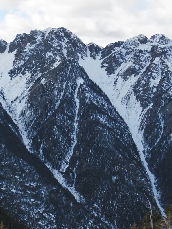
This picture is of an E/NE couloir on W Needle that has my attention....
Nice report. Did you ask those campers at the 12,100' lake and at the base of West Needle where on Earth they started from? I would be more surprised to see campers there than climbers.
Caution: The information contained in this report may not be accurate and should not be the only resource used in preparation for your climb. Failure to have the necessary experience, physical conditioning, supplies or equipment can result in injury or death. 14ers.com and the author(s) of this report provide no warranties, either express or implied, that the information provided is accurate or reliable. By using the information provided, you agree to indemnify and hold harmless 14ers.com and the report author(s) with respect to any claims and demands against them, including any attorney fees and expenses. Please read the 14ers.com Safety and Disclaimer pages for more information.
Please respect private property: 14ers.com supports the rights of private landowners to determine how and by whom their land will be used. In Colorado, it is your responsibility to determine if land is private and to obtain the appropriate permission before entering the property.