Download Agreement, Release, and Acknowledgement of Risk:
You (the person requesting this file download) fully understand mountain climbing ("Activity") involves risks and dangers of serious bodily injury, including permanent disability, paralysis, and death ("Risks") and you fully accept and assume all such risks and all responsibility for losses, costs, and damages you incur as a result of your participation in this Activity.
You acknowledge that information in the file you have chosen to download may not be accurate and may contain errors. You agree to assume all risks when using this information and agree to release and discharge 14ers.com, 14ers Inc. and the author(s) of such information (collectively, the "Released Parties").
You hereby discharge the Released Parties from all damages, actions, claims and liabilities of any nature, specifically including, but not limited to, damages, actions, claims and liabilities arising from or related to the negligence of the Released Parties. You further agree to indemnify, hold harmless and defend 14ers.com, 14ers Inc. and each of the other Released Parties from and against any loss, damage, liability and expense, including costs and attorney fees, incurred by 14ers.com, 14ers Inc. or any of the other Released Parties as a result of you using information provided on the 14ers.com or 14ers Inc. websites.
You have read this agreement, fully understand its terms and intend it to be a complete and unconditional release of all liability to the greatest extent allowed by law and agree that if any portion of this agreement is held to be invalid the balance, notwithstanding, shall continue in full force and effect.
By clicking "OK" you agree to these terms. If you DO NOT agree, click "Cancel"...
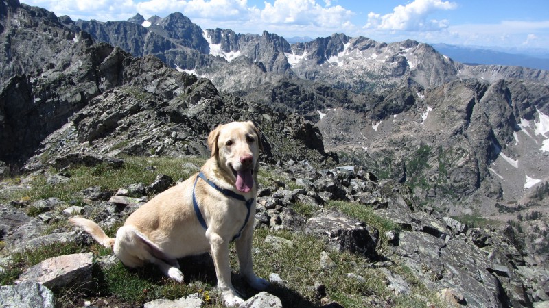
July 20-22, 2012 Partner: My yellow lab, Floyd Total Mileage: ~28 miles and 8,000 feet Peaks Climbed:
"Ohh La La" Point 12,945 (Soft Ranked)
Point 12,277 (Soft Ranked)
"Red Deer Mountain" Point 12,391 (#1,077)
Sawtooth Mountain elev. 12,304 (#1,139)
"Algonquin" Point 12,574 (#954)
Background: : I had this trip circled for a La Guarita tour with Chicago Transplant, but as the trip approached, his work schedule wasn't going to permit him to get away for an entire weekend and I started to rethink a very aggressive itinerary considering the forecast. I was all over the place in potential destinations but I wanted to go somewhere I could log some miles with a full pack to get ready for our 9-day excursion kicking off the following weekend and, at the same time, get some quality time in with my dog, Floyd.
Floyd was constantly at my side though a lot of my 14er journey, but lately I've directed my attention at less dog-friendly pursuits. I've tried to save one trip a year for him, but friends have a tendency to be persuasive, especially with some of the options that they've presented. So, he's been left at home for the majority of the last couple of years. This was going to change this weekend.
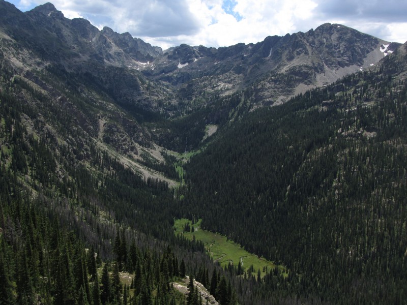
It all came together when I was half asleep Thursday night and it hit me... west side of the IPW, Gourd Lake, lots of miles, below tree-line in case of weather, and gentle peaks along the divide and we were off...
Friday, July 20: Pack to Gourd Lake: 8.16 miles, 2,725 feet.
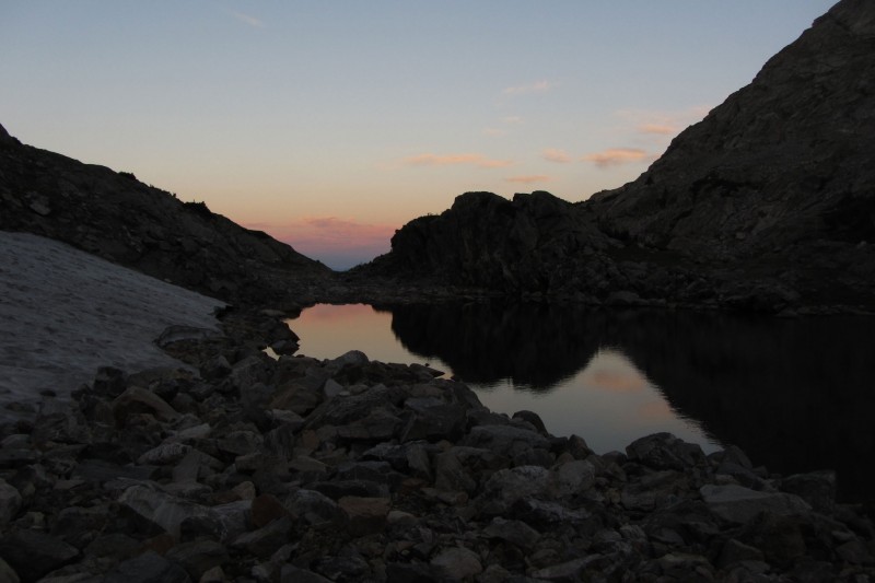
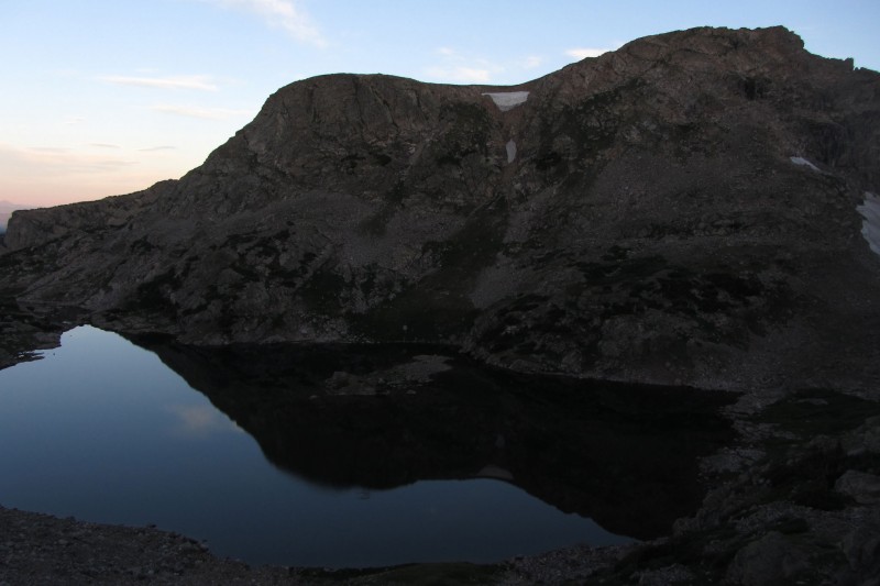
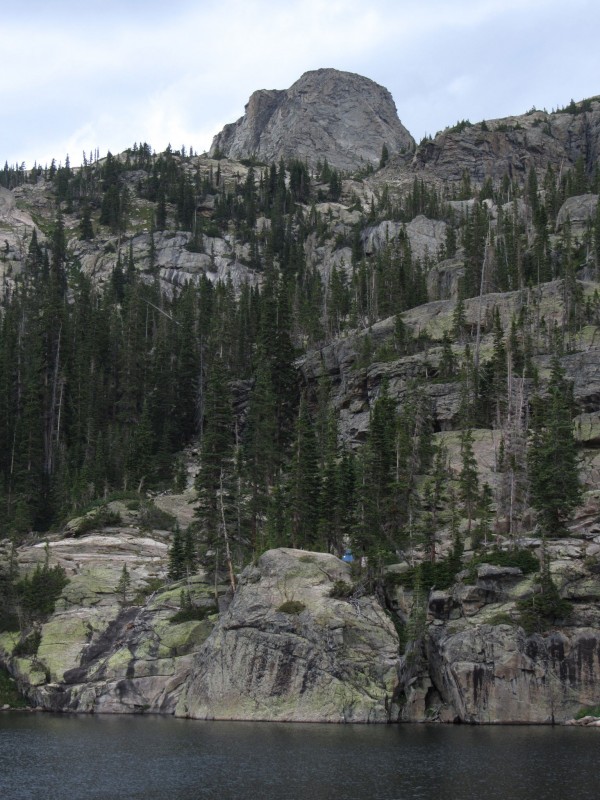
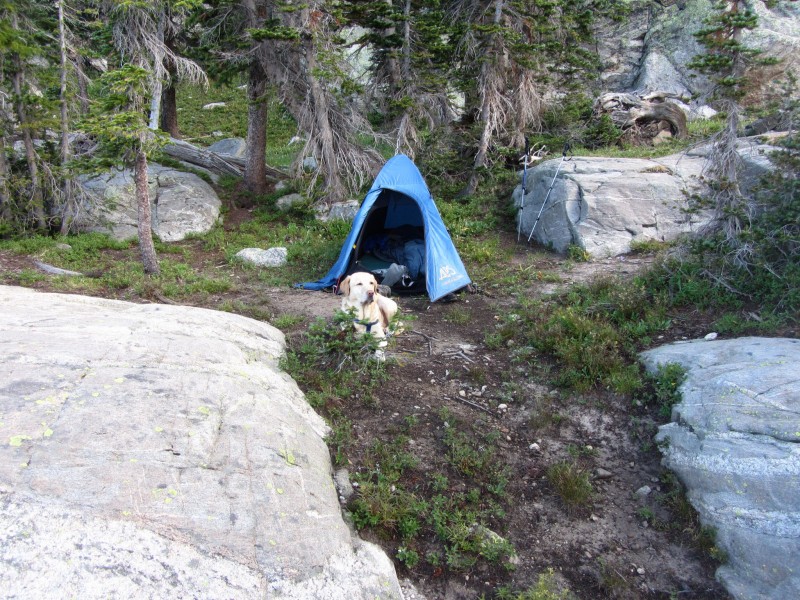
We left the Monarch Lake trailhead at 4:15 under cloudy skies and rumbling thunder in the distance. We bypassed my familiar turnoff for the Cascade Creek trail about an hour in and were off to uncharted territory for me. The Buchanan Pass trail climbs away from the creek until leveling off around 9,100. The Gourd Lake trail is much farther beyond the crossing of the creek coming from Gourd Lake (second creek crossing beyond the turnoff) than the map shows. I was glad I had my Grand County Hiking Guide as it was marked more accurately. The switchbacks up to the lake took an hour and seemed never ending. We strolled into the lake at 7:15 and began the search for a campsite. There were a few on the south side, but I wanted to be on the north side since Saturday's plans started up that way. I saw a small group camped on a nice rock outcropping on the NW side so I figured there were options over there. I settled in a couple hundred yards east of them, on a cliff high above the lake.
I'm a Simple Kind of Man
Saturday, July 21: A stroll on the divide with 5 summits. 11.5 miles, 5,300 feet
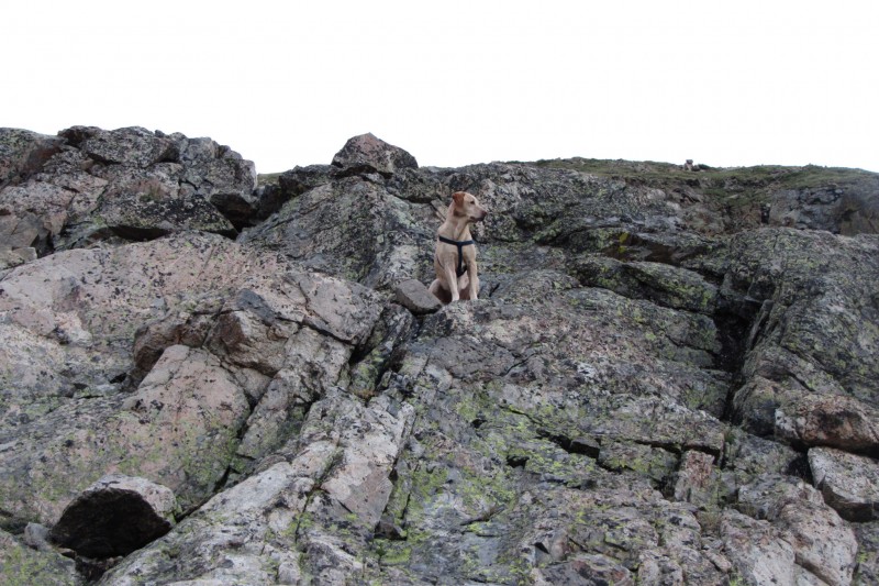
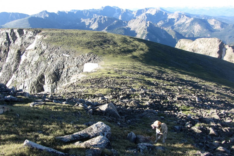
Alarm at 4:00 and we were off and running a little after 5:00. There is a use-trail that ascends from Gourd Lake that is easy enough to follow as the route basically goes along the path of least resistance. We hit a small willow field that I bypassed using some rocks, but Floyd hit it head on. I hate willows almost as much as I hate loose talus, but seeing them thrashed about with only a yellow tail sticking high in the air was downright comical. Occasionally, Floyd would jump up with ears perked, tongue wagging, to show how much fun he was having. I guess perspective is an amazing thing. The topo looked gentle enough that we could gain the divide short of Island Lake, but it's pretty much a nasty field of scree. We kept going up to the lake when our ascent path became apparent - a nice grassy line rising from the NE corner of the lake.
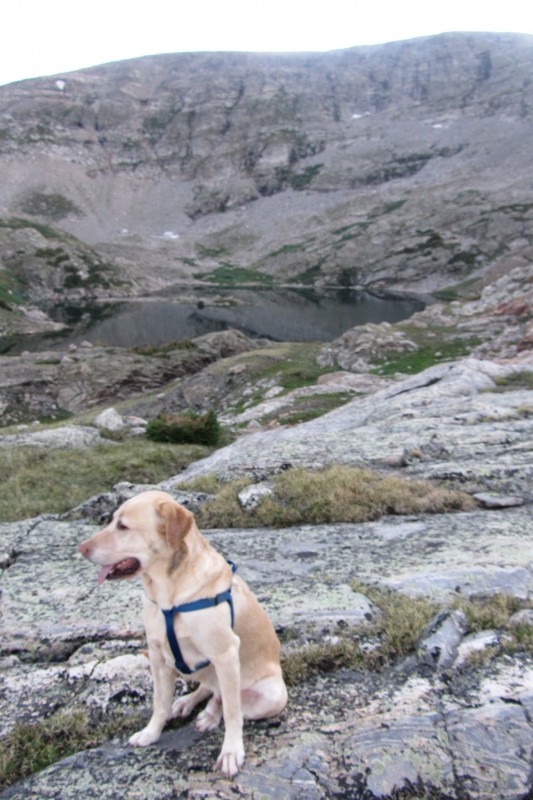
Floyd w Island Lake in the background
Cooper rises above Island Lake
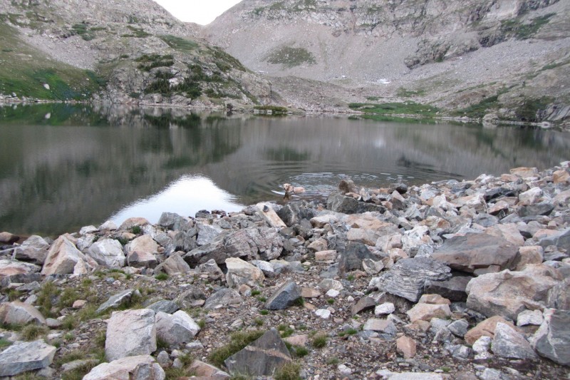
Floyd gets a pre-dawn swim in Island Lake
View West During Sunrise
Getting Gorgeous
Floyd can't take his eyes off the view west either
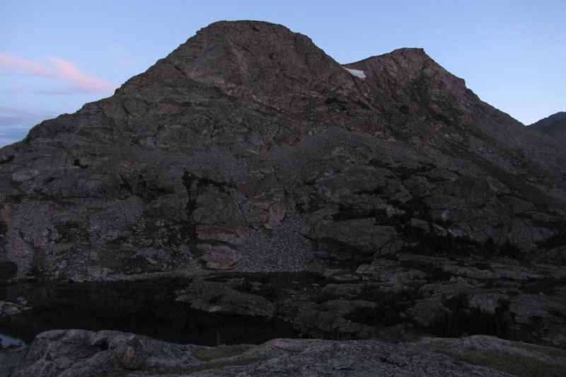
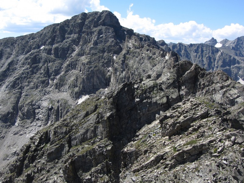
Cooper
Some Friendly Neighbors
Oh yeah, that's why I came this way.
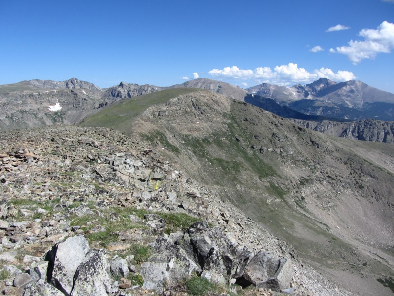
The "ridge" is more like a huge expanse of grass. I arrived the point ~12,700 due south of the Elk Tooth-Ogalalla saddle thinking that was the summit, but my eyes were telling me differently and my map confirmed we still had some work to do. I underestimated how far north this peak actually sits. It looked worse than it was though, as 15 minutes later we finally sat atop our first summit of the way at 7:15. The summit register is in a glass jar and didn't survive the winter. The jar is intact, but the register is soaked through, I didn't even try to get it out.
Floyd heading up "Oh La La"
Floyd w/ some peaks that don't welcome his kind. Ogallala, Elk Tooth, and Copeland
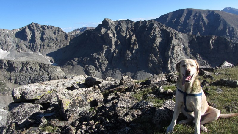
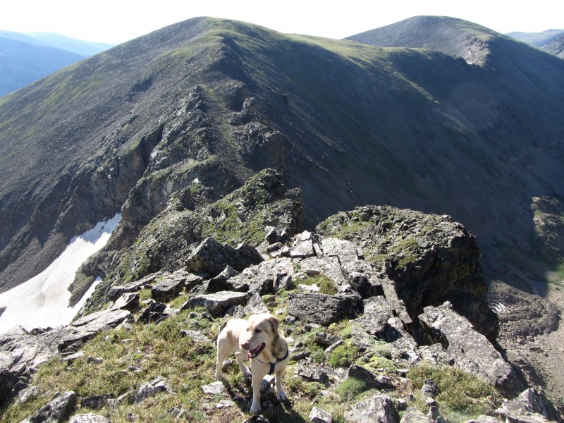
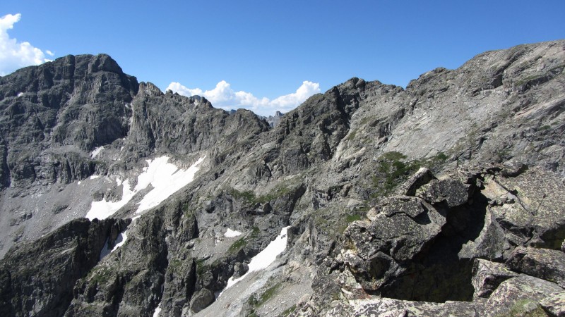
Algonquin looked like a long shot given the forecast so we didn't stay on the summit long. Plus, we had over 2 miles to our next summit - Point 12,277. Most of the "traverse" over was a pleasant grass walk until we dropped to the saddle. This was the portion of the trip that I was kind of shaky about looking at the Topo. The ridge itself holds what looks like some interesting class 3-4 towers, but I don't put my dog on anything tougher than 2+. Luckily, the difficulties were bypassed using some route finding along the grassy ledges to the north side on the descent. For the ascent, the terrain was a bit unusual. There was an interesting gully that led between towers rising on both sides of the ridge. It was an easy walk up, but very unique terrain.
Ridge to 12,277 (Notice the "Tower Alley")
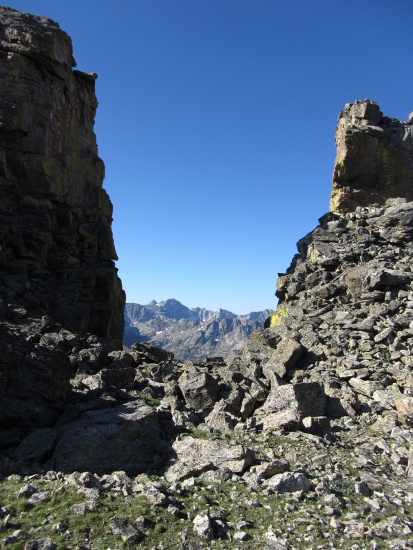
Apache pearing through a window on the ridge
That's big.
Looking back at the difficulties along the ridge (we bypassed on looker's left)
"Red Deer Mountain" was next on the agenda and Roach mentions some minor Class 3 scrambling on the way. The south ridge of -277 had some obstacles that needed to be bypassed to the west (would have been fun without my partner) but, again, everything was on grass ledges. I didn't see anything that would warrant a class 3 move on Red Deer's north ridge as Roach indicates, it was another straight forward walk. As I was nearing Buchanan Pass, I was getting weary that my summit streak of not seeing anyone else would be in danger. Sure enough, I started hearing voices just below the summit. A couple of trail runners in squishy shoes hit the summit simultaneously as us. They were headed north towards Oh La La and after a brief conversation about potential descent options into St. Vrain, they were off.
12,277 from Red Deer
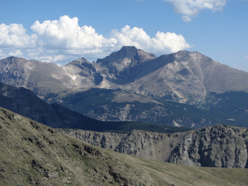
There's Cheif's Head's North Ridge (that's a slope on the south side of the peak?)
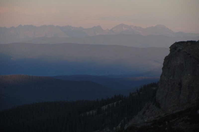
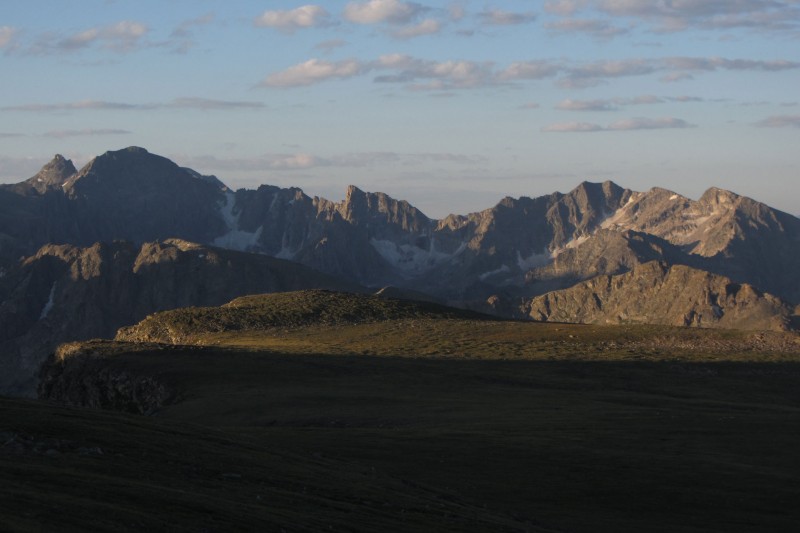
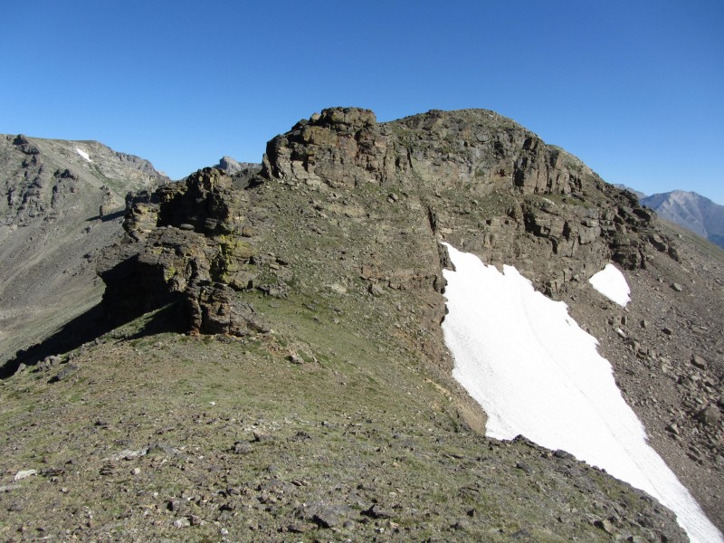
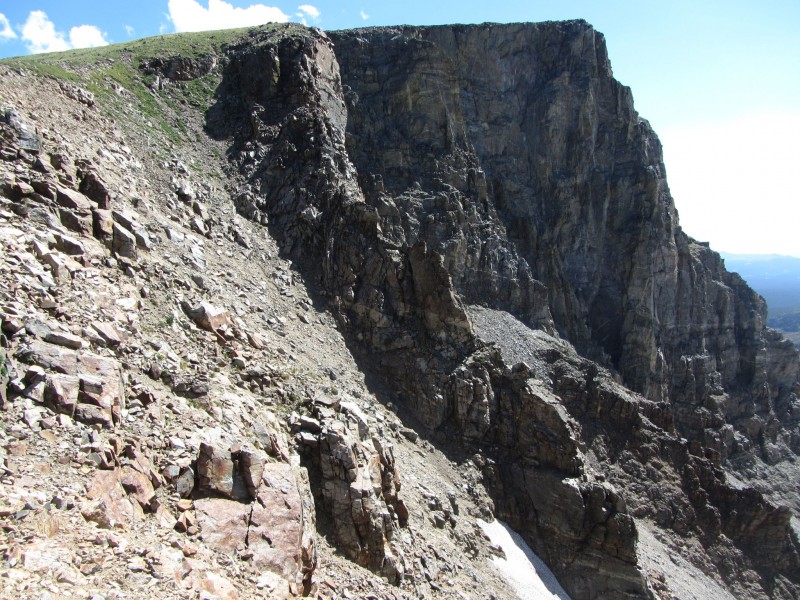
I could see some indication of some weather forming, but I couldn't have asked for a nicer July day to spend along the divide. Regardless, I was going to need to keep moving if I wanted to get to Algonquin. Sawtooth Mountain was next up and this one will be re-climbed someday by one of the sportier routes on the east side (along with "Coney Island" when I get down to the IPW 11ers). From Buchanan Pass, it's an easy grass stroll. The summit is interesting as the ridge comes to a fine point and you get the idea of "walking the plank." Also, the wind breaks at the summit are pretty intricate.
Sawtooth's more extreme side
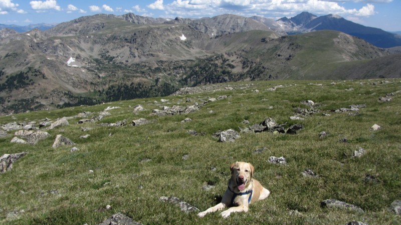
It was now about 10:30 and clouds were coming in from the south, but nothing at all threatening so my 5 peak agenda was coming to fruition. Again, all that was ahead of me was a mile or so of tundra and intermittent talus. There was a small hump that is best to walk straight over as the gentlest terrain was found on the crest of the ridge - the east side is a steep/sharp cliff to Upper Coney Lake while the west side is a mellow grass slope. Roach writes in his guide that standing on Algonquin's summit will improve your outlook on life. I'm not sure my outlook needed improving, but this summit didn't hurt. Floyd seemed to enjoy the views as well.
That's a sporty traverse!
Floyd with one heck of a backdrop
Some Paiute North Face Beta
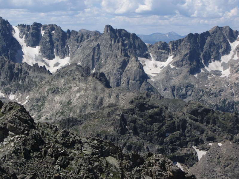
Lone Eagle Cirque - IPW's finest
We started our descent a little after 11:30 and we basically bailed straight north into Fox Park and picked up the trail just below tree-line. Aside from one cliff band that we had to negotiate (I led Floyd down one gully and quickly switched to another and met him at the bottom as to not kick rocks on one another), it was the same walk in the park we had been enjoying all day. The cliff band can be skipped entirely to the east, but the descent would still be on talus. Once in the trees, we had to avoid some downfall which I did on the lower side of the hill. I thought we could pick up the trail again at the next switchback, but unfortunately, that wasn't the case. So, we descended all the way to the valley floor (about 10,300). My guide referenced a short cut back to Gourd Lake from Fox Park on a non-maintained trail. We were about 200 feet below where the intersection was supposed to be so we walked straight over the trail and up the opposite slope. I found the trail before too long, but then the fun began.
Floyd in his Utopia
Water!
I was figuring on maybe an hour-hour and a half to traverse the slope to Gourd, but this short-cut is anything but. The trail is intermittent, when present, and side hills either loose mess or hard pan. Just before it swung north around the final ridge, it pointed straight downhill. Against my better judgment, I followed the trail and it dumped us onto the Gourd Lake trail, about 600 feet below the lake. So, I think we climbed about 1,200 feet on a rotten, faint trail in an effort to skip a gentle 1,300 foot climb on a nice trail with comfortable (albeit numerous) switchbacks. The one plus, however, was an amazing view of Thunderbolt Basin.
Thunderbolt Basin
Finally, at 3:30, we were back at the lake. I wanted to go for a swim, but the clouds were getting angry and it was best for us to get under some shelter. I filtered some water and we dove into the tent around 4:00. I may have been asleep before I hit the mat as the next thing I know it was 4:45 and the rain had stopped.
Home Sweet Home (Can you find my tent? Hint: It's Blue)
Floyd had obviously met his limit for climbing as he wouldn't move from his spot in the tent. Only after I pulled the food out did he decide to gingerly walk over with his eyes at half mast. He tried to beg for some Pringles, but he couldn't keep his head up so he kept nodding off and jerking his head up in an effort to get a chip.
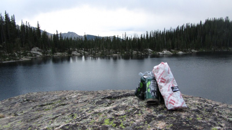
He slept the rest of the day away while I spent the remainder of the evening relaxing on our rock overlooking the lake with a good book and better beer. We turned in around 7:30 as I could no longer keep my eyes open.
Sunday: Hike Out: 8.25 miles / elevation counted on the approach.
I initially had plans of packing over the Cooper/Marten saddle and exiting Roaring Fork, possibly hitting Irving Hale (or even Hiamovi if I was really driven), but Floyd was obviously in no shape for anything besides a direct line back to the car. We slept in until 8:30 which felt absolutely amazing. Breakfast was enjoyed lounging on our rock until the sun crested the ridge and I was able to lay out our gear, tent, sleeping bag, etc on the rocks to air out and dry off. I took this opportunity to take a swim. The northwest corner of the lake has some rocks that drop straight into an abyss - at least I couldn't see the bottom. I chose a pedestrian level diving platform and the water felt invigorating. I need to remember that no matter how cold it may be, a swim always helps the morale and, at the very least, knocks a layer or two of grime off. Floyd, a bit panicked by my dive, jumped in after me and I also need to remember that I can't swim with him. His paws go 100mph and he needs to be right beside me so his claws ripped me up pretty well. It's all in good fun though, so I lifted him back out of the water and wandered back over to camp to get packed up.
Floyd wouldn't move from this spot until there was food involved.
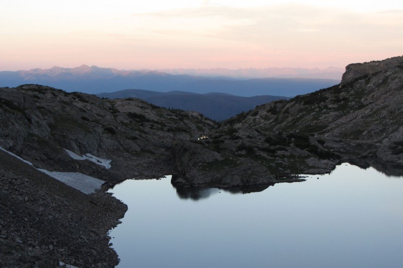
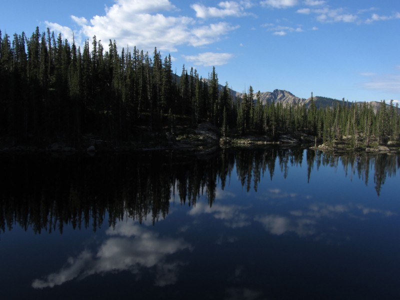
Good Morning Gourd Lake
The hike out was uneventful, the best kind. I made small talk with a few people I passed along the way, but mostly just pointed Floyd downhill and hoped he had the energy to make the car. He didn't take long to find a comfortable spot in the back to curl up and sleep away the ride home while I cursed the I-70 traffic.
Thanks for reading and I hope this prompts someone to head back there and explore this absolutely beautiful corner of our mountains.
Thumbnails for uploaded photos (click to open slideshow):
I could have stopped reading there and clicked ”like,” but you had to go and add a long stroll on the divide. Outstanding.
Great campsite, to boot.
So, who likes the alpine swims more, you or Floyd?
During sunrise along with its reflection will probably change your outlook on life.
Good thing you saved hiamovi group for another time and even better Floyd doesn't care about those arbitrary lists. He seems to enjoy what's truly enjoyable
Matt, I'll give the nod to him on the pre-dawn swims. I don't think I have that in me.
Dillon/Alex,a simple walk around the block makes him happy. A weekend in the hills and he's in euphoric bliss.
Lemmi, by all means check it out. Gourd Lake is a great destination, but Cascade Creek may be my favorite hike in the state.
Helmut, Cooper/Marten and Hiamovi/Tower are a top priority for next summer. I scouted some great routes we should discuss over wings Wednesday. Floyd really wanted to climb Lindsey, but I think he was content with random soft ranked 12ers.
Gotta love the west side of the IPW 7/26/2012 3:42am
Nice to see you were able to get a good weekend in with Floyd. I'm really looking forward to Cooper/Marten next year and the multi-pitch route on Hiamovi. Thanks for wetting my appetite.
Dang, can't believe I missed this! 11/28/2012 11:35pm
Somehow missed this when you posted it, awesome report! Thanks for posting!
-D
Caution: The information contained in this report may not be accurate and should not be the only resource used in preparation for your climb. Failure to have the necessary experience, physical conditioning, supplies or equipment can result in injury or death. 14ers.com and the author(s) of this report provide no warranties, either express or implied, that the information provided is accurate or reliable. By using the information provided, you agree to indemnify and hold harmless 14ers.com and the report author(s) with respect to any claims and demands against them, including any attorney fees and expenses. Please read the 14ers.com Safety and Disclaimer pages for more information.
Please respect private property: 14ers.com supports the rights of private landowners to determine how and by whom their land will be used. In Colorado, it is your responsibility to determine if land is private and to obtain the appropriate permission before entering the property.