| Report Type | Full |
| Peak(s) |
Mt. Emma - 13,592 feet "T 5" - 13,437 feet Mendota Peak - 13,279 feet |
| Date Posted | 09/08/2019 |
| Modified | 09/10/2019 |
| Date Climbed | 09/01/2019 |
| Author | bergsteigen |
| Additional Members | RyGuy, Tony1 |
| Traipsing around with a crown of wildflowers in a rock garden |
|---|
|
Mt Emma, Mendota Peak, T 5
Note: Mt Emma has gained a spot in my top 10 13ers, not just because of the prolific wildflowers and delightful scramble climb to the summit, but because of the teamwork needed to get there. The full package, so therefore a ton of photos. Sorry, not sorry. We woke up from our campsite and drove down to the Sneffels 2WD trailhead to drop Tony's BJ to minimize the vehicles up top. The drive up to Govenor's basin was a good one, and the road is in great shape. We found a good parking spot near the mine, that still allowed people to turn around easy enough. We deployed our marmot guards and after discussing our route with a group of hunters going after a stag on Mt Emma's slopes, we dropped a short distance and crossed the basin over to the switchbacking narrow jeep trail on the other side. 
On the other side of the basin, we were immediately distracted by the explosion of wildflowers. Hard to believe it's September, and the flowers are still prime! 

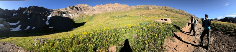
After the flower distraction, we ascended a steep grassy slope on the left, to avoid the hunter to our upper right. 
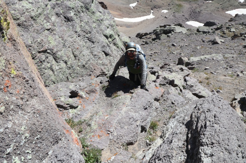
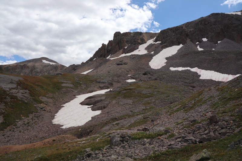
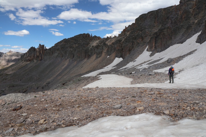
On the first bench, we started to get a view of the upper route on the mountain, or at least what we had to look for. The loose talus/scree dues collector! 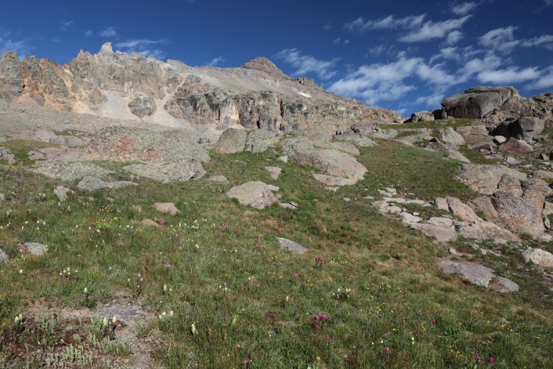
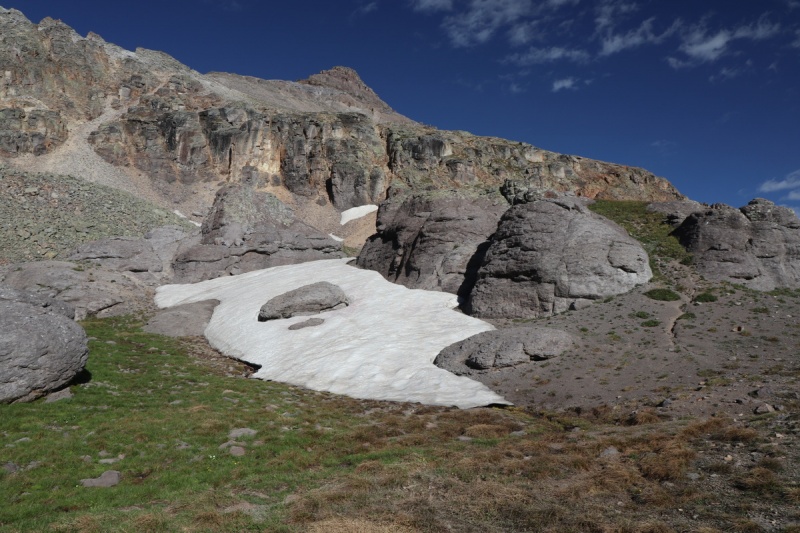
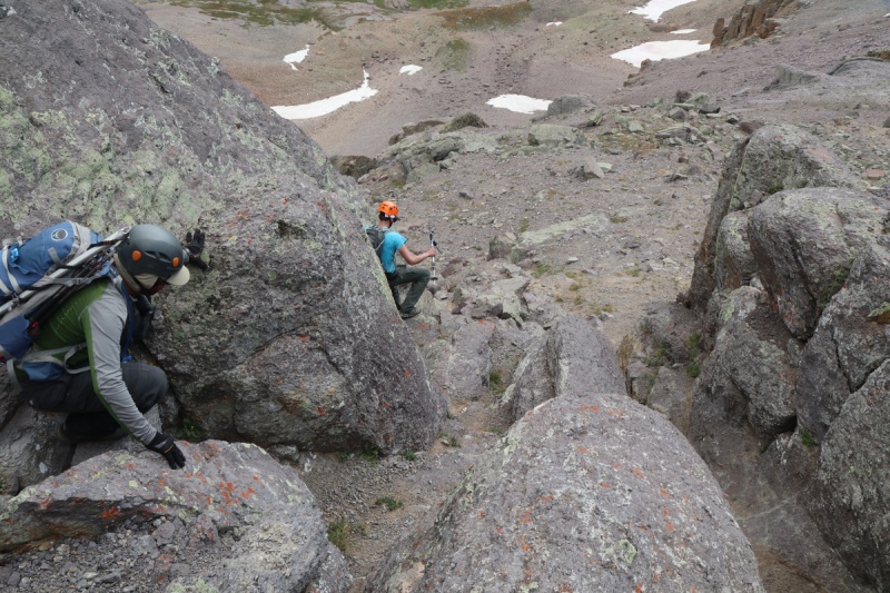
After a really cool rock garden, we dodged the lower snowfield and went up a scree field to a mini scramble section to get to the base of the peak. I chose a class 4 chute that while fun, I wouldn't go down, The guys went up the chute to the left and the scrambling was as desired, but not necessary. When we got to the base of the peak itself, there was a debate on the route. Ryan wanted to head up to the left of the snow to gain a higher cliff zone and then traverse. I didn't like the snow field above. I didn't want to hike all the way up there, to get to uncrossable steep snow and then have to descend, loosing elevation. I left my crampons in the truck, and the guys only had micro spikes (or at least Tony had them). From Potosi, you could see the snowfield better, and it didn't look good. I figured the best AND most efficient way, would be an ascending traverse to the right of the initial snowfield. But Ryan was unconvinced. To each their own! 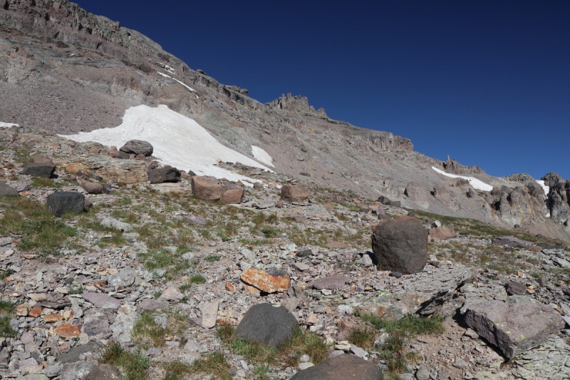

My ascending traverse was loose and not really pleasant, but it was very efficient. I got up to a corner on the cliffs, where we went straight up to the notch in the ridge below Emma, well before the guys. Thankfully we were able to be in voice communication, so I could get the guys across. Ryan asked what slope angle I thought the snow was, if they could cross it, and if they did, could they make it over to me. Thankfully I was able to give them beta on the snow crossing with my zoom lens. I could see that if they could climb the snow on their side, there was a separation in the snow and the cliff above, so they could travel between the snow and the cliff. Then it would just be a loose talus traverse over to me. 


While the guys were playing on the snow, I got to scout the route beyond, take a snack break, and use the restroom. Bonus break of being an efficiency route queen. 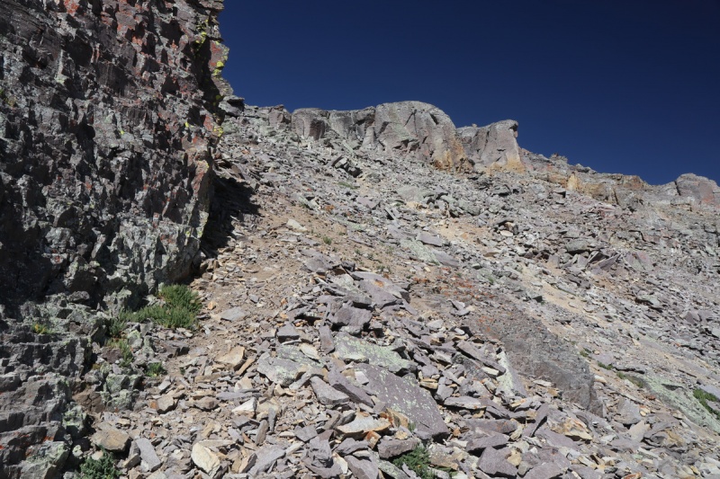
Eventually the guys got around the snow patch. So I advised them on the best path to me. 


Once the guys got to me, we stuck much closer together, so the route finding would be more collaborative. 
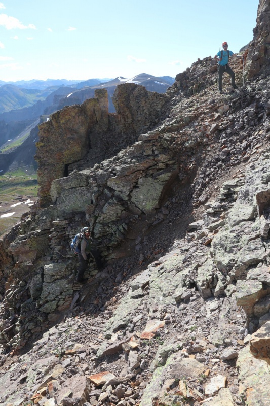
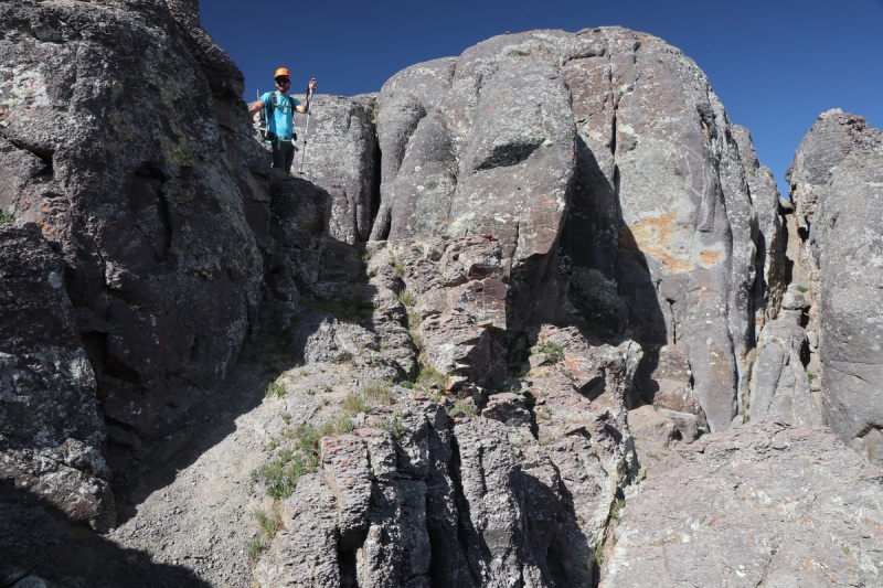
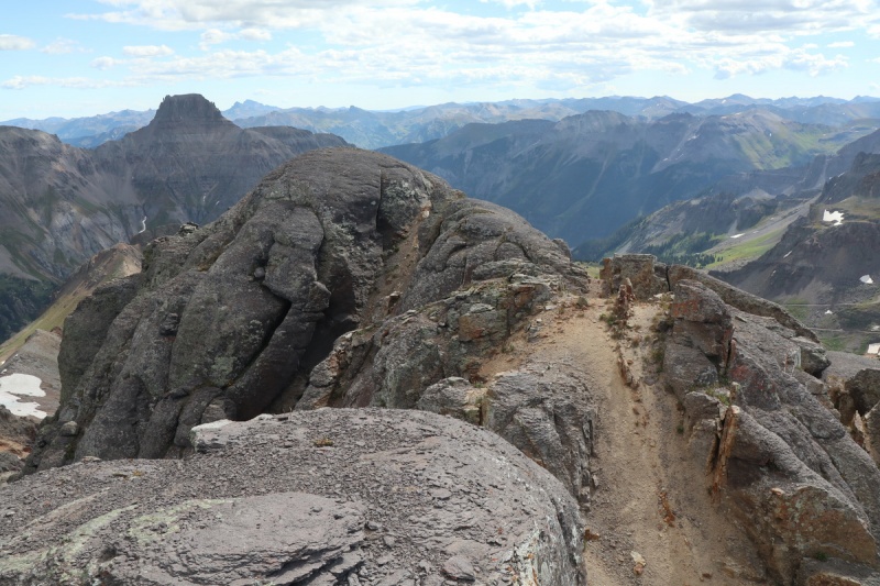
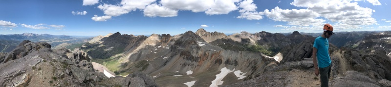
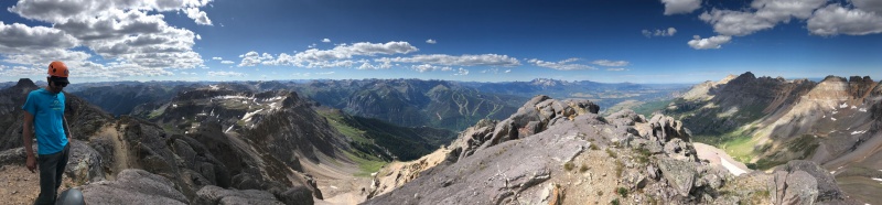
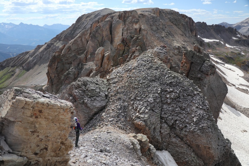
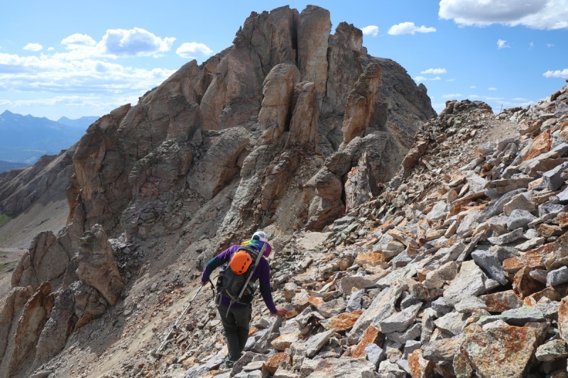
At the saddle, we had a clear shot to Telluride and got a good view of Emma's summit turrets. The terrain eased in steepness and most loose crap. We went up the ridge, and then dodged around to the right/east of the turrets, until we found a spot that looked easily scramble-able. 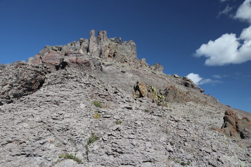
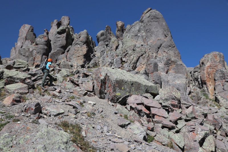
The next scramble section has a couple options, so choose your adventure! 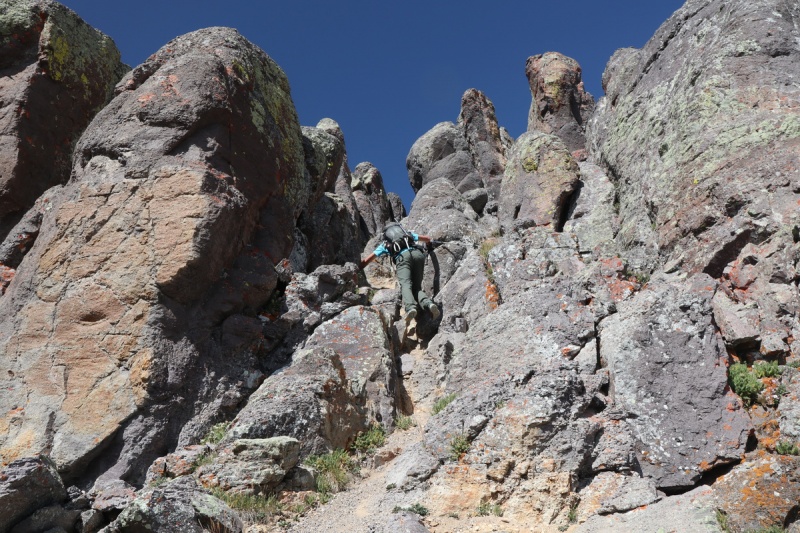
The cross over has a fun little down scramble to a mini saddle area in the giant summit boulders. 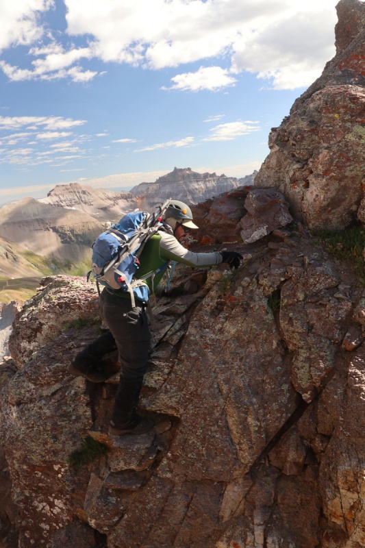
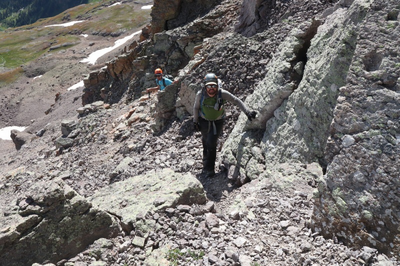
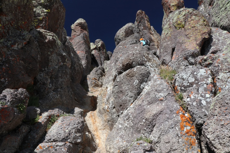
When we got to that multi direction saddle, we had quite the decision point. There looked to be a steep, narrow scree chute that had signs of foot prints that dropped to the left/south. Tony was eyeing the giant summit ridge boulders that only tall people could get on top of (I was in no way capable of this route, too short. Plus I couldn't make the leap down with my titanium leg on the return). Then there was a fun looking option with a tight squeeze climb. Some have sandbagged this option, saying class 3. I call BS with the loudest voice I can summon. At best its stiff class 4+. I used climbing moves on it, and Ryan said it was reminiscent of the upper crux on Jagged. So I call it 5.easy. So with our unique group of 3, we had to find options that worked for all of us. I figured I could get up the class 5.easy route, but descending is always different. Tony really like the boulder hop. So once Ryan went and checked out the squeeze climb option, and thought he could do it, we got on it. Ryan went first with me spotting the upper route from below. Once he got up, I ascended and checked out the next step - which was not trivial, before we gave Tony the OK to bounce up the ridge. 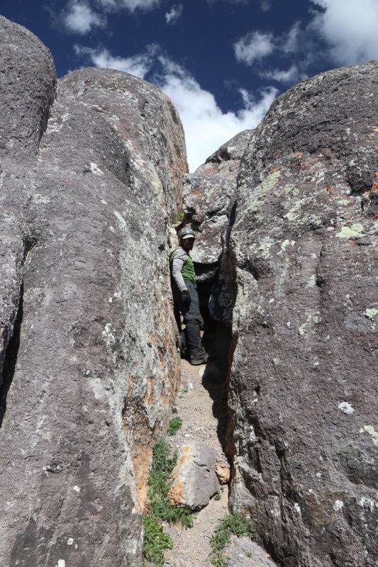
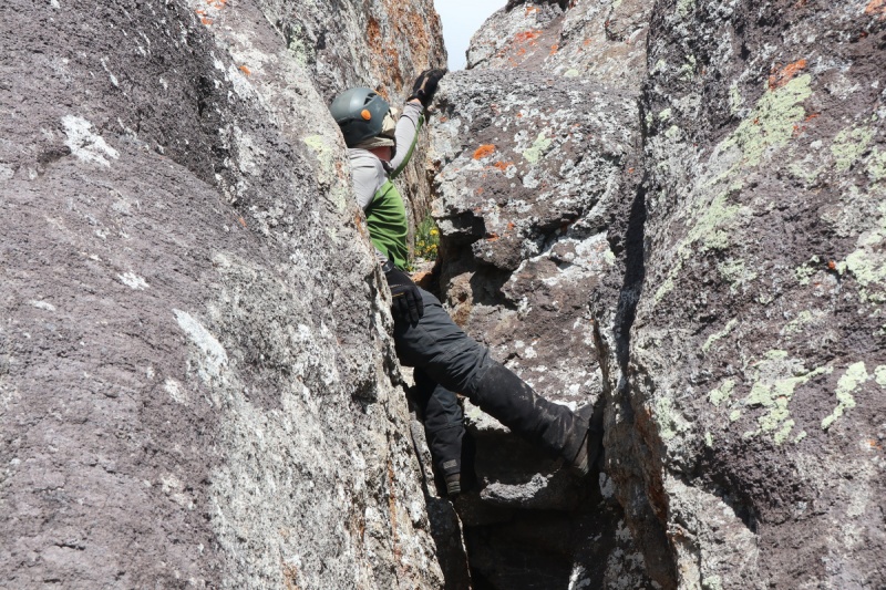

I made quick work of the 5.easy climb up to the round summit ridge boulder, and looked over at what was required to get to the summit. I could do it, with a bit of help from the guys. 
When Tony arrived, as the tallest, he went and butt scooted and then jumped down off the rounded mound we were on. I didn't like the thought of jumping with my titanium rod, so after Ryan followed Tony's scoot-jump technique, they helped me get down. I scooted as far as I could to try and reach the foot holds, but I was short. Ryan grabbed my right hand for stability, and Tony physically moved my feet into position. Great teamwork!!! Glad I wasn't solo today! 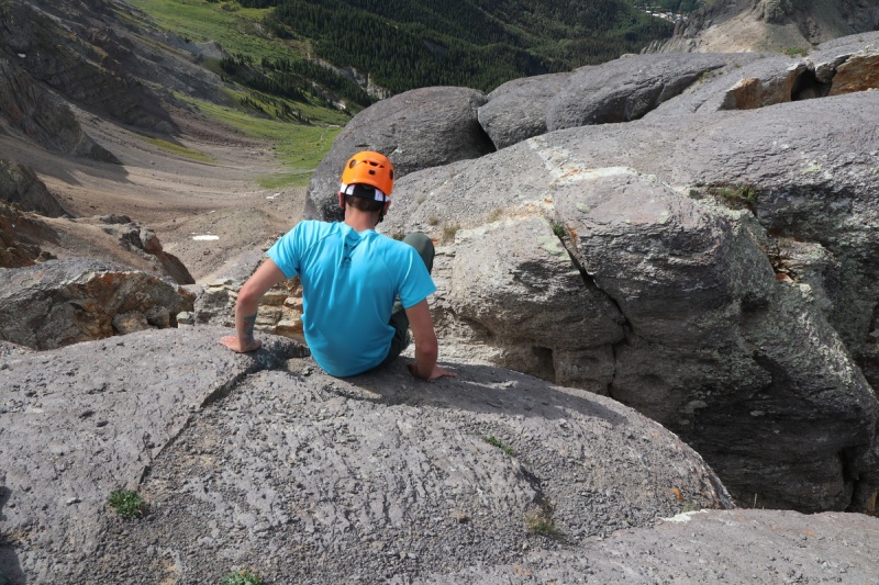
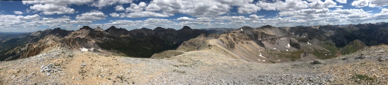
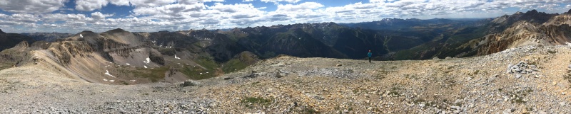
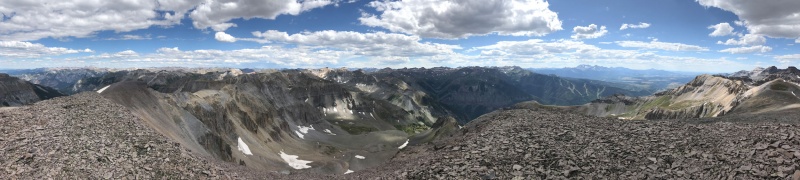
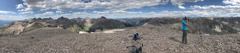
It was quite the celebration on this well earned summit. We were all in great spirits. Plus the views were amaze balls!!! 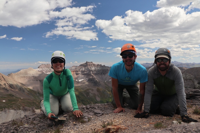


Since Tony and I wanted to get T 5 today, we couldn't spend too much time on the summit. Plus we all wanted to get down the climbing section before any weather (that never showed up). Getting up the round mound also proved tricky too, since there were no hand holds. Ryan went up first, and layed down above, so he could grab my hand and Tony's if needed. It was a bit of a tummy scraper, and I did grab Ryan's hand to help my progress up it. I grabbed onto Ryan's ankles to give extra support, in case Tony needed a hand. 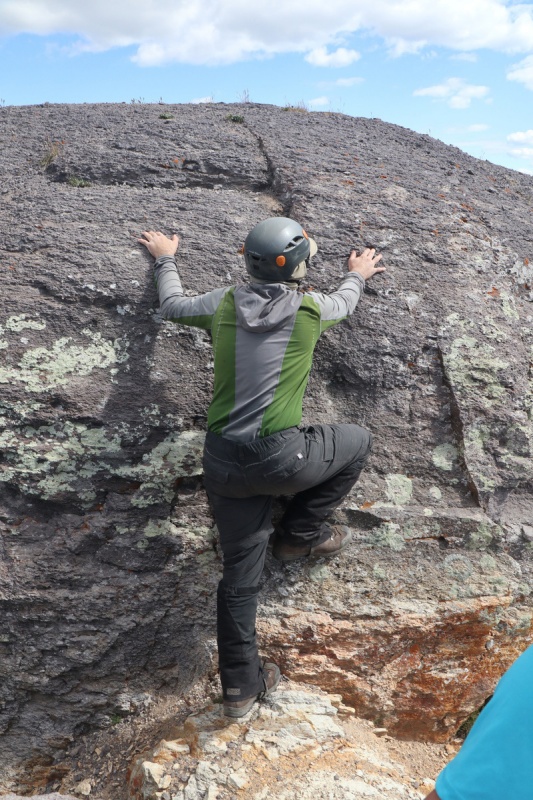
On the mound we proceeded back to the squeeze climb, and Tony decided to join in the fun too. 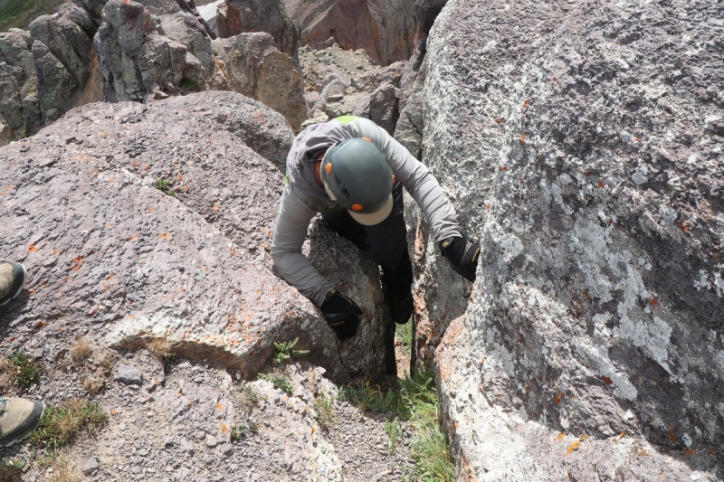
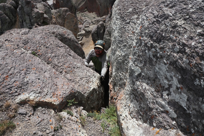
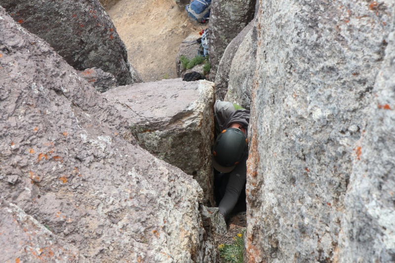

Ryan stayed below for moral support as I came down the route. Was such a tight squeeze, my helmet with bill on my hat got stuck! So you have to plan out your head position on the lower squeeze!!! 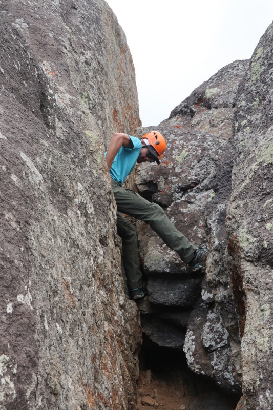
Once down the class 5.easy section, we rapidly descended the easy scramble section to the talus below. 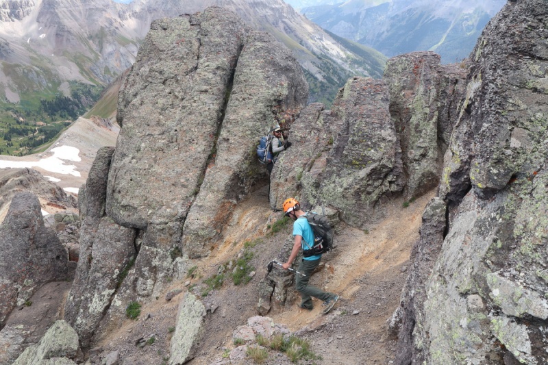
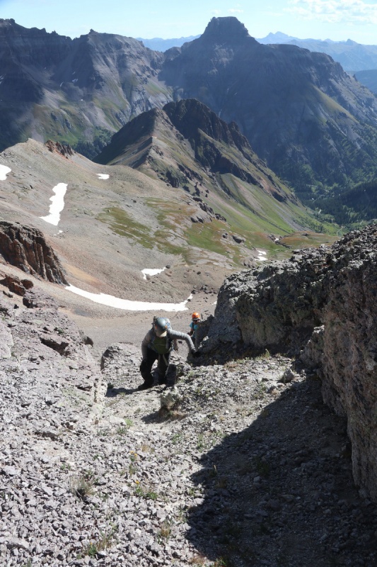
Back at the saddle, Ryan was very interested in pounding directly down to the lower bench via the scree slope. Tony and I decided to do the descending traverse that was the trail I took up. But we also wanted to do some boot skiing!!! 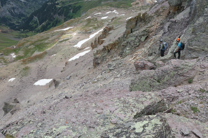
I got to check out the route the guys took up on the first cliff section above the snow field that we would boot ski. 

Then it was just a short scree section to get to the fun boot ski, that Ryan took video of (that I'll attach later) 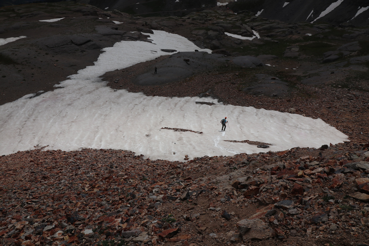

We got to just above the Jeep trail and parted ways with Ryan. He would go relax by the vehicles and entertain and be entertained by the flux of tourists in the basin. 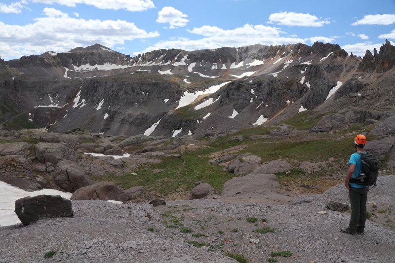

Tony and I were able to follow the mining road over to an old abandoned mine to approach Mendota, which Tony really wanted. 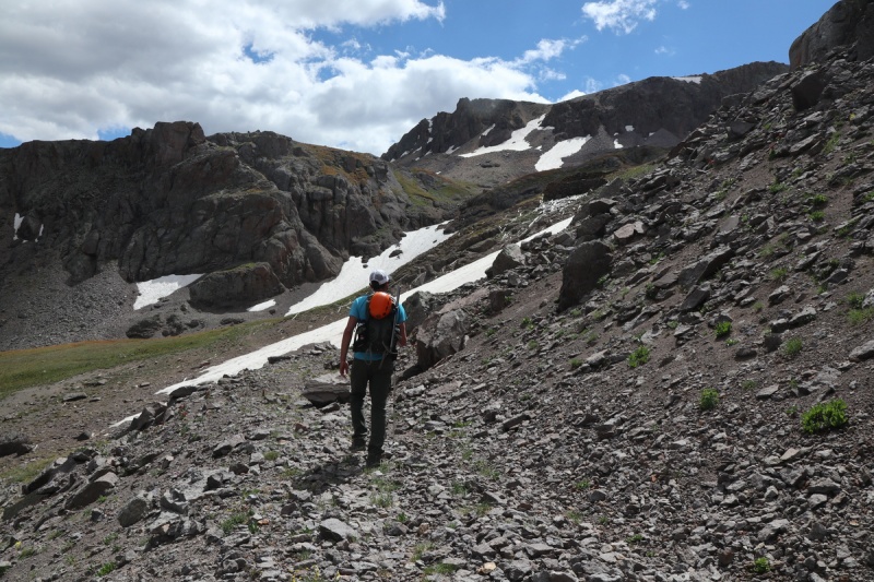
Along the way, we spotted the perfect 3 musketeer Columbine group 
At the end of the mining road, we scampered up some mining piles, before ascending some easy snow. 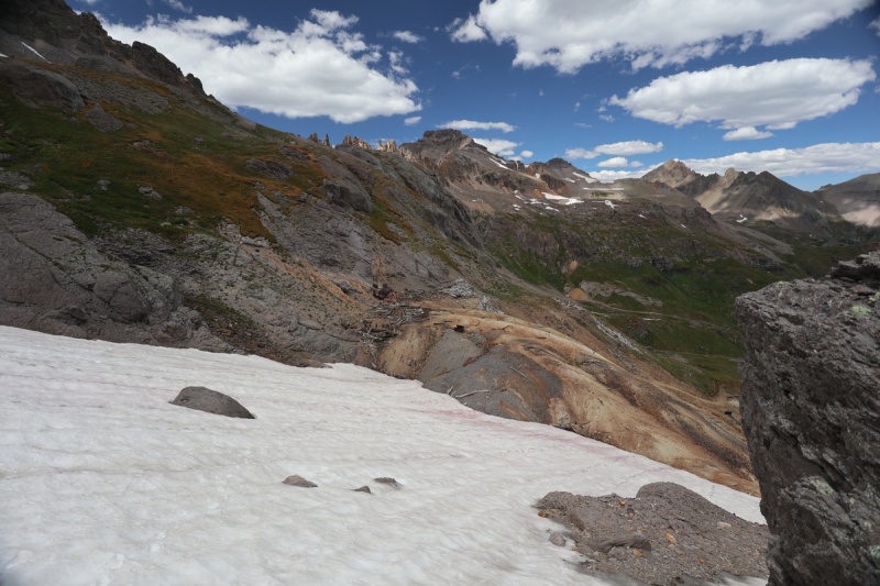
We both eyed the snow route up to the ridge above. I was hoping the ridge would be continuous over to T 5 (surprise it's not), and figured I might as well go up with Tony and get Mendota too. The snow climb started off mellow enough to do without sharp and pointies on my feet, but soon became too difficult. As I didn't want to practice my ice ax arrest skills AND lose hard fought elevation, I made my way over to the right to ascend the loose talus to the ridge. 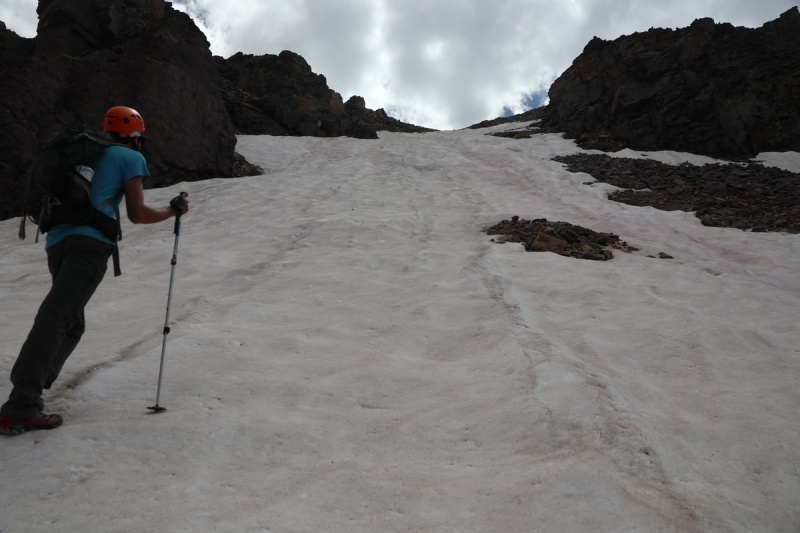
Once on the ridge, it was a short stroll over to the unranked summit of Mendota. It has great views, so worth it! 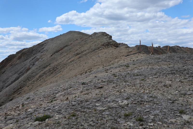
We couldn't see Ryan from the summit, so we couldn't moon him from Men-dota. 

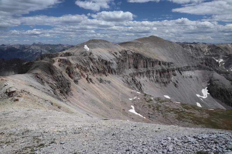
After a short break on the unranked peak, we strolled down the ridge to the saddle with T 5. Some guys on the ridge up T 5 yelled over that we'd have to drop down to the trail and go around. Uhhhh yeah, we see that, NOW. Grrrr. 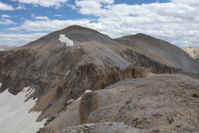
We back tracked by a gully or two, before we found one that looked easily doable to the south. Well, it was delightful. Some of the BEST scree skiing I've had in my life, and we were down to the lower trail to the south rapidly. Then we just had to take the trail up to the saddle. 


There's a trail or two that goes up T 5 from the saddle. The one on ascender's left in steep and loose while the on the right we took on the way down, was much nicer. 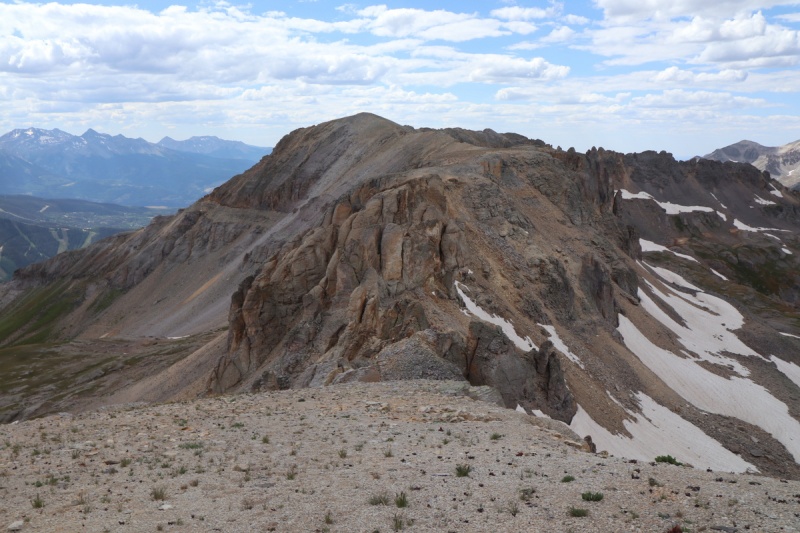
The stroll over to T 5 was easy flat talus stroll. We met the 2 older guys from Delta on the false summit, and chatted for a short bit before going over to the real summit. 


After a nice summit stay, we headed down. Still couldn't see Ryan. We hoped he was full of meat and beer with his feet up, relaxing. 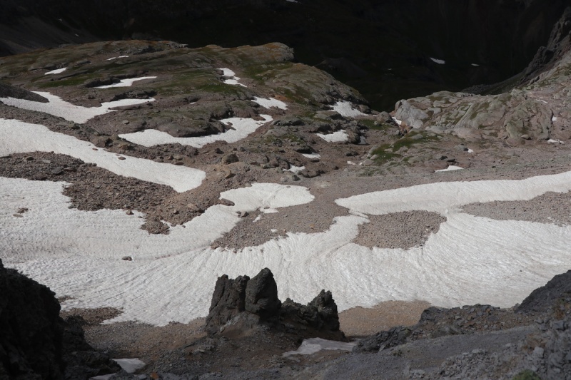
We got to the saddle and the original trail between Telluride and Ouray (some knowledge dropped by the older gentlemen we met). It was steep and loose, but it went. Then I got in some butt skiing, complete with my own personal butt jump. Yeah, I caught air. It kinda hurt in-between the fun squealing! 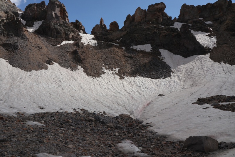
Once below, we continued along the trail back to Ryan and the vehicles. 
After dropping down through the lower cliff band, it was a loose talus descent down to the mining road. 

Once on the road, it was a quick stroll to where Ryan was in his chair looking up at us. He told us all about the tourist cluster that happened all day long, and how my marmot guard was commented on by everyone. Someone thought it was a fence for a dog!!! Such a great day climbing fun peaks with great, supportive partners! We all worked hard for this day to go well! All for one, one for all! Day 5: Lookout Peak& Day 6: S. Snowdon Thumbnails for uploaded photos (click to open slideshow): ")
")
")
")
")
")
")
")
")
")
")
")
")
")
")
")
")
")
")
")
")
")
")
")
")
")
")
")
")
")
")
")
")
")
")
")
")
")
")
")
")
")
")
")
")
")
")
")
")
")
|
| Comments or Questions | ||||||||||||
|---|---|---|---|---|---|---|---|---|---|---|---|---|
|
Caution: The information contained in this report may not be accurate and should not be the only resource used in preparation for your climb. Failure to have the necessary experience, physical conditioning, supplies or equipment can result in injury or death. 14ers.com and the author(s) of this report provide no warranties, either express or implied, that the information provided is accurate or reliable. By using the information provided, you agree to indemnify and hold harmless 14ers.com and the report author(s) with respect to any claims and demands against them, including any attorney fees and expenses. Please read the 14ers.com Safety and Disclaimer pages for more information.
Please respect private property: 14ers.com supports the rights of private landowners to determine how and by whom their land will be used. In Colorado, it is your responsibility to determine if land is private and to obtain the appropriate permission before entering the property.


