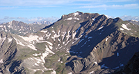
The Colorado 14ers
Colorado is home to
58 named peaks that rise above 14,000 feet in elevation, known as the
fourteeners or 14ers . Climbing to the summit of these impressive peaks is one of the most popular outdoor activities in the state. If climbing 14ers is your goal, you’ve come to the right place! 14ers.com provides all the resources you need to
research ,
plan , and
prepare for your 14er adventures.
Mount Elbert
14,438 ft
CO 14er Rank: 1 of 53
Sawatch Range
1
Mount Massive
14,427 ft
CO 14er Rank: 2 of 53
Sawatch Range
2
Mount Harvard
14,424 ft
CO 14er Rank: 3 of 53
Sawatch Range
3
Blanca Peak
14,350 ft
CO 14er Rank: 4 of 53
Sangre de Cristo
4
La Plata Peak
14,344 ft
CO 14er Rank: 5 of 53
Sawatch Range
5
"North Massive"
14,337 ft
CO 14er Rank: Unranked
Sawatch Range
Uncompahgre Peak
14,318 ft
CO 14er Rank: 6 of 53
San Juan Mountains
6
"Massive Green"
14,311 ft
CO 14er Rank: Unranked
Sawatch Range
Crestone Peak
14,299 ft
CO 14er Rank: 7 of 53
Sangre de Cristo
7
"East Crestone"
14,299 ft
CO 14er Rank: Unranked
Sangre de Cristo
Mount Lincoln
14,293 ft
CO 14er Rank: 8 of 53
Mosquito Range
8
Grays Peak
14,275 ft
CO 14er Rank: 9 of 53
Front Range
9
Castle Peak
14,274 ft
CO 14er Rank: 10 of 53
Elk Mountains
10
Quandary Peak
14,272 ft
CO 14er Rank: 11 of 53
Tenmile Range
11
Torreys Peak
14,272 ft
CO 14er Rank: 12 of 53
Front Range
12
Mount Antero
14,271 ft
CO 14er Rank: 13 of 53
Sawatch Range
13
Mount Blue Sky
14,268 ft
CO 14er Rank: 14 of 53
Front Range
14
Longs Peak
14,259 ft
CO 14er Rank: 15 of 53
Front Range
15
"West Evans"
14,257 ft
CO 14er Rank: Unranked
Front Range
Mount Wilson
14,256 ft
CO 14er Rank: 16 of 53
San Juan Mountains
16
"Northeast Crestone"
14,251 ft
CO 14er Rank: Unranked
Sangre de Cristo
Mount Cameron
14,248 ft
CO 14er Rank: Unranked
Mosquito Range
*
Mount Shavano
14,230 ft
CO 14er Rank: 17 of 53
Sawatch Range
17
Mount Belford
14,202 ft
CO 14er Rank: 18 of 53
Sawatch Range
18
Mount Princeton
14,200 ft
CO 14er Rank: 19 of 53
Sawatch Range
19
Mount Yale
14,200 ft
CO 14er Rank: 20 of 53
Sawatch Range
20
Crestone Needle
14,196 ft
CO 14er Rank: 21 of 53
Sangre de Cristo
21
"East La Plata"
14,186 ft
CO 14er Rank: Unranked
Sawatch Range
Mount Bross
14,178 ft
CO 14er Rank: 22 of 53
Mosquito Range
22
El Diente Peak
14,175 ft
CO 14er Rank: Unranked
San Juan Mountains
*
Kit Carson Peak
14,167 ft
CO 14er Rank: 23 of 53
Sangre de Cristo
23
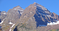
Maroon Peak
14,163 ft
CO 14er Rank: 24 of 53
Elk Mountains
24
Mount Oxford
14,158 ft
CO 14er Rank: 25 of 53
Sawatch Range
25
Tabeguache Peak
14,158 ft
CO 14er Rank: 26 of 53
Sawatch Range
26
"South Massive"
14,157 ft
CO 14er Rank: Unranked
Sawatch Range
Mount Sneffels
14,155 ft
CO 14er Rank: 27 of 53
San Juan Mountains
27
Mount Democrat
14,154 ft
CO 14er Rank: 28 of 53
Mosquito Range
28
Capitol Peak
14,138 ft
CO 14er Rank: 29 of 53
Elk Mountains
29
"South Elbert"
14,129 ft
CO 14er Rank: Unranked
Sawatch Range
Pikes Peak
14,109 ft
CO 14er Rank: 30 of 53
Front Range
30
Snowmass Mountain
14,105 ft
CO 14er Rank: 31 of 53
Elk Mountains
31
"South Wilson"
14,105 ft
CO 14er Rank: Unranked
San Juan Mountains
"West Wilson"
14,101 ft
CO 14er Rank: Unranked
San Juan Mountains
Windom Peak
14,089 ft
CO 14er Rank: 32 of 53
San Juan Mountains
32
Mount Eolus
14,087 ft
CO 14er Rank: 33 of 53
San Juan Mountains
33
Challenger Point
14,086 ft
CO 14er Rank: Unranked
Sangre de Cristo
*
Mount Columbia
14,075 ft
CO 14er Rank: 34 of 53
Sawatch Range
34
Missouri Mountain
14,071 ft
CO 14er Rank: 35 of 53
Sawatch Range
35
Humboldt Peak
14,068 ft
CO 14er Rank: 36 of 53
Sangre de Cristo
36
"Southeast Longs"
14,067 ft
CO 14er Rank: Unranked
Front Range
Mount Bierstadt
14,066 ft
CO 14er Rank: 37 of 53
Front Range
37
Sunlight Peak
14,061 ft
CO 14er Rank: 38 of 53
San Juan Mountains
38
Handies Peak
14,058 ft
CO 14er Rank: 39 of 53
San Juan Mountains
39
Ellingwood Point
14,057 ft
CO 14er Rank: 40 of 53
Sangre de Cristo
40
Mount Lindsey
14,055 ft
CO 14er Rank: 41 of 53
Sangre de Cristo
41
Culebra Peak
14,053 ft
CO 14er Rank: 42 of 53
Sangre de Cristo
42
Mount Sherman
14,043 ft
CO 14er Rank: 43 of 53
Mosquito Range
43
North Eolus
14,042 ft
CO 14er Rank: Unranked
San Juan Mountains
*
"Pin Point"
14,042 ft
CO 14er Rank: Unranked
San Juan Mountains
Little Bear Peak
14,041 ft
CO 14er Rank: 44 of 53
Sangre de Cristo
44
Redcloud Peak
14,037 ft
CO 14er Rank: 45 of 53
San Juan Mountains
45
Conundrum Peak
14,037 ft
CO 14er Rank: Unranked
Elk Mountains
*
Pyramid Peak
14,029 ft
CO 14er Rank: 46 of 53
Elk Mountains
46
"South Little Bear"
14,028 ft
CO 14er Rank: Unranked
Sangre de Cristo
"North Snowmass"
14,024 ft
CO 14er Rank: Unranked
Elk Mountains
San Luis Peak
14,023 ft
CO 14er Rank: 47 of 53
San Juan Mountains
47
North Maroon Peak
14,022 ft
CO 14er Rank: 48 of 53
Elk Mountains
48
Wetterhorn Peak
14,021 ft
CO 14er Rank: 49 of 53
San Juan Mountains
49
Wilson Peak
14,021 ft
CO 14er Rank: 50 of 53
San Juan Mountains
50
"South Bross"
14,020 ft
CO 14er Rank: Unranked
Mosquito Range
Mount of the Holy Cross
14,007 ft
CO 14er Rank: 51 of 53
Sawatch Range
51
Huron Peak
14,006 ft
CO 14er Rank: 52 of 53
Sawatch Range
52
Sunshine Peak
14,004 ft
CO 14er Rank: 53 of 53
San Juan Mountains
53
* To be ranked, a peak must have at least 300 feet of prominence, which is the amount
of elevation it rises above the lowest saddle that connects to the nearest, higher peak. This guideline has been in use in Colorado for some time. The following named 14ers are not ranked because they do not have enough prominence:
Mt. Cameron Elevation 14,248 , prominence 152
El Diente Peak Elevation 14,175 , prominence 264
Challenger Point Elevation 14,086 , prominence 264
North Eolus Elevation 14,042 , prominence 212
Conundrum Peak Elevation 14,037 , prominence 225