Log In 
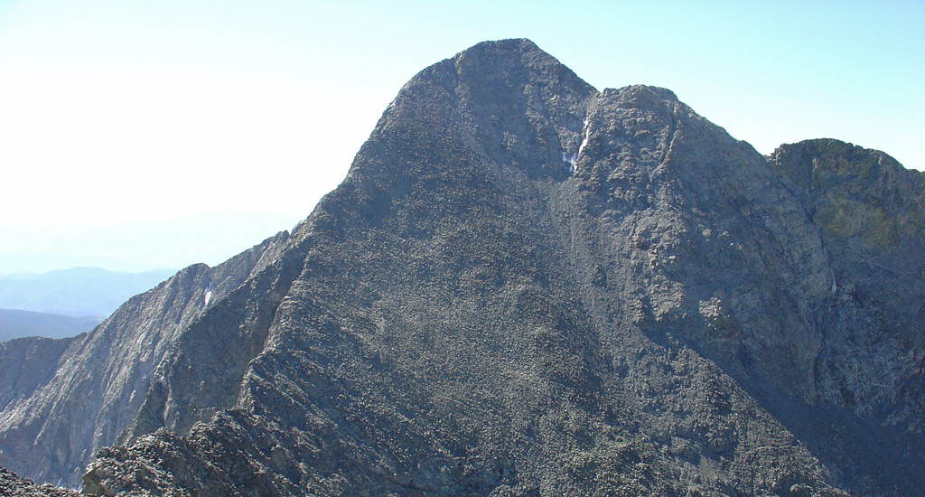
Blanca is the 4th highest peak in Colorado and towers over the San Luis Valley, in the southern, central portion of the state. This massive "valley" covers 8,000 square miles, with the Sangre de Cristo Mountains (Sangres) to the east and the San Juan Mountains to the west. If you visit Alamosa or Great Sand Dunes National Park & Preserve, it doesn't matter which part of the state you drive from because once you reach the San Luis Valley, you'll be able to see the might Blanca Peak. Climbing Blanca is no small feat. While the standard route has a trail almost all the way to the top, it still requires over 6,000 feet of elevation gain because the trailhead is quite low. Blanca is not a 14er you start out with — there are over 30 easier Colorado 14ers. When you do get to Blanca, be sure to include Blanca's little brother, Ellingwood Point but be careful of the dangerous Little Bear Peak.
Elevation 14,350' (LiDAR)
Prev Elevation 14,345'
CO 14er Rank 4 of 53
Range Sangre de Cristo
Counties Alamosa, Huerfano, Costilla
Towns Fort Garland, Blanca, Alamosa
Blanca Peak

Photos

360 Pano
360° Summit Pano
pic1
pic2
pic3
pic4
pic5 pic6
pic7 pic8 pic9 pic10 pic11 pic12 pic13 pic14 pic15
pic16
pic17 pic18 pic19 pic20 pic21 pic22 pic23 pic24 pic25 pic26 pic27
pic28
pic29
pic30
pic31 pic32 pic33 pic34 pic35

Climbing Routes

route
Lake Como Approach
Difficulty: Class 1
Total Elevation Gain: 3,900'
Round-trip Distance: 11 mi
Exposure: Low
Rockfall Potential: Low
Route-Finding: Low
Commitment: Low
route
Blanca Peak - Northwest Ridge Standard Route
Difficulty: Difficult Class 2
Total Elevation Gain: 6,500'
Round-trip Distance: 17 mi
Exposure: Considerable
Rockfall Potential: Considerable
Route-Finding: Moderate
Commitment: Considerable
route
Ellingwood Point - South Face Standard Route
Difficulty: Difficult Class 2
Total Elevation Gain: 6,200'
Round-trip Distance: 17 mi
Exposure: Considerable
Rockfall Potential: Considerable
Route-Finding: Considerable
Commitment: Considerable
route
Little Bear Peak - West Ridge and Hourglass Standard Route
Difficulty: Class 4
Total Elevation Gain: 6,200'
Round-trip Distance: 14 mi
Exposure: High
Rockfall Potential: High
Route-Finding: High
Commitment: High
route
Combo: Blanca and Ellingwood
Difficulty: Class 3
Total Elevation Gain: 6,800'
Round-trip Distance: 18 mi
Exposure: Considerable
Rockfall Potential: Considerable
Route-Finding: Considerable
Commitment: Considerable
route
Combo: Little Bear + Blanca Traverse
Difficulty: Class 5
Total Elevation Gain: 8,000'
Round-trip Distance: 17 mi
Exposure: Extreme
Rockfall Potential: Considerable
Route-Finding: High
Commitment: Extreme
route  _
Ellingwood Point - Southwest Ridge
Difficulty: Class 3
Total Elevation Gain: 2,200'
Round-trip Distance: 15 mi
Exposure: High
Rockfall Potential: High
Route-Finding: Considerable
Commitment: Considerable
route  _
Ellingwood Point - North Ridge via South Zapata Creek
Difficulty: Easy Class 3
Total Elevation Gain: 5,200'
Round-trip Distance: 12.5 mi
Exposure: Considerable
Rockfall Potential: High
Route-Finding: High
Commitment: High
route  _
Little Bear Peak - West Ridge Indirect
Difficulty: Class 4
Total Elevation Gain: 6,200'
Round-trip Distance: 14 mi
Exposure: Extreme
Rockfall Potential: Considerable
Route-Finding: High
Commitment: High

Map

Human Verification Required

Trip Reports

  8 Recent Reports Peaks Climbed Added
  Quest to 100 / Part 4: Late Summer Deception and I Cannot Read Metric / #53 to #69 Google Map Included GPX file available for download
By: notidealbutfine
Added: 12/15/2025
Grizzly Peak
Mt. Hope
Uncompahgre Peak
Wetterhorn Peak
Cronin Peak
"Phoenix Peak"
Redcloud Peak
Handies Peak
Little Bear Peak
Mt. Lindsey
Mt. Oklahoma
Blanca Peak
Ellingwood Point
Sunshine Peak
Unnamed 13838
8/31/2025 12/15/2025 5  14
  Blanca ..getting in and out
By: ryanchrys
Added: 10/22/2025
Blanca Peak
Ellingwood Point
10/21/2025 10/22/2025 9  14
  6 Peaks in 7 Days
By: texaseagle16
Added: 8/15/2025
Mt. Lindsey
Blanca Peak
Ellingwood Point
Little Bear Peak
Mt. Massive
Mt. of the Holy Cross
8/4/2025 8/15/2025 5  50
  Blanca X Ellingwood Traverse - Ridge Direct Google Map Included GPX file available for download
By: chrishjunge
Added: 8/13/2025
Blanca Peak
Ellingwood Point
8/12/2025 8/13/2025 5  26
  Tour de 14ers Bikepack - Summer 2025
By: Cool Hand Luke
Added: 8/11/2025
Mt. Elbert
Blanca Peak
Uncompahgre Peak
Mt. Lincoln
Castle Peak
Mt. Blue Sky
Mt. Wilson
All 58 14ers
6/16/2025 8/11/2025 15  50
  Ellingwood Point Southwest Ridge + Blanca
By: Mjarjoura
Added: 7/31/2025
Ellingwood Point
Blanca Peak
7/30/2025 7/31/2025 3  7
  Solo Winter LB-Blanca Traverse Google Map Included GPX file available for download
By: bthulick
Added: 7/15/2025
Little Bear Peak
Blanca Peak
2/6/2025 7/15/2025 11  19
  Como Se Dice Self-Inflicted Stockholm Syndrome
By: HikesInGeologicTime
Added: 5/20/2025
Blanca Peak
Ellingwood Point
Hagar Mountain
Little Bear Peak
6/7/2020 5/20/2025 4 
View All 266 Trip Reports

Frequently Asked Questions about Blanca Peak

What makes Lake Como Road up to Blanca and Ellingwood so notorious?

Lake Como Road is widely considered the most brutal, vehicle-destroying 4WD road in Colorado. It features extreme, named rock obstacles like "Jaws 1 through 4" that will instantly high-center or flip standard SUVs. Unless you possess a highly modified, rock-crawling rig with massive tires and locking differentials, you must park standard 2WD or vehicles at the lower lot (around 8,000 feet) and normal 4WD vehicles near 9,000 feet, and backpack the remaining 5 to 7 miles up the unrelenting, loose-rock road to reach Lake Como. However, some stock 4WD vehicles crawl as high as 10,000 feet on the road and park along the road.

Are Blanca Peak and Ellingwood Point suitable for beginner 14er hikers?

No, both peaks sit at the upper limit of Class 2 difficulty and should not be attempted by beginners. Above 13,400', the trails completely dissolve into boulder fields and talus. The final summit pushes require route-finding, steady balance over shifting rock blocks, and a high level of physical stamina to manage the elevation gain.

Can I climb both Blanca Peak and Ellingwood Point in the same day?

Because both peaks wrap around the same upper basin, most climbers bag them as a single "doubleheader" day trip from a base camp at Lake Como. That means first packing in to Lake Como and setting up a camp. On peak day, the standard method is to ascend Blanca Peak first via its Northwest Ridge, drop back down the trail to the high ridge saddle at 13,800 feet, and then navigate the rugged traverse across the connecting ridge to Ellingwood Point. This saves you from having to descend all the way back to 13,400 feet to start the second peak.

Do I need a bear canister or special food storage when camping at Lake Como?

While bear canisters are not legally mandated, hanging your food or using an animal-proof container is highly recommended. The Lake Como basin is heavily populated with aggressive marmots, mice, and porcupines that will easily chew through tent fabric and backpacks to reach food or salt from sweat-stained gear. Bears also frequent the drainage, so all food, trash, and scented items should be secured well away from your sleeping area.

Additional Blanca Peak History