Download Agreement, Release, and Acknowledgement of Risk:
You (the person requesting this file download) fully understand mountain climbing ("Activity") involves risks and dangers of serious bodily injury, including permanent disability, paralysis, and death ("Risks") and you fully accept and assume all such risks and all responsibility for losses, costs, and damages you incur as a result of your participation in this Activity.
You acknowledge that information in the file you have chosen to download may not be accurate and may contain errors. You agree to assume all risks when using this information and agree to release and discharge 14ers.com, 14ers Inc. and the author(s) of such information (collectively, the "Released Parties").
You hereby discharge the Released Parties from all damages, actions, claims and liabilities of any nature, specifically including, but not limited to, damages, actions, claims and liabilities arising from or related to the negligence of the Released Parties. You further agree to indemnify, hold harmless and defend 14ers.com, 14ers Inc. and each of the other Released Parties from and against any loss, damage, liability and expense, including costs and attorney fees, incurred by 14ers.com, 14ers Inc. or any of the other Released Parties as a result of you using information provided on the 14ers.com or 14ers Inc. websites.
You have read this agreement, fully understand its terms and intend it to be a complete and unconditional release of all liability to the greatest extent allowed by law and agree that if any portion of this agreement is held to be invalid the balance, notwithstanding, shall continue in full force and effect.
By clicking "OK" you agree to these terms. If you DO NOT agree, click "Cancel"...
Already August and no 14ers?! Figured it was time to stop being lazy :). Given some of the discussion I'd seen recently about Missouri's east ridge, I figured it was something worth looking into to see if it was a feasible option for getting all three in Belford Group. Lol maybe it's just me but I'd much rather deal with technical terrain than lose elevation if at all possible and the idea of descending Missouri all the way down to the Elkhead Pass trail in order to continue didn't sound all that appealing. And seeing that the east ridge would be the toughest challenge, I was only considering options by which I did Missouri first as this wasn't something I wanted to be worrying about at the end of the day after Belford and Oxford.
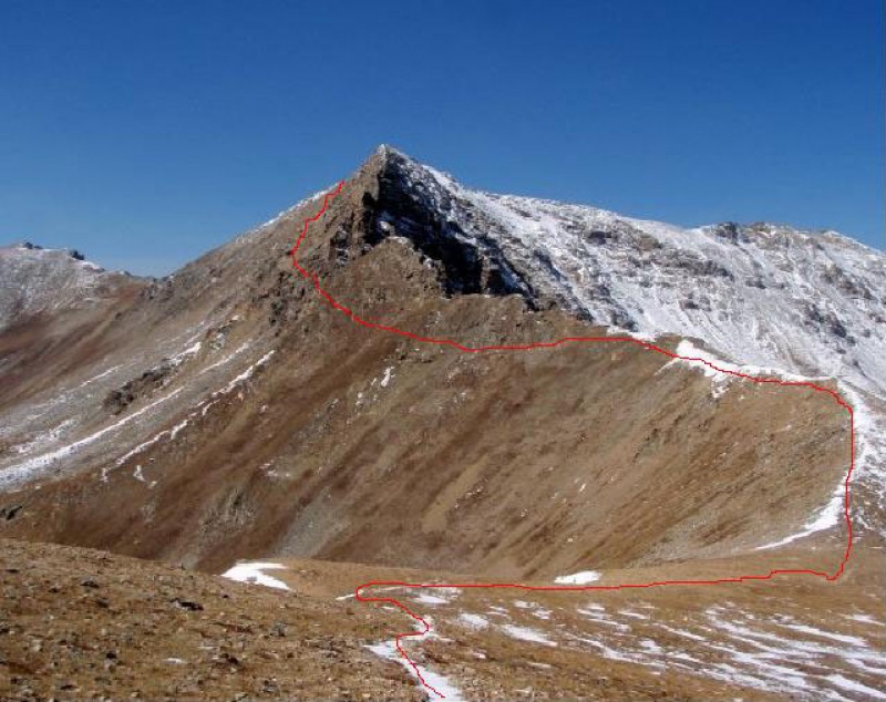
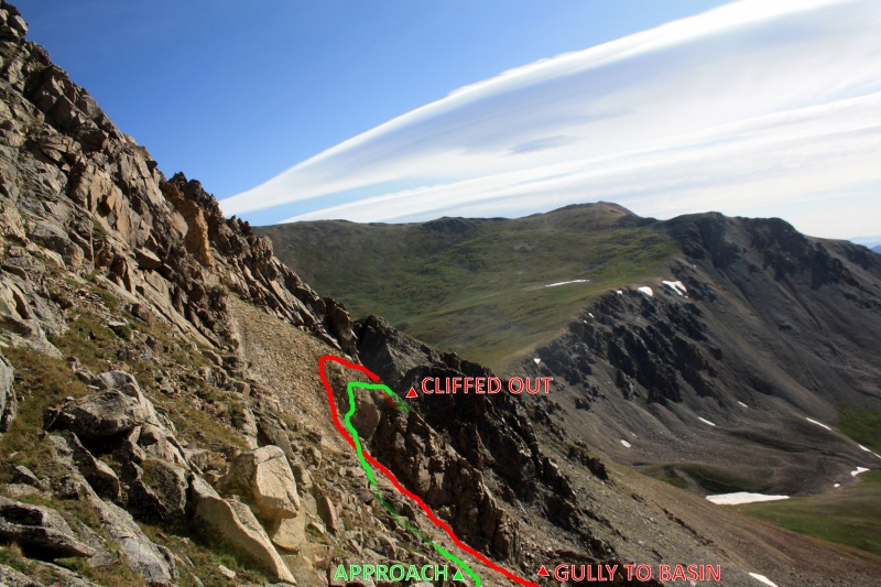
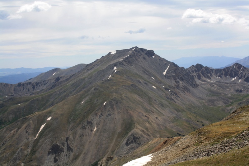
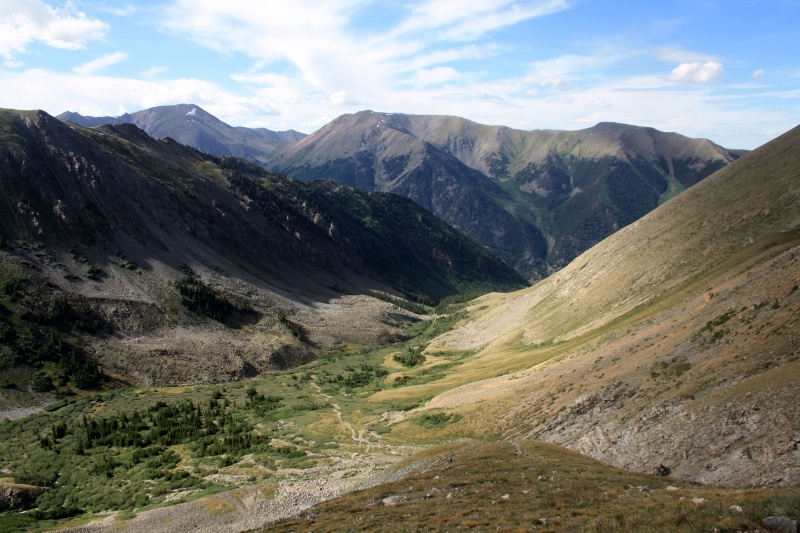
Going through the trip reports, I found this one from The_Flex to be extremely helpful and basically was going to be what I was going to attempt. While I was up for giving it a shot, there was still a lot of risk in this description as descending from the ridge proper admittedly looked sketchy and I still wanted to find a better option if possible. Fortunately I came across a series of threads discussing this further leading me to this picture posted by Monster5 highlighting a "medium" option of staying between cliffs and the scree:
This avoids the extremely technical terrain of descending from the ridge proper as well as dropping down into the scree (sufferfest) or the basin (tedious). I referenced a few more trip reports from Emerald Peak just to see if there were better vantage points and ended up using this as my basic guide:
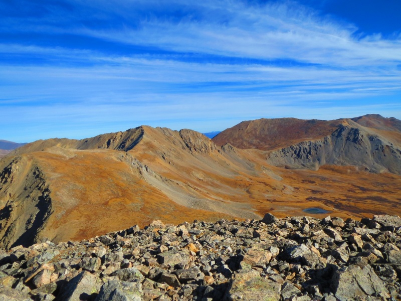
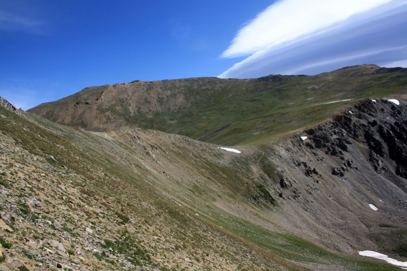
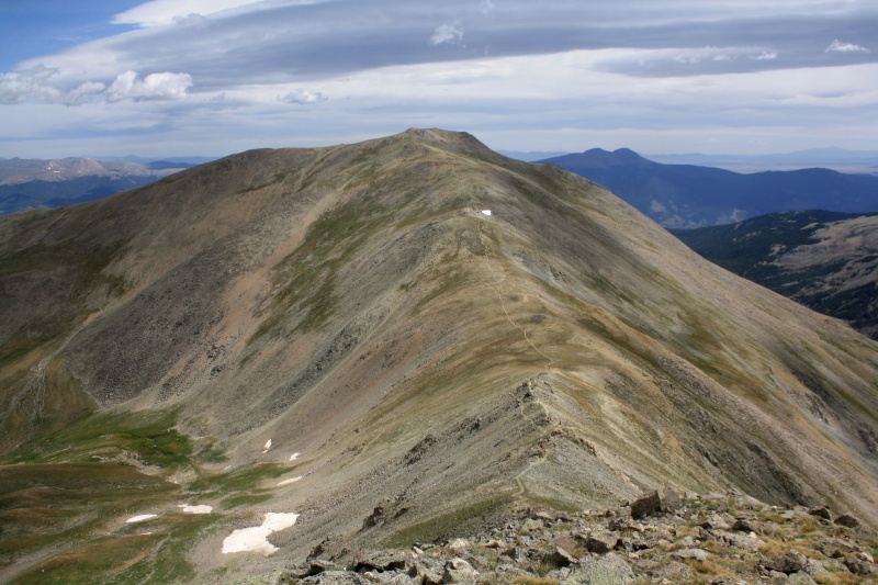
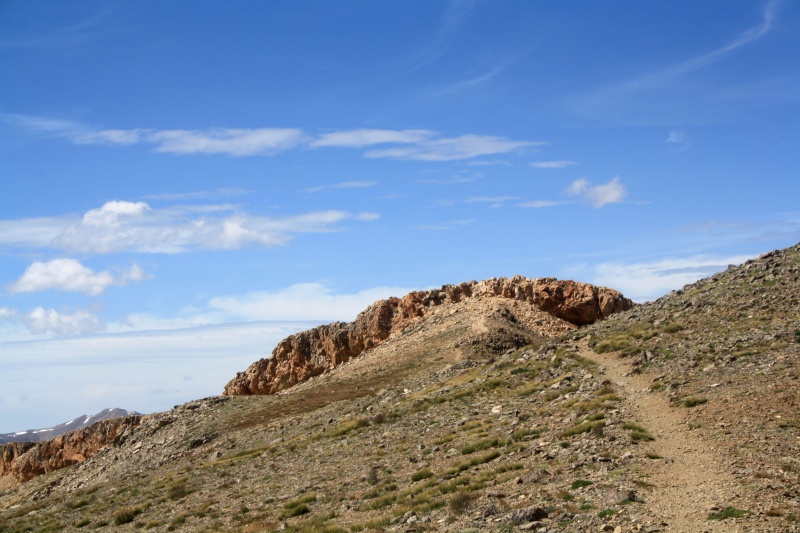
The Elkhead Pass trail is well defined through Missouri Gulch and honestly feel it should be the standard route for Belford and Oxford. Getting up Missouri was pretty straightforward. Had hoped to catch the sunrise from the summit, but unfortunately didn't start early enough (one day!).
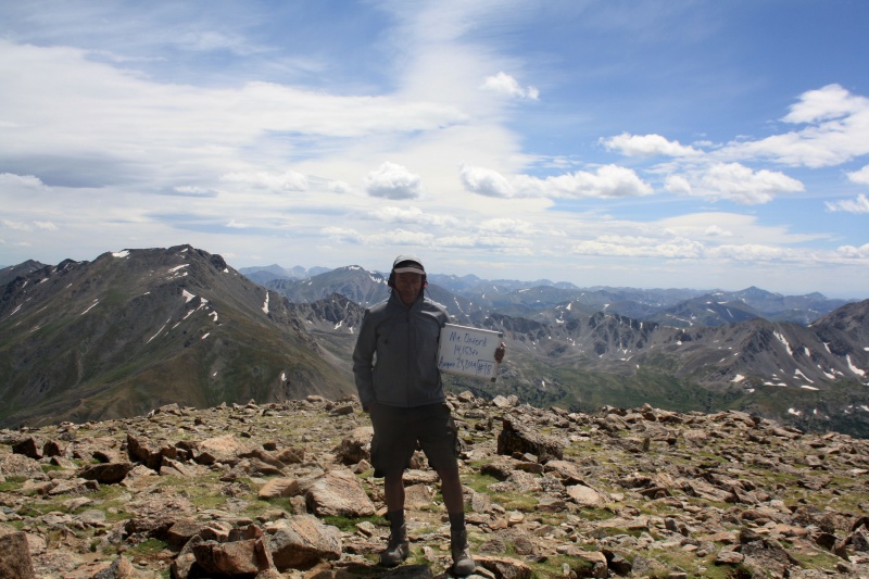
So far so good, Missouri Mountain for #17 but the fun's just beginning...
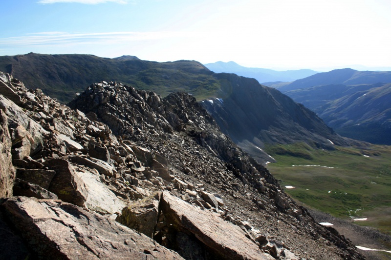
After taking in the summit for a good half hour, finally decided it was time to get moving. Based on the picture from Emerald Peak, I knew I had to descend southeast almost immediately and aim for the middle of the cliffs.
From here I was targeting that second snowfield from the bottomPlenty loose through here but manageable so far...
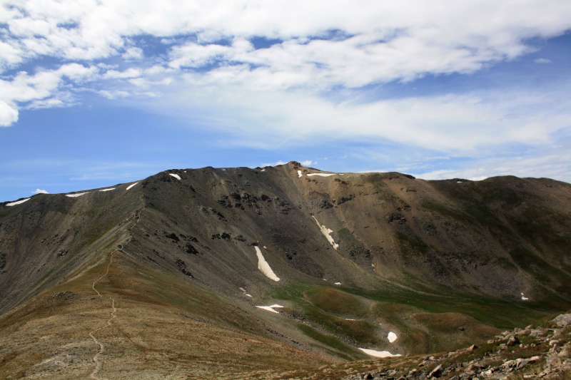
As I progressed, I made sure to note my escape options. While there were exposed areas in the cliff section, there were a good five or six gullies that ran all the way out into the basin and I figured worst case scenario if I cliff out or get in over my head, I can just ride one of them down and regain Elkhead Pass later (though ideally I was trying to avoid it coming to that at all costs).
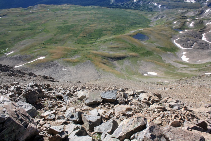
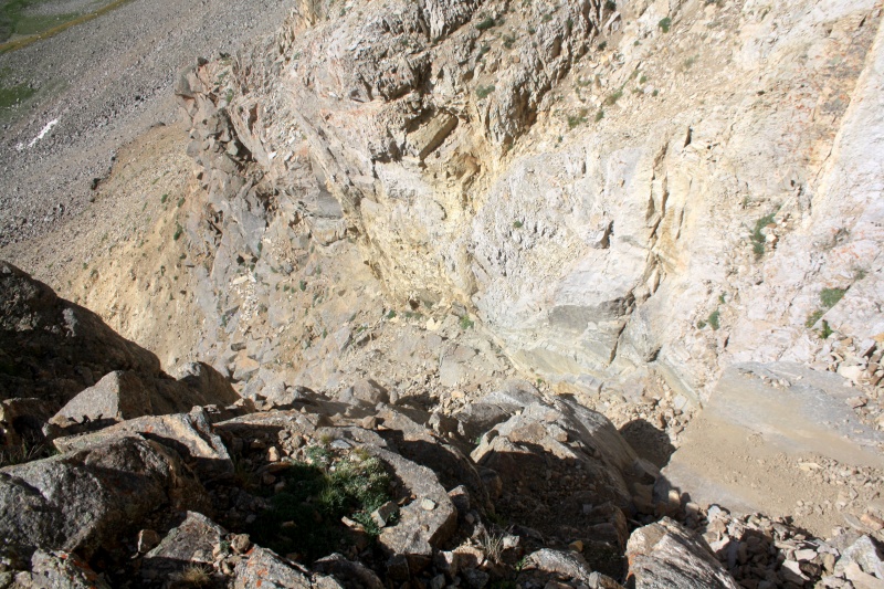
The hardest thing to gauge throughout the route was whether I had descended far enough or where I was relative to the bottom of the cliffs. I continued eastward and downward as best I as I could tell relative to the viewpoint from Emerald Peak and eventually came upon a loose gully. It seemed like there was a route on the other side so I waded through it and continued on the other side only to end up cliffing out shortly afterward.
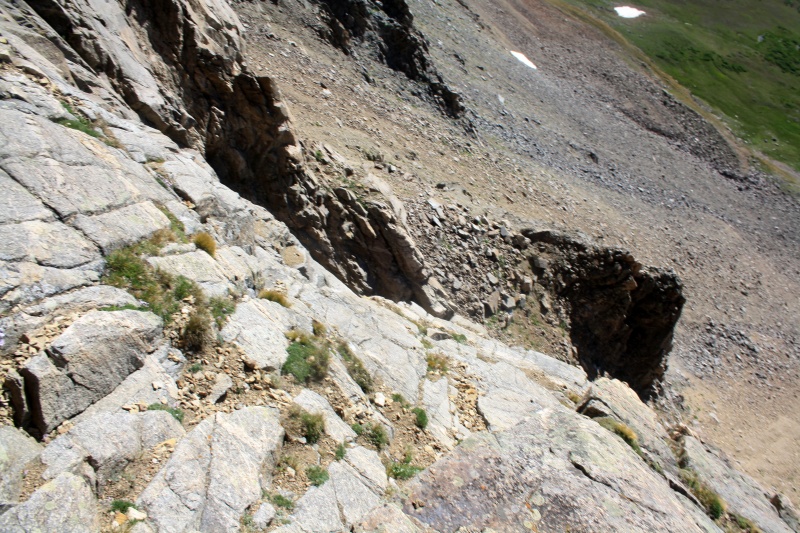
While I could probably make it down to that ledge, I couldn't see what my next move would be and realized it was time to turn aroundLol from this picture taken earlier in the route it's easier to see there wasn't anywhere left to go, but it was hard to tell up close in the gully
Fortunately I saw that the loose gully I passed through ran all the way out to the basin so when I cliffed out, I knew I had an escape option. At that point I was so tired of dealing with the cliffs, I wasn't considering trying to find a "lower" route through as I was almost to the notch and knew there wouldn't have been much of one anyway. I figured I'd just bail all the way out and worry about the scree slope once I got there. The gully was so loose that I had to hold onto the east cliff wall most of the way down to arrest or I likely could have been swept out, though at least it began to stabilize as I neared the exit.
Almost out!
Home free, right? I wish, still had to deal with navigating the remaining scree slope between me and Elkhead Pass. Wasn't truly out of it until I gained the ridge.
Looks calm here but the slope's still steep enough that I was sliding at least 5 feet down about every 60-70 feet I was able to advance across.
Now I'm home free! Lol so much for this 2:15 "shortcut," I likely could have descended the standard route, regained Elkhead Pass, and been on my way a lot faster. I did have my GoPro running during this segment and put together a video which along with the GPX file below hopefully shows my path a bit more clearly:
I was beginning to have my doubts as to whether or not I'd have enough left to do all three but when I got to Elkhead Pass, I was surprisingly motivated and reenergized and knew there was no way after enduring all that I could not come away with all three! Onward to Oxford!
Looking back at my ordealDecided to do Oxford first because that would make me have to do Belford. If I did it the other way around, the temptation to bail would be too great...Looking over at HarvardLol pretty steep drop off of Belford's ridge, could tell this wasn't going to be pleasant coming back...
Pretty cool to see goats grazing down in Belford Gulch in an open field like this, lol pretty much had only seen them on rocky terrain before
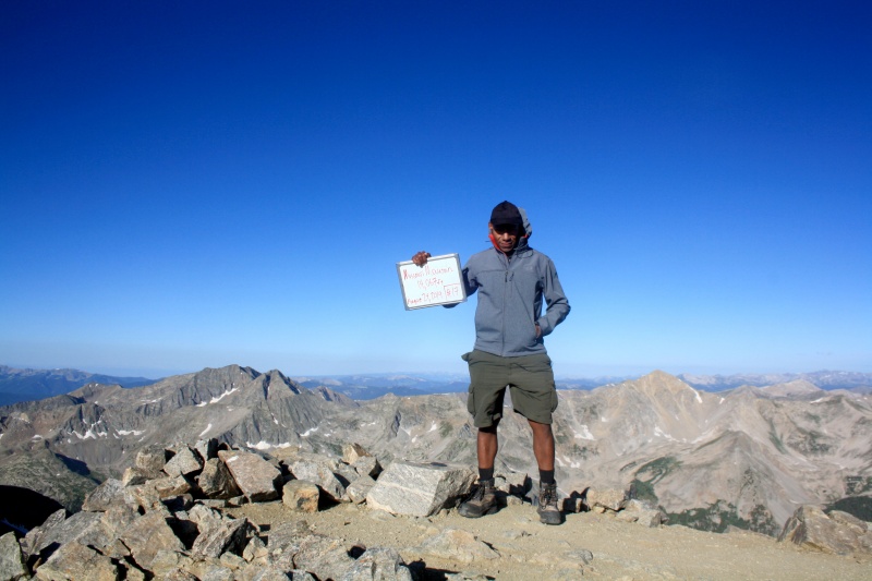
#18 Mt. Oxford! Although bluebird weather wise, the wind was pretty fierce all morning. Easily 30-35mph gusts, could barely stay on the trail.
As demoralizing as seeing the Oxford saddle ahead was, knowing I only had one left was enough to propel me forward. Still don't know where this wind was coming from as I didn't see it that severe in the forecast, but at that point I was just pushing through it.
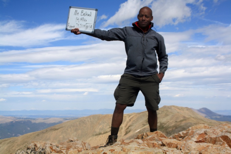
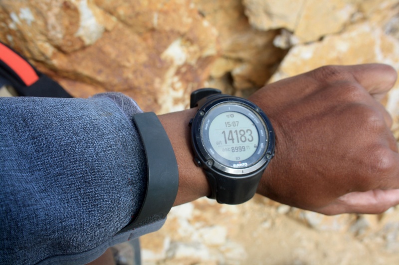
Doesn't look that bad here but I seem to remember it being STEEP! Lol I don't know, maybe fatigue was affecting my perception/recollection...Belford's summit block#19 Mt. Belford! Nice to finally have some success in the Sawatch seeing that the past two winters Princeton's been taking my lunch money...Not bad at only 14' off
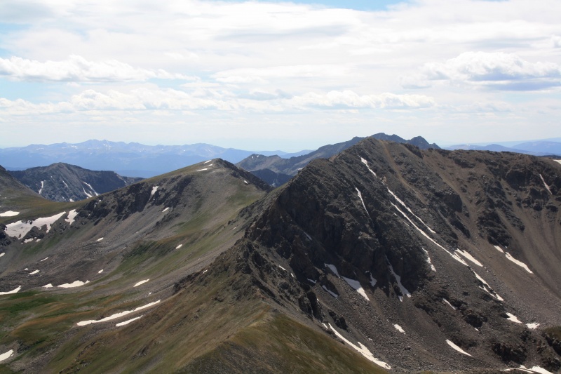
One last look at Missouri's miserable east ridge from Belford. Lol, don't even want to think about the north face...
With that, all that remains is descending Belford. I noticed most people going back down Elkhead Pass but I wanted to "complete a loop" and at least experience Belford's standard route. While certainly "shorter" I can honestly say even going down it's a miserable experience, can't imagine coming up that way. I would definitely say that Elkhead Pass is the preferable and more enjoyable option unless enduring switchback misery on the standard route is your thing in which case, have at it :).
Has it really been nearly three years since my last trip report?! Lol figured this was an uncommon enough route/experience to put one together, mainly just wanted to put some information out there on the middle route through the south face and highlight that there is a relatively safe path through the east ridge. Now whether that's an enjoyable or efficient path, I suppose that depends on how much of Missouri's misery you're willing to put yourself through...
Homeward bound!
My GPS Tracks on Google Maps (made from a .GPX file upload):
Good job on a challenging hike. While you may have not chosen
the easiest route to bag all three summits, you posed a problem for
yourself and worked through it. Can't ask for any more than that.
@mathguy
Yeah, definitely a reminder that standard routes are there for a reason! It was just hard to gauge while on the slope where I was or else I would have known to descend more sharply earlier and maybe avoided more of that loose gully or cliffing out. Made a few mistakes here for sure, but I was able to keep it pretty close to class 3 throughout so I think I was mostly succssful in finding the middle route mentioned before.
@OldTrad
Lol yeah, couldn't bear the thought of fatigue or bad strategy making me have to come back and resummit Belford just to get to Oxford when I was already there on what was mostly a bluebird day.
I always regret not sticking around and getting Oxford and Missouri when I bagged Belford. (weather was a concern) I've often thought about going back and trying to find a good way to go to Elkhead Pass, bag Oxford and then also get Missouri too. This report definitely gives another good reference for Missouri first and then Oxford. And yeah, that ascent on Belford's "standard route" is pretty miserable. We descended via Elkhead Pass just to not have to descend those miserable switchbacks.
Thanks! Yeah I'd been considering these for a while, but knowing it was going to be a long day and I would likely run into class 4 navigating the ridge, I was waiting until I was fairly confident it would be bluebird all day so I could take as much time as I needed. I remember heading up the trail from Elkhead Pass to Oxford and seeing all these people descending and wondering why they weren't going down the standard route which based on my research was much shorter--lol I soon found out :). Yeah I'd definitely recommend doing Missouri first. While you have to gain and lose elevation over and back from the Belford/Oxford saddle, the switchbacks to Missouri's summit ridge are much steeper with more elevation gain (plus some scrambling at the end) and are better to tackle when you're fresh. Getting Oxford afterward will still be a chore (lol I was pretty much dead on my feet on that saddle), but it's mostly just a trail that as long as the weather cooperates you can will yourself through.
Caution: The information contained in this report may not be accurate and should not be the only resource used in preparation for your climb. Failure to have the necessary experience, physical conditioning, supplies or equipment can result in injury or death. 14ers.com and the author(s) of this report provide no warranties, either express or implied, that the information provided is accurate or reliable. By using the information provided, you agree to indemnify and hold harmless 14ers.com and the report author(s) with respect to any claims and demands against them, including any attorney fees and expenses. Please read the 14ers.com Safety and Disclaimer pages for more information.
Please respect private property: 14ers.com supports the rights of private landowners to determine how and by whom their land will be used. In Colorado, it is your responsibility to determine if land is private and to obtain the appropriate permission before entering the property.


")
")
")
")
")
")
")
")
")
")
")
")
")
")
")
")
")
")
")
")
")
")
")
")
")
")
")
")
")
")
")
")
")
")