Download Agreement, Release, and Acknowledgement of Risk:
You (the person requesting this file download) fully understand mountain climbing ("Activity") involves risks and dangers of serious bodily injury, including permanent disability, paralysis, and death ("Risks") and you fully accept and assume all such risks and all responsibility for losses, costs, and damages you incur as a result of your participation in this Activity.
You acknowledge that information in the file you have chosen to download may not be accurate and may contain errors. You agree to assume all risks when using this information and agree to release and discharge 14ers.com, 14ers Inc. and the author(s) of such information (collectively, the "Released Parties").
You hereby discharge the Released Parties from all damages, actions, claims and liabilities of any nature, specifically including, but not limited to, damages, actions, claims and liabilities arising from or related to the negligence of the Released Parties. You further agree to indemnify, hold harmless and defend 14ers.com, 14ers Inc. and each of the other Released Parties from and against any loss, damage, liability and expense, including costs and attorney fees, incurred by 14ers.com, 14ers Inc. or any of the other Released Parties as a result of you using information provided on the 14ers.com or 14ers Inc. websites.
You have read this agreement, fully understand its terms and intend it to be a complete and unconditional release of all liability to the greatest extent allowed by law and agree that if any portion of this agreement is held to be invalid the balance, notwithstanding, shall continue in full force and effect.
By clicking "OK" you agree to these terms. If you DO NOT agree, click "Cancel"...
From reading previous reports, I wanted to shortcut the hike from Missouri to Oxford by using the East Ridge from Missouri. I hate having to redo elevation if avoidable. I think there is too little information on this route, so maybe I can be of help. The goal was to get to the Elkhead Pass (a trail that avoids 14ers heading north-south, and is not on this website map), from where starts an excellent trail going directly to Oxford bypassing Belford slightly to the south.
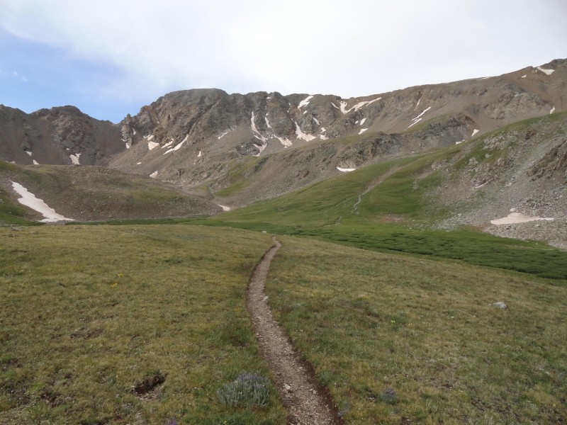
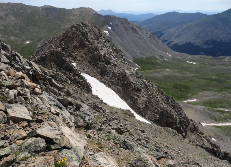
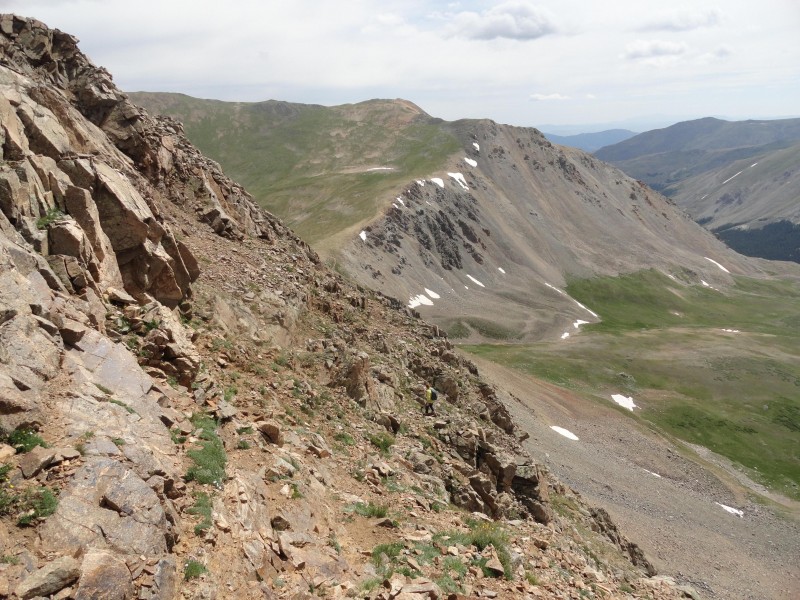
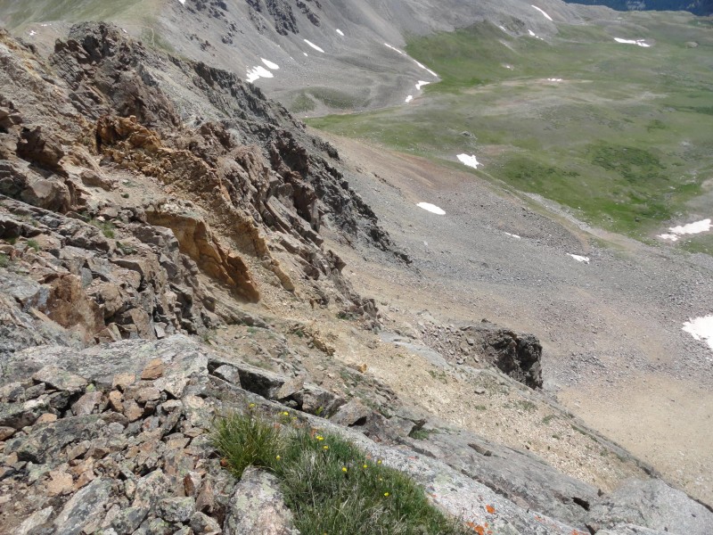
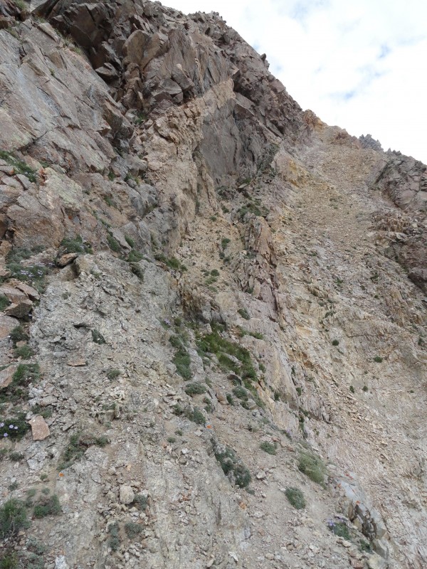
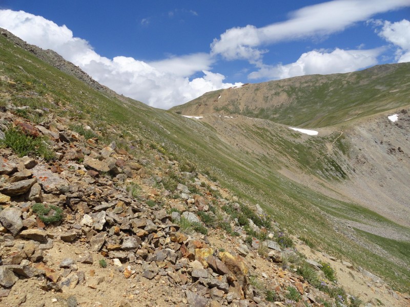
One of the key features to this ridge is a thick slice of creamy yellow rock that slices vertically through the ridge, cutting north-south with a slight tilt to the east. This can be identified coming up from Missouri Gulch on picture 1. On the ridge moving east, when reaching this slice, the ridge soon takes a significant decent.
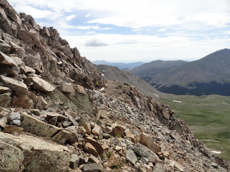
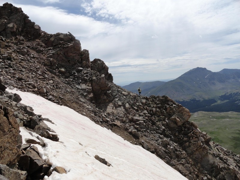
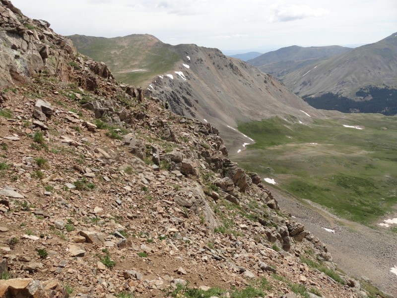
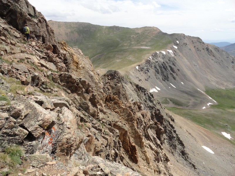
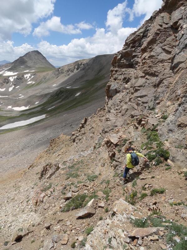
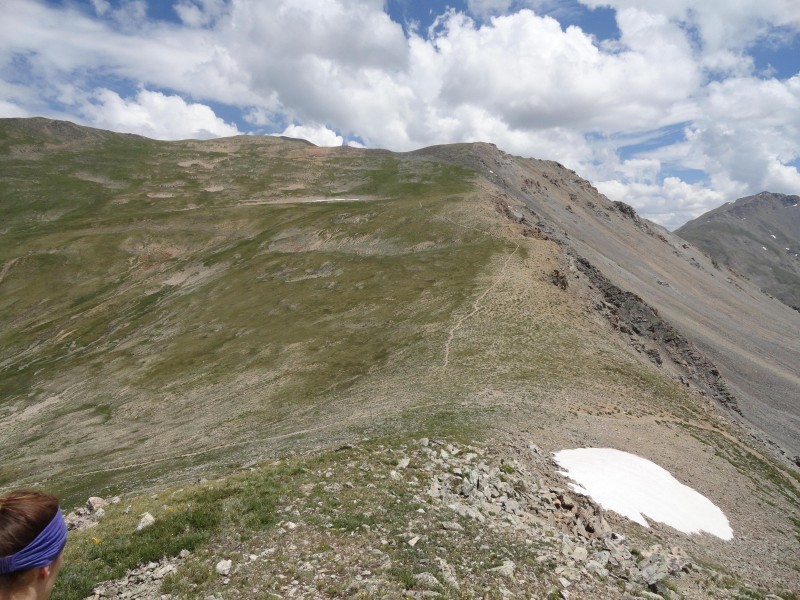
Starting from top of Missouri at 10:18AM, I kept to the south side of the ridge. There is no marked trail but a safe path is easy to find, class 2 & 3. A couple early waypoints along the route are (lat 38.94772, Lon -106.377144) and (lat 38.947937, Lon -106.37547). The idea was to traverse keeping elevation or angling slightly down. This worked great getting around the obvious point tops. This section was best described as amazing fun. Below are some pictures from many of the buttresses that I passed while high up. I was with a lady who took the lead and is in most of the pictures (can you find her?) for perspective. Picture 3 looks back at the top of Missouri. Picture 15, you feel so close to Elkhead Pass that you can touch it. This is as far as we could go.
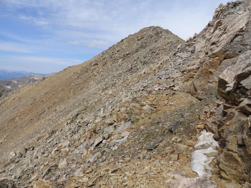
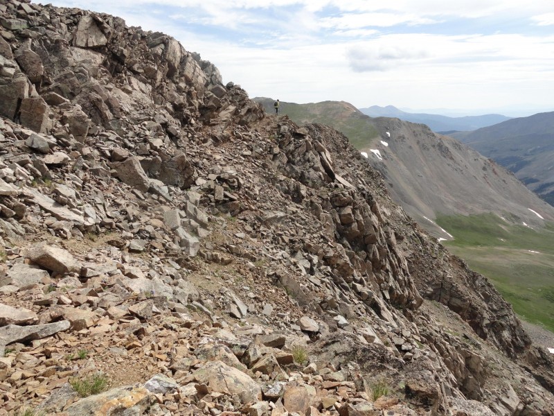
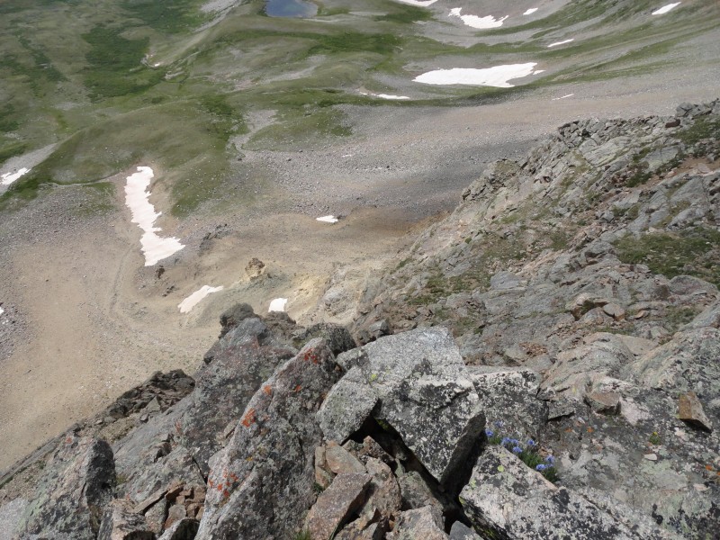
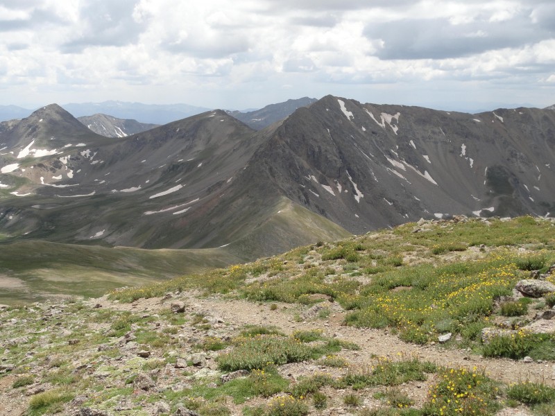
We reached the end of the fun around 11:15 or 11:30AM. Pictures 12-14 show a sweeping arc view from east to west. Picture 13 gives the best idea how steep and high it is.
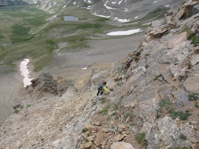
Fun changed to more of a horror. We had gone far enough that turning around was not a great option. After a lot of feeling around, we found what could be a path angling down and to the right, following that yellow rock slice. Picture 16 shows my path down, under the flat rock slightly to the left of the lady. What makes everything so hard is that the solid rock is terrible. Most handholds need to be tested first. This would be the class 4 part of the route.
Picture 17 looks up at the hardest part (the crux) of the route I came down. I stayed on the left side of the yellow stripe where the plants are growing. After doing that, I got my nerve back.
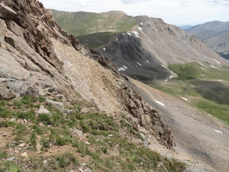
The rest going down was slow to avoid any potential of knocking rocks on her. Pictures 18-21 show that. 21 shows a last look up, with the yellow slice cutting to the right behind a mound of rock.
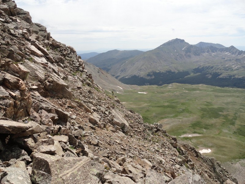
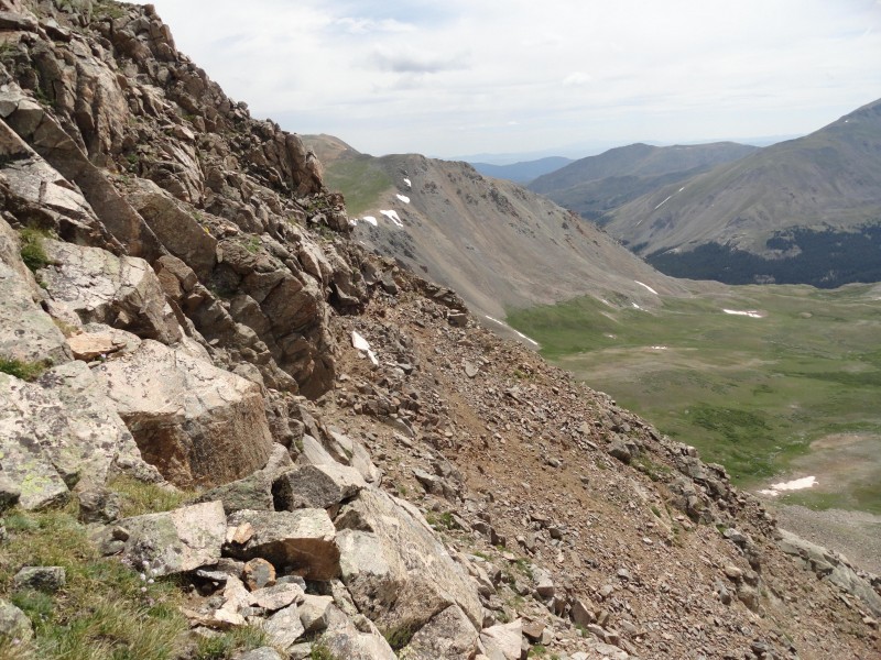
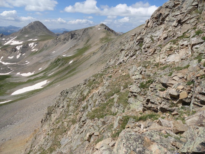
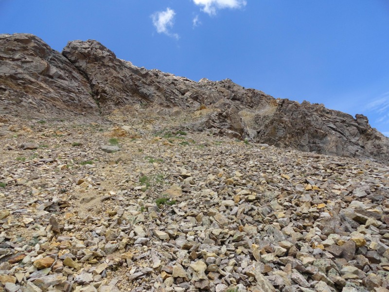
At this point, about 12:42PM, I realized that I could start traversing along the mostly loose rock to get to the Elkhead Pass instead of going all the way down. I had gotten to the point that either direction was fairly easy. Pictures 22-25 show that.
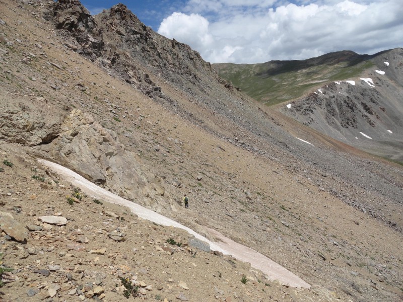
Picture 26 at 1:31PM shows the final view down onto the Elkhead Pass looking east, with the trail to Oxford going up the hill on the other side. Oxford may be the mountain on the far right side.
Final picture 27 is from up that trail looking back west over everything.
Final Notes: It may be easier to do the hike if I went down earlier starting around the given waypoints, but just a guess. If coming from the east, and you can reach the yellow rock on top of the ridge; then the rest of the route gets only easier and recommended. The standard route down and around to the Elkhead Pass may be faster. This may be the most dangerous hike I have done and do not want to do it again...unexpected loose rocks make it not worthwhile!
Thumbnails for uploaded photos (click to open slideshow):
for such a detailed report of this route. Roach describes it as the stuff of his worst nightmares. Looks, though, like it would be a little less horrible to ascend.
I did this in reverse with my daughter in 2014 (see my only trip report). I agree with you –– this was my scariest experience in the 14ers by far. However, as screeman57 said, it is easier to go up – you see your options. We ascended and then re–descended that yellow band, but then ascended some class 4 rocks without losing much elevation. I would not want to attempt what Roach is describing.
Did this today coming up from the pass. Tried a couple possible routes to gain the ridge earlier, but they got class 5ish, and I was solo, so a bit more adventurous than I needed. Ended up climbing up a horrible talus field right below the summit. One of the worst things I’ve done on a 14er. Looks so tempting though!
Caution: The information contained in this report may not be accurate and should not be the only resource used in preparation for your climb. Failure to have the necessary experience, physical conditioning, supplies or equipment can result in injury or death. 14ers.com and the author(s) of this report provide no warranties, either express or implied, that the information provided is accurate or reliable. By using the information provided, you agree to indemnify and hold harmless 14ers.com and the report author(s) with respect to any claims and demands against them, including any attorney fees and expenses. Please read the 14ers.com Safety and Disclaimer pages for more information.
Please respect private property: 14ers.com supports the rights of private landowners to determine how and by whom their land will be used. In Colorado, it is your responsibility to determine if land is private and to obtain the appropriate permission before entering the property.


")
")
")
")
")
")
")
")
")
")
")
")
")
")
")
")
")
")
")
")
")
")
")
")
")
")
")


