Download Agreement, Release, and Acknowledgement of Risk:
You (the person requesting this file download) fully understand mountain climbing ("Activity") involves risks and dangers of serious bodily injury, including permanent disability, paralysis, and death ("Risks") and you fully accept and assume all such risks and all responsibility for losses, costs, and damages you incur as a result of your participation in this Activity.
You acknowledge that information in the file you have chosen to download may not be accurate and may contain errors. You agree to assume all risks when using this information and agree to release and discharge 14ers.com, 14ers Inc. and the author(s) of such information (collectively, the "Released Parties").
You hereby discharge the Released Parties from all damages, actions, claims and liabilities of any nature, specifically including, but not limited to, damages, actions, claims and liabilities arising from or related to the negligence of the Released Parties. You further agree to indemnify, hold harmless and defend 14ers.com, 14ers Inc. and each of the other Released Parties from and against any loss, damage, liability and expense, including costs and attorney fees, incurred by 14ers.com, 14ers Inc. or any of the other Released Parties as a result of you using information provided on the 14ers.com or 14ers Inc. websites.
You have read this agreement, fully understand its terms and intend it to be a complete and unconditional release of all liability to the greatest extent allowed by law and agree that if any portion of this agreement is held to be invalid the balance, notwithstanding, shall continue in full force and effect.
By clicking "OK" you agree to these terms. If you DO NOT agree, click "Cancel"...
4x4 Equipment: 2002 Toyota Tacoma with 2.5" lift for 13.5" of clearance, Toyota BJ74 from Japan
Hikers: Ryan & Tony (I sat and watched them)
With the lightning and the rain starting at 6:30 am, we weren't going anywhere for the morning. So we headed into town for breakfast. Mmmmm bacon! It's better than hiking in the rain. We got to check the weather forecast and watch the radar. It looked like we would have a short window till the next storm system. So we went 4x4 and easy 13er picking. Too bad I've already done that, so I was mostly along for the drive.
Note on our vehicles. I have a Subaru 3.6R, which is awesome for speeding along on highways and for ski/snow travel, but I wouldn't be crazy enough to take something with a measly 8.7" of clearance up any of these roads. Real 4Lo is needed, not that barely adequate for driving down Stevens Gulch from G&T, X-Mode. Of course I'm biased and enjoy my big truck, but I also don't want to ruin the stealth sports car either.
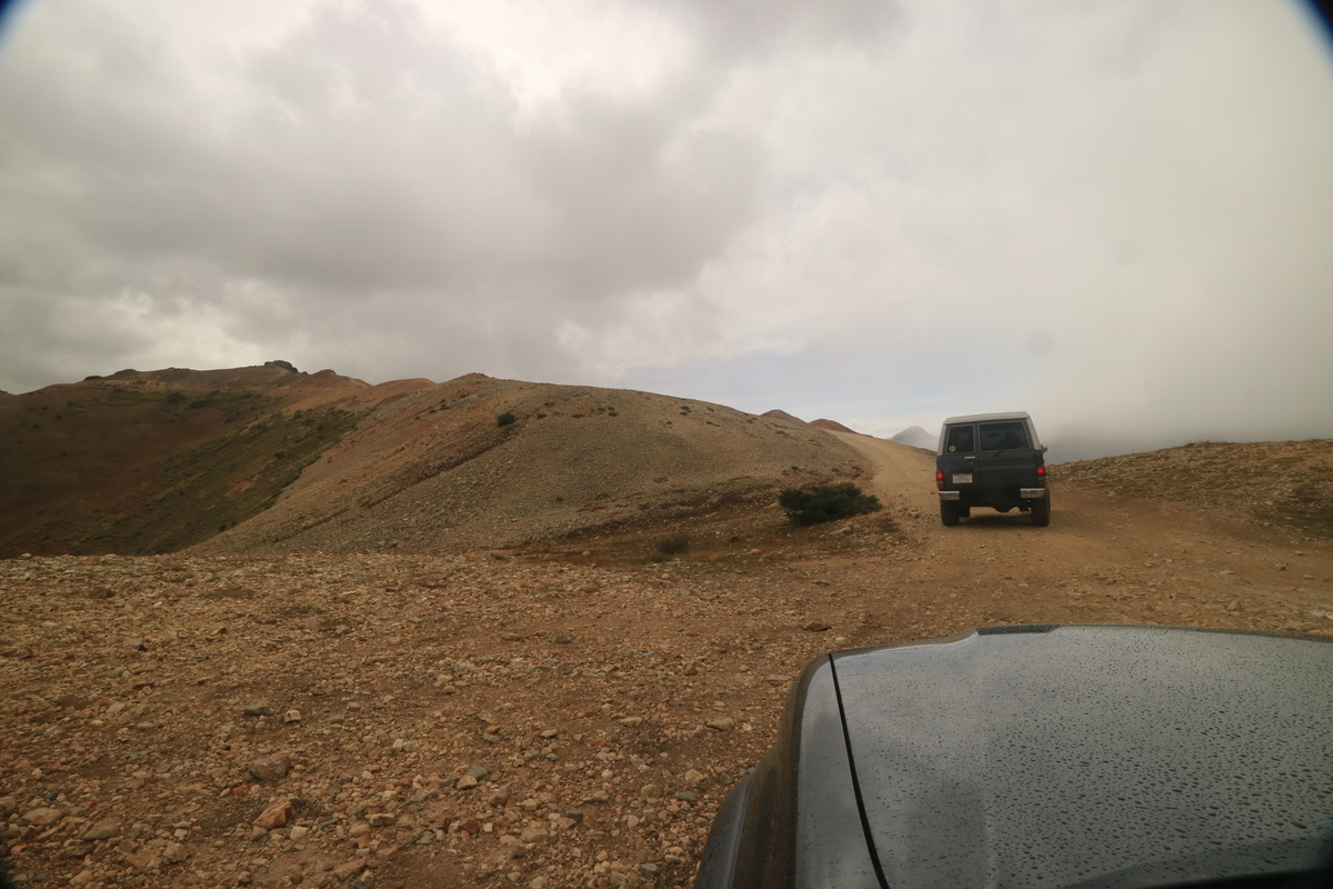
So after all the bacon, eggs and hash browns the 3 of us could eat, we drove up to Hurricane Pass to check out the weather. Not terrible, but not great either. Ryan and Tony wanted to run up Browns Mountain, so we went over to that pass a bit north. We hung around waiting for a bit, when I see them rushing out of the BJ to say they were making a run for it. Go for it! I'll put on my zoom lens and capture the action. It's like watching someones Delorme on a screen, but much better! No 10min delays. Though, when they lulligagged on the summit for a long time, I didn't know what they were doing. Hmmmm....
Up to Hurricane PassPoukipsie Gulch - not sure super Taco or I are ready for that road...
Hurricane from Hurricane PassMaking a run for it
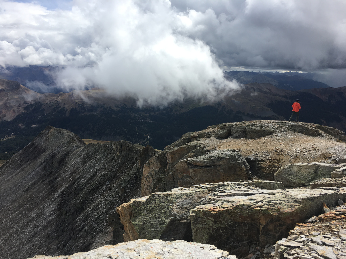
They're looking at me!Making the ridge
The guys are near the nipple on the ridge.
Sky goes clear with them on summitWalking back down
Hurricane in the weather window
After the guys got back down, we decided to try for Hurricane from a 4x4 road from the other side. The weather had cleared a bit for a nice donut hole. So off we went! Too bad when we got to the other road, we could have driven much further up - in fact the entire length of my gps track, since that is where Ryan and I stopped. Tony made a run for the summit. I didn't care enough for an unranked peak, so I was not going to risk the approaching storm. Still a nice bit of exercise for the day after 2 big ones the previous 2 days before!
Hiking up the other side of Hurricane
Hiking up the roadHurricane from where you can park
Tony on the summitSome mining ruins, in the fore and in the back
SHEEP!Ryan checking out a deep shaftAnother deep shaft with the Holy Marmot Shit Farm in front. Ewwwwww!
After checking out the mining ruins, we drove over and up Corkscrew Pass for the views
Down one road, up anotherCorkscrew action shotDescending Corckscrew
Future 4x4 model
Taking the husky for a walkAlpine Looping
The mine disaster cleanup, with the Storm Peaks behind
We drove into Silverton to get supplies and to meet Anastasia and Ezra. They were going to camp with us that night before heading up to Ice Lakes Basin the next day.
Note near our campsite. A few years ago, a porcupine got under my truck at 2am and I had to drive back and forth through a stream really fast to get it out. So the warning is real, if misspelled.
Back at camp, Ryan helped me articulate my truck on a rock. I've wanted to do this for a long time, so yay #bucketlist
Taco Love!
Foot under an airy tireCheck out that clearance!
After the 4x4 silliness, we started the camp silliness. We were fully prepared for rain, but that didn't happen!
CampDouble fisting the P Noir
My meat is sooooo hot, it's on fire!
Lightsabers rule!
Day 4: Sheep Mtn A, Greenhalgh
Mileage: 4.89
Elevation gain: 1,945'
Partners: Ryan & Tony
With a decent weather window in the morning, we decided to go after the only other viable option for new 13ers I had in the neighborhood. So up and over Stoney Pass we went, to where the Rio Grande River crosses the road for the first time. We parked and waited through a rainstorm, till we wouldn't get soaked from above, just from the bushes and grasses below. Would be a short day, but a wet one!
Am I stoked over the snow or is an Offspring song playing on the radio?
Stoney Pass Peak and Canby MtnCrossing the Rio Grande River. Sooooo easy here!Sheep Mountains gentle slopesAlong Sheep's ridge, looking at its more cliffy side.The guys nearing the summitA bit of rocky ridge to the summit
Final steps up Sheep, photo:Ryan
Wemi
Pano south, where I haven't hiked much at allPano north, where I've hiked virtually everything in view
Half Peak
GraupelHeading to GreenhalghThe edge
At the ridge edge, the guys pounded down another loose talus gully. I started after them, then thought better of it. The ridge to the right was solid and quite pleasant! I recommend!
GreenhalghLooking back on Sheep and the slope vs ridge on leftAnother graupel pauseHeading up Greenhalgh
graupel and fall colors
A ridge cairn
RGP and the Window
The Poles, wanted to get these, but another time
Pano SWPano north
Instead of going back over Sheep, we had to decide wether to dodge to the left or right. The left and down near the road was more appealing.
Sheep with our contour routeRyan is sure fast pounding down loose gullies!
Fall is here - What I felt like after 4 days of hiking after not hiking in a month!
ContouringOld shack with Sheep behindGame trails made this trek easy!
Pretty flowers still
I see the Toyotas!
Driving back up to the pass
Day 4.5: Denver Hill,12,340 Seigal Mtn
Mileage: 1.75
Elevation gain: 517'
Partners for 12ers: solo
Seigal: Ryan & Tony
After dinner at Handlebars, we had beautiful weather, so we decided to head up and hike some more. The guys would go for the 13er Seigal, and I would go up Denver Hill and the Denver Lakes for some photography.
Denver Hill from belowDenver Hill from the way upSummit of Denver Hill with Houghton to the right
I hiked up the first hill, Denver Hill, and noticed that there was a higher point in the distance. Based on the guys progress uphill, I would have enough time to hike over there.
Denver LakesDenver Lakes
Great views of the setting sun from the next point, and I made it just before the guys summited the 13er in the clouds behind me.
Ryan and Tony on SeigalView down from Seigal of me somewhere
Sneffels and companySeigal and Denver Lakes
Day 5: Trico
Hikers: Ryan & Tony (I sat and watched them)
With the guys heading home today, and the weather being only good in the morning, we went for another hearty breakfast and 4x4 day. I would be extremely lazy and just ride up with Tony and Ryan in the BJ up to Black Bear Pass. Figured I could listen to Ryan's running commentary on how to drive up there, and learn something!
Spotting the lineRyan directing TonyPass Bagger!
Ryan and Tony heading up TricoStormynessT10, I remember this peak!Summit of Trico, can always tell which one is Tony by the orangeTony on Trico
Tony getting sillyReally silly, like we all just spent 5 days together !
Back at the end of the road, we parted ways. They guys back home, and me back to Silverton for V5 the next day. This mini vacation with friends was exactly what I needed! Thanks for letting me hang out!
Lots of cool adventuring down there. We enjoyed Trico from US 550. I didn't think the corolla's 5" of clearance couldn't handle the road. :lol: Still an easy day, I think just over 3 hours round trip; something that can be snuck in during a thin weather window.
Yeah, I think a Corolla would eventually get stuck, or else you would be leaving it there! I've hiked down the road when my traverse had to be cut short years ago. At least there's easy access to the peaks!
Caution: The information contained in this report may not be accurate and should not be the only resource used in preparation for your climb. Failure to have the necessary experience, physical conditioning, supplies or equipment can result in injury or death. 14ers.com and the author(s) of this report provide no warranties, either express or implied, that the information provided is accurate or reliable. By using the information provided, you agree to indemnify and hold harmless 14ers.com and the report author(s) with respect to any claims and demands against them, including any attorney fees and expenses. Please read the 14ers.com Safety and Disclaimer pages for more information.
Please respect private property: 14ers.com supports the rights of private landowners to determine how and by whom their land will be used. In Colorado, it is your responsibility to determine if land is private and to obtain the appropriate permission before entering the property.


")
")
")
")
")
")
")
")
")
")
")
")
")
")
")
")
")
")
")
")
")
")
")
")
")
")
")
")
")
")
")
")
")
")
")
")
")
")
")
")
")
")
")
")
")
")
")
")
")
")


