1 provides a distant view of the route. Begin the hike by crossing the large bridge spanning Stevens Gulch and follow the well-defined Grays trail into Stevens Gulch. At approximately 11,800', you'll get a clear and full view of Grays Peak -
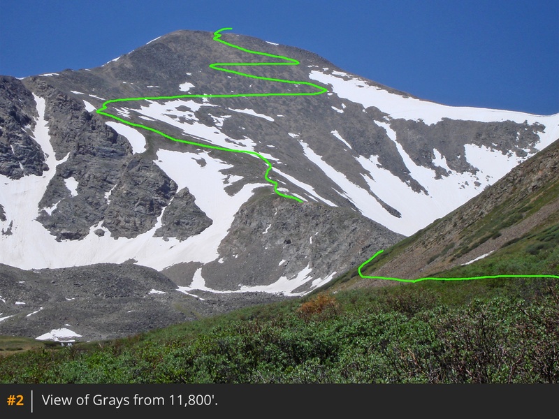
2. Continue for about 1.5 miles to an information sign
-
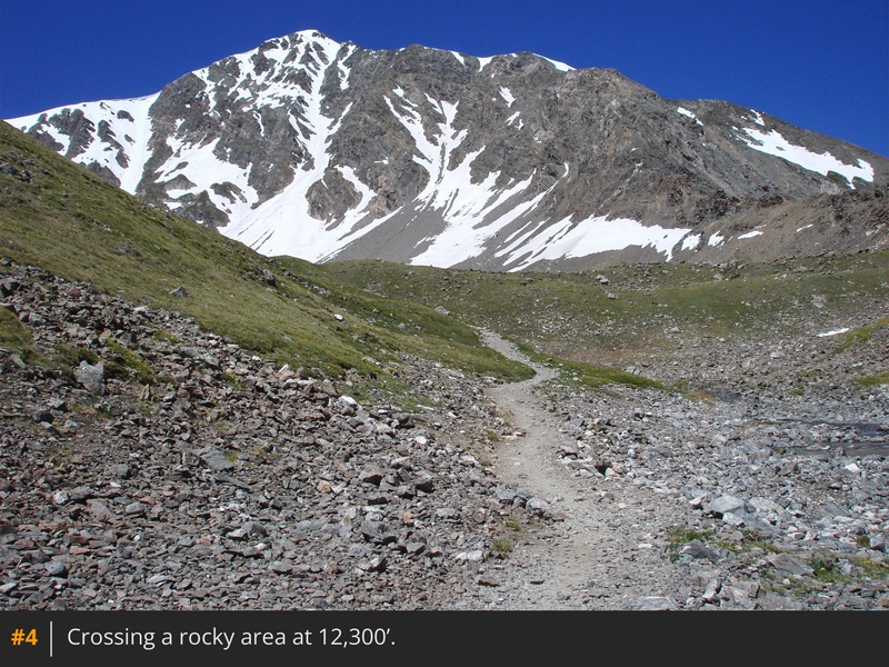
3. Not long after this point, hike across a flat, rocky area -
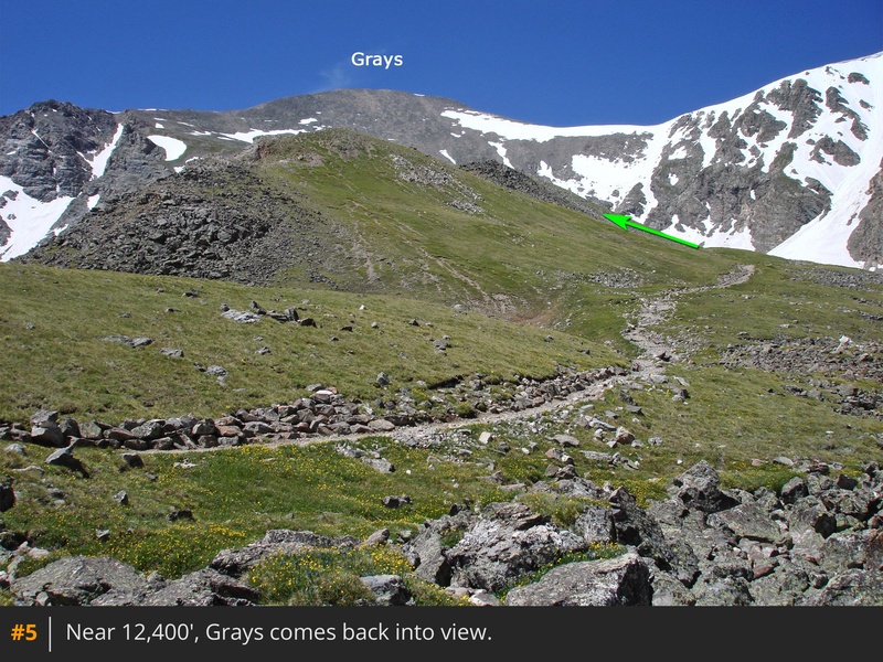
4. The trail gradually curves left as it moves behind a small ridge running south toward the east side of Grays -
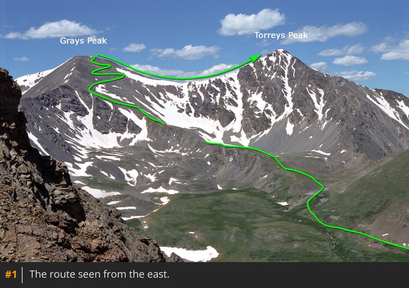
5, with Torreys Peak visible to your right. As you proceed, more of Grays Peak begins to come into view.
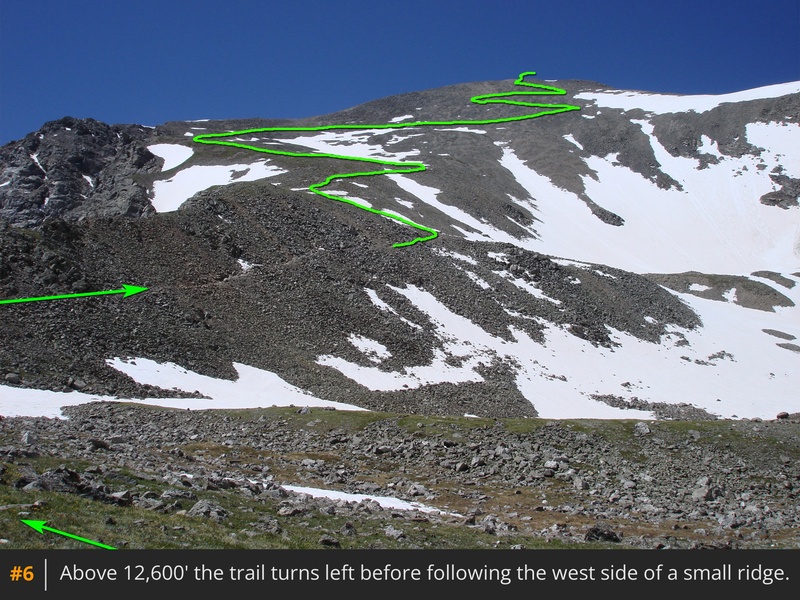
Near 12,600', the trail turns left and then continues south along the small ridge -
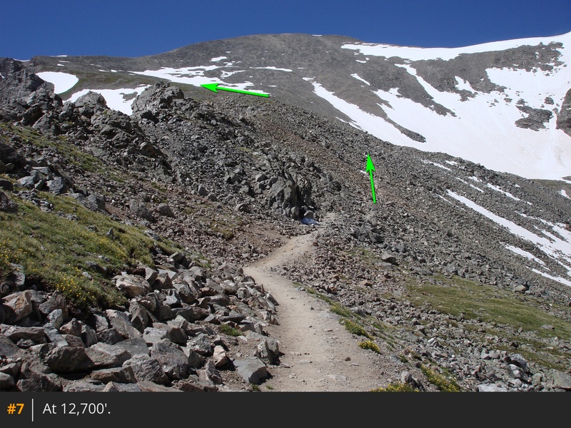
6 and
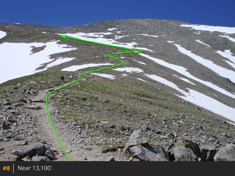
7. After navigating this rugged section, the terrain becomes easier (
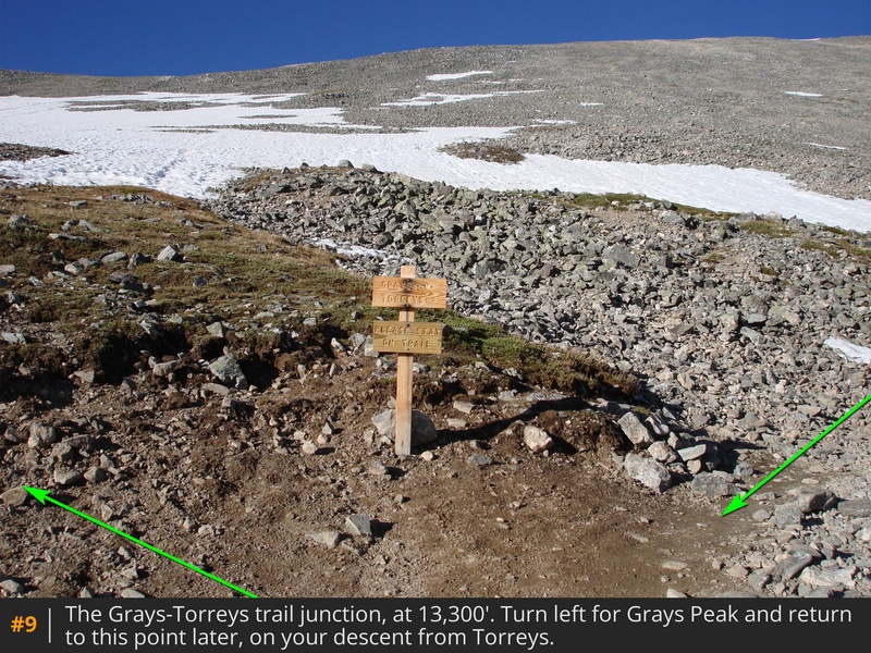
8), leading to a trail junction
at 13,300' -
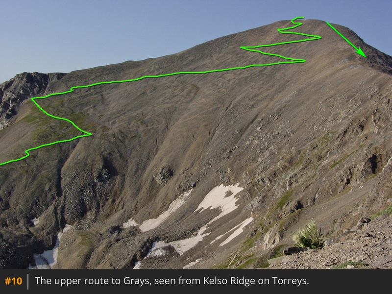
9. A different perspective of the area can be seen in
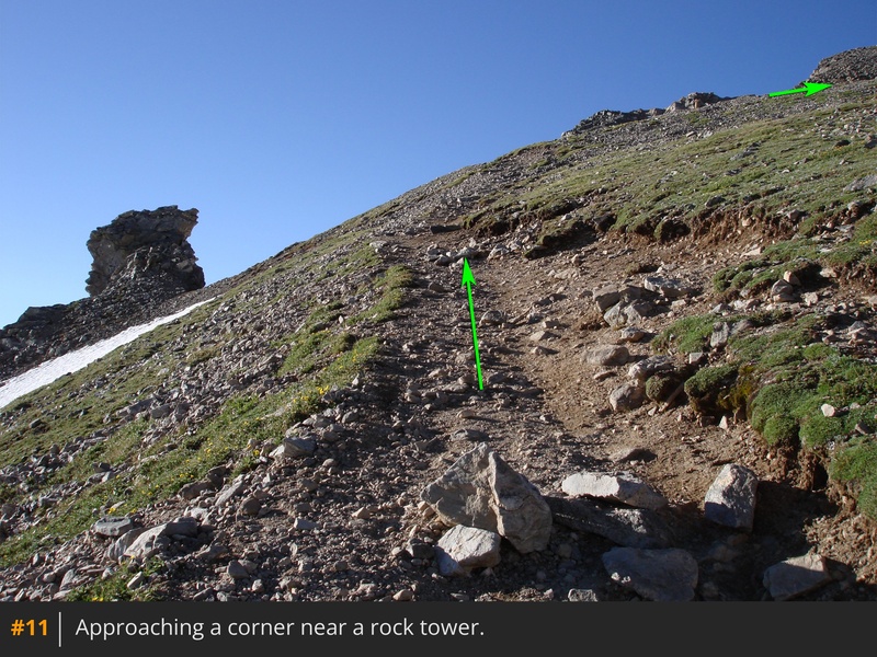
10, as taken from Kelso Ridge on Torreys Peak. If starting with Grays, stay left on the main Grays trail. Follow it to reach a corner overlook of Stevens Gulch at approximately 13,700' -
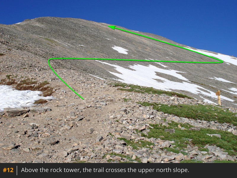
11. Turn right here and gradually ascend west across Grays' north slope, utilizing a few switchbacks below the summit -
12 and
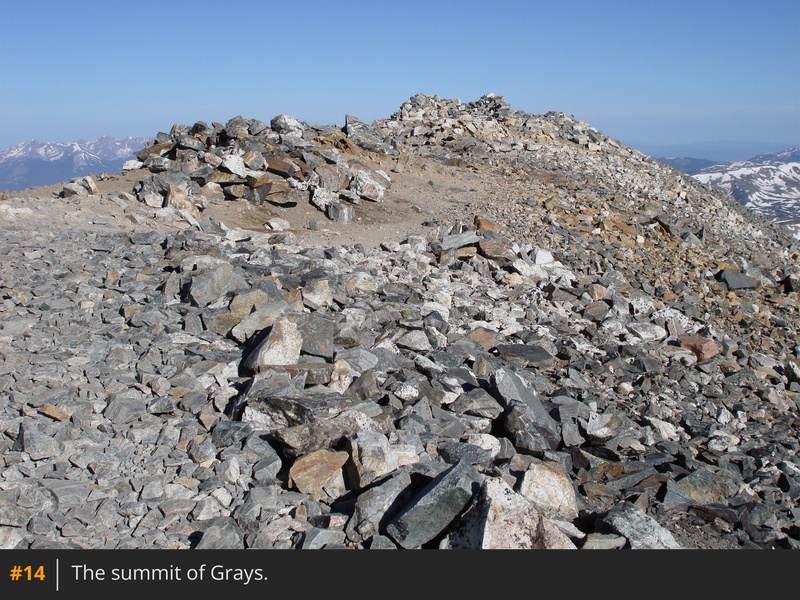
13. With roughly 3,000' of elevation gain over 3.5 miles, you'll arrive at the summit of Grays -
14.
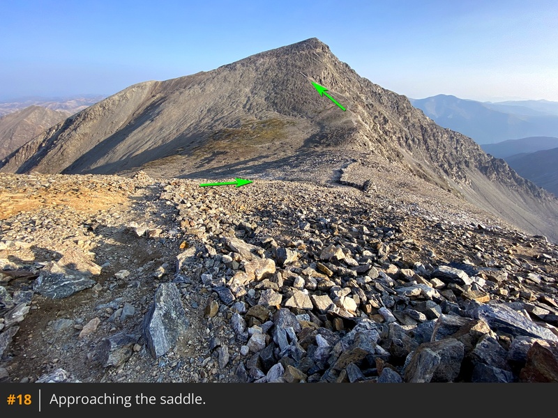
If continuing to Torreys Peak, your next step is to descend Grays' north ridge. Drop north down the ridge and follow the trail toward the Grays-Torreys saddle -
15,
16,
17, and
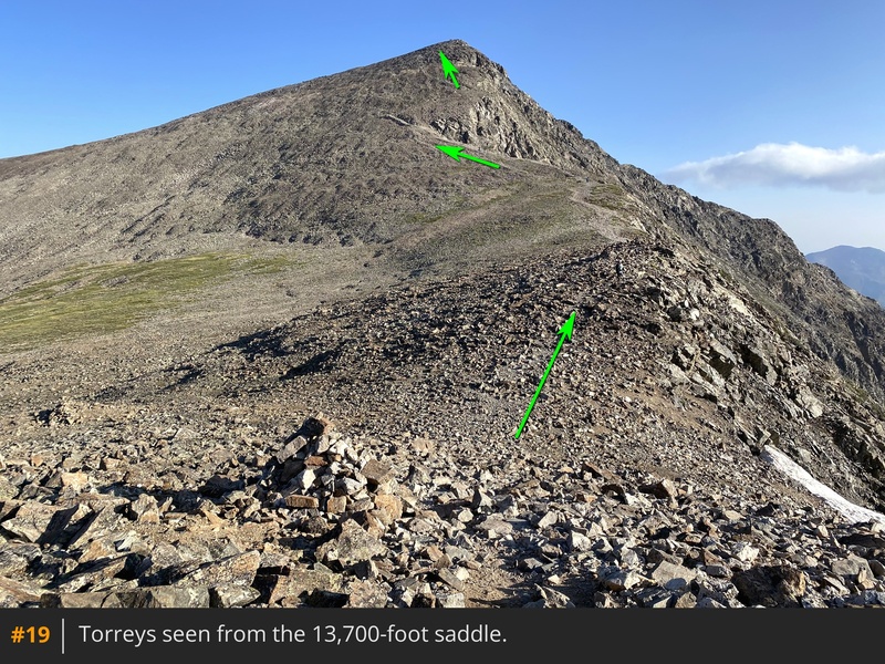
18. Reach the wide saddle
at 13,700' -
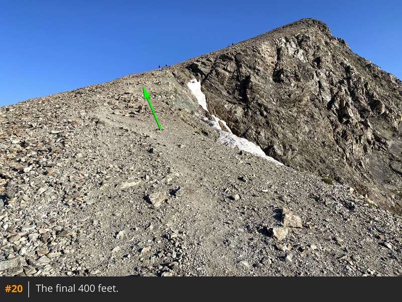
19. Cross it and begin ascending Torreys -
20. Follow the trail along Torreys' southeast ridge, staying on the path all the way to the summit -
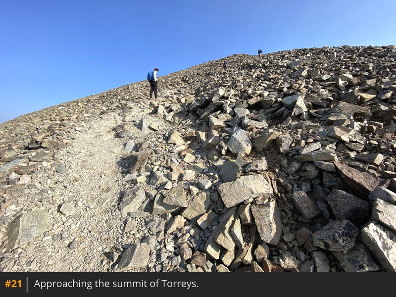
21 and
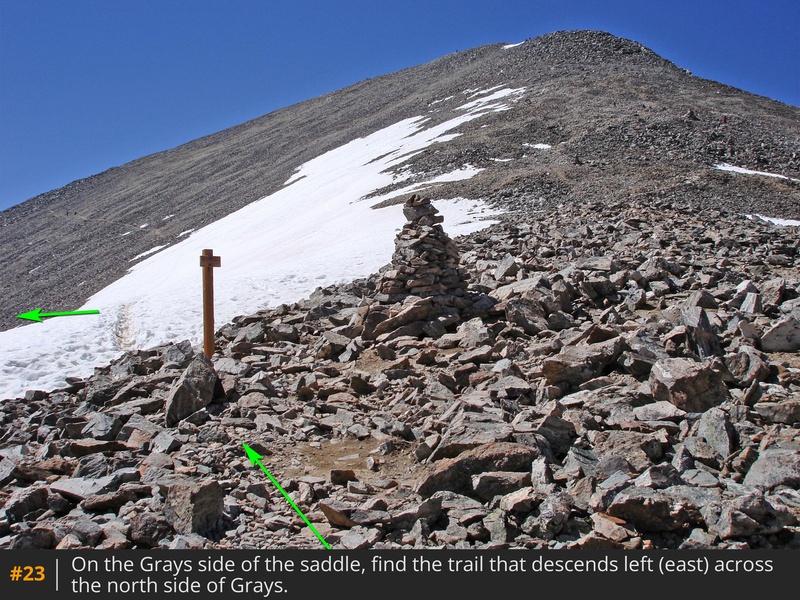
22. For your descent, backtrack your route down Torreys to the Grays-Torreys saddle. On the Grays side of the saddle, locate a trail that descends left away from the saddle -
23. This is the trail used for a direct Torreys hike without summiting Grays and will also serve as your descent -
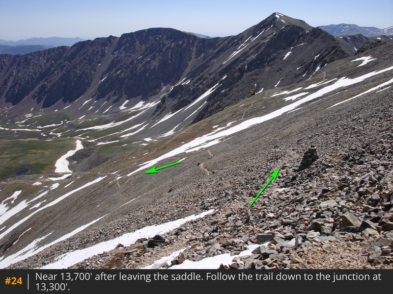
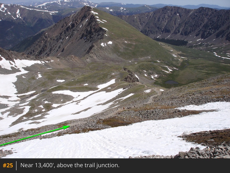
24. Continue down this trail to reconnect with the Grays trail near 13,200' -
25.


 GPX Track File
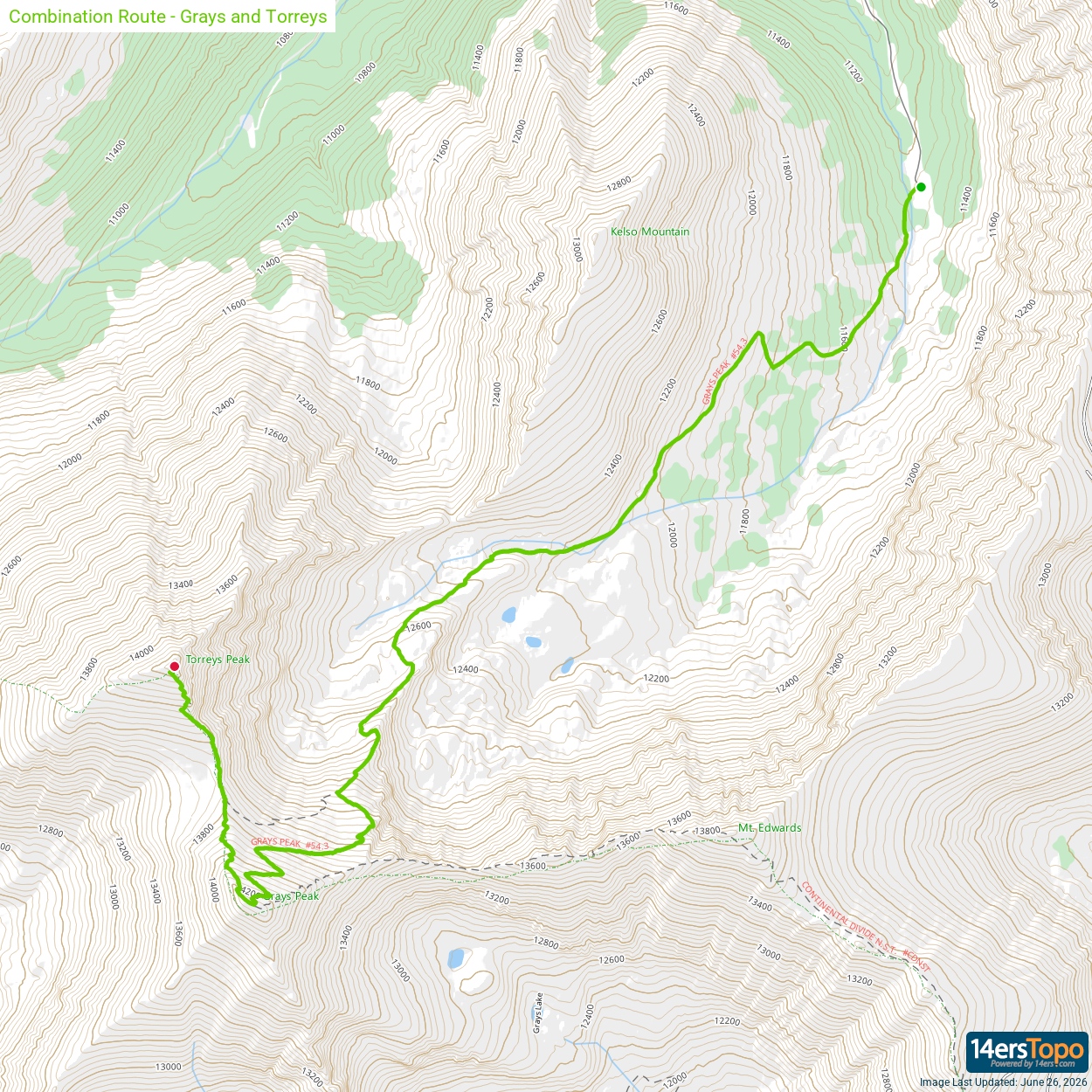


