Download Agreement, Release, and Acknowledgement of Risk:
You (the person requesting this file download) fully understand mountain climbing ("Activity") involves risks and dangers of serious bodily injury, including permanent disability, paralysis, and death ("Risks") and you fully accept and assume all such risks and all responsibility for losses, costs, and damages you incur as a result of your participation in this Activity.
You acknowledge that information in the file you have chosen to download may not be accurate and may contain errors. You agree to assume all risks when using this information and agree to release and discharge 14ers.com, 14ers Inc. and the author(s) of such information (collectively, the "Released Parties").
You hereby discharge the Released Parties from all damages, actions, claims and liabilities of any nature, specifically including, but not limited to, damages, actions, claims and liabilities arising from or related to the negligence of the Released Parties. You further agree to indemnify, hold harmless and defend 14ers.com, 14ers Inc. and each of the other Released Parties from and against any loss, damage, liability and expense, including costs and attorney fees, incurred by 14ers.com, 14ers Inc. or any of the other Released Parties as a result of you using information provided on the 14ers.com or 14ers Inc. websites.
You have read this agreement, fully understand its terms and intend it to be a complete and unconditional release of all liability to the greatest extent allowed by law and agree that if any portion of this agreement is held to be invalid the balance, notwithstanding, shall continue in full force and effect.
By clicking "OK" you agree to these terms. If you DO NOT agree, click "Cancel"...
First, I must tell you the time and date stamp on my camera is incorrect. The climb was May 3rd 2011, not May 1, 2010.
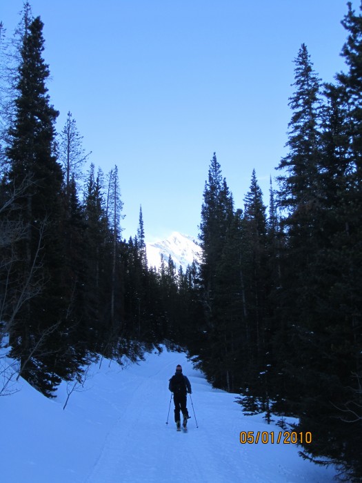
My friend Paul and i met at 6:15 am in the stegosauras lot in Morrison. We had to park at the bakerville exit and start our skin from there at 7:30 am. It took 1.5 hours to get to the trailhead up Stevens gulch.
Emperor from bakerville Stevens Gulch road with objective in back ground. Long way to go!
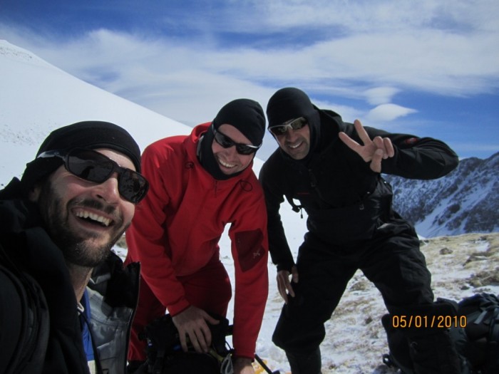
In the past it has only taken me 2.5 hours to summit Torrey's but for some reason it took us 4 hours to summit this time. Maybe it was the extra distance due to the snowy road, or the large blisters I had on my heels. Rod and Razz, the Welshmen who fixed my blisters! Paul gaining the ridge to Grays with the top of Lost Rat in the background. Kelso East Face of Torrey's
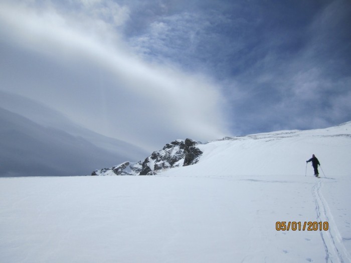
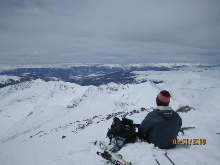
Anyway, by the time we hit the saddle, we were worked. The last pitch was very hard. Once we got to the top, the sun broke through the afternoon overcast and all was good in the world again.
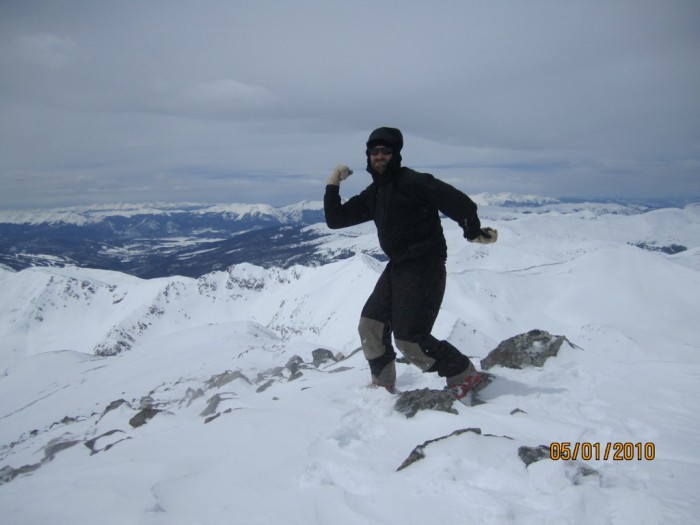
Me on the peak. All is good in the world! Paul on the peak (worked)
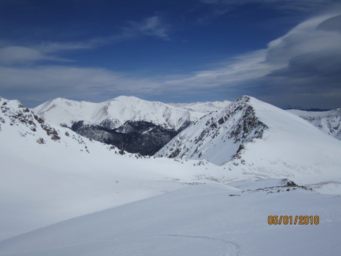
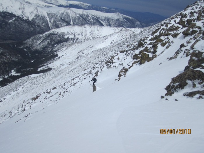
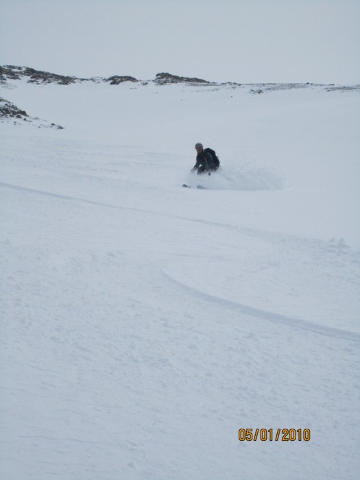
We hung out for a few, and then descended the northwest coulior, or tuning fork I believe some call it. Conditions were pretty bad at first. Boiler plate for the first 50 feet through narrow chutes, to very thick windslabs which I though for sure were gonna break and slide through scree.
Paul on the Boiler plate entry
Then, the coulior showed its true form and wonderfull powder conditions persisted for the entire pitch.
Paul enjoying May POW!
Boot to shin deep, light snow, 35 degrees straight to grizzly gulch (~ 2800 ft) where the snow turned into something I never felt before. I don't know how else to describe it but weird. Once we were at the bottom of the snow field, we saw the tracks of the group who had skied the Emperor. We followed their tracks straight out of Grizzly Gulch to the junction of stevens/grizzly where their truck was stuck in snow
All in all, it was a great day getting out for the first 14 er of the year. I can wait for some corn! And will probably ski this line again this year as the pitch is perfect for huge turns! Once the snow melts on Stevens gulch, the approach will be much easier. What a winter we had!
Stats:
Elevation gain: 4,500 ft
Distance traveled: 10.5 miles
Time: 8 hours
Thumbnails for uploaded photos (click to open slideshow):
Comments or Questions
Caution: The information contained in this report may not be accurate and should not be the only resource used in preparation for your climb. Failure to have the necessary experience, physical conditioning, supplies or equipment can result in injury or death. 14ers.com and the author(s) of this report provide no warranties, either express or implied, that the information provided is accurate or reliable. By using the information provided, you agree to indemnify and hold harmless 14ers.com and the report author(s) with respect to any claims and demands against them, including any attorney fees and expenses. Please read the 14ers.com Safety and Disclaimer pages for more information.
Please respect private property: 14ers.com supports the rights of private landowners to determine how and by whom their land will be used. In Colorado, it is your responsibility to determine if land is private and to obtain the appropriate permission before entering the property.

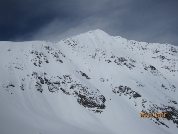
 Emperor from bakerville")
 Stevens Gulch road with objective in back ground. Long way to go!")
 Rod and Razz, the Welshmen who fixed my blisters!")
 Paul gaining the ridge to Grays with the top of Lost Rat in the background.")
 Kelso")
 East Face of Torrey's")
 Me on the peak. All is good in the world!")
 Paul on the peak (worked)")
 Paul on the Boiler plate entry")
 Paul enjoying May POW!")

