Download Agreement, Release, and Acknowledgement of Risk:
You (the person requesting this file download) fully understand mountain climbing ("Activity") involves risks and dangers of serious bodily injury, including permanent disability, paralysis, and death ("Risks") and you fully accept and assume all such risks and all responsibility for losses, costs, and damages you incur as a result of your participation in this Activity.
You acknowledge that information in the file you have chosen to download may not be accurate and may contain errors. You agree to assume all risks when using this information and agree to release and discharge 14ers.com, 14ers Inc. and the author(s) of such information (collectively, the "Released Parties").
You hereby discharge the Released Parties from all damages, actions, claims and liabilities of any nature, specifically including, but not limited to, damages, actions, claims and liabilities arising from or related to the negligence of the Released Parties. You further agree to indemnify, hold harmless and defend 14ers.com, 14ers Inc. and each of the other Released Parties from and against any loss, damage, liability and expense, including costs and attorney fees, incurred by 14ers.com, 14ers Inc. or any of the other Released Parties as a result of you using information provided on the 14ers.com or 14ers Inc. websites.
You have read this agreement, fully understand its terms and intend it to be a complete and unconditional release of all liability to the greatest extent allowed by law and agree that if any portion of this agreement is held to be invalid the balance, notwithstanding, shall continue in full force and effect.
By clicking "OK" you agree to these terms. If you DO NOT agree, click "Cancel"...
sources: High in Utah - Weibel/Miller; summitpost.org - Scott Patterson
Perfect weather would attend for my first visit to the High Uinta. Several dozen cars were at the TH, but since everyone else was attempting Kings Pk, I would be alone until returning to the main trail in the afternoon.
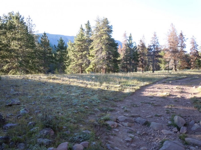
After 4+ miles, I turned left off the trail at a meadow. The meadow where I left the trail
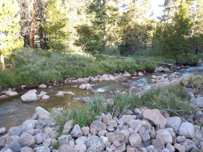
I brought Teva's for the creek crossing, but water was low, and I crossed in boots. Creek crossing
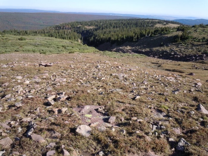
I reached a huge meadow, then did easy bushwhacking through open forest to the north ridge of Gilbert. At 11400', I was free of trees and willows. Gilbert north ridge
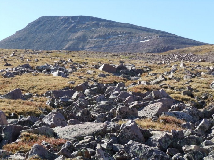
The north ridges are long and gentle, reminding me of the Colorado Flat Tops. approaching Gilbert
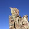
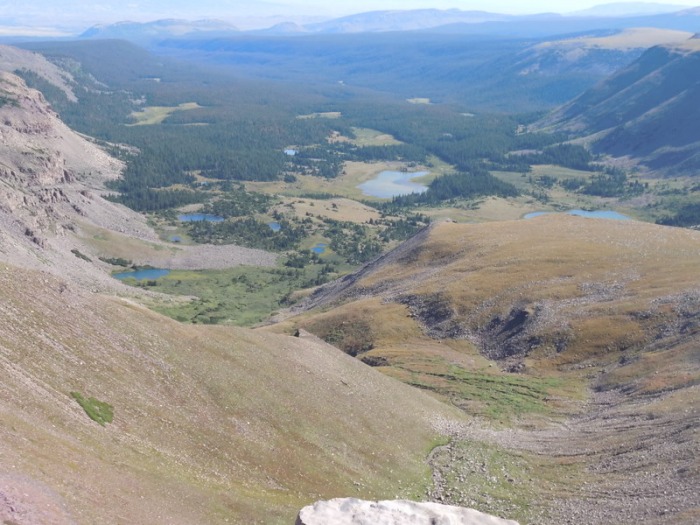
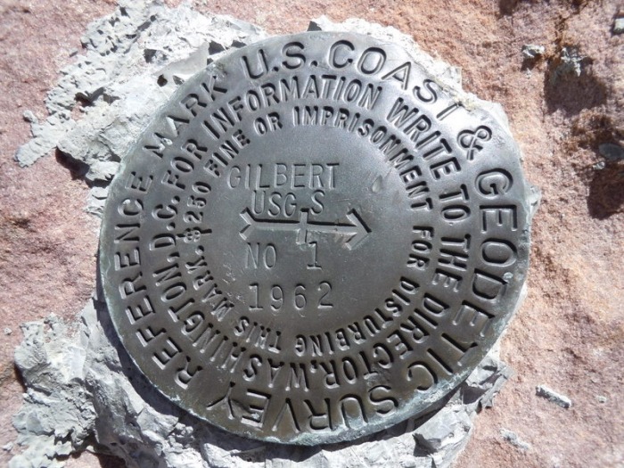
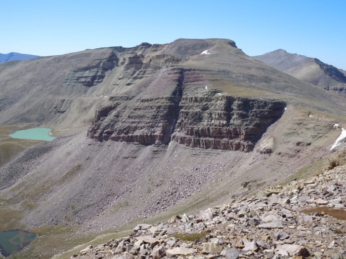
A little scrambling presented at the left turn to the summit pyramid, but the day was generally easy class 2. After 4 hours, I topped out on Gilbert. The 3rd highest peak in Utah, (and highest without 'Kings' in the name), today it received little attention. basin NE of Gilbert Gilbert benchmark view down ascent ridge
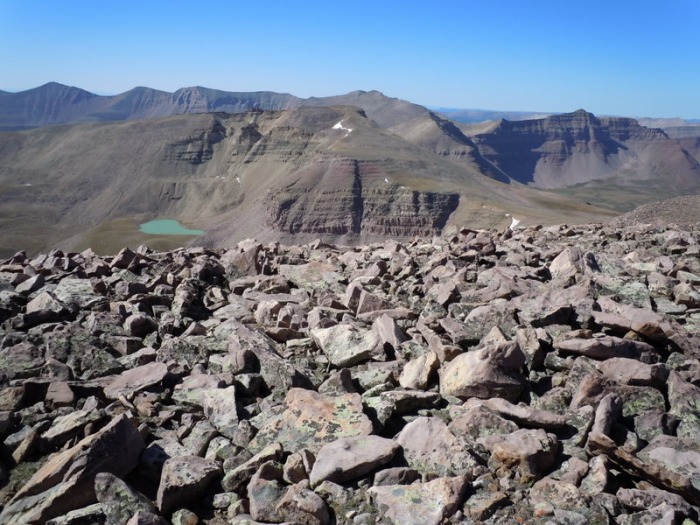
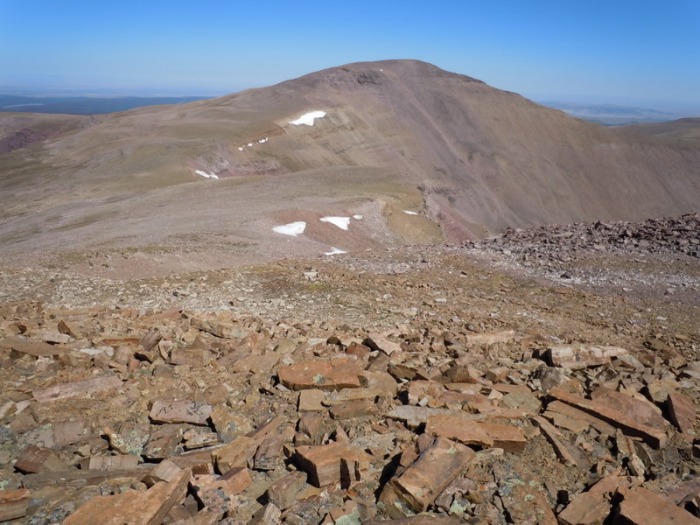
With energy and weather holding, I looked over at the day's next objective - "Gunsight Pk". Gunsight from Gilbert Gunsight Peak
The descent to the saddle had some loose boulders but was straightforward. Gilbert from saddle Gunsight from saddle
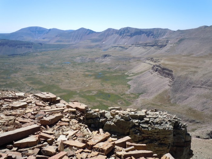
After 600' more elevation, I stood atop Utah's 7th highest. Gilbert from Gunsight Gunsight Pass, West Gunsight Pk Kings cirque
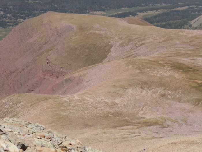
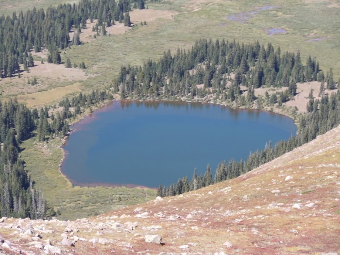
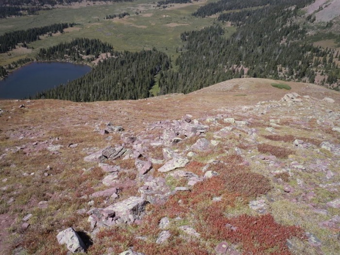
To descend, I headed north down a little ridge above Dollar Lake. descent ridge Dollar Lake Dollar Lake and the descent ridge
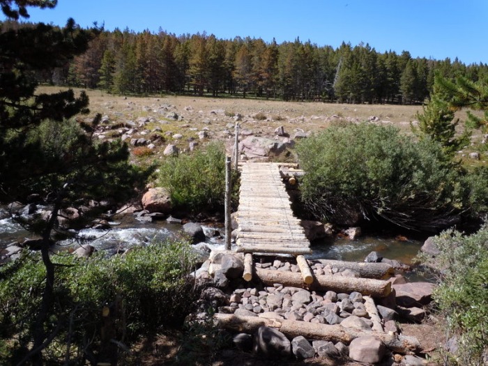
I was happy to be back on the trail, but 8 miles of trail awaited. I suspect my next visit may entail a backpack! descent ridge from trail Elkhorn crossing - 5.5 miles to go!
Thumbnails for uploaded photos (click to open slideshow):
Yes, if it was only Kings, I might try to dayhike it. But, since I'll want South Kings, too, I'll probably backpack and then see what else can be added on. Maybe West Gunsight?
Caution: The information contained in this report may not be accurate and should not be the only resource used in preparation for your climb. Failure to have the necessary experience, physical conditioning, supplies or equipment can result in injury or death. 14ers.com and the author(s) of this report provide no warranties, either express or implied, that the information provided is accurate or reliable. By using the information provided, you agree to indemnify and hold harmless 14ers.com and the report author(s) with respect to any claims and demands against them, including any attorney fees and expenses. Please read the 14ers.com Safety and Disclaimer pages for more information.
Please respect private property: 14ers.com supports the rights of private landowners to determine how and by whom their land will be used. In Colorado, it is your responsibility to determine if land is private and to obtain the appropriate permission before entering the property.


 The meadow where I left the trail")
 Creek crossing")
 Gilbert north ridge")
 approaching Gilbert")
 basin NE of Gilbert")
 Gilbert benchmark")
 view down ascent ridge")
 Gunsight from Gilbert")
 Gunsight Peak")
 Gilbert from saddle")
 Gunsight from saddle")
 Gilbert from Gunsight")
 Gunsight Pass, West Gunsight Pk")
 Kings cirque")
 descent ridge")
 Dollar Lake")
 Dollar Lake and the descent ridge")
 descent ridge from trail")
 Elkhorn crossing - 5.5 miles to go!")