Download Agreement, Release, and Acknowledgement of Risk:
You (the person requesting this file download) fully understand mountain climbing ("Activity") involves risks and dangers of serious bodily injury, including permanent disability, paralysis, and death ("Risks") and you fully accept and assume all such risks and all responsibility for losses, costs, and damages you incur as a result of your participation in this Activity.
You acknowledge that information in the file you have chosen to download may not be accurate and may contain errors. You agree to assume all risks when using this information and agree to release and discharge 14ers.com, 14ers Inc. and the author(s) of such information (collectively, the "Released Parties").
You hereby discharge the Released Parties from all damages, actions, claims and liabilities of any nature, specifically including, but not limited to, damages, actions, claims and liabilities arising from or related to the negligence of the Released Parties. You further agree to indemnify, hold harmless and defend 14ers.com, 14ers Inc. and each of the other Released Parties from and against any loss, damage, liability and expense, including costs and attorney fees, incurred by 14ers.com, 14ers Inc. or any of the other Released Parties as a result of you using information provided on the 14ers.com or 14ers Inc. websites.
You have read this agreement, fully understand its terms and intend it to be a complete and unconditional release of all liability to the greatest extent allowed by law and agree that if any portion of this agreement is held to be invalid the balance, notwithstanding, shall continue in full force and effect.
By clicking "OK" you agree to these terms. If you DO NOT agree, click "Cancel"...
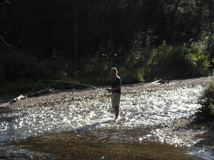
On Thursday we packed up and headed for Leadville. It was nice to be close, and we stopped at the Ranger Station killing abundant time. They were very helpful, and recommended the Elbert Creek campground (Why is the Elbert Creek campground on Half Moon Creek???) for the NE ridge route. View of Elbert from road near trailheadWe navigated an OK road and chose a spot on the creek. There was time for a bit of fishing. Fishing in Halfmoon Creek
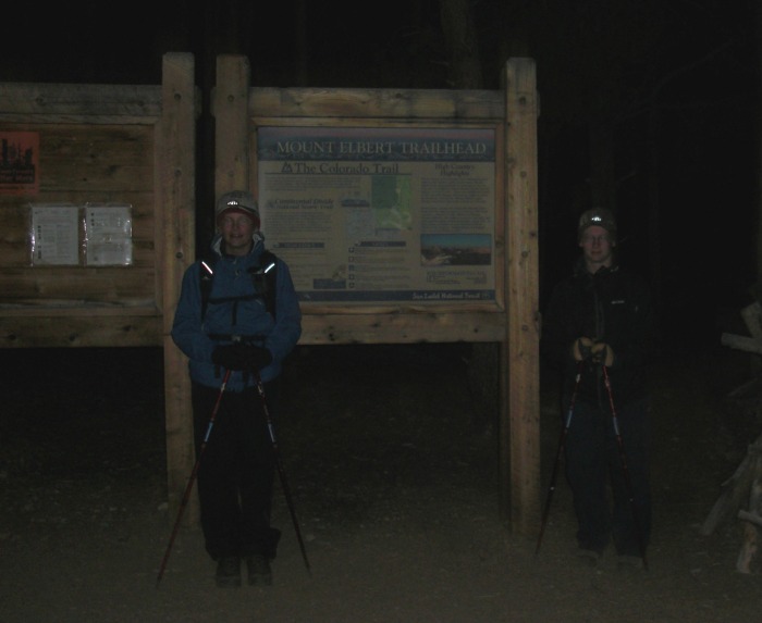
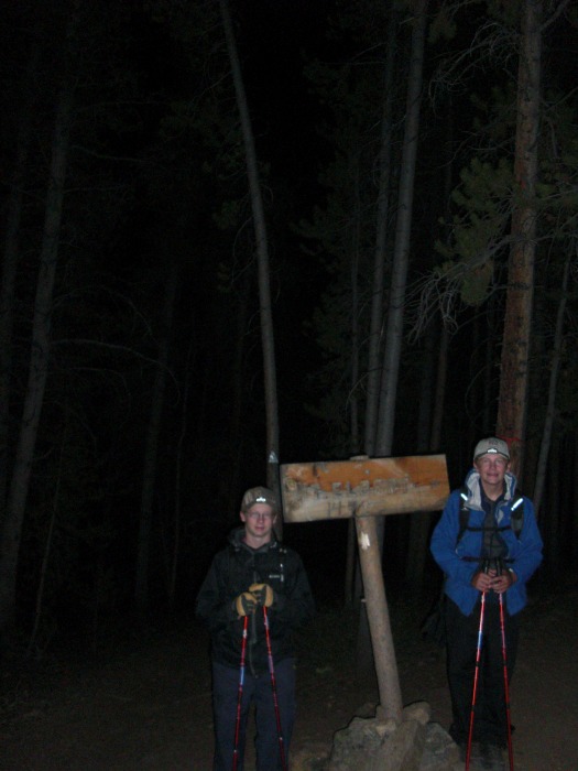
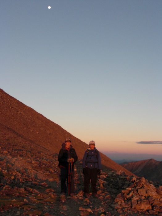
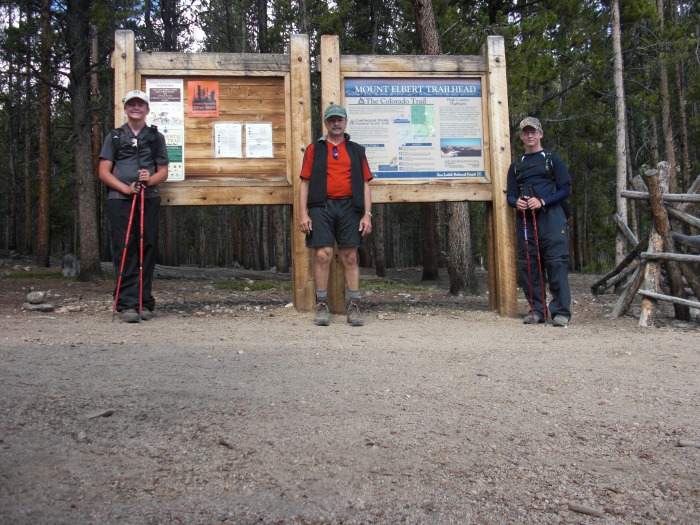
Friday would bring a 1:30 AM start at the trailhead. At Trailhead - 1:30 AM This would be the moonlight hike envisioned when planning this trip. The day was clear and calm.
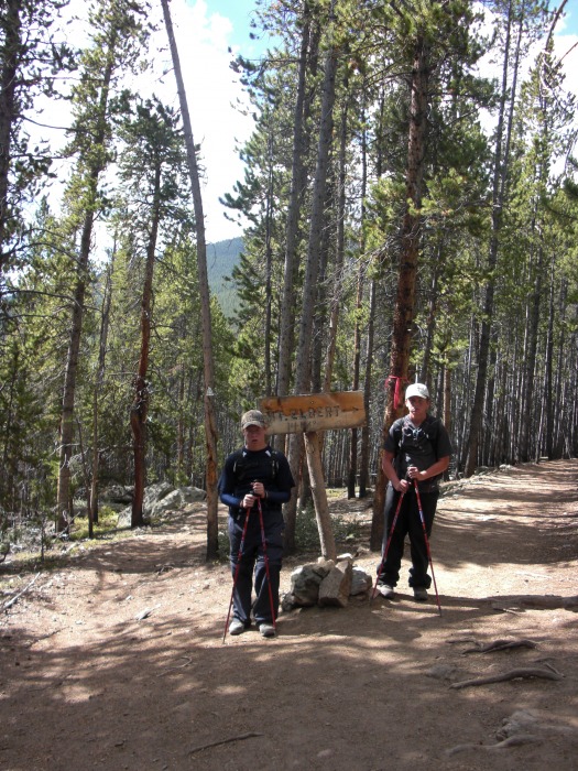
We had a moment of hesitation when we didn't find the branch from the Colorado Trail as/when expected. We took a break and consulted the maps. We were on course, and a decision to continue on brought us to the junction which was just out of sight when we paused.At Colorado trail split - 2:35 AM
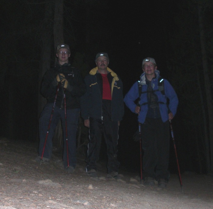
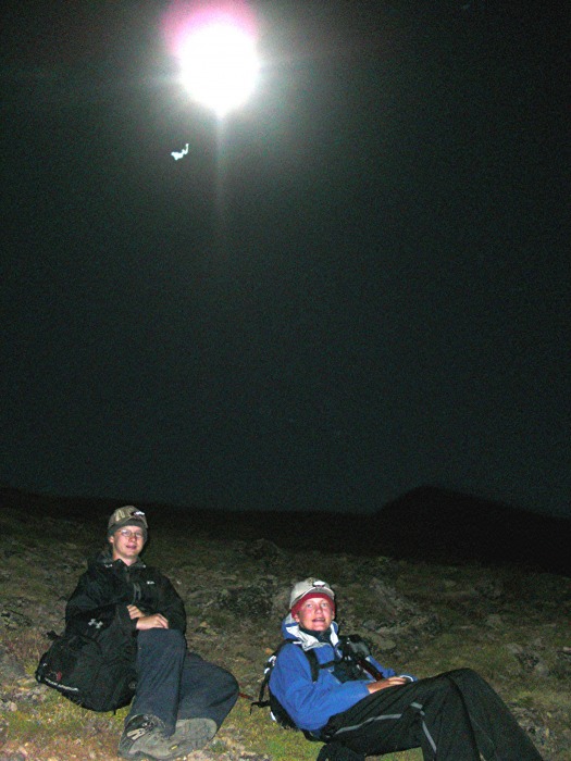
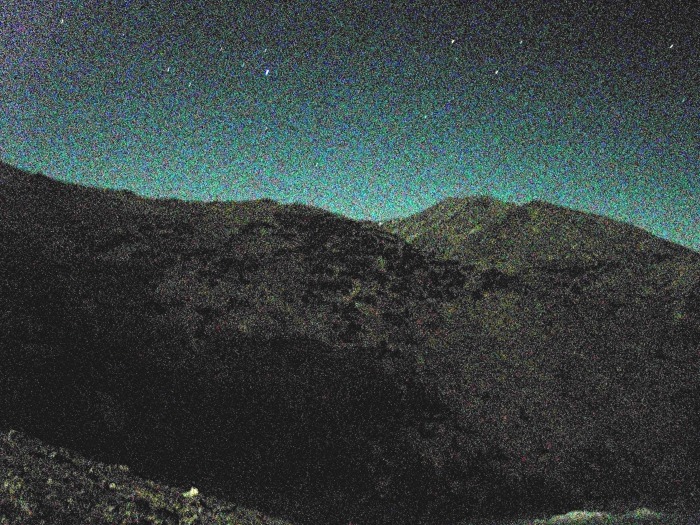
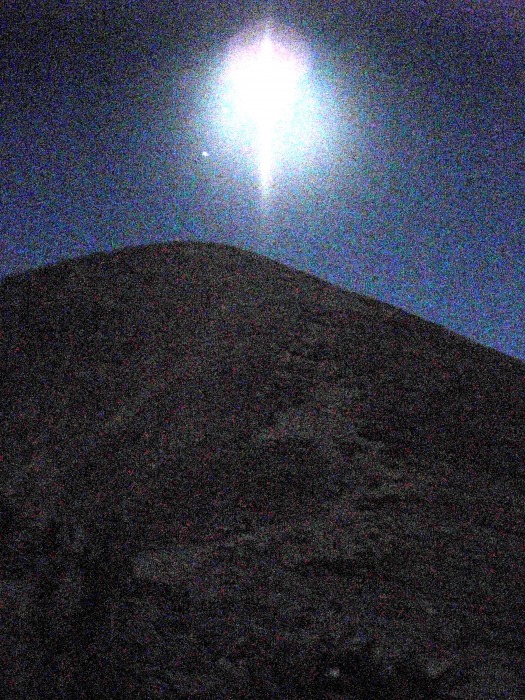
The route is a steady climb up through the trees. We alternated between moonlight and headlights, but there was no partly moony unlike the weather at Quandary. We would discover stunning views in the past-full moon in every direction this morning.All of us in the trees yetAbove the trees - 4:30 AMMoonlight - 4:30 AMMoon over false summit - 5:40 AM
As we worked our way up, the pre-dawn orange gave way to the first rays of sunlight. We would welcome the first rays to take away the nighttime chill. Pre-dawn 5:40 AMSunrise about 6:30 AMSunrise about 6:30 AM
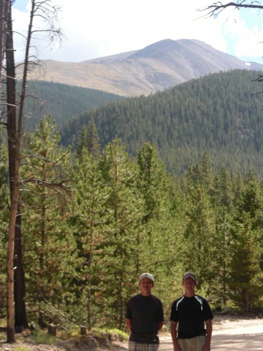
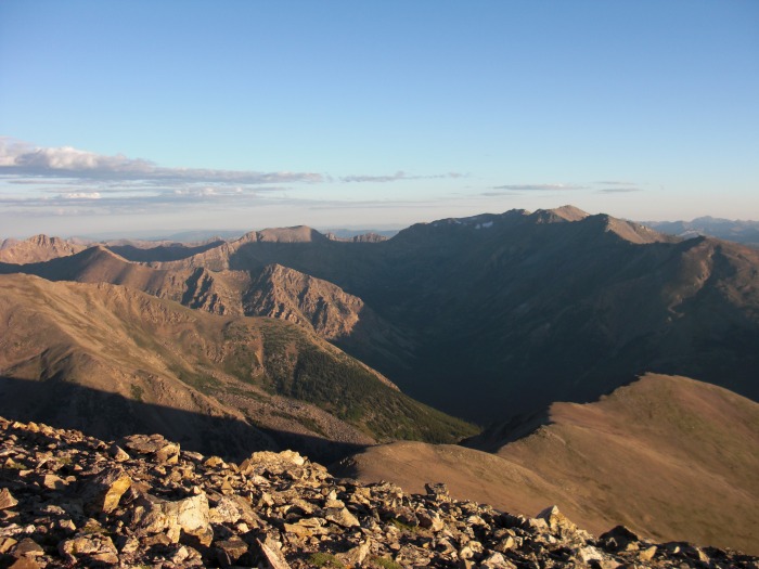
It's a long steady climb, but the early morning views were just breathtaking. The choice of an 'easy' climb during an off time was paying off!Mt. Massive - 7:00 AM
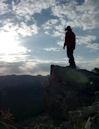
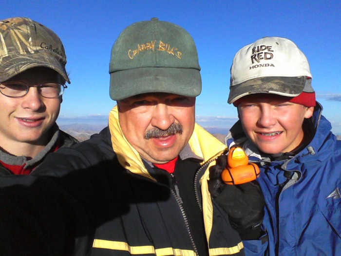
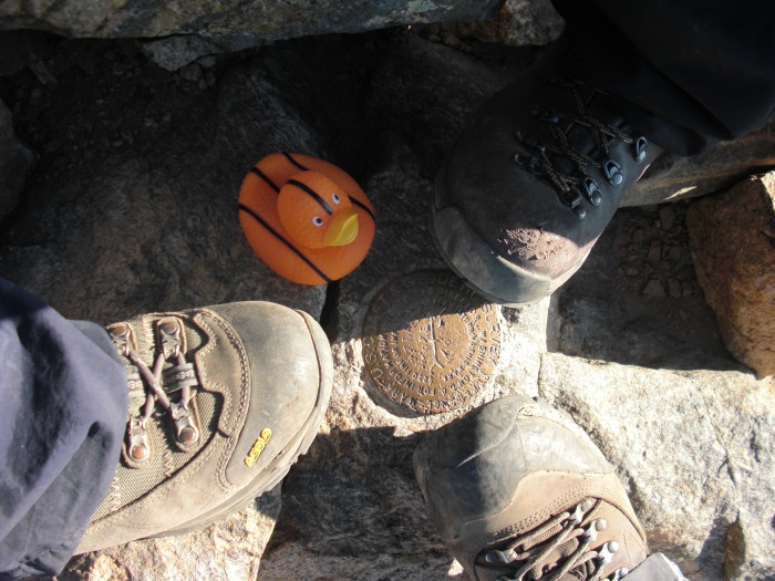
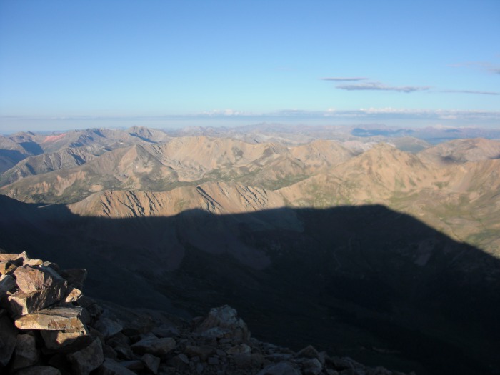
At 7:10 - 7:15 AM, we would have our second summit to ourselves as well. As we reached the summit ridge, my boys kicked my butt this time, as it should be. No one to help with photo on summitUSGS Arrow marker - Mascot Navigator Duck joins in.Our mascot, Navigator Duck, even joined in the summit pics. The morning shadow of Elbert - 7:25 AMWe took a little longer and thought about the pictures more, as well as sending out messages to my wife (thank you does not begin to express what your support of this trip has meant) and other family members. (Remainder of summit 360 pics are below)
We had seen headlamps below us on the way up, and encountered the first of the morning parade on the false summit bumps as we were on our way down.
The trip down was tough in that I emphasized keeping control at all times. I'm trying to instill and practice good habbits, and knowing your footing is #1. The trail is steep and loose at times, and I wondered to myself how some make it back down.
A stop at the fork for a duplicate of the picture from earlier, Colorado Trail branch on return trip (Img. #4 earlier)then on to the trailhead. Back at trailhead after a great summit
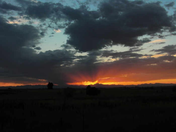
We decided that the trip was over and it was time to go home. We napped, packed up and were back at the Mint for another round of summit steaks. Then eastbound I-70 and I-76, where we were blessed with a final spectacular view of a sunset over RMNP. Along I-76 on the way home.We arrived home the next day after 3,200 miles, 3 summits and 11 days. We would discover that good friends were somewhere in the final sunset picture, having summited Longs while we were in Silverthorne on Thursday. (Congratulations, guys!)
To my boys, WOW, what a trip. Thanks and I hope we have many more outings like this ahead.
A final thanks to this online community, without which the trip of a lifetime with my two sons would not have taken shape.
I plan on being in the area in 2 weeks and was curious how the fishing is in halfmoon creek? I'll have a day or so to to spend fishing and was contemplating spending time at halfmoon creek or heading to the Arkansas.
Hi, im his older son, and did most of the fishing. I had a couple of smaller fish on, but didn't land/know what either were in half moon creek. The fish didn't seem to be too picky on half moon creek or on the colorado river.
Caution: The information contained in this report may not be accurate and should not be the only resource used in preparation for your climb. Failure to have the necessary experience, physical conditioning, supplies or equipment can result in injury or death. 14ers.com and the author(s) of this report provide no warranties, either express or implied, that the information provided is accurate or reliable. By using the information provided, you agree to indemnify and hold harmless 14ers.com and the report author(s) with respect to any claims and demands against them, including any attorney fees and expenses. Please read the 14ers.com Safety and Disclaimer pages for more information.
Please respect private property: 14ers.com supports the rights of private landowners to determine how and by whom their land will be used. In Colorado, it is your responsibility to determine if land is private and to obtain the appropriate permission before entering the property.


 Sunrise about 6:30 AM")
 Summit Rotation 7:25 am")
 Summit Rotation 7:25 am")
 Summit Rotation 7:25 am")
 Summit Rotation 7:25 am")
 Summit Rotation 7:25 am")
 Summit Rotation 7:25 am")
 Summit Rotation 7:25 am")
 Summit Rotation 7:25 am")