| Report Type | Full |
| Peak(s) |
Uncompahgre Peak - 14,318 feet Wetterhorn Peak - 14,021 feet |
| Date Posted | 08/22/2010 |
| Date Climbed | 08/21/2010 |
| Author | stonebaez |
| Uncompahgre and Wetterhorn |
|---|
|
Uncompahgre Peak and Wetterhorn Peak Date: August 21st, 2010 Trailhead: Matterhorn Creek Distance: 18.8 mi. Estimated Elevation Gain: 6300 ft. Time: 10:00 hours 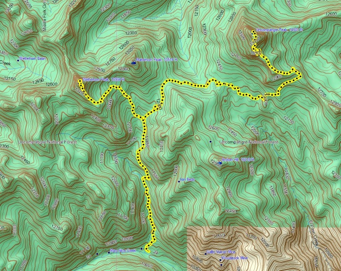 The trip started with an early departure from work in downtown Denver, with the drive taking 5 hours to Lake City. Before I headed up Engineer pass I had to stop by The Smoque Shack from some pulled pork. The drive up to the lower trail head was enjoyable, easily passable. I set up shop and got ready for my early morning, I had a good landscape (as below) and it was a peaceful night: 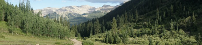 I slowly began waking up at 2:30 AM, which was no set point but I felt well rested and excited to start the day. As excited as I was, there was no rush and made sure to do as many chores as I could while still in the sleeping bag. By 3:20 AM I was on the trail, quite dark as the moon had set and the sky was illuminated by thousands of starts and the Milky Way - quite impressive! First light came around 5:40 AM and the sun rose about 20 minutes later: 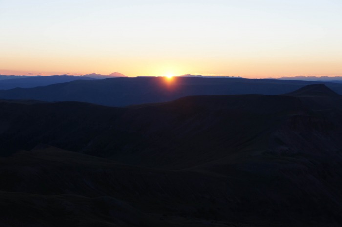 While the trail was easy to follow in the light, I had to be extra careful in the dead of night not to loose the trail and did manage to stray in two occasions but it was quite obvious within 100 feet and I soon found my way back to the trail proper. By the time light began to dominate the landscape I had made my way past the west ridge, over the 12500 foot pass and around to the eastern ridge underneath the eastern cliffs. Looking back, I could see the route traveled: 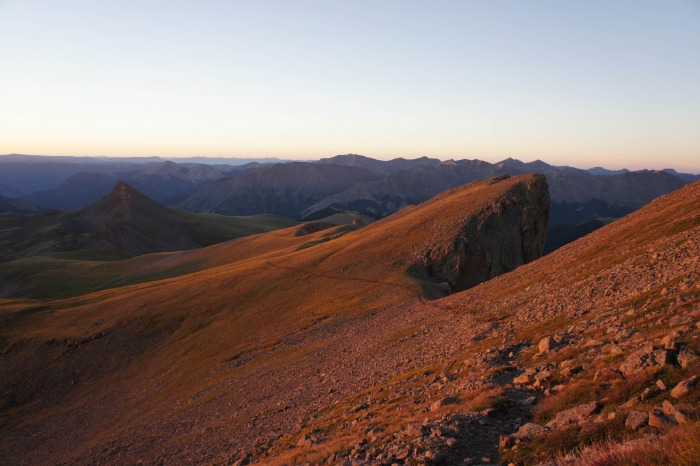 Ahead, the east cliffs lay in Alpenglow:  The ridge up to the summit of Uncompahgre is straightforward and only requires a brief stint of class two scrambling before returning to a moderate grade up to the expansive summit with views outstretched over massive cliff drops. At this point is was just before 7 AM and 7 miles into the trek. Injustice to the views from the summit: 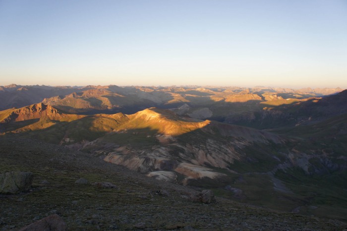 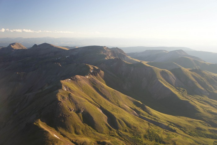 At this point it was time to think of the journey over to Wetterhorn, which lays more than 3 miles away and is separated by Matterhorn Peak. I had to retrace my steps, but it felt new ground as darkness no longer dominated the surroundings. Views of Uncompahgre's western cliffsides as well as the surrounding valley pre-occupied my time as I looked forward to Matterhorn:  The split to the Matterhorn trail lead me back down to 12,000 feet and at this point I was 12-13 miles into my hike. The thought of regaining this elevation began to seep into my head and soon began the battle of willpower. Under such occasions I have learned to take a moderate pace and go steady, but this never takes my mind off the situation. Slowly but surely the saddle to Matterhorn approached at 13,100 feet and I could turn my focus to the more interested southeast ridge. At this point I could take time to examine the trip up to this point:  The last 900 feet scamble up to the summit of Wetterhorn was quite enjoyable, and the semi technical demands of the route helped to keep my mind of my growing fatigue. At this point I started to run into several other hikers as we navigated up the various 'routes' determined by cairns left behind. By this point I have learned to not trust these piles of rock left behind by who knows, and took what I felt was the best route which held true to the left side of the ridge. This enjoyable route led me to solid rock for the final pitch of fairly vertical climbing - if only I could keep the sounds of the sheep screaming bloody murder from down in the valley out of my head. Upon reaching the summit I was greeted by limitless views: 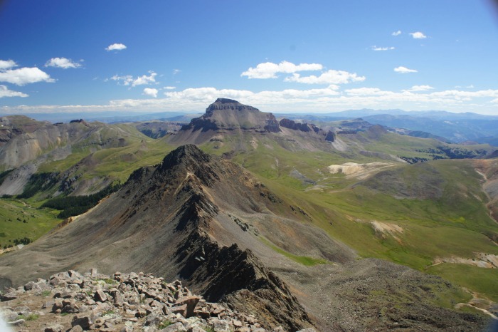 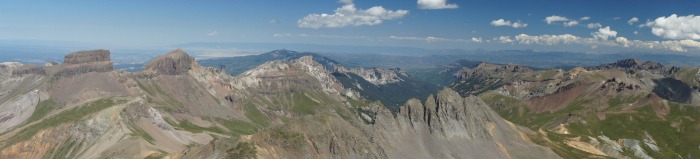 It was now 11:30 and gratefully the weather had held, it was time to make my B-line for the trailhead. After navigating back down the ridge it was a straightforward descent back to the treeline and below, though it was nice having sunlight (which was plenty) this time around. With the last of my 1.5L of water gone with about 2 miles to go, I put my head down and motored ahead reaching my car at 1:20 PM. This was one of my more favorable climbs in Colorado to this point. The San Juans, the 3 hours of hiking in amazing starlight, the perfect clear weather, and the relative solitude I enjoyed for most of the hike highlighted the trip for me. Now all that was left was a bit to eat in Lake City and the 5 hour drive back to Golden. Thanks for reading! Thumbnails for uploaded photos (click to open slideshow):
|
| Comments or Questions | |||
|---|---|---|---|
|
Caution: The information contained in this report may not be accurate and should not be the only resource used in preparation for your climb. Failure to have the necessary experience, physical conditioning, supplies or equipment can result in injury or death. 14ers.com and the author(s) of this report provide no warranties, either express or implied, that the information provided is accurate or reliable. By using the information provided, you agree to indemnify and hold harmless 14ers.com and the report author(s) with respect to any claims and demands against them, including any attorney fees and expenses. Please read the 14ers.com Safety and Disclaimer pages for more information.
Please respect private property: 14ers.com supports the rights of private landowners to determine how and by whom their land will be used. In Colorado, it is your responsibility to determine if land is private and to obtain the appropriate permission before entering the property.


