Download Agreement, Release, and Acknowledgement of Risk:
You (the person requesting this file download) fully understand mountain climbing ("Activity") involves risks and dangers of serious bodily injury, including permanent disability, paralysis, and death ("Risks") and you fully accept and assume all such risks and all responsibility for losses, costs, and damages you incur as a result of your participation in this Activity.
You acknowledge that information in the file you have chosen to download may not be accurate and may contain errors. You agree to assume all risks when using this information and agree to release and discharge 14ers.com, 14ers Inc. and the author(s) of such information (collectively, the "Released Parties").
You hereby discharge the Released Parties from all damages, actions, claims and liabilities of any nature, specifically including, but not limited to, damages, actions, claims and liabilities arising from or related to the negligence of the Released Parties. You further agree to indemnify, hold harmless and defend 14ers.com, 14ers Inc. and each of the other Released Parties from and against any loss, damage, liability and expense, including costs and attorney fees, incurred by 14ers.com, 14ers Inc. or any of the other Released Parties as a result of you using information provided on the 14ers.com or 14ers Inc. websites.
You have read this agreement, fully understand its terms and intend it to be a complete and unconditional release of all liability to the greatest extent allowed by law and agree that if any portion of this agreement is held to be invalid the balance, notwithstanding, shall continue in full force and effect.
By clicking "OK" you agree to these terms. If you DO NOT agree, click "Cancel"...
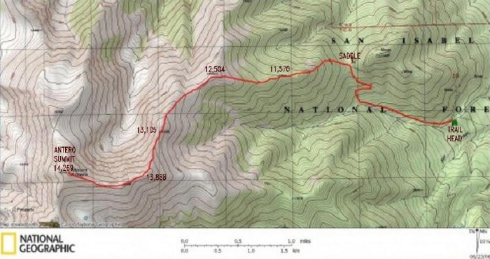
On this year's weeklong adventure trip, I decided to try a non-standard, off the beat route. Antero had been creeping up on my list and I remember having seen an old short TR from 14ers.com member "Freeze". This, and a good quad map were really the only guidance that I had. The quad map was invaluable to have as much of the route is not on a trail; I referred to it often. As "Freeze" refers to in his report, I concurred that I really was not looking forward to being passed up by ATV's on a road en-route to the summit. So this route sounded like a fun challenge. While I've added much more detail below, for anyone interested here is the link to his report: "Freeze's" Trip Report In addition, I've recycled his map since I don't have map software and don't know where to find online free. His map is immediately below, though I've taken the liberty to add some of the key features to it as they were not legible.
EDIT:
To my knowledge this was the first Rasberry Gulch TR since 2006. Fast forward 4 years and the morning that I posted this TR, 14ers.com member "Doctor No" was out hiking it! He has posted his TR as well, with both TR's posted on the same day. This was a total unconnected coincidence and brings to mind a similarity from history where Alexander Grahm bell in 1876, working independantly from Elisha Gray, beat her to the patent office by a matter of only one hour for patent rights to the modern telephone. (Of course we now have cell phones - I think William Shatner has those rights ). Anyway, I feel bad for Dr. No, inadvertanly "beating him to the patent office" and all. But he provides a fine report that I highly recommend: "Doctor No's" Trip Report In it he provides good beta for two alternate ways back down to provide a loop experience. In his report, he references an excellent thread on the rasberry gulch route (see his TR). Inside of that thread, 14ers.com member "Colorado Native" provides and excellement map of the route and also the driving directions linked directly here: "Colorado Native's" Map
DRIVING DIRECTIONS AND TRAILHEAD INFO:
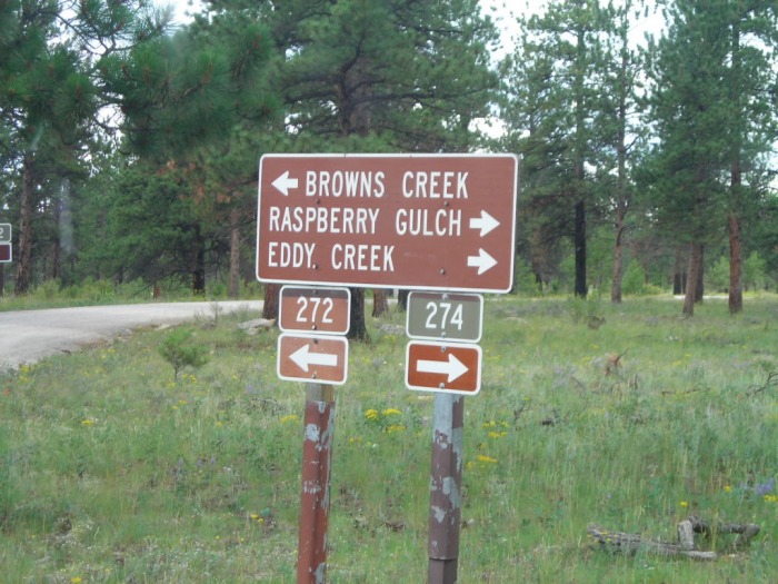
Based on what I clocked off on the odometer: On Highway 285, about 3 or 4 miles south of Nathrop, find the intersection to road 270. Starting from this intersection, the miles are listed cumulatively. Road 270 is paved, at 1.5 miles 270 veers right, but stay straight - the road now turns to easy 2WD dirt and is now road 272. At 2.3 miles, pass a cattle guard. At 3.5 miles you will come to the 272 / 274 intersection:
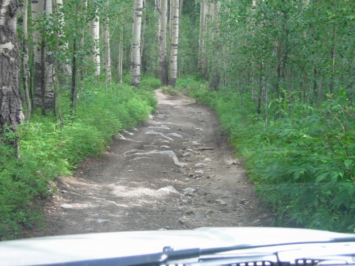
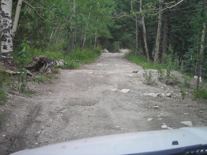
Stay straight on road 274 toward Rasberry Gulch. Shortly after at 3.8 miles take a left onto road 273. At this point the road is mostly easy 2WD, but there are the typical high erosion mounds to go over that require higher clearance. From the 273 / 274 intersection there is good dispersed camping spots for about a mile (some of them looked very nice for car camping). At 5.0 miles the road now enters private property and becomes 4WD. There are fences on each side, but to respect the land owners, do go not off the road (not that you really can). The road leaves private property at 5.5 miles, and finally at 5.8 miles you will reach the trail head. As indicated the last 0.8 miles is 4WD, it reminds me of the Nellie Creek Road (Uncompaghre), though a little tamer and no river crossings. If you wanted you could probably walk the last mile, My quad map indicates about 400 ft of gain over that distance.
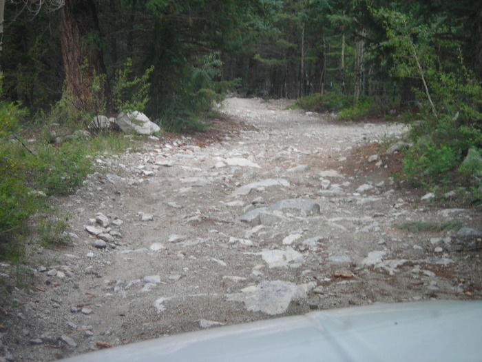
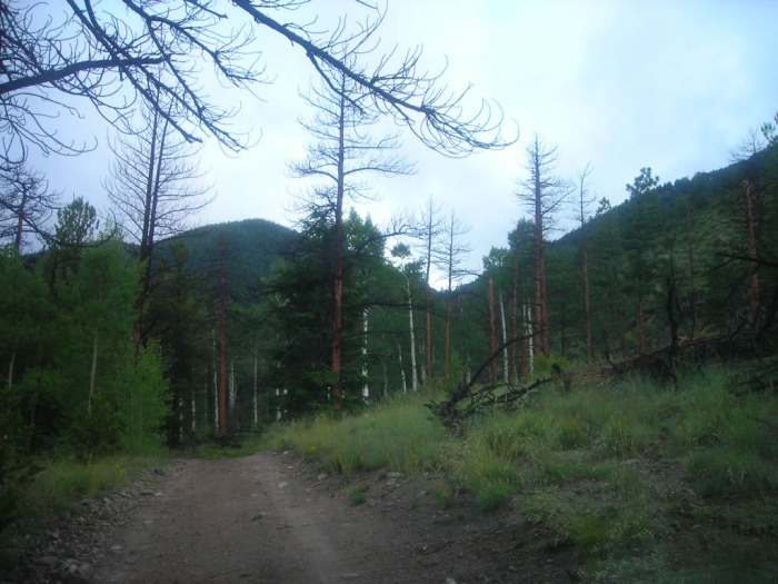
Some choice photos of the 4WD portion:
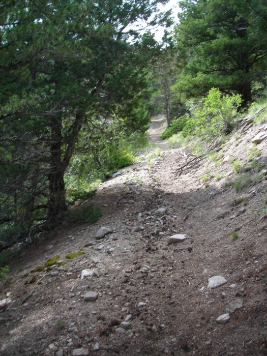
Approaching the TH. Note the saddle ahead on the right side. (photo evening before).
Looking back from the very start of the TH: There is limited parking, though I did not see a soul all day (except the summit) on a July Saturday. Also there was room for a few more vehicles (and a campspot) just below the TH area.
TRIP REPORT:
In looking at the quad map, it appears that I started hiking at about 9,400 ft. Antero's summit is 14,269 ft. I chose to skirt many of the ridgeline bumps along the way. This minimized any lost elevation gain, so I estimate I gained about 5,000 ft for the day. "Freeze" estimated a 9 mile round trip, and just looking at the quad map that seems about right, though I have not put any effort into checking that. In essence, the route I chose started on the trail that goes up to the saddle (shown two pictures ago), and then veers left up a forrested slope, up above treeline, and then along a long ridge to the summit that changes from tundra to rock.
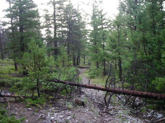
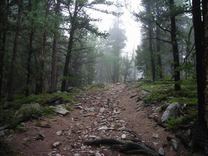
Starting up the trail, I passed a few down trees, but nothing too bad that couldn't be easily gone over or around. (This is looking back):
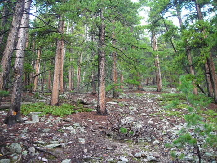
After a short distance there were a few long switchbacks:
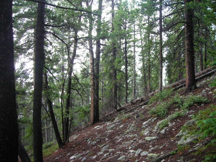
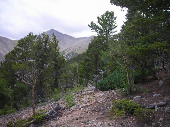
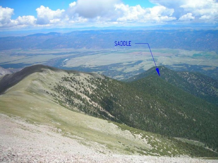
Approaching the saddle: The saddle, in the light, is obvious. Point 11,038 was on the right and point 11,570 on the left. The saddle is at about 10,500 ft.
From here, I turned left off the trail and headed up a steep slope up in the forest:
This picture looks to the side of my route and shows the steepness of the slope:
At the saddle the ridge was broad. Then taking attention not to veer off too far left or right, but to stay on the "ridge", it took about 1,000 ft of gain on this slope to reach point 11,570. At this time the terrain started to level off some, and the ridge became more defined.
Looking left over to Mount White:
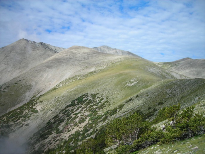
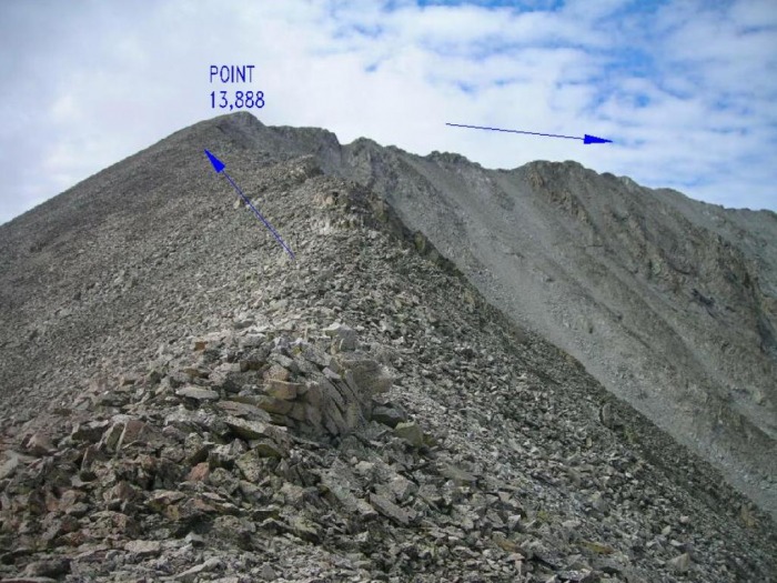
Taken later in the day, this photo shows point 13,888 ahead (Anterro summit was not yet visible):
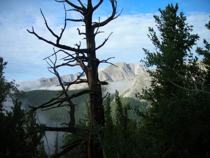
Nearing treeline: I should note that from the time of leaving the trail at the saddle, the trees were scattered such that they were easy to pass thru and was not a "bushwacking" experience:
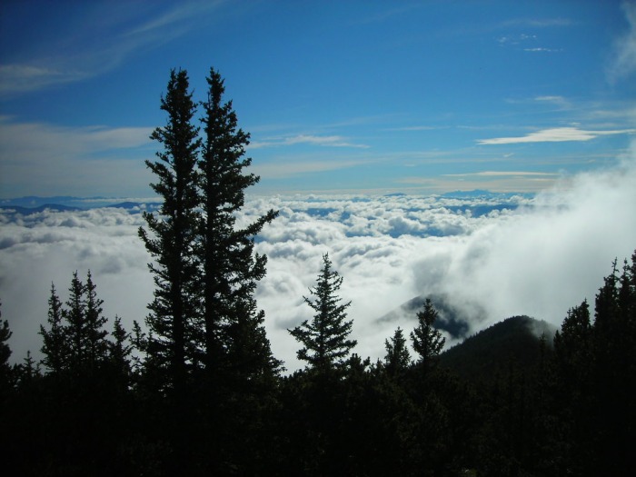
Looking back from near treeline: Beautiful low clouds:
Just above treeline, looking back - the saddle is behind point 11,570 (right) and beneath the low clouds:
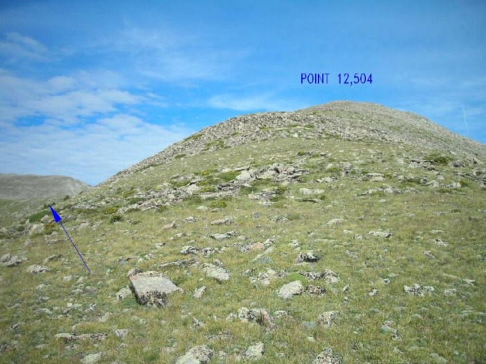
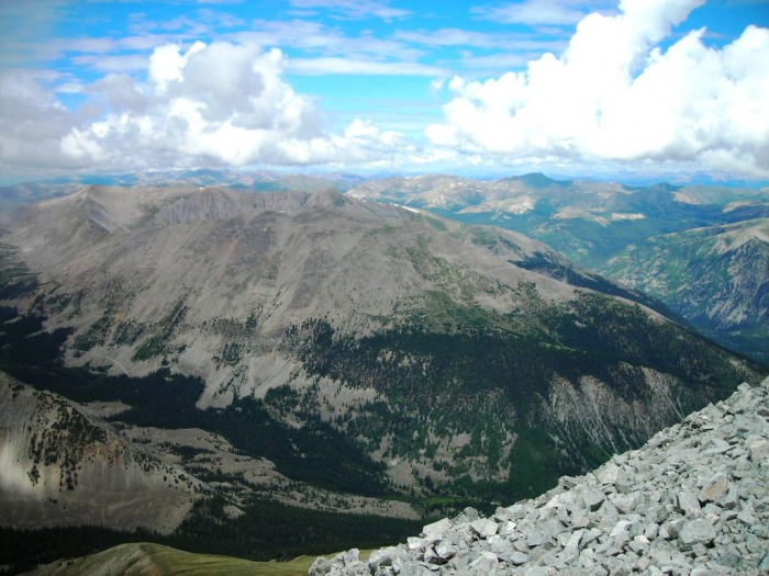
Now above treeline, point 12,504 came into view. I chose to skirt left of it and continue on the long ridge to Anterro:
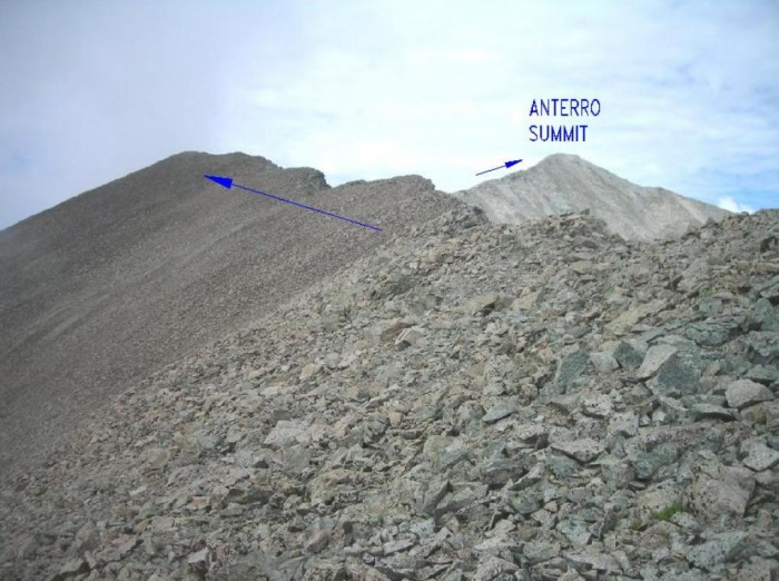
A look at the rest of the route that I would take, Antero's summit was now visible:
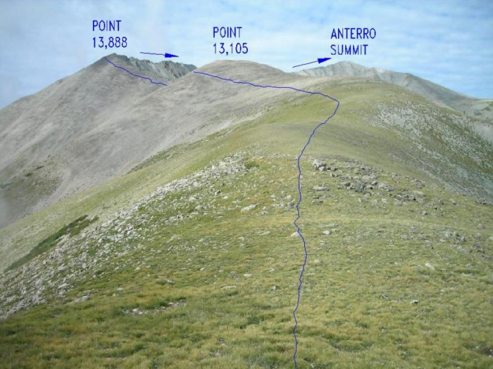
A closer look, with the fun blue arrows. Point 13,105 ahead was also side skirted: After point 13,105 the tundra generally ended and it was all rock from there. It reminded me much of Holy Cross Halo ridge and Princeton which I had climbed the previous day. It was "rock-hopping" type rock.
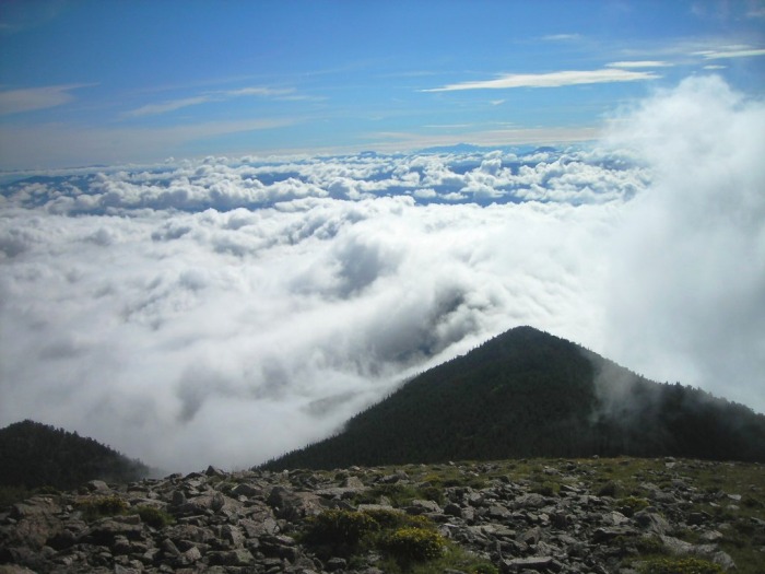
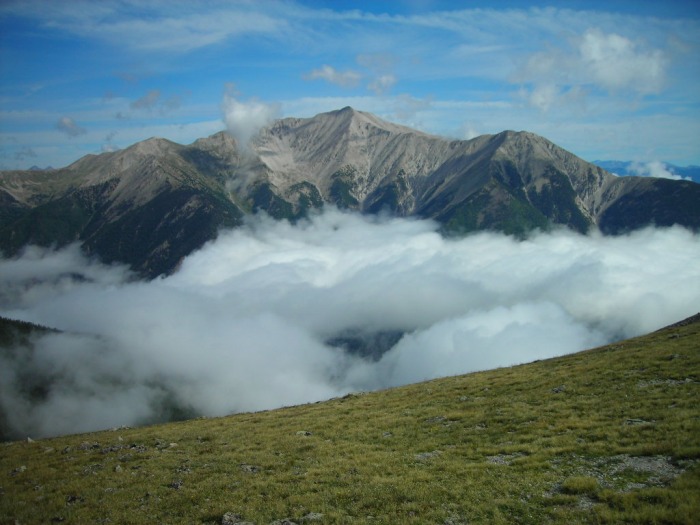
Along the ridge, neighboring Princeton proudly rises above the clouds:
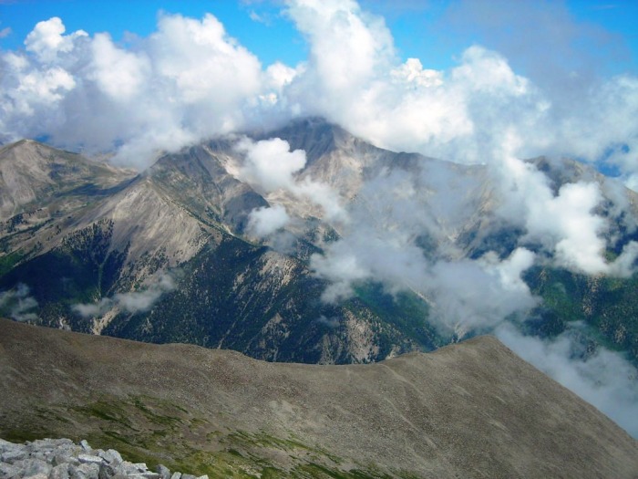
A look ahead at point 13,888: the jagged bumps looked intimidating and "Freezes" route description made a general mention to "scrambling". Though I've gotten better with more experience, I am not yet a "natural" scrambler and this was worrisome on this lonely route
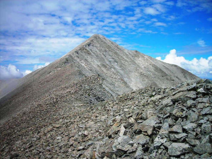
Not to worry. After again side skirting just left of point 13,888, the backside revealed that the terrain would permit passage without what I would consider any difficult scrambling. I was able to keep everything to what I considered class 2 or 2+ at the very most.
Antero summit now starting to tease me:
On the summit:
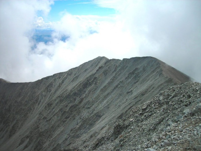
On the way back, the ridge leading back down to point 13,888:
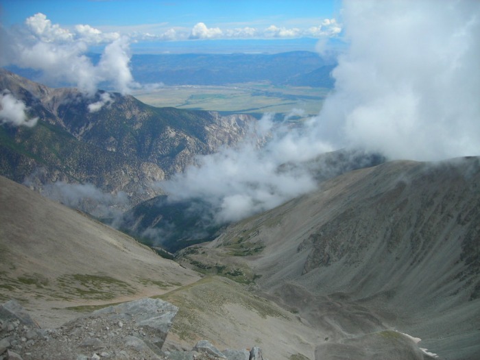
Farther back down, the saddle finally came into view after being in the clouds for the morning:
This was a great hike that I was glad to have mustered the courage to attempt, being as "lonely" as it is. I really enjoyed being: "below", "above", and "in" the clouds as the weather changed throughout the hike. I was worried I had started too late and risked some lightening, but the weather always looked just promising enough to continue and did hold. The wide open ridge tundra opportuned for a few "Sound of Music" moments and the scattered trees in the flatter ridge area above 11,570 were an absolute joy to pass thru. Conversely, the steep 1,000 foot gain in the forest below 11,570 and the rock-hopping on the high ridge were physical challenges - but hey, it's a 14er!
Thumbnails for uploaded photos (click to open slideshow):
I literally just stepped in the door after doing this route - since there was no current beta, I was really looking forward to writing it up (I'm still looking forward to it :lol: )
Unfortunately, I was blown off the saddle (literally - I fell about 15 feet) just before Point 13,888 and ended up shortcutting through a gully which somehow had every downed tree in a 40-mile radius piled up. So no summit for me, but it's a tremendous route!
I've eyed this interesting route for many years and always wondered what it would be like to climb it. Yours was a bold adventure -- congratulations on a fine ascent and great trip report. Thanks for posting this. Well done!
I completed this route today and had a great time. The part from about 12,000' down to the saddle was rough on me on the way down. All of the off trail made for a long day - for some reason it seemed as hard as the Halo Ridge and Longs but I think it was just all of the off trail that got me. The portion of the ridge from 12,000' up to about 13,000' was really nice - particularly on the descent with amazing views of the Chalk Cliffs.
Caution: The information contained in this report may not be accurate and should not be the only resource used in preparation for your climb. Failure to have the necessary experience, physical conditioning, supplies or equipment can result in injury or death. 14ers.com and the author(s) of this report provide no warranties, either express or implied, that the information provided is accurate or reliable. By using the information provided, you agree to indemnify and hold harmless 14ers.com and the report author(s) with respect to any claims and demands against them, including any attorney fees and expenses. Please read the 14ers.com Safety and Disclaimer pages for more information.
Please respect private property: 14ers.com supports the rights of private landowners to determine how and by whom their land will be used. In Colorado, it is your responsibility to determine if land is private and to obtain the appropriate permission before entering the property.