Download Agreement, Release, and Acknowledgement of Risk:
You (the person requesting this file download) fully understand mountain climbing ("Activity") involves risks and dangers of serious bodily injury, including permanent disability, paralysis, and death ("Risks") and you fully accept and assume all such risks and all responsibility for losses, costs, and damages you incur as a result of your participation in this Activity.
You acknowledge that information in the file you have chosen to download may not be accurate and may contain errors. You agree to assume all risks when using this information and agree to release and discharge 14ers.com, 14ers Inc. and the author(s) of such information (collectively, the "Released Parties").
You hereby discharge the Released Parties from all damages, actions, claims and liabilities of any nature, specifically including, but not limited to, damages, actions, claims and liabilities arising from or related to the negligence of the Released Parties. You further agree to indemnify, hold harmless and defend 14ers.com, 14ers Inc. and each of the other Released Parties from and against any loss, damage, liability and expense, including costs and attorney fees, incurred by 14ers.com, 14ers Inc. or any of the other Released Parties as a result of you using information provided on the 14ers.com or 14ers Inc. websites.
You have read this agreement, fully understand its terms and intend it to be a complete and unconditional release of all liability to the greatest extent allowed by law and agree that if any portion of this agreement is held to be invalid the balance, notwithstanding, shall continue in full force and effect.
By clicking "OK" you agree to these terms. If you DO NOT agree, click "Cancel"...
Mt. Shavano, near Salida, is known for the "Angel of Shavano" snowfield. During the spring snowmelt, the last of the mountainside snow to melt is in the shape of an angel.
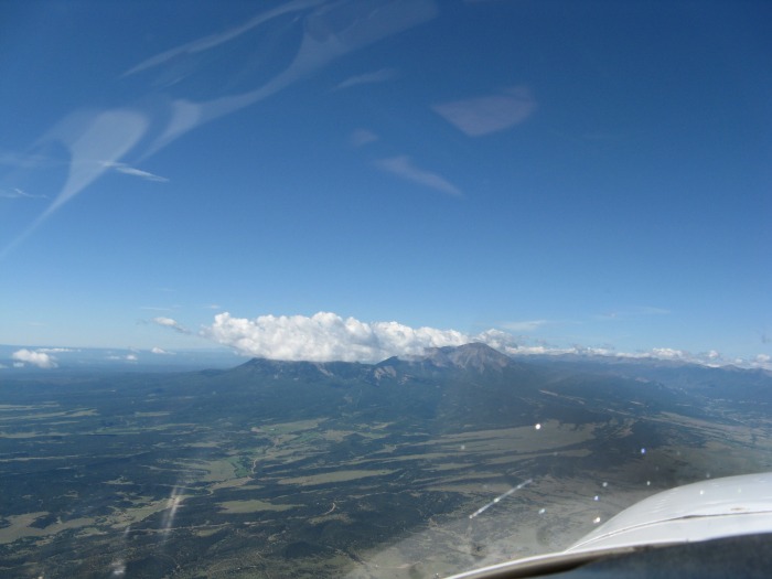
Flying to Salida from Texas, my first Colorado waypoint is Walsenburg. The Spanish Peaks near Walsenburg:
At Walsenburg it's decison time. Continue northwest toward Westcliffe, or turn west over La Veta Pass, then north up the San Luis Valley? I opted for the La Veta Pass route, as it had fewer clouds.
The Blanca group after flying over La Veta Pass:
The Great Sand Dunes, after turning north near Alamosa:
My hiking destination, Mt. Shavano, from the Salida airport. Hopefully there will be fewer clouds during my hike:
On climbing day I hit the trail around daybreak. The trail is obvious until you get near the stream crossing. Then, according to the route description on the 14ers.com website, the trail "can be hard to follow". I thought that "bewildering" might be a more apt description. Some more cairns would be helpful.
After breaking past treeline, I looked back and had this view of Salida:
As I approached the saddle, although by August the snow had melted, I could make out a faint outline of the famous Angel of Shavano:
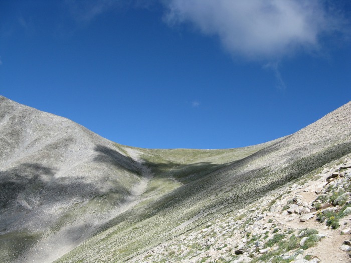
A view of the summit from the saddle:
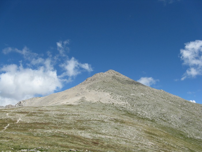
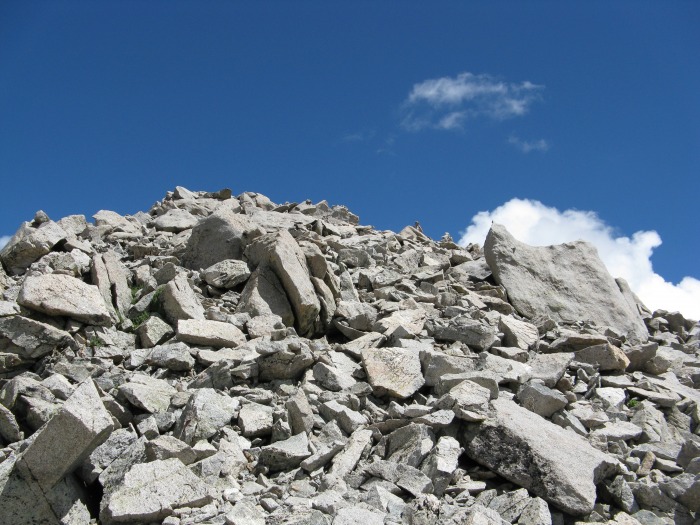
A closer view of the summit. Be warned, there are several false summits as you make your final ascent:
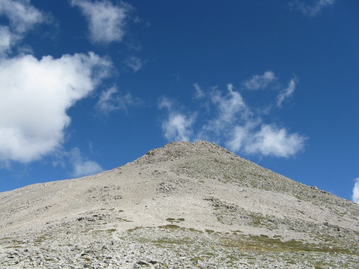
At last, the final, yes final, summit pitch:
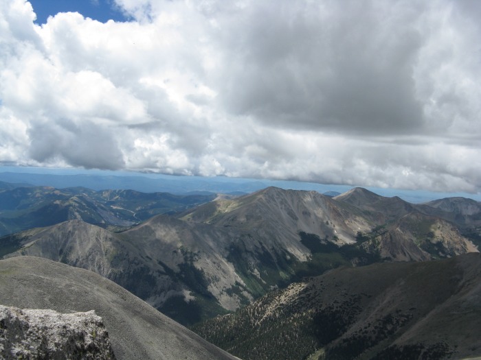
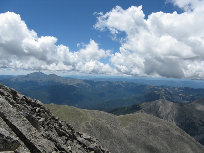
And a couple of views from the summit:
On my descent, I noticed that it was raining near Salida, and wondered whether my airplane was getting a free wash job:
For my return flight home I opted for the Westcliffe route. Here's a shot of the Crestones from over Westcliffe:
And, over Walsenburg, a final shot of the Spanish Peaks, this time sans clouds:
All in all, an excellent adventure.
Thumbnails for uploaded photos (click to open slideshow):
Love the shots from the plane.... 8/23/2010 12:20am
I always enjoy the drive from Borger to the mountains, but it is fun to try and recognize peaks when I fly from Amarillo to Denver. Which airport do you fly out of? Hey Flood, when we finally get to go hike something together, I'll drive! :D
Great report, Mooney!
Flood & huffy13: I live in Livingston, TX (just north of Houston). On my trips to Colorado I stop for gas and a visit with my mother in Pampa. The three of us should get together for dinner, drinks, and mountain climbing stories sometime when I'm in the panhandle.
Caution: The information contained in this report may not be accurate and should not be the only resource used in preparation for your climb. Failure to have the necessary experience, physical conditioning, supplies or equipment can result in injury or death. 14ers.com and the author(s) of this report provide no warranties, either express or implied, that the information provided is accurate or reliable. By using the information provided, you agree to indemnify and hold harmless 14ers.com and the report author(s) with respect to any claims and demands against them, including any attorney fees and expenses. Please read the 14ers.com Safety and Disclaimer pages for more information.
Please respect private property: 14ers.com supports the rights of private landowners to determine how and by whom their land will be used. In Colorado, it is your responsibility to determine if land is private and to obtain the appropriate permission before entering the property.


")
")
")
")
")
")
")
")
")
")
")
")
")
")


