| Report Type | Full |
| Peak(s) |
Mt. Elbert - 14,438 feet |
| Date Posted | 08/02/2010 |
| Modified | 08/03/2010 |
| Date Climbed | 07/29/2010 |
| Author | Fairlight |
| Elbert-North Trailhead |
|---|
Flying in early from Chicago on Wednesday morning, I briefly visited with a friend in Highlands Ranch and then made the drive out to Leadville. I had the privilege of staying two nights at the clean and quiet Leadville Hostel under the ownership of "Wild" Bill and his wife Cathy--highly recommended! Bill asked about my itinerary, and when hearing that I was attempting Elbert, offered a print out of turn-by-turn directions to the trailhead--re-printed below.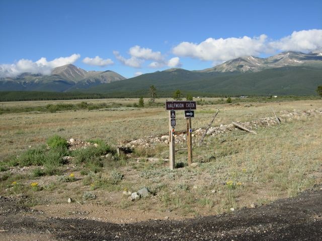 Thursday morning 7-29 at 5 a.m. under a half-moon, I drove to the Half Moon Campground/North Trailhead. I started alone on the trail with headlamp beaming. At some point in the first half hour I realized that I must have veered off the main trail as I was following a flowing creek on my left that should've been on my right. I backtracked, and as sunlight started to light the forest, I came upon a family of three from Greeley. We talked about the confusing spot on the trail and continued to hike back where I had previously been. Not being convinced we were on the main trail, we again backtracked and met several others who pointed us to a sharp turn onto what was obviously the right path. From there it was a great hike up, switch-backing through the forest and getting glimpses through the trees of the misty sunrise. It had rained heavily the night before so everything was damp and drips were falling from the pines. 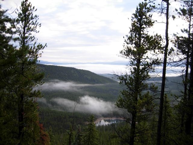 When I approached the tree-line the first of several false summits came into view. 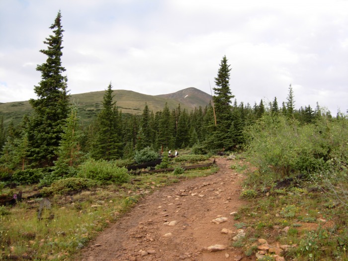 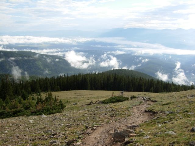  The climbing still remained fairly easy at this point, though the ground became increasingly rocky. As the air thinned I started feeling the typical altitude effects. I developed a slight headache and by 13k ft. it was pretty intense, though not enough to turn me around. I had been drinking a ton of water and nibbling snacks so I felt strong enough that I could continue. I became jealous of all the Colorado natives passing me who were obviously well acclimated. The false summits were a bit frustrating, but were good progress goals for me. Things then became steeper and the rocks bigger as the trail wound upward. The slowed pace and frequent rests allowed me to enjoy the breathtaking scenery. 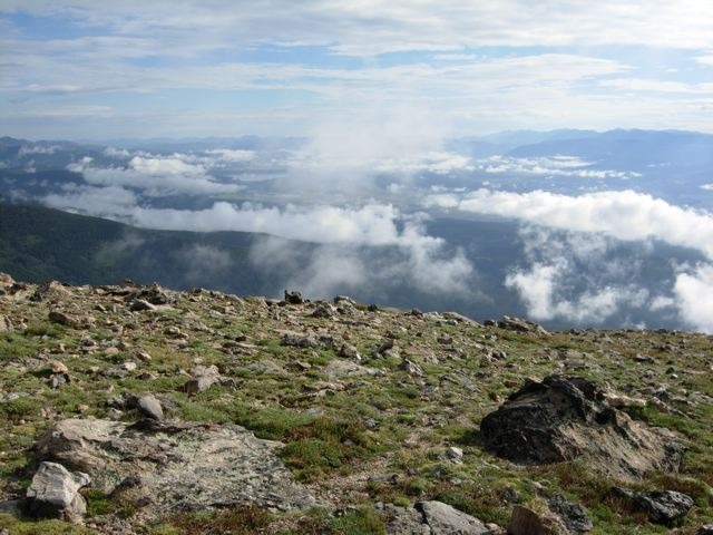 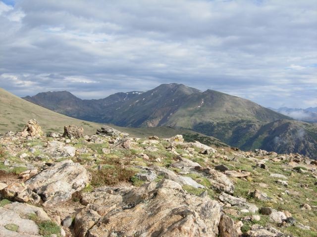 About this time (9:30-10 a.m.) clouds were building and wisps were rising on both sides of the mountain. With the mist, the temperature started to drop and I put on a fleece and my wind gloves. 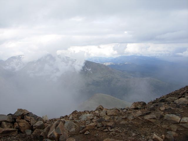  With a final push, I baby-stepped onto the summit with a dozen or so other folks. My first fourteener! 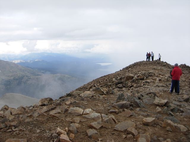 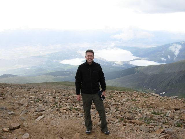 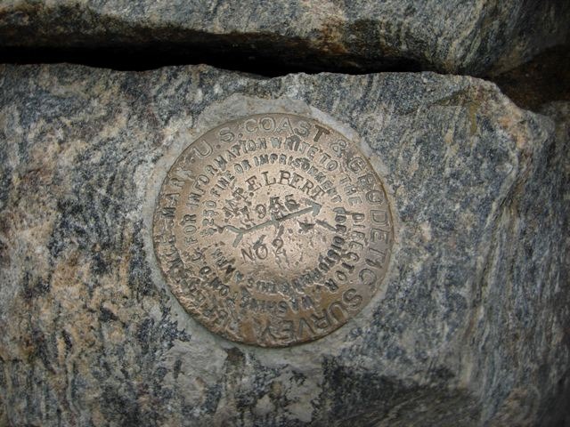 I stayed on the summit for only about 15 minutes as small ice pellets began falling. I quickly snapped some photos and found the summit marker before descending. The ice then turned to a soaking rain. I was too tired and dizzy to pull out all of my rain gear so I put on my Precip jacket and just continued down. A little above 13k ft. it stopped and the sun came out again and things started to warm up. I stopped for a bite and a rest with little Pika chirping and squeaking all around. 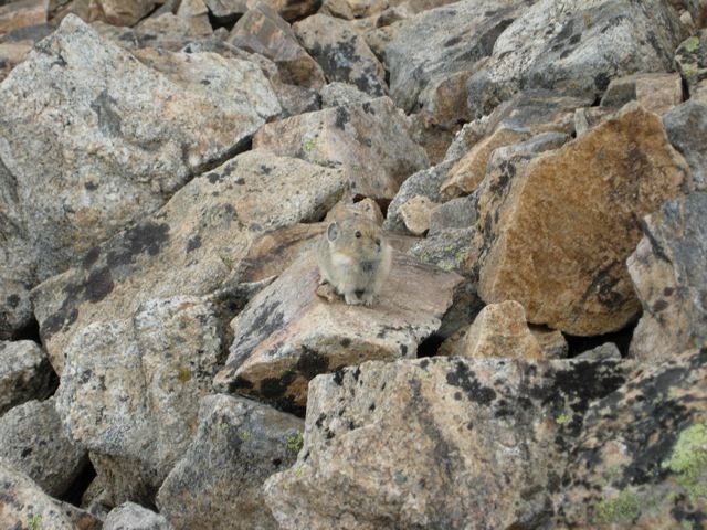 Slowly I dried out and, when I reached the tree-line, established a quick pace for the remaining 2 mile maze through the trees. I was very thankful for trek poles on this section where my knees would've taken a serious beating.  As a flat-lander, with very little acclimatization, the summit was a serious effort -especially during the last 1,000 ft.. But it was a great reward to actually make it and complete the goal! The view (in between the clouds) was beautiful and the clean trail and pristine wilderness made the hike all the more enjoyable. I used the next day to rest and get better photos of Elbert and Massive before attempting Quandary Peak on Saturday morning. 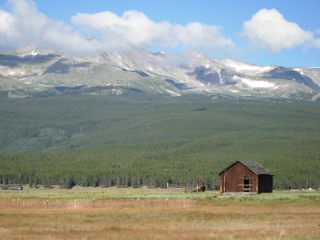 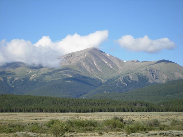  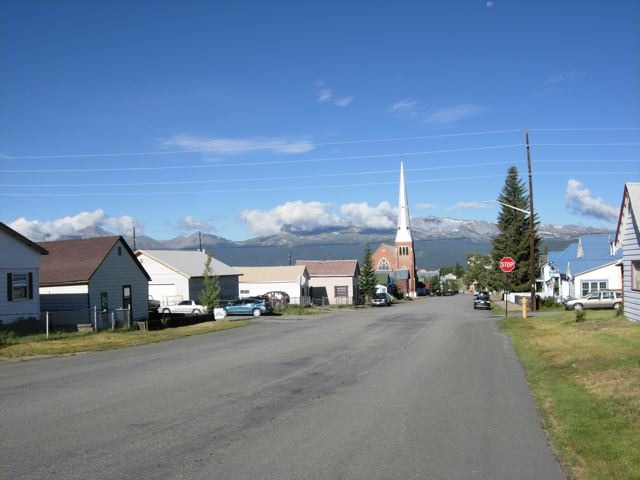 Directions to Mt. Elbert Trailhead (Half Moon Campground) Heading South on Harrison through downtown Leadville, go 3.4 miles to where the road curves left at Saturday's Convenience Store - take County road 300 to the right -go .7 miles and turn left where the sign points to Half-Moon road. Go 1.2 miles and turn right on a gravel road - the sign points towards Half-Moon campground -- go 5 miles and turn in on the left where the sign says Mt. Elbert trailhead. The Mt. Massive trailhead is .04 miles beyond. It is 11 miles from downtown Leadville to the trailhead. Thumbnails for uploaded photos (click to open slideshow):  Taken Friday morning-directions to the trailhead")
 Hiking low through the trees")
 Treeline")
 Looking back down the trail at treeline")
 First false summit")
 Over a ledge")
 Mt. Massive")
 Clouds and mist rolling in (and up)")
 Looking toward the South-East Ridge")
 Approaching the summit")
 At the summit!")
 Summit marker")
 A Pika")
 Pine on the way out")
 Mt. Massive")
 Mt. Elbert")
 Mt. Massive with half-moon")
 Elbert and Massive from Leadville")
|
| Comments or Questions | |||
|---|---|---|---|
|
Caution: The information contained in this report may not be accurate and should not be the only resource used in preparation for your climb. Failure to have the necessary experience, physical conditioning, supplies or equipment can result in injury or death. 14ers.com and the author(s) of this report provide no warranties, either express or implied, that the information provided is accurate or reliable. By using the information provided, you agree to indemnify and hold harmless 14ers.com and the report author(s) with respect to any claims and demands against them, including any attorney fees and expenses. Please read the 14ers.com Safety and Disclaimer pages for more information.
Please respect private property: 14ers.com supports the rights of private landowners to determine how and by whom their land will be used. In Colorado, it is your responsibility to determine if land is private and to obtain the appropriate permission before entering the property.

