Download Agreement, Release, and Acknowledgement of Risk:
You (the person requesting this file download) fully understand mountain climbing ("Activity") involves risks and dangers of serious bodily injury, including permanent disability, paralysis, and death ("Risks") and you fully accept and assume all such risks and all responsibility for losses, costs, and damages you incur as a result of your participation in this Activity.
You acknowledge that information in the file you have chosen to download may not be accurate and may contain errors. You agree to assume all risks when using this information and agree to release and discharge 14ers.com, 14ers Inc. and the author(s) of such information (collectively, the "Released Parties").
You hereby discharge the Released Parties from all damages, actions, claims and liabilities of any nature, specifically including, but not limited to, damages, actions, claims and liabilities arising from or related to the negligence of the Released Parties. You further agree to indemnify, hold harmless and defend 14ers.com, 14ers Inc. and each of the other Released Parties from and against any loss, damage, liability and expense, including costs and attorney fees, incurred by 14ers.com, 14ers Inc. or any of the other Released Parties as a result of you using information provided on the 14ers.com or 14ers Inc. websites.
You have read this agreement, fully understand its terms and intend it to be a complete and unconditional release of all liability to the greatest extent allowed by law and agree that if any portion of this agreement is held to be invalid the balance, notwithstanding, shall continue in full force and effect.
By clicking "OK" you agree to these terms. If you DO NOT agree, click "Cancel"...
Report Type
Full
Peak(s)
Whale Peak - 13,080 feet
Pt 12088
Pt 12567
Glacier Peak - 12853
Jefferson Hill - 10511
July 31st, 2010 Whale Peak - 13,078'
PT 12,567 - 12,567'
PT 12,088 - 12,088'
Glacier Peak - 12,853' (Unranked)
Jefferson Hill - 10,511'
Partner: SOLO
TH: Jefferson Lake Boat Launch Parking
Whale Group Stats
Distance : 10 miles
Elevation : 3300'
Total Time : 5 hours
Jefferson Hill Stats
Distance : 2.2 miles
Elevation : 600'
Total Time : 1 hour, 15 min
Whale Group
Honestly, not a whole lot of planning went into this hike. As late as 9:00 PM the night before I still had not decided on what I was going to do. My original plans for a Snowmass/Hagerman weekend fell through due to time constraints, and I really wanted something "close and plentiful" to make up for it. I recalled Todd (zoomie83) saying that he had been interested in the Whale Peak group, and I thought that might be a decent plan. After all, I was severely lacking on 12ers for the season, and this would give me the chance to grab two new ranked ones. I checked out a nice report by Kevin Baker on the Whale group, and that gave me a bit of an idea on what to expect.
I was out of Denver a bit after 4 AM, made it to Jefferson Lake around 6:00 AM. From a couple descriptions I had read regarding the road to the lake, I was expecting some 4WD/clearance issues. After arriving, I discovered that the final few miles are paved! Looks like I didn't need to bring the truck! Oh well. The day pass for parking at the Jefferson Lake area is $5.00.
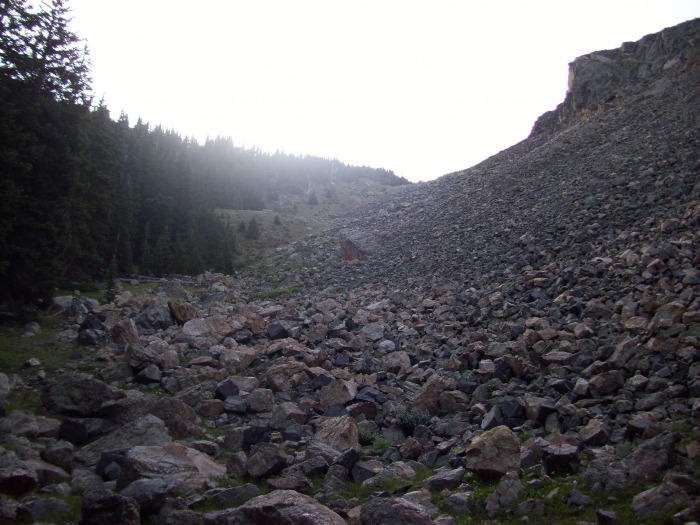
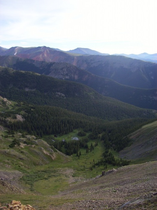
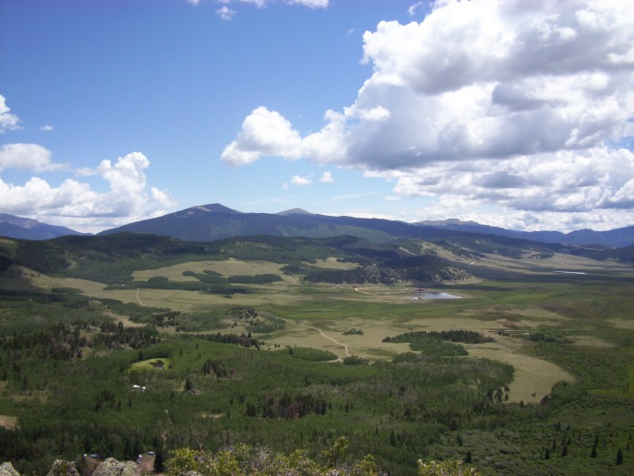
I parked in the "boat launch" parking lot and headed out right at 6:15. I headed due east directly out of the parking lot (near the outhouses) and started out immediately with some steep bushwhacking. There is no warm up for this hike. The bushwhacking really wasn't too bad, I kept close to the low point in the gully when feasible, and went higher to my left when the terrain got too "bushy". After a few hundred feet, I popped out of the trees and into a large rock gully. By staying to the left of the gully, I kept on solid ground and was able to gain the top of the ridge quickly. Once I hit the ridge, I was treated to a great view of the Lost Creek Wilderness.
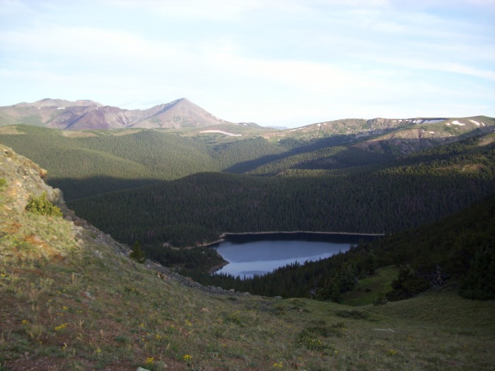
Rock gully that led to the ridge below Pt. 12088. Looking back at the Jefferson Lake from near the top of the ridge.
I turned left and continued the final .3 miles to the summit of Pt. 12,088', arriving at 7:15. I had my first view of Whale Peak from here, and although it looked a long ways away, the connecting ridge looked VERY mellow. And it was.
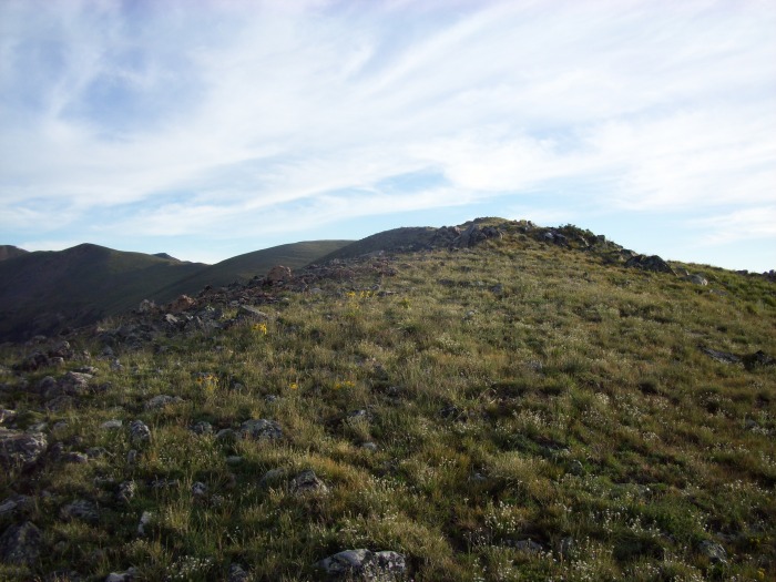
Final gentle slope to the summit of Pt. 12088. Looking at Pt. 12567 from the summit of Pt. 12088. Glacier Peak (left) and Whale Peak (right) from the summit of Pt. 12088.
I continued on over the summit of Pt. 12,088' and dropped down to its saddle with my next 12er, Pt. 12,567'. This peak was nothing more than a gigantic blob of grass. I loved the easy stroll that it provided, even though the consistency of the grade made me have to pause quite a bit to rest the legs. It took me a little bit to find the true summit, as the top area was huge. It reminded me a bit of Kenosha Peak, even when you are on the summit it doesn't feel like a summit. I stopped for a quick break at the top of Pt. 12,567' and chowed on my seriously over-ripe banana. Didn't really hit the spot.
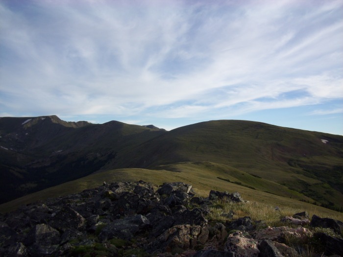
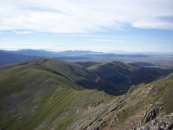
Looking back at Pt. 12088 and Jefferson Lake from the ascent of Pt. 12567. Whale Peak from Pt. 12,567. Some very nice views to the northeast during my ascent.
Whale Peak was now only 1.75 miles away, but following the ridge directly takes you up and down a couple bumps that you really don't have to take. I decided to skirt the left side of the first minimal bump, then skirted the right side of the second larger bump. Hindsight, the second bump would have been easier to go straight over because the distance saved would have made up for the extra elevation. Oh well.
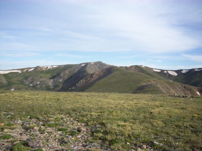
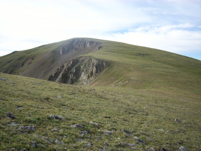
After reaching the final ridge of Whale Peak, it looks like some scrambling is required. However, it is not. A faint trail can be found along the left side of the ridge that bypasses any need to go above class 2. After a quick 50 feet of manageable scree near the top of the ridge, you are in view of the summit with only a short distance over easy terrain to go. I reached the summit of Whale Peak around 9:15.
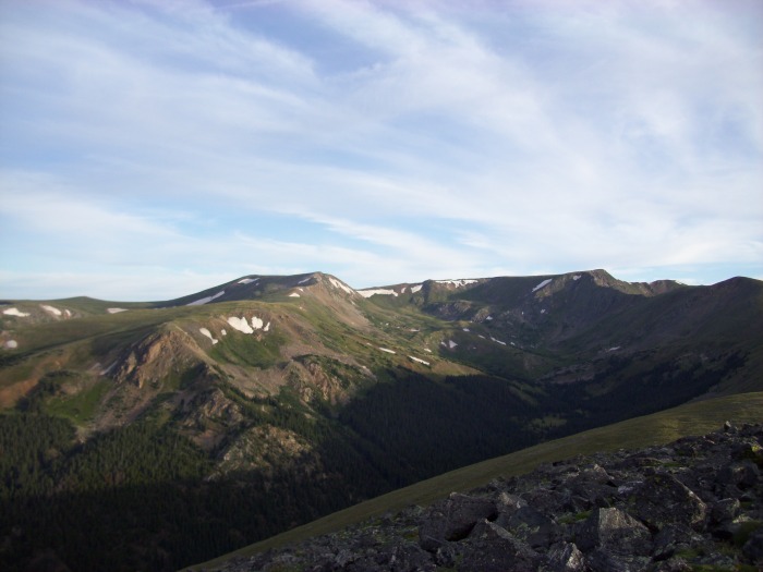
Looking back at Pt. 12567 during my descent to the saddle with Whale Peak. Approaching Whale Peak's final ridge. More nice views to the east. Whale Peak trying to look tough. Approaching the summit of Whale Peak. Looking back at the first two peaks of the day from Whale Peak. 12567 (left) and 12088 (right) Glacier Peak. The true summit is the lower looking side to the right.
For having traveled almost 5 miles already that morning, I was feeling pretty good. Those mellow ridges were easy on the legs, and I was thinking that this would be a great first timer hike for someone.
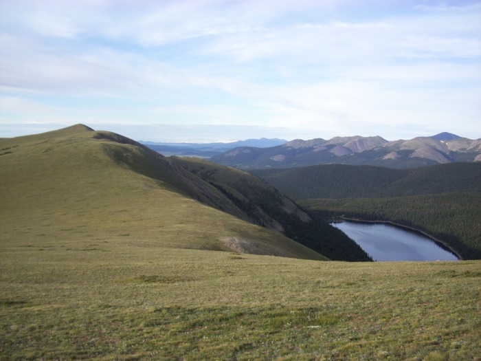
To complete the loop, I was going to continue around the ridge and pick up unranked Glacier Peak. Once again, it looked far away but there was nothing but rolling grass between the summit and myself. I took off and followed the Continental Divide all the way to the east summit of Glacier Peak. The west summit is the true highpoint based on all the information I had seen, but I went up both just to make sure. It was a short "out-and-back" to get the west summit, and I descended off the east summit towards the easy south slope that would lead back to Jefferson Lake.
Doesn't get much more gentle than this! Looking back at Whale Peak from near the summit of Glacier Peak. My descent ridge towards the lake from Glacier Peak. Lake coming back into view, only from the other side.
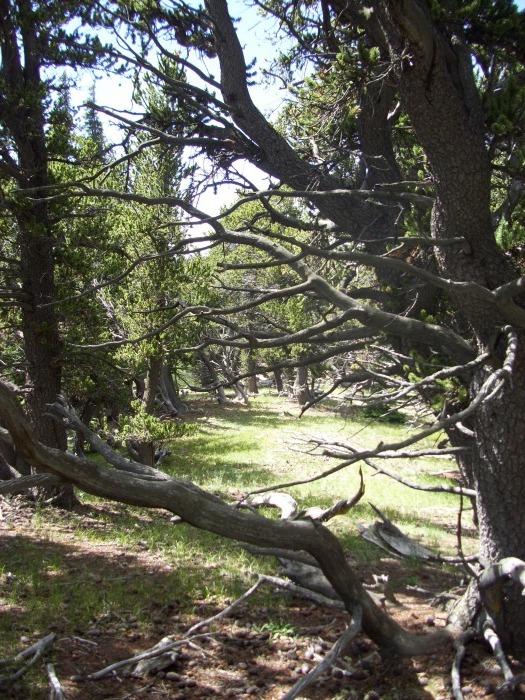
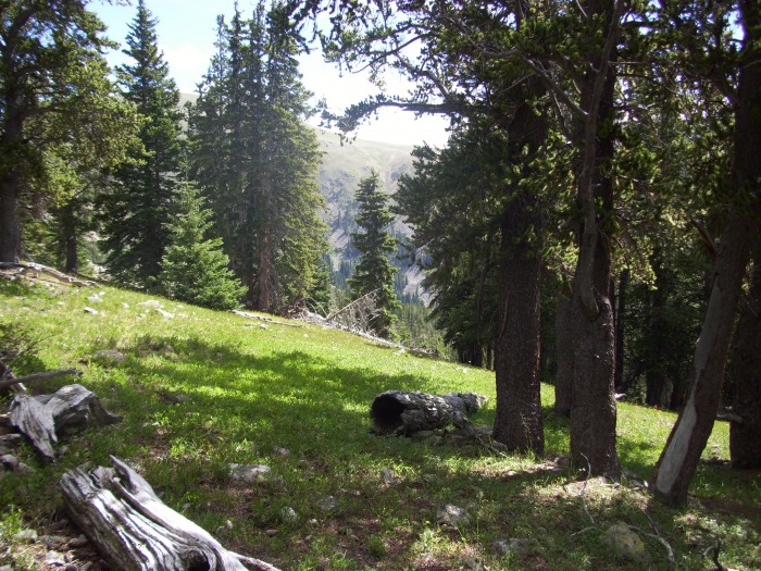
Finally, I bid farewell to my grassy setting and descended back into the trees. After entering the trees, I was treated to the best scenery of the day. It almost reminded me of a giant apple orchard: lots of trees but the ground is completely bare of any debris. It's hard to explain... I slowed down in this area to take in this unusual setting.
Great scenery in the trees, favorite part of the day. A great spot for a nap! Looking back up towards my route from the lake.
I continued in a southern direction until I was at the middle section of Jefferson Lake, where I then dropped down directly to the lakeside. The final 200 feet to the lake was pretty rough. Lots of downed trees and boggy sections led to some slips and falls. I emerged at the lake with my feet wet and my butt bruised. I strolled on around the rocky shore of the lake, talking to some of the many people fishing as I passed. Eventually, the shore wrapped back around and set me back into the parking lot right at 11:15, 5 hours after I had left earlier that morning.
Google earth view of my route, click for full view.
Jefferson Hill
It was still early and the weather still looked great. I had viewed Jefferson Hill on my way in, and I had decided if time allowed I would give it a go. I drove down the road from Jefferson Lake a few miles and turned onto a pull out just south of the Aspen Campground. (The pull off is where the road crosses the stream.)
Jefferson Hill from the road.
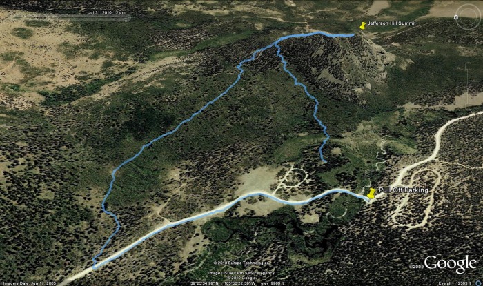
I went directly from my parking spot and made a beeline straight for the lower northern ridge of Jefferson Hill. Wow, was that ever a mistake. In no time I was trudging through marsh area and being attacked by every flying insect in the county. Once I started gaining altitude, the wet areas disappeared and the insects started to thin out a bit. Now, I was facing a tangled mess of aspen thickets. Awesome. This was turning out to be a rough hike, and I was barely a half mile from the car! After a few angry sputters, I finally reached the northern ridge. From here, I turned right and I was almost immediately among the summit rocks. The only problem now was that the true summit was on the opposite end. The traverse from one side to the other carries plenty of class 3, and it turned out to be enjoyable. It was only .75 miles and 550' to the summit, but I was happy when I finally arrived. That was one rough little 10er.
I don't really care for aspens...at least not today. Some of the initial scrambling to gain the north summit. Final portion up to the north summit. True (south) summit viewed from the north summit. Twin Cones and the X group seen from Jefferson Hill.
Shortly after arriving at the summit, I started getting hit with some rain drops. Not wanting to negotiate the length of the ridge back in the event that a downpour came, I took off after only a minute at the summit. I returned back to the lower ridge, but I was NOT going to descend back the same way I came up. I continued further north on the descending ridge and ran into the Colorado Trail after about .25 miles. Once on the trail, I followed it all the way back to the road. This added a mile to my total distance, but it was worth it to avoid the bugs and marsh. Once back at the road, I followed it south .5 miles to my parking spot.
Googleearth track of my route up Jefferson Hill. (I forgot to turn on the GPS for the first few hundred yards.)
I debated on heading over to Observatory Rock in the Puma Hills, but a loud clap of thunder right as I reached my truck made me change my mind. So I decided to head back to Jefferson County to see what else I could find...
I highly recommend these peaks (maybe not Jefferson Hill) to anyone looking for a nice easy day out. I had a very enjoyable time.
--Derek
My GPS Tracks on Google Maps (made from a .GPX file upload):
definately looks peaceful. Sometimes those moments are the highlight of the day, specially when the weather cooperates. Thanks for the visual of what that looks like from driving through countless times.
This hike really surprised me, better views than I expected and so close! Might need to look around for something else in that area...or just head back up there this winter.
Jay, the Falcon hike afterwards was so exciting that I don't know if I can show it with the 30 picture limit. :wink:
Love the report, but hate over-ripe bananas. Yuck. As always, I really enjoyed learning of a new peak, esp one that I've probably seen many times while driving down 285. I've often wondered about those peaks, and well, now I know something about them. Thanks for posting another unique and rare trip report! Glad all seems to be going well for you... :D
I know this is a seriously old post - but this might be the most useful trip report I've ever read. Tackling this same loop on Whale Peak this weekend and I will be using your route! Thanks for the super helpful info! :D
Caution: The information contained in this report may not be accurate and should not be the only resource used in preparation for your climb. Failure to have the necessary experience, physical conditioning, supplies or equipment can result in injury or death. 14ers.com and the author(s) of this report provide no warranties, either express or implied, that the information provided is accurate or reliable. By using the information provided, you agree to indemnify and hold harmless 14ers.com and the report author(s) with respect to any claims and demands against them, including any attorney fees and expenses. Please read the 14ers.com Safety and Disclaimer pages for more information.
Please respect private property: 14ers.com supports the rights of private landowners to determine how and by whom their land will be used. In Colorado, it is your responsibility to determine if land is private and to obtain the appropriate permission before entering the property.










 Download GPX file used in this map