Download Agreement, Release, and Acknowledgement of Risk:
You (the person requesting this file download) fully understand mountain climbing ("Activity") involves risks and dangers of serious bodily injury, including permanent disability, paralysis, and death ("Risks") and you fully accept and assume all such risks and all responsibility for losses, costs, and damages you incur as a result of your participation in this Activity.
You acknowledge that information in the file you have chosen to download may not be accurate and may contain errors. You agree to assume all risks when using this information and agree to release and discharge 14ers.com, 14ers Inc. and the author(s) of such information (collectively, the "Released Parties").
You hereby discharge the Released Parties from all damages, actions, claims and liabilities of any nature, specifically including, but not limited to, damages, actions, claims and liabilities arising from or related to the negligence of the Released Parties. You further agree to indemnify, hold harmless and defend 14ers.com, 14ers Inc. and each of the other Released Parties from and against any loss, damage, liability and expense, including costs and attorney fees, incurred by 14ers.com, 14ers Inc. or any of the other Released Parties as a result of you using information provided on the 14ers.com or 14ers Inc. websites.
You have read this agreement, fully understand its terms and intend it to be a complete and unconditional release of all liability to the greatest extent allowed by law and agree that if any portion of this agreement is held to be invalid the balance, notwithstanding, shall continue in full force and effect.
By clicking "OK" you agree to these terms. If you DO NOT agree, click "Cancel"...
Route: NW Face of Little Bear and traverse to Blanca
Team: Hana and John (me)
On Sunday in the early am I was looking over at a modified version of the Gash Ridge from roughly 12,800 ft or so. The plan was to climb the Gash and camp in Lake Como Basin for the night before ascending Little Bear, traversing over to Blanca, and then out via Blanca's South Ridge. The problem was I couldn't make out a decent descent down the South Ridge and knew that the weather report was not ideal and that we'd be slower carrying our heavy packs. It became clear one of us (of our party of three) would have to sacrifice this chance at the Gash Ridge to basically run a car shuttle and park at Lake Como road, thereby allowing us to climb with day packs and hike out over a grueling but easy trail as opposed to a Class 4 ridge with no discernible weakness. I volunteered knowing that this would mean that I would have to hike up the Lake Como 'Road' again. I salvaged the day by putting together a sporty ridge run on either a high 12er or low 13er and watched as Steve and Hana started to make progress towards Blanca's summit.
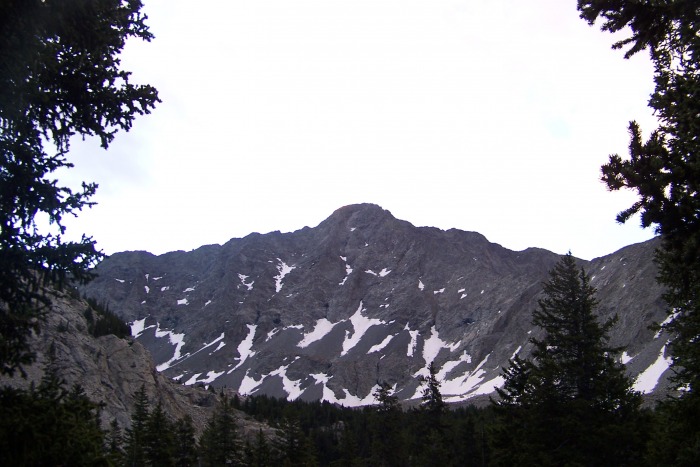
Last Look at Blanca before seeing my partners off and turning back
Monday morning started with a nice 2:30 am wake up call for me 2 miles into the road. I got ready quickly and hiked to the lake. I arrived to find my two partners still in their sleeping bags awaiting my arrival. When Steve discovered that the group he had planned to lead up the standard route of Little Bear decided not to show he lost interest in the climb and opted to hang out at the lake and make the trip down to the car solo. After a bit of weather discussion and timing issues Hana and I decided to head up and see what the day would bring. The route of choice was the NW Face of LB as I had (have) no interest in re-climbing the hour glass route again.
Quick Disclaimer - I didn't take a lot of pics or put any effort into taking interesting shots as I was pushing the pace so that we wouldn't have to worry about weather while on the traverse - this paid off as it started to snow on us 5 minutes after reaching Blanca. The following is what I do have.
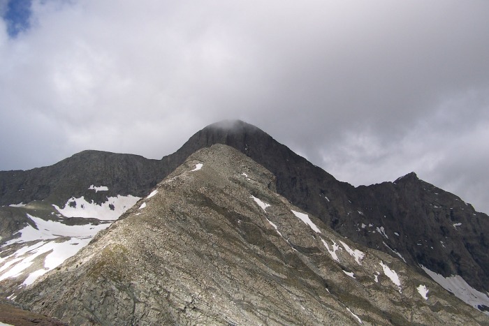
The NW Face Little Bear
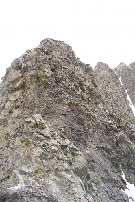
I took the above pic from the lake and it proved very valuable as we climbed as we had it as a reference point. Basically we ascended between the two water stains and traversed right. We quickly changed direction and did an ascending traverse to the left until we reached that snow field. We ascended to the right of the snow field and zig zagged our way to the ridge keeping much of the climbing in the Class 3 range (that said there was quite a bit of class 4 just not as much as I expected - and you could make it as hard as you wanted climbing a few hundred feet to our right).
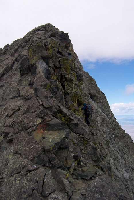
On route?? One of the few cairns we saw on the day Hana and the terrain of the NW Face Hana topping out on Little Bear
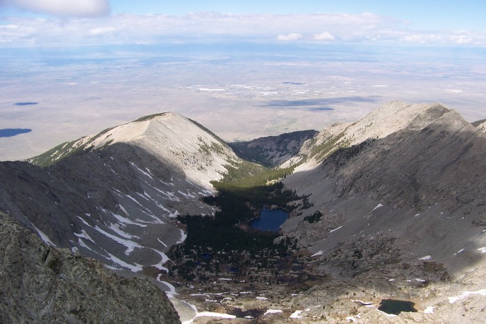
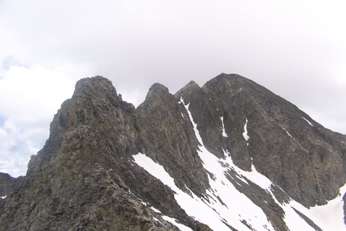
We made it to Little Bear's summit by 9:30. From this vantage we could see how impossibly far away Blanca was. We down climbed the first of many knife edges back to our packs, which we stashed at the notch where we gained the ridge, and had a quick snack before starting the long push towards Blanca. My way of dealing with a traverse of this nature is to try my best not to look at Blanca but to focus on each small segment (sometimes just 15 ft) of the climb - it makes it much more manageable for me. The best way to describe the first 3/4 of this traverse is to imagine an elevated sidewalk with bumps on it. A lot of the traverse involved doubly exposed ridge walking and navigating the bumps (over or around). The final three towers before Blanca's summit proved another obstacle. Skirt the 1st on the right, climb the 2nd and traverse over the third. This 3rd tower made me the most nervous as much of the traverse to it was blocked from view and I kept wondering if we had to downclimb around it (which did not look fun) - thankfully it worked out.
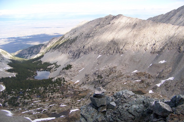
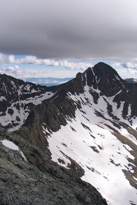
Some Traverse Shots The whole thing - and the clouds on Blanca which forced us to rush our pace Getting started with Ellingwood watching Hana downclimbing the first knife edge a bump Hana going around another bump An upper level course in ridge running Lake Como Basin Looking back blurry shot but it shows the exposure Getting closer An upclimb At this point we can see the finish and it doesn't look rough - traverse is mostly finished Final obstacle before the summit push Looking back at the last tower The Little Bears! Lindsey
Once we topped out on Blanca - a little under 2 hours from being atop Little Bear - we snapped a few pics and were greeted with a brief (20 minute or so) snow storm. We took this as a clear message that we were granted our weather window and it was time to get off the high peaks. We booked it down Blanca. The snow relented as we hiked toward camp. Hana packed up and we started the long painful hike (one I don't plan on ever repeating - although I have said that before) back to the car.
Steve - I still can't tell you how happy I am you moved the car an extra mile up the road - my knees really appreciate it - also sorry we didn't share a summit but it was an awesome weekend. And Hana - unrelenting is the best word to describe your effort. It was a blast being out with both of ya.
See ya Little Bear
Thumbnails for uploaded photos (click to open slideshow):
I have been wanting this climb for a while and got off route on the NW Face last year. I guess that‘s what happens when you arrive at camp in the dark and start in the dark. We were about to come up somewhere in the middle of the traverse on 5th class terrain and one of the partners got a bit scared. Anyhow. Great job and thanks for the beta.
Micah - I‘d say it‘s definitely worth going back for these routes - it was a blast. Hana and that shot I took from the lake really helped keep the climbing pretty tame but there were quite a few more aggressive lines you could take and I could see how you got ‘off‘ route
Gary - thanks man
Dsunwall - completely agree with both - not sure why people climb through the hourglass when so much fun scrambling is available, And this was the coolest of the 4 traverses in my opinion - I wish the clouds were less threatening so I could have relaxed on it a bit more
Good beta. And no soft effort on your part, nice! Is it correct that your partners made it over the day before via Gash Ridge? Any info you can pass along on that portion? Namely how long did it take them? Thanks.
I‘m not really sure how long it took them to do the Gash. Steve (the 3rd member of our team) said he‘d have a tr up at some point. Hopefully he answers all your questions. I will tell you that we came towards the Gash from Huerfano Basin after climbing Lindsey and the Iron Nipple on Sat and planned on climbing point 13081 (i think) from the east and not the traditional start of the Gash. Hana (my partner and the only person on our team to do both routes this trip) described the gash as harder but less exposed than the lb/blanca traverse for what that‘s worth (she said hiking it with a heavy pack may have been the difference maker). I saw ur post on the 4 traverse in 4 days - good luck man - that‘s an ambitious agenda. If you have any questions feel free to ask - i also may have a few more shots of the nw face if that interests you.
Nice Report - some additional data please 8/23/2010 3:32am
Thanks for posting the excellent photos. There is definately some serious exposure. How hard are the up and down climbing moves? Is this soloing low 5th class or easier than that? Is the rock quality good? I have rock climbed for several years and when in shape can climb lead 8-9 trad and 10-11 sport. But this is roped placing pro where you all were unroped.
On the NW face we didn't get into anything harder than class 4 (the majority of the climbing was in the class 3 range I'd say - but that's only if you choose an easy line - there are a million options up there).
On the ridge if you bypass captain bivwacko (5.6-5.7ish) then the traverse is no harder than really low class 5 (5.0-5.2). As far as rock quality - it was not great but ok - you had to check all the holds but they were decent. I probably can't do what you can do in the gym but I'm cool with exposure and all the moves were in my comfort zone. Hope that helps - Good luck.
A little over 2.5 hours on the road - about 3 hours from the lake to Little Bear - A little under 2 hours to Blanca - 2.5 hours back to camp - 2 hours back to the car - There was about an hour gap between me arriving at the lake and starting to hike - between a 13 and 14 hour day - no idea on actual distance and elevation but from Roach's book he puts the trip (using the std route of LB) at 14.7 miles and 6800 vert - i prob did a touch less as I didn't start from the base of the road.
Caution: The information contained in this report may not be accurate and should not be the only resource used in preparation for your climb. Failure to have the necessary experience, physical conditioning, supplies or equipment can result in injury or death. 14ers.com and the author(s) of this report provide no warranties, either express or implied, that the information provided is accurate or reliable. By using the information provided, you agree to indemnify and hold harmless 14ers.com and the report author(s) with respect to any claims and demands against them, including any attorney fees and expenses. Please read the 14ers.com Safety and Disclaimer pages for more information.
Please respect private property: 14ers.com supports the rights of private landowners to determine how and by whom their land will be used. In Colorado, it is your responsibility to determine if land is private and to obtain the appropriate permission before entering the property.


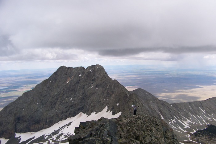


 Last Look at Blanca before seeing my partners off and turning back")
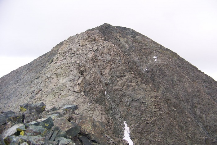
 Little Bear")
")
 On route?? One of the few cairns we saw on the day")
 Hana and the terrain of the NW Face")
 Hana topping out on Little Bear")
 The whole thing - and the clouds on Blanca which forced us to rush our pace")
 Getting started with Ellingwood watching")
 Hana downclimbing the first knife edge")
 a bump")
 Hana going around another bump")
 An upper level course in ridge running")
 Lake Como Basin")
 Looking back")
 blurry shot but it shows the exposure")
 Getting closer")
 An upclimb")
 At this point we can see the finish and it doesn't look rough - traverse is mostly finished")
 Final obstacle before the summit push")
 Looking back at the last tower")
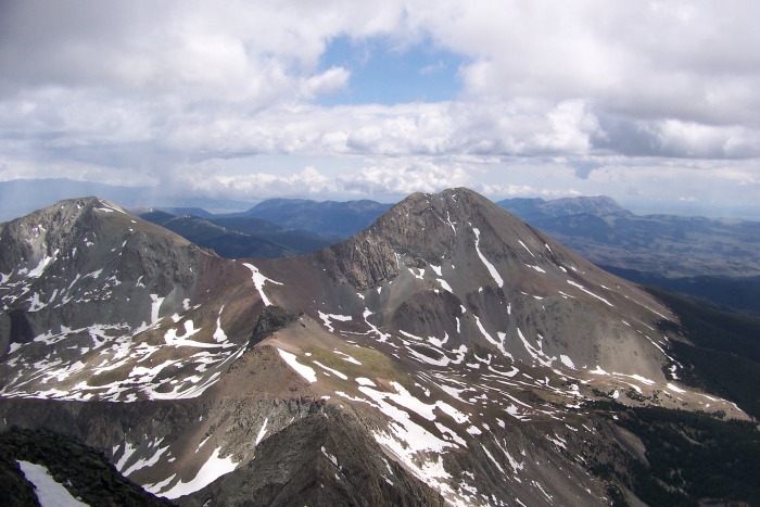
 The Little Bears!")
 Lindsey")
 See ya Little Bear")


