Download Agreement, Release, and Acknowledgement of Risk:
You (the person requesting this file download) fully understand mountain climbing ("Activity") involves risks and dangers of serious bodily injury, including permanent disability, paralysis, and death ("Risks") and you fully accept and assume all such risks and all responsibility for losses, costs, and damages you incur as a result of your participation in this Activity.
You acknowledge that information in the file you have chosen to download may not be accurate and may contain errors. You agree to assume all risks when using this information and agree to release and discharge 14ers.com, 14ers Inc. and the author(s) of such information (collectively, the "Released Parties").
You hereby discharge the Released Parties from all damages, actions, claims and liabilities of any nature, specifically including, but not limited to, damages, actions, claims and liabilities arising from or related to the negligence of the Released Parties. You further agree to indemnify, hold harmless and defend 14ers.com, 14ers Inc. and each of the other Released Parties from and against any loss, damage, liability and expense, including costs and attorney fees, incurred by 14ers.com, 14ers Inc. or any of the other Released Parties as a result of you using information provided on the 14ers.com or 14ers Inc. websites.
You have read this agreement, fully understand its terms and intend it to be a complete and unconditional release of all liability to the greatest extent allowed by law and agree that if any portion of this agreement is held to be invalid the balance, notwithstanding, shall continue in full force and effect.
By clicking "OK" you agree to these terms. If you DO NOT agree, click "Cancel"...
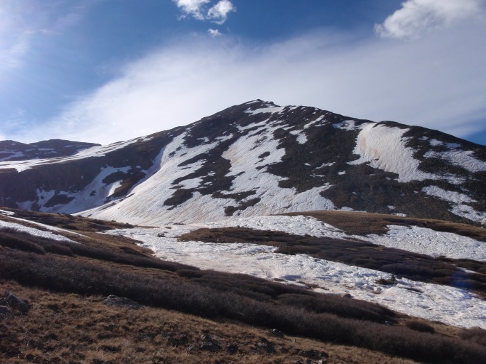
After getting in some easy 13ers last weekend I wanted to get my first 14er of the year this weekend. I figured Huron would be a good warmup due to its relative shortness (both trail length and height) and my friend Dan was in for it as well. After reading the trip report from the previous weekend I knew there would still be snow in the basin and so initially planned for a 5:00am start, however as I viewed the weather for the week I realized it wasn't freezing at night and the likelyhood of being able to walk on the snow would be slim no matter when we started, so we decided we could hit the trail a bit later. We left Colorado Springs just after 4:00 and arrived at the trailhead just after 7:00, besides the campers along the road there were two vehicles in the parking lot that had arrived before us. It was my first four-wheeling test of my new Jeep, and it handled it just fine, the stream crossing was only a few inches deep in the morning and to our surprise wasn't significantly deeper when we were leaving shortly after noon. Driving up to the trailhead, anyone know which mountain is this? First view of Huron.
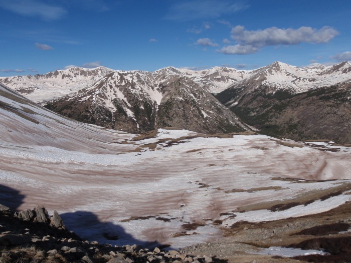
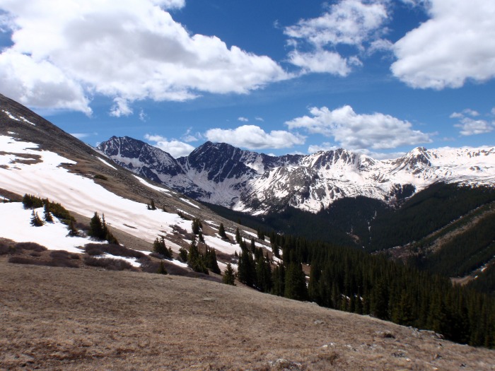
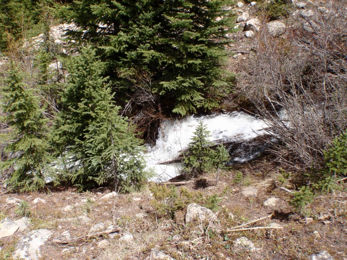
We were on the trail by 7:15, and I was greatly disappointed by the sign at the trailhead indicating that hang gliders were not allowed in the area, I've long though that would be the optimal descent for summer climbs, but oh well. Snow banks started appearing about half a mile along, but were for the most part easily avoidable. As we broke treeline Huron came into view for the first time, and we saw some larger, though still avoidable snowfields. As we crested the hill overlooking the true basin we saw it was still covered in snow, and set off across it, hoping between the dry patches. Postholing was the rule here, I probably only managed 20 steps across the entire field that didnt sink in to some extent, knee deep was common, I sank to my waist 2-3 times, it wasn't uncommon to punch through to standing or running water below. My boots and socks got thoroughly soacked, but I was pleased to learn that my new hiking pants (REI Saharas) really were as water proof as they claimed and stayed completely dry. We cut through the snowfield to reach the ridge up past it a bit sooner than the standard summer trail would have taken us, and from what we saw pretty much everyone else that day did as well. We climbed up the ridge a bit and wrung out our socks, then continued on. Looking back at the basin from the ridge.
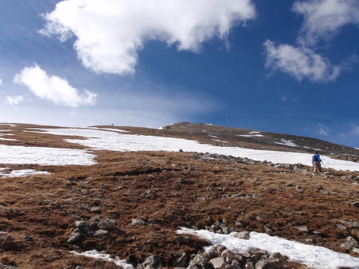
Heading up the early part of the ridge to Huron's summit had substantially less snow than the basin, but it was still not completely avoidable and we looked for the shortest snow bridges to pass. Early part of the ridge.
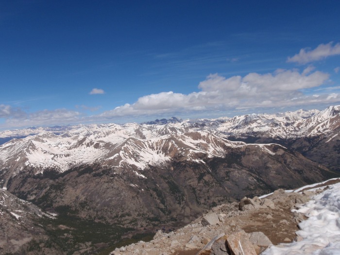
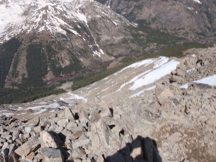
Once we actually hit the class 2 rock approaching the summit the snow more or less died out, though with the increase in steepness our pace didn't increase that much. The wind also picked up some at this point, but it was warm enough that it wasn't bad. As we ascended the ridge we saw several groups crossing the snowfield below us. Snow was present again just before the summit, but it was still largely rock. I hit the summit just before 10:15 and met fellow 14ers.com members Scanner and Meteor there. Dan arrived a minute later, and they were kind enough to take our picture, confirm our suspicions on the identities of a few nearby peaks as well as pointing out some other ones we hadn't identified. Scanner said the summit register had been destroyed by the moisture, as the summit was still largely covered in snow. The snow also didn't really leave anywhere to sit, so we stayed on the summit for only a couple minutes before heading down, as the cold and still damp boots were making our toes numb. 7th peak down. Looking south-west-ish. About 1/2 the available bare rock on the summit is visible. Most of Huron has virutally no exposure, so this little bit at the end did take me by a bit of surprise.
We passed several groups heading up as we went down, I think there were about 20 people total on the mountain that day. I was able to make a couple short glissades on the more extensive snowbanks on the ridge down, but most of the time was spent walking. Once we got back to the basin the trail had been significantly more defined from all the people crossing it, and Dan and I gave Scanner and Meteor some help in further breaking it in for anyone else who wanted to come through. We spent 3 hour going up and only 2 coming down, with at least half an hour being saved in the basin by the better trail. As we had descended the ridge and entered the basin the temperature had increased a fair amount, so even when we did post hole through on the way back it was almost a bit of a refreshment. The Three Apsotles as we headed back down.
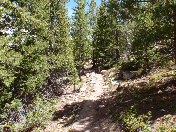
After wringing out our socks again we started down back into the forest, which was fully in the late stages of spring. To our surprise neither the foot stream crossing at the beginning of the trail nor the vehicle one on the 4WD trail had risen significantly, and both were easily crossable. We arrived back at the car almost exaclty 5 hours after we started. 14er number 7 down! No snow at this point. Late spring in the Rockies.
Thumbnails for uploaded photos (click to open slideshow):
We are thinking about heading up that way in a couple of weeks. Looks like conditions are shaping up nicely if your pictures are any indication. Can‘t wait!
Caution: The information contained in this report may not be accurate and should not be the only resource used in preparation for your climb. Failure to have the necessary experience, physical conditioning, supplies or equipment can result in injury or death. 14ers.com and the author(s) of this report provide no warranties, either express or implied, that the information provided is accurate or reliable. By using the information provided, you agree to indemnify and hold harmless 14ers.com and the report author(s) with respect to any claims and demands against them, including any attorney fees and expenses. Please read the 14ers.com Safety and Disclaimer pages for more information.
Please respect private property: 14ers.com supports the rights of private landowners to determine how and by whom their land will be used. In Colorado, it is your responsibility to determine if land is private and to obtain the appropriate permission before entering the property.
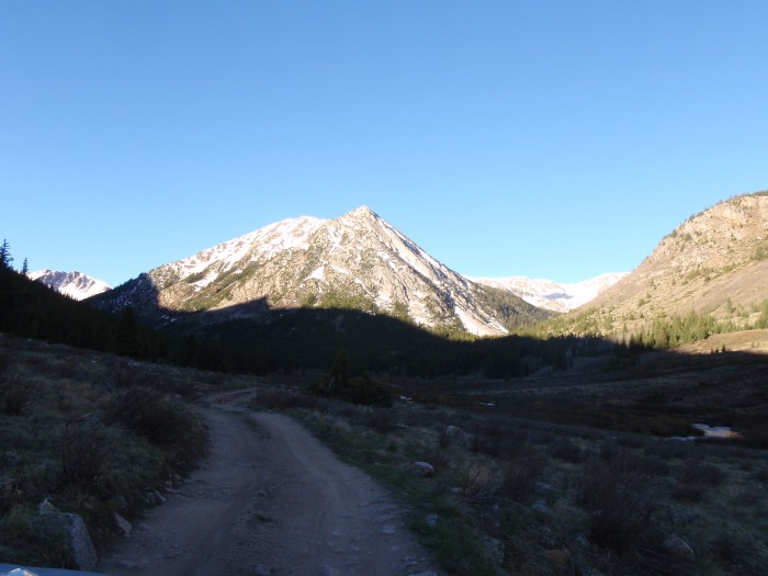

 Driving up to the trailhead, anyone know which mountain is this?")
 First view of Huron.")
 Looking back at the basin from the ridge.")
 Early part of the ridge.")
 7th peak down.")
 Looking south-west-ish. About 1/2 the available bare rock on the summit is visible.")
 Most of Huron has virutally no exposure, so this little bit at the end did take me by a bit of surprise.")
 The Three Apsotles as we headed back down.")
 No snow at this point.")
 Late spring in the Rockies.")


